Results
1 2 3 … 16 Next »
1524 results found
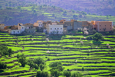
Terraced landscape, Taroudant, Morocco, North Africa

Red Snapper, Fiji, Pacific Islands
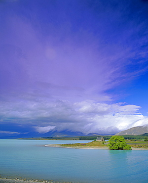
Storm approaching over Two Thumb Range, the Church of the Good Shepherd on the shore of Lake Tekapo, Canterbury District, South Island, New Zealand
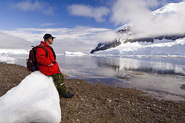
Neko Harbor, Gerlache Strait, Antarctic Peninsula, Antarctica, Polar Regions
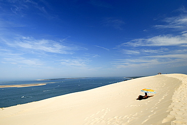
Tourists under a parasol on the Dune du Pyla, largest dune in Europe, Bay of Arcachon, Cote d'Argent, Gironde, Aquitaine, France, Europe
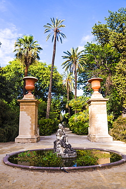
Palermo Botanical Gardens (Orto Botanico), Palermo, Sicily, Italy, Europe
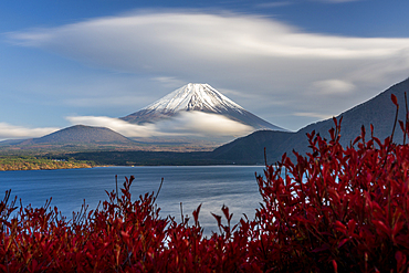
Mt Fuji in autumn from Lake Motosu, Japan

The gardens of the Villa Cimbrone in Ravello, Amalfi coast, UNESCO World Heritage Site, Campania, Italy, Europe
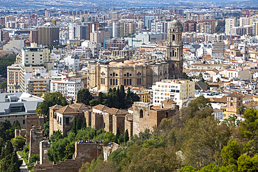
Cityscape view over city centre high density buildings with cathedral church in centre, Malaga, Andalusia, Spain, Europe

Coral hind (cephalopholis), Southern Thailand, Andaman Sea, Indian Ocean, Southeast Asia, Asia
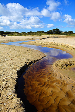
Small stream winding through the beach to the sea, Studland Bay, Dorset, England, United Kingdom, Europe
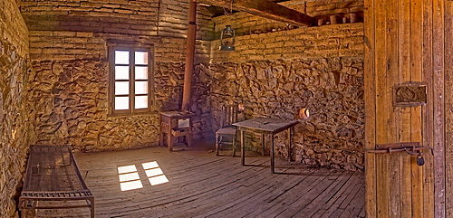
A panorama of the historic cabin of Henry Wickenburg, who founded the Arizona town with the same name in the late 1800s, Wickenburg, Arizona, United States of America, North America
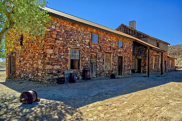
An outside view of the historic cabin of Henry Wickenburg, founder of Vulture City and the town of Wickenburg, Arizona, United States of America, North America
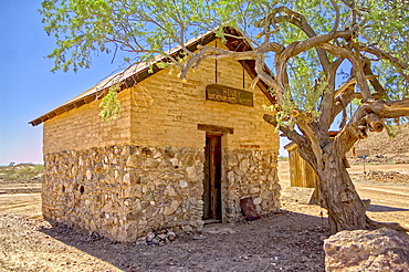
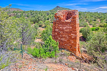
The Assay Office in the ghost town of Vulture City, near Wickenburg, Arizona, United States of America, North America
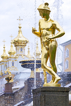
Golden statue of Hermes (Mercury), Grand Cascade, Peterhof (Petrodvorets), St. Petersburg, Russia, Europe

Xi'an City Wall, Shaanxi Province, China, Asia

City Palace and Lake Pichola, Udaipur, Rajasthan, India, Asia
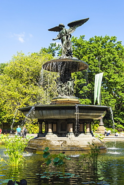
Bethesda Fountain, Central Park, Manhattan, New York City, New York, United States of America, North America

Big Ben and the Sir Winston Churchill statue, Westminster, London, England, United Kingdom, Europe
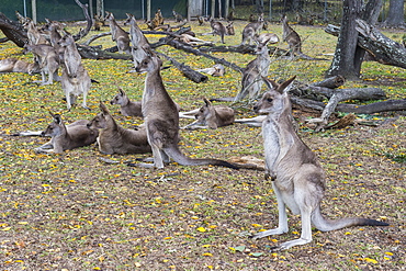
Kangaroos (macropods), Lone Pine Sanctuary, Brisbane, Queensland, Australia, Pacific
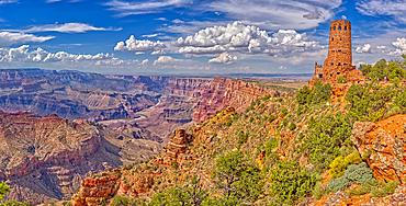
View of Grand Canyon west of the historic Watch Tower, managed by the National Park Service, UNESCO World Heritage Site, Arizona, United States of America, North America
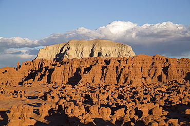
Goblin Valley State Park, near Hanksville, Utah, United States of America, North America
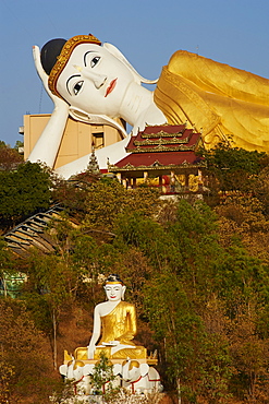
Reclining Buddha, Bodhi Tataung, Monywa, Sagaing Division, Myanmar (Burma), Asia

Barcelona Marina, Barcelona, Catalonia, Spain, Europe

The facade of the 17th century Town Hall, Oppenheim, wine area, Rhineland Palatinate, Germany, Europe
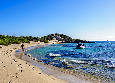
Beach in Sullivan Bay, Santiago (James) Island, Galapagos, UNESCO World Heritage Site, Ecuador, South America
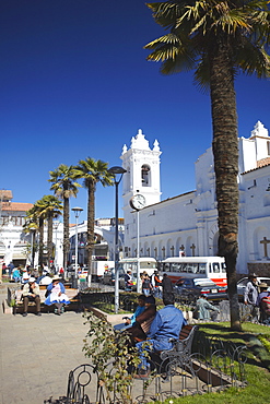
Iglesia de San Francisco, Sucre, UNESCO World Heritage Site, Bolivia, South America
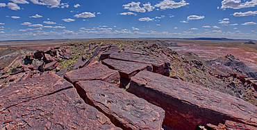
The summit of Haystack Mesa in Petrified Forest National Park, Arizona, United States of America, North America
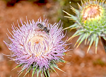
Macro photo of a Wheeler's Thistle Flower native to Arizona, United States of America, North America
Historic Puntenney Kiln in Prescott National Forest, one of few relics left of the ghost towns of Puntenney and Cedar, Arizona, United States of America, North America
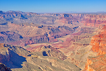
Colorado River viewed from the cliffs of Desert View Point at Grand Canyon South Rim, Grand Canyon National Park, UNESCO World Heritage Site, Arizona, United States of America, North America
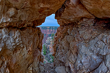
A gap between a stack of balanced boulders on a cliff east of Grandview Point at Grand Canyon South Rim, Grand Canyon National Park, UNESCO World Heritage Site, Arizona, United States of America, North America
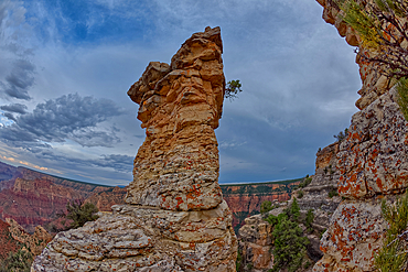
View of Grand Canyon and a rock spire from within a gap between a stack of balanced boulders at Grandview Point, Grand Canyon National Park, UNESCO World Heritage Site, Arizona, United States of America, North America
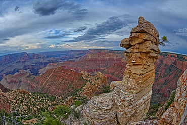
A rock spire just east of Grandview Point at Grand Canyon South Rim, Grand Canyon National Park, UNESCO World Heritage Site, Arizona, United States of America, North America
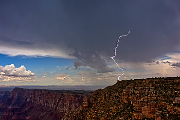
Lightning striking the Desert View Watchtower on Grand Canyon South Rim during the 2023 Arizona Monsoon season, viewed from Navajo Point, Grand Canyon National Park, UNESCO World Heritage Site, Arizona, United States of America, North America
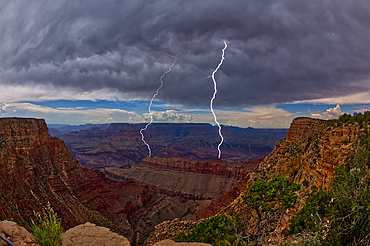
Lightning striking inside the Grand Canyon during the 2023 Arizona Monsoon season, viewed from No Name Overlook between Pinal Point on the left and Lipan Point on the right, Grand Canyon National Park, UNESCO World Heritage Site, Arizona, United States of America, North America
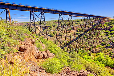
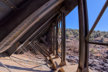
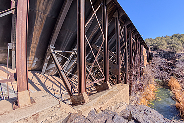
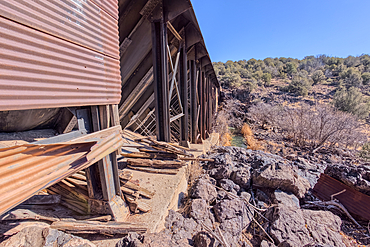
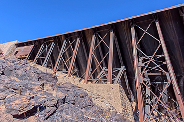
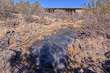
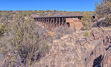
A historic railroad bridge spanning Hell Canyon in Drake, Arizona, United States of America, North America
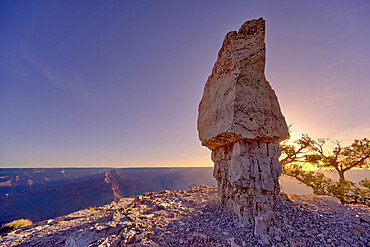
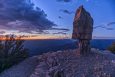
The famous Mushroom Rock at Shoshone Point at sunrise, Grand Canyon National Park, UNESCO World Heritage Site, Arizona, United States of America, North America
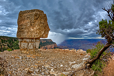
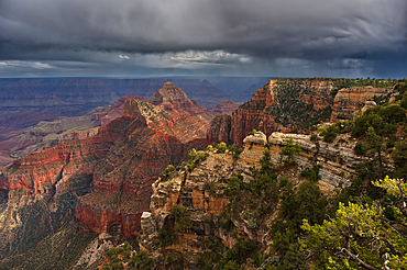
Storm approaching Shoshone Point on the South Rim, Grand Canyon National Park, UNESCO World Heritage Site, Arizona, United States of America, North America
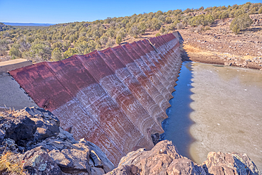
The eastern edge of the lake created by the historic Bainbridge Steel Dam near Ash Fork Arizona in the Kaibab National Forest. It was originally constructed in the late 1800s and is now a historic landmark that is open to the public.
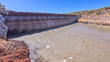
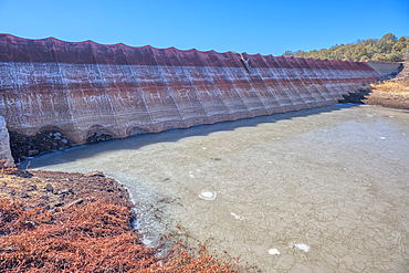
Shoreline view of the historic Bainbridge Steel Dam near Ash Fork Arizona in the Kaibab National Forest. It was originally constructed in the late 1800s and is now a historic landmark that is open to the public.
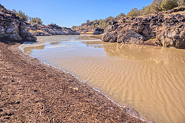
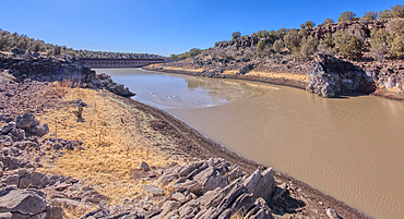
View of the lake created by the historic Bainbridge Steel Dam near Ash Fork Arizona in the Kaibab National Forest. It was originally constructed in the late 1800s and is now a historic landmark that is open to the public.
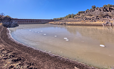
Shoreline view of the historic Bainbridge Steel Dam near Ash Fork Arizona in the Kaibab National Forest. It was originally constructed in the late 1800s and is now a historic landmark that is open to the public.
Top face view of the historic Bainbridge Steel Dam near Ash Fork Arizona in the Kaibab National Forest. It was originally constructed in the late 1800s and is now a historic landmark that is open to the public.
Top face view of the historic Bainbridge Steel Dam near Ash Fork Arizona in the Kaibab National Forest. It was originally constructed in the late 1800s and is now a historic landmark that is open to the public.
Top face view of the historic Bainbridge Steel Dam near Ash Fork Arizona in the Kaibab National Forest. It was originally constructed in the late 1800s and is now a historic landmark that is open to the public.
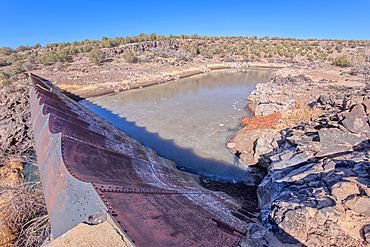
Overhead view of the historic Bainbridge Steel Dam near Ash Fork Arizona in the Kaibab National Forest. It was originally constructed in the late 1800s and is now a historic landmark that is open to the public.
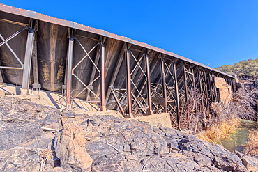
Closeup view of the steel framework of the historic Bainbridge Steel Dam near Ash Fork Arizona in the Kaibab National Forest. It was originally constructed in the late 1800s and is now a historic landmark that is open to the public.
View from inside the steel framework of the historic Bainbridge Steel Dam near Ash Fork Arizona in the Kaibab National Forest. It was originally constructed in the late 1800s and is now a historic landmark that is open to the public.
Closeup view of the steel framework of the historic Bainbridge Steel Dam near Ash Fork Arizona in the Kaibab National Forest. It was originally constructed in the late 1800s and is now a historic landmark that is open to the public.
View from below the historic Bainbridge Steel Dam near Ash Fork Arizona in the Kaibab National Forest. It was originally constructed in the late 1800s and is now a historic landmark that is open to the public.
View from below the historic Bainbridge Steel Dam near Ash Fork Arizona in the Kaibab National Forest. It was originally constructed in the late 1800s and is now a historic landmark that is open to the public.
View from below the historic Bainbridge Steel Dam near Ash Fork Arizona in the Kaibab National Forest. It was originally constructed in the late 1800s and is now a historic landmark that is open to the public.
The historic Bainbridge Steel Dam near Ash Fork Arizona in the Kaibab National Forest. It was originally constructed in the late 1800s and is now a historic landmark that is open to the public.
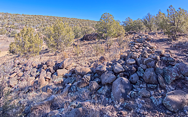
The remains of a rock wall built by ancient Indians along the Stone to Steel Trail that runs between the historic Stone Dam and Bainbridge Steel Dam near Ash Fork Arizona.
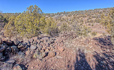
The remains of a rock wall built by ancient Indians along the Stone to Steel Trail that runs between the historic Stone Dam and Bainbridge Steel Dam near Ash Fork Arizona.
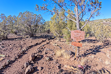
The Stone to Steel Trailhead, also known as Fay's Trail, that runs between the Stone Dam and the historic Bainbridge Steel Dam near Ash Fork Arizona. Located in the Kaibab National Forest. Sign is on public land. No property release needed.
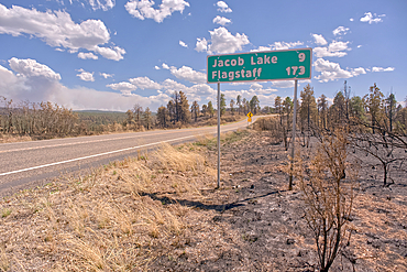
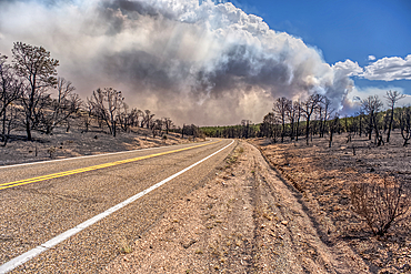
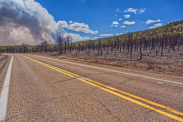
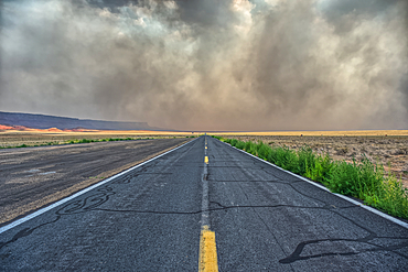
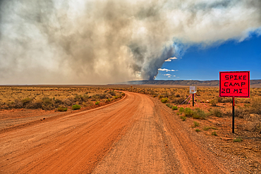
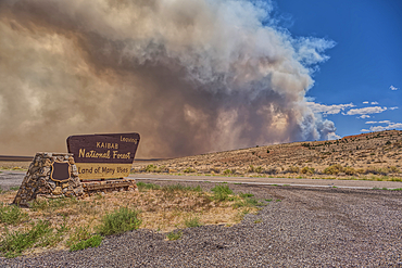
Road sign along US89A north of Jacob Lake Arizona that has been partially damaged by the White Sage Fire.
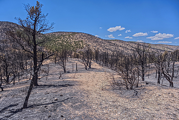
Scorched Earth and burned trees from the White Sage Wildfire near Jacob Lake Arizona in the Kaibab National Forest.
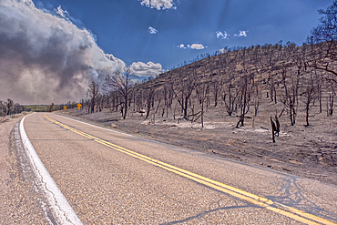
Scorched Earth and burned trees from the White Sage Wildfire near Jacob Lake Arizona in the Kaibab National Forest.
Scorched Earth and burned trees from the White Sage Wildfire near Jacob Lake Arizona in the Kaibab National Forest.
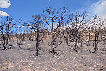
Scorched Earth and burned trees from the White Sage Wildfire near Jacob Lake Arizona in the Kaibab National Forest.
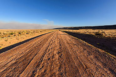
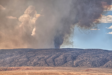
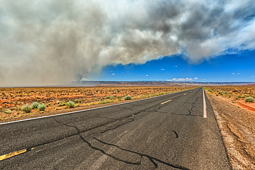
Smoke from the Dragon Bravo Wildfire burning on Grand Canyon North Rim billowing off the Kaibab Plateau. Viewed north of US89A across from Vermilion Cliffs.
Scorched Earth and burned trees from the White Sage Wildfire near Jacob Lake Arizona in the Kaibab National Forest.
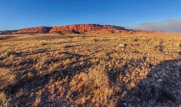
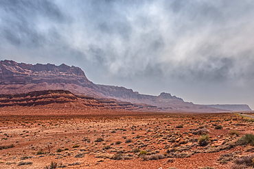
Vermilion Cliffs National Monument Arizona near sunset with smoke in the sky from the Dragon Bravo Wildfire burning on North Rim in the background.
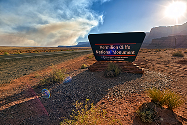
Sign for Vermilion Cliffs National Monument Arizona near sunset with smoke in the sky from the Dragon Bravo Wildfire burning on North Rim.
Sun shining thru dense smoke from the Dragon Bravo Wildfire enshrouding Vermilion Cliffs National Monument Arizona. Viewed from US89A.
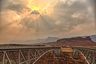
Sun shining thru dense smoke from the Dragon Bravo Wildfire enshrouding Vermilion Cliffs National Monument Arizona. Viewed from US89A at Navajo Bridge.
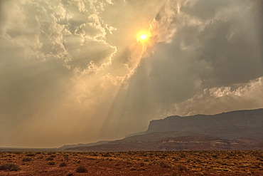
Sun shining thru dense smoke from the Dragon Bravo Wildfire enshrouding Vermilion Cliffs National Monument Arizona. Viewed from US89A.
Smoke from the Dragon Bravo Wildfire enshrouding Vermilion Cliffs National Monument Arizona. Viewed from US89A.
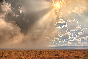
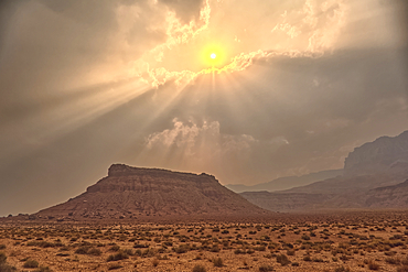
Late day sun shining thru dense smoke from the Dragon Bravo Wildfire billowing off the Kaibab Plateau. Viewed from US89A across from Vermilion Cliffs Arizona.
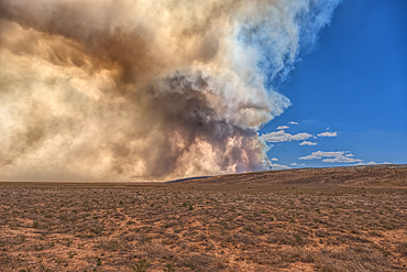
Smoke from the Dragon Bravo Wildfire burning on Grand Canyon North Rim billowing off the Kaibab Plateau. Viewed from US89A across from Vermilion Cliffs.
Smoke from the Dragon Bravo Wildfire burning on Grand Canyon North Rim billowing off the Kaibab Plateau. Viewed from US89A across from Vermilion Cliffs.
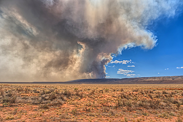
Smoke from the Dragon Bravo Wildfire burning on Grand Canyon North Rim billowing off the Kaibab Plateau. Viewed from US89A across from Vermilion Cliffs.
Smoke from the Dragon Bravo Wildfire burning on Grand Canyon North Rim billowing off the Kaibab Plateau. Viewed from House Rock Road across from Vermilion Cliffs.
Vermilion Cliffs at Marble Canyon Arizona enshrouded with smoke from the Dragon Bravo Wildfire burning on Grand Canyon North Rim. Viewed from US89A.
Smoke from the Dragon Bravo Wildfire burning on Grand Canyon North Rim billowing off the Kaibab Plateau. Viewed from US89A next to Vermilion Cliffs.
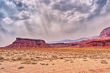
Vermilion Cliffs at Marble Canyon Arizona enshrouded with smoke from the Dragon Bravo Wildfire burning on Grand Canyon North Rim. Viewed from US89A.
Vermilion Cliffs National Monument Arizona at sunset viewed from House Rock Road north of US89A.
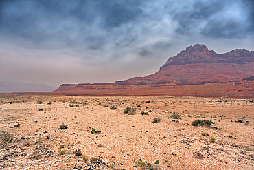
Echo Cliffs near Marble Canyon Arizona enshrouded with smoke from the Dragon Bravo Wildfire burning on Grand Canyon North Rim.
Echo Cliffs near Marble Canyon Arizona near sunset with smoke in the sky from the Dragon Bravo Wildfire burning on Grand Canyon North Rim.
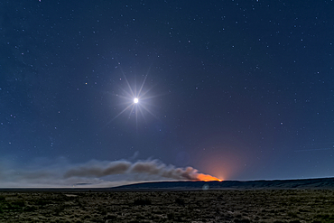
Dragon Bravo Wildfire on Grand Canyon North Rim viewed from US89A near Vermilion Cliffs Arizona at night under moonlight.
Echo Cliffs near Marble Canyon Arizona enshrouded with smoke from the Dragon Bravo Wildfire burning on Grand Canyon North Rim.
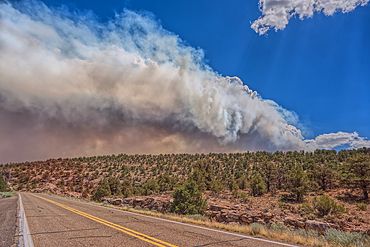
Smoke from the Dragon Bravo Wildfire burning on Grand Canyon North Rim billowing off the Kaibab Plateau. Viewed from US89A.
Smoke from the Dragon Bravo Wildfire burning on Grand Canyon North Rim billowing off the Kaibab Plateau. Viewed from US89A at the Kaibab National Forest Boundary.
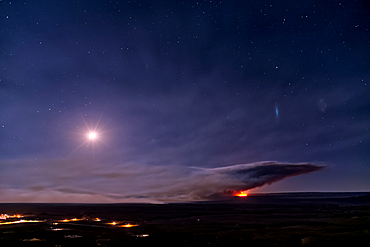
Dragon Bravo Wildfire burning on Grand Canyon North Rim viewed from Antelope Pass on Echo Cliffs off of US89 at night under moonlight.
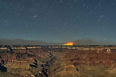
Dragon Bravo Wildfire on Grand Canyon North Rim viewed from Yavapai Point on South Rim Arizona at night under moonlight.
Dragon Bravo Wildfire burning on Grand Canyon North Rim viewed from Antelope Pass on Echo Cliffs off of US89 at night under moonlight.
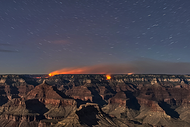
Dragon Bravo Wildfire on Grand Canyon North Rim viewed from Yavapai Point on South Rim Arizona at night under moonlight.
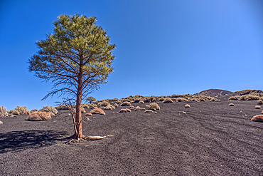
Lone Pine Tree, Coconino National Forest, Arizona, USA

A male Tarantula native to the Chino Valley area of Arizona crawling on a cactus. This is a male because the females hide underground and don't roam around like the males.
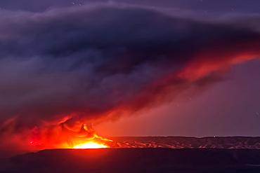
Smoke from the Dragon Bravo wildfire burning on the North Rim of Grand Canyon Arizona. Viewed from Shoshone Point on the South Rim at sundown. The fire started from a lightning strike on July 4th, 2025.
Smoke from the Dragon Bravo wildfire burning on the North Rim of Grand Canyon Arizona. Viewed from Shoshone Point on the South Rim. The fire started from a lightning strike on July 4th, 2025.
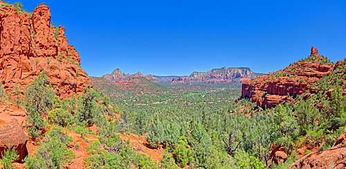
View of Sedona from the north slope of the Twin Buttes, Arizona, United States of America, North America
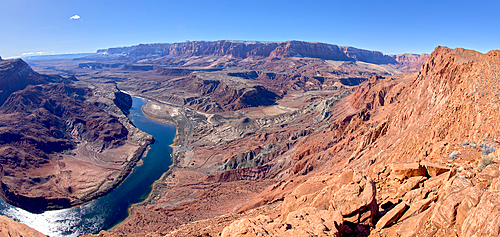
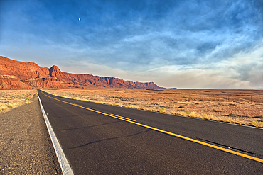
The Vermilion Cliffs adjacent to Glen Canyon Recreation Area viewed from the plateau at the end of Spencer Trail in Marble Canyon with Lee's Ferry on the lower left with the Colorado River, Arizona, United States of America, North America
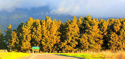
Landscape near Fox Glacier, South Island, New Zealand
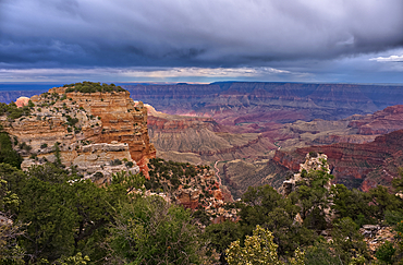
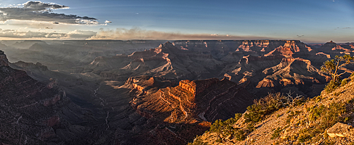
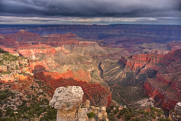
Storm rolling over Grand Canyon viewed from the Walhalla Overlook on North Rim Arizona.
Storm rolling over Grand Canyon viewed from the Walhalla Overlook on North Rim Arizona. Cape Final is on the left.
Storm rolling over Grand Canyon viewed from the Walhalla Overlook on North Rim Arizona.
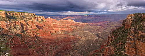
Storm rolling over Grand Canyon viewed from North Rim Arizona. Just left of center is Freya's Castle and Vishnu Temple. Cape Royal is right of center.