Results
1 2 3 … 15 Next »
1439 results found
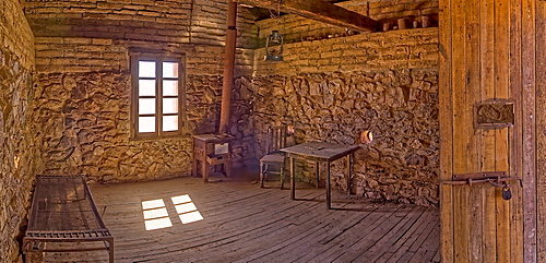
A panorama of the historic cabin of Henry Wickenburg, who founded the Arizona town with the same name in the late 1800s, Wickenburg, Arizona, United States of America, North America
An outside view of the historic cabin of Henry Wickenburg, founder of Vulture City and the town of Wickenburg, Arizona, United States of America, North America
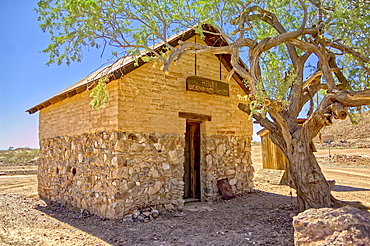
The Assay Office in the ghost town of Vulture City, near Wickenburg, Arizona, United States of America, North America
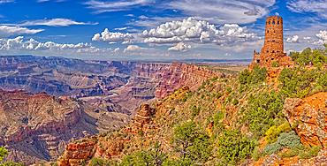
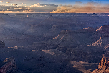
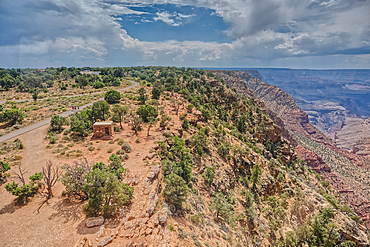
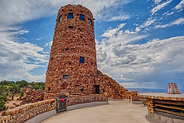
View of Grand Canyon west of the historic Watch Tower, managed by the National Park Service, UNESCO World Heritage Site, Arizona, United States of America, North America
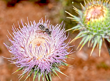
Macro photo of a Wheeler's Thistle Flower native to Arizona, United States of America, North America
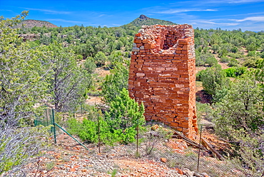
Historic Puntenney Kiln in Prescott National Forest, one of few relics left of the ghost towns of Puntenney and Cedar, Arizona, United States of America, North America
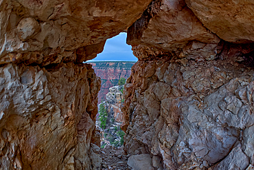
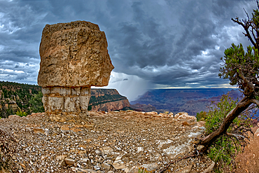
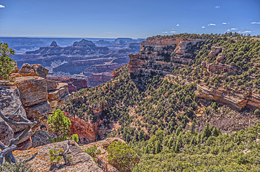
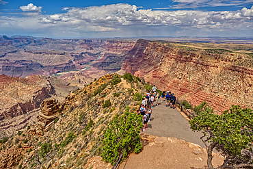
A gap between a stack of balanced boulders on a cliff east of Grandview Point at Grand Canyon South Rim, Grand Canyon National Park, UNESCO World Heritage Site, Arizona, United States of America, North America
View of Grand Canyon and a rock spire from within a gap between a stack of balanced boulders at Grandview Point, Grand Canyon National Park, UNESCO World Heritage Site, Arizona, United States of America, North America
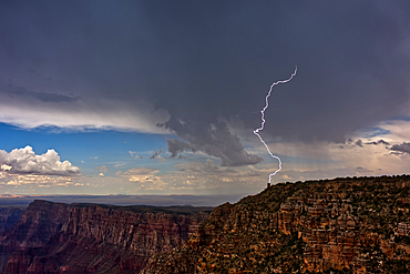
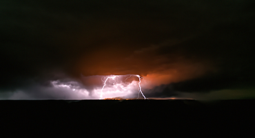
Lightning striking the Desert View Watchtower on Grand Canyon South Rim during the 2023 Arizona Monsoon season, viewed from Navajo Point, Grand Canyon National Park, UNESCO World Heritage Site, Arizona, United States of America, North America
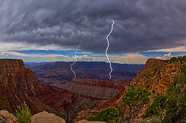
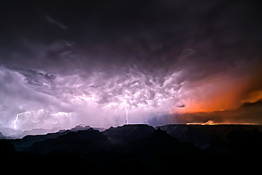
Lightning striking inside the Grand Canyon during the 2023 Arizona Monsoon season, viewed from No Name Overlook between Pinal Point on the left and Lipan Point on the right, Grand Canyon National Park, UNESCO World Heritage Site, Arizona, United States of America, North America
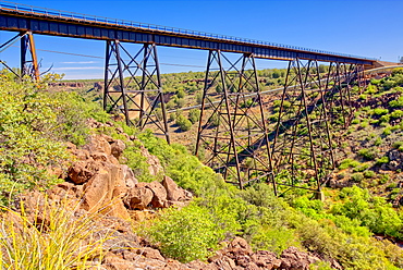
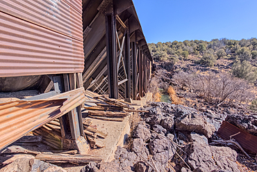
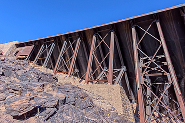
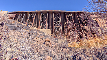
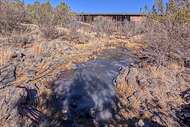
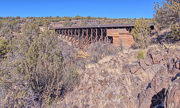
A historic railroad bridge spanning Hell Canyon in Drake, Arizona, United States of America, North America
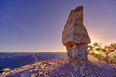
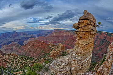
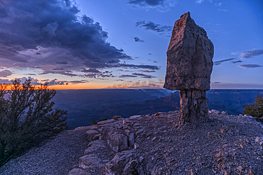
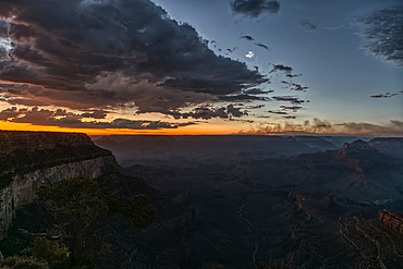
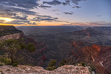
The famous Mushroom Rock at Shoshone Point at sunrise, Grand Canyon National Park, UNESCO World Heritage Site, Arizona, United States of America, North America
Storm approaching Shoshone Point on the South Rim, Grand Canyon National Park, UNESCO World Heritage Site, Arizona, United States of America, North America
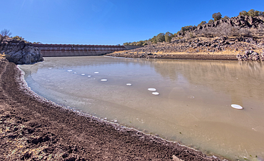
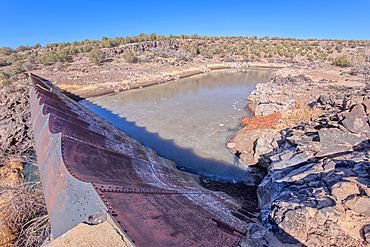
The eastern edge of the lake created by the historic Bainbridge Steel Dam near Ash Fork Arizona in the Kaibab National Forest. It was originally constructed in the late 1800s and is now a historic landmark that is open to the public.
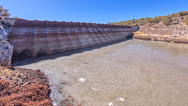
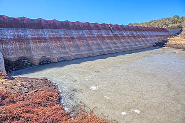
Shoreline view of the historic Bainbridge Steel Dam near Ash Fork Arizona in the Kaibab National Forest. It was originally constructed in the late 1800s and is now a historic landmark that is open to the public.
View of the lake created by the historic Bainbridge Steel Dam near Ash Fork Arizona in the Kaibab National Forest. It was originally constructed in the late 1800s and is now a historic landmark that is open to the public.
Shoreline view of the historic Bainbridge Steel Dam near Ash Fork Arizona in the Kaibab National Forest. It was originally constructed in the late 1800s and is now a historic landmark that is open to the public.
Top face view of the historic Bainbridge Steel Dam near Ash Fork Arizona in the Kaibab National Forest. It was originally constructed in the late 1800s and is now a historic landmark that is open to the public.
Top face view of the historic Bainbridge Steel Dam near Ash Fork Arizona in the Kaibab National Forest. It was originally constructed in the late 1800s and is now a historic landmark that is open to the public.
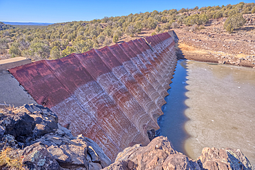
Top face view of the historic Bainbridge Steel Dam near Ash Fork Arizona in the Kaibab National Forest. It was originally constructed in the late 1800s and is now a historic landmark that is open to the public.
Overhead view of the historic Bainbridge Steel Dam near Ash Fork Arizona in the Kaibab National Forest. It was originally constructed in the late 1800s and is now a historic landmark that is open to the public.
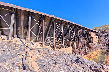
Closeup view of the steel framework of the historic Bainbridge Steel Dam near Ash Fork Arizona in the Kaibab National Forest. It was originally constructed in the late 1800s and is now a historic landmark that is open to the public.
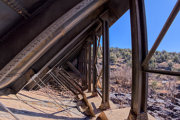
View from inside the steel framework of the historic Bainbridge Steel Dam near Ash Fork Arizona in the Kaibab National Forest. It was originally constructed in the late 1800s and is now a historic landmark that is open to the public.
Closeup view of the steel framework of the historic Bainbridge Steel Dam near Ash Fork Arizona in the Kaibab National Forest. It was originally constructed in the late 1800s and is now a historic landmark that is open to the public.
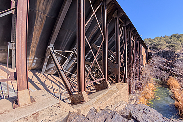
View from below the historic Bainbridge Steel Dam near Ash Fork Arizona in the Kaibab National Forest. It was originally constructed in the late 1800s and is now a historic landmark that is open to the public.
View from below the historic Bainbridge Steel Dam near Ash Fork Arizona in the Kaibab National Forest. It was originally constructed in the late 1800s and is now a historic landmark that is open to the public.
View from below the historic Bainbridge Steel Dam near Ash Fork Arizona in the Kaibab National Forest. It was originally constructed in the late 1800s and is now a historic landmark that is open to the public.
View from below the historic Bainbridge Steel Dam near Ash Fork Arizona in the Kaibab National Forest. It was originally constructed in the late 1800s and is now a historic landmark that is open to the public.
The historic Bainbridge Steel Dam near Ash Fork Arizona in the Kaibab National Forest. It was originally constructed in the late 1800s and is now a historic landmark that is open to the public.
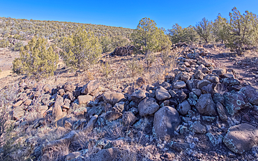
The remains of a rock wall built by ancient Indians along the Stone to Steel Trail that runs between the historic Stone Dam and Bainbridge Steel Dam near Ash Fork Arizona.
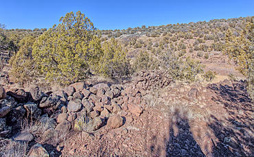
The remains of a rock wall built by ancient Indians along the Stone to Steel Trail that runs between the historic Stone Dam and Bainbridge Steel Dam near Ash Fork Arizona.
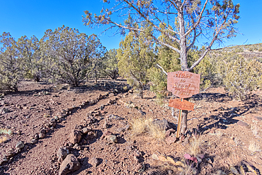
The Stone to Steel Trailhead, also known as Fay's Trail, that runs between the Stone Dam and the historic Bainbridge Steel Dam near Ash Fork Arizona. Located in the Kaibab National Forest. Sign is on public land. No property release needed.
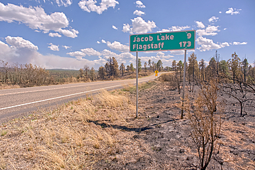
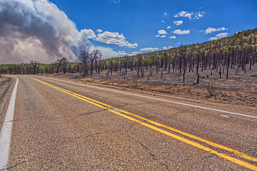
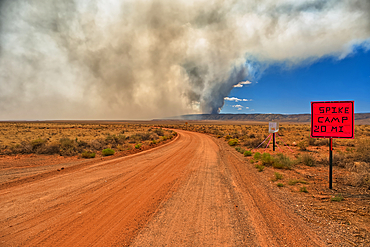
Road sign along US89A north of Jacob Lake Arizona that has been partially damaged by the White Sage Fire.
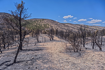
Scorched Earth and burned trees from the White Sage Wildfire near Jacob Lake Arizona in the Kaibab National Forest.
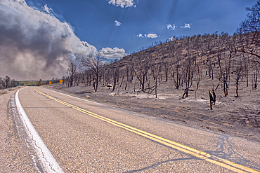
Scorched Earth and burned trees from the White Sage Wildfire near Jacob Lake Arizona in the Kaibab National Forest.
Scorched Earth and burned trees from the White Sage Wildfire near Jacob Lake Arizona in the Kaibab National Forest.
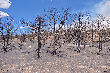
Scorched Earth and burned trees from the White Sage Wildfire near Jacob Lake Arizona in the Kaibab National Forest.
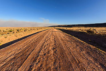
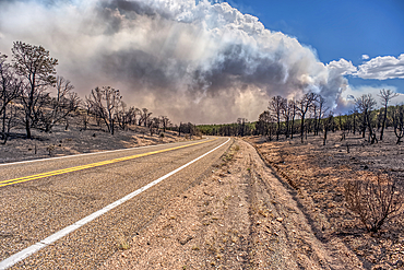
Smoke from the Dragon Bravo Wildfire burning on Grand Canyon North Rim billowing off the Kaibab Plateau. Viewed north of US89A across from Vermilion Cliffs.
Scorched Earth and burned trees from the White Sage Wildfire near Jacob Lake Arizona in the Kaibab National Forest.
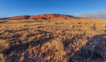
Vermilion Cliffs National Monument Arizona near sunset with smoke in the sky from the Dragon Bravo Wildfire burning on North Rim in the background.
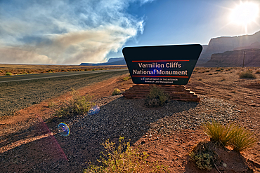
Sign for Vermilion Cliffs National Monument Arizona near sunset with smoke in the sky from the Dragon Bravo Wildfire burning on North Rim.
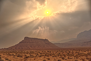
Sun shining thru dense smoke from the Dragon Bravo Wildfire enshrouding Vermilion Cliffs National Monument Arizona. Viewed from US89A.
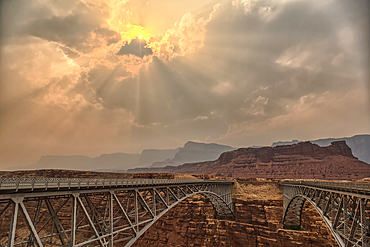
Sun shining thru dense smoke from the Dragon Bravo Wildfire enshrouding Vermilion Cliffs National Monument Arizona. Viewed from US89A at Navajo Bridge.
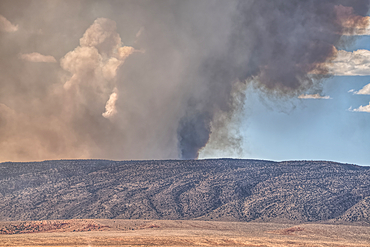
Smoke from the Dragon Bravo Wildfire burning on Grand Canyon North Rim billowing off the Kaibab Plateau. Viewed from US89A across from Vermilion Cliffs.
Smoke from the Dragon Bravo Wildfire burning on Grand Canyon North Rim billowing off the Kaibab Plateau. Viewed from House Rock Road across from Vermilion Cliffs.
Vermilion Cliffs National Monument Arizona at sunset viewed from House Rock Road north of US89A.

A male Tarantula native to the Chino Valley area of Arizona crawling on rocks. This is a male because the females hide underground and don't roam around like the males.
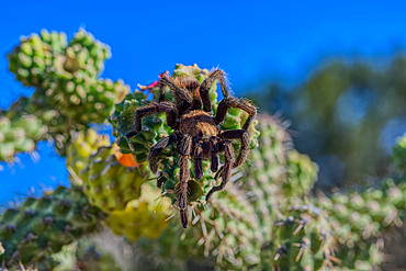
A male Tarantula native to the Chino Valley area of Arizona crawling on a cactus. This is a male because the females hide underground and don't roam around like the males.

A male Tarantula native to the Chino Valley area of Arizona crawling on a cactus. This is a male because the females hide underground and don't roam around like the males.

A male Tarantula native to the Chino Valley area of Arizona crawling on a cactus. This is a male because the females hide underground and don't roam around like the males.
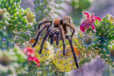
A male Tarantula native to the Chino Valley area of Arizona crawling on a cactus. This is a male because the females hide underground and don't roam around like the males.

A male Tarantula native to the Chino Valley area of Arizona crawling on a cactus. This is a male because the females hide underground and don't roam around like the males.
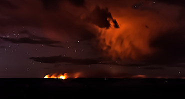
Dragon Bravo wildfire burning on the North Rim of Grand Canyon Arizona with a lightning storm. Viewed from Yavapai Point on the South Rim at night. The fire started from a lightning strike on July 4th, 2025.
Dragon Bravo wildfire burning on the North Rim of Grand Canyon Arizona with a lightning storm. Viewed from Yavapai Point on the South Rim at night. The fire started from a lightning strike on July 4th, 2025.
Smoke from the Dragon Bravo wildfire burning on the North Rim of Grand Canyon Arizona. Viewed from Shoshone Point on the South Rim at sundown. The fire started from a lightning strike on July 4th, 2025.
Dragon Bravo wildfire burning on the North Rim of Grand Canyon Arizona. Viewed from Pipe Creek Vista on the South Rim at night. The fire started from a lightning strike on July 4th, 2025. Due to high winds and long exposure time there is motion blur.
Smoke from the Dragon Bravo wildfire burning on the North Rim of Grand Canyon Arizona. Viewed from Shoshone Point on the South Rim at sundown. The fire started from a lightning strike on July 4th, 2025.
Smoke from the Dragon Bravo wildfire burning on the North Rim of Grand Canyon Arizona. Viewed from Shoshone Point on the South Rim. The fire started from a lightning strike on July 4th, 2025.
Smoke from the Dragon Bravo wildfire burning on the North Rim of Grand Canyon Arizona. Viewed from Shoshone Point on the South Rim. The fire started from a lightning strike on July 4th, 2025.
Smoke from the Dragon Bravo wildfire burning on the North Rim of Grand Canyon Arizona. Viewed from Shoshone Point on the South Rim. The fire started from a lightning strike on July 4th, 2025.
Smoke from the Dragon Bravo wildfire burning on the North Rim of Grand Canyon Arizona. Viewed from Shoshone Point on the South Rim. The fire started from a lightning strike on July 4th, 2025.
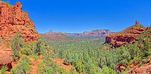
View of Sedona from the north slope of the Twin Buttes, Arizona, United States of America, North America
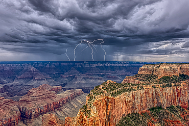
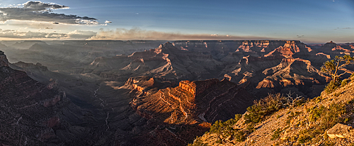
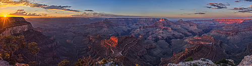
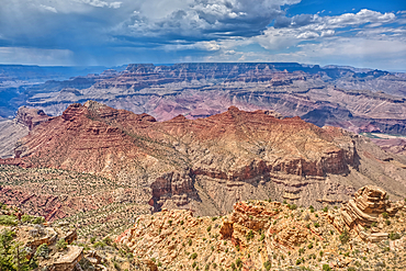
A thunderstorm approaching the South Rim of Grand Canyon Arizona. Viewed from Cape Royal on the North Rim.
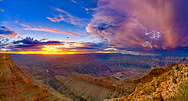
A dying storm at twilight viewed from Lipan Point, Grand Canyon, with Spider Lightning visible, Grand Canyon National Park, UNESCO World Heritage Site, Arizona, United States of America, North America
The landmark in Petrified Forest National Park called Squared Off Butte, a marker on the way to Onyx Bridge, Arizona, United States of America, North America

A section of Petrified Forest National Park called Angel Garden, northwest of the Onyx Bridge, Arizona, United States of America, North America
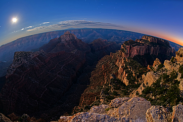
View from Cape Royal, below is Vishnu Creek running between Vishnu Temple on the left with Wotans Throne on the right at twilight with the Moon rising, Grand Canyon National Park, UNESCO World Heritage Site, Arizona, United States of America, North America
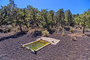
A water catchment in the Coconino National Forest, Sunset Crater National Monument, Arizona, USA
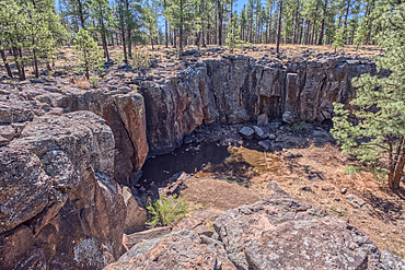
The cliff rim of Keyhole Sink in the Kaibab National Forest near Williams, Arizona, USA
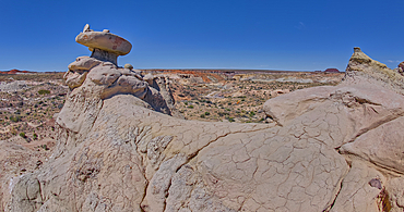
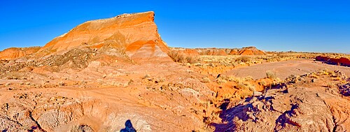
Mushroom shaped sandstone spire on an eroded ridge west of Hamilili Point in Petrified Forest National Park, Arizona, United States of America, North America
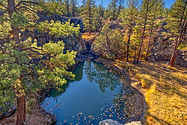
One of several natural ponds near Sycamore Falls known as the Pomeroy Tanks, Kaibab National Forest near Williams, Arizona, United States of America, North America

A twisted Juniper Tree near Sycamore Canyon in the Kaibab National Forest south of Williams, Arizona, United States of America, North America
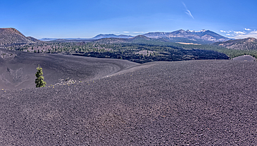
Volcanic cinder rim in Coconino National Forest, Arizona, USA
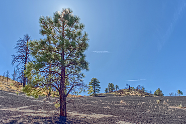
Volcanic cinder hill in Coconino National Forest, Arizona, USA
View of Honan Point on the North Rim of Grand Canyon National Park, Arizona, USA
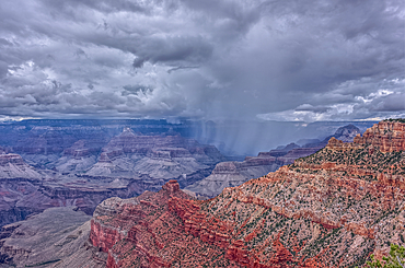
A rain storm over the North Rim of Grand Canyon National Park, Arizona, USA
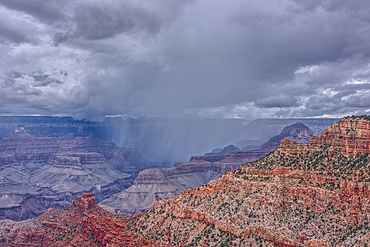
A rain storm over the North Rim of Grand Canyon National Park, Arizona, USA
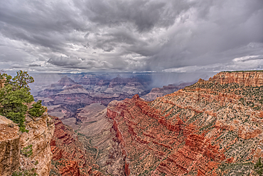
A rain storm over the North Rim of Grand Canyon National Park, Arizona, USA
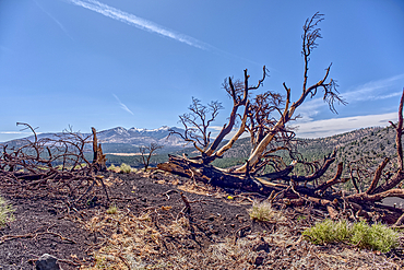
Burned trees on a Volcanic cinder rim in Coconino National Forest, Arizona, USA
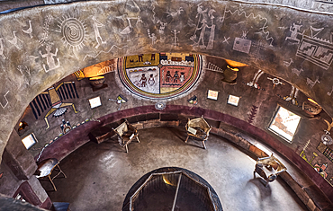
An interior view of the historic Desert View Watchtower at Grand Canyon South Rim, artwork created by Fred Kobotie in 1933, now owned by the National Park Service, UNESCO World Heritage Site, Arizona, United States of America, North America
An interior view of the historic Desert View Watchtower at Grand Canyon South Rim, artwork created by Fred Kobotie in 1933, now owned by the National Park Service, Arizona, United States of America, North America
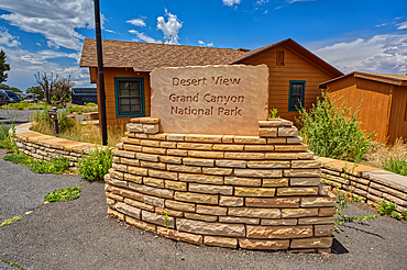
The welcome sign for Desert View Point on the east side of Grand Canyon South Rim, UNESCO World Heritage Site, Arizona, United States of America, North America
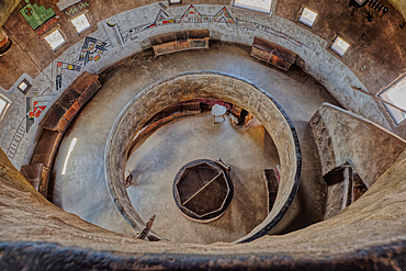
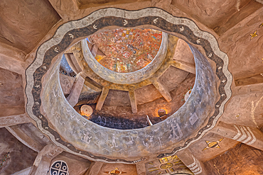
Downward view from the third floor in the historic Desert View Watchtower at Grand Canyon South Rim, artwork created by Fred Kobotie in 1933, now owned by the National Park Service, UNESCO World Heritage Site, Arizona, United States of America, North America
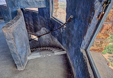
Stairs going down from the fourth floor in the historic Desert View Watchtower at Grand Canyon South Rim, UNESCO World Heritage Site, Arizona, United States of America, North America
Downward view from the second floor in historic Desert View Watchtower at Grand Canyon South Rim, artwork created by Fred Kobotie in 1933, now owned by the National Park Service, UNESCO World Heritage Site, Arizona, United States of America, North America
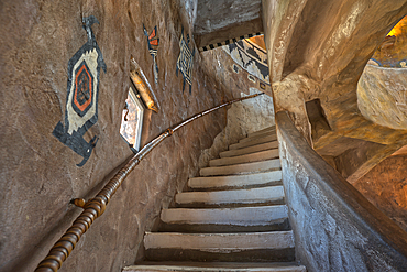
Stairs up to the third floor in the historic Desert View Watchtower at Grand Canyon South Rim, artwork created by Fred Kobotie in 1933, now owned by the National Park Service, UNESCO World Heritage Site, Arizona, United States of America, North America

Stairs up to the seconnd floor in the historic Desert View Watchtower at Grand Canyon South Rim, artwork created by Fred Kobotie in 1933, now owned by the National Park Service, UNESCO World Heritage Site, Arizona, United States of America, North America
Southwest view of Grand Canyon South Rim Arizona from the top floor of the historic Watchtower, taken through glass window, Grand Canyon, UNESCO World Heritage Site, Arizona, United States of America, North America
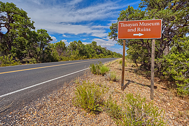
The direction sign for the Tusayan Museum and ruins at Grand Canyon South Rim, Arizona, United States of America, North America
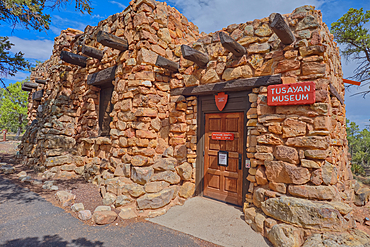
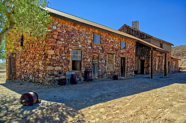
The Tusayan Museum building at Grand Canyon South Rim, Arizona, United States of America, North America
Northwest view of Grand Canyon South Rim Arizona from the top floor of the historic Watchtower, taken through glass window, Grand Canyon, UNESCO World Heritage Site, Arizona, United States of America, North America

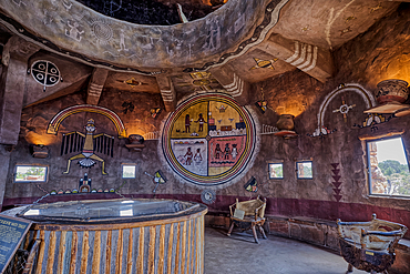
The top floor of the historic Watchtower at Grand Canyon South Rim, Grand Canyon, UNESCO World Heritage Site, Arizona, United States of America, North America
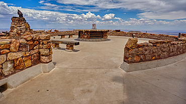
The observation deck of the Desert View Watchtower at Grand Canyon South Rim, UNESCO World Heritage Site, Arizona, United States of America, North America
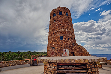
The upper half of the Desert View Watchtower viewed from the observation deck at Grand Canyon South Rim, UNESCO World Heritage Site, Arizona, United States of America, North America
View from the observation deck of the Desert View Watchtower at Grand Canyon South Rim, UNESCO World Heritage Site, Arizona, United States of America, North America
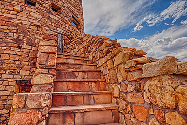
Steps to a platform above the observation deck of the Desert View Watchtower at Grand Canyon South Rim, HDR enhanced, Arizona, United States of America, North America
The upper half of the Desert View Watchtower viewed from the observation deck at Grand Canyon South Rim, UNESCO World Heritage Site, Arizona, United States of America, North America
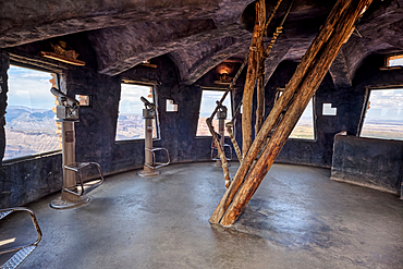
The top floor of the historic Watchtower at Grand Canyon South Rim, UNESCO World Heritage Site, Arizona, United States of America, North America