Results
34 results found
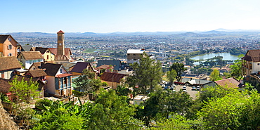
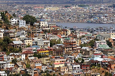
Panorama over Antananarivo, Madagascar, Africa
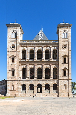
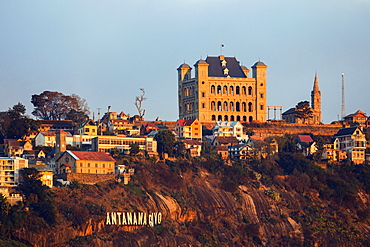
Former Queen's palace, Antananarivo, Madagascar, Africa
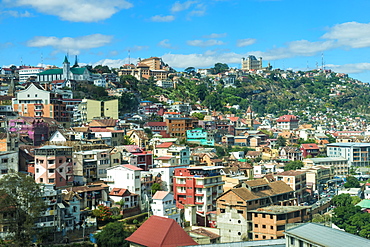
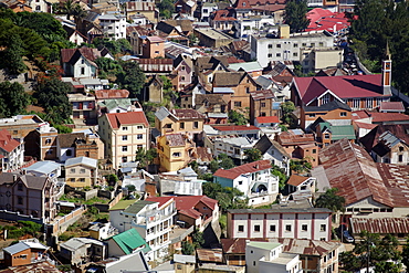
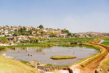
View over a hillside, Antananarivo, Madagascar, Africa

Crocodile Farm, Nile crocodile (Crocodylus niloticus), Antananarivo, Madagascar, Africa
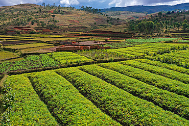
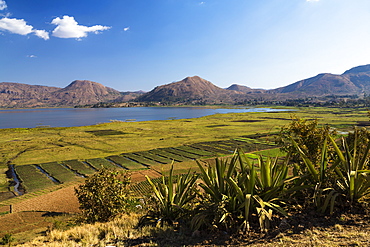
Vegetable cultivation and brick making on the rice fields, National Route RN7 between Antsirabe and Antananarivo, Madagascar, Africa
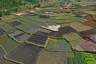
Vegetable cultivation and brick making on the rice fields, National Route RN7 between Antsirabe and Antananarivo, Madagascar, Africa
Brick making on the rice fields on the National Route RN7 between Antsirabe and Antananarivo, Ambatotapaka, Madagascar, Africa
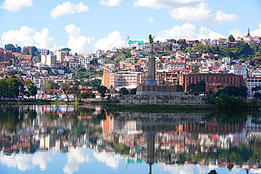
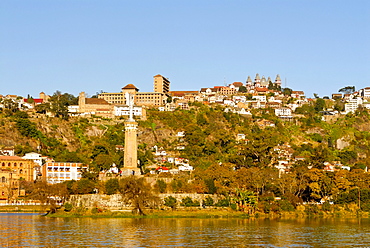
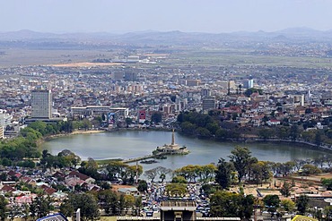
The town of Antananarivo, Lac Anosy and the Monument de l'Ange Noir, Antananarivo, Madagascar, Africa
Vegetable cultivation and brick making on the rice fields, National Route RN7 between Antsirabe and Antananarivo, Madagascar, Africa

Brick making on the rice fields on the National Route RN7 between Antsirabe and Antananarivo, Ambatotapaka, Madagascar, Africa
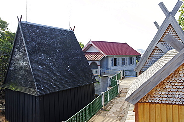
Residences and burial sites of several members of the royalty of Imerina, Royal Hill of Ambohimanga, Antananarivo Province, Madagascar, Africa
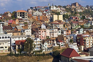
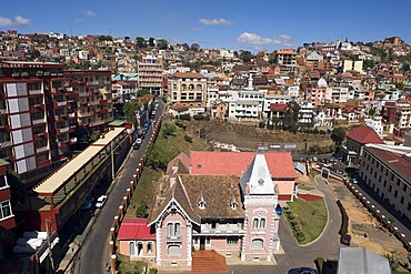
View from the upper city, Antananarivo city, Tananarive, Madagascar, Africa

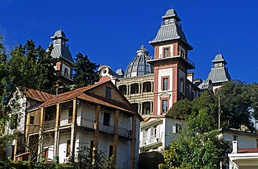
Queen's Palace, Rova of Antananarivo Upper City, Antananarivo city, Tananarive, Madagascar, Africa
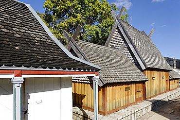
Residences and burial sites of several members of the royalty of Imerina, Royal Hill of Ambohimanga, Antananarivo Province, Madagascar, Africa

Queen's Palace, Rova of Antananarivo Upper City, Antananarivo city, Tananarive, Madagascar, Africa
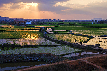
Sunset over rice fields in Antananarivo.
Central Antananarivo, Madagascar, Africa

Central Antananarivo, Madagascar, Africa
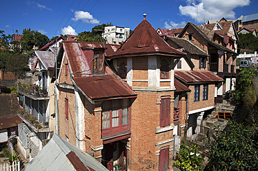
Hillside houses, Antananarivo, Madagascar, Africa
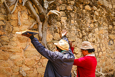
Malagasy worshippers praying at Ambohimanga Royal Palace, Antananarivo.
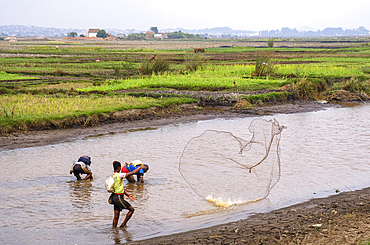
Malagasy people fishing the rivers in Antananarivo.
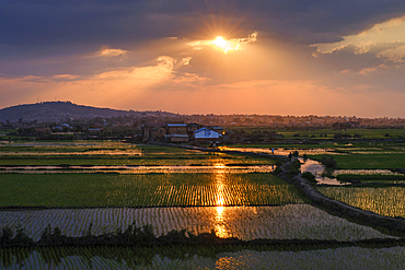
Sunset over rice fields in Antananarivo.
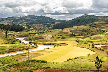
Rice paddy field scenery near Antananarivo, Antananarivo Province, Eastern Madagascar, Africa
Rice paddy field scenery near Antananarivo, Antananarivo Province, Eastern Madagascar, Africa
Panorama of Antananarivo city, Antananarivo, Madagascar, Africa
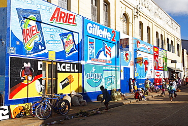
Wall painting advertising, Low City, Antananarivo (Tananarive), Madagascar, Africa
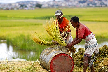
Farmers harvest and thresh by hand in rice paddy fields, Antananarivo, Madagascar, Africa

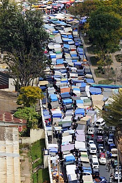
Food market close to Gare Soarano train station, Antananarivo, Madagascar, Africa
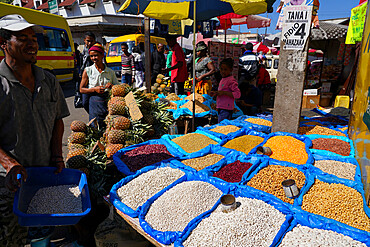
Food market close to Gare Soarano train station, Antananarivo, Madagascar, Africa
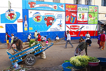
Wall painting advertising, Low City, Antananarivo (Tananarive), Madagascar, Africa
The high city, Antananarivo (Tananarive), Madagascar, Africa
Food market close to Gare Soarano train station, Antananarivo, Madagascar, Africa
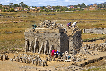
Brick production in Antananarivo, Madagascar, Africa
Brick production in Antananarivo, Madagascar, Africa

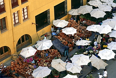
The central market of Antananarivo, Madagascar, Africa
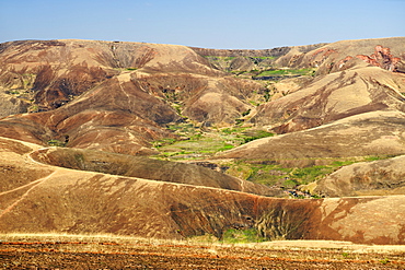
Landscape along the RN6 road approximately 200 kms north of Antananarivo, Madagascar, Africa

The central market of uptown in Antananarivo, Madagascar, Africa

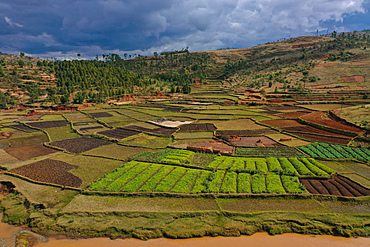
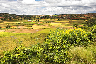
Landscape with rice paddies and assorted crops approximately 20 kms north of Antananarivo, Madagascar, Africa
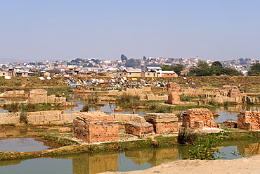
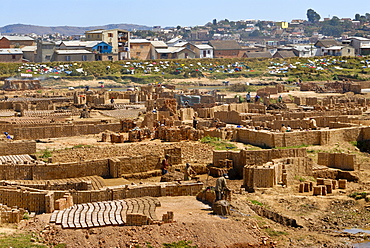
Brick factories on the outskirts of Antananarivo, Madagascar, Africa
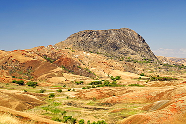
Landscape along the RN6 road approximately 200 kms north of Antananarivo, Madagascar, Africa
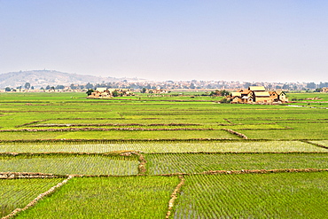
Rice paddies being cultivated on the outskirts of Antananarivo, Madagascar, Africa
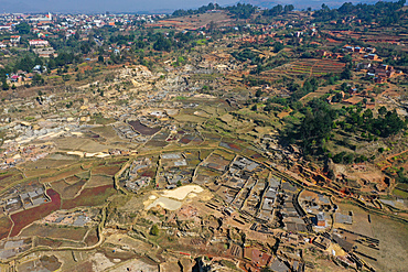
View of the housing and landscape on the outskirts of Antananarivo, Madagascar, Africa
View over Tana, from the hill of the Queen Mother, Madagascar, Africa

La Digue, one of the biggest markets of Tana, with the first hill of Tana in the background, Madagascar, Africa
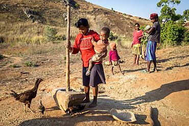
Family of farmers, near Antananarivo, Madagascar
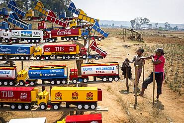
Girls selling wooden toys on National Highway 7, near Antananarivo, Madagascar
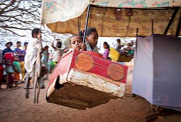
Carousel, outskirts of Antananarivo, Madagascar
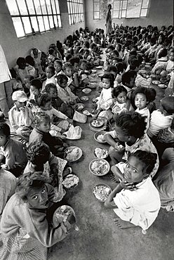
Medicine In Madagascar
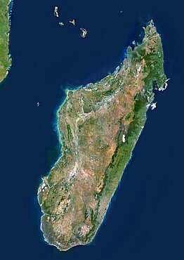
Madagascar, True Colour Satellite Image. Madagascar, true colour satellite image. This image was compiled from data acquired by LANDSAT 5 & 7 satellites.
Market in Antananarivo, Madagascar, Africa
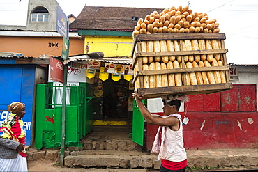
Man delivering bread, Bread deliverer, street scenario, Antananarivo, capital, Madagascar, Africa
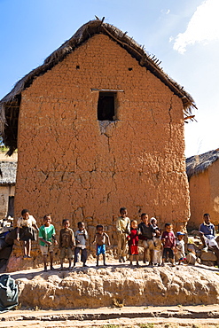
Children and houses near Ampefy, Merina people, Madagascar, Africa
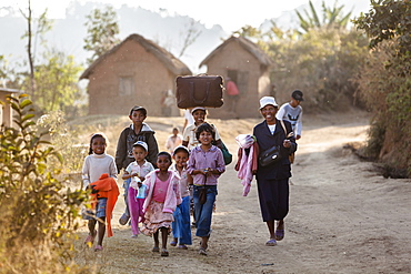
Madagascan people walking along a dusty road near Ampefy, Merina people, Madagascar, Africa
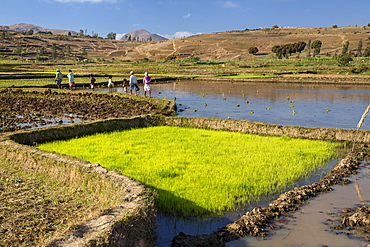
Rice fields, paddyfields west of Antananarivo, highlands, Madagascar, Africa
King's Palace, Rova, Analamanga hill, Antananarivo, capital, central highlands, Madagascar, Africa
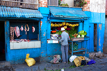
Butcher and Greengrocer, Antananarivo, Madagascar, Africa
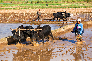
Farmer plows rice field with zebus west of Antananarivo, highlands, Madagascar, Africa
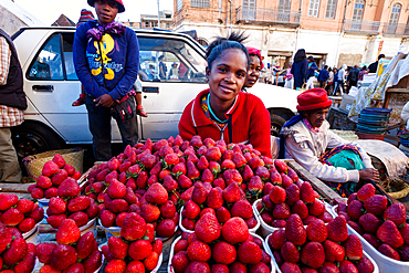
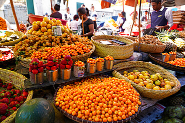
Zoma, market stall with strawberries on the Friday market in the capital Antananarivo, Madagascar, Africa
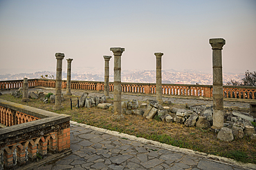
Ruins of the Rova Antananarivo (former Royal Palace), Madagascar, Africa

Cathedral of the Immaculate Conception, Antananarivo capital, Madagascar, Africa
Rova Antananarivo (former Royal Palace), Madagascar, Africa
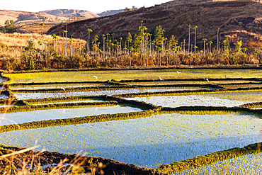
Rice fields west of Antananarivo, highlands, Madagascar, Africa
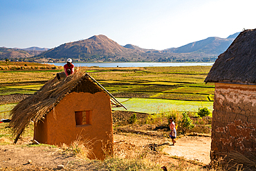
Houses on Lake Itasy, Lac Itasy, Merina tribe, highlands west of Antananarivo, Madagascar, Africa
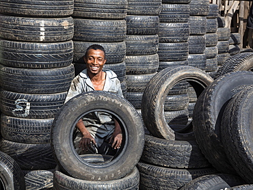
Tyre dealer, Antananarivo, capital of Madagascar, Africa

Stone sculpture at Rova Antananarivo (former Royal Palace), Madagascar, Africa

Church at Rova Antananarivo (former Royal Palace), Madagascar, Africa
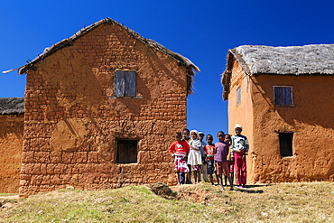
Children and houses west of Antananarivo, Merina people, Madagascar, Africa
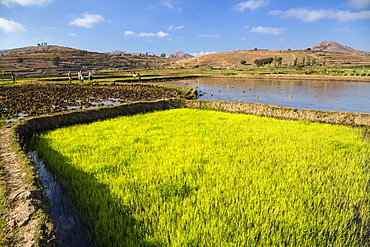
Rice fields, paddyfields west of Antananarivo, highlands, Madagascar, Africa
King's Palace, Palace of the Queen, Ambohimanga, Madagascar, Africa
Lake Itasy, highlands west of Antananarivo, Madagascar, Africa
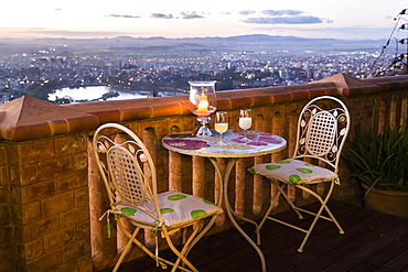
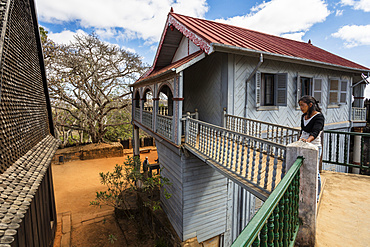
Terrace of the Lokanga hotel above Antananarivo, capital of Madagascar, Africa
King's Palace, Rova, Analamanga hill, Antananarivo, capital, central highlands, Madagascar, Africa
Weekly market in Antananarivo or Tana, formerly Tananarive, Madagascar, Africa
Typical district of the capital Antananarivo or Tana, formerly Tananarive, Madagascar, Africa

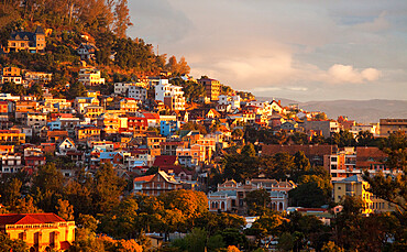
Sunset over capital city Antananarivo, Madagascar, Africa
Anosy Lake, behind the historic district of Antananarivo, capital of Madagascar, with the Rova of Antananarivo, a royal palace complex, Madagascar, Africa
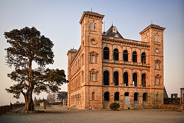
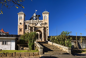
Historical Prime minister's palace in Antananarivo, Madagascar
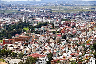
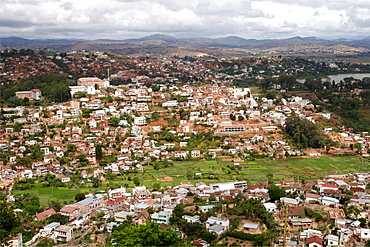
Antananarivo cityscape, Madagascar, Africa
Antananarivo cityscape, Madagascar, Africa
Antananarivo or Tana, formerly Tananarive, capital of Madagascar, Africa
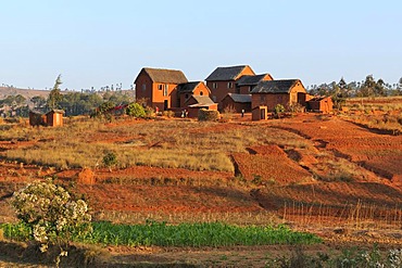
Typical village in the highlands around Antananarivo or Tana, formerly Tananarive, Madagascar, Africa
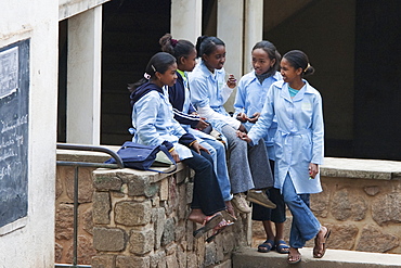
Schoolchildren In Antananarivo, Madagascar
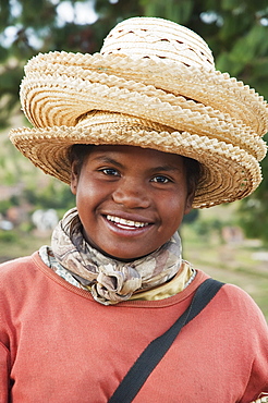
Girl Selling Hats In Tritiva, Antananarivo Province, Madagascar
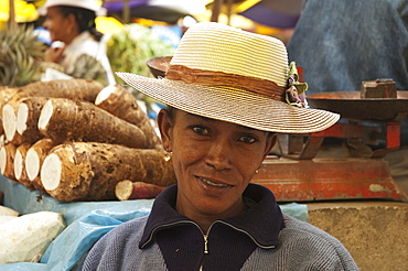
Woman At An Antananarivo Market, Antananarivo Province, Madagascar
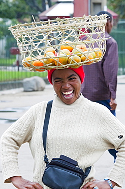
Woman carrying a basket with oranges on her head in Antananarivo, Madagascar

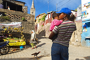
Woman and baby in Antananarivo, Madagascar

Girl selling hats in Tritiva, Antananarivo Province, Madagascar
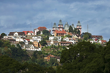
Houses in Haute-Ville, Antananarivo, Madagascar
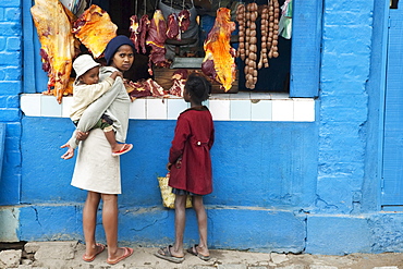
Children at a butcher shop, Antananarivo, Madagascar
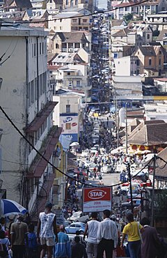
MADAGASCAR Antananarivo Downtown area. People walking down towards a busy road running between buildings and shopfronts filled with people and cars