Results
50 results found
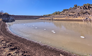
The eastern edge of the lake created by the historic Bainbridge Steel Dam near Ash Fork Arizona in the Kaibab National Forest. It was originally constructed in the late 1800s and is now a historic landmark that is open to the public.
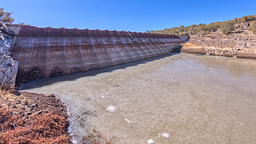
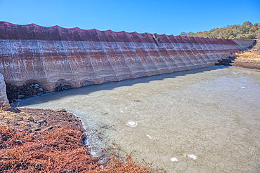
Shoreline view of the historic Bainbridge Steel Dam near Ash Fork Arizona in the Kaibab National Forest. It was originally constructed in the late 1800s and is now a historic landmark that is open to the public.
View of the lake created by the historic Bainbridge Steel Dam near Ash Fork Arizona in the Kaibab National Forest. It was originally constructed in the late 1800s and is now a historic landmark that is open to the public.
Shoreline view of the historic Bainbridge Steel Dam near Ash Fork Arizona in the Kaibab National Forest. It was originally constructed in the late 1800s and is now a historic landmark that is open to the public.
Top face view of the historic Bainbridge Steel Dam near Ash Fork Arizona in the Kaibab National Forest. It was originally constructed in the late 1800s and is now a historic landmark that is open to the public.
Top face view of the historic Bainbridge Steel Dam near Ash Fork Arizona in the Kaibab National Forest. It was originally constructed in the late 1800s and is now a historic landmark that is open to the public.
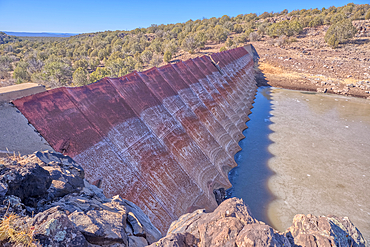
Top face view of the historic Bainbridge Steel Dam near Ash Fork Arizona in the Kaibab National Forest. It was originally constructed in the late 1800s and is now a historic landmark that is open to the public.
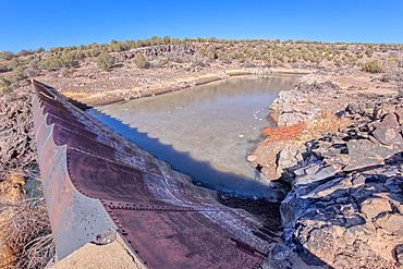
Overhead view of the historic Bainbridge Steel Dam near Ash Fork Arizona in the Kaibab National Forest. It was originally constructed in the late 1800s and is now a historic landmark that is open to the public.
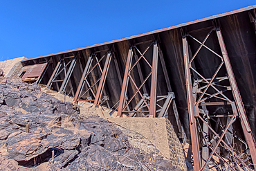
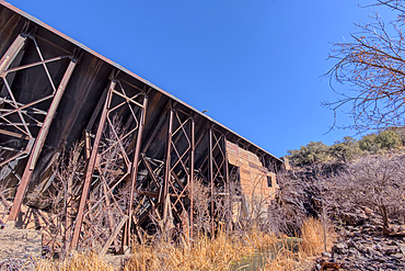
Closeup view of the steel framework of the historic Bainbridge Steel Dam near Ash Fork Arizona in the Kaibab National Forest. It was originally constructed in the late 1800s and is now a historic landmark that is open to the public.
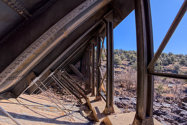
View from inside the steel framework of the historic Bainbridge Steel Dam near Ash Fork Arizona in the Kaibab National Forest. It was originally constructed in the late 1800s and is now a historic landmark that is open to the public.
Closeup view of the steel framework of the historic Bainbridge Steel Dam near Ash Fork Arizona in the Kaibab National Forest. It was originally constructed in the late 1800s and is now a historic landmark that is open to the public.
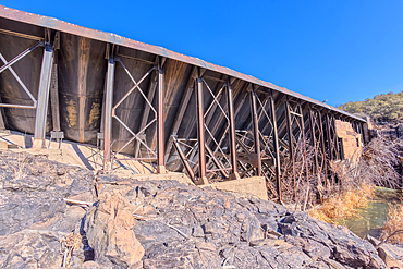
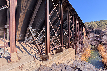
View from below the historic Bainbridge Steel Dam near Ash Fork Arizona in the Kaibab National Forest. It was originally constructed in the late 1800s and is now a historic landmark that is open to the public.
View from below the historic Bainbridge Steel Dam near Ash Fork Arizona in the Kaibab National Forest. It was originally constructed in the late 1800s and is now a historic landmark that is open to the public.
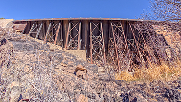
View from below the historic Bainbridge Steel Dam near Ash Fork Arizona in the Kaibab National Forest. It was originally constructed in the late 1800s and is now a historic landmark that is open to the public.
View from below the historic Bainbridge Steel Dam near Ash Fork Arizona in the Kaibab National Forest. It was originally constructed in the late 1800s and is now a historic landmark that is open to the public.
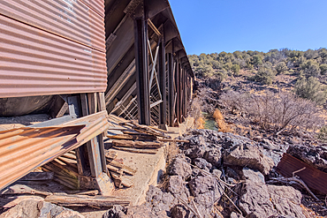
The historic Bainbridge Steel Dam near Ash Fork Arizona in the Kaibab National Forest. It was originally constructed in the late 1800s and is now a historic landmark that is open to the public.
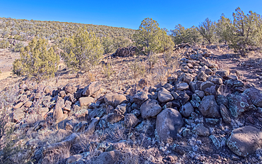
The remains of a rock wall built by ancient Indians along the Stone to Steel Trail that runs between the historic Stone Dam and Bainbridge Steel Dam near Ash Fork Arizona.
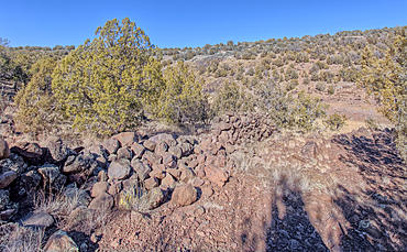
The remains of a rock wall built by ancient Indians along the Stone to Steel Trail that runs between the historic Stone Dam and Bainbridge Steel Dam near Ash Fork Arizona.
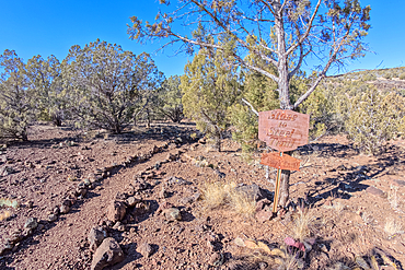
The Stone to Steel Trailhead, also known as Fay's Trail, that runs between the Stone Dam and the historic Bainbridge Steel Dam near Ash Fork Arizona. Located in the Kaibab National Forest. Sign is on public land. No property release needed.
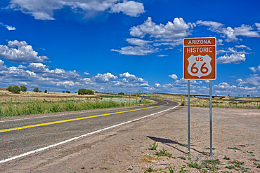
A road sign marking the Historic Route 66 just west of Ash Fork, Arizona, United States of America, North America
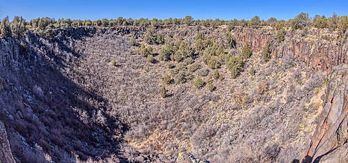
View from below the rim of the giant sinkhole known as Johnson Crater in the Kaibab National Forest near Ash Fork Arizona, USA
View from below the rim of the giant sinkhole known as Johnson Crater in the Kaibab National Forest near Ash Fork Arizona, USA
View from below the rim of the giant sinkhole known as Johnson Crater in the Kaibab National Forest near Ash Fork Arizona, USA
View from below the rim of the giant sinkhole known as Johnson Crater in the Kaibab National Forest near Ash Fork Arizona, USA
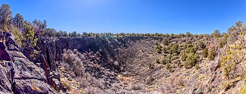
Super Panorama of the giant sinkhole known as Johnson Crater in the Kaibab National Forest near Ash Fork Arizona, USA
The giant sinkhole known as Johnson Crater in the Kaibab National Forest near Ash Fork Arizona, USA
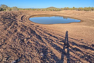
The Thirteen Mile Cattle Tank off of Corva Road in the Kaibab National Forest near Ash Fork Arizona, USA
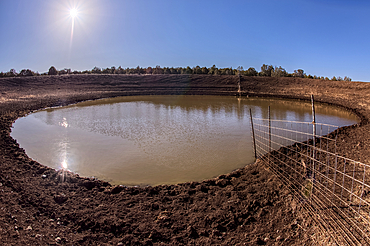
The Thirteen Mile Cattle Tank off of Corva Road in the Kaibab National Forest near Ash Fork Arizona, USA

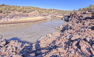
View from below the Stone Dam in the Kaibab National Forest, Arizona, USA
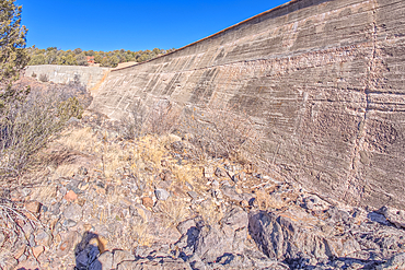
View from below the Stone Dam in the Kaibab National Forest, Arizona, USA
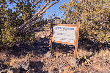
Historical information sign at Stone Dam Lake in the Kaibab National Forest, Arizona, USA
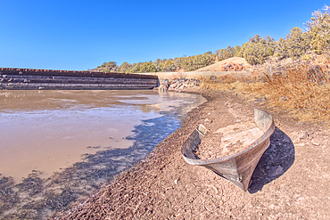
An abandoned boat along the shore of Stone Dam Lake in the Kaibab National Forest, Arizona, USA
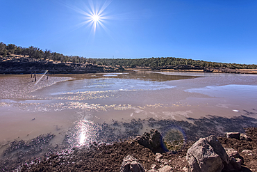
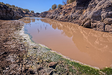
View from the shore of Stone Dam Lake in the Kaibab National Forest, Arizona, USA
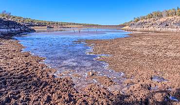
View from the shore of Stone Dam Lake in the Kaibab National Forest, Arizona, USA
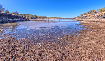
View from the shore of Stone Dam Lake in the Kaibab National Forest, Arizona, USA
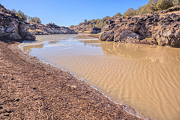
Shoreline view of the historic Bainbridge Steel Dam near Ash Fork, Kaibab National Forest, Arizona, United States of America
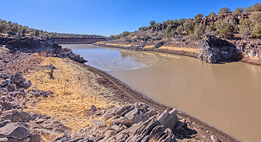
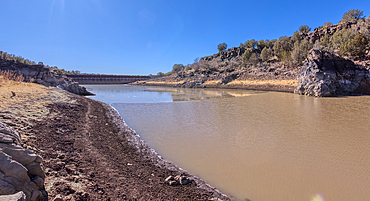
View of the lake created by the historic Bainbridge Steel Dam near Ash Fork, Kaibab National Forest, Arizona, United States of America
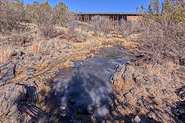
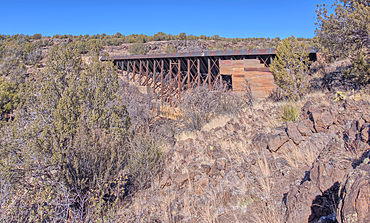
View from below the historic Bainbridge Steel Dam near Ash Fork, Kaibab National Forest, Arizona, United States of America
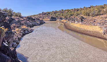
View of the lake created by the historic Bainbridge Steel Dam near Ash Fork, Kaibab National Forest, Arizona, United States of America
View of the lake created by the historic Bainbridge Steel Dam near Ash Fork, Kaibab National Forest, Arizona, United States of America
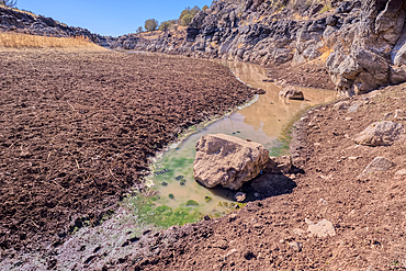
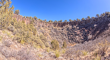
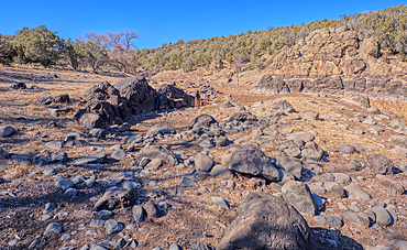
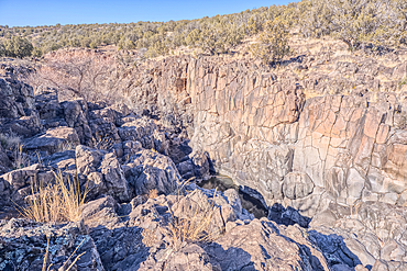
Basalt boulders and cliffs, Johnson Canyon east of Bainbridge Steel Dam Lake near Ash Fork, Kaibab National Forest, Arizona, United States of America
Basalt formation in Johnson Canyon east of the Bainbridge Steel Dam Lake near Ash Fork, Kaibab National Forest, Arizona, United States of America
Basalt boulders and cliffs, Johnson Canyon east of Bainbridge Steel Dam Lake near Ash Fork, Kaibab National Forest, Arizona, United States of America
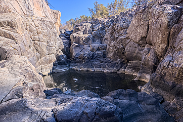
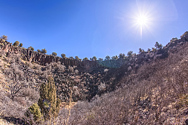
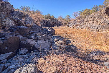
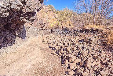
Dry waterfall cliffs, Johnson Canyon between Bainbridge Steel and Stone Dams near Ash Fork, Kaibab National Forest, Arizona, United States of America
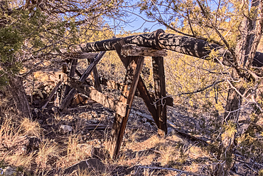
Old water pipe, Johnson Canyon between Bainbridge Steel and Stone Dams near Ash Fork, Kaibab National Forest, Arizona, United States of America
Dry waterfall cliffs, Johnson Canyon between Bainbridge Steel and Stone Dams near Ash Fork, Kaibab National Forest, Arizona, United States of America
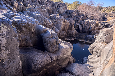
Dry waterfall cliffs, Johnson Canyon between Bainbridge Steel and Stone Dams near Ash Fork, Kaibab National Forest, Arizona, United States of America
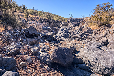
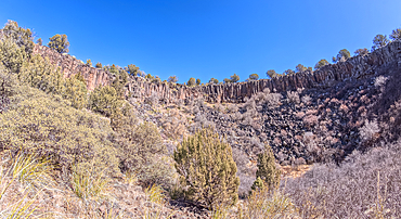
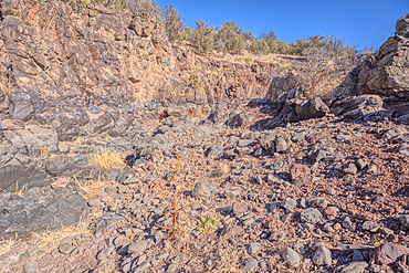
Basalt boulders and cliffs in a section of Johnson Canyon halfway between the Bainbridge Steel Dam and Stone Dam near Ash Fork Arizona in the Kaibab National Forest.
Basalt boulders and cliffs in a section of Johnson Canyon halfway between the Bainbridge Steel Dam and Stone Dam near Ash Fork Arizona in the Kaibab National Forest.
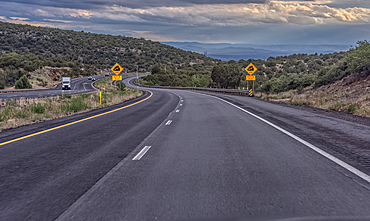
Approaching a steep grade on westbound I-40 near Ash Fork, Arizona, USA