Results
1 2 3 … 14 Next »
1305 results found
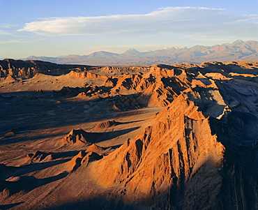
Valley of the Moon, Atacama Desert, Chile
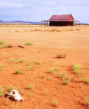
A shack in the Outback, New South Wales, Australia
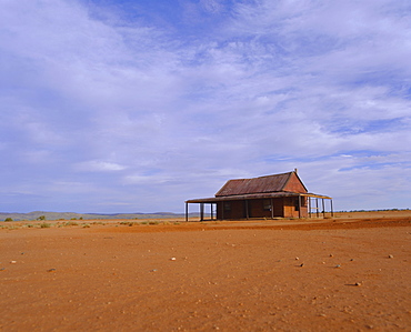
Outback shack, New South Wales, Australia
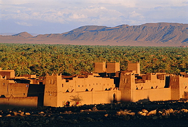
Zagora, Draa Valley, Anti Atlas mountains, Morocco, North Africa, Africa
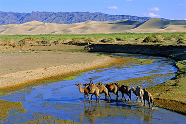
Camel caravan, Khongoryn Els dune, Gobi Desert National Park, Omnogov, Mongolia
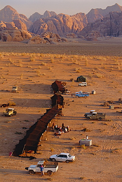
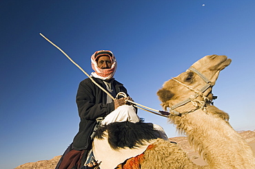
A bedouin (bedu) camp, Wadi Rum, Jordan, Middle East
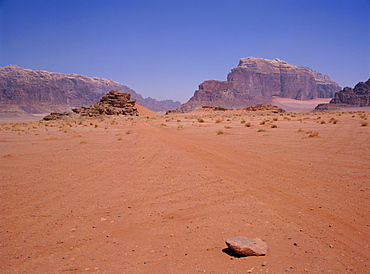
Arid landscape, Wadi Rum, Jordan, Middle East
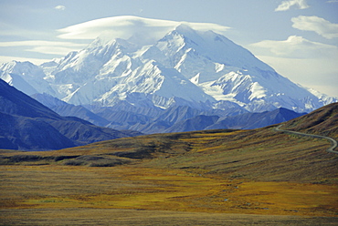
Mt. McKinley, Denali National Park, Alaska, USA
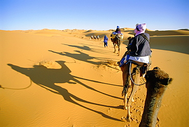
Camel trek in Sahara dunes near Merzouga, Morocco, North Africa
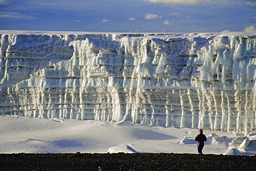
Glacier and trekker from summit at Uhuru Peak, Kilimanjaro National Park, Tanzania, Africa
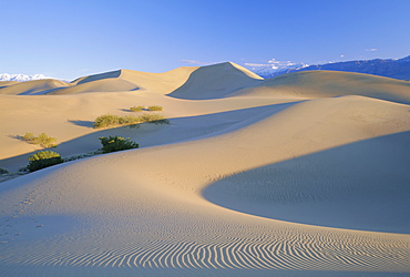
Sand dunes, Death Valley National Monument, California, USA
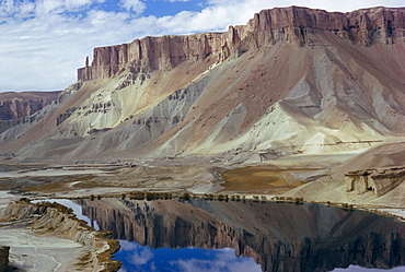
Band-i-Amir, Afghanistan, Asia
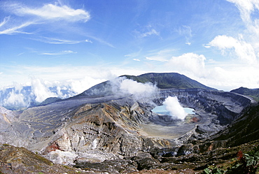
Steam plume from active vent beside crater lake, Volcan Poas, Cordillera Central, Costa Rica, Central America
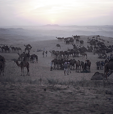
Camels and traders, Pushkar Camel Fair, Pushkar, Rajasthan State, India, Asia
Sahara Desert, Algeria, North Africa, Africa
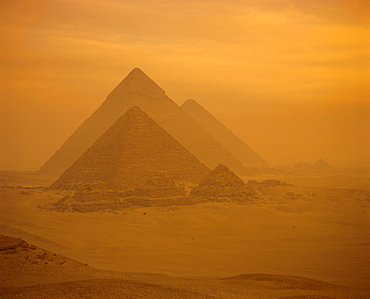
The Pyramids, Giza, UNESCO World Heritage Site, near Cairo, Egypt, North Africa, Africa
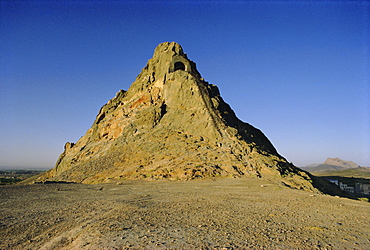
Babur's Alcove, Kandahar, Afghanistan
Atacama Desert, Chile, South America
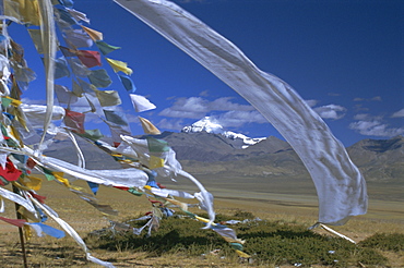
Prayer flags on top of low pass on Barga Plain, with Mount Kailas (Kailash) beyond, sacred mountain for Buddhists and Hindus, Tibet, China, Asia
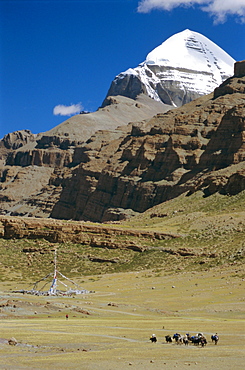
Yak train approaches Tarboche, prayer flag pole in Lha Chu canyon, on the kora round sacred mountain, Mount Kailas (Kailash), Tibet, China, Asia
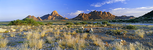
Panoramic view, Spitzkoppe, Namibia, Africa
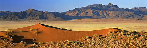
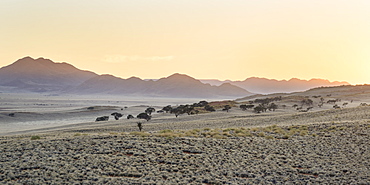
Panoramic view over orange sand dunes towards mountains, Namib Rand private game reserve, Namibia, Africa
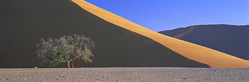
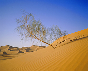
Dune and tree, Namib Naukluft Park, Namib Desert, Namibia, Africa
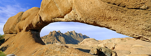
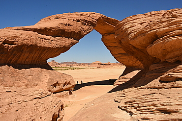
Panoramic view of rock arch, Spitzkoppe, Namibia, Africa
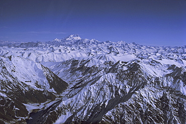
Aerial view of Himalaya mountain range, with Nanga Parbat, 8125m, seen from south west, rising above other mountains, Pakistan, Asia
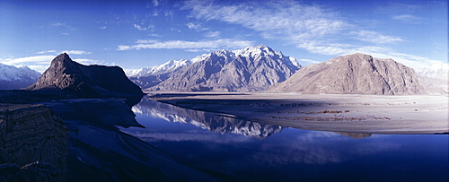
Panorama of mountains reflected in the water of the Indus River, Skardu, Baltistan, Pakistan, Asia
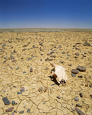
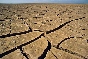
Animal skull, rocks and cracked dry earth, Outback, South Australia, Australia, Pacific
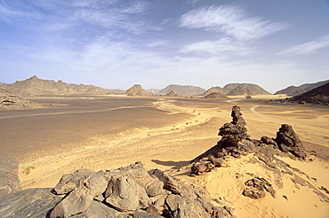
Akakus, Sahara Desert, Fezzan, Libya, North Africa, Africa
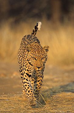
Leopard, Panthera pardus, Duesternbrook Private Game Reserve, Windhoek, Namibia
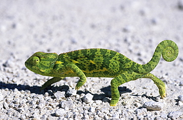
Flap-necked Chameleon, (Chamaeleo dilepsis), Etoscha National Park, Namibia
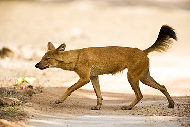
Dhole/Wild Dog, (Cuon alpinus), Bandhavgarh N.P., Madhya Pradesh, India
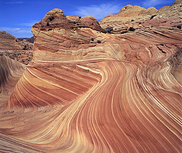
Rock formation known as Swirls on Colorado Plateau, Arizona, United States of America (U.S.A.), North America
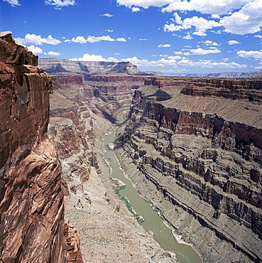
West Rim, Grand Canyon, UNESCO World Heritage Site, Arizona, United States of America (U.S.A.), North America
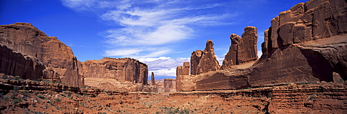
Park Avenue, Arches National Park, Moab, Utah, United States of America (U.S.A.), North America
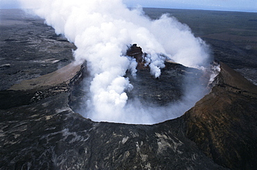
View of active volcano from helicopter, Big Island, Hawaii, Hawaiian Islands, United States of America (U.S.A.), North America
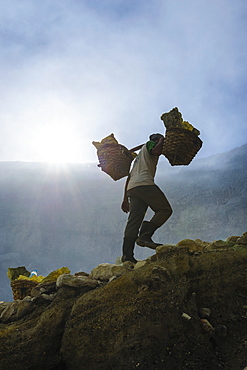
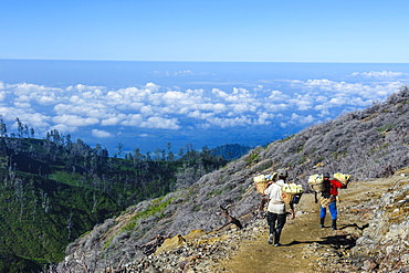
Backlit image of workers loaded with sulphur pieces cut out from a sulphur mine on Ijen crater lake, Java, Indonesia, Southeast Asia, Asia
Workers carrying big pieces of sulphur out of the Ijen Volcano, Java, Indonesia, Southeast Asia, Asia
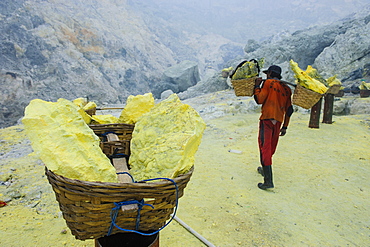
Worker carrying fully loaded baskets of sulphur out of the Ijen Volcano, Java, Indonesia, Southeast Asia, Asia
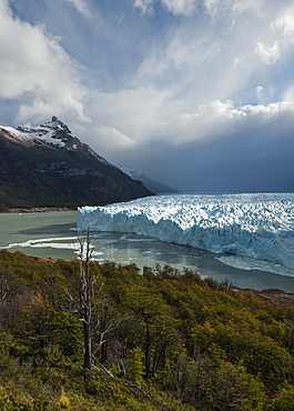
Afternoon light on the Perito Moreno Glacier, Los Glaciares National Park, UNESCO World Heritage Site, Patagonia, Argentina, South America
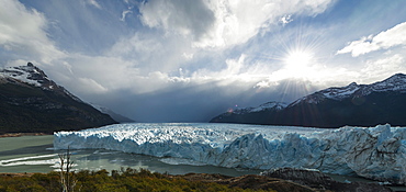
Afternoon light on the Perito Moreno Glacier, Los Glaciares National Park, UNESCO World Heritage Site, Patagonia, Argentina, South America
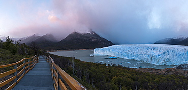
Perito Moreno Glacier at dawn, Los Glaciares National Park, UNESCO World Heritage Site, Patagonia, Argentina, South America
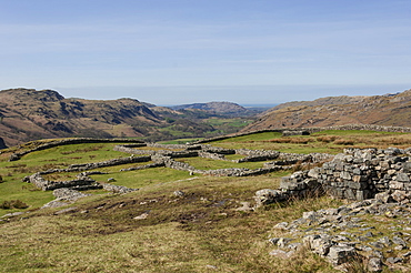
Hardknott Roman Fort interior looking west along the Eskdale Valley to the Solway Firth, South Lakes, Lake District National Park, Cumbria, England, United Kingdom, Europe
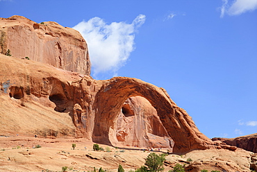
Corona Arch, Bootlegger Canyon, near Moab, Potash Road, Utah, United States of America, North America

Shafer Trail Road, Canyonlands National Park, Utah, United States of America, North America

Corona Arch, Bootlegger Canyon, near Moab, Potash Road, Utah, United States of America, North America
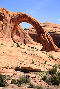
Corona Arch, Bootlegger Canyon, near Moab, Potash Road, Utah, United States of America, North America
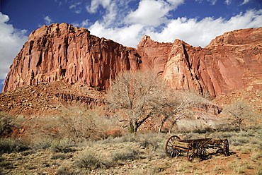
Mormon Pioneer Wagon, Capitol Reef National Park, Utah, United States of America, North America
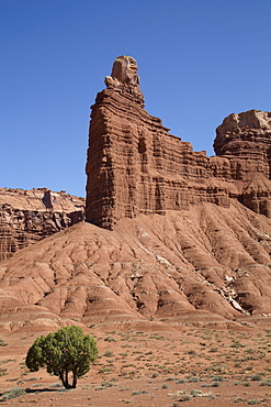
Layered sandstone formation, Capitol Reef National Park, Utah, United States of America, North America
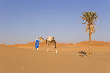
Camel, Erg Chebbi, Merzouga, Sahara Desert, Morocco, North Africa, Africa
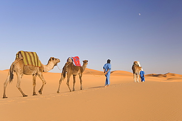
Camels, Erg Chebbi, Merzouga, Sahara Desert, Morocco, North Africa, Africa
Bedouin on camel in the desert, Wadi Rum, Jordan, Middle East
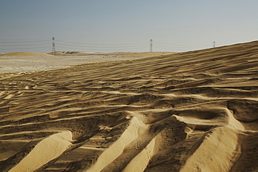
Sand dunes and electricity pylons dominate the desert landscape, Qatar, Middle East
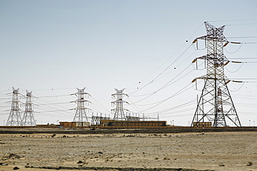
Electricity pylons dominate the flat barren landscape, pointing to civilisation somewhere, Qatar, Middle East
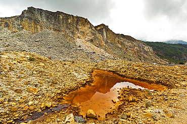
Mineral stained pond on collapsed flank of Papandayan Volcano, an active four crater caldera, Garut, West Java, Java, Indonesia, Southeast Asia, Asia
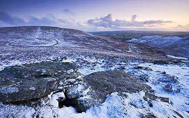
Snow covered rocky moorland landscape overlooking the Bronze Age walled settlement of Grimspound, Dartmoor National Park, Devon, England, United Kingdom, Europe
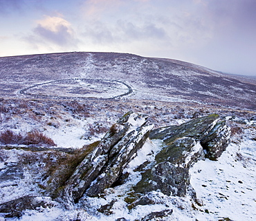
Bronze Age walled settlement of Grimspound, isolated in a snow covered moorland wilderness, viewed from Hookney Tor overlook, Dartmoor National Park, Devon, England, United Kingdom, Europe
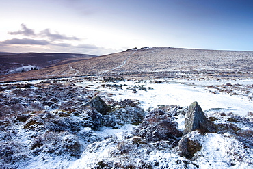
Snow covered stone hut circles in Bronze Age settlement of Grimspound in Dartmoor National Park, Devon, England, United Kingdom, Europe
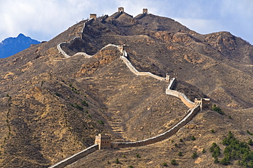
View of a section of the Great Wall, UNESCO World Heritage Site, between Jinshanling and Simatai near Beijing, China, Asia
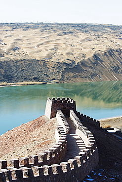
Great Wall of China, UNESCO World Heritage Site, and the Yellow River in the Tengger desert at Shapotou near Zhongwei, Ningxia Province, China, Asia
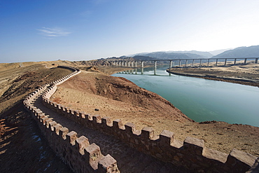
Great Wall of China, UNESCO World Heritage Site, and the Yellow River in the Tengger desert at Shapotou near Zhongwei, Ningxia Province, China, Asia
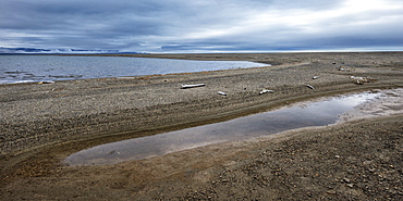
Mammoth River, Wrangel Island, UNESCO World Heritage Site, Chukotka, Russian Far East, Eurasia
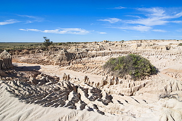
Walls of China, a series of Lunettes in the Mungo National Park, part of the Willandra Lakes Region, UNESCO World Heritage Site, Victoria, Australia, Pacific
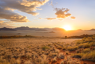
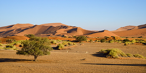
The sun starts to light up the distant mountains in the NamibRand Nature Reserve, Namib Desert, Namibia, Africa
The setting sun lights up a lone acacia tree and the mountains of NamibRand, Namib Desert, Namibia, Africa
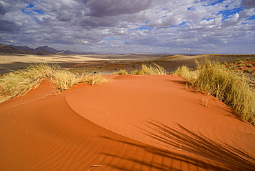
Brooding clouds over the vivid red dunes of NamibRand, Namib Desert, Namibia, Africa
Sunset in the NamibRand Nature Reserve, Namib Desert, Namibia, Africa
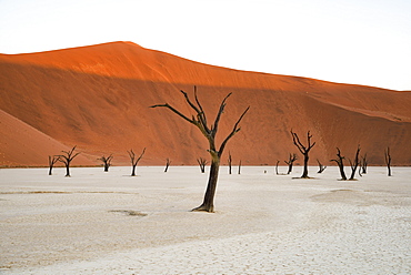
Camelthorn trees (Acacia erioloba) in the clay pans of Deadvlei with Big Daddy dune towering above, Namib Naukluft, Namibia, Africa
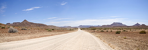
The road from the Skeleton Coast joins Damaraland, Namibia, Africa
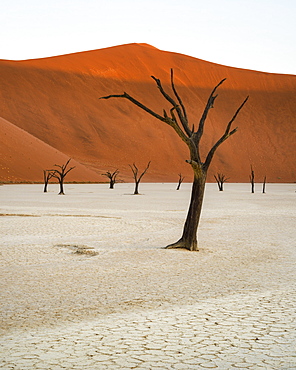
Camelthorn trees (Acacia erioloba) in the clay pans of Deadvlei with Big Daddy dune towering above, Namib Naukluft, Namibia, Africa
A couple of springbok enjoy a peaceful evening at Sossusvlei, Namib Naukluft, Namibia, Africa
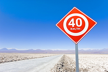
Road sign in the Atacama Desert, Norte Grande, Chile, South America
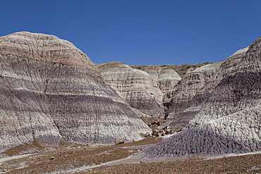
Petrified Forest National Park, Blue Mesa, Blue Mesa Trail, sedimentary layers of bluish bentonite clay
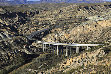
Motorway A7 road running through limestone desert, Paraje Natural de Karst en Yesos, Almeria, Andalusia, Spain, Europe
Aerial view from hot air balloon over magnificent desert landscape of sand dunes, mountains and Fairy Circles, Namib Rand game reserve Namib Naukluft Park, Namibia, Africa
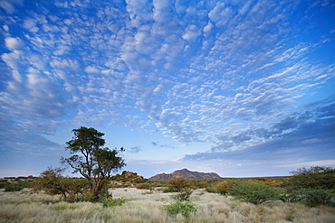
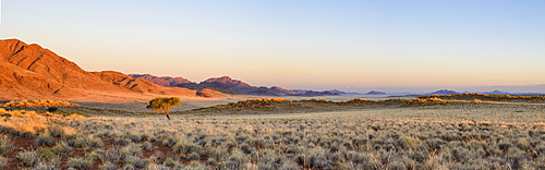
Early morning view across barren landscape towards sandstone mountains beneath dramatic sky, near Spitzkoppe, Namibia, Africa
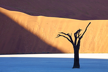
Dead camelthorn tree said to be centuries old in silhouette against towering orange sand dunes bathed in evening light at Dead Vlei, Namib Desert, Namib Naukluft Park, Namibia, Africa
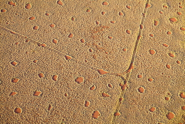
Aerial view from hot air balloon of sand road cutting across desert landscape covered in Fairy Circles, Namib Rand game reserve Namib Naukluft Park, Namibia, Africa
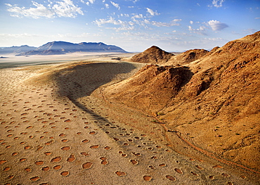
Aerial view from hot air balloon over magnificent desert landscape of sand dunes, mountains and Fairy Circles, Namib Rand game reserve Namib Naukluft Park, Namibia, Africa
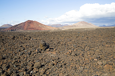
Malpais badlands volcanic landscape looking northeast from Los Hervideros, Parque Natural Los Volcanes, near Yaiza, Lanzarote, Canary islands, Spain, Atlantic, Europe
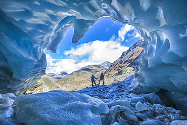
Hikers inside Forni Glacier, Forni Valley, Stelvio National Park, Valtellina, Lombardy, Italy, Europe
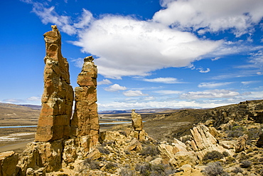
Sandstone pillars on the Patagonian Steppe, Patagonia, Argentina, South America
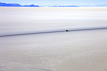
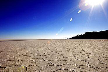
Salar de Uyuni is the largest salt flat in the world and is in South West Bolivia, Bolivia, South America
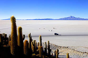
Cacti on Isla de los Pescadores, Volcan Tunupa and the salt flats, Salar de Uyuni, Southwest Highlands, Bolivia, South America
Isla de los Pescadores and salt flats, Salar de Uyuni, Southwest Highlands, Bolivia, South America
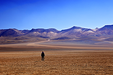
Desert in the Avaroa Andean Fauna National Reserve, Bolivia, South America
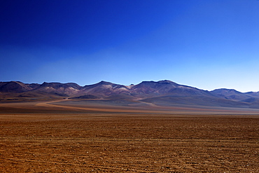
Desert in the Avaroa Andean Fauna National Reserve, Bolivia, South America
Rainbow Arch, in sandstone, north of Al Ula, North West Saudi Arabia, Middle East
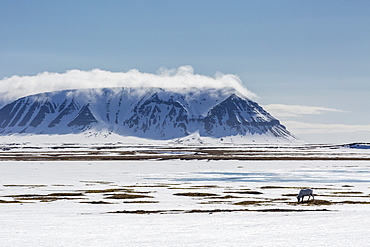
A lone reindeer (Rangifer tarandus) grazing on the tundra in Russebukta, Edgeoya, Norway, Scandinavia, Europe
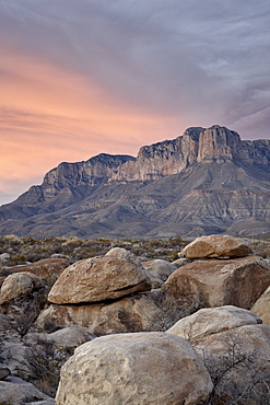
Guadalupe Peak and El Capitan at sunset, Guadalupe Mountains National Park, Texas, United States of America, North America
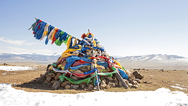
An ovoo, traditional place of worship in the middle of the Mongolian countrtyside, Mongolia, Central Asia, Asia
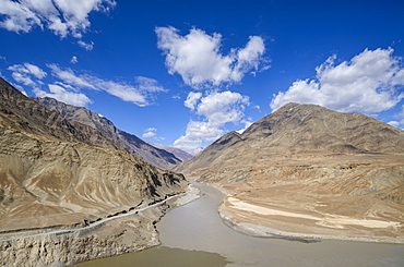
The mountainous scenery of the Zanskar River, Ladakh, Himalayas, India, Asia
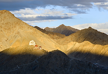
Evening view from Shanti Stupa to the Namgyal Tsemo fort and monastery (gompa), Leh, Ladakh, India, Asia
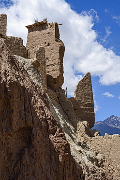
The 16th and 17th century fort and monastery at Basgo, Ladakh, Himalayas, India, Asia
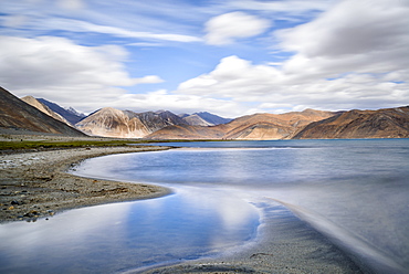
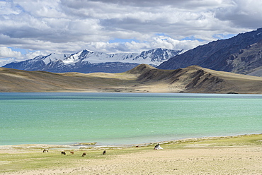
The turquoise, saline water of Tso Pangong, backed by mountains, Ladakh, India, Asia
Horses and nomad tents on the shores of Tso Thadsang Karu, Ladakh, India, Asia
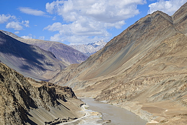
The mountainous scenery of the Zanskar River, Ladakh, Himalayas, India, Asia
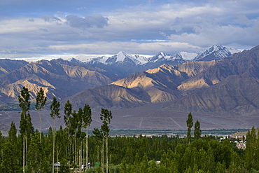
Mountains and poplars at sunrise from Leh, Ladakh, Himalayas, India, Asia
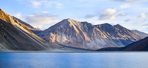
First light on the mountains flanking the lake of Tso Pangong, Ladakh, India, Asia
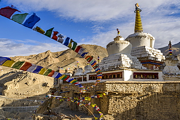
Prayer flags and stupa at the monastery at Lamayuru, Ladakh, Himalayas, India, Asia
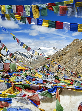
Prayer flags at Khardung La mountain pass. the highest road pass in the world, Ladakh, Himalayas, India, Asia