Results
53 results found
British Antarctic Survey base at Rothera, Antarctica
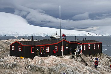
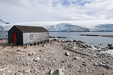
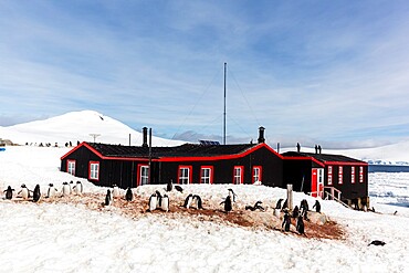
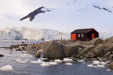
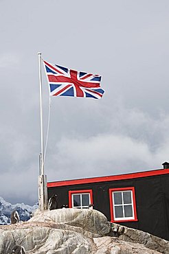
British Base A research station at Port Lockroy, Goudier Island, Antarctica, Southern Ocean, Polar Regions
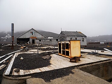
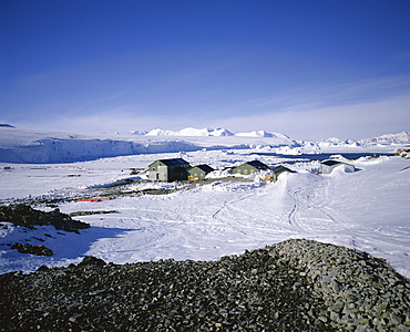
British Research Base W, abandoned and left in 1959 on Detaille Island, Crystal Sound, below the Antarctic Circle, Antarctica, Polar Regions
British Research Base W, abandoned and left in 1959 on Detaille Island, Crystal Sound, below the Antarctic Circle, Antarctica, Polar Regions
British Base A research station at Port Lockroy, Goudier Island, Antarctica, Southern Ocean, Polar Regions
British Research Base W, abandoned and left in 1959 on Detaille Island, Crystal Sound, below the Antarctic Circle, Antarctica, Polar Regions
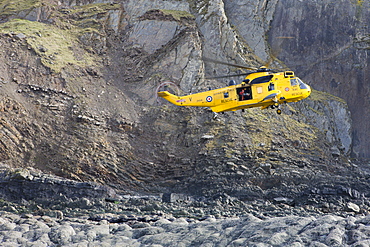
RAF helicopter performing a coastal rescue at the base of the steep cliffs of Spekes Mill Mouth, Hartland, Devon, England, United Kingdom, Europe
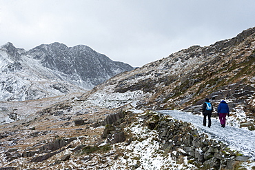
Hikers on the Miner's Track at base of Mount Snowdon in a wintry landscape in the Snowdonia National Park, Gwynedd, Wales, United Kingdom, Europe
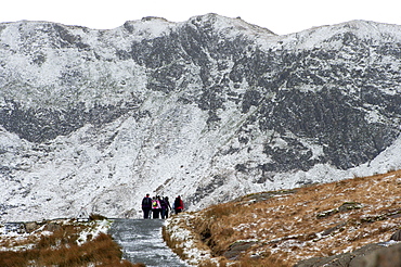
Hikers on the Miner's Track at base of Mount Snowdon in a wintry landscape in the Snowdonia National Park, Gwynedd, Wales, United Kingdom, Europe
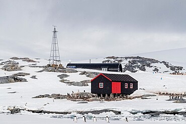
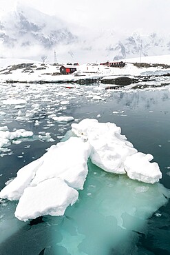
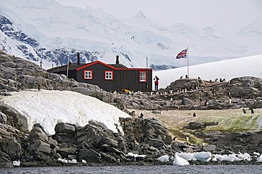
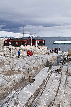
British Base and Post Office, Port Lockroy, Antarctic Peninsula, Antarctica, Polar Regions
British Base and Post Office, Port Lockroy, Antarctic Peninsula, Antarctica, Polar Regions

British Base A research station at Port Lockroy, Goudier Island, Antarctica, Southern Ocean, Polar Regions
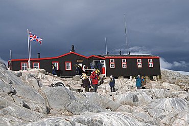
British Base and Post Office, Port Lockroy, Antarctic Peninsula, Antarctica, Polar Regions
British Base and Post Office, Port Lockroy, Antarctic Peninsula, Antarctica, Polar Regions
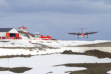
British Antarctic Survey (BAS) research plane landing at the Chilean Research base Frei on King George Island, Antarctica, Polar Regions
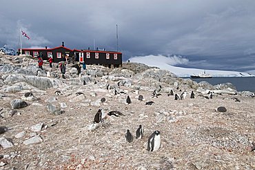
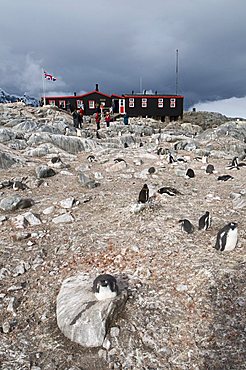
Gentoo penguins (Pygoscelis papua), Port Lockroy British Antarctic Base, Wiencke Island, Antarctica, Polar Regions
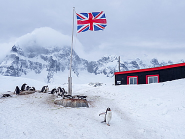
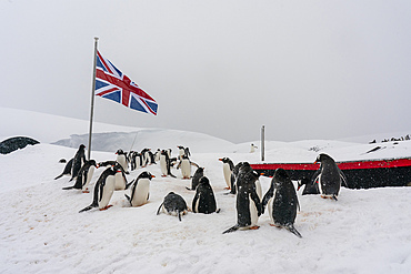
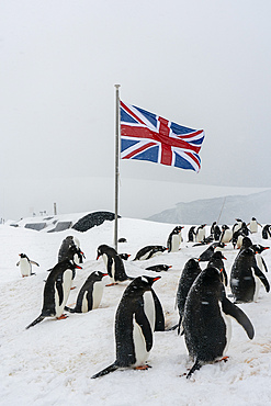
A gentoo penguin (Pygoscelis papua), breeding colony beneath a Union Jack flag flying at British Base A at Port Lockroy, Antarctica, Polar Regions
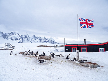
A gentoo penguin (Pygoscelis papua), breeding colony beneath Union Jack flag, at British Base A at Port Lockroy, Antarctica, Polar Regions
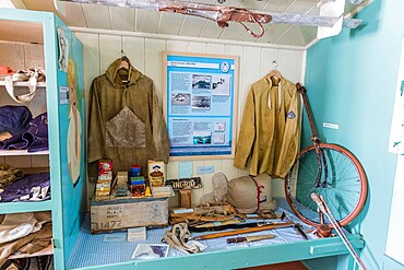
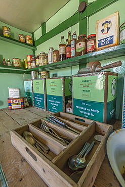
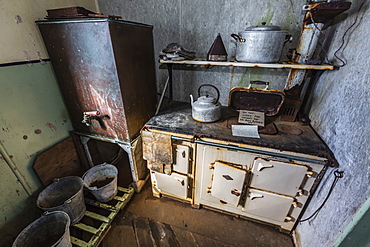
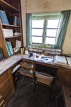
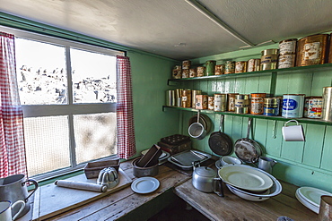
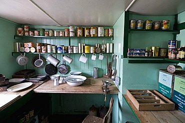
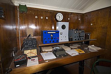
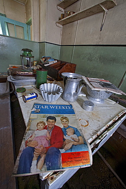
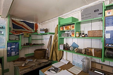
Interior of former British Base A, now a museum and post office at Port Lockroy on tiny Goudier Island, Antarctica, Polar Regions
Former British Base A, now a museum and post office at Port Lockroy on tiny Goudier Island, Antarctica, Polar Regions
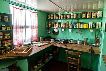
Interior of former British Base A, now a museum and post office at Port Lockroy on tiny Goudier Island, Antarctica, Polar Regions
Former British Base A, now a museum and post office at Port Lockroy on tiny Goudier Island, Antarctica, Polar Regions

Interior of former British Base A, now a museum and post office at Port Lockroy on tiny Goudier Island, Antarctica, Polar Regions
The remains of an old British Base at Deception Island, an active volcano which last erupted in 1969, Antarctica, Polar Regions
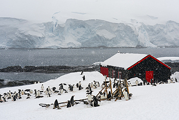
Gentoo penguins (Pygoscelis papua), Port Lockroy British Antarctic Base, Wiencke Island, Antarctica, Polar Regions
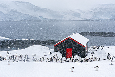
Gentoo penguins (Pygoscelis papua), Port Lockroy British Antarctic Base, Wiencke Island, Antarctica, Polar Regions
Cyprus. Abandoned houses along th Green Line in Nicosia dividing the Republic of Cyprus and Turkish controlled northern part. The United Nations Buffer Zone in Cyprus runs for more than 180.5?kilometres (112.2?mi) along what is known as the Green Line and has an area of 346?square kilometres (134?sq?mi). The zone partitions the island of Cyprus into a southern area effectively controlled by the government of the Republic of Cyprus (which is the de jure government for the entire island save for the British Sovereign Base Areas), and the northern area controlled by the Turkish army
Gentoo penguins (Pygoscelis papua), Port Lockroy British Antarctic Base, Wiencke Island, Antarctica, Polar Regions
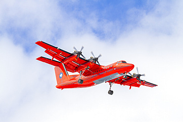
British Antarctic Survey (BAS) research plane landing at the Chilean Research base Frei on King George Island, Antarctica, Polar Regions
Former British Base A, now a museum and post office at Port Lockroy on tiny Goudier Island, Antarctica, Polar Regions
Former British Base A, now a museum and post office at Port Lockroy on tiny Goudier Island, Antarctica, Polar Regions

Former British Base A, now a museum and post office at Port Lockroy on tiny Goudier Island, Antarctica, Polar Regions
Former British Base A, now a museum and post office at Port Lockroy on tiny Goudier Island, Antarctica, Polar Regions
Cyprus. Abandoned houses along th Green Line in Nicosia dividing the Republic of Cyprus and Turkish controlled northern part. The United Nations Buffer Zone in Cyprus runs for more than 180.5?kilometres (112.2?mi) along what is known as the Green Line and has an area of 346?square kilometres (134?sq?mi). The zone partitions the island of Cyprus into a southern area effectively controlled by the government of the Republic of Cyprus (which is the de jure government for the entire island save for the British Sovereign Base Areas), and the northern area controlled by the Turkish army
Cyprus. Abandoned houses along th Green Line in Nicosia dividing the Republic of Cyprus and Turkish controlled northern part. The United Nations Buffer Zone in Cyprus runs for more than 180.5?kilometres (112.2?mi) along what is known as the Green Line and has an area of 346?square kilometres (134?sq?mi). The zone partitions the island of Cyprus into a southern area effectively controlled by the government of the Republic of Cyprus (which is the de jure government for the entire island save for the British Sovereign Base Areas), and the northern area controlled by the Turkish army
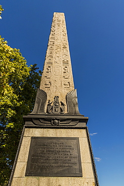
Cleopatra's Needle and the plaque to Erasmus Wilson at its base, London, England, United Kingdom, Europe

British Base and Post Office, Port Lockroy, Antarctic Peninsula, Antarctica, Polar Regions
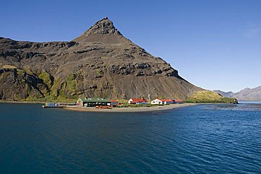
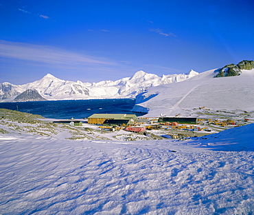
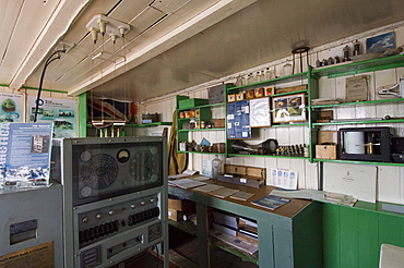
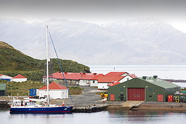
British Antarctic Survey site, King Edwards point, Grytviken, South Georgia, South Atlantic
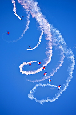
RAF Falcons freefall parachute team taking part in air display at RAF Brize Norton Air Base, UK
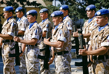
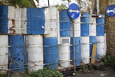
British forces part of United Nations peacekeeping troops at their UN base in Cyprus
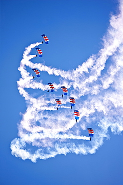
RAF Falcons freefall parachute team taking part in air display at RAF Brize Norton Air Base, UK
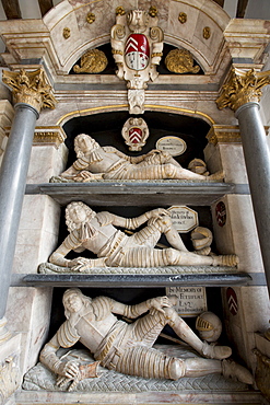
Fettiplace tombs 1613 in the chancel of St Mary's Church in Swinbrook - top Sir Edmund Fettiplace mid John baronet base John Esquire

British soldier in the United Nations peacekeeping troops at their UN base in Cyprus

RAF Falcons freefall parachute team taking part in air display at RAF Brize Norton Air Base, UK

RAF Falcons freefall parachute team taking part in air display at RAF Brize Norton Air Base, UK
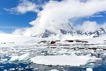
British base, Port Lockroy, Antarctic Peninsula, Antarctica, Polar Regions
British Antarctic Survey site, King Edwards point, Grytviken, South Georgia, South Atlantic
British base, Port Lockroy, Antarctic Peninsula, Antarctica, Polar Regions
British Base and Post office, Port Lockroy, Antarctic Peninsula, Antarctic
British Base and Post Office, Port Lockroy, Antarctic Peninsula, Antarctica, Polar Regions
British Base and Post office, Port Lockroy, Antarctic Peninsula, Antarctic
British Base and Post Office, Port Lockroy, Antarctic Peninsula, Antarctica, Polar Regions
British Base and Post Office, Port Lockroy, Antarctic Peninsula, Antarctica, Polar Regions
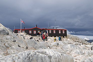
British Base and Post Office, Port Lockroy, Antarctic Peninsula, Antarctica, Polar Regions
British Base and Post Office, Port Lockroy, Antarctic Peninsula, Antarctica, Polar Regions
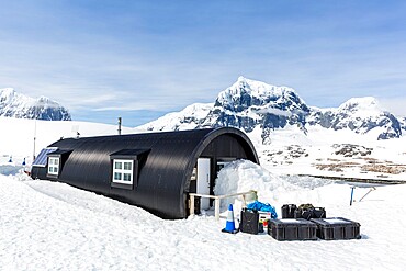
Rothera Base, British base, Antarctic Peninsula, Antarctica, Polar Regions
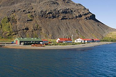
The British Antarctic Survey base at Grytviken on South Georgia in the Southern Ocean.
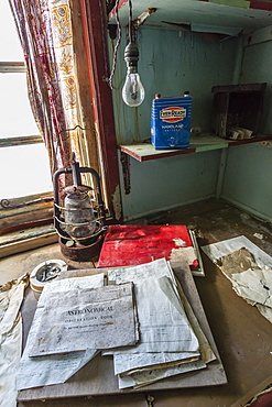
Inside the abandoned Antarctic research British Base "W" on Detaille Island, Lallemand Fjord, Loubet Coast, Antarctica
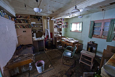
Inside the abandoned Antarctic research British Base "W" on Detaille Island, Lallemand Fjord, Loubet Coast, Antarctica
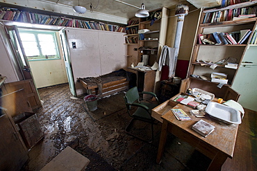
Inside the abandoned Antarctic research British Base "W" on Detaille Island, Lallemand Fjord, Loubet Coast, Antarctica
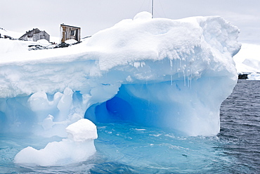
Iceberg detail in and around the abandoned British research base "W" in Crystal Sound near the Antarctic Peninsula
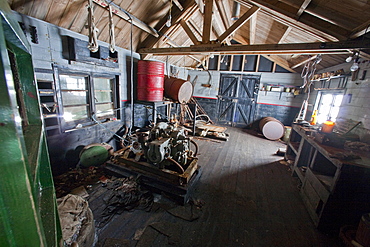
Inside the abandoned Antarctic research British Base "W" on Detaille Island, Lallemand Fjord, Loubet Coast, Antarctica
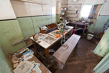
Inside the abandoned Antarctic research British Base "W" on Detaille Island, Lallemand Fjord, Loubet Coast, Antarctica
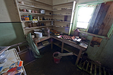
Inside the abandoned Antarctic research British Base "W" on Detaille Island, Lallemand Fjord, Loubet Coast, Antarctica

Inside the abandoned Antarctic research British Base "W" on Detaille Island, Lallemand Fjord, Loubet Coast, Antarctica

Iceberg detail in and around the abandoned British research base "W" in Crystal Sound near the Antarctic Peninsula
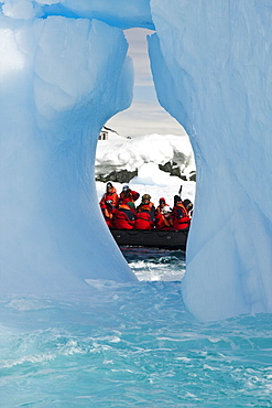
Zodiac and iceberg detail in and around the abandoned British research base "W" in Crystal Sound near the Antarctic Peninsula
British base, Port Lockroy, Antarctic Peninsula, Antarctica