Results
18 results found
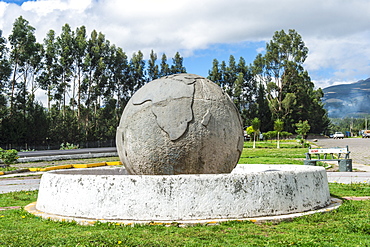
Equator line monument Guachala ball, Guachala, Pichincha Province, Ecuador, South America
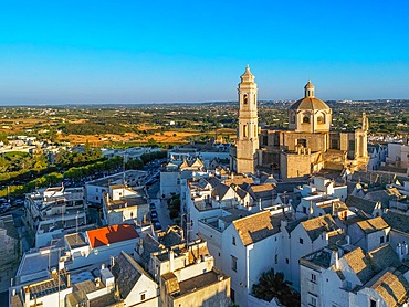
Locorotondo, Bari, Apulia, Italy

Oldest map of Palestine, mosaic, dated AD 560, St. George's Church, Madaba, Jordan, Middle East

Oldest map of Palestine, mosaic, dated AD 560, St. George's Church, Madaba, Jordan, Middle East
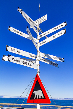
View of signpost in Longyearbyen on the island of Spitsbergen in the Svalbard Archipelago, Norway, Arctic, Europe
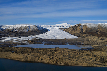
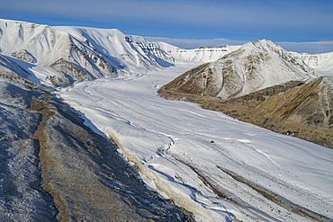
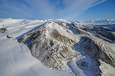
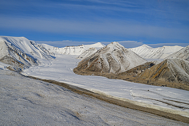
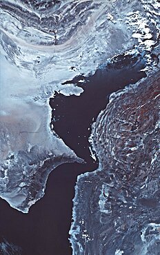
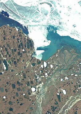
Aerial of Axel Heiberg island, Nunavut, Canadian Arctic, Canada, North America
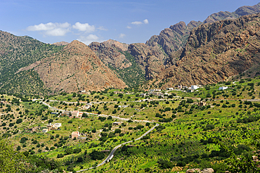
Landscape around Ait Baha, Chtouka Ait Baha Province, Souss-Massa-Draa region, Morocco
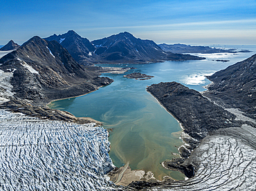
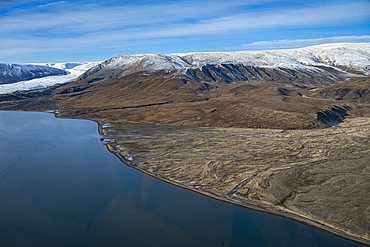
Aerial of Kulusuk fjord, Greenland, Denmark, Polar Regions
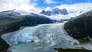
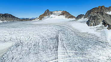
Aerial of Pia glacier, Tierra del Fuego, Chile, South America
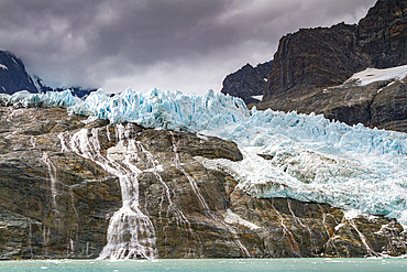
Views of the glaciers and mountains of Drygalski Fjord on the southeast side of South Georgia, Southern Ocean, Polar Regions
Aerial of a glacier, Kulusuk, Greenland, Denmark, Polar Regions

Aerial of the mountainous coastline around Kulusuk, Greenland, Polar Regions
Aerial of Axel Heiberg island, Nunavut, Canadian Arctic, Canada, North America
Aerial of Axel Heiberg island, Nunavut, Canadian Arctic, Canada, North America
Aerial of Axel Heiberg island, Nunavut, Canadian Arctic, Canada, North America
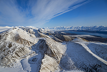
Aerial of Axel Heiberg island, Nunavut, Canadian Arctic, Canada, North America
Aerial of Axel Heiberg island, Nunavut, Canadian Arctic, Canada, North America
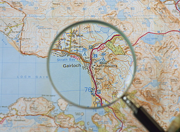
Magnifying glass above an Ordnance Survey map, Scotland, United Kingdom, Europe
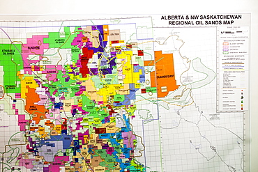
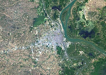
A map of the Athabasca tar sands in Alberta, Canada, North America
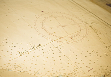
Arctic Cirle on board the Clipper Odyssey, map, charts, Arctic Circle (Bering Sea) Russia, Asia
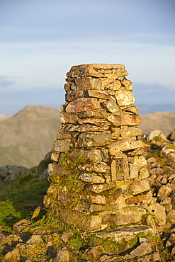
A trig point on the summit of Red Screes in the Lake District, Cumbria, England, United Kingdom, Europe

Caucasian brother and sister examining globe

Gaia Satellite

Gaia Satellite

Beijing, China, 2016, satellite image
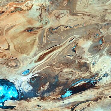
Great Salt Desert, Landsat 7
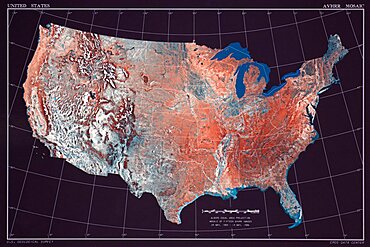
United States
Persian Gulf
Satellite view of Wallis Island, part of Wallis and Futuna Islands. This image was compiled from data acquired by Landsat 8 satellite in 2014.

Satellite view of Cuba and Jamaica. This image was compiled from data acquired by Landsat satellites.
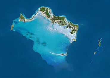
Satellite view of Turks and Caicos Islands. This image was compiled from data acquired by Landsat satellites.
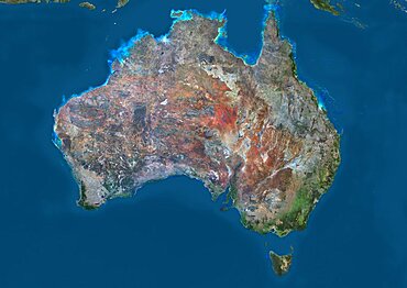
Satellite view of Australia. This image was compiled from data acquired by Landsat 8 satellite in 2014.
Satellite view of Christmas Island, Kiribati. This image was compiled from data acquired by Landsat 8 satellite in 2014.
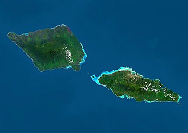
Satellite view of Samoa that consists of two large islands, Upolu and Savaii. This image was compiled from data acquired by Landsat 8 satellite in 2014.

Color satellite image of Tunis, capital city of Tunisia. Image collected on August 19, 2017 by Sentinel-2 satellites.
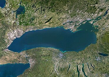
Color satellite image of Lake Ontario, North America. Image collected on May 1, 2016 by Landsat 8 satellite.
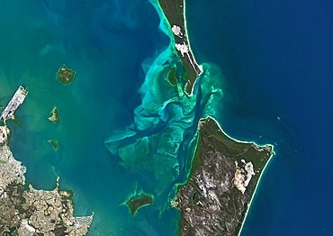
Satellite view of Moreton Bay, Queensland, Australia. This image was compiled from data acquired in 2014 by Landsat 8 satellite.
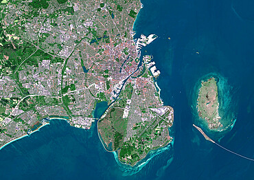
Color satellite image of Copenhagen, capital city of Denmark. The Oresund Bridge which is a combination of tunnel and bridge, connects Copenhagen to the Swedish city of Malmo. Image collected on May 27, 2017 by Sentinel-2 satellites.
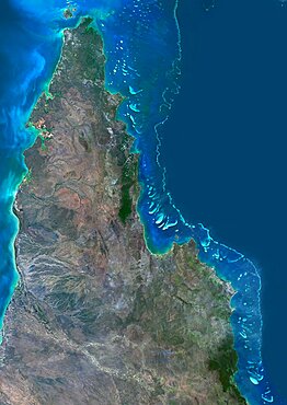
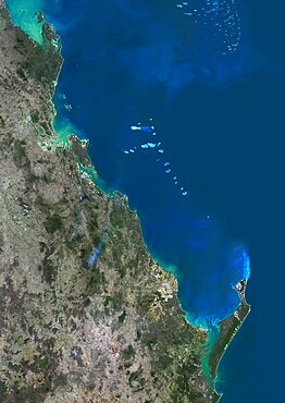
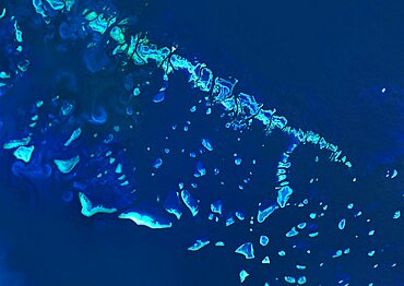
Satellite view of the Northern Great Barrier Reef along the east coast of Cape York Peninsula in north Australia. This image was compiled from data acquired in 2014 by Landsat 8 satellite.
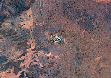
Satellite view of Uluru Ayers Rock, Northern Territory, Australia. This image was compiled from data acquired by Landsat satellites.
Color satellite image of Kuala Lumpur, capital city of Malaysia. Image collected on February 03, 2017 by Sentinel-2 satellites.
Satellite view of Grand Cayman. It is the largest of the three Cayman Islands. This image was compiled from data acquired by Landsat satellites.
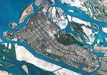
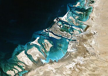
Color satellite image of Abu Dhabi, capital city of United Arab Emirates. The city is on an island connected by bridges to the mainland and other islands. Image collected on September 21, 2017 by Sentinel-2 satellites.
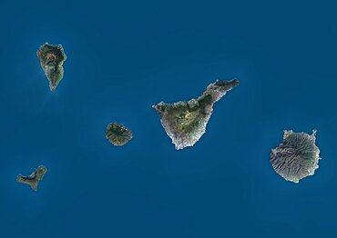
Satellite view of La Palma, Tenerife and Gran Canaria, Canary Islands, Spain. The smallest islands of La Gomera and El Hierro are also shown. This image was compiled from data acquired by Landsat 8 satellite in 2014.
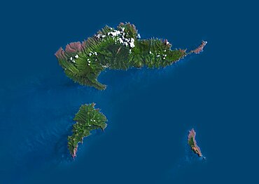
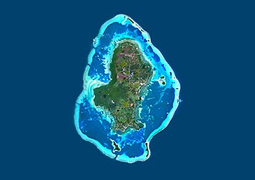
Satellite view of Hiva Oa, the second largest island in the Marquesas Islands, in French Polynesia. This image was compiled from data acquired by Landsat 8 satellite in 2014.
Satellite image of Abu Dhabi, United Arab Emirates, taken on February 2, 1985 by the satellite Landsat 5. The territory covered is 78 km x 55 km.
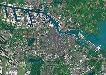
Color satellite image of Amsterdam, capital city of Netherlands. The River Amstel flows through the city. Image collected on May 26, 2017 by Sentinel-2 satellites.

Satellite view of Africa. This image was compiled from data acquired by Landsat 7 & 8 satellites.
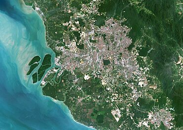
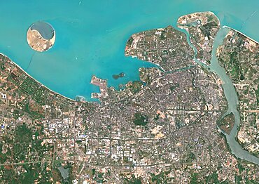
Colour satellite image of Phnom Penh, Cambodia. This image was taken on January 15, 2015 by Landsat 8 satellite.

Satellite view of Adam's Bridge. This chain of limestone shoals connects Sri Lanka to India. This image was taken in 2014 by Landsat 8 satellite.
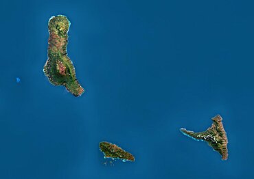
Satellite view of Efate, Vanuatu. It is the most populous island of Vanuatu archipelago. This image was compiled from data acquired by Landsat 8 satellite in 2014.
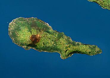
Satellite view of Ambrym, a volcanic island in the archipelago of Vanuatu. This image was compiled from data acquired by Landsat 8 satellite in 2014.
Color satellite image of Conakry, capital city of Guinea. Image collected on March 03, 2017 by Sentinel-2 satellites.
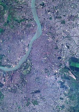
Color satellite image of Kolkata, India. The city is located on the east bank of the Hooghly River. Image collected on March 16, 2017 by Sentinel-2 satellites.
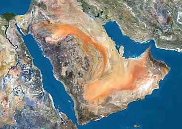
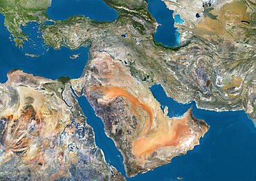
Satellite view of the Arabian Peninsula. This image was compiled from data acquired in 2014 by Landsat 8 satellite.
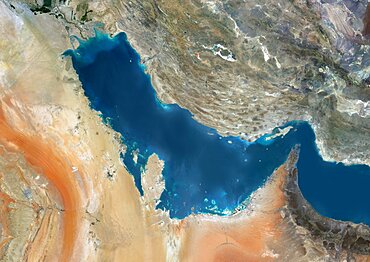
Satellite view of the Persian Gulf. This image was compiled from data acquired in 2014 by Landsat 8 satellite.
Satellite view of the Comoros Archipelago. This image was compiled from data acquired by Landsat satellites.
Color satellite image of Kingston, capital city of JaMayca. Image collected on December 16, 2017 by Sentinel-2 satellites.
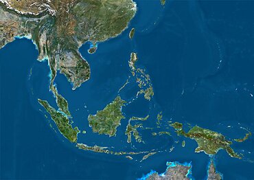
Satellite view of Southeast Asia. This image was compiled from data acquired by Landsat 7 & 8 satellites.
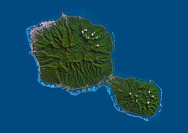
Satellite view of Tahiti, French Polynesia. This image was compiled from data acquired by Landsat 8 satellite in 2014.

Color satellite image of Port-au-Prince, capital city of Haiti. Image collected on March 25, 2017 by Sentinel-2 satellites.
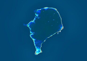
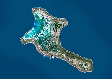
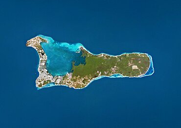
Satellite view of Funafuti, an atoll on which the capital of the island nation of Tuvalu is located. This image was compiled from data acquired by Landsat 8 satellite in 2014.
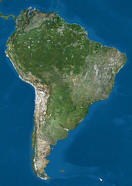
Satellite view of South America. This image was compiled from data acquired by Landsat 7 & 8 satellites.
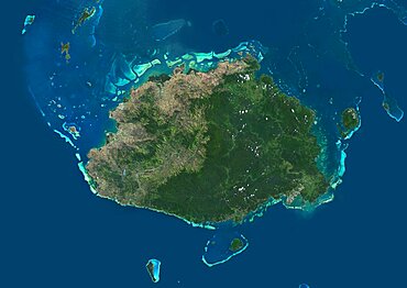
Satellite view of Viti Levu Island, Fiji. This is the largest island in the Republic of Fiji and the site of the nation's capital, Suva. This image was compiled from data acquired by Landsat 8 satellite in 2014.
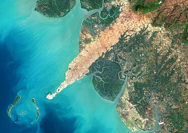
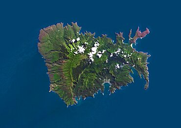
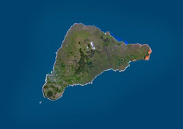
Satellite view of Pico Island, Azores, Portugal. Volcano Mount Pico, to the West, is the highest point in Portugal, at 2351 m, and the most famous landmark in the Azores. This image was compiled from data acquired by Landsat satellites.
Satellite view of the Middle East. This image was compiled from data acquired in 2014 by Landsat 8 satellite.
Satellite view of the Southern Great Barrier Reef and Fraser Island along Queensland's coastline in north-east Australia. This image was compiled from data acquired in 2014 by Landsat 8 satellite.
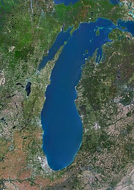
Color satellite image of Lake Michigan, United States. Image collected on May 1, 2016 by Landsat 8 satellite.
Satellite view of Nuku Hiva, the largest of the Marquesas Islands in French Polynesia. This image was compiled from data acquired by Landsat 8 satellite in 2014.
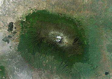
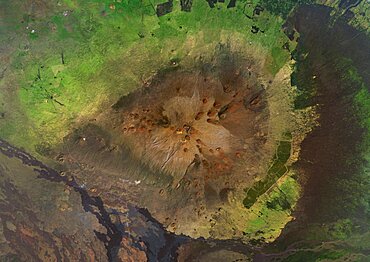
Satellite view of Mount Kilimanjaro, Tanzania. This dormant volcano is the highest mountain in Africa. It is part of the Kilimanjaro National Park. This image was compiled from data acquired by Landsat satellites.
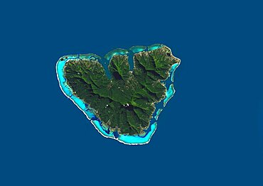
Satellite view of Moorea, French Polynesia. This image was compiled from data acquired by Landsat 8 satellite in 2014.

Satellite view of Crete, Greece. Crete is the largest and most populous of the Greek islands. This image was compiled from data acquired by Landsat 8 satellite in 2014.
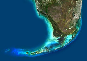
Color satellite image of Southern Florida, United States. It shows Miami at east, Everglades National Park at center, and the Florida Keys at south. Image collected on January 06, 2017 by Sentinel-2 satellites.
Satellite view of the Great Barrier Reef, Australia, off Mackay's coast. This image was compiled from data acquired in 2014 by Landsat 8 satellite.
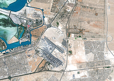
Color satellite image of Abu Dhabi International Airport, United Arab Emirates. The amusement park Ferrari World Abu Dhabi is on Yas Island, at center left on the image. Image collected on September 21, 2017 by Sentinel-2 satellites.
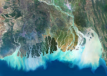
Satellite image of the Ganges River Delta, Bangladesh, India. Also known as the Brahmaputra Delta
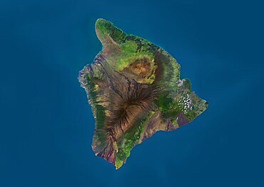
Satellite view of the Island of Hawaii, USA. The island is formed of five volcanoes, Mauna Loa being the largest. This image was compiled from data acquired by Landsat 8 satellite in 2014.
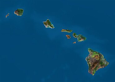
Satellite view of the State of Hawaii, USA. The main islands are Kauai, Oahu, Maui and the Island of Hawaii. This image was compiled from data acquired by Landsat 8 satellite in 2014.
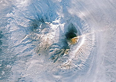
Color satellite image of Volcanoes on Kamchatka Peninsula, Russia. Klyuchevskaya, to the right, the tallest and most active volcano on the peninsula

Satellite view of British and US Virgin Islands. This image was compiled from data acquired by Landsat satellites.
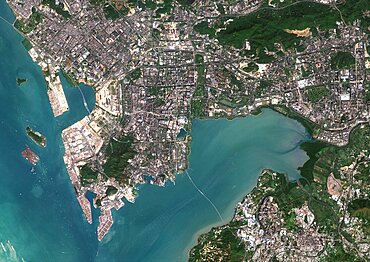
Color satellite image of Shenzhen, China. It forms part of the Pearl River Delta megalopolis. Image collected on November 01, 2017 by Sentinel-2 satellites.
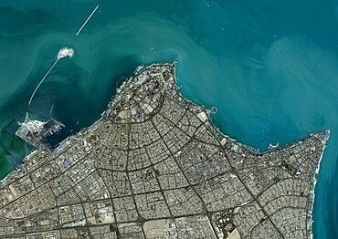
Color satellite image of Kuwait City, capital city of Kuwait. Image collected on October 23, 2017 by Sentinel-2 satellites.
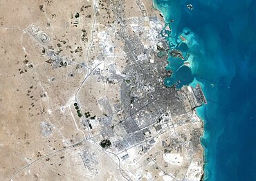
Color satellite image of Doha, capital city of Qatar. Image collected on October 17, 2017 by Sentinel-2 satellites.
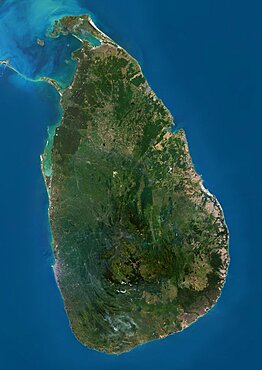
Satellite view of Sri Lanka. This image was compiled from data acquired by Landsat 8 satellite in 2014.
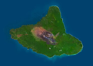
Satellite view of Easter Island. This image was compiled from data acquired by Landsat 8 satellite in 2014.
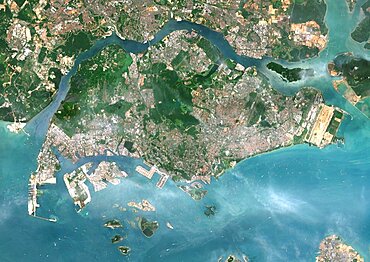
Color satellite image of Singapore. Image collected on July 10, 2017 by Sentinel-2 satellites.
Satellite view of Mauna Kea Volcano, Island of Hawaii. This image was compiled from data acquired by Landsat 8 satellite in 2014.
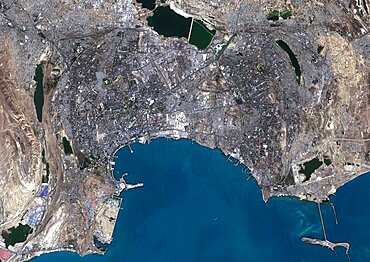
Color satellite image of Baku, capital city of Azerbaijan. The city is situated on the western coast of the Caspian Sea. Image collected on September 13, 2017 by Sentinel-2 satellites.
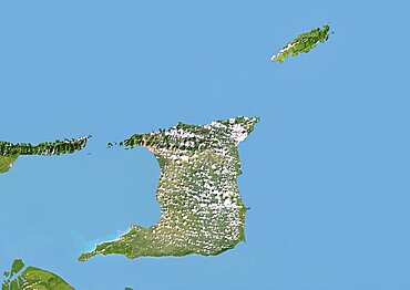
Trinidad and Tobago, Satellite Image With Bump Effect, With Border

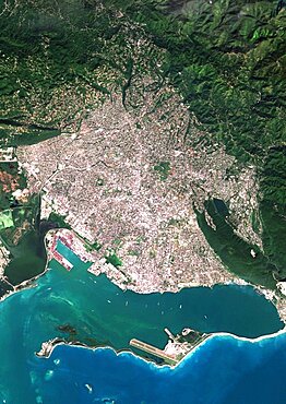
Color satellite image of Mogadishu, capital city of Somalia. Image collected on March 01, 2017 by Sentinel-2 satellites.
Color satellite image of Haikou, Hainan, China. Image collected on June 21, 2020 by Sentinel-2 satellites.
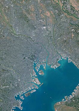
Color satellite image of Tokyo, Capital city of Japan. Image collected on December 14, 2019 by Sentinel-2 satellites.
Color satellite image of breakup of ice pack at the mouth of the Pine Island Glacier in Antarctica. This glacier is one of the most studied in Antarctica, as part of climate change monitoring. Image collected on January 31, 2019 by Sentinel-2 satellites.

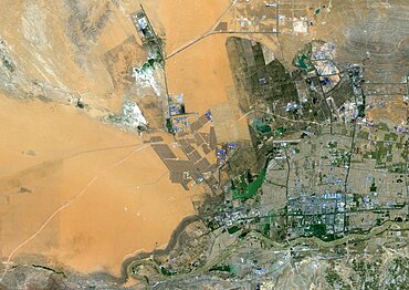
Color satellite image of Prudhoe Bay Oil Field, Alaska, United States. Image collected on July 02, 2020 by Sentinel-2 satellites.
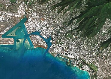
Color satellite image of Honolulu, Hawaii, United States. Image collected on May 05, 2020 by Sentinel-2 satellites.
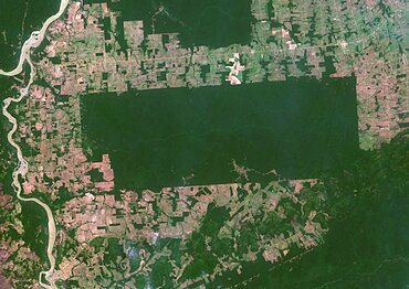
Color satellite image of the indigenous territory Igarape Lage, Rondonia, Brazil, covering an area of 688,000 square kilometers. Image collected on September 25, 2020 by Sentinel-2 satellites.
Color satellite image of Prudhoe Bay Oil Field, Alaska, United States. Image collected on July 02, 2020 by Sentinel-2 satellites.
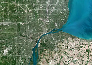
Color satellite image of Detroit, Michigan, United States. Image collected on June 18, 2020 by Sentinel-2 satellites.
Color satellite image of Tengger Desert Solar Park in Zhongwei, Ningxia, China. Image collected on June 28, 2020 by Sentinel-2 satellites.
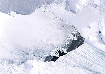
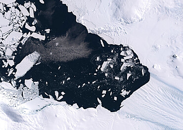
Color satellite image of ice pack at the mouth of Pine Island Glacier in Antarctica. This glacier is one of the most studied in Antarctica, as part of climate change monitoring. Image collected on March 07, 2018 by Sentinel-2 satellites.