Results
5 results found
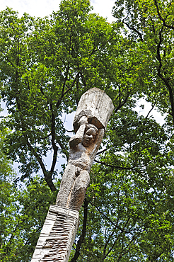
'Les Atlantes' sculpture on trunk (Douglas tree) by Antoine Halbwachs & Christophe Vehruny in the Forest of Troncais (Forêt de Tronçais), Allier department, Auvergne-Rhone-Alpes region, France, Europe
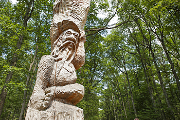
'Les Atlantes' sculpture on trunk (Douglas tree) by Antoine Halbwachs & Christophe Vehruny in the Forest of Troncais (Forêt de Tronçais), Allier department, Auvergne-Rhone-Alpes region, France, Europe
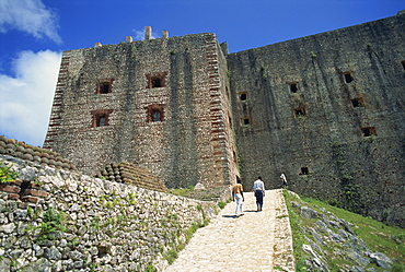
Approach to the Citadelle Fort, built in 1817 by Henri Christophe, the walls are four metres thick, Milot, Haiti, West Indies, Caribbean, Central America
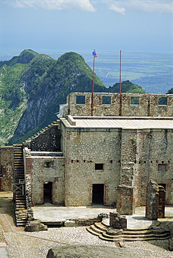
Detail from the Citadelle Fort, built in 1817 by Henri Christophe, the walls are four metres thick, Milot, Haiti, West Indies, Caribbean, Central America
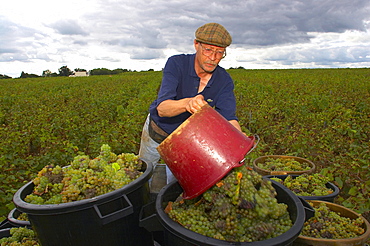
Vintage near Gorges at Christophe Branger's, Muscadet, Pays Nantais, Sevre et Maine, dept Loire-Atlantique, France, Europe

American flag "Stars and Stripes" floating onboard the Hydroptere, Long Beach, Los Angeles, United States of America.
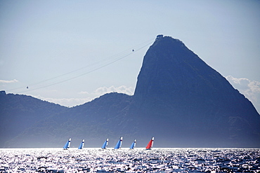
Rio de Janeiro Olympic Test Event - Fédération Française de Voile. 2015 Aquece Nacra 17 Besson, Riou.

On board Ginninderra a 60 feet catamaran, cruising under spinnaker close from the Queensland coast on her way for a circumnavigation of Australia.

Apocalyptic vision of Sydney shrouded in red dust blown in by winds from the deserts of the outback.
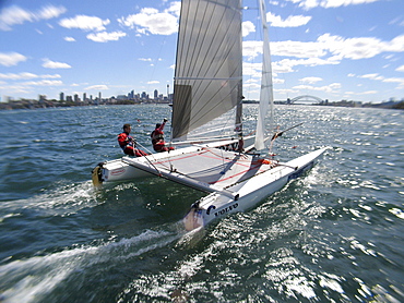
The Tornado Multihull Olympic class at the Sydney International Regatta.The skipper is Andrew Macpherson.
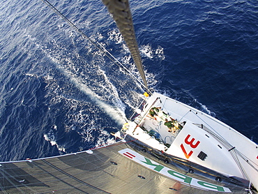
A Spanish racing yacht sailing in Australia. Test sailing in preparation for the around-the-world sailing challenge.The skipper is Unai Basurko de Miguel.
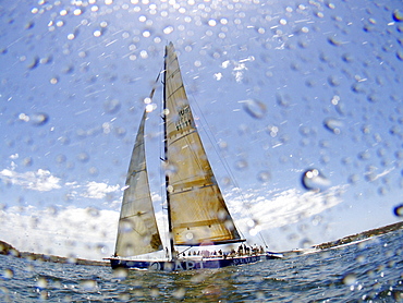
The Big Boat Canon Race in Sydney, Australia, is open for yachts bigger then 60 Feet, such as the AAPT.The AAPT it's a Tokolosh-Simonis design with a length of 98 feet. The owner is Ludde Igval, the skipper is Sean Langman.
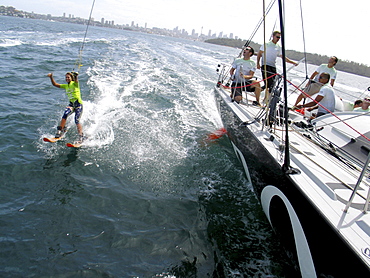
Water skier, Lauryn Eagle pulled behind the yacht. She was Miss Teen Australia for 2004 and the world speed champion in speed water skiing for 2005.
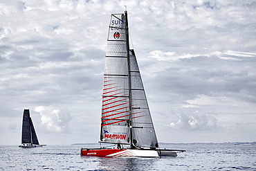
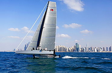
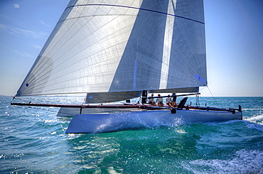
The GC32 is the one design for the Great Cup Racing circuit, at the Extreme Sailing Series, Nice, Alpes-Maritimes, France.

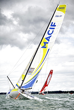
Onboard the IMOCA Open 60 Macif crewed by Francois Gabart and Michel Desjoyeaux during a training session before the Transat Jacques Vabre in the English Channel from Plymouth to Port la Foret after she won on her class the Rolex Fastnet Race.
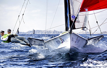
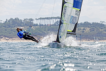
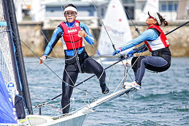
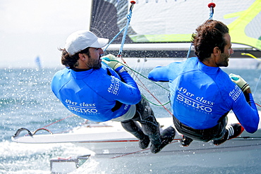
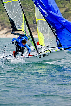
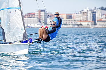
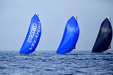
The 2013 Seiko 49er and 49erFX World Championships, 150 skiffs - 28 nations Two World Championship Titles, Marseille, France.
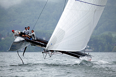
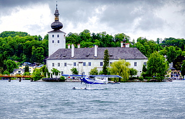
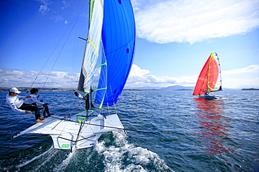
The GC32 is the one design for the future Great Cup Racing circuit, Austria Cup, Lake Traunsee, Gmunden, Austria.
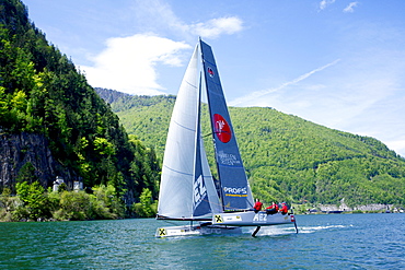
The GC32 is the one design for the future Great Cup Racing circuit, Austria Cup, Lake Traunsee, Gmunden, Austria.

Onboard the IMOCA Open 60 Macif crewed by Francois Gabart and Michel Desjoyeaux during a training session before the Transat Jacques Vabre in the English Channel from Plymouth to Port la Foret after she won on her class the Rolex Fastnet Race.
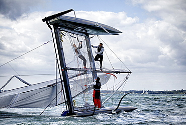
The GC32 is the one design for the Great Cup Racing circuit, Cowes Week 2013, Isle of Wight, England, United Kingdom.
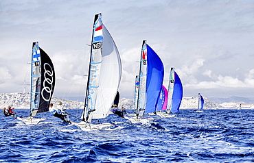
The 2013 Seiko 49er and 49erFX World Championships, 150 skiffs - 28 nations Two World Championship Titles, Marseille, France.
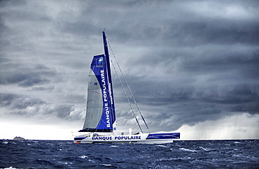
Armel Le Cléac?h and the Maxi Trimaran Solo Banque Populaire VII Trans at the start of the record attempt Marseille ? Carthage.
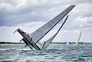
The GC32 is the one design for the Great Cup Racing circuit, Cowes Week 2013, Isle of Wight, England, United Kingdom.
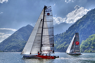
The GC32 is the one design for the future Great Cup Racing circuit, Austria Cup, Lake Traunsee, Gmunden, Austria.
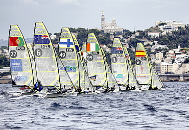
The 2013 Seiko 49er and 49erFX World Championships, 150 skiffs - 28 nations Two World Championship Titles, Marseille, France.
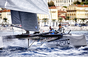
The GC32 is the one design for the Great Cup Racing circuit, at the Extreme Sailing Series, Nice, Alpes-Maritimes, France.

The IMOCA Open 60 PRB crewed by Vincent Riou and Jean Le Cam racing and winning the around the Isle of Wight Artemis Challenge, Cowes, England.
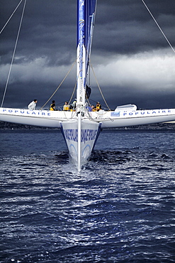
Armel Le Cléac?h and the Maxi Trimaran Solo Banque Populaire VII Trans at the start of the record attempt Marseille ? Carthage.

Onboard the IMOCA Open 60 Macif crewed by Francois Gabart and Michel Desjoyeaux during a training session before the Transat Jacques Vabre in the English Channel from Plymouth to Port la Foret after she won on her class the Rolex Fastnet Race.

Onboard the IMOCA Open 60 Macif crewed by Francois Gabart and Michel Desjoyeaux during a training session before the Transat Jacques Vabre in the English Channel from Plymouth to Port la Foret after she won on her class the Rolex Fastnet Race.
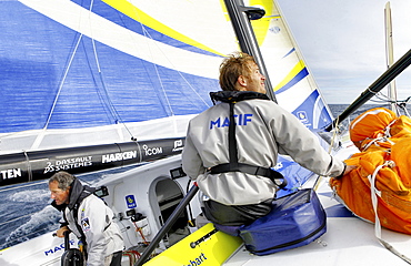
Onboard the IMOCA Open 60 Macif crewed by Francois Gabart and Michel Desjoyeaux during a training session before the Transat Jacques Vabre in the English Channel from Plymouth to Port la Foret after she won on her class the Rolex Fastnet Race.

Onboard the IMOCA Open 60 Macif crewed by Francois Gabart and Michel Desjoyeaux during a training session before the Transat Jacques Vabre in the English Channel from Plymouth to Port la Foret after she won on her class the Rolex Fastnet Race.

Onboard the IMOCA Open 60 Macif crewed by Francois Gabart and Michel Desjoyeaux during a training session before the Transat Jacques Vabre in the English Channel from Plymouth to Port la Foret after she won on her class the Rolex Fastnet Race.

Onboard the IMOCA Open 60 Macif crewed by Francois Gabart and Michel Desjoyeaux during a training session before the Transat Jacques Vabre in the English Channel from Plymouth to Port la Foret after she won on her class the Rolex Fastnet Race.
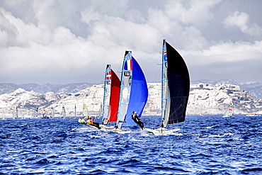
The 2013 Seiko 49er and 49erFX World Championships, 150 skiffs - 28 nations Two World Championship Titles, Marseille, France.
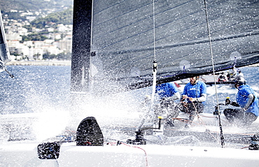
The GC32 is the one design for the Great Cup Racing circuit, at the Extreme Sailing Series, Nice, Alpes-Maritimes, France. Day Two.
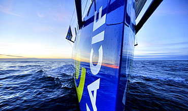
Onboard the IMOCA Open 60 Macif crewed by Francois Gabart and Michel Desjoyeaux during a training session before the Transat Jacques Vabre in the English Channel from Plymouth to Port la Foret after she won on her class the Rolex Fastnet Race.
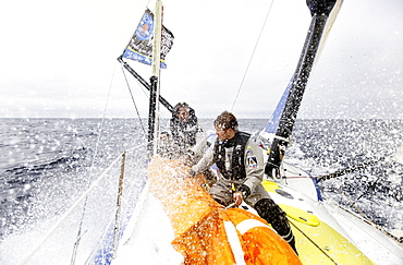
Onboard the IMOCA Open 60 Macif crewed by Francois Gabart and Michel Desjoyeaux during a training session before the Transat Jacques Vabre in the English Channel from Plymouth to Port la Foret after she won on her class the Rolex Fastnet Race.
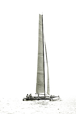
The GC32 is the one design for the Great Cup Racing circuit, at the Extreme Sailing Series, Nice, Alpes-Maritimes, France.

The Maxi Trimaran Solo Banque Populaire VII (FRA), the 103 feet trimaran skippered by Armel Le Cléac?h in front of the Mucem (Museum for Europe and the Mediterranean), Marseille, France.
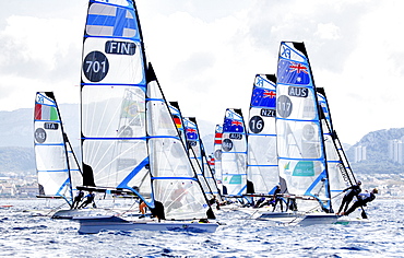
The 2013 Seiko 49er and 49erFX World Championships, 150 skiffs - 28 nations Two World Championship Titles, Marseille, France.

Onboard the IMOCA Open 60 Macif crewed by Francois Gabart and Michel Desjoyeaux during a training session before the Transat Jacques Vabre in the English Channel from Plymouth to Port la Foret after she won on her class the Rolex Fastnet Race.

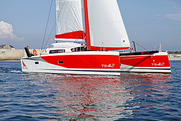
The TS42 Imagine Catamaran Design by Christophe Barreau and built by Marsaudon Composites, Lorient, Morbihan, France.

Loick Peyron onboard the Maxi Trimaran Solo Banque Populaire VII in preparation for "La Route du Rhum".

Onboard Shamrock V (JK3) during the Regates Royales in Cannes, France. Shamrock V was built in 1930 for Sir Thomas Lipton's fifth and last America's Cup challenge. Designed by Nicholson, she was the first British yacht to be built to the new J Class Rule and is the only remaining J to have been built in wood.
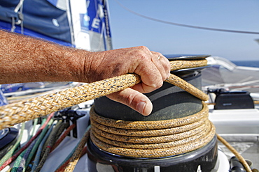
Loick Peyron onboard the Maxi Trimaran Solo Banque Populaire VII in preparation for "La Route du Rhum".

The TS42 Imagine Catamaran Design by Christophe Barreau and built by Marsaudon Composites, Lorient, Morbihan, France.

Loick Peyron onboard the Maxi Trimaran Solo Banque Populaire VII in preparation for "La Route du Rhum".
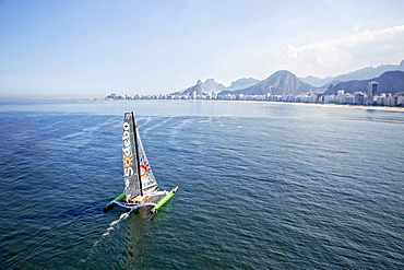
Thomas Coville and the Ultime Class 100' VPLP designed trimaran Sodebo in Rio de Janeiro, Brazil. Thomas Coville (FRA) and his 31m maxi trimaran Sodebo Ultim? has successfully broken the solo round the world record, completing the 28400 nm route in 49 days 3 hours 7 minutes and 38 seconds.
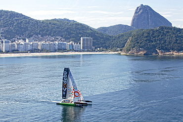
Thomas Coville and the Ultime Class 100' VPLP designed trimaran Sodebo in Rio de Janeiro, Brazil. Thomas Coville (FRA) and his 31m maxi trimaran Sodebo Ultim? has successfully broken the solo round the world record, completing the 28400 nm route in 49 days 3 hours 7 minutes and 38 seconds.

Porspoder (Breton: Porspoder) is a commune in the Finistère department of Brittany in north-western France.
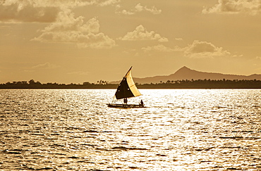
The Louisiade Archipelago is a string of ten larger volcanic islands frequently fringed by coral reefs, and 90 smaller coral islands located 200 km southeast of New Guinea, stretching over more than 160 km and spread over an ocean area of 26,000 km? between the Solomon Sea to the north and the Coral Sea to the south. The aggregate land area of the islands is about 1,790 km? (690 square miles), with Vanatinai (formerly Sudest or Tagula as named by European claimants on Western maps) being the largest.Sideia Island and Basilaki Island lie closest to New Guinea, while Misima, Vanatinai, and Rossel islands lie further east. The archipelago is divided into the Local Level Government (LLG) areas Louisiade Rural (western part, with Misima), and Yaleyamba (western part, with Rossell and Tagula islands. The LLG areas are part of Samarai-Murua District district of Milne Bay. The seat of the Louisiade Rural LLG is Bwagaoia on Misima Island, the population center of the archipelago.
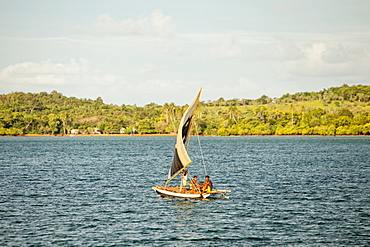
The Louisiade Archipelago is a string of ten larger volcanic islands frequently fringed by coral reefs, and 90 smaller coral islands located 200 km southeast of New Guinea, stretching over more than 160 km and spread over an ocean area of 26,000 km? between the Solomon Sea to the north and the Coral Sea to the south. The aggregate land area of the islands is about 1,790 km? (690 square miles), with Vanatinai (formerly Sudest or Tagula as named by European claimants on Western maps) being the largest. Sideia Island and Basilaki Island lie closest to New Guinea, while Misima, Vanatinai, and Rossel islands lie further east. The archipelago is divided into the Local Level Government (LLG) areas Louisiade Rural (western part, with Misima), and Yaleyamba (western part, with Rossell and Tagula islands. The LLG areas are part of Samarai-Murua District district of Milne Bay. The seat of the Louisiade Rural LLG is Bwagaoia on Misima Island, the population center of the archipelago.
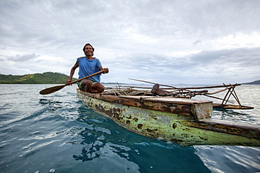
Nimoa Island - here the island mission will impress. The five-sided church features murals of island life and all mission buildings are surrounded by well maintained paths and gardens filled with flowering plants. Edged by jungle-covered mountains, postcard beaches and crystal clear waters - an island paradise indeed! The Louisiade Archipelago is a string of ten larger volcanic islands frequently fringed by coral reefs, and 90 smaller coral islands located 200 km southeast of New Guinea, stretching over more than 160 km and spread over an ocean area of 26,000 km? between the Solomon Sea to the north and the Coral Sea to the south. The aggregate land area of the islands is about 1,790 km? (690 square miles), with Vanatinai (formerly Sudest or Tagula as named by European claimants on Western maps) being the largest. Sideia Island and Basilaki Island lie closest to New Guinea, while Misima, Vanatinai, and Rossel islands lie further east. The archipelago is divided into the Local Level Government (LLG) areas Loui!
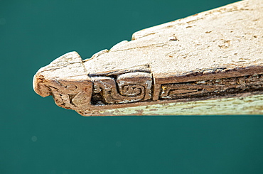
Nimoa Island - here the island mission will impress. The five-sided church features murals of island life and all mission buildings are surrounded by well maintained paths and gardens filled with flowering plants. Edged by jungle-covered mountains, postcard beaches and crystal clear waters - an island paradise indeed! The Louisiade Archipelago is a string of ten larger volcanic islands frequently fringed by coral reefs, and 90 smaller coral islands located 200 km southeast of New Guinea, stretching over more than 160 km and spread over an ocean area of 26,000 km? between the Solomon Sea to the north and the Coral Sea to the south. The aggregate land area of the islands is about 1,790 km? (690 square miles), with Vanatinai (formerly Sudest or Tagula as named by European claimants on Western maps) being the largest. Sideia Island and Basilaki Island lie closest to New Guinea, while Misima, Vanatinai, and Rossel islands lie further east. The archipelago is divided into the Local Level Government (LLG) areas Loui!

Nimoa Island - here the island mission will impress. The five-sided church features murals of island life and all mission buildings are surrounded by well maintained paths and gardens filled with flowering plants. Edged by jungle-covered mountains, postcard beaches and crystal clear waters - an island paradise indeed! The Louisiade Archipelago is a string of ten larger volcanic islands frequently fringed by coral reefs, and 90 smaller coral islands located 200 km southeast of New Guinea, stretching over more than 160 km and spread over an ocean area of 26,000 km? between the Solomon Sea to the north and the Coral Sea to the south. The aggregate land area of the islands is about 1,790 km? (690 square miles), with Vanatinai (formerly Sudest or Tagula as named by European claimants on Western maps) being the largest. Sideia Island and Basilaki Island lie closest to New Guinea, while Misima, Vanatinai, and Rossel islands lie further east. The archipelago is divided into the Local Level Government (LLG) areas Louisiade Rural (western part, with Misima), and Yaleyamba (western part, with Rossell and Tagula islands. The LLG areas are part of Samarai-Murua District district of Milne Bay. The seat of the Louisiade Rural LLG is Bwagaoia on Misima Island, the population center of the archipelago.
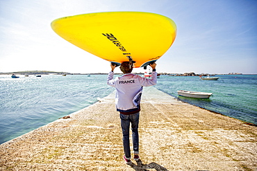
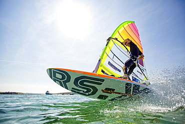
Pierre Le Coq carries his windsurfing board over his head on a jetty at Plouguerneau, Brittany, France.
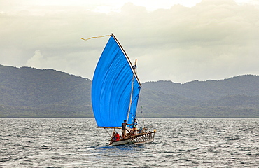
Nimoa Island - here the island mission will impress. The five-sided church features murals of island life and all mission buildings are surrounded by well maintained paths and gardens filled with flowering plants. Edged by jungle-covered mountains, postcard beaches and crystal clear waters - an island paradise indeed! The Louisiade Archipelago is a string of ten larger volcanic islands frequently fringed by coral reefs, and 90 smaller coral islands located 200 km southeast of New Guinea, stretching over more than 160 km and spread over an ocean area of 26,000 km? between the Solomon Sea to the north and the Coral Sea to the south. The aggregate land area of the islands is about 1,790 km? (690 square miles), with Vanatinai (formerly Sudest or Tagula as named by European claimants on Western maps) being the largest. Sideia Island and Basilaki Island lie closest to New Guinea, while Misima, Vanatinai, and Rossel islands lie further east.
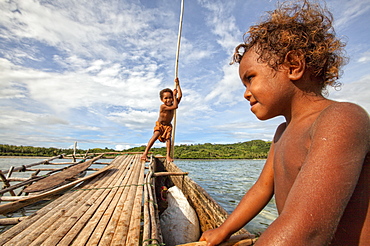
Children playing with a outrigger canoe in the village of Hessessai Bay at PanaTinai (Panatinane)island in the Louisiade Archipelago in Milne Bay Province, Papua New Guinea. The island has an area of 78 km2. The Louisiade Archipelago is a string of ten larger volcanic islands frequently fringed by coral reefs, and 90 smaller coral islands located 200 km southeast of New Guinea, stretching over more than 160 km and spread over an ocean area of 26,000 km? between the Solomon Sea to the north and the Coral Sea to the south. The aggregate land area of the islands is about 1,790 km? (690 square miles), with Vanatinai (formerly Sudest or Tagula as named by European claimants on Western maps) being the largest. Sideia Island and Basilaki Island lie closest to New Guinea, while Misima, Vanatinai, and Rossel islands lie further east. The archipelago is divided into the Local Level Government (LLG) areas Louisiade Rural (western part, with Misima), and Yaleyamba (western part, with Rossell and Tagula islands. The LLG areas are part of Samarai-Murua District district of Milne Bay. The seat of the Louisiade Rural LLG is Bwagaoia on Misima Island, the population center of the archipelago.PanaTinai (Panatinane) is an island in the Louisiade Archipelago in Milne Bay Province, Papua New Guinea.

Nimoa Island - here the island mission will impress. The five-sided church features murals of island life and all mission buildings are surrounded by well maintained paths and gardens filled with flowering plants. Edged by jungle-covered mountains, postcard beaches and crystal clear waters - an island paradise indeed! The Louisiade Archipelago is a string of ten larger volcanic islands frequently fringed by coral reefs, and 90 smaller coral islands located 200 km southeast of New Guinea, stretching over more than 160 km and spread over an ocean area of 26,000 km? between the Solomon Sea to the north and the Coral Sea to the south. The aggregate land area of the islands is about 1,790 km? (690 square miles), with Vanatinai (formerly Sudest or Tagula as named by European claimants on Western maps) being the largest. Sideia Island and Basilaki Island lie closest to New Guinea, while Misima, Vanatinai, and Rossel islands lie further east. The archipelago is divided into the Local Level Government (LLG) areas Louisiade Rural (western part, with Misima), and Yaleyamba (western part, with Rossell and Tagula islands. The LLG areas are part of Samarai-Murua District district of Milne Bay. The seat of the Louisiade Rural LLG is Bwagaoia on Misima Island, the population center of the archipelago.
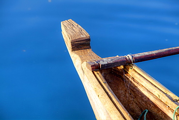
Nimoa Island - here the island mission will impress. The five-sided church features murals of island life and all mission buildings are surrounded by well maintained paths and gardens filled with flowering plants. Edged by jungle-covered mountains, postcard beaches and crystal clear waters - an island paradise indeed! The Louisiade Archipelago is a string of ten larger volcanic islands frequently fringed by coral reefs, and 90 smaller coral islands located 200 km southeast of New Guinea, stretching over more than 160 km and spread over an ocean area of 26,000 km? between the Solomon Sea to the north and the Coral Sea to the south. The aggregate land area of the islands is about 1,790 km? (690 square miles), with Vanatinai (formerly Sudest or Tagula as named by European claimants on Western maps) being the largest. Sideia Island and Basilaki Island lie closest to New Guinea, while Misima, Vanatinai, and Rossel islands lie further east. The archipelago is divided into the Local Level Government (LLG) areas Louisiade Rural (western part, with Misima), and Yaleyamba (western part, with Rossell and Tagula islands. The LLG areas are part of Samarai-Murua District district of Milne Bay. The seat of the Louisiade Rural LLG is Bwagaoia on Misima Island, the population center of the archipelago.
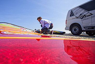
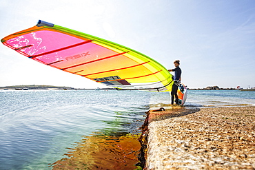
Pierre Le Coq preparing his windsurfing gear on a jetty near his van at Plouguerneau, Brittany, France.
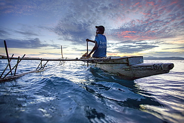
Nimoa Island - here the island mission will impress. The five-sided church features murals of island life and all mission buildings are surrounded by well maintained paths and gardens filled with flowering plants. Edged by jungle-covered mountains, postcard beaches and crystal clear waters - an island paradise indeed! The Louisiade Archipelago is a string of ten larger volcanic islands frequently fringed by coral reefs, and 90 smaller coral islands located 200 km southeast of New Guinea, stretching over more than 160 km and spread over an ocean area of 26,000 km? between the Solomon Sea to the north and the Coral Sea to the south. The aggregate land area of the islands is about 1,790 km? (690 square miles), with Vanatinai (formerly Sudest or Tagula as named by European claimants on Western maps) being the largest. Sideia Island and Basilaki Island lie closest to New Guinea, while Misima, Vanatinai, and Rossel islands lie further east. The archipelago is divided into the Local Level Government (LLG) areas Loui!
