Results
89 results found
Man rock climbing, Coconino National Forest, Arizona, United States of America, North America
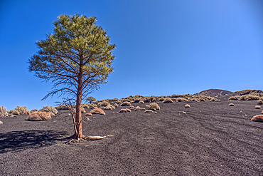
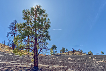
Lone Pine Tree, Coconino National Forest, Arizona, USA
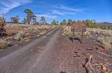
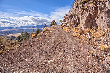
Fire Road 546 where it branches off from Sunset Crater National Monument into Coconino National Forest of Arizona, USA
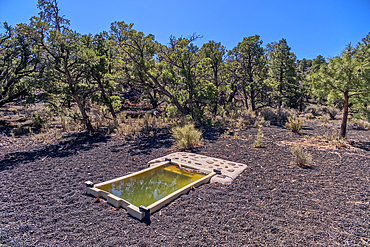
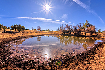
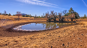
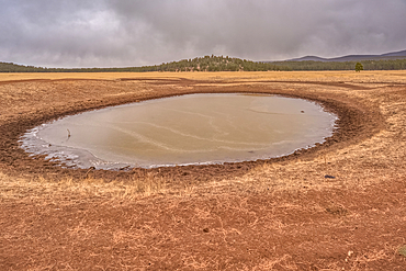
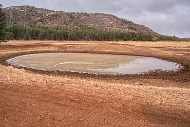
A water catchment in the Coconino National Forest, Sunset Crater National Monument, Arizona, USA
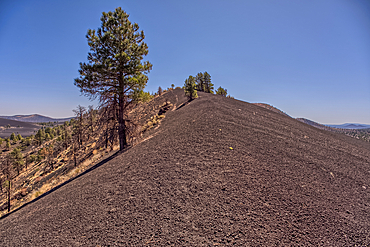
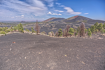
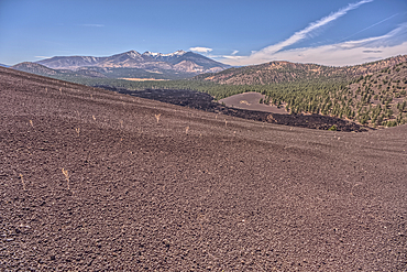
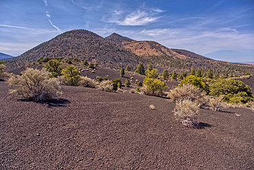
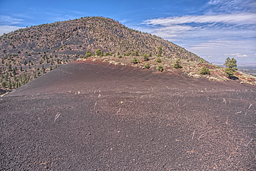
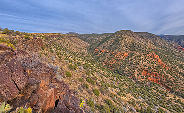
Volcanic cinder rim in Coconino National Forest, Arizona, USA
Volcanic cinder hill in Coconino National Forest, Arizona, USA
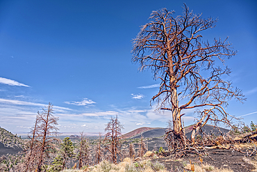
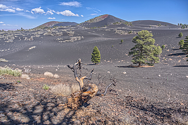
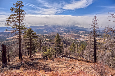
Burned trees on a Volcanic cinder rim in Coconino National Forest, Arizona, USA
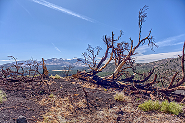
Burned trees on a Volcanic cinder rim in Coconino National Forest, Arizona, USA
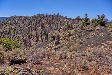
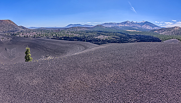
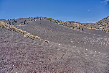
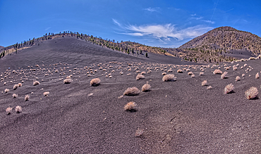
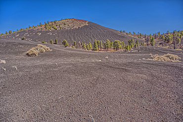
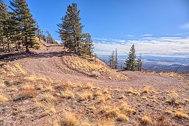
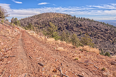
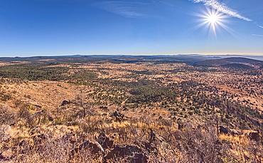
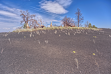
Volcanic cinder hills in Coconino National Forest, Arizona, USA
Volcanic cinder hills in Coconino National Forest, Arizona, USA
Humphrey's Peak, Coconino National Forest, Arizona, USA
The southeast summit of O'Leary Peak, Coconino National Forest, Arizona, USA
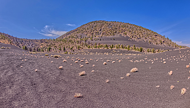
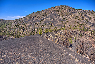
Volcanic cinder hills in Coconino National Forest, Arizona, USA
Volcanic cinder hills in Coconino National Forest, Arizona, USA
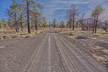
Fire Road 546 where it branches off from Sunset Crater National Monument into Coconino National Forest of Arizona, USA
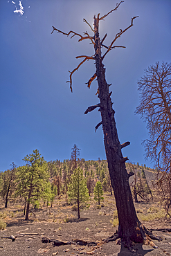
A burned tree below a volcanic cinder hill in the Coconino National Forest, Arizona, USA
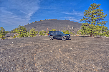
An SUV traveling near Volcanic cinder hills in Coconino National Forest, Arizona, USA
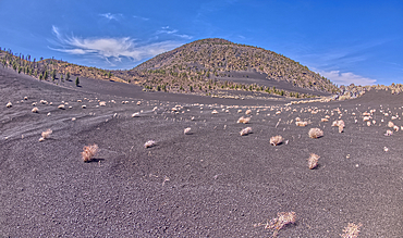
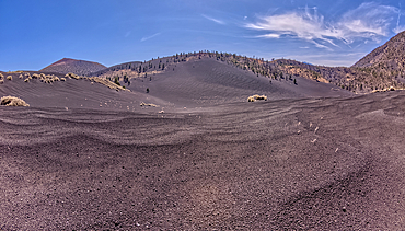
Volcanic cinder hills in Coconino National Forest, Arizona, USA
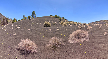
Volcanic cinder hills in Coconino National Forest, Arizona, USA
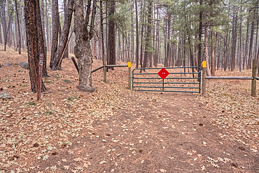
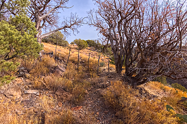
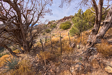
The boundary fence between Coconino National Forest and Sunset Crater National Monument of Arizona, USA
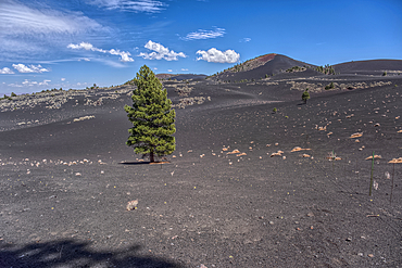
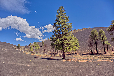
Lone Pine Tree in a volcanic valley in Coconino National Forest, Arizona, USA
Volcanic cinder hills in Coconino National Forest, Arizona, USA
The boundary fence between Coconino National Forest and Sunset Crater National Monument of Arizona.
Volcanic cinder hills in Coconino National Forest, Arizona, USA
Volcanic cinder hill in Coconino National Forest, Arizona, USA
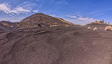
Volcanic cinder hills in Coconino National Forest, Arizona, USA

The Coconino Overlook along the North Kaibab Trail at Grand Canyon North Rim, UNESCO, Arizona, United States of America
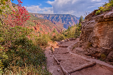
A curve in the North Kaibab Trail between Coconino Overlook and the Supai Tunnel Rest Area, Grand Canyon, Arizona, United States of America
O'Leary Peak, Coconino National Forest, Arizona, USA
Volcanic cinder hills in Coconino National Forest, Arizona, USA
Volcanic cinder hills in Coconino National Forest, Arizona, USA
Volcanic cinder hills in Coconino National Forest, Arizona, USA
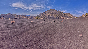
Volcanic cinder hills in Coconino National Forest, Arizona, USA
Volcanic cinder hills in Coconino National Forest, Arizona, USA
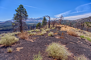
Burned trees on a Volcanic cinder rim in Coconino National Forest, Arizona, USA
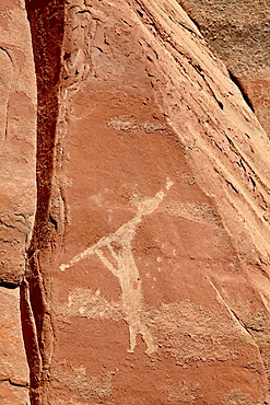
Flute player pictograph, Honanki Heritage Site, Coconino National Forest, Arizona, United States of America, North America
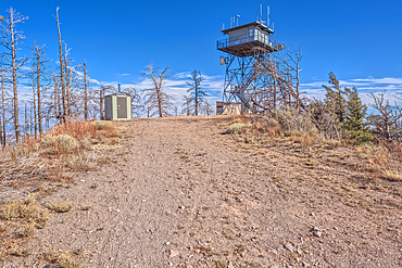
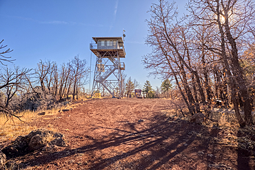
The fire watchtower on the summit of O'Leary Peak in the Coconino National Forest of Arizona. Adjacent to the Sunset Crater National Monument.
Forest Service Road that leads to the O'Leary Peak Watchtower and Overlook. Adjacent to Sunset Crater National Monument Arizona in the Coconino National Forest.
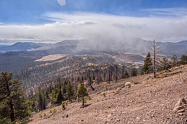
A snow squall storm building up over Humphrey's Peak. Viewed from O'Leary Peak in the Coconino National Forest of Arizona. Adjacent to Sunset Crater National Monument.
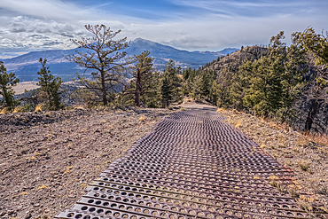
End of the Forest Service Road that leads to the O'Leary Peak Watchtower and Overlook. The metal grating is to add traction for vehicles. Adjacent to Sunset Crater National Monument Arizona in the Coconino National Forest.
A snow squall storm building up over Humphrey's Peak. Viewed from O'Leary Peak in the Coconino National Forest of Arizona. Adjacent to Sunset Crater National Monument.
The Forest Service Road that leads to the summit of O'Leary Peak in the Coconino National Forest of Arizona.
The eastern summit of O'Leary Peak in the Coconino National Forest of Arizona. Adjacent to the Sunset Crater National Monument.
O'Leary Peak, Coconino National Forest, Arizona, USA
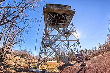
The fire watchtower on the summit of Apache Maid Mountain, Coconino National Forest, Arizona, United States of America
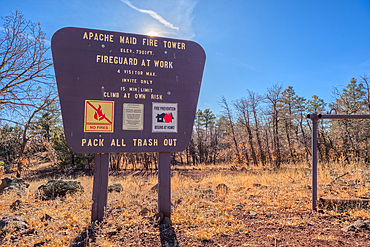
An information sign on the summit of Apache Maid Mountai, Coconino National Forest, Arizona, United States of America
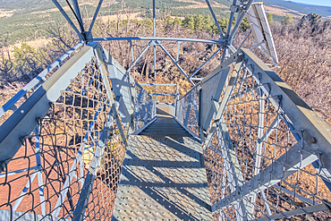
Fisheye view from below the fire watchtower on summit of Apache Maid Mountain, Coconino National Forest, Arizona, United States of America
View from second deck of fire watchtower on summit of Apache Maid Mountain, Coconino National Forest, Arizona, United States of America
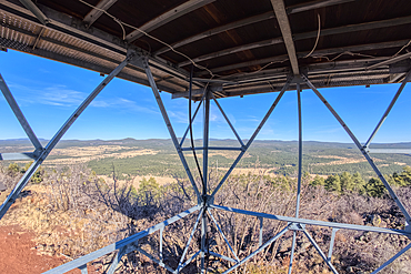
View from second deck of fire watchtower on summit of Apache Maid Mountain, Coconino National Forest, Arizona, United States of America
Coconino National Forest from the southwest summit of Apache Maid Mountain, Coconino National Forest, Arizona, United States of America
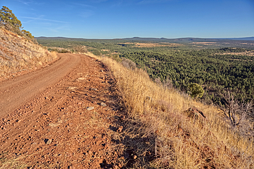
Road to the summit of Apache Maid Mountain, Coconino National Forest, Arizona, United States of America
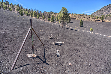
The gate for the Campbell Draw Tank, Coconino National Forest, Arizona, United States of America
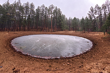
The frozen Campbell Draw Tank with approaching snow storm, Coconino National Forest, Arizona, United States of America
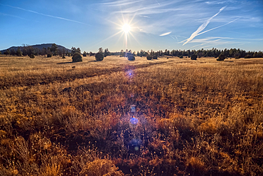
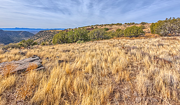
Golden grassland prairie near sundown, Coconino National Forest, Arizona, United States of America
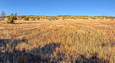
Golden grassland prairie near sundown, Coconino National Forest, Arizona, United States of America
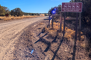
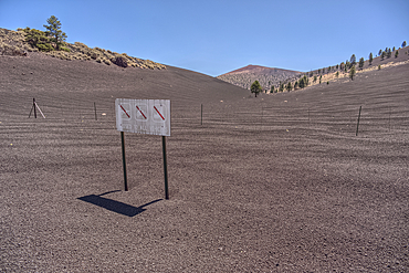
A warning sign stating that the road can be closed seasonally, Coconino National Forest, Arizona, United States of America
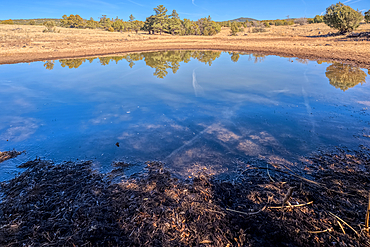
A cattle pond, Rarick Tank, Coconino National Forest, Arizona, United States of America
A cattle pond, Rarick Tank, Coconino National Forest, Arizona, United States of America
A cattle pond, Rarick Tank, Coconino National Forest, Arizona, United States of America
Burned trees on a Volcanic cinder rim in Coconino National Forest, Arizona, USA
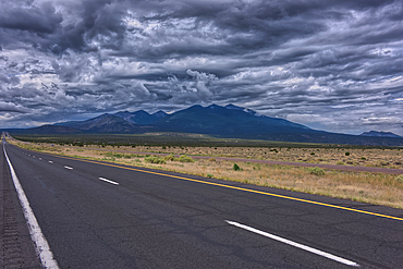
Storm clouds rolling in over Humphrey's Peak near Flagstaff Arizona in the Coconino National Forest. Viewed from US89.
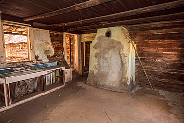
Interior of an abandoned homestead in the Coconino National Forest, Arizona, United States of America
A cattle pond (livestock tank), partially frozen, Coconino National Forest Arizona, United States of America
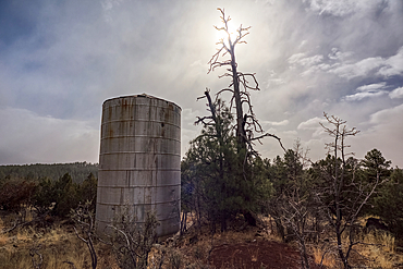
Old water tank perched on a cliff overlooking the T-Bar Ranch Homestead in the Coconino National Forest of Arizona, United States of America
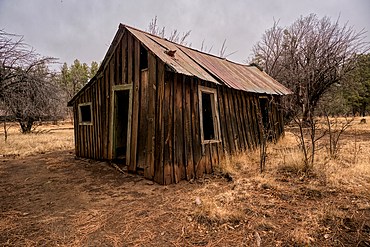
Outbuilding, abandoned historic T-Bar Ranch Homestead, with approaching snow storm, Coconino National Forest, Arizona, United States of America
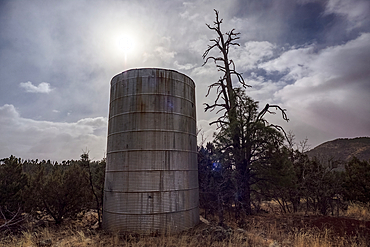
Old water tank perched on a cliff overlooking the T-Bar Ranch Homestead in the Coconino National Forest, Arizona, United States of America
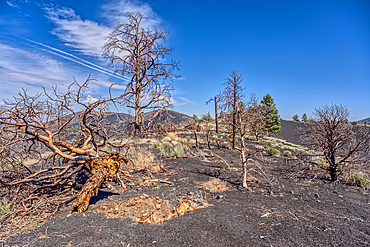
Burned trees on a Volcanic cinder rim in Coconino National Forest, Arizona, USA
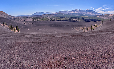
Volcanic cinder rim in Coconino National Forest, Arizona, USA
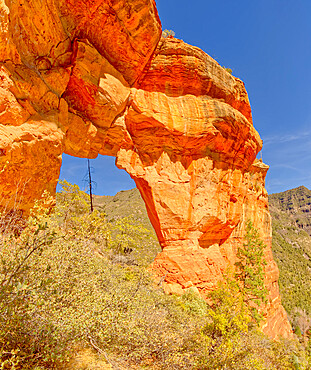
South side of Pendley Arch, Coconino National Forest just outside of Slide Rock State Park, Sedona, Arizona, United States of America, North America
View from the western slope of Steamboat Rock looking north, Coconino National Forest, Sedona, Arizona, United States of America, North America
A dry waterfall sandstone ledge on a trail to Steamboat Rock, Coconino National Forest, Sedona, Arizona, United States of America, North America
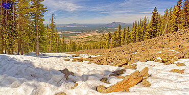
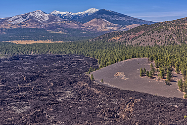
West panorama view from a lava field on the side of Humphrey's Peak near Flagstaff in the Coconino National Forest, Arizona, United States of America, North America
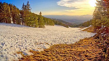
The slopes of Arizona Snow Bowl facing west close to sundown, Coconino National Forest near Flagstaff, Arizona, United States of America, North America
Boundary gate and cattle-proof fence between Coconino National Forest and Wet Beaver Creek Wilderness, Arizona, United States of America
Boundary gate and cattle-proof fence between Coconino National Forest and Wet Beaver Creek Wilderness, Arizona, United States of America
A cattle pond (livestock tank), part frozen, Coconino National Forest, Apache Maid Mountain in the background, Arizona, United States of America
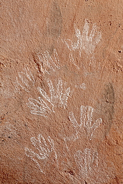
Hand pictographs, Honanki Heritage Site, Coconino National Forest, Arizona, United States of America, North America

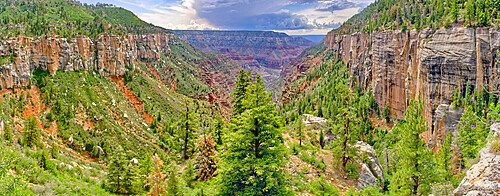
Wet Beaver Creek Canyon in the Coconino National Forest, Arizona, United States of America
View of Wet Beaver Creek off of the Bell Trail in Coconino National Forest, Arizona, United States of America
The grassland prairie on the summit of White Mesa in Coconino National Forest, Arizona, United States of America

Wet Beaver Creek Canyon viewed from the south end of White Mesa in Coconino National Forest, Arizona, United States of America
Casner Canyon in Wet Beaver Creek Wilderness viewed from White Mesa summit, in Coconino National Forest, Arizona, United States of America
Bright Angel Canyon viewed from Coconino Overlook along North Kaibab Trail on Grand Canyon North Rim, Arizona, United States of America, North America
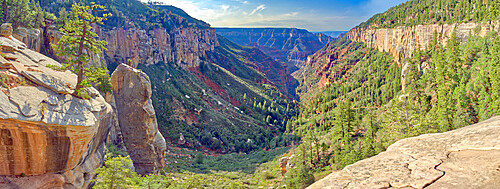
Bright Angel Canyon viewed from Coconino Overlook along North Kaibab Trail on Grand Canyon North Rim, Arizona, United States of America, North America
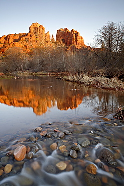
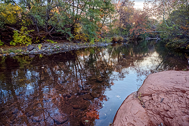
Cathedral Rock reflected in Oak Creek, Crescent Moon Picnic Area, Coconino National Forest, Arizona, United States of America, North America
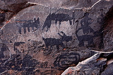
Pictographs, Palatki Heritage Site, Coconino National Forest, Arizona, United States of America, North America
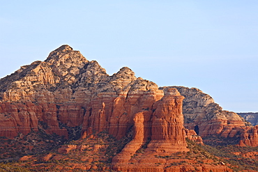
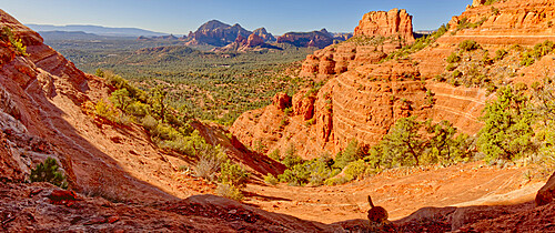
Red rock formations at sunrise, Coconino National Forest, Arizona, United States of America, North America
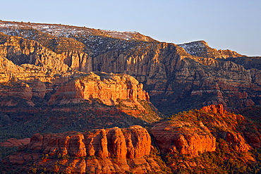
Red cliffs at sunset, Coconino National Forest, Arizona, United States of America, North America
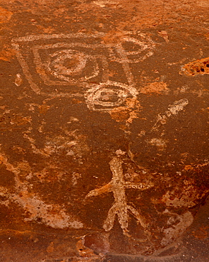
Pictographs, Honanki Heritage Site, Coconino National Forest, Arizona, United States of America, North America
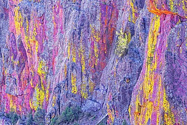
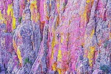
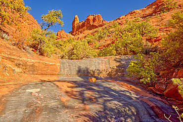
Multicoloured canyon wall, Coconino National Forest, Arizona, USA, North America
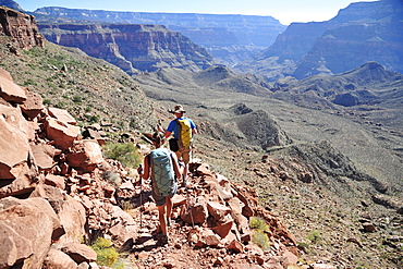
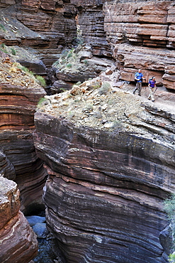
Hikers descend into Surprise Valley to access the lower canyon through a break in the 400-foot-tall Redwall on the Thunder River Trail in the Grand Canyon outside of Fredonia, Arizona November 2011. The 21.4-mile loop starts at the Bill Hall trailhead on the North Rim and descends 2000-feet in 2.5-miles through Coconino Sandstone to the level Esplanada then descends further into the lower canyon to access Thunder River, Tapeats Creek and Deer Creek.
Hikers walk along Deer Creek Narrows in the Grand Canyon outside of Fredonia, Arizona November 2011. The 21.4-mile loop starts at the Bill Hall trailhead on the North Rim and descends 2000-feet in 2.5-miles through Coconino Sandstone to the level Esplanada then descends further into the lower canyon through a break in the 400-foot-tall Redwall to access Surprise Valley. Hikers connect Thunder River and Tapeats Creek to a route along the Colorado River and climb out Deer Creek.

Male hiker filters water on a cliff-pinched patio near Deer Creek Falls in the Grand Canyon outside of Fredonia, Arizona November 2011. The 21.4-mile loop starts at the Bill Hall trailhead on the North Rim and descends 2000-feet in 2.5-miles through Coconino Sandstone to the level Esplanada then descends further into the lower canyon through a break in the 400-foot-tall Redwall to access Surprise Valley. Hikers connect Thunder River and Tapeats Creek to a route along the Colorado River and climb out Deer Creek.
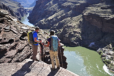
Hikers overlook the Colorado River as they exit the Deer Creek Narrows in the Grand Canyon outside of Fredonia, Arizona November 2011. The 21.4-mile loop starts at the Bill Hall trailhead on the North Rim and descends 2000-feet in 2.5-miles through Coconino Sandstone to the level Esplanada then descends further into the lower canyon through a break in the 400-foot-tall Redwall to access Surprise Valley. Hikers connect Thunder River and Tapeats Creek to a route along the Colorado River and climb out Deer Creek.
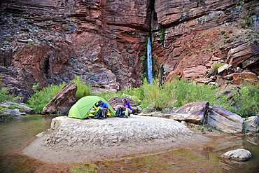
Hikers setup camp on a beach along the Colorado River near the plumeting 180-foot Deer Creek Falls in the Grand Canyon outside of Fredonia, Arizona November 2011. The 21.4-mile loop starts at the Bill Hall trailhead on the North Rim and descends 2000-feet in 2.5-miles through Coconino Sandstone to the level Esplanada then descends further into the lower canyon through a break in the 400-foot-tall Redwall to access Surprise Valley. Hikers connect Thunder River and Tapeats Creek to a route along the Colorado River and climb out Deer Creek.
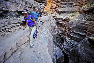
Hikers walk along Deer Creek Narrows in the Grand Canyon outside of Fredonia, Arizona November 2011. The 21.4-mile loop starts at the Bill Hall trailhead on the North Rim and descends 2000-feet in 2.5-miles through Coconino Sandstone to the level Esplanada then descends further into the lower canyon through a break in the 400-foot-tall Redwall to access Surprise Valley. Hikers connect Thunder River and Tapeats Creek to a route along the Colorado River and climb out Deer Creek.
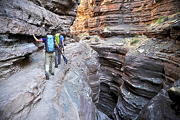
Hikers walk along Deer Creek Narrows in the Grand Canyon outside of Fredonia, Arizona November 2011. The 21.4-mile loop starts at the Bill Hall trailhead on the North Rim and descends 2000-feet in 2.5-miles through Coconino Sandstone to the level Esplanada then descends further into the lower canyon through a break in the 400-foot-tall Redwall to access Surprise Valley. Hikers connect Thunder River and Tapeats Creek to a route along the Colorado River and climb out Deer Creek.
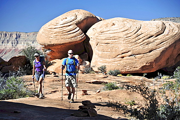
Hikers on the sandstone Esplanade of the Thunder River Trail below the North Rim of the Grand Canyon outside Fredonia, Arizona November 2011. The 21.4-mile loop descends 2000-feet in 2.5-miles through Coconino Sandstone from the Bill Hall trailhead to connect the Thunder River and Deer Creeks trails. Hikers descend into the lower canyon through a break in the 400-foot-tall Redwall to access Surprise Valley, Deer Creek, Tapeats Creek via Thunder River and even the Colorado River.

Hikers follow a route along the Colorado River that connect Tapeats Creek and Thunder River to Deer Creek in the Grand Canyon outside of Fredonia, Arizona November 2011. The 21.4-mile loop starts at the Bill Hall trailhead on the North Rim and descends 2000-feet in 2.5-miles through Coconino Sandstone to the level Esplanada then descends further into the lower canyon through a break in the 400-foot-tall Redwall to access Surprise Valley. Hikers connect Thunder River and Tapeats Creek to a route along the Colorado River and climb out Deer Creek.
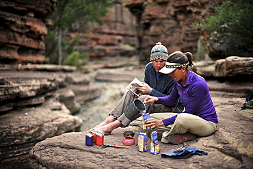
Hikers cook dinner along Deer Creek Narrows in the Grand Canyon outside of Fredonia, Arizona November 2011. The 21.4-mile loop starts at the Bill Hall trailhead on the North Rim and descends 2000-feet in 2.5-miles through Coconino Sandstone to the level Esplanada then descends further into the lower canyon through a break in the 400-foot-tall Redwall to access Surprise Valley. Hikers connect Thunder River and Tapeats Creek to a route along the Colorado River and climb out Deer Creek.