Results
14 results found
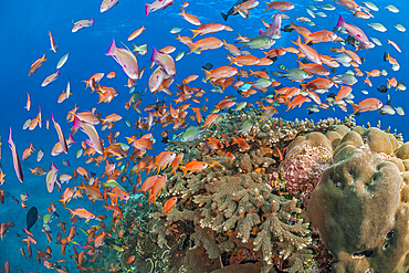
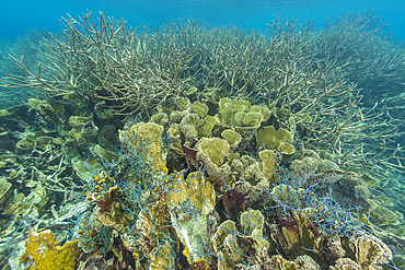
A hard coral reef along with schooling anthias and reef fish, Crystal Bay, Bali island, Indonesia, Southeast Asia, Asia
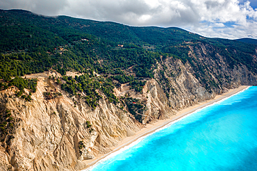
Drone view of Egremni beach cliffs and turquoise water, Lefkada island, Ionian Islands, Greek Islands, Greece
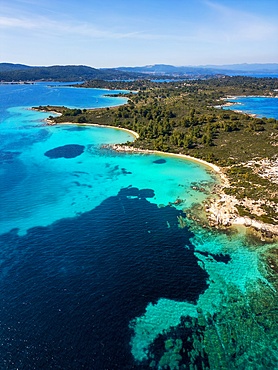
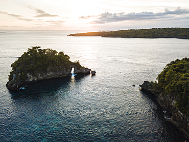
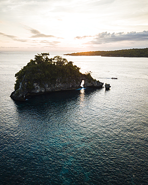
Diaporos island with wild beaches with turquoise water, drone aerial view, Chalkidiki, Greece
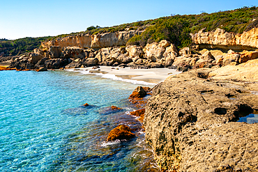
Petrified forest, Agia Marina, Agios Nikolaos Geopark, beach with turquoise water in the south of Greece, Greece
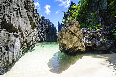
Hidden bay with crystal clear water in the Bacuit archipelago, Palawan, Philippines, Southeast Asia, Asia

Tropical Indonesian beach of Nusa Penida island with turquoise and crystal sea water, aerial shot, Crystal Bay, Nusa Penida, Klungkung regency, Bali, Indonesia, Southeast Asia, Asia
Crystal Bay at sunset, Nusa Penida, Bali, Indonesia, Southeast Asia, Asia

Above and below photo in the crystal clear water in the shallow reefs off Wayag Bay, Raja Ampat, Indonesia, Southeast Asia, Asia
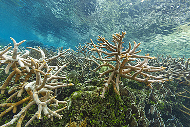
Fishing net imbedded in the coral in the crystal clear water in the shallow reefs off Wayag Bay, Raja Ampat, Indonesia, Southeast Asia, Asia
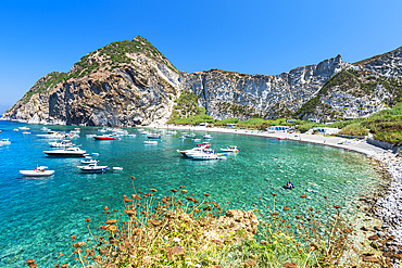
Palmarola bay with boats in crystal clear water, Palmarola island, Ponza municipality, Tyrrhenian sea, Pontine archipelago, Latina Province, Latium (Lazio), Italy, Europe
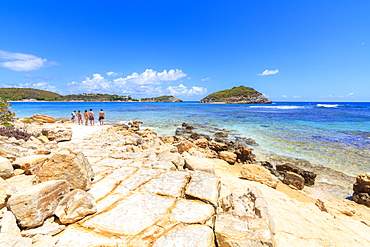
People on rocks overlooking the crystal sea, Half Moon Bay, Antigua and Barbuda, Leeward Islands, West Indies, Caribbean, Central America
Crystal Bay at sunset, Nusa Penida, Bali, Indonesia, Southeast Asia, Asia
Abundant life in the crystal clear water in the shallow reefs off Wayag Bay, Raja Ampat, Indonesia, Southeast Asia, Asia
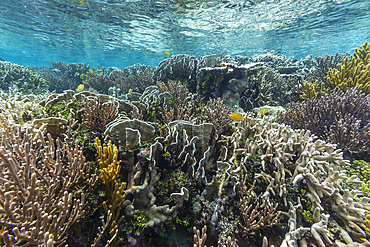
Abundant life in the crystal clear water in the shallow reefs off Wayag Bay, Raja Ampat, Indonesia, Southeast Asia, Asia
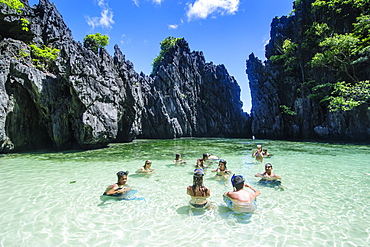
Tourists in the hidden bay with crystal clear water in the Bacuit archipelago, Palawan, Philippines, Southeast Asia, Asia
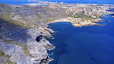
Aerial view of la manga del mar menor with its crystal clear turquoise waters gently lapping against the rocky coastline near cala reona
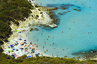
Bathing tourists and colorful parasols on the beach, crystal clear turquoise water, Cala Giunco, Porto Giunco, Capo Carbonara, Villasimius, Sardinia, Italy, Europe

Bathing tourists and colorful parasols on the beach, crystal clear turquoise water, Cala Giunco, Porto Giunco, Capo Carbonara, Villasimius, Sardinia, Italy, Europe

Quiet bay with crystal clear water, harbour, stone house and Viking ship, Lerwick, Shetland Islands, Scotland, United Kingdom, Europe
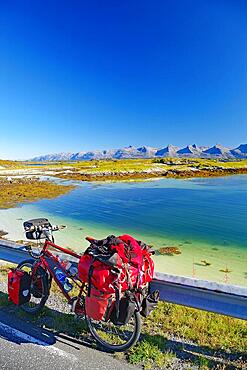
Packed touring bike, crystal clear water in a shallow bay, view of the mountain range Seven Sisters, cycle tourism, cycle trip, Heroey Island FV 17, Kystriksveien, Nordland, Norway, Europe
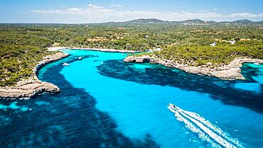
Crystal water bay in Mallorca, Spain, Europe
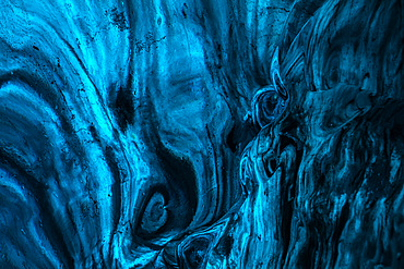
Blue ice texture in the caves in Jˆkuls·rlÛn glacier, Iceland, North Atlantic Ocean
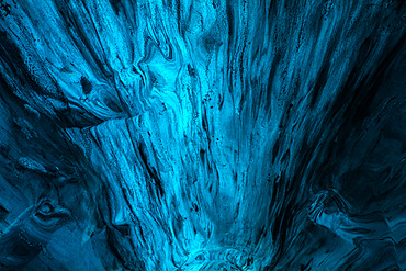
Blue ice texture in the caves in Jˆkuls·rlÛn glacier, Iceland, North Atlantic Ocean
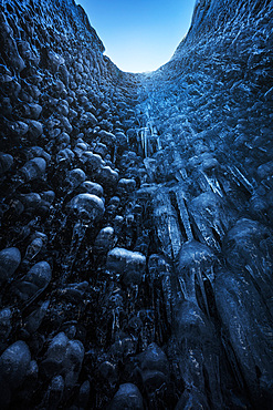
Blue ice caves in Jˆkuls·rlÛn glacier, Iceland, North Atlantic Ocean

Nimoa Island - here the island mission will impress. The five-sided church features murals of island life and all mission buildings are surrounded by well maintained paths and gardens filled with flowering plants. Edged by jungle-covered mountains, postcard beaches and crystal clear waters - an island paradise indeed! The Louisiade Archipelago is a string of ten larger volcanic islands frequently fringed by coral reefs, and 90 smaller coral islands located 200 km southeast of New Guinea, stretching over more than 160 km and spread over an ocean area of 26,000 km? between the Solomon Sea to the north and the Coral Sea to the south. The aggregate land area of the islands is about 1,790 km? (690 square miles), with Vanatinai (formerly Sudest or Tagula as named by European claimants on Western maps) being the largest. Sideia Island and Basilaki Island lie closest to New Guinea, while Misima, Vanatinai, and Rossel islands lie further east. The archipelago is divided into the Local Level Government (LLG) areas Louisiade Rural (western part, with Misima), and Yaleyamba (western part, with Rossell and Tagula islands. The LLG areas are part of Samarai-Murua District district of Milne Bay. The seat of the Louisiade Rural LLG is Bwagaoia on Misima Island, the population center of the archipelago.

Nimoa Island - here the island mission will impress. The five-sided church features murals of island life and all mission buildings are surrounded by well maintained paths and gardens filled with flowering plants. Edged by jungle-covered mountains, postcard beaches and crystal clear waters - an island paradise indeed! The Louisiade Archipelago is a string of ten larger volcanic islands frequently fringed by coral reefs, and 90 smaller coral islands located 200 km southeast of New Guinea, stretching over more than 160 km and spread over an ocean area of 26,000 km? between the Solomon Sea to the north and the Coral Sea to the south. The aggregate land area of the islands is about 1,790 km? (690 square miles), with Vanatinai (formerly Sudest or Tagula as named by European claimants on Western maps) being the largest. Sideia Island and Basilaki Island lie closest to New Guinea, while Misima, Vanatinai, and Rossel islands lie further east. The archipelago is divided into the Local Level Government (LLG) areas Louisiade Rural (western part, with Misima), and Yaleyamba (western part, with Rossell and Tagula islands. The LLG areas are part of Samarai-Murua District district of Milne Bay. The seat of the Louisiade Rural LLG is Bwagaoia on Misima Island, the population center of the archipelago.

Nimoa Island - here the island mission will impress. The five-sided church features murals of island life and all mission buildings are surrounded by well maintained paths and gardens filled with flowering plants. Edged by jungle-covered mountains, postcard beaches and crystal clear waters - an island paradise indeed! The Louisiade Archipelago is a string of ten larger volcanic islands frequently fringed by coral reefs, and 90 smaller coral islands located 200 km southeast of New Guinea, stretching over more than 160 km and spread over an ocean area of 26,000 km? between the Solomon Sea to the north and the Coral Sea to the south. The aggregate land area of the islands is about 1,790 km? (690 square miles), with Vanatinai (formerly Sudest or Tagula as named by European claimants on Western maps) being the largest. Sideia Island and Basilaki Island lie closest to New Guinea, while Misima, Vanatinai, and Rossel islands lie further east. The archipelago is divided into the Local Level Government (LLG) areas Louisiade Rural (western part, with Misima), and Yaleyamba (western part, with Rossell and Tagula islands. The LLG areas are part of Samarai-Murua District district of Milne Bay. The seat of the Louisiade Rural LLG is Bwagaoia on Misima Island, the population center of the archipelago.

French Polynesia, Moorea, Woman free diving in turquoise ocean.
Rough seas, large curling waves and cloudy sky

French Polynesia, Moorea, Woman free diving in turquoise ocean.
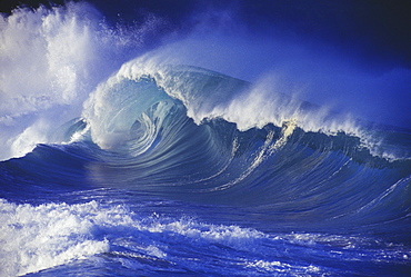
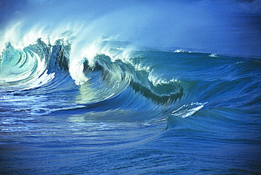
Hawaii, Oahu, Waimea Shorebreak, side view large, misty wave coming in to shore

Hawaii, Oahu, Waimea Shorebreak, side view large, misty wave coming in to shore.
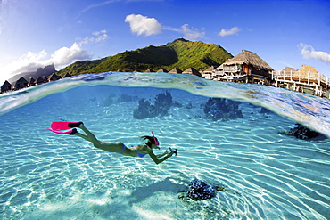
French Polynesia, Moorea, Woman free diving in turquoise ocean.

French Polynesia, Moorea, Woman free diving in turquoise ocean.

French Polynesia, Moorea, Woman free diving in turquoise ocean.
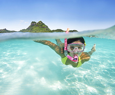
French Polynesia, Moorea, Woman free diving in turquoise ocean.
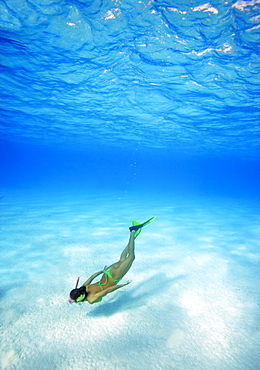
French Polynesia, Moorea, Woman free diving in turquoise ocean.

Hawaii, Woman standing on tropical beach holding fins.

French Polynesia, Moorea, Woman free diving in turquoise ocean.

French Polynesia, Moorea, Woman free diving in turquoise ocean.

French Polynesia, Moorea, Woman free diving in turquoise ocean.
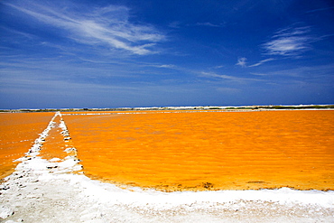
Caribbean, Bonaire, Netherlands Antilles, Salt Pan near Lac Bay.
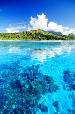
French Polynesia, Turquoise ocean with coral beneath surface