Results
19 results found
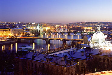
Snow covered bridges across Vltava River dividing Old Town from Mala Strana suburbs in winter twilight, Mala Strana, Prague, Czech Republic, Europe
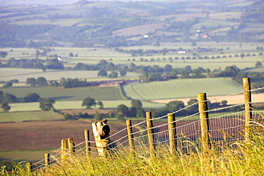
Barbed wire fence dividing fields in rural Devon, England, United Kingdom, Europe
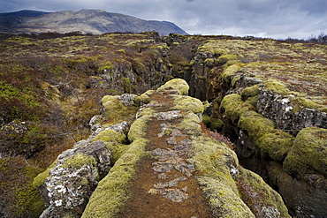
Fault in the landscape caused by continental drift between North American and Eurasian tectonic plates at Thingvellir National Park near Reykjavik, Iceland, Polar Regions

Water dividing Captiva and Sanibel Island, Sanibel on right, Gulf Coast, Florida, United States of America, North America

The Great Wall of China, Mutianyu, China
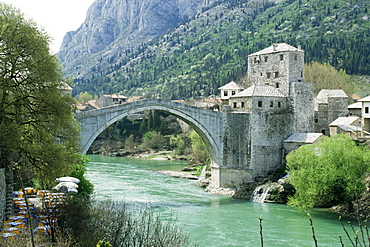
The Turkish Bridge over the River Neretva dividing the town, Mostar, Bosnia, Bosnia-Herzegovina, Europe
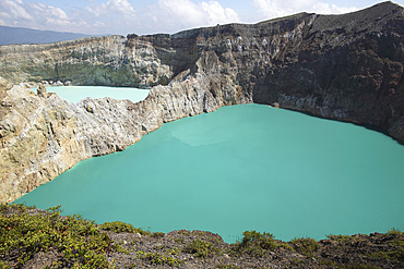
December 3, 2012 - Colourful crater lakes of Kelimutu volcano, Flores Island, Indonesia. Tiwu Nua Muri Kofah (Lake of Young Men and Maidens) and Tiwu Ata Polo (Bewitched Lake). The two lakes are highly acidic due to underwater fumarole activity and are turqoise in colour.
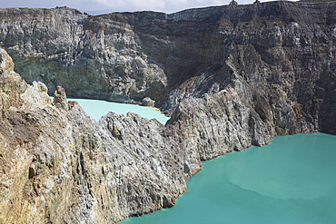
December 3, 2012 - Colourful crater lakes of Kelimutu volcano, Flores Island, Indonesia. A crater wall separates Tiwu Nua Muri Koo Fai (Lake of Young Men and Maidens) and Tiwu Ata Polo (Bewitched Lake). The two lakes are highly acidic due to underwater fumarole activity and are turqoise in colour.
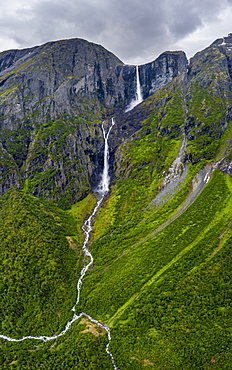
Aerial view of Mardalsfossen waterfall dividing in Mardola river branches, Eikesdalen, Nesset, More og Romsdal county, Norway, Scandinavia, Europe
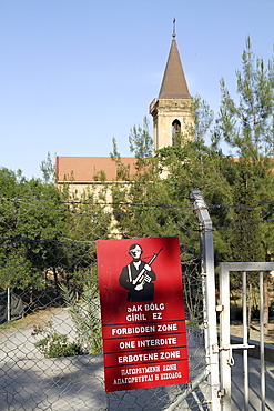
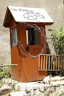
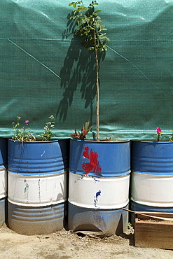
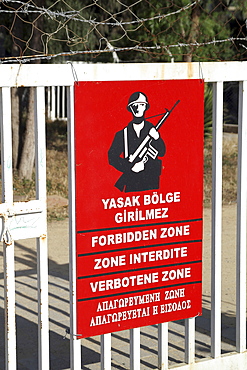
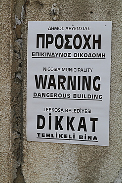
Cyprus. Abandoned houses along th Green Line in Nicosia dividing the Republic of Cyprus and Turkish controlled northern part.
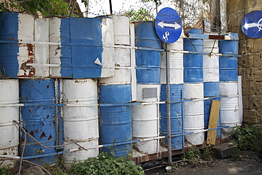
Cyprus. Abandoned houses along th Green Line in Nicosia dividing the Republic of Cyprus and Turkish controlled northern part. The United Nations Buffer Zone in Cyprus runs for more than 180.5?kilometres (112.2?mi) along what is known as the Green Line and has an area of 346?square kilometres (134?sq?mi). The zone partitions the island of Cyprus into a southern area effectively controlled by the government of the Republic of Cyprus (which is the de jure government for the entire island save for the British Sovereign Base Areas), and the northern area controlled by the Turkish army
Cyprus. Abandoned houses along th Green Line in Nicosia dividing the Republic of Cyprus and Turkish controlled northern part. The United Nations Buffer Zone in Cyprus runs for more than 180.5?kilometres (112.2?mi) along what is known as the Green Line and has an area of 346?square kilometres (134?sq?mi). The zone partitions the island of Cyprus into a southern area effectively controlled by the government of the Republic of Cyprus (which is the de jure government for the entire island save for the British Sovereign Base Areas), and the northern area controlled by the Turkish army
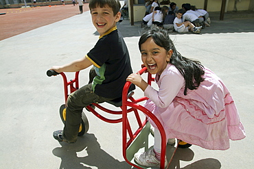
Cyprus.Children play at school near Green Line in Nicosia dividing the Republic of Cyprus and Turkish controlled north
Cyprus. Abandoned houses along th Green Line in Nicosia dividing the Republic of Cyprus and Turkish controlled northern part. The United Nations Buffer Zone in Cyprus runs for more than 180.5?kilometres (112.2?mi) along what is known as the Green Line and has an area of 346?square kilometres (134?sq?mi). The zone partitions the island of Cyprus into a southern area effectively controlled by the government of the Republic of Cyprus (which is the de jure government for the entire island save for the British Sovereign Base Areas), and the northern area controlled by the Turkish army

Aerial view of the dividing streets between Modern and Old Havana, with crumbling houses in foreground, Cuba

Cyprus.Children play at school near Green Line in Nicosia dividing the Republic of Cyprus and Turkish controlled north
Cyprus. Abandoned houses along th Green Line in Nicosia dividing the Republic of Cyprus and Turkish controlled northern part.
Cyprus. Abandoned houses along the Green Line in Nicosia dividing the Republic of Cyprus and Turkish controlled northern part
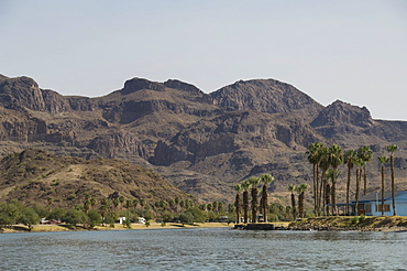
Colorado River dividing California and Arizona, near Parker, Arizona, United States of America, North America
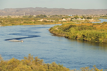
Colorado River dividing California and Arizona, near Parker, Arizona, United States of America, North America
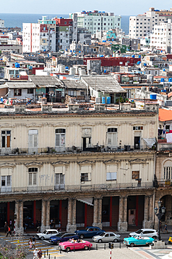
Aerial view of the dividing streets between Modern and Old Havana, classic cars in foreground, Cuba 3
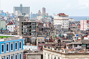
Aerial view of the dividing streets between Modern and Old Havana, Cuba 2

Cyprus.Children play at school near Green Line in Nicosia dividing the Republic of Cyprus and Turkish controlled north
Cyprus.Children play at school near Green Line in Nicosia dividing the Republic of Cyprus and Turkish controlled north
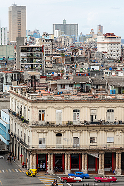
Aerial view of the dividing streets between Modern and Old Havana, classic cars in foreground, Cuba 4
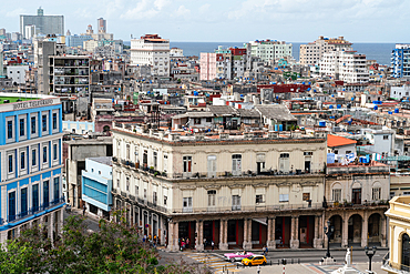
Aerial view of the dividing streets between Modern and Old Havana, Cuba 1
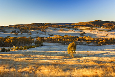
Field and hoar frost, Great Dividing Range, near Goulburn, New South Wales, Australia, Pacific
Colorado River dividing California and Arizona, near Parker, Arizona, United States of America, North America
Colorado River dividing California and Arizona, near Parker, Arizona, United States of America, North America
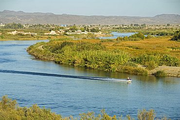
Colorado River dividing California and Arizona, near Parker, Arizona, United States of America, North America
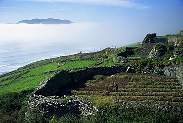
Stone walls dividing fields, Slea Head, County Kerry, Munster, Republic of Ireland, Europe
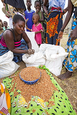
In mid January 2015, a three day period of excessive rain brought unprecedneted floods to the small poor African country of Malawi. It displaced nearly quarter of a million people, devastated 64,000 hectares of land, and killed several hundred people. This shot shows displaced people dividing up food aid in a refugee camp near Phalombe.
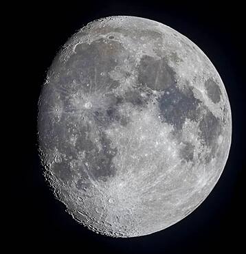
A mosaic of the 11-day-old gibbous Moon, on March 17, 2019, showing the full disk and extent of incredible detail along the terminator, the dividing line between the day and night sides of the Moon where the Sun is rising as seen from the surface of the Moon.
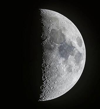
A panorama of the 7-day-old first quarter Moon on March 13, 2019, showing the full disk and extent of incredible detail along the terminator, the dividing line between the day and night sides of the Moon where the Sun is rising as seen from the surface of the Moon. Note the tiny points of light at the centres of some of the craters (particularly Alphonsus and Arzachel below centre) in the Southern Highlands from sunlight just catching the central peaks of those craters. At top in the north the slash of the Alpine Valley is obvious as well as the curve of the Apennine Mountains.
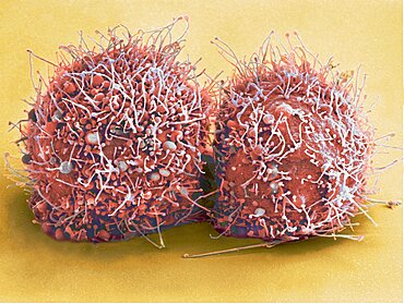
Dividing HeLa Cells, SEM
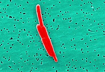
Sebaldella termitidis Bacteria Dividing, SEM
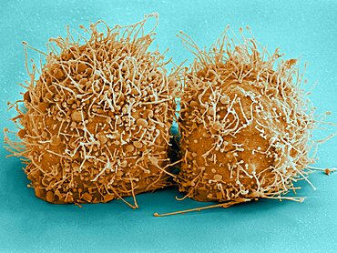
Dividing HeLa Cells, SEM
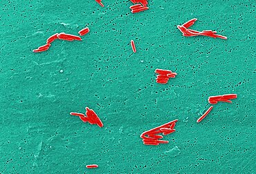
Sebaldella termitidis Bacteria Dividing, SEM
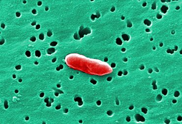
Sebaldella termitidis Bacteria Dividing, SEM
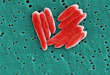
Sebaldella termitidis Bacteria Dividing, SEM
Hokkaido, Japan
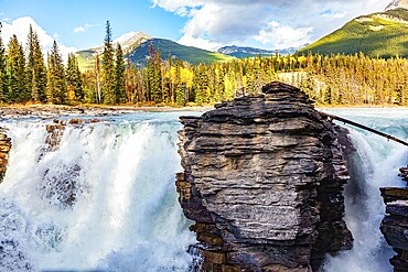
Magnificent rock divides thundering Athabasca Falls. Athabasca Falls is the most powerful waterfall in Alberta. Jasper Park. Canadian Rockies. Picturesque forest illuminated by sunset

The up to 8m high wall dividing Israel and the Palestinian West Bank, near Bethlehem, West Bank, Israel, Near East, Orient
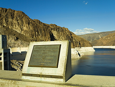
Hoover Dam plaque showing the dividing line between Nevada and Arizona states, United States of America, North America
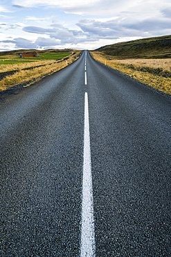
Road leading into the distance, Iceland
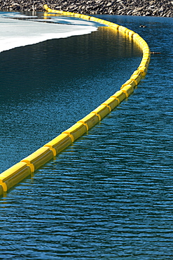
Yellow Buoy Across The Water With Rocky Shoreline And Ice On Lake, Kananaskis Country, Alberta, Canada
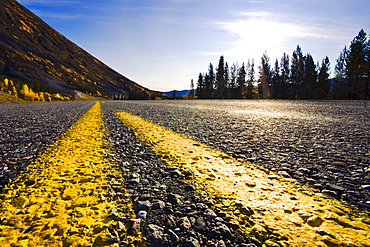
Yellow dividing lines on Alaska Highway, Yukon

Baker dividing dough in sections for baking by a large commercial oven

Baker dividing dough in sections for baking by a large commercial oven
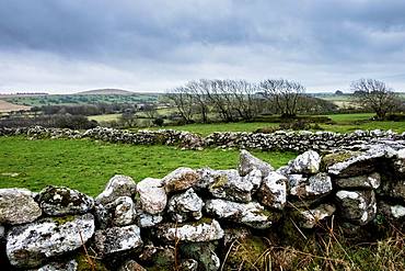
Landscape with dry-stone wall dividing fields, row of trees and hills in the distance
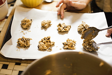
Hand of mid adult woman spooning baking mixture in kitchen

Close-up of dried flowers
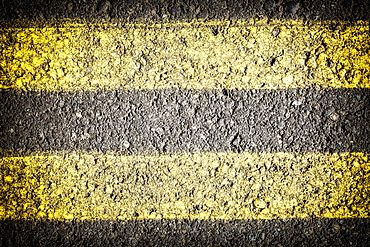
Close-up of dividing line
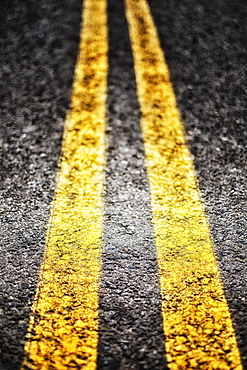
Close-up of dividing line