Results
1 2 3 … 12 Next »
1156 results found
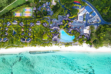
Aerial view by drone of luxury tourist resort on palm-fringed beach facing the tropical lagoon, Le Morne Brabant, Mauritius, Indian Ocean, Africa
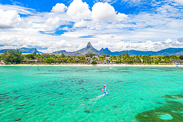
Aerial view by drone of windsurfer in the lagoon facing Flic en Flac beach and Piton de la Petite Riviere Noire mountain, Black River, Mauritius, Indian Ocean, Africa
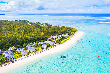
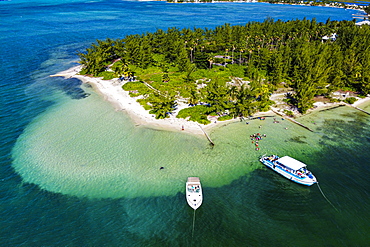
Aerial view by drone of luxury tourist resort on white sand beach, Flic en Flac, Black River district, Mauritius, Indian Ocean, Africa
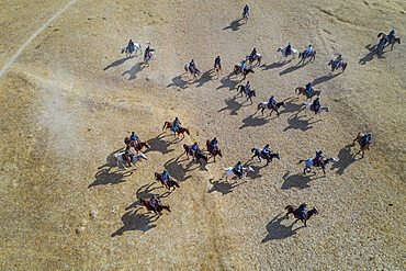
Aerial by drone of a Buzkashi game, Yaklawang, Afghanistan, Asia
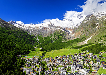
Aerial by drone of Saas-Fee village, Valais Canton, Switzerland, Europe
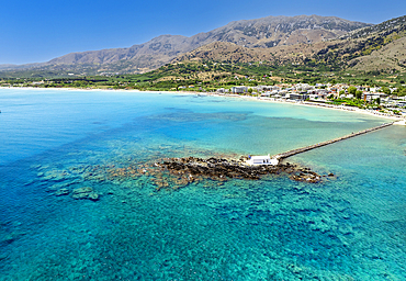
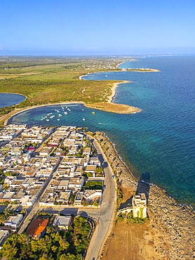
Aerial drone photo of Georgioupoli and famous chapel of Agios Nikolaos built at sea with a small path connecting to mainland, Chania, Crete island, Greek Islands, Gteece, Europe
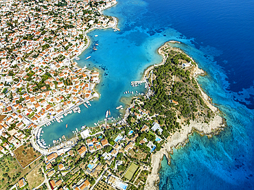
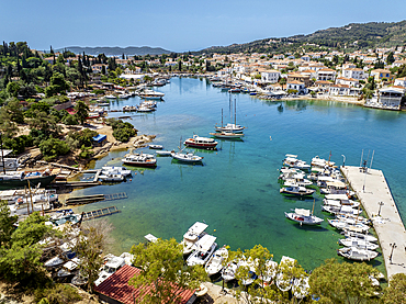
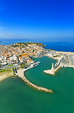
Aerial drone photo of picturesque old town and harbor of Spetses island with emerald crystal clear sea, Saronic gulf, Greece
Aerial drone photo of picturesque old town and harbor of Spetses island Saronic gulf, Greece.
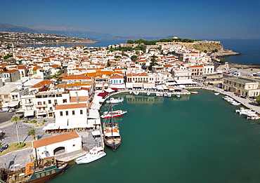
Aerial view by drone of Rethymno old town, Venetian Harbour and fortress, Crete Island, Greek Islands, Greece, Europe
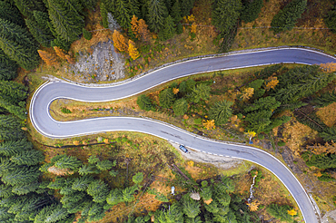
A view by drone of a winding road in the Dolomites, Veneto, Italy, Europe
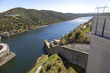
Barragem do Alqueva dam, part of the multipurpose water management project on the Rio Guadiana river, hydro-electricity generation electricity power lines, Moura, Portugal, Europe
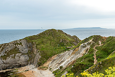
Coastal landscape with rugged cliffs, green vegetation, and a view of the ocean under a cloudy sky at Durdle Door, Jurassic Coast, UNESCO World Heritage Site, Dorset, England, United Kingdom, Europe

Las Vegas Strip, Nevada, United States of America, North America
Aerial view of Rethymno old town, Venetian Harbour and fortress, Crete Island, Greek Islands, Greece, Europe (Drone)

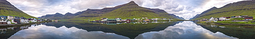
Elevated view of typical church in Saksun, Streymoy Island, Faroe Islands, Denmark, Europe (Drone)
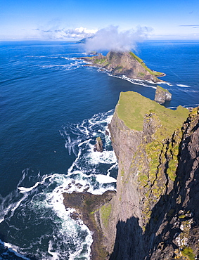
Panoramic of the sea stacks of Drangarnir and Tindholmur islet, Vagar Island, Faroe Islands, Denmark, Europe (Drone)
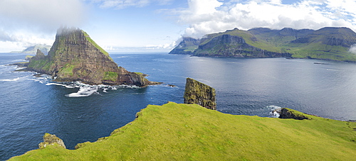
Panoramic of Drangarnir and Tindholmur islet, Vagar Island, Faroe Islands, Denmark, Europe (Drone)
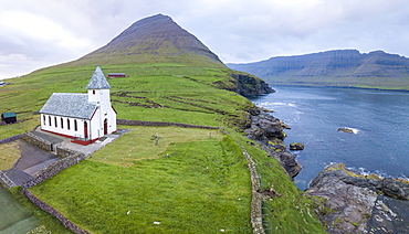
Panoramic of Church of Vidareidi by the sea, Vidoy Island, Faroe Islands, Denmark, Europe (Drone)
Panoramic of Hvannasund on Vidoy Island and Norddepil on Bordoy Island, Faroe Islands, Denmark, Europe (Drone)
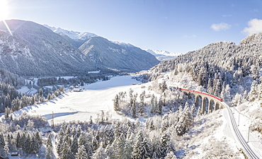
Panoramic of Bernina Express train on Landwasser Viadukt, UNESCO World Heritage Site, Filisur, Albula Valley, Canton of Graubunden, Switzerland, Europe (Drone)
Drone view of Nordlenangen, Lyngen peninsula, Troms County, Norway, Scandinavia, Europe
Drone view of the hilltop village of Saint-Suzanne in the Mayenne area, France, Europe
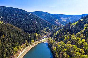
The Upper Harz Water Regale, taken by drone, UNESCO World Heritage Site, Goslar, Lower Saxony, Germany, Europe
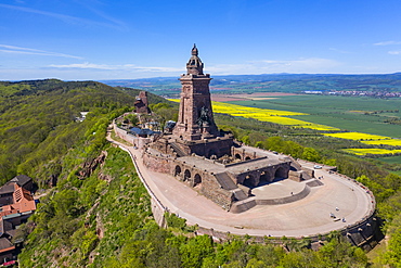
Drone aerial of the Kyffhaeuser Monument, Barbarossa monument, Thuringia, Germany, Europe
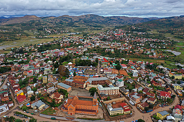
Ambositra, capital of the Amoron'i Mania region, Ambositra District, centre of Madagascar's wood-carving industry, Madagascar, Africa
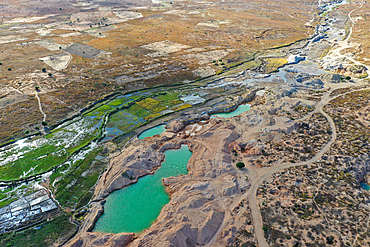
Ilakaka sapphire mine, one of Earth's largest known alluvial sapphire deposits, Ilakaka, Ihorombe Region, Madagascar, Africa

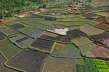
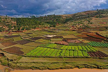
Rice fields and small mud villages near Sandrandahy, on the National Route RN7 between Ranomafana and Antsirabe, Madagascar, Africa
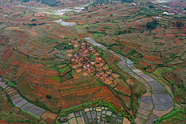
Rice fields and small villages near Ivato, Ambositra district, National Route RN7 between Ranomafana and Antsirabe, Madagascar, Africa
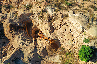
Ilakaka sapphire mine, one of Earth's largest known alluvial sapphire deposits, Ilakaka, Ihorombe Region, Madagascar, Africa
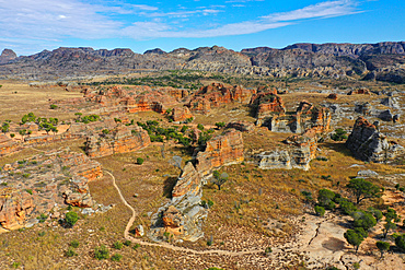
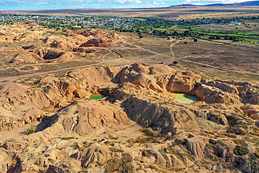
Sandstone landscape at Isalo National Park, Ihorombe Region, Fianarantsoa province, Madagascar, Africa
Rice fields and small villages near Ivato, Ambositra district, National Route RN7 between Ranomafana and Antsirabe, Madagascar, Africa
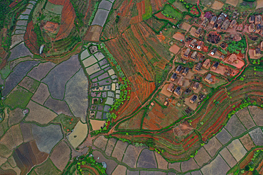
Vegetable cultivation and brick making on the rice fields, National Route RN7 between Antsirabe and Antananarivo, Madagascar, Africa
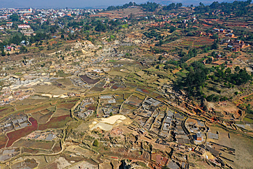
Brick making on the rice fields on the National Route RN7 between Antsirabe and Antananarivo, Ambatotapaka, Madagascar, Africa
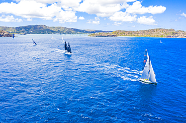
Aerial view by drone of sailing boats during a regatta, Antigua, Leeward Islands, West Indies, Caribbean, Central America
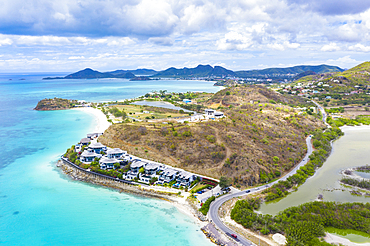
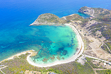
Aerial view by drone of Tamarind Hills luxury hotel ocean front and Ffryes Bay, Antigua, Antigua and Barbuda, Leeward Islands, West Indies, Caribbean, Central America
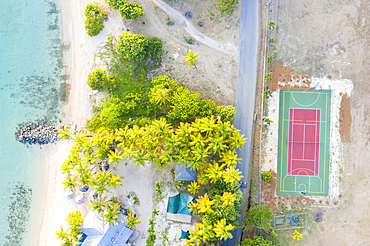
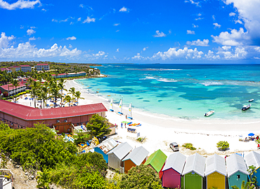
Aerial by drone of Sport court beside a tropical sand beach from above, Morris Bay, Old Road, Antigua, Antigua and Barbuda, Leeward Islands, West Indies, Caribbean, Central America
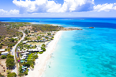
Aerial view by drone of tropical white sand of Turners Beach, Antigua, Antigua and Barbuda, Leeward Islands, West Indies, Caribbean, Central America
Aerial view by drone of the fine white sand of Half Moon Bay washed by Caribbean Sea, Antigua, Leeward Islands, West Indies, Caribbean, Central America
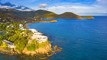
Aerial panoramic by drone of the Curtain Bluff resort overlooking the Caribbean Sea, Old Road, Antigua and Barbuda, Leeward Islands, West Indies, Caribbean, Central America

Swimming pool and beach umbrellas on white sand beach from above by drone, Morris Bay, Old Road, Antigua, Leeward Islands, West Indies, Caribbean, Central America
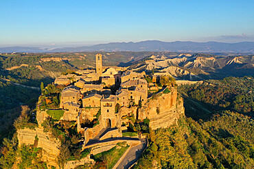
Aerial view by drone of Civita di Bagnoregio village, known as the dying city, Viterbo province, Lazio, Italy, Europe
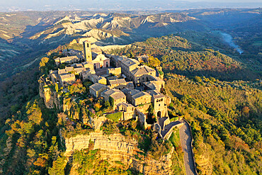
Aerial view by drone of Civita di Bagnoregio village, known as the dying city, Viterbo province, Lazio, Italy, Europe

Aerial view by drone of Etruscan village of Vetralla, Viterbo province, Lazio, Italy, Europe

Aerial view by drone of Etruscan village of Vetralla, Viterbo province, Lazio, Italy, Europe

Aerial drone view of beautiful tropical island beach with palm trees, The Maldives, Indian Ocean, Asia
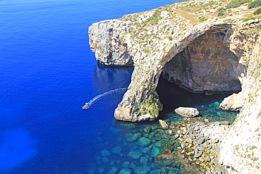
The Blue Grotto natural sea arch and cliffs, Wied iz-Zurrieq, Malta, Mediterranean, Europe
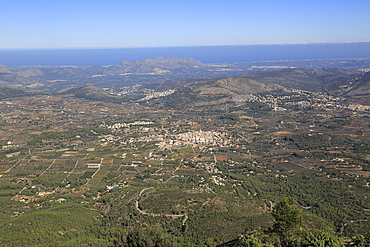
Raised view over Parcent village and Pop Valley, La Marina Alta, Alicante province, Spain, Europe

The Upper Harz Water Regale, taken by drone, UNESCO World Heritage Site, Goslar, Lower Saxony, Germany, Europe
Vegetable cultivation and brick making on the rice fields, National Route RN7 between Antsirabe and Antananarivo, Madagascar, Africa
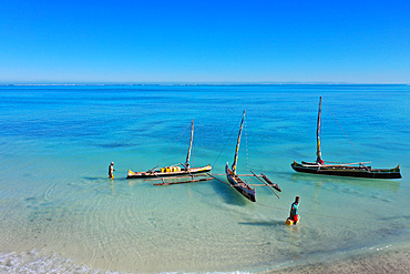
Outrigger boats on the coral reef near Salary, South Western coast of Madagascar, Indian Ocean, Africa

Elevated view of typical grass roof (turf roof) houses, Saksun, Streymoy Island, Faroe Islands, Denmark, Europe (Drone)

Drone view of Nordlenangen, Lyngen peninsula, Troms County, Norway, Scandinavia, Europe
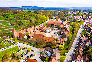
Aerial by drone of Maulbronn Monastery, UNESCO World Heritage Site, Baden Wurttemberg, Germany, Europe
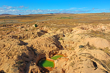
Ilakaka sapphire mine, one of Earth's largest known alluvial sapphire deposits, Ilakaka, Ihorombe Region, Madagascar, Africa
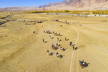
Aerial by drone of a Buzkashi game, Yaklawang, Afghanistan, Asia

Brick making on the rice fields on the National Route RN7 between Antsirabe and Antananarivo, Ambatotapaka, Madagascar, Africa
Ilakaka sapphire mine, one of Earth's largest known alluvial sapphire deposits, Ilakaka, Ihorombe Region, Madagascar, Africa
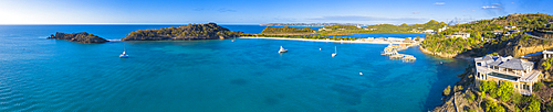
Aerial view by drone of Caribbean Sea surrounding Deep Bay, Antigua, Leeward Islands, West Indies, Caribbean, Central America

Aerial panoramic by drone of Shirley Heights towards Galleon Beach and English Harbour, Antigua, Leeward Islands, West Indies, Caribbean, Central America

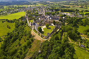
De Monti Castle (Castello de Monti), Corigliano d'Otranto, Lecce, Salento, Apulia, Italy
Torre Colimena (Colimena Tower), Manduria, Taranto, Apulia, Italy
Drone view of Nordlenangen, Lyngen peninsula, Troms County, Norway, Scandinavia, Europe
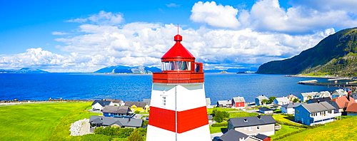
Aerial panoramic of high section of Alnes Lighthouse, Godoya Island, Alesund, More og Romsdal County, Norway (drone)
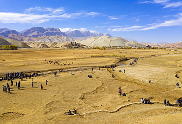
Aerial by drone of a Buzkashi game, Yaklawang, Afghanistan, Asia
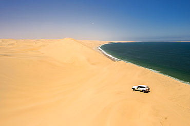
Drone shot of car in Sandwich Harbour, Namibia, Africa

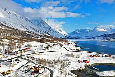
Drone view of Lyngen Alps, Nordlenangen, Lyngen peninsula, Troms County, Norway, Scandinavia, Europe

Aerial view by drone of Shirley Heights belvedere with Galleon Beach and English Harbour in background, Antigua, Caribbean, (drone)
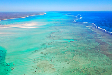
Coral reef near Ambatomilo, South Western coast of Madagascar, Indian Ocean, Africa
Front view of Hogsteinen Lighthouse, aerial view by drone, Godoya Island, Alesund, More og Romsdal County, Norway, Scandinavia, Europe
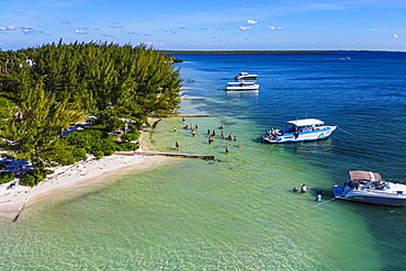
Aerial by drone of Starfish Point on Water Cay, Grand Cayman, Cayman Islands, Caribbean, Central America
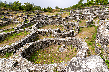
Archaeological site of Castro de Santa Trega, Castro Culture settlement, A Guarda, Pontevedra Province, Galicia, Spain, Europe

Drone view of Lyngen Alps, Nordlenangen, Lyngen peninsula, Troms County, Norway, Scandinavia, Europe
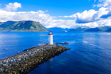
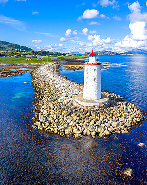
Aerial view by drone of Hogsteinen Lighthouse, Godoya Island, Alesund, More og Romsdal County, Norway, Scandinavia, Europe

Las Vegas, Nevada, United States of America, North America
Aerial by drone of Starfish Point on Water Cay, Grand Cayman, Cayman Islands, Caribbean, Central America

Drone view of Nordlenangen, Lyngen peninsula, Troms County, Norway, Scandinavia, Europe
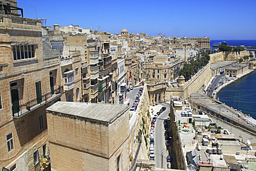
Historic buildings on the Grand Harbour waterfront in Valletta, Malta, Mediterranean, Europe

Drone view of Nordlenangen, Lyngen peninsula, Troms County, Norway, Scandinavia, Europe

Scenic view of a large rock formation overlooking a lush valley with a small town and green fields in the background in Ilkley, North Yorkshire, England, United Kingdom Europe

Drone view of Nordlenangen, Lyngen peninsula, Troms County, Norway, Scandinavia, Europe

Sandstone landscape at Isalo National Park, Ihorombe Region, Fianarantsoa province, Madagascar, Africa

Loop Head, County Clare, Munster, Republic of Ireland, Europe (Drone)

Coral reef near Salary, South Western coast of Madagascar, Indian Ocean, Africa
Aerial panoramic by drone of palm-fringed beach washed by Caribbean Sea, Antilles, West Indies, Caribbean, Central America
Coral reef near Salary, South Western coast of Madagascar, Indian Ocean, Africa

Coral reef near Salary, South Western coast of Madagascar, Indian Ocean, Africa
Aerial panoramic by drone of Long Bay beach washed by Caribbean Sea, Antigua, Leeward Islands, West Indies, Caribbean, Central America

Aerial drone view of Praia de Vale do Lobo with magnificent golf courses overlooking the ocean in Algarve, Portugal, Europe

Aerial drone view of Vale do Lobo Beach, iconic beachfront resort and home, near Quarteira in Algarve, Portugal, Europe
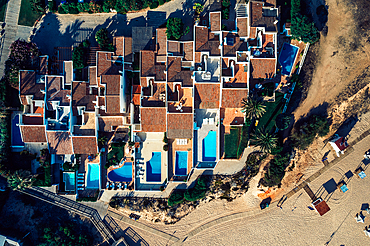
Aerial drone top down view of luxurious residences in Vale do Lobo, iconic beachfront resort and home, near Quarteira in Algarve, Portugal, Europe
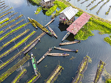
Aerial by drone of canoes in the floating gardens, Inle Lake, Shan state, Myanmar (Burma), Asia
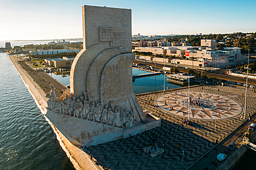
Aerial drone view of Padrao dos Descobrimentos (Monument of the Discoveries), a monument on the northern bank of the Tagus River estuary, Belem, Lisbon, Portugal, Europe
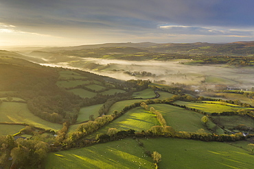
Aerial vista by drone of rolling countryside at dawn in winter, Devon, England, United Kingdom, Europe
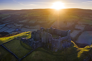
View by drone of sunrise over Carreg Cennen Castle in winter, Brecon Beacons National Park, Carmarthenshire, Wales, United Kingdom, Europe

View by drone of St. Michael's Tower on Glastonbury Tor at dawn in winter, Somerset, England, United Kingdom, Europe
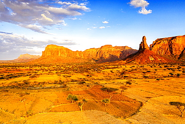
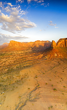
Sunset lit the red rocks of Gheralta Mountains, aerial view by drone, Hawzen, Tigray Region, Ethiopia, Africa
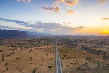
Empty road across the arid landscape, aerial view by drone, Gheralta Mountains, Hawzen, Tigray Region, Ethiopia, Africa
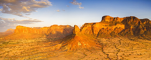
Aerial panoramic by drone of Gheralta Mountains lit by sunset, Hawzen, Tigray Region, Ethiopia, Africa
Aerial panoramic by drone of Gheralta Mountains lit by sunset, Hawzen, Tigray Region, Ethiopia, Africa
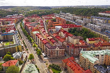
Aerial view by drone of Haga area on sunny day, Gothenburg, Sweden, Scandinavia, Europe