Results
1 results found
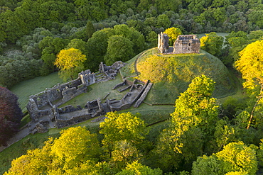
Aerial image showing the ruins of Okehampton Castle on a spring morning, Okehampton, Devon, England, United Kingdom, Europe
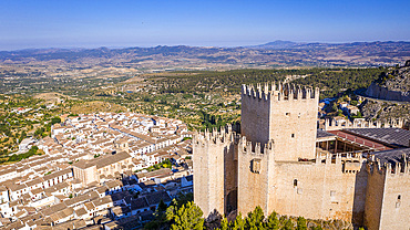
Renaissance castle and white village, Velez Blanco, Almeria, Andalucia, Spain,
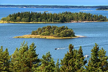
Aerial view of the islands in front Mossala Island Resort Southwest Finland archipelago. The archipelago ring road or Saariston rengastie is full of things to see, do and do. The Archipelago Trail can be taken clockwise or counter clockwise, starting in the historical city of Turku, and continuing through rural archipelago villages and astonishing Baltic Sea sceneries. The Trail can be taken from the beginning of June until the end of August.
Aerial view of small island in front Mossala Island Resort Southwest Finland archipielago. The archipelago ring road or Saariston rengastie is full of things to see, do and do. The Archipelago Trail can be taken clockwise or counter clockwise, starting in the historical city of Turku, and continuing through rural archipelago villages and astonishing Baltic Sea sceneries. The Trail can be taken from the beginning of June until the end of August.
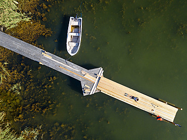
Aerial view of small dock in Korpo or Korppoo island, Korpostrom coast Southwest Finland Turku archipelago. The archipelago ring road or Saariston rengastie is full of things to see, do and do. The Archipelago Trail can be taken clockwise or counter clockwise, starting in the historical city of Turku, and continuing through rural archipelago villages and astonishing Baltic Sea sceneries. The Trail can be taken from the beginning of June until the end of August.
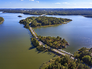
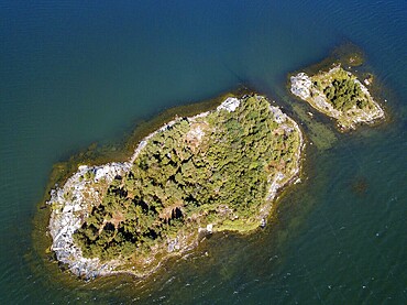
Aerial view of Kustavi small islands in Southwest Finland archipielago. The archipelago ring road or Saariston rengastie is full of things to see, do and do. The Archipelago Trail can be taken clockwise or counter clockwise, starting in the historical city of Turku, and continuing through rural archipelago villages and astonishing Baltic Sea sceneries. The Trail can be taken from the beginning of June until the end of August.
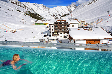
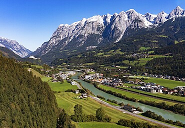
Kuhtai sky resort village and ski slopes near Innsbruck Tyrol Austria. Swimming pool of the Mooshaus Hotel.
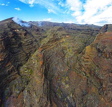
Whimsically eroded gorge, Barranco de la Negra, near Alajero, drone image, La Gomera, Canary Islands, Spain, Europe
Settlement La Manteca, Barranco de la Negra, near Alajero, drone image, La Gomera, Canary Islands, Spain, Europe
Canyon Barranco de la Negra, near Alajero, drone image, La Gomera, Canary Islands, Spain, Europe
Drone image, view of the village with parish church, Hinterhornbach, Hornbachtal, Reutte district, Tyrol, Austria, Europe
Drone image, settlement area, view of village with church, Pfarrwerfen, Tennengebirge, Salzachtal, Pongau, Salzburg province, Austria, Europe
Drone image, settlement area, view of village with church, Pfarrwerfen, Tennengebirge, Salzachtal, Pongau, Salzburg province, Austria, Europe
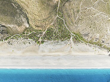
The Playa de los Muertos (beach of the dead) . Aerial view. Drone shot. Nature Reserve Cabo de Gata-Nijar, Almería province, Andalusia, Spain, Europe
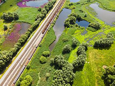
Drone image of railway tracks and wetland near Klein Ilsede, Ilsede, Peine district, Lower Saxony, Germany, Europe

Isar, at the inflow into the Sylvenstein lake, Sylvenstein reservoir, drone image, Lenggries, Isarwinkel, Upper Bavaria, Bavaria, Germany, Europe
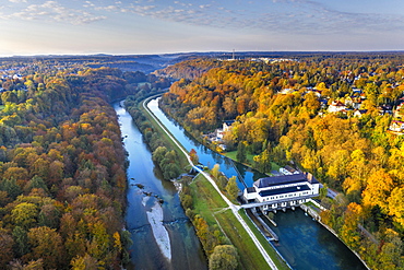
Pullach hydroelectric power plant power station, Isar and Isarkanal, Pullach in the Isar valley, Grunwald on the left, near Munich, drone image, Upper Bavaria, Bavaria, Germany, Europe
Isar, at the inflow into the Sylvenstein lake, Sylvenstein reservoir, drone image, Lenggries, Isarwinkel, Upper Bavaria, Bavaria, Germany, Europe

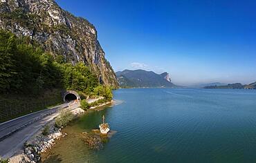
Sylvensteinsee, Sylvenstein Dam, drone image, Lenggries, Isarwinkel, Upper Bavaria, Bavaria, Germany, Europe
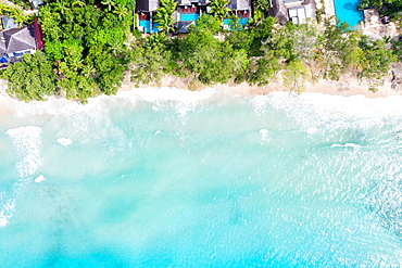
Seychelles beach Mahe Mahe island text free space copyspace sea ocean drone image bird's eye view , Seychelles, Africa
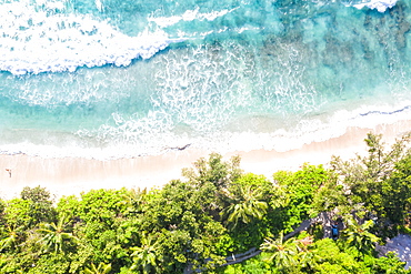
Seychelles Takamaka beach Mahe text free space copyspace paradise ocean drone image bird's eye view , Seychelles, Africa
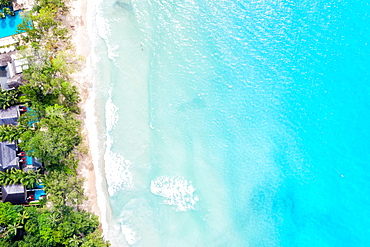
Seychelles beach Mahe Mahe island text free space copyspace sea drone image bird's eye view , Seychelles, Africa
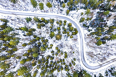
Drone image, winter in Swabian Forest, mixed forest, Baden-Wuerttemberg, Germany, Europe
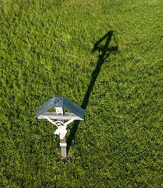
Drone image, wayside cross near Pattigham, Innviertel, Upper Austria, Austria, Europe
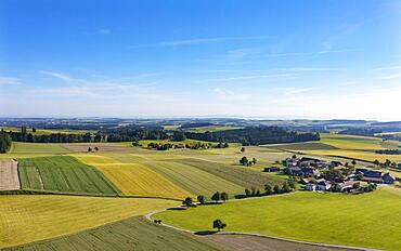
Drone image, agricultural landscape, agricultural fields with farms near Waldzell, Innviertel, Upper Austria, Austria, Europe
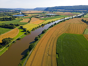
Drone image of the river Weser near Holzminden, Weserbergland, Lower Saxony, right North Rhine-Westphalia, Germany, Europe
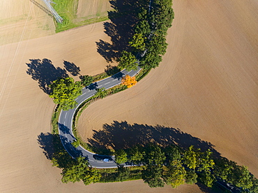
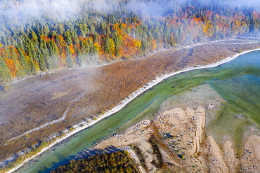
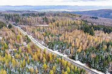
Drone image, curve in autumnal forest, Roter Berg, L485, between Diekholzen and Sibbesse, Hildesheim district, Lower Saxony, Germany, Europe
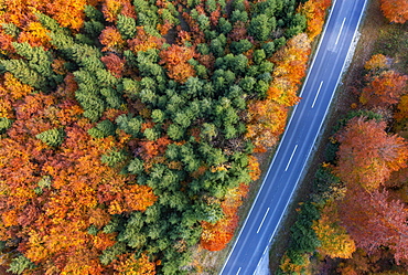
Drone image, autumnal forest along the main road in Weissenbachtal, Salzkammergut, Upper Austria, Austria, Europe
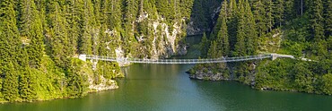
Suspension bridge, drone image, Passerelle himalayenne du lac de St-Guérin, Beaufort, Beaufortain, Savoie, France
Suspension bridge, drone image, Passerelle himalayenne du lac de St-Guérin, Beaufort, Beaufortain, Savoie, France
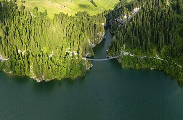
Suspension bridge, drone image, Passerelle himalayenne du lac de St-Guérin, Beaufort, Beaufortain, Savoie, France
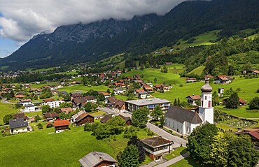
Drone image, view of the village with parish church, Braz, Klostertal, Vorarlberg, Austria
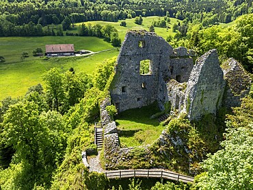
Historic site ruins of the Château de Löwenburg, drone image, Pleigne, Jura, Switzerland
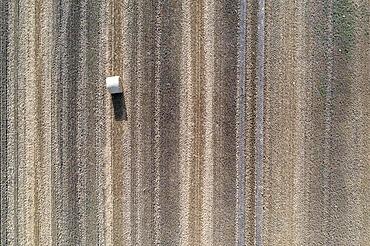
A roll of straw lies on a harvested field, image taken with drone, Egeln, Saxony-Anhalt, Germany, Europe
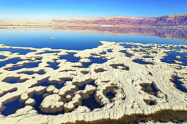
Dead Sea. Evaporated salt forms bizarre patterns on the water. Sunny winter day. The blue water is surrounded by pink mountains. The picture was taken by a drone from a aerial view. Israel
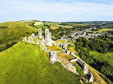
Ruins of Corfe Castle from a drone, Corfe Village, Purbeck Hills, Dorset, England, United Kingdom, Europe
Isar, at the inflow into the Sylvenstein lake, Sylvenstein reservoir, drone image, Lenggries, Isarwinkel, Upper Bavaria, Bavaria, Germany, Europe
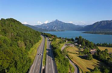
Drone image, Westautobahn (A1) near Mondsee, Mondsee with Schafberg, Salzkammergut, Upper Austria, Austria, Europe

Drone image of Salamanca with new and old cathedral, Spain, Europe
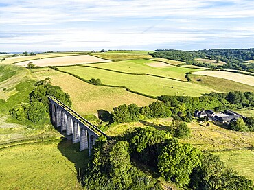
Cannington Viaduct from a drone, Uplyme, Lyme Regis, Dorset, Devon, England, United Kingdom, Europe
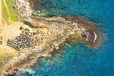
Necropolis of Son Real from above, Punta des Fenicis near Can Picafort, drone image, Majorca, Balearic Islands, Spain, Europe
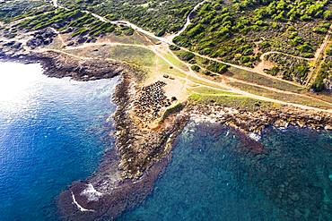
Necropolis of Son Real, Punta des Fenicis near Can Picafort, drone image, Majorca, Balearic Islands, Spain, Europe
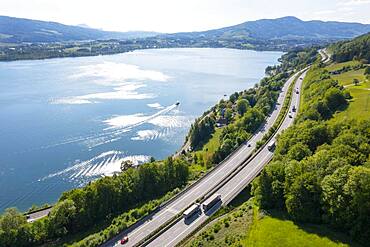
Drone image, Westautobahn (A1) near Mondsee, Salzkammergut, Upper Austria, Austria, Europe
Drone image, village of Koppl, Osterhorngruppe, Flachgau, province of Salzburg, Austria, Europe
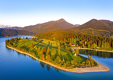
Walchensee with peninsula dwarfs in the morning light, Simetsberg, drone image, Upper Bavaria, Bavaria, Germany, Europe
Drone image, hiking trail in mixed forest, Schurwald, Baden-Wuerttemberg, Germany, Europe
Drone image, agricultural landscape, agricultural fields and meadows near Waldzell, Innviertel, Upper Austria, Austria, Europe

Drone image, Gaisberg transmitter on the Gaisberspitze, Gaisberg, Salzburg, Austria, Europe
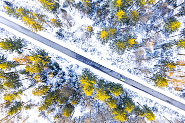
Drone image, winter in Swabian Forest, mixed forest, Baden-Wuerttemberg, Germany, Europe
Drone image, mixed forest, Schurwald, Baden-Wuerttemberg, Germany, Europe
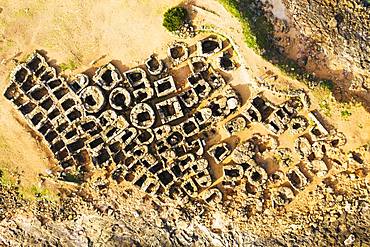
Necropolis of Son Real from above, Punta des Fenicis near Can Picafort, drone image, Majorca, Balearic Islands, Spain, Europe
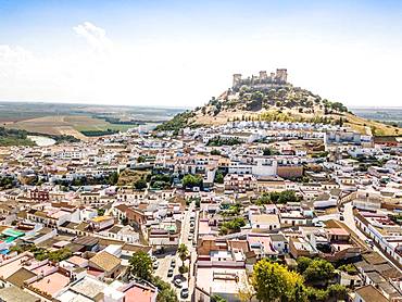
Drone image of Castle of Almodovar del Rio, Cordoba, Andalusia, Spain, Europe
Drone image, Kreuzstein at Mondsee with Kienbergwandtunnel, Salzkammergut, Upper Austria, Austria, Europe
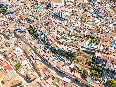
Architectural pattern of little Spanish town, drone image, Almodovar del Rio, Andalusia, Spain, Europe
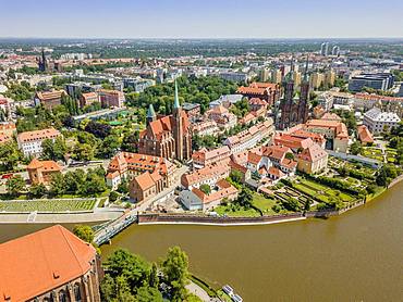
Drone image of the oldest, historic part of Wroclaw located mostly on the islands, Poland, Europe
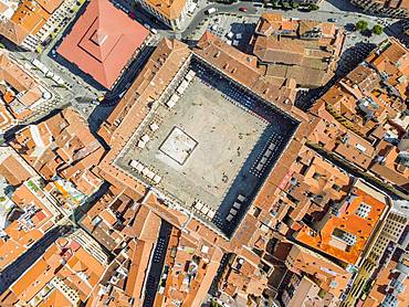
Main square called in Spanish Plaza Mayor, drone image, Salamanca, Spain, Europe

Drone image of Salamanca with new and old cathedral, Spain, Europe

Drone image of Salamanca with new and old cathedral, Spain, Europe
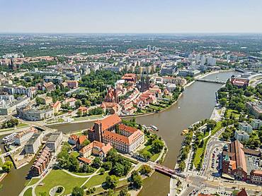
Drone image of the oldest, historic part of Wroclaw located mostly on the islands, Poland, Europe
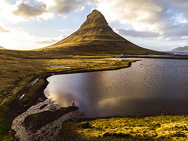
Man observing volcano mountain in Iceland. Image taken with a drone, Grundarfjorour, Iceland

Man standing on bridge in Iceland. Image taken with a drone, Grundarfjorour, Iceland
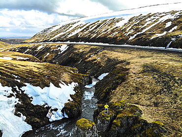
Man observing river next to road in Iceland. Image taken with a drone, Grundarefjorour, Iceland
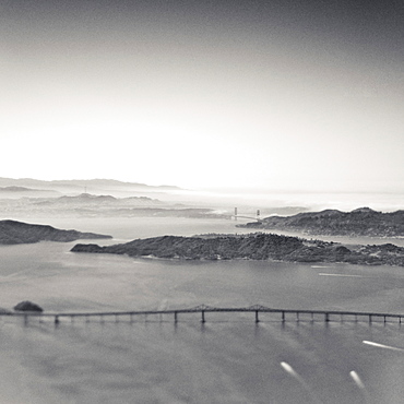
Aerial View of San Francisco Bay, San Francisco, California, United States of America
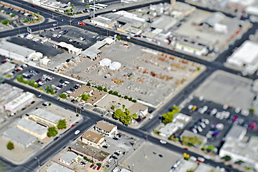
Aerial View of Commercial Area, Las Vegas, Nevada, United States of America
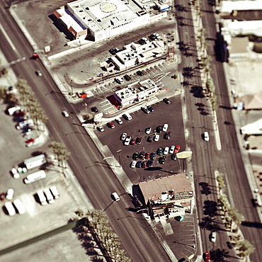
Aerial View of City Streets, Las Vegas, Nevada, United States of America
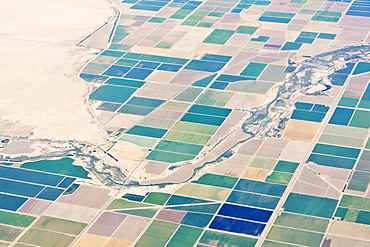
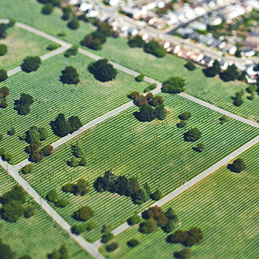
Patchwork Fields, California, United States of America
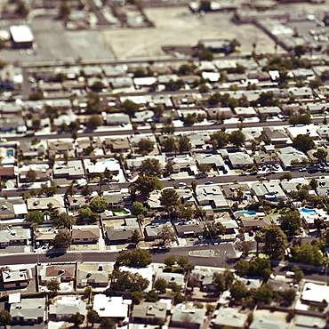
Aerial View of Residential Area, Richmond, California, United States of America
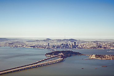
Aerial View of San Francisco Bay, San Francisco, California, United States of America
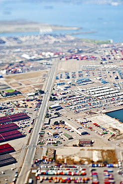
Aerial View of Industrial Area, Oakland, California, United States of America
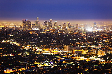
Large City at Night, Los Angeles, California, United States of America
Aerial View of City Park, Colma, California, United States of America

Aerial View of San Francisco, San Francisco, California, United States of America
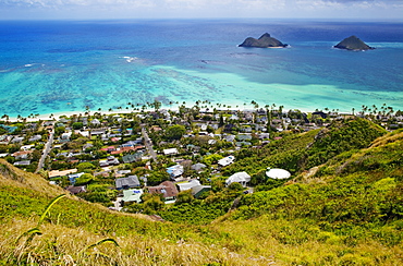
Town of Kailua with Mokulua Islands, Hawaii, United States of America
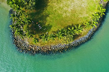
Drone view of tropical island and turquoise sea
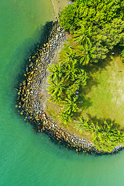
Drone view of tropical island and turquoise sea
Australia, Queensland, Blue sky over coastline (Drone)
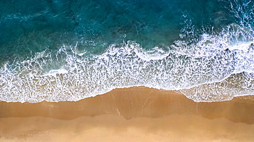
Drone shot of beach
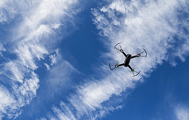
Low angle view of drone flying against sky

Drone flying over beach at sunset

Double exposure of drone and fibre optic cables

Drone flying over beach at sunset
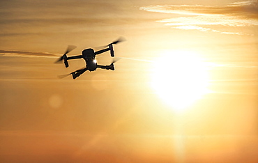
Drone flying at sunset

Australia, Queensland, Landscape with bridge and mountain range in background (Drone)
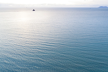
Australia, Queensland, Sea reflecting sunlight (Drone)
Australia, Queensland, Coast at dusk (Drone)
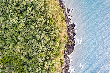
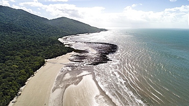
Australia, Queensland, Rainforest by sea (Drone)
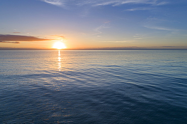
Sea at sunset (Drone)
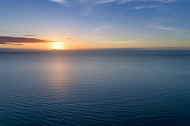
Sunrise over sea (Drone)

Drone flying in sky
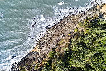
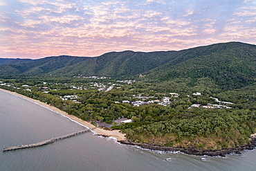
Australia, Queensland, Aerial view of coastline (Drone)
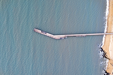
Australia, Queensland, Aerial view of pier (Drone)
Australia, Queensland, Sea and coastline on sunny day (Drone)
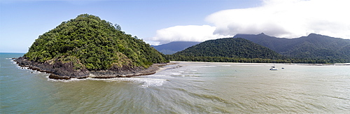
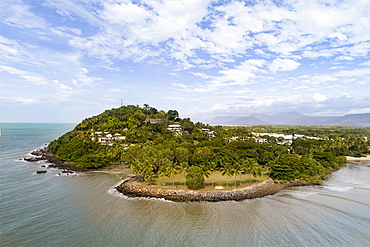
Australia, Queensland, Blue sky over green peninsula (Drone)

Drone flying in sky