Results
1 results found
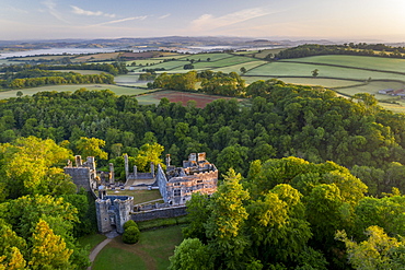
Aerial photograph of Berry Pomeroy Castle at dawn in spring, Devon, England, United Kingdom, Europe
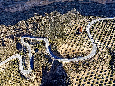
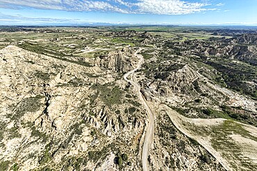
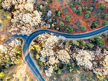
Deep canyon at the Gorafe desert, winding road to village Gorafe, aerial view, Gorafe Desert, UNESCO Granada Geopark, Granada province, Andalusia, Spain
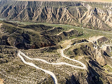
Canyons and gorges near village Gorafe, winding road, aerial view, Gorafe Desert, UNESCO Granada Geopark, Granada province, Andalusia, Spain
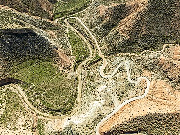
Winding road in the desert, surrounded by colorful canyons and gorges, aerial view, Gorafe Desert, UNESCO Granada Geopark, Granada province, Andalusia, Spain
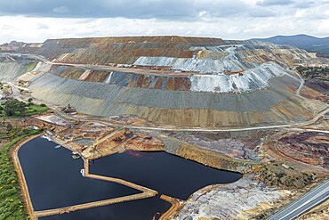
Aerial view of open pit mining, copper mine, Rio Tinto, Minas de Rio Tinto, Andalusia, Spain
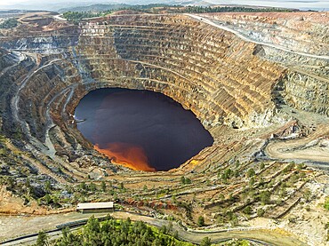
Aerial view of Corta Atalaya open pit mine, copper mine, Rio Tinto, Minas de Rio Tinto, Andalusia, Spain
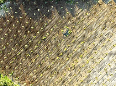
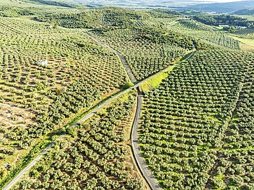
Fields of olive trees, trees planted in rows, aerial view, near village Cabra, Andalusia, Spain
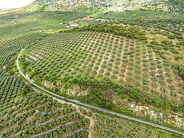
Fields of olive trees, trees planted in rows, aerial view, near village Cabra, Andalusia, Spain
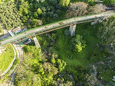
Cycle path Via Verde Del Aceite, old railroad track leading over a bridge, at village Zuheros, Andalusia, Spain
Gravel road Ruta Jubierre, desert, rock formations, aerial view, Desierto de los Monegros, Spain
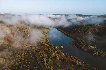
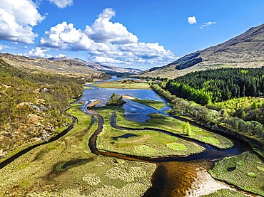
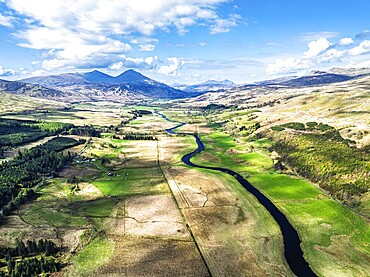
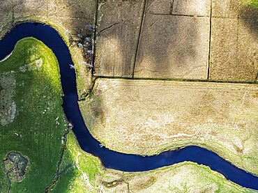
Drone shot, river course, low cloud cover
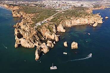
Drone shot, Ponta da Piedade, typical Algarve rock formation, Portugal
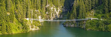
Suspension bridge, drone image, Passerelle himalayenne du lac de St-Guérin, Beaufort, Beaufortain, Savoie, France
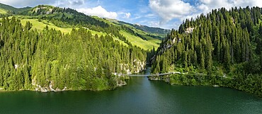
Suspension bridge, drone image, Passerelle himalayenne du lac de St-Guérin, Beaufort, Beaufortain, Savoie, France
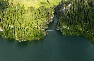
Suspension bridge, drone image, Passerelle himalayenne du lac de St-Guérin, Beaufort, Beaufortain, Savoie, France
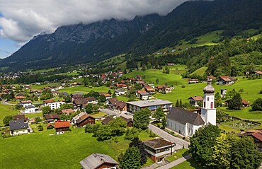
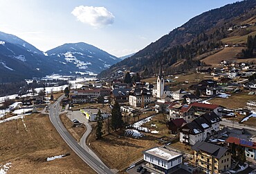
Drone shot, view of village with church, Pfarrwerfen, Tennengebirge, Salzachtal, Pongau, Salzburg province, Austria
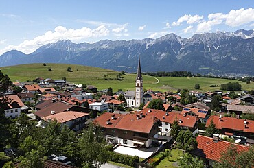
Drone shot, view of village with parish church and Karwendel mountains, Rinn, Tyrol, Austria
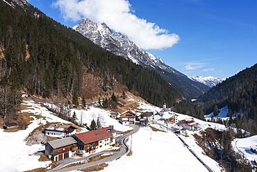
Drone image, view of the village with parish church, Braz, Klostertal, Vorarlberg, Austria
Baltic resort Wustrow pier
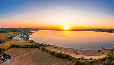
Kelbra reservoir at sunset

Baltic resort Wustrow pier
Aerial view of a rural landscape with a curvy road running through it in Sedona, Arizona. Drone photograph
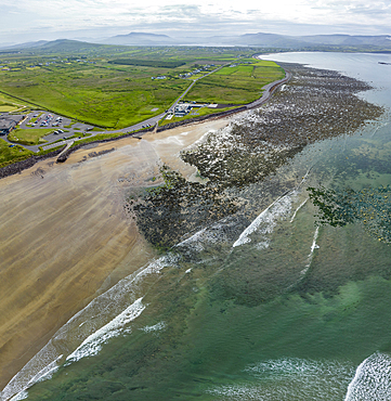
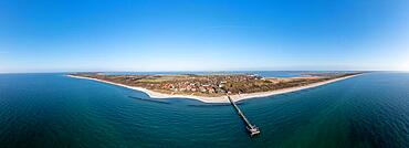
Ballinskelligs Bay, sandy beach, Waterville, Ring of Kerry, drone shot, Kerry, Ireland, Europe
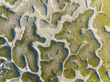
Network of dry channels and streams at low tide, in the marshland of the Bahia de Cadiz, aerial view, drone shot, Cadiz province, Andalusia, Spain, Europe
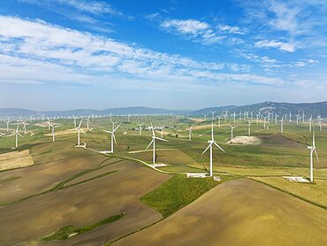
Windmills on a wind farm near Zahara de los Atunes, aerial view, drone shot, Cadiz province, Andalusia, Spain, Europe
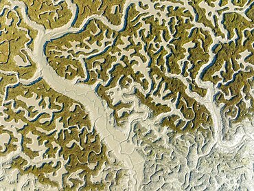
Network of dry channels and streams at low tide, in the marshland of the Bahia de Cadiz, aerial view, drone shot, Cadiz province, Andalusia, Spain, Europe
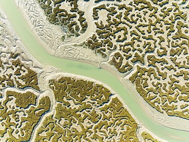
Network of channels and streams at low tide, in the marshland of the Bahia de Cadiz, aerial view, drone shot, Cadiz province, Andalusia, Spain, Europe

Beautiful rock formations in the desert of the American Southwest from above using a drone
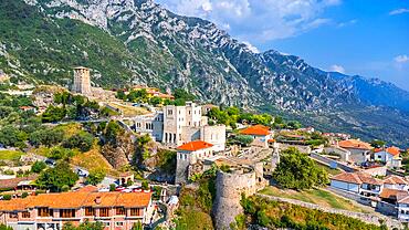
Aerial drone view of Kruje Castle and its fortress, inside the Kruje tower and museum with the mountains in the background. Albania
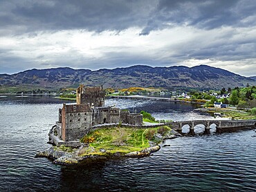
Eilean Donan Castle and Loch Duich from a drone, Isle of Skye, Highlands, Scotland, England, United Kingdom
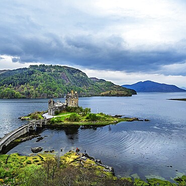
Eilean Donan Castle and Loch Duich from a drone, Isle of Skye, Highlands, Scotland, England, United Kingdom
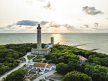
WHALE LIGHTHOUSE from a drone, Saint-Clement-des-Baleines, Atlantic, France
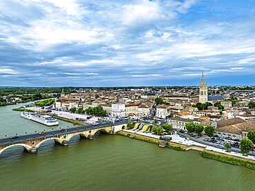
Libourne from a drone, Gironde, Nouvelle-Aquitaine, Saint-Emilion and Pomerol, Southwestern France
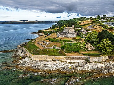
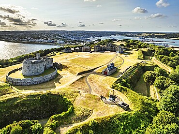
St Mawes Castle from a drone, Carrick Roads, River Fal, Falmouth, Cornwall, UK
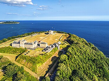
Pendennis Castle and Pendennis Point from a drone, Falmouth, Cornwall, UK
Pendennis Castle and Pendennis Point from a drone, Falmouth, Cornwall, UK
Cycle path Via Verde Del Aceite, old railroad track passes through olive fields, near village Cabra, Andalusia, Spain, Europe
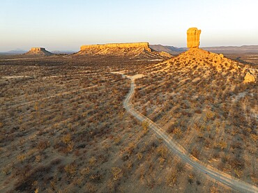
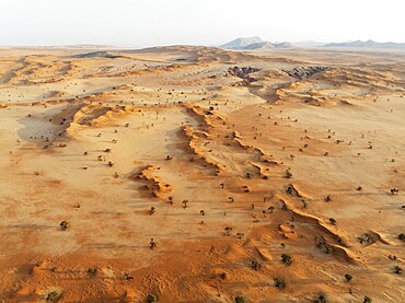
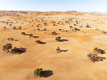
The Vingerklip (rock finger) and the Ugab Valley Terraces are surrounded by thornbush and mopane (Colophospermum mopane) savanna. Aerial view. Drone shot. Damaraland, Namibia
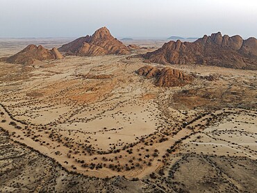
Spitzkoppe (1728 m) - on the left - and Pondok Mountain majestically rise above the surrounding desert plains. At dawn. Aerial view. Drone shot. Damaraland, Namibia
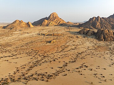
The isolated Spitzkoppe mountain (1728 m) majestically rises above the surrounding desert plains. Aerial view. Drone shot. Damaraland, Namibia
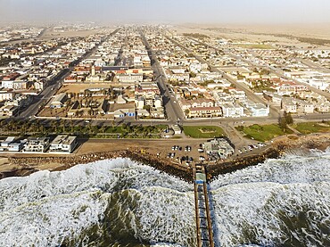
The coastal town of Swakopmund between Namib Desert and Atlantic Ocean. Aerial view. Namibia
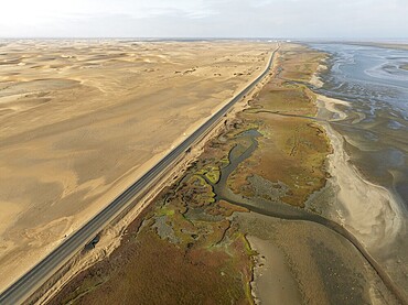
The Walvis Bay Lagoon between Namib Desert and Atlantic Ocean at low tide. Aerial view. Drone shot. Namibia
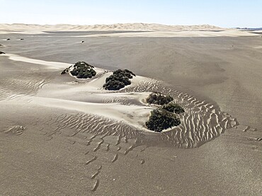
Small sand heaps form around the sparse vegetation in the Namib Desert. Aerial view. Drone shot. Skeleton Coast National Park, Namibia
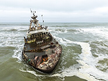
White-breasted Cormorant (Phalacrocorax lucidos). Nesting on the Zeila shipwreck at the Skeleton Coast. Aerial view. Drone shot. Dorob National Park, Namibia
Sand dunes grown with camelthorn trees (Vachellia erioloba) in the Tsondab Valley in the Namib Desert. Aerial view. Drone shot. Namibia
Salt marsh at the Skeleton Coast. Aerial view. Drone shot. Dorob National Park, Namibia
Sand dunes and camelthorn trees (Vachellia erioloba) in the Tsondab Valley in the Namib Desert. Aerial view. Drone shot. Namibia
Canyon, sand dunes and camelthorn trees (Vachellia erioloba) in the Tsondab Valley in the Namib Desert. In the distance the Tsondab Valley Lodge. Aerial view. Drone shot. Namibia
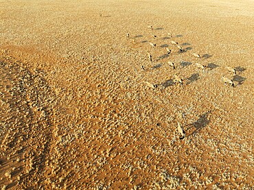
Gemsbok (Oryx gazella). Roaming an arid plain at the edge of the Namib Desert. Aerial view. Drone shot. Namibia
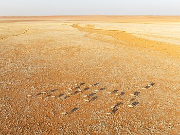
Gemsbok (Oryx gazella). Roaming an arid plain at the edge of the Namib Desert. Aerial view. Drone shot. Namibia
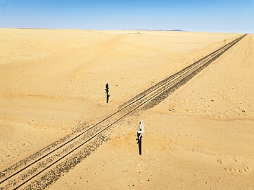
Rails and level crossing in the southern Namib Desert. Aerial view. Drone shot. Namibia
Lyme Regis from a drone, Jurassic Coast, Dorset, England, United Kingdom, Europe
Top view of the pier and old town. Drone photo
Drone view of the Perast coast with ancient houses and a tower. Montenegro.
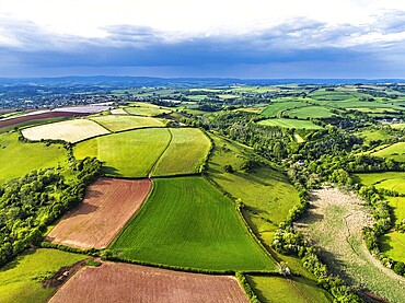
Farms and Fields over River Dart from a drone, Stoke Gabriel, Totnes, Devon, England, United Kingdom
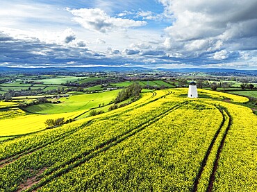
Rapeseed fields and Farms over Devon Windmill from a drone, Torquay, Devon, England, United Kingdom
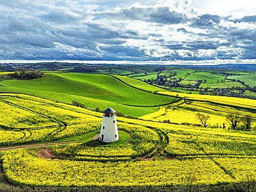
Rapeseed fields and Farms over Devon Windmill from a drone, Torquay, Devon, England, United Kingdom
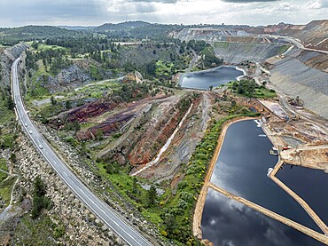
Aerial view of open pit mining, copper mine, Rio Tinto, Minas de Rio Tinto, Andalusia, Spain, Europe
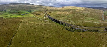
Ribblehead Viaduct, railway viaduct in the Yorkshire Dales, behind Whernside mountain, drone shot, Carnforth, England, Great Britain
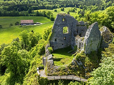
Historic site ruins of the Château de Löwenburg, drone image, Pleigne, Jura, Switzerland
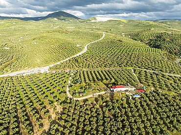
Fields of olive trees, trees planted in rows, aerial view, near village Cabra, Andalusia, Spain, Europe
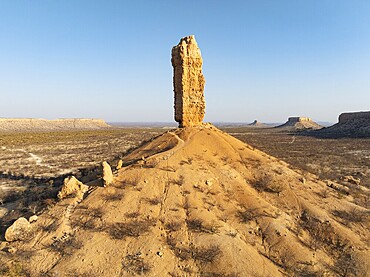
The Vingerklip (rock finger) and the Ugab Valley Terraces are surrounded by thornbush and mopane (Colophospermum mopane) savanna. Aerial view. Drone shot. Damaraland, Namibia
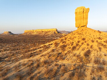
The Vingerklip (rock finger) and the Ugab Valley Terraces are surrounded by thornbush and mopane (Colophospermum mopane) savanna. Aerial view. Drone shot. Damaraland, Namibia
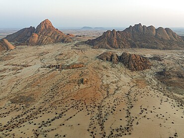
Spitzkoppe (1728 m) - on the left - and Pondok Mountain majestically rise above the surrounding desert plains. At dawn. Aerial view. Drone shot. Damaraland, Namibia
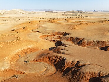
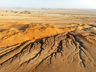
Canyons, arid plains grown with camelthorn trees (Vachellia erioloba) and isolated mountain ridges in the Tsondab Valley in the Namib Desert. Aerial view. Drone shot. Namibia
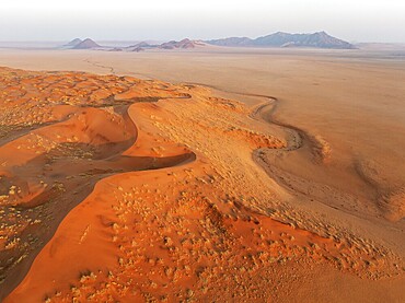
Sand dunes and isolated mountain ridges at the edge of the Namib Desert. Aerial view. Drone shot. Namibia
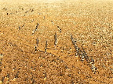
Gemsbok (Oryx gazella). Roaming an arid plain at the edge of the Namib Desert. Aerial view. Drone shot. Namibia
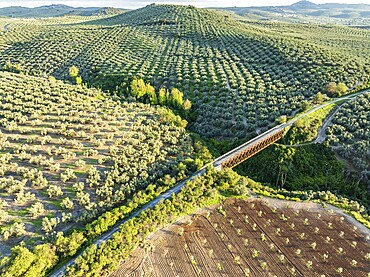
Cycle path Via Verde Del Aceite, old railroad track passes through olive fields, cycle path on bridge, near village Cabra, aerial view, Andalusia, Spain, Europe
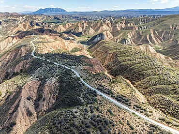
Winding road on a plateau, surrounded by colorful canyons and gorges, aerial view, Gorafe Desert, UNESCO Granada Geopark, Granada province, Andalusia, Spain, Europe
Network of channels and streams at low tide, in the marshland of the Bahia de Cadiz, aerial view, drone shot, Cadiz province, Andalusia, Spain, Europe
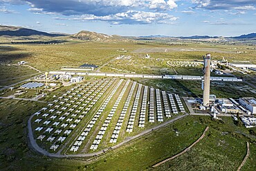
Plataforma Solar de Almaria, solar park, research facility in the Tabernas desert, Andalusia, Spain, Europe
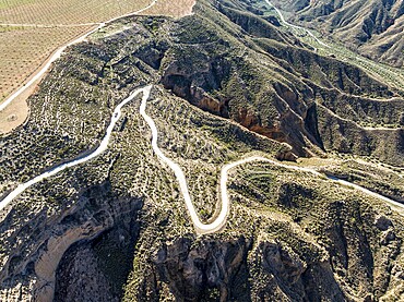
Canyons and gorges near village Gorafe, winding road, aerial view, Gorafe Desert, UNESCO Granada Geopark, Granada province, Andalusia, Spain, Europe
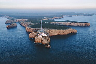
Drone shot, southern tip, Sagres, lighthouse, blue hour, Portugal, Europe
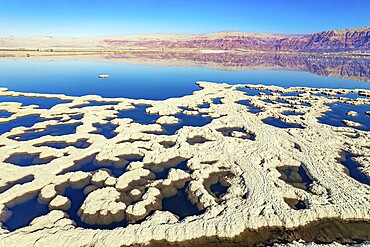
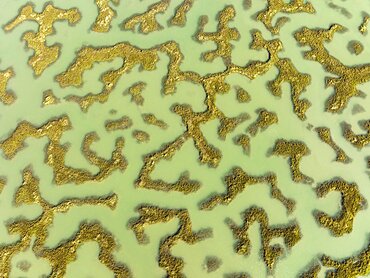
Dead Sea. Evaporated salt forms bizarre patterns on the water. Sunny winter day. The blue water is surrounded by pink mountains. The picture was taken by a drone from a aerial view. Israel
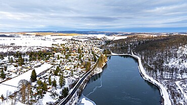
Aerial photograph Güntersberge Selketal Harz
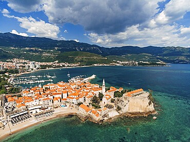
Old Town of Budva, photo from a drone.
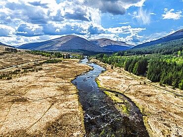
Mountains and Moors over Loch Tulla and River Orchy from a drone, Highlands, Scotland, UK
Mountains and Moors over Loch Tulla and River Orchy from a drone, Highlands, Scotland, UK
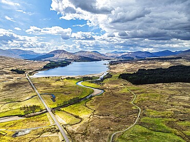
Loch Dochart and River Fillan from a drone, Highlands, Scotland, United Kingdom, Europe
Farms and Mountains over River Dochart and Road A85 from a drone, Perthshire, Scotland, UK
Top Down over Farms and River Dochart and Road A85 from a drone, Perthshire, Scotland, UK

Aerial view of lake Lovatnet (or: Loenvatnet), Lovatnet, view towards south to glacier Jostedalsbreen, islands in the lake, valley Lodalen south of village Loen, Norway, Europe
Aerial drone view of the paradise beach of Kroreza or Krorez on the Albanian riviera in Sarande, Albania. turquoise waters
Drone shot, view of village with parish church, Rangersdorf, Mölltal, Carinthia, Austria, Europe
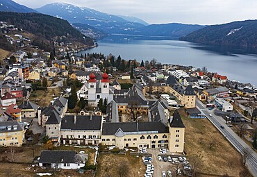
Drone shot, view of the town, Millstatt Abbey, Millstatt, Lake Millstatt, Carinthia, Austria, Europe
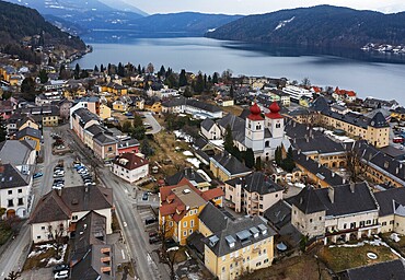
Drone shot, view of the town, Millstatt Abbey, Millstatt, Lake Millstatt, Carinthia, Austria, Europe
Drone image, view of the village with parish church, Hinterhornbach, Hornbachtal, Reutte district, Tyrol, Austria, Europe
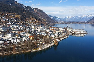
Drone shot, city view, Zell am See, Zeller See, Pinzgau, Land Salzburg, Austria, Europe
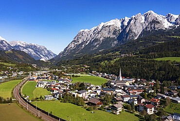
Drone image, settlement area, view of village with church, Pfarrwerfen, Tennengebirge, Salzachtal, Pongau, Salzburg province, Austria, Europe
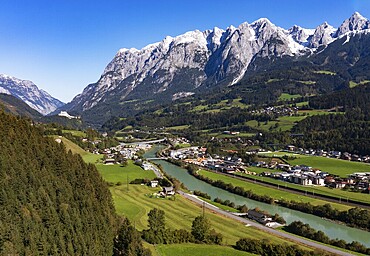
Drone image, settlement area, view of village with church, Pfarrwerfen, Tennengebirge, Salzachtal, Pongau, Salzburg province, Austria, Europe
Drone shot, view of the village with Augustinian monastery Reichersberg, Reichersberg, Innviertel. Upper Austria, Austria, Europe
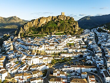
The White Town of Zahara de la Sierra below a Moorish castle. Aerial view. Drone shot. Cádiz province, Andalusia, Spain, Europe
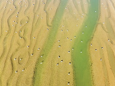
Seagulls in the marshland adjacent to the Odiel river. At low tide. Aerial view. Drone shot. Huelva province, Andalusia, Spain, Europe
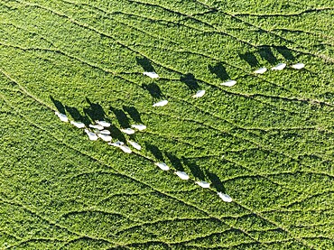
Sheep (Ovis aries). Aerial view. Drone shot. Cádiz province, Andalucía, Spain, Europe
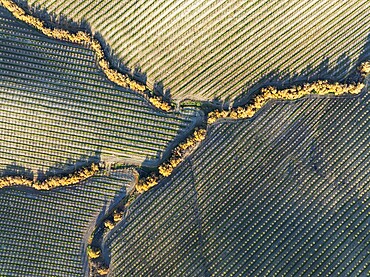
Cultivated almond trees (Prunus dulcis) and streams with riverine vegetation in the Campiña Cordobesa, the fertile rural area south of the town of Córdoba. Aerial view. Drone shot. Córdoba province, Andalusia, Spain, Europe
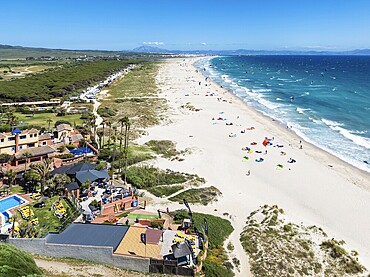
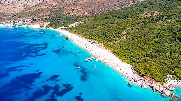
Kite surfers at the Los Lances beach near Tarifa. Next to the Dos Mares Hotel. In the distance the coastline of Morocco. Aerial view. Drone shot. Cádiz province, Andalusia, Spain, Europe
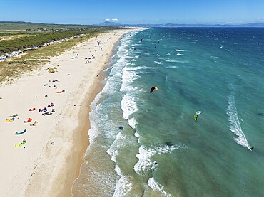
Kite surfers at the Los Lances beach near Tarifa. In the distance the coastline of Morocco. Aerial view. Drone shot. Cádiz province, Andalusia, Spain, Europe
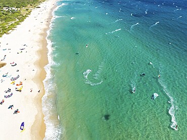
Kite surfers at the Valdevaqueros beach near Tarifa. Aerial view. Drone shot. Cádiz province, Andalusia, Spain, Europe
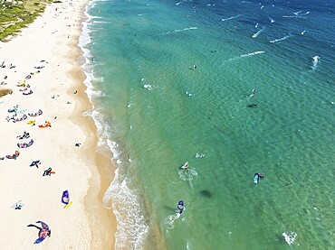
Kite surfers at the Valdevaqueros beach near Tarifa. Aerial view. Drone shot. Cádiz province, Andalusia, Spain, Europe
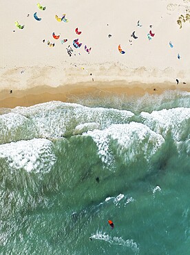
Kite surfers at the Los Lances beach near Tarifa. Aerial view. Drone shot. Cádiz province, Andalusia, Spain, Europe