Results
4 results found
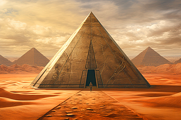
AI generated image of a Pyramids in the desert, Symbol of the life after death and embodying the union of earth and heaven
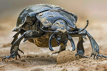
AI generated image of a Dung (scarab) beetle pushing a round ball of faeces

AI generated image of Two cute Dachshund pups looking at each other
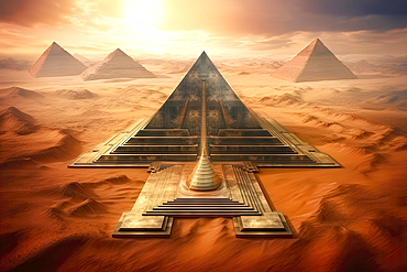
AI generated image of a Pyramids in the desert, Symbol of the life after death and embodying the union of earth and heaven
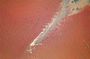
Tsauchab River and Sossus Vlei Lakebed, Namibia
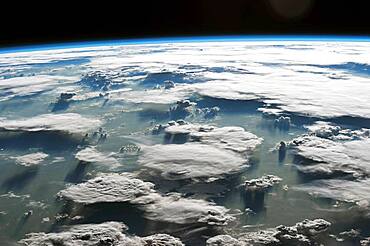
Clouds over the Amazon, Satellite Image
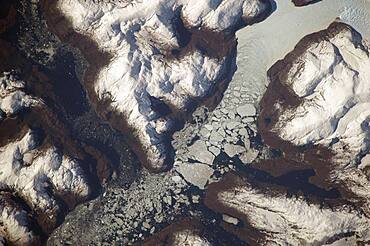
Glacier Outlet, Southern Patagonian Ice Field, Chile
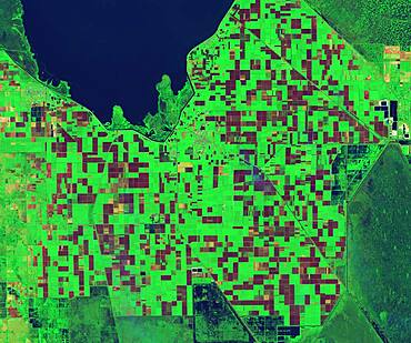
Sugarcane Fields, Controlled Burn, Infrared Satellite Image
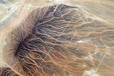
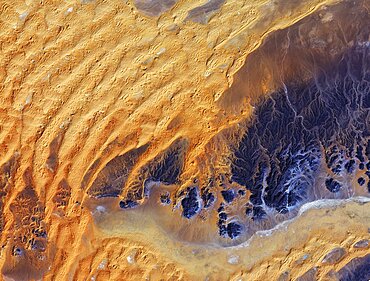
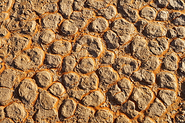
Water Imprints in Desert, Oman

Aurora Borealis, ISS Image, 2016
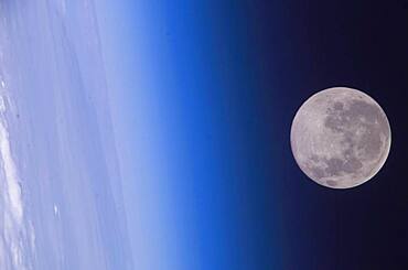
Full Moon, Earth's Horizon and Airglow, ISS Image
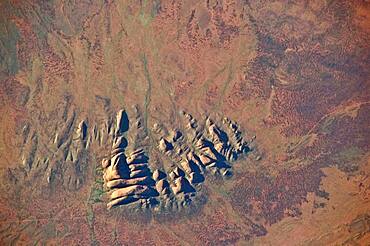
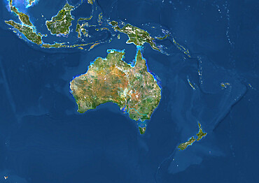
Northern Territory, Australia
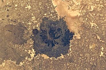
Es Safa Volcanic Field, Syria
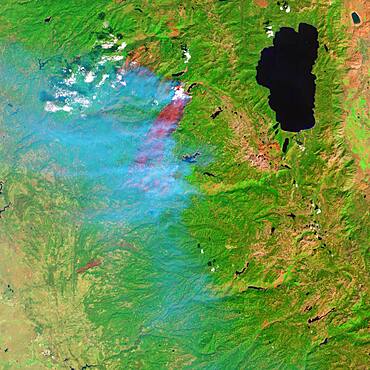
Forest Fire
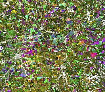
Chernozem Black Earth cropland, Russia, satellite image
Sahara Desert, Algeria
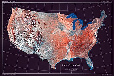
United States
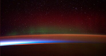
Aurora australis, ISS Image, 2014
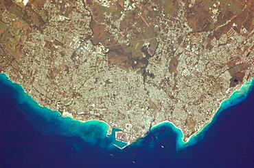
Greater Bridgetown Area, Barbados
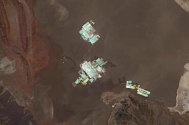
Evaporation Ponds, Salar de Atacama, Chile
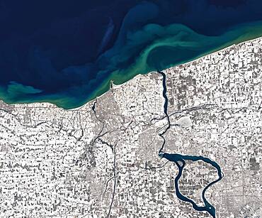
Niagara River in Winter, Satellite Image

Hurricane Florence, ISS image

Sunset, ISS Image
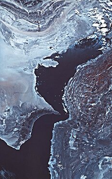
Persian Gulf

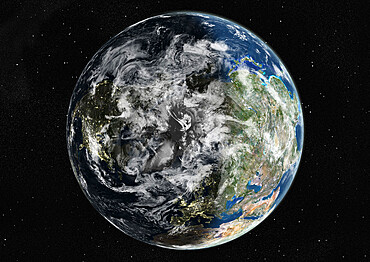
Earth, DSCOVR Satellite Image
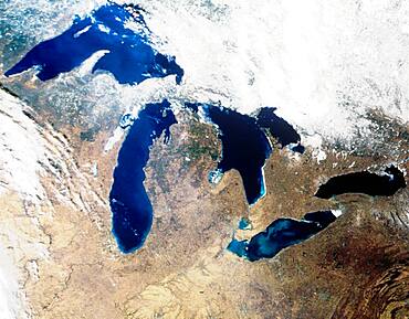
Satellite image of the Great Lake region
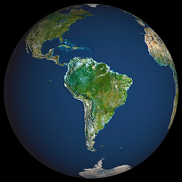
Globe South America, True Colour Satellite Image. Earth. True colour satellite image of the Earth, centred on South America
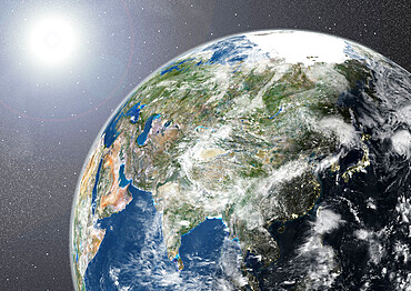
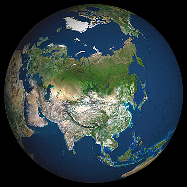
Globe Showing Asia, True Colour Satellite Image
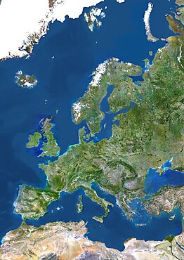
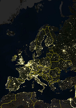
Europe, True Colour Satellite Image. True colour satellite image of Europe. This image in Lambert Conformal Conic projection was compiled from data acquired by LANDSAT 5 & 7 satellites.

Globe Europe, True Colour Satellite Image. True colour satellite image of the whole earth, showing Europe at centre. The picture is a composite created from thousands of separate images recorded by LANDSAT 5 & 7 satellites. Print size 42x42cm.

Asia At Night, True Colour Satellite Image. True colour satellite image of Asia at night. This image in Lambert Azimuthal Equal Area projection was compiled from data acquired by LANDSAT 5 & 7 satellites.
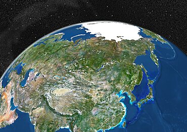
Globe Showing Asia, True Colour Satellite Image. True colour satellite image of the Earth showing Asia and the North Pole. This image in orthographic projection was compiled from data acquired by LANDSAT 5 & 7 satellites.
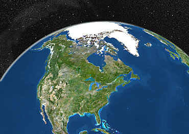
Globe Showing Northern America, True Colour Satellite Image. True colour satellite image of the Earth showing Greenland, the North Pole and Northern America. This image in orthographic projection was compiled from data acquired by LANDSAT 5 & 7 satellites.
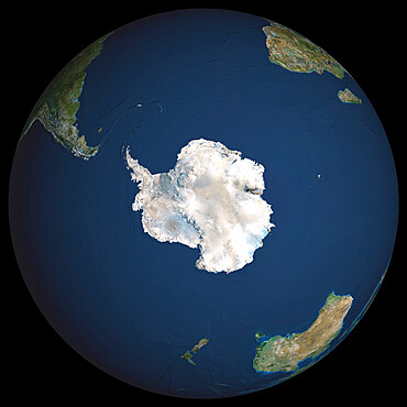
Globe South Pole, True Colour Satellite Image. Earth. True colour satellite image of the Earth, centred on Antarctica
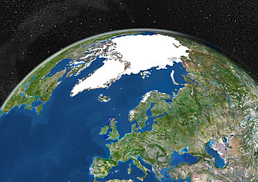
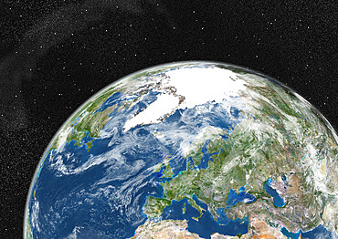
Globe Showing Europe, True Colour Satellite Image. True colour satellite image of the Earth showing Greenland, the North Pole and Europe. This image in orthographic projection was compiled from data acquired by LANDSAT 5 & 7 satellites.
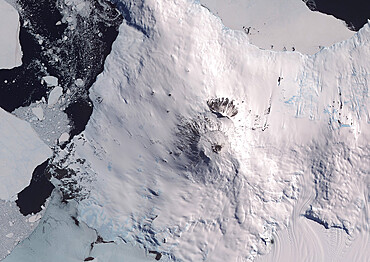
Satellite view of Mount Erebus, the tallest volcano in Antarctica. Situated on Ross Island, just off the coast of West Antarctica, Erebus is the southernmost active volcano on Earth. This image was taken on December 31, 2013 by Landsat 8 satellite.
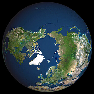
Globe North Pole, True Colour Satellite Image. Cloudless true colour satellite image of the Earth, centred on the Arctic or north polar region
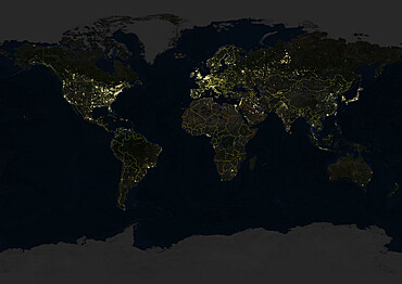
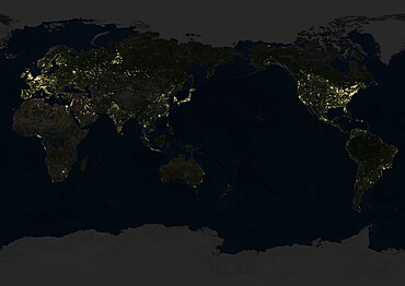
Whole Earth At Night With Country Borders, True Colour Satellite Image. True colour satellite image of the whole Earth at night with country borders. This image in Miller projection was compiled from data acquired by LANDSAT 5 & 7 satellites.
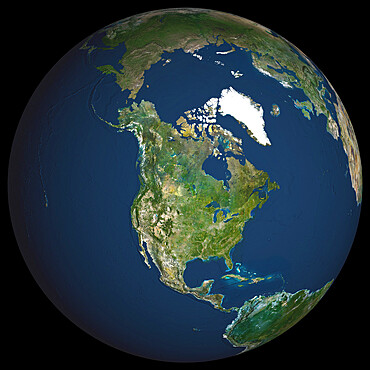
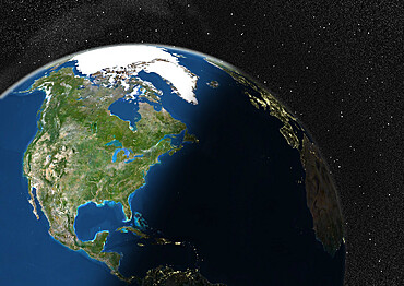
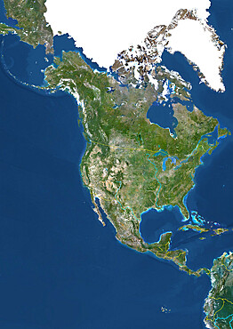
Globe North America, True Colour Satellite Image. Earth. True colour satellite image of the Earth, centred on North America
Globe Showing Northern America, True Colour Satellite Image. True colour satellite image of the Earth showing Northern America, half in shadow. This image in orthographic projection was compiled from data acquired by LANDSAT 5 & 7 satellites.
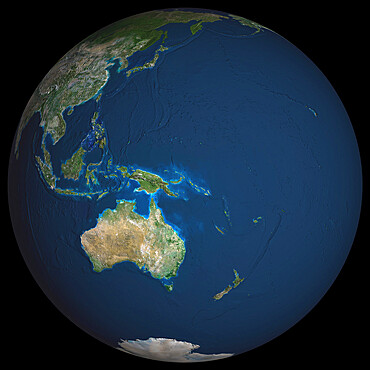
Globe Oceania, True Colour Satellite Image. Earth. True colour satellite image of the Earth, centred on the region of Oceania
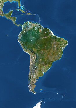
South America, True Colour Satellite Image. True colour satellite image of South America. This image in Lambert Azimuthal Equal Area projection was compiled from data acquired by LANDSAT 5 & 7 satellites.
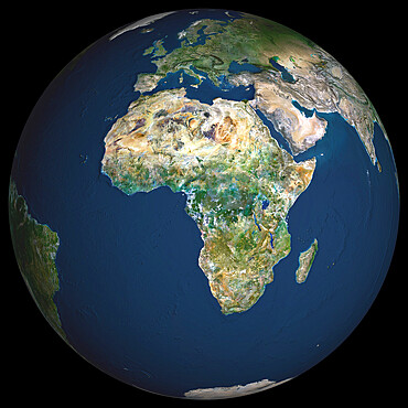
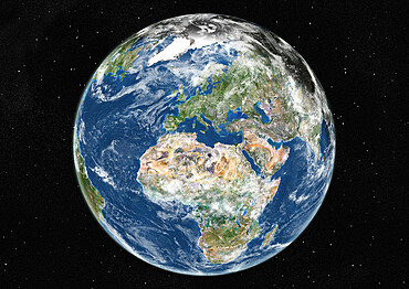
Globe Africa, True Colour Satellite Image. Earth. True colour satellite image of the Earth, centred on Africa
Globe Centred On The North Pole, True Colour Satellite Image
Globe Asia, True Colour Satellite Image. Earth. True colour satellite image of the Earth, centred on Asia
Europe At Night With Country Borders, True Colour Satellite Image. True colour satellite image of Europe at night with country borders. This image in Lambert Conformal Conic projection was compiled from data acquired by LANDSAT 5 & 7 satellites.
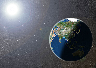
Globe Showing Asia, True Colour Satellite Image. True colour satellite image of the Earth showing Asia and Oceania, half in shadow, and the sun. This image in orthographic projection was compiled from data acquired by LANDSAT 5 & 7 satellites.
Whole Earth Centred On Pacific Ocean, True Colour Satellite Image
Globe Showing Europe, True Colour Satellite Image
North America With Country Borders And Major Rivers, True Colour Satellite Image
Globe Centred On Europe And Africa, True Colour Satellite Image
Whole Earth At Night Centred On Pacific Ocean, True Colour Satellite Image. True colour satellite image of the whole Earth at night, centred on the Pacific Ocean. This image in Miller projection was compiled from data acquired by LANDSAT 5 & 7 satellites.
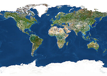
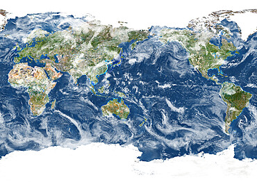
Whole Earth With Country Borders, True Colour Satellite Image. True colour satellite image of the whole Earth with country borders

Africa At Night, True Colour Satellite Image. True colour satellite image of Africa at night. This image in Lambert Azimuthal Equal Area projection was compiled from data acquired by LANDSAT 5 & 7 satellites.

South America At Night, True Colour Satellite Image. True colour satellite image of South America at night. This image in Lambert Azimuthal Equal Area projection was compiled from data acquired by LANDSAT 5 & 7 satellites.
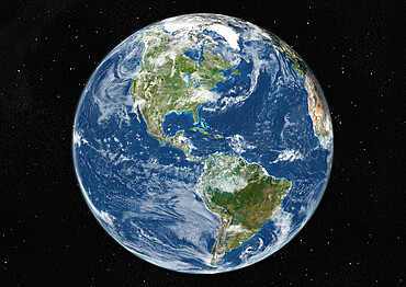
Globe Centred On The Americas, True Colour Satellite Image
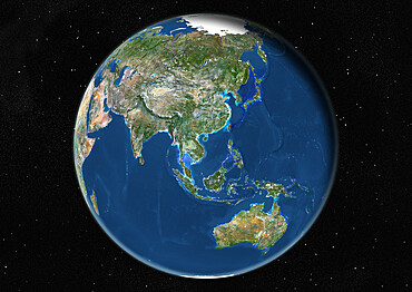
Globe Centred On Asia And Oceania, True Colour Satellite Image. True colour satellite image of the Earth centred on Asia and Oceania
Oceania With Country Borders And Major Rivers, True Colour Satellite Image
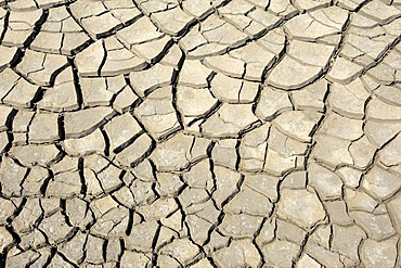
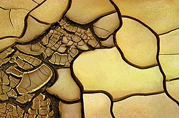
Broken surface of a salt and clay pan, In Tehak region, Acacus Mountains or Tadrart Acacus range, Tassili N'Ajjer National Park, Algeria, Sahara, North Africa
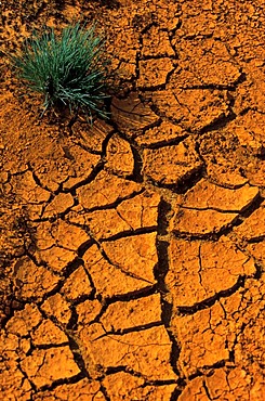
Cracks in red soil, Lausitz, Germany
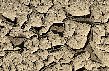
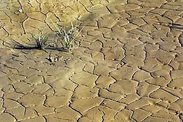
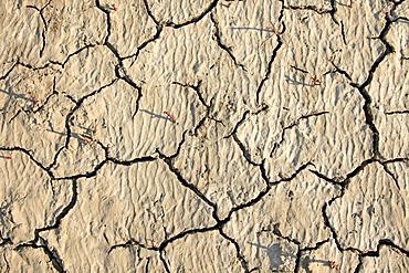
Dried out soil caused by drought and lack of water

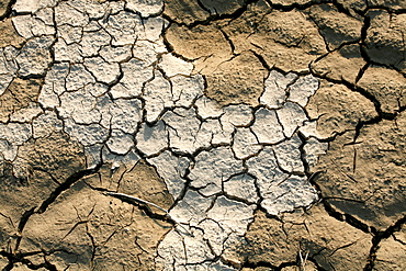
Parched ground, Camargue, Provence, Southern France, France, Europe
Dried out earth, Camargue, Provence, Southern France, France, Europe

Parched ground, Camargue, Provence, Southern France, France, Europe
Dry river bed, detail
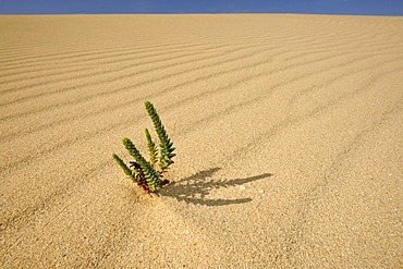
Symbolic image of life in the desert, Large Yellow Restharrow (Ononis natrix) in the Dunes of Corralejo national park, Fuerteventura, Canary Islands, Spain, Europe
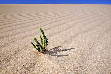
Symbolic image of life in the desert, Large Yellow Restharrow (Ononis natrix) in the Dunes of Corralejo national park, Fuerteventura, Canary Islands, Spain, Europe
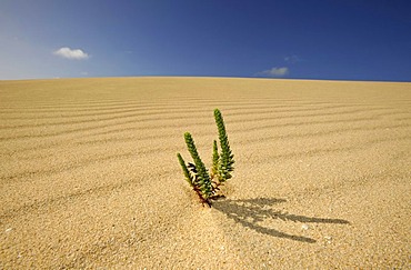
Symbolic image of life in the desert, Large Yellow Restharrow (Ononis natrix) in the Dunes of Corralejo national park, Fuerteventura, Canary Islands, Spain, Europe
Dry cracks in sand, gravel plant in Geretsried, Bavaria, Germany, Europe

Dried and cracked mud along the Rio Grande, Big Bend National Park, Texas, USA

Structures in a dry river bed, Monument Valley, Arizona, USA

Parched lake, Andalucia, Spain, Europe
Parched soil surface, Saintes-Marie-de-la-Mer, Bouches du Rhone, Camargue, France, Europe
Cracks in clay soil, Madeira, Portugal
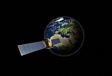
Satellite in front of the globe with Europe, symbolic image Galileo navigation system, overhead intelligence, data transmission

Child holding globe studio
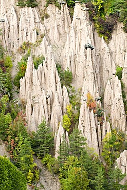
Earth pyramids, Ritten, Bolzano, Alto Adige, Italy, Europe

Parched soil surface, Saintes-Marie-de-la-Mer, Bouches du Rhone, Camargue, France, Europe
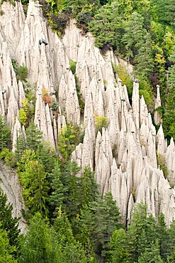
Earth pyramids, Ritten, Bolzano, Alto Adige, Italy, Europe

Parched soil surface, Saintes-Marie-de-la-Mer, Bouches du Rhone, Camargue, France, Europe
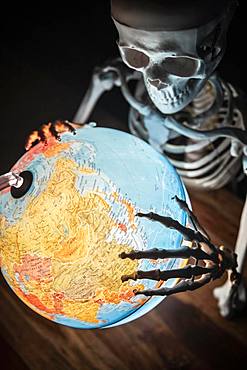
Skeleton with bony hand on globe, symbolic image of war and environmental catastrophe, Germany, Europe

View of the Rhine river at low water level, photomontage, Cologne, North Rhine-Westphalia, Germany, Europe, PublicGround
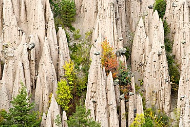
Earth pyramids, Ritten, Bolzano, Alto Adige, Italy, Europe

Extremely dried-out soil, Lake Neusiedl, Burgenland, Austria, Europe

Aerial image of the agricultural land on the island of Oahu, Oahu, Hawaii, United States of America
Hawaii, This image captures the split second when this breaching humpback whale (Megaptera novaeangliae) is completely airbore. An incredible feat for this enormous leviathan.
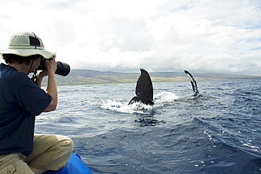
Hawaii, Maui, Lahaina, A photograher on a whale watching boat out of got a close up look at the tail of a humpback whale (Megaptera novaeangliae).
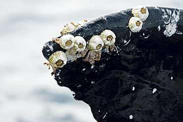
Hawaii, Acorn barnacles (Coronula diaderma) and goose neck barnacles (Conchorderma auritum) attached to a Humpback whale tail (Megaptera novaeangliae).

Hawaii, Maui, Lahaina, A photograher on a whale watching boat out of got a close up look at the tail of a humpback whale (Megaptera novaeangliae).
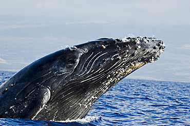
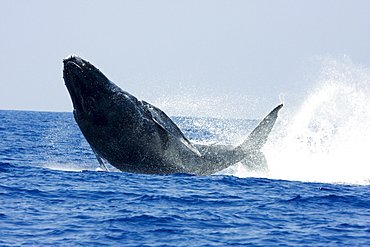
Hawaii, Breaching Humpback whale, (Megaptera novaeangliae).

Hawaii, Maui, Lahaina, A photograher on a whale watching boat out of got a close up look at the tail of a humpback whale (Megaptera novaeangliae).

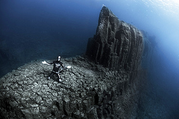
Volcanic underwater bottoms. True seamounts can be seen in the image, a natural monument made of basaltic columns called a columnar disjunction. The highest point is about 15 meters below the surface of the Atlantic Ocean and drops vertically to more than 40 meters at its deepest point. The place is known as La Rapadura on the coast of Santa Úrsula, north of the island of Tenerife. Seabed of the Canary Islands.
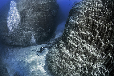
Volcanic underwater bottoms. True seamounts can be seen in the image, a natural monument made of basaltic columns called a columnar disjunction. The highest point is about 15 meters below the surface of the Atlantic Ocean and drops vertically to more than 40 meters at its deepest point. The place is known as La Rapadura on the coast of Santa Úrsula, north of the island of Tenerife. Seabed of the Canary Islands.

Volcanic underwater beds, Tenerife. The image shows the top of an underwater mountain formed by basaltic columns;columnar disjunction. Canary Islands.
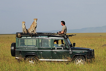
Cheetahs on car and photographer, East Africa
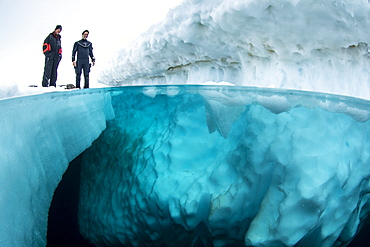
Split image of scuba divers before to dive under the ice, only in springtime, when the hard winter slowly subsides, are the ice-cold waters suitable for divers who can dive around a iceberg that floats in crystal-clear water, Tasiilaq, East Greenland
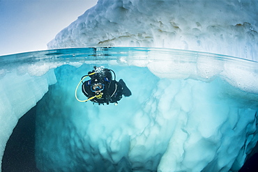
Spit image of a scuba diver diving close to an iceberg, only in springtime, when the hard winter slowly subsides, are the ice-cold waters suitable for divers who can dive around a iceberg that floats in crystal-clear water, Tasiilaq, East Greenland
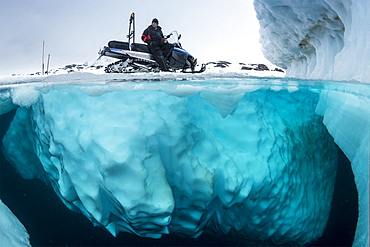
Split image of guide with snowmobile waiting the divers, only in springtime, when the hard winter slowly subsides, are the ice-cold waters suitable for divers who can dive around a iceberg that floats in crystal-clear water, Tasiilaq, East Greenland
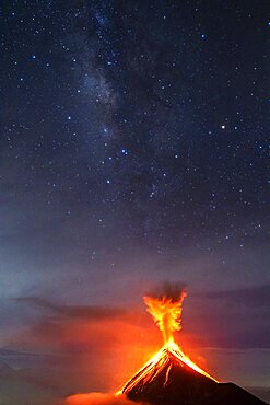
Volcán de Fuego (Volcano of fire) eruption at night, Sierra Madre de Chiapas, Guatemala. Awarded image, Asferico 2022 competition
Volcanic underwater beds, Tenerife. The image shows the top of an underwater mountain formed by basaltic columns (columnar disjunction. Canary Islands.