Results
84 results found
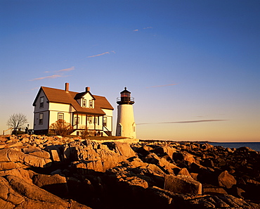
Prospect Harbour Point Light, lighthouse at Lubec, Maine, New England, United States of America, North America
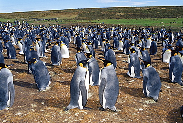
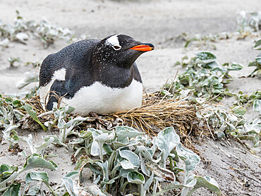
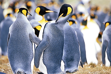
Colony of king penguins (Aptenodytes patagonicus), Volunteer Point, East Falkland, Falkland Islands, South Atlantic, South America
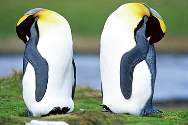
King penguins (Aptenodytes patagonicus) sleeping, Volunteer Point, East Falkland, Falkland Islands, South Atlantic, South America
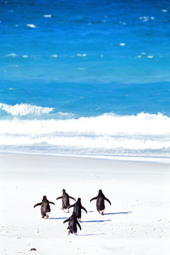
King penguins (Aptenodytes patagonicus) running into the sea, Volunteer Point, East Falkland, Falkland Islands, South Atlantic, South America
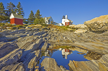
Pemaquid lightouse and fishermans museum, Pemaquid Point, Maine, United States of America, North America
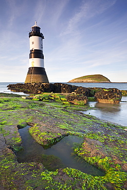
Penmon Point lighthouse and Puffin Island on the east coast of Anglesey, North Wales, Wales, United Kingdom, Europe
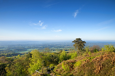
Leith Hill, highest point in south east England, view south towards The South Downs on a spring morning, Surrey Hills, Greensand Way, Surrey, England, United Kingdom, Europe
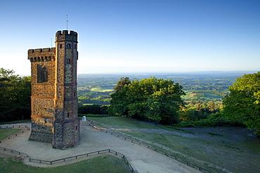
Leith Hill Tower, highest point in south east England, view sout on a summer morning, Surrey Hills, GreensandWay, Surrey, England, United Kingdom, Europe
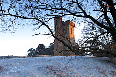
Leith Hill Tower in frost, Surrey Hills, highest point in south east England, Greensand Way, Surrey, England, United Kingdom, Europe

Flowering heather on the clifftops of the Valley of Rocks, looking east towards Foreland Point at sunrise, Exmoor National Park, Devon, England, United Kingdom, Europe
Looking east from Freathy Point over Whitsand Bay towards Rame Head, Cornwall, England, United Kingdom, Europe
The Grudge building built in 1954, the house is just a bit over 13 feet at its widest point, and around 2 feet at its narrowest, Beirut, Lebanon, Middle East
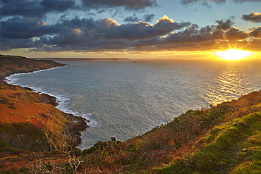
View of coast looking east towards Prawle Point from Sharpitor, Salcombe, south Devon, England, United Kingdom, Europe
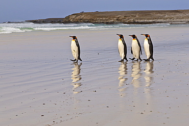
King penguins (Aptenodytes patagonicus) in a line on a white sand beach, Volunteer Point, East Falkland, Falkland Islands, South America
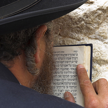
Close up of an Orthodox Jew holding prayer book against the wall and praying, Western Wall, Jerusalem, Israel, Middle East
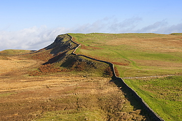
East to the Trig Point on Sewingshields Crags, Hadrians Wall, National Heritage Site, UNESCO World Heritage Site, Northumbria, England, United Kingdom, Europe
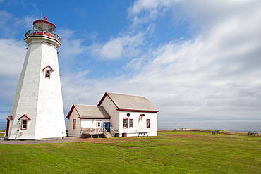
East Point Lighthouse, East Point, Prince Edward Island, Canada, North America
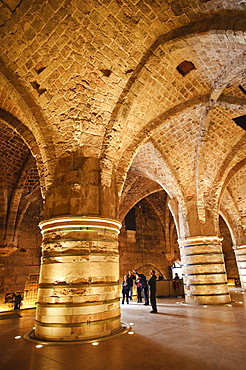
Interior of the Crusader Castle, Akko (Acre), Israel, Middle East
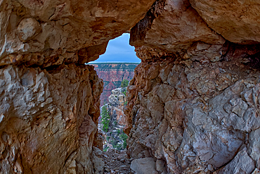
A gap between a stack of balanced boulders on a cliff east of Grandview Point at Grand Canyon South Rim, Grand Canyon National Park, UNESCO World Heritage Site, Arizona, United States of America, North America
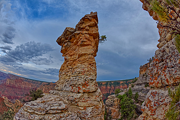
A rock spire just east of Grandview Point at Grand Canyon South Rim, Grand Canyon National Park, UNESCO World Heritage Site, Arizona, United States of America, North America

King penguin (Aptenodytes patagonicus) chick creche, Volunteer Point, East Falkland, Falkland Islands, South America
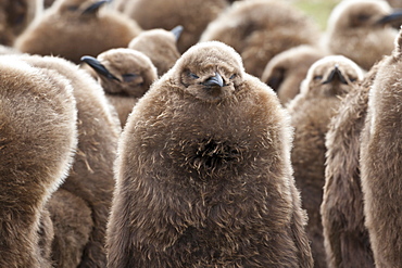
King penguin (Aptenodytes patagonicus) chick creche, Volunteer Point, East Falkland, Falkland Islands, South America
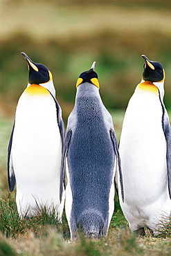
King penguins (Aptenodytes patagonicus), Volunteer Point, East Falkland, Falkland Islands, South Atlantic, South America
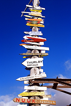
All world directions sign post, Stanley, East Falkland, Falkland Islands, South Atlantic, South America
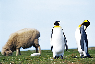
King penguins (Aptenodytes patagonicus) sharing their territory with a sheep, Volunteer Point, East Falkland, Falkland Islands, South Atlantic, South America
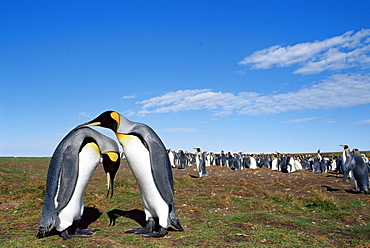
King penguins (Aptenodytes patagonicus) in mating ritual, Volunteer Point, East Falkland, Falkland Islands, South Atlantic, South America
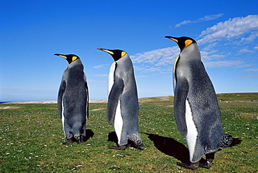
King penguins (Aptenodytes patagonicus), Volunteer Point, East Falkland, Falkland Islands, South Atlantic, South America
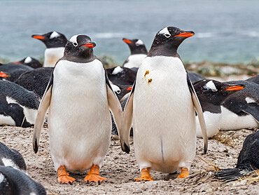
Gentoo penguins (Pygoscelis papua) at nesting site on Bull Point, East Island, Falkland Islands, South America
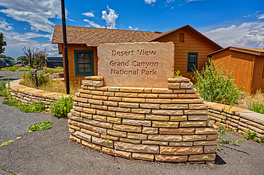
The welcome sign for Desert View Point on the east side of Grand Canyon South Rim, UNESCO World Heritage Site, Arizona, United States of America, North America
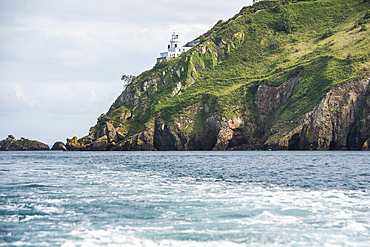
Point Robert Lighthouse on the east coast, Sark island, Channel Islands, Bailiwick of Guernsey, United Kingdom
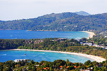
South East Asia, Thailand, Phuket, Kata beach view point
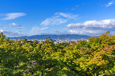
View of Kyoto and Nidec Kyoto Tower from Kiyomizu-dera Temple, Kiyomizu, Higashiyama Ward, Kyoto, Honshu, Japan
Gentoo penguin (Pygoscelis papua) at nesting site on Bull Point, East Island, Falkland Islands, South America
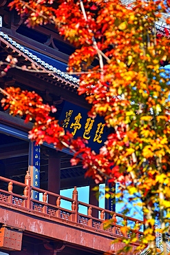
Pipa Pavilion, Jiujiang City, Jiangxi Province, China
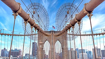
Brooklyn Bridge, New York City, spanning the East River between Manhattan and Brooklyn. When built in 1883 it was the longest suspension bridge in the world.

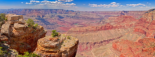
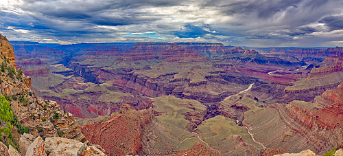
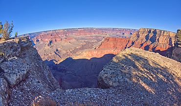
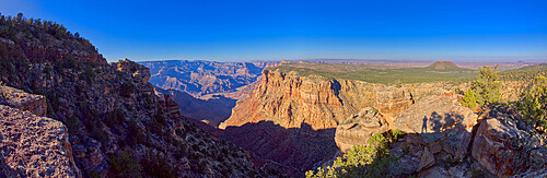
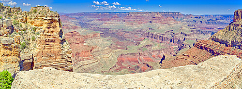
Panorama of the Grand Canyon just east of Zuni Point on the south rim with haze from smoke from a wildfire on the north rim, Grand Canyon National Park, UNESCO World Heritage Site, Arizona, United States of America, North America
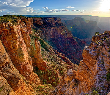
The Spire Abyss near Zuni Point on the south rim of the Grand Canyon near sundown, located a mile east of Moran Point, Grand Canyon National Park, UNESCO World Heritage Site, Arizona, United States of America, North America
Grand Canyon view east of Shoshone Point on the south rim, Grand Canyon National Park, UNESCO World Heritage Site, Arizona, United States of America, North America
Inside the crater on the top of Mount Kilimanjaro with the highest point Uhuru Peak at the end of the ridge, UNESCO World Heritage Site, Tanzania, East Africa, Africa
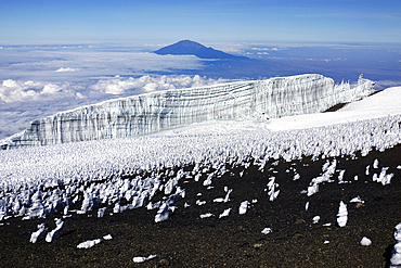
The summit plateau of Uhuru peak, Africa's highest point, Kilimanjaro, UNESCO World Heritage Site, Tanzania, East Africa, Africa
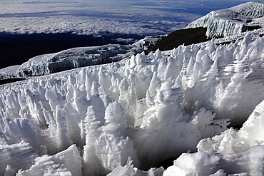
Ice formations on the summit plateau of Uhuru peak, Africa's highest point, Kilimanjaro, UNESCO World Heritage Site, Tanzania, East Africa, Africa
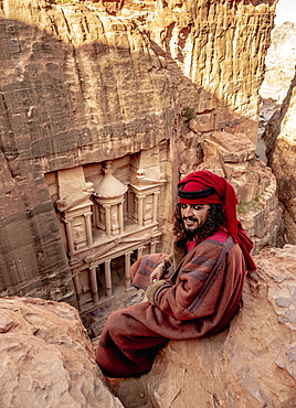
Bedouin man at The Treasury view point, Petra The Monastery (Ad-Deir), Petra, UNESCO World Heritage Site, Ma'an Governorate, Jordan, Middle East
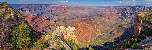
Panorama of Grand Canyon viewed from Buggeln Point just east of Buggeln Hill on the South Rim around sundown, Grand Canyon National Park, UNESCO World Heritage Site, Arizona, United States of America, North America
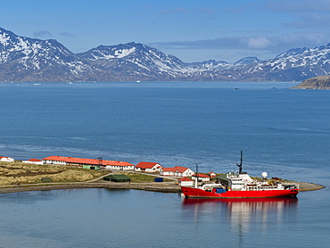
British Antarctic Survey research ship at King Edward Point in East Cumberland Bay, South Georgia, Polar Regions

Grand Canyon viewed from the east side of Maricopa Point along the Hermit Road, Grand Canyon National Park, UNESCO World Heritage Site, Arizona, United States of America, North America
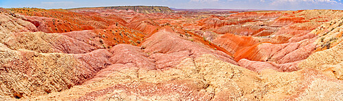
Blood red ridges of Bentonite clay on the east side of Tiponi Point in Petrified Forest National Park, Arizona, United States of America, North America
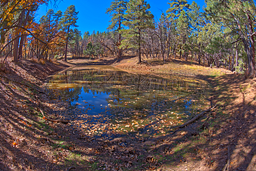
One of three ponds called the Hearst Tanks, on Grand Canyon South Rim, located one mile east of Grandview Point, Grand Canyon National Park, UNESCO World Heritage Site, Arizona, United States of America, North America
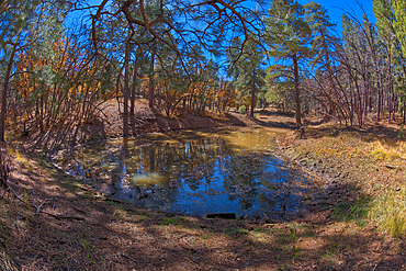
One of three ponds called the Hearst Tanks, on Grand Canyon South Rim, located one mile east of Grandview Point, Grand Canyon National Park, UNESCO World Heritage Site, Arizona, United States of America, North America
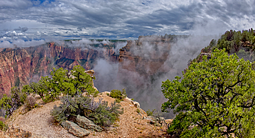
Steamlike fog rising out of Grand Canyon South Rim just east of Grandview Point, Grand Canyon National Park, UNESCO World Heritage Site, Arizona, United States of America, North America
King penguins (Aptenodytes patagonicus), Volunteer Point, East Falkland, Falkland Islands, South Atlantic, South America

Footprints of large plant-eating Jurassic Saurapod dinosaurs, an important middle Jurassic find on the north east coast in 2018, Brothers' Point (Rubha nam Brathairean), Trotternish Peninsula, Skye, Inner Hebrides, Scotland, United Kingdom, Europe
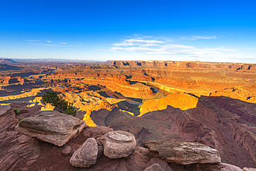
Bend of Colorado River at Dead Horse Point at sunrise, Dead Horse Point State Park, Utah, United States of America, North America
Footprint of large plant-eating Jurassic Saurapod dinosaurs, an important middle Jurassic find on the north east coast in 2018, Brothers' Point (Rubha nam Brathairean), Trotternish Peninsula, Skye, Inner Hebrides, Scotland, United Kingdom, Europe
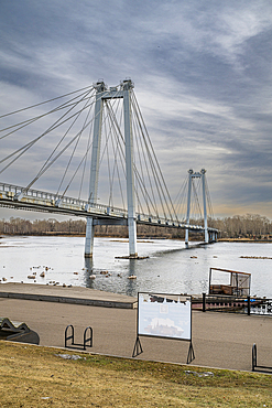
Bridge over Yenisey river, Krasnoyarsk, Siberia, Russia
Grand Canyon view east of Pinal Point on the south rim, Grand Canyon National Park, UNESCO World Heritage Site, Arizona, United States of America, North America
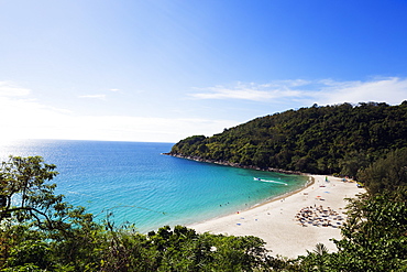
South East Asia, Thailand, Phuket, Kata beach view point

Hermit Canyon at Grand Canyon viewed from the east side of Yuma Point along the Boucher Trail with Pima Point on the upper right, Grand Canyon National Park, UNESCO World Heritage Site, Arizona, United States of America, North America
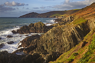
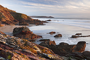
The rocky coast of Penlee Point, looking towards Rame Head and at the mouth of Plymouth Sound, east Cornwall, England, United Kingdom, Europe
Grand Canyon viewed just east of Zuni Point on a stormy day, Grand Canyon National Park, UNESCO World Heritage Site, Arizona, United States of America, North America
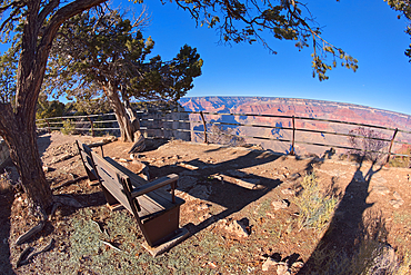
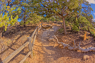
A small overlook east of Pima Point at Grand Canyon off of Hermit Road, Grand Canyon, Arizona, United States of America, North America
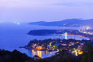
South East Asia, Thailand, Phuket, Kata beach view point
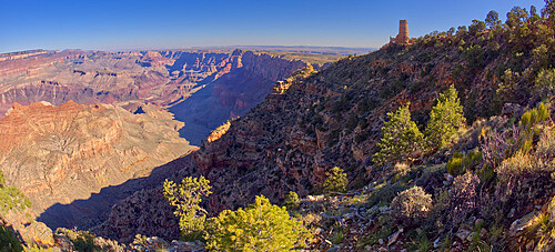
The Desert View Watchtower at Grand Canyon viewed from below the cliffs east of Navajo Point, Grand Canyon National Park, UNESCO World Heritage Site, Arizona, United States of America, North America
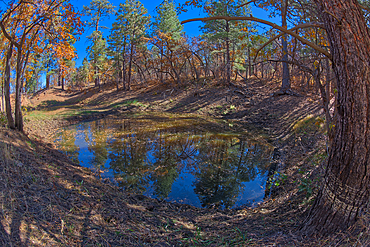
Two of three ponds called the Hearst Tanks, on Grand Canyon South Rim, located one mile east of Grandview Point, Grand Canyon National Park, UNESCO World Heritage Site, Arizona, United States of America, North America

Grand Canyon view from the east side of Skeleton Point along the South Kaibab Trail, Grand Canyon National Park, UNESCO World Heritage Site, Arizona, United States of America, North America
Grand Canyon viewed east of Pima Point with Mohave Point on the right, Grand Canyon National Park, UNESCO World Heritage Site, Arizona, United States of America, North America

Ancient Indian Ruins on the edge of a cliff east of Papago Point at Grand Canyon, Grand Canyon National Park, UNESCO World Heritage Site, Arizona, United States of America, North America
The rim trail at Grand Canyon heading east toward Powell Point from Hopi Point, Grand Canyon, UNESCO World Heritage Site, Arizona, United States of America, North America
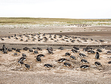
Gentoo penguins (Pygoscelis papua) at nesting site on Bull Point, East Island, Falkland Islands, South America
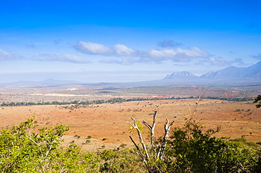
Kudu Point, Tsavo West National Park, Kenya, East Africa, Africa
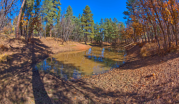
Two of three ponds called the Hearst Tanks, on Grand Canyon South Rim, located one mile east of Grandview Point, Grand Canyon National Park, UNESCO World Heritage Site, Arizona, United States of America, North America North America
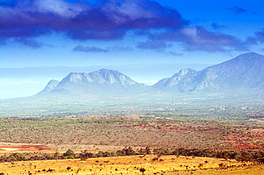
Kudu Point, Savannah and Taita Hills behind, Kenya, East Africa, Africa
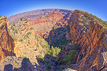
A fisheye view of a deep chasm east of Pinal Point at Grand Canyon, Grand Canyon National Park, UNESCO World Heritage Site, Arizona, United States of America, North America
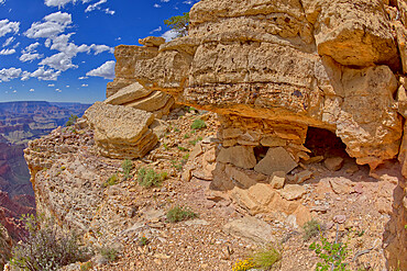
Ancient Indian Ruins on the edge of a cliff east of Papago Point at Grand Canyon, Grand Canyon National Park, UNESCO World Heritage Site, Arizona, United States of America, North America
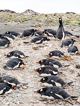
Gentoo penguins (Pygoscelis papua) at nesting site on Bull Point, East Island, Falkland Islands, South America
Sunrise from the top of the Umm ad Dami mountain, the highest point in the country, Jordan, Middle East
Grand Canyon view from cliffs east of the Desert View Point, with Cedar Mountain in the distance on the right, Grand Canyon National Park, UNESCO World Heritage Site, Arizona, United States of America, North America
Early morning view of the cliffs at Rame Head, looking towards Penlee Point and the entrance to Plymouth Sound, in east Cornwall, England, United Kingdom, Europe

View of Hermit Canyon from the east side of Yuma Point at Grand Canyon Arizona along the Boucher Trail with Pima Point on the upper right, Grand Canyon National Park, UNESCO World Heritage Site, Arizona, United States of America, North America
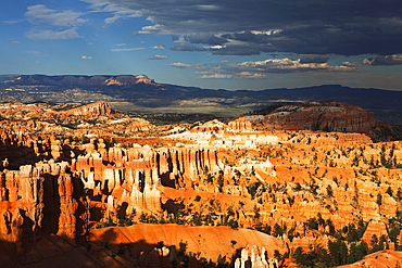
Looking east across Bryce Canyon from Sunset Point, Utah, United States of America, North America
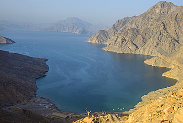
Woman at a viewing point over the Khor An-najd fjord, Musandam, Oman, Middle East
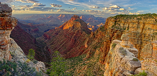
Grand Canyon viewed from the cliffs east of Moran Point, Grand Canyon National Park, UNESCO World Heritage Site, Arizona, United States of America, North America
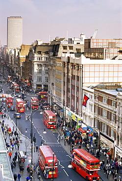
Birds eye view of Oxford Street looking east to Centre Point, London, England, United Kingdom, Europe
Point Lenana, 4985m, and Lewis Glacier, from top hut, Mount Kenya, UNESCO World Heritage Site, Kenya, East Africa, Africa
Point Lenana, 4985m, and the Curling Pond, from top hut, Mount Kenya, UNESCO World Heritage Site, Kenya, East Africa, Africa
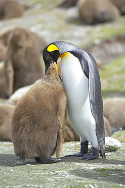
An adult King penguin (Aptenodytes patagonicus) feeding its chick, Volunteer Point, East Falkland, Falkland Islands, South Atlantic, South America
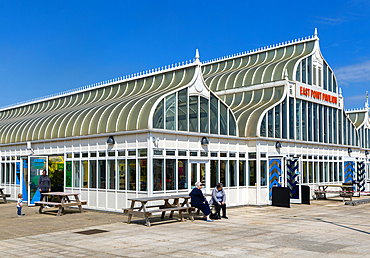
East Point Pavilion building on seafront at Royal Plain, Lowestoft, Suffolk, England, UK

Diana Point, Al Jabal Al Akkar region, Hajar Mountains, Sultanate of Oman, Middle East
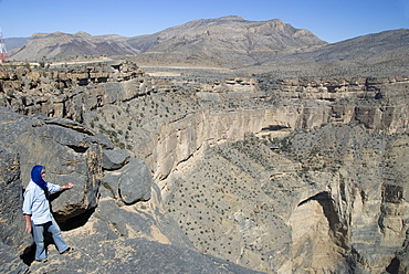
Cliffs of Wadi Saydran, below Jabal Shams, abandoned village of Sap Bani Khamis is on ledges above the large overhang, high point of Jabal Akhdar mountains, northern Oman, Middle East

East 2 West Point Source sculpture by Larry Kirland, Wellington E. Webb Municipal Building, Denver, Colorado, United States of America, North America
The Da Gama padrao, a monument to Vasco Da Gama in the Cape Point Nature Reserve in South Africa. Da Gama was a Portuguese sailor/explorer and led expeditions from the Cape to the East in 1497. A padrao is a limestone pillar bearing the Portuguese coat of arms and an inscription stating when and by whom it was raised. The cross signified Portuguese sovereignty and Christianity.
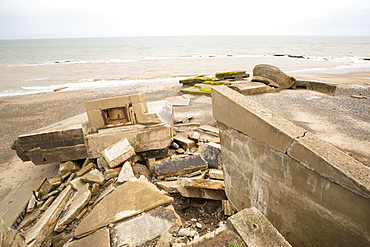
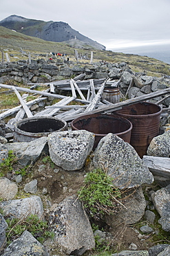
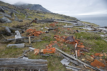
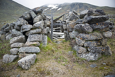
The Remains of the Godwin battery on the beach at Kilnsea at the head of Spurn point on Yorkshires East Coast, UK. Initially constructed during the First World War, the Godwin Battery was added to during the Second World War. It comprised of gun emplacements, search light, barracks, officers’ mess, and a hospital. This section of coastline is the fastest eroding coastline in Europe. The soft boulder clay cliffs are easily eroded and have been eroding since Roman Times, but recently the climate change impacts of increased stormy weather, increased heavy rainfall events and sea level rise have accelerated the rate of erosion. The average rate of attrition is 1.5metres per year, last year it was 5 metres.
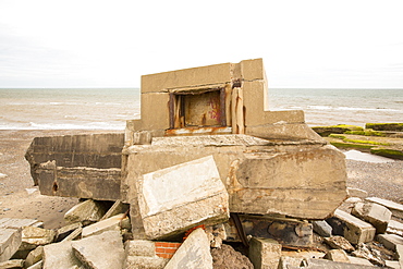
The Remains of the Godwin battery on the beach at Kilnsea at the head of Spurn point on Yorkshires East Coast, UK. Initially constructed during the First World War, the Godwin Battery was added to during the Second World War. It comprised of gun emplacements, search light, barracks, officers’ mess, and a hospital. This section of coastline is the fastest eroding coastline in Europe. The soft boulder clay cliffs are easily eroded and have been eroding since Roman Times, but recently the climate change impacts of increased stormy weather, increased heavy rainfall events and sea level rise have accelerated the rate of erosion. The average rate of attrition is 1.5metres per year, last year it was 5 metres.
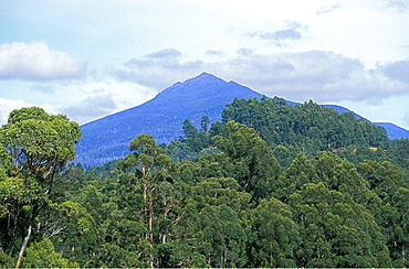
1255m Haartz Peak, high point of Haartz Mountains National Park, south east, Tasmania, Australia, Pacific
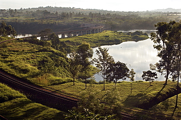
With a surface area of 68,800-úsquare kilometres (26,600-úsq-úmi), Lake Victoria is AfricaG®ös largest lake, and the largest tropical lake in the world. The Rail track meanders across Lake Victoria, just upstream from where the Victoria Nile river forms. This is the furthest point, and considered the source of the River Nile, the worldG®ös longest river. Jinja, Uganda, East Africa
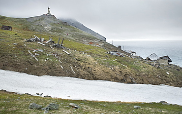
Semyon Dezhnev settlement, abandoned and ruined, Cape Dezhnev (Chukotskiy Peninsular ) Russia, Asia. MORE INFO: cape that forms the easternmost mainland point of Eurasia. In 1898 it was officially renamed Cape Dezhnev, replacing Captain James Cook's 'East Cape', in honor of Semyon Dezhnyov, the first recorded European to round it (1648). There is a large monument to Dezhnev on the coast.
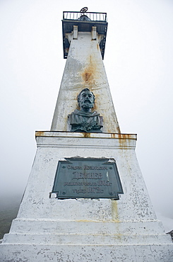
Semyon Dezhnev settlement, abandoned and ruined, Cape Dezhnev (Chukotskiy Peninsular ) Russia, Asia. MORE INFO: cape that forms the easternmost mainland point of Eurasia. In 1898 it was officially renamed Cape Dezhnev, replacing Captain James Cook's 'East Cape', in honor of Semyon Dezhnyov, the first recorded European to round it (1648). There is a large monument to Dezhnev on the coast.
Semyon Dezhnev settlement, abandoned and ruined, Cape Dezhnev (Chukotskiy Peninsular ) Russia, Asia. MORE INFO: cape that forms the easternmost mainland point of Eurasia. In 1898 it was officially renamed Cape Dezhnev, replacing Captain James Cook's 'East Cape', in honor of Semyon Dezhnyov, the first recorded European to round it (1648). There is a large monument to Dezhnev on the coast.
Semyon Dezhnev settlement, abandoned and ruined, Cape Dezhnev (Chukotskiy Peninsular ) Russia, Asia. MORE INFO: cape that forms the easternmost mainland point of Eurasia. In 1898 it was officially renamed Cape Dezhnev, replacing Captain James Cook's 'East Cape', in honor of Semyon Dezhnyov, the first recorded European to round it (1648). There is a large monument to Dezhnev on the coast.
Semyon Dezhnev settlement, abandoned and ruined, Cape Dezhnev (Chukotskiy Peninsular ) Russia, Asia. MORE INFO: cape that forms the easternmost mainland point of Eurasia. In 1898 it was officially renamed Cape Dezhnev, replacing Captain James Cook's 'East Cape', in honor of Semyon Dezhnyov, the first recorded European to round it (1648). There is a large monument to Dezhnev on the coast.
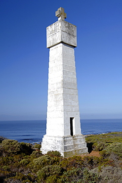
Makapu point lighthouse, East Oahu, Hawaii, United States of America, Pacific