Results
40 results found
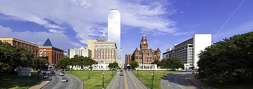
Grassy Knoll, site of Kennedy assassination, Dealey Plaza Historic District, West End, Dallas, Texas, United States of America, North America
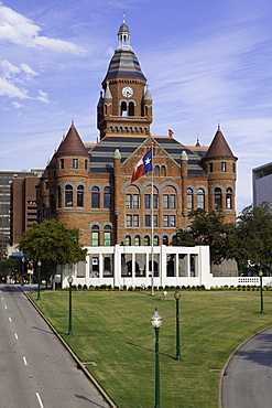
Grassy Knoll, site of Kennedy assassination, Dealey Plaza Historic District, West End, Dallas, Texas, United States of America, North America
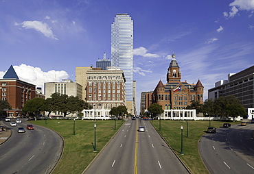
Grassy Knoll, site of Kennedy assassination, Dealey Plaza Historic District, West End, Dallas, Texas, United States of America, North America
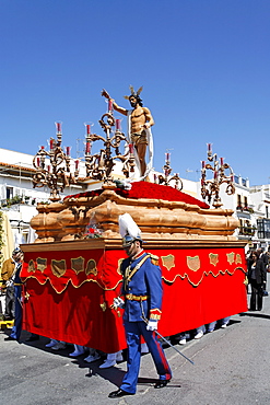
Float of resurrected Jesus, Easter Sunday procession at the end of Semana Santa (Holy Week), Ayamonte, Andalucia, Spain, Europe
Christmas decorations on Bond Street, West End, London, England, United Kingdom, Europe
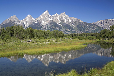
Water reflections of the Teton Range, taken from the end of Schwabacker Road, Grand Teton National Park, Wyoming, United States of America, North America
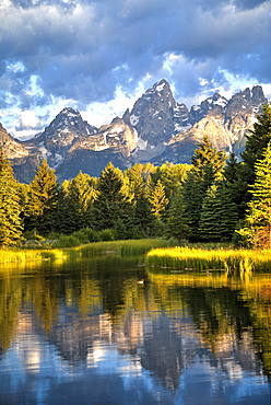
Water reflection of the Teton Range, taken from the end Schwabacher Road, Grand Teton National Park, Wyoming, United States of America, North America
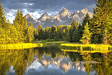
Water reflection of the Teton Range, taken from the end Schwabacher Road, Grand Teton National Park, Wyoming, United States of America, North America
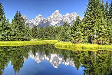
Water reflection of the Teton Range, taken from the end Schwabacher Road, Grand Teton National Park, Wyoming, United States of America, North America
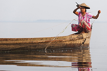
A young woman pulls in her nets at the end of the day on Indawgyi Lake, Kachin State, Myanmar (Burma), Asia
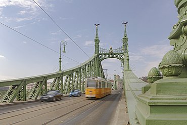
Szabadsag Hid (Liberty Bridge) (Freedom Bridge), designed in art nouveau at the end of the 19th century, Budapest, Hungary, Europe
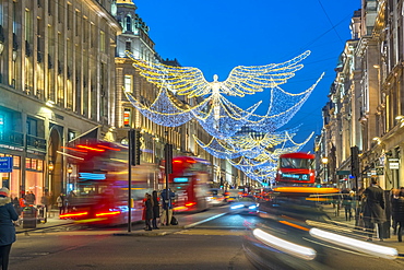
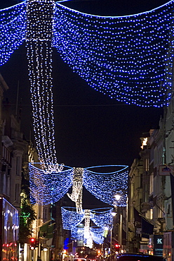
Christmas Lights, Regent Street, West End, London, England, United Kingdom, Europe
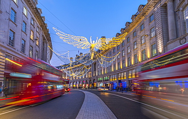
Christmas Lights, Regent Street, West End, London, England, United Kingdom, Europe
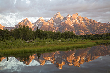
Water reflections of the Teton Range, taken from the end of Schwabacker Road, Grand Teton National Park, Wyoming, United States of America, North America
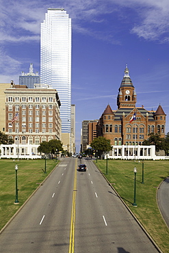
Grassy Knoll, site of Kennedy assassination, Dealey Plaza Historic District, West End, Dallas, Texas, United States of America, North America
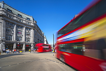
Double decker buses, Oxford Circus, West End, London, England, United Kingdom, Europe
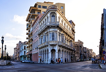
Buildings at the end of Prado, near The Malecon, Havana Centro, Havana, Cuba, West Indies, Central America

Lands End, Cornwall, England, United Kingdom, Europe

Great Western Road and Oran Mor at Glasgow West End, Glasgow, Scotland, United Kingdom, Europe
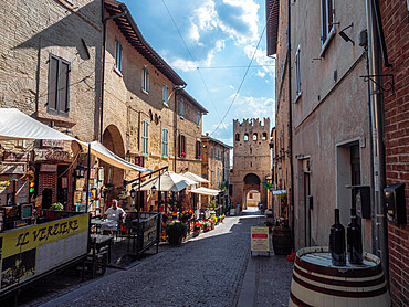
The main street in Montefalco with the entrance gate at the end of it, Montefalco, Umbria, Italy, Europe

View of alfresco dining on Bear Street, West End, Westminster, London, England, United Kingdom, Europe
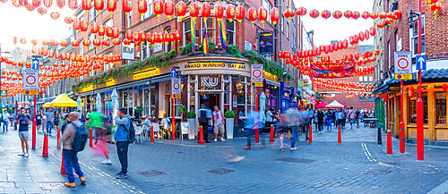
View of Gerrard Street in colourful Chinatown, West End, Westminster, London, England, United Kingdom, Europe
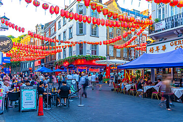
View of colourful Wardour Street in Chinatown, West End, Westminster, London, England, United Kingdom, Europe
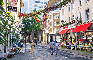
Restaurants and pedestrians on Monmouth Street, a shopping street near Seven Dials, Covent Garden, West End, London, England, United Kingdom, Europe
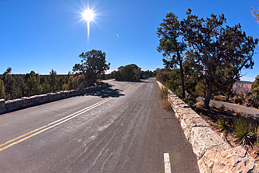
The end of Hermit Road, Hermits Rest is just beyond the parking lot, Grand Canyon, Arizona, United States of America, North America
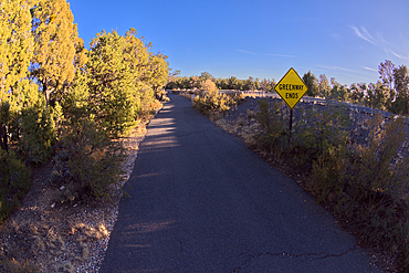
Sign marking the end of the paved Greenway Trail that runs between Monument Creek Vista and Pima Point, Grand Canyon, Arizona, United States of America, North America
Columbia Road Flower Market, East End, London, England,
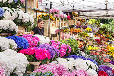
Columbia Road Flower Market, East End, London, England,
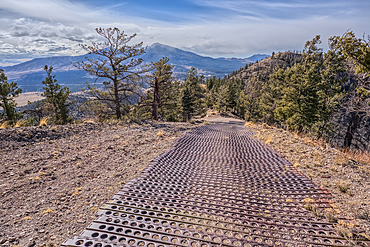
End of the Forest Service Road that leads to the O'Leary Peak Watchtower and Overlook. The metal grating is to add traction for vehicles. Adjacent to Sunset Crater National Monument Arizona in the Coconino National Forest.
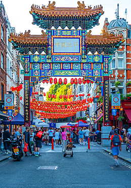
View of colourful Chinatown Gate in Wardour Street, West End, Westminster, London, England, United Kingdom, Europe
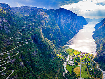
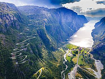
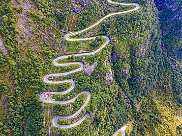
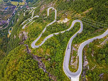
Zigzag road leading down to Lysebodn, at the end of Lystrefjord (Lysefjord), Rogaland, Norway, Scandinavia, Europe
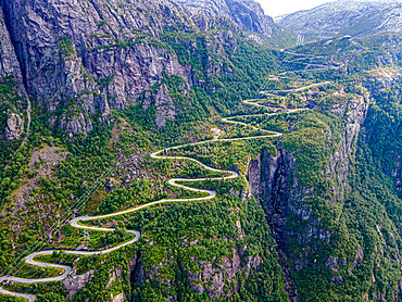
Zigzag road leading down to Lysebodn, at the end of Lystrefjord (Lysefjord), Rogaland, Norway, Scandinavia, Europe
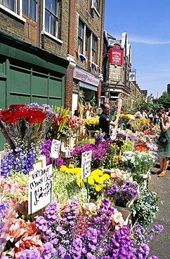
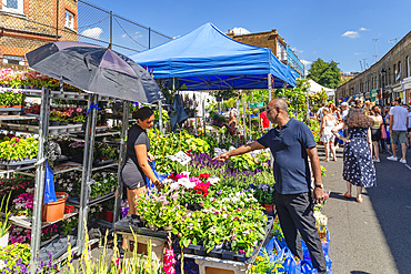
Vibrant displays of cut flowers at East End's Sunday flower market, Columbia Road, London, England, United Kingdom, Europe
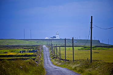
Open road to Loop Head lighthouse at the end of the Loop peninsula, County Clare, West of Ireland
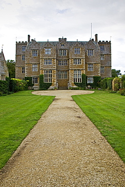
Chastleton House, a Jacobean Manor in the Cotswolds, Oxfordshire, United Kingdom.
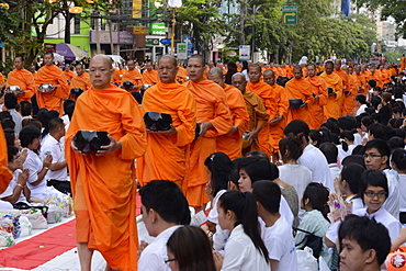
2555 monks gather in Soi 55, Sukhumvit Road to mark the end of Buddhist year 2555, Bangkok, Thailand, Southeast Asia, Asia
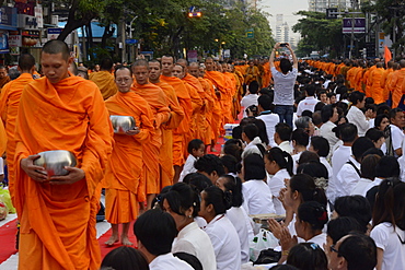
2555 monks gather in Soi 55, Sukhumvit Road to mark the end of Buddhist year 2555, Bangkok, Thailand, Southeast Asia, Asia
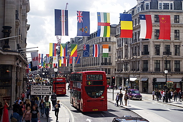
Flags, Regent Street, West End, London, England, United Kingdom, Europe
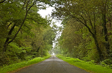
A car travelling down a Frech road
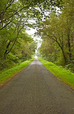
A road in France
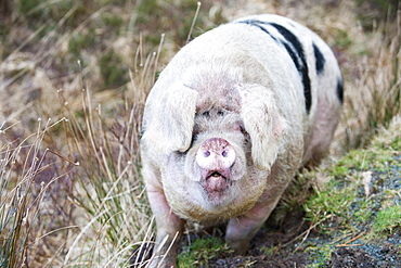
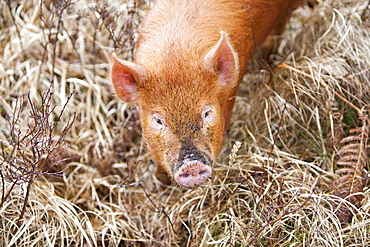
This Gloucester Old Spot Pig has the run of virtually the whole of the Isle of Raasay, but tends to stay on the northern end of the isle on Calums road near Arnish, Isle of Raasay, Scotland, United Kingdom, Europe

This Gloucester Old Spot Pig has the run of virtually the whole of the Isle of Raasay, but tends to stay on the northern end of the isle on Calums road near Arnish, Isle of Raasay, Scotland, United Kingdom, Europe

This Gloucester Old Spot Pig has the run of virtually the whole of the Isle of Raasay, but tends to stay on the northern end of the isle on Calums road near Arnish, Isle of Raasay, Scotland, United Kingdom, Europe
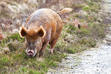
Tamworth Pig that has the run of virtually the whole island, but tends to stay on the northern end of the isle on Calums road near Arnish, Isle of Raasay, Scotland, United Kingdom, Europe
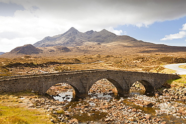
The North end of the Cuillin Ridge on the Isle of Skye, from the old road bridge at Sligachan, Scotland, United Kingdom, Europe

Tamworth Pig that has the run of virtually the whole island, but tends to stay on the northern end of the isle on Calums road near Arnish, Isle of Raasay, Scotland, United Kingdom, Europe
Tamworth Pig that has the run of virtually the whole island, but tends to stay on the northern end of the isle on Calums road near Arnish, Isle of Raasay, Scotland, United Kingdom, Europe
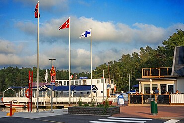
Pizzeria Restaurant in Nagu harbour or Nauvo island in Väståboland in Pargas in Southwest Finland Turku archipelago. The archipelago ring road or Saariston rengastie is full of things to see, do and do. The Archipelago Trail can be taken clockwise or counter clockwise, starting in the historical city of Turku, and continuing through rural archipelago villages and astonishing Baltic Sea sceneries. The Trail can be taken from the beginning of June until the end of August.
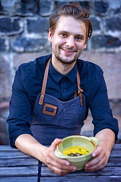
Chef William Hellgren at the fabulous Backpocket Restaurant in Hotel Nestor in Korpo or Korppoo island, Korpostrom coast Southwest Finland Turku archipelago. The archipelago ring road or Saariston rengastie is full of things to see, do and do. The Archipelago Trail can be taken clockwise or counter clockwise, starting in the historical city of Turku, and continuing through rural archipelago villages and astonishing Baltic Sea sceneries. The Trail can be taken from the beginning of June until the end of August.
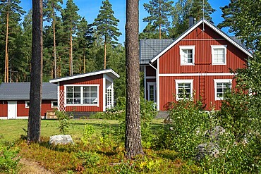
Typical wooden house in in Nagu village or Nauvo island in Väståboland in Pargas in Southwest Finland Turku archipelago. The archipelago ring road or Saariston rengastie is full of things to see, do and do. The Archipelago Trail can be taken clockwise or counter clockwise, starting in the historical city of Turku, and continuing through rural archipelago villages and astonishing Baltic Sea sceneries. The Trail can be taken from the beginning of June until the end of August.
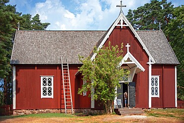
Själö Church in Seili Island in Väståboland in Pargas in Southwest Finland Turku archipelago. The archipelago ring road or Saariston rengastie is full of things to see, do and do. The Archipelago Trail can be taken clockwise or counter clockwise, starting in the historical city of Turku, and continuing through rural archipelago villages and astonishing Baltic Sea sceneries. The Trail can be taken from the beginning of June until the end of August.
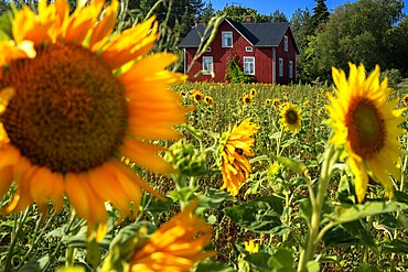
Typical houses and sunflowers field in Korpo or Korppoo island, Korpostrom coast Southwest Finland Turku archipelago. The archipelago ring road or Saariston rengastie is full of things to see, do and do. The Archipelago Trail can be taken clockwise or counter clockwise, starting in the historical city of Turku, and continuing through rural archipelago villages and astonishing Baltic Sea sceneries. The Trail can be taken from the beginning of June until the end of August.
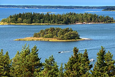
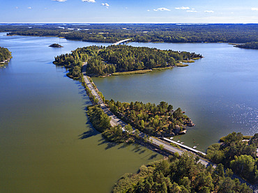
Aerial view of the islands in front Mossala Island Resort Southwest Finland archipelago. The archipelago ring road or Saariston rengastie is full of things to see, do and do. The Archipelago Trail can be taken clockwise or counter clockwise, starting in the historical city of Turku, and continuing through rural archipelago villages and astonishing Baltic Sea sceneries. The Trail can be taken from the beginning of June until the end of August.
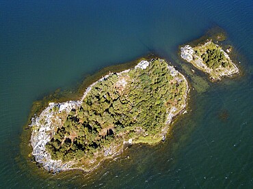
Aerial view of small island in front Mossala Island Resort Southwest Finland archipielago. The archipelago ring road or Saariston rengastie is full of things to see, do and do. The Archipelago Trail can be taken clockwise or counter clockwise, starting in the historical city of Turku, and continuing through rural archipelago villages and astonishing Baltic Sea sceneries. The Trail can be taken from the beginning of June until the end of August.
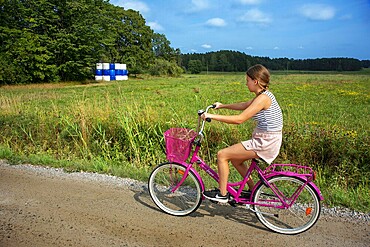
Riding a bicycle in Nagu or Nauvo island in Väståboland in Pargas in Southwest Finland Turku archipelago. The archipelago ring road or Saariston rengastie is full of things to see, do and do. The Archipelago Trail can be taken clockwise or counter clockwise, starting in the historical city of Turku, and continuing through rural archipelago villages and astonishing Baltic Sea sceneries. The Trail can be taken from the beginning of June until the end of August.
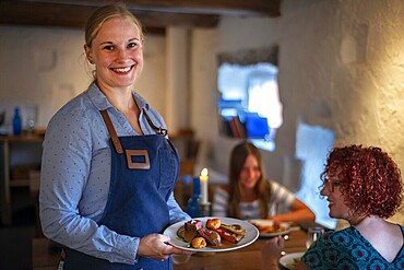
Backpocket Restaurant in Hotel Nestor in Korpo or Korppoo island, Korpostrom coast Southwest Finland Turku archipelago. The archipelago ring road or Saariston rengastie is full of things to see, do and do. The Archipelago Trail can be taken clockwise or counter clockwise, starting in the historical city of Turku, and continuing through rural archipelago villages and astonishing Baltic Sea sceneries. The Trail can be taken from the beginning of June until the end of August.
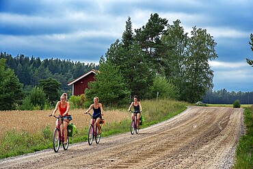
Riding a bicycle in Nagu or Nauvo island in Väståboland in Pargas in Southwest Finland Turku archipelago. The archipelago ring road or Saariston rengastie is full of things to see, do and do. The Archipelago Trail can be taken clockwise or counter clockwise, starting in the historical city of Turku, and continuing through rural archipelago villages and astonishing Baltic Sea sceneries. The Trail can be taken from the beginning of June until the end of August.
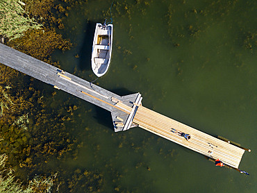
Aerial view of small dock in Korpo or Korppoo island, Korpostrom coast Southwest Finland Turku archipelago. The archipelago ring road or Saariston rengastie is full of things to see, do and do. The Archipelago Trail can be taken clockwise or counter clockwise, starting in the historical city of Turku, and continuing through rural archipelago villages and astonishing Baltic Sea sceneries. The Trail can be taken from the beginning of June until the end of August.
Aerial view of Kustavi small islands in Southwest Finland archipielago. The archipelago ring road or Saariston rengastie is full of things to see, do and do. The Archipelago Trail can be taken clockwise or counter clockwise, starting in the historical city of Turku, and continuing through rural archipelago villages and astonishing Baltic Sea sceneries. The Trail can be taken from the beginning of June until the end of August.
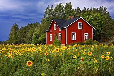
Typical houses and sunflowers field in Korpo or Korppoo island, Korpostrom coast Southwest Finland Turku archipelago. The archipelago ring road or Saariston rengastie is full of things to see, do and do. The Archipelago Trail can be taken clockwise or counter clockwise, starting in the historical city of Turku, and continuing through rural archipelago villages and astonishing Baltic Sea sceneries. The Trail can be taken from the beginning of June until the end of August.
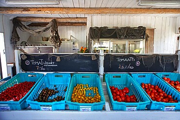
Fresh tomatoes in Isaksson���s farm on the road to the Korpo ferry in Houtskv�r in an array of colours at the farm shop. There are no staff here, simply weigh your vegetables and place the appropriate amount in the moneybox. Southwest Finland archipelago near Kustavin Savipaja. The archipelago ring road or Saariston rengastie is full of things to see, do and do. The Archipelago Trail can be taken clockwise or counter clockwise, starting in the historical city of Turku, and continuing through rural archipelago villages and astonishing Baltic Sea sceneries. The Trail can be taken from the beginning of June until the end of August.
Southwest Finland archipelago near Kustavin Savipaja. The archipelago ring road or Saariston rengastie is full of things to see, do and do. The Archipelago Trail can be taken clockwise or counter clockwise, starting in the historical city of Turku, and continuing through rural archipelago villages and astonishing Baltic Sea sceneries. The Trail can be taken from the beginning of June until the end of August.
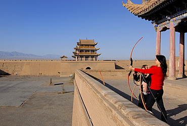
Chinese woman using a bow and arrow at the Jiayuguan Fortress with two gatehouses at the western end of the Great Wall of China, Silk Road, Gansu, China, Asia
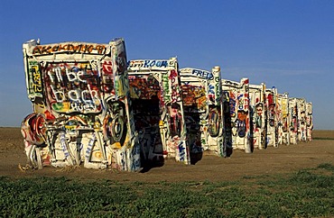
Cadillac Ranch, Amarillo, Texas, USA
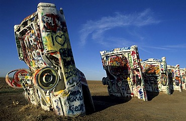
Cadillac Ranch, Amarillo, Texas, USA
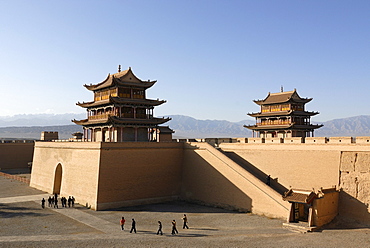
Jiayuguan fortress with two gatehouses at the western end of the Great Wall, Silk Road, Gansu, China, Asia
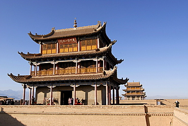
Jiayuguan fortress at the western end of the Great Wall, Silk Road, Gansu, China, Asia
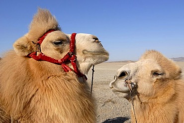
Camels with winter coat and bridles at the Jiayuguan fortress at the western end of the Great Wall, Silk Road, Gansu, China, Asia
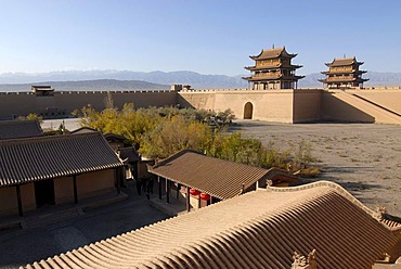
Jiayuguan fortress with two gatehouses at the western end of the Great Wall with trees in autumn colours, Silk Road, Gansu, China, Asia
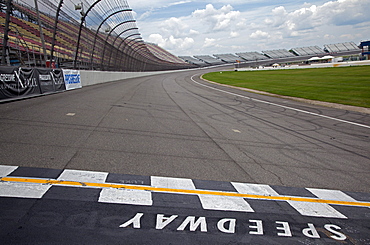
The start - finish line at Michigan International Speedway which features a two-mile race track and seats nearly 120, 000 fans for NASCAR races, Brooklyn, Michigan, USA, America
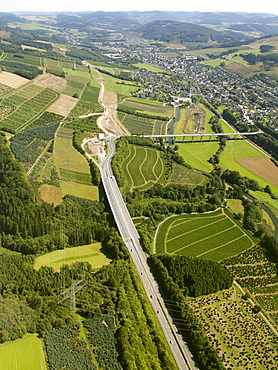
Aerial view, extension of the A46 motorway, highway expansion, end of the motorway, A445 motorway near Bestwig, Meschede, North Rhine-Westphalia, Germany, Europe

Pedestrians walking on wet road at night, reflection of neon light, West End, London, Great Britain
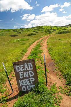
Dead end keep out sign on wire fence at dirt road

Aerial view, extension of the A46 motorway, highway expansion, end of the motorway, A445 motorway near Bestwig, Meschede, North Rhine-Westphalia, Germany, Europe
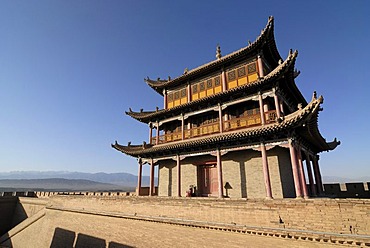
Jiayuguan fortress with gatehouse at the western end of the Great Wall, Silk Road, Gansu, China, Asia
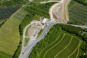
Aerial view, extension of the A46 motorway, highway expansion, end of the motorway, A445 motorway near Bestwig, Meschede, North Rhine-Westphalia, Germany, Europe
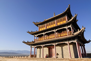
Jiayuguan fortress with gatehouse at the western end of the Great Wall, Silk Road, Gansu, China, Asia
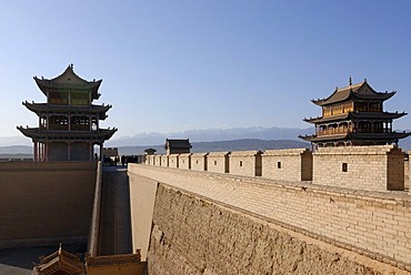
Jiayuguan fortress with two gatehouses at the western end of the Great Wall, Silk Road, Gansu, China, Asia
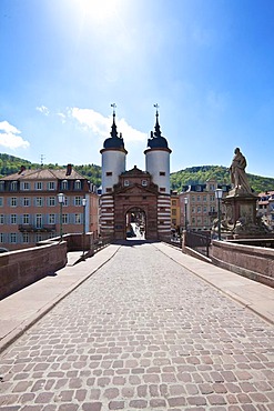
Old bridge gate at the south end of the Karl-Theodor Bridge or Old Bridge, Alte Bruecke, Heidelberg, Neckar, Baden-Wuerttemberg, Germany, Europe

Lantern and parked gondolas at the end of Piazza San Marco with a view of the Basilica of San Giorgio Maggiore, Venice, Veneto, Italy, Europe
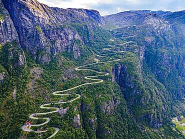
Zigzag road leading down to Lysebodn, at trhe end of Lystrefjord, Norway, Europe
Zigzag road leading down to Lysebodn, at trhe end of Lystrefjord, Norway, Europe
Zigzag road leading down to Lysebodn, at trhe end of Lystrefjord, Norway, Europe

Light at the end of the tunnel, South Tyrol, Italy
Zigzag road leading down to Lysebodn, at trhe end of Lystrefjord, Norway, Europe
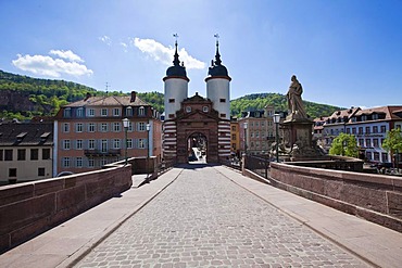
Old bridge gate at the south end of the Karl-Theodor Bridge or Old Bridge, Alte Bruecke, Heidelberg, Neckar, Baden-Wuerttemberg, Germany, Europe
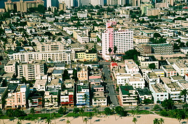
South end of Miami Beath where Art Deco Hotels are located, Florida

Entrance arch to Santa Monica Pier, from the Pacific Coast Highway. A popular excursion spot for more than a century, the Santa Monica Pier draws crowds daily. From Wikipedia: "The Santa Monica Pier is a large double-jointed pier located at the foot of Colorado Avenue in Santa Monica, California and is a prominent, 100-year-old landmark. The pier contains Pacific Park, a family amusement park with its one-of-a-kind, state-of-the-art, solar paneled Ferris wheel. It also has an original carousel hippodrome from the 1920s, the Santa Monica Pier Aquarium operated by Heal the Bay, shops, entertainers, a video arcade, a trapeze school, pubs, and restaurants. The west end of the pier is a popular location for anglers.
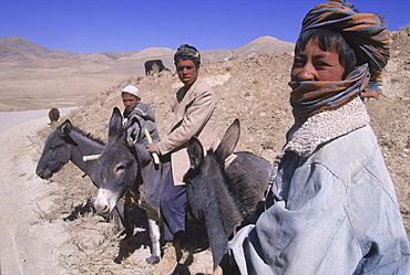
Young boys on donkeys watch over flocks of goats, sheep and donkeys near the top of the Shebar Pass, which crosses into the Province of Bamiyan. Due to a devastating drought in the region, dry wheat farming has failed for three years from 1998-2002 and the forage is extremely sparse, The pass is a strategic point leading into the Central Highlands, the Koh-i-Baba range and the Hazarajat, at the end of the Hindu Kush. Most of the people of this region are of the Hazara tribe, and are Shi'a Moslems who have been persecuted for centuries by many of the Pashtun rulers of Afghanistan, who are from the Sunni sect.
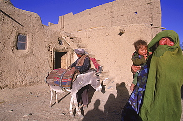
Striking Mongol features distinguish the face of a woman and her child (who is blind) living in the ruins of the Qala-i-Dokthar (Daughter's Castle), outside of the town of Bamiyan, August 30, 2002. Most of the old town was destroyed and up to 20,000 people of the region might have perished when Bamiyan fell to the Taliban in 2001. Bamiyan Valley is located in the Hazarajat at the edge of the Koh-i-Baba range , the end of the Hindu Kush. Bamiyan was a prosperous Buddhist kingdom on the ancient Silk Road until the 10th century, when the region was converted to Islam; in the 12th century, it was destroyed by Ghengis Khan. Most of the people of this region are of the Hazara tribe, and are Shi'a Moslems who have been persecuted for centuries by many of the Pashtun rulers of Afghanistan, who are from the Sunni sect. They most recently suffered at the hand of the Taliban, who tried for years to ethnically cleanse the region of its Shi'a people.
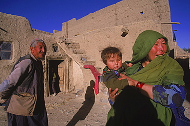
Striking Mongol features distinguish the face of Hamir Mohammed, his daughter and grandson (who is blind), all living in the ruins of the Qala-i-Dokthar (Daughter's Castle), outside of the town of Bamiyan, August 30, 2002. Most of the old town was destroyed and up to 20,000 people of the region might have perished when Bamiyan fell to the Taliban in 2001. Bamiyan Valley is located in the Hazarajat at the edge of the Koh-i-Baba range , the end of the Hindu Kush. Bamiyan was a prosperous Buddhist kingdom on the ancient Silk Road until the 10th century, when the region was converted to Islam; in the 12th century, it was destroyed by Ghengis Khan. Most of the people of this region are of the Hazara tribe, and are Shi'a Moslems who have been persecuted for centuries by many of the Pashtun rulers of Afghanistan, who are from the Sunni sect. They most recently suffered at the hand of the Taliban, who tried for years to ethnically cleanse the region of its Shi'a people
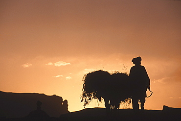
A farmer with his donkey loaded with forage walks toward the setting sun above the town of Bamiyan, August 30, 2002. Most of the old town was destroyed and up to 20,000 people of the region might have perished when Bamiyan fell to the Taliban in 2001. Bamiyan Valley is located in the Hazarajat at the edge of the Koh-i-Baba range , the end of the Hindu Kush. Bamiyan was a prosperous Buddhist kingdom on the ancient Silk Road until the 10th century, when the region was converted to Islam; in the 12th century, it was destroyed by Ghengis Khan. Most of the people of this region are of the Hazara tribe, and are Shi'a Moslems who have been persecuted for centuries by many of the Pashtun rulers of Afghanistan, who are from the Sunni sect. They most recently suffered at the hand of the Taliban, who tried for years to ethnically cleanse the region of its Shi'a people
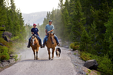
Horseback riders ride through a forested section near the northern end of the Medicine Bow Rail Trail that winds through the Medicine Bow National Forest outside of Laramie, Wyoming

A Road And Trees Covered With Deep Snow And A Yellow Sign Saying Dead End, Alaska, United States Of America
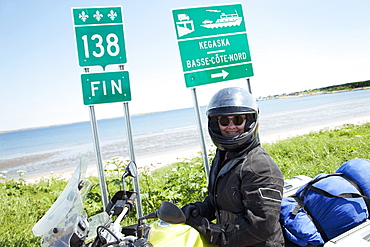
The End Of Road 138 On Motorcycle, Kagaska, Quebec, Canada
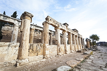
The Latrine, Built Prior To The End Of The First Century A.d. When It Collapsed Due To An Earthquake, Pamukkale, Turkey
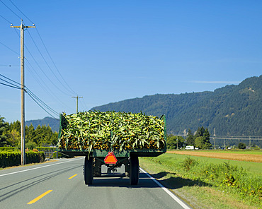
Back end of tractor carrying a load of harvested cornstalks (Zea Mays) on a highway driving through the countryside; Yarrow, British Columbia, Canada

Long Bien Bridge; Hanoi, Vietnam
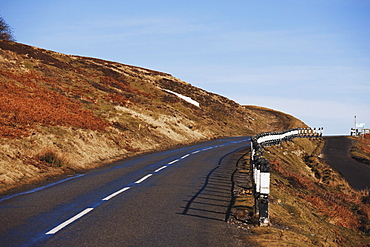
Hill End, County Durham, England; A Road Through The Hills

Country Road At Sunset