Results
1 2 3 … 11 Next »
1066 results found
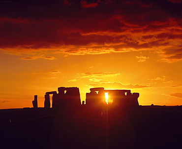
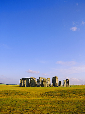
Stonehenge, Ancient ruins, Wiltshire, England, UK, Europe
Stonehenge, Ancient ruins, Wiltshire, England, UK, Europe
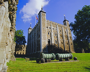
The White Tower, Tower of London, London, England, UK
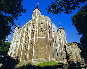
The White Tower, Tower of London, London, England, UK, Europe
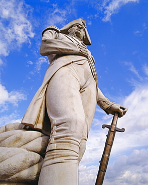
Nelson's Column, Trafalgar Square, London, England, UK, Europe
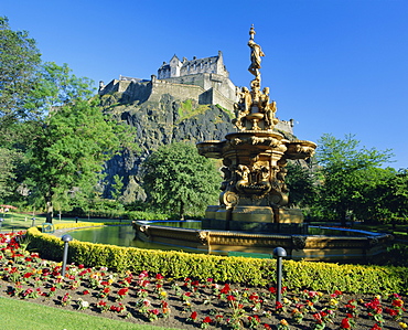
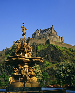
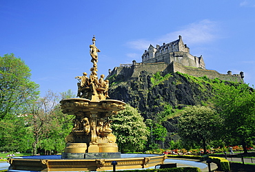
The Castle from Princes Street Gardens, Edinburgh, Lothian, Scotland, UK, Europe
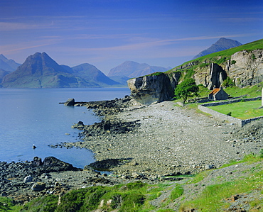
Elgol and the Cuillin Hills, Isle of Skye, Highlands Region, Scotland, UK, Europe
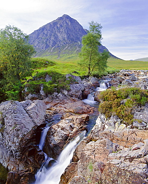
Beauchaille Etive, Glencoe (Glen Coe), Highlands Region, Scotland, UK, Europe
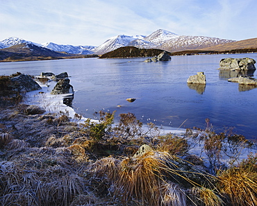
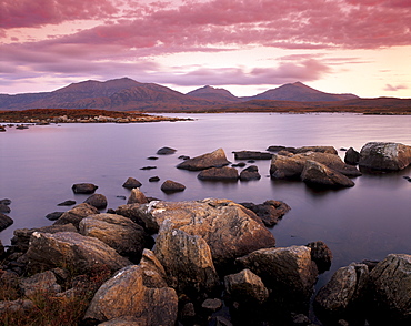
Lochan na h-Achlaise, Rannoch Moor, Strathclyde, Highlands Region, Scotland, UK, Europe
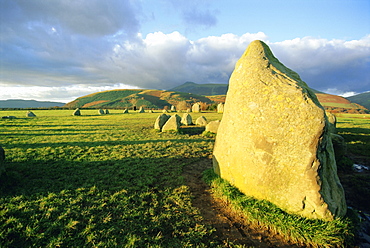
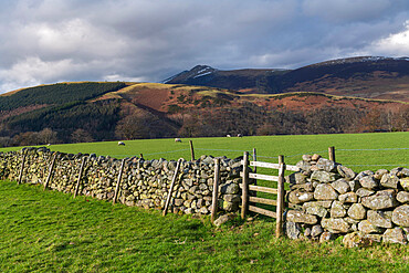
The prehistoric Castlerigg Stone Circle, Keswick, Lake District, Cumbria, England, UK
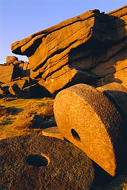
Millstones, Stanage Edge, Peak District National Park, Derbyshire, England, UK
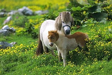
Two Shetland ponies, Shetland Islands, Scotland, UK, Europe
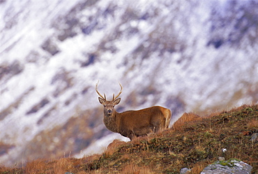
Red deer stag in the Highlands in February, Highland Region, Scotland, UK, Europe
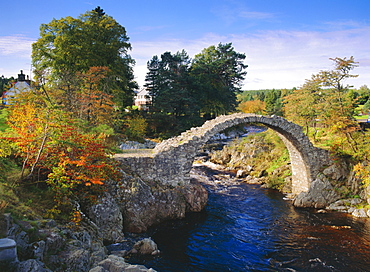
Old Bridge of Carr, Carrbridge, Highlands Region, Scotland, UK, Europe
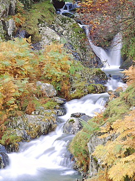
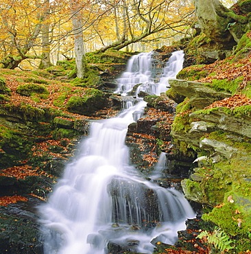
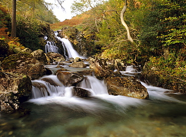
Stream tumbling over rocks, Lake District, Cumbria, England, UK, Europe
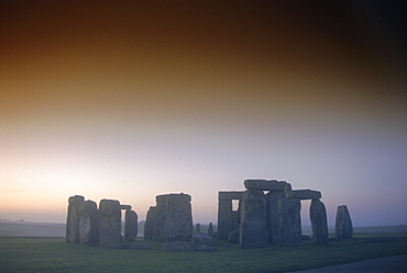
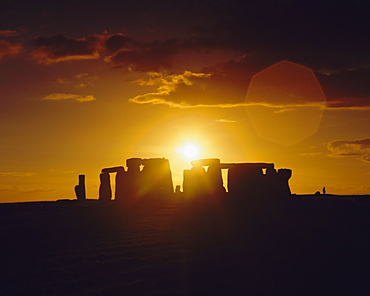
Standing stone circle at sunrise, Stonehenge, Wiltshire, England, UK, Europe
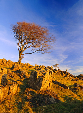
Bare tree on stony outcrop, Parwich, Hartington, Peak District National Park, Derbyshire, England, UK, Europe
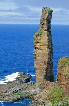
The Old Man of Hoy, sandstone sea stack 137m high, Hoy, Orkney Islands, Scotland, UK
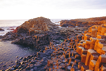
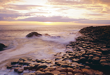
Giant's Causeway, County Antrim, Northern Ireland, UK, Europe
Giant's Causeway, County Antrim, Northern Ireland, UK, Europe
Birks of Aberfeldy, Tayside, Scotland, UK, Europe
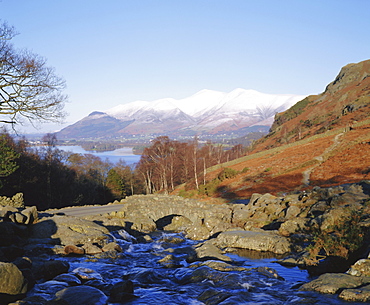
Ashness Bridge, Skiddaw in the background, Lake District National Park, Cumbria, England, UK
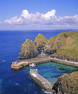
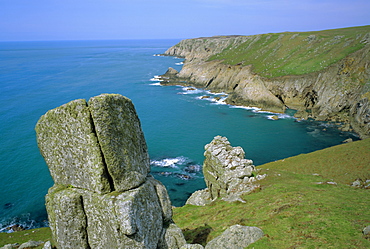
Mullion Cove, Cornwall, England, UK
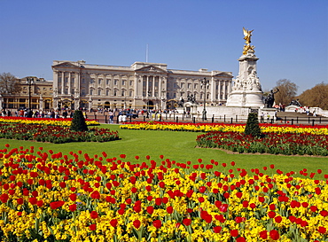
Buckingham Palace, London, England, UK
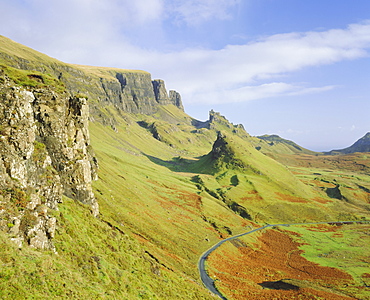
The Quiraing, Isle of Skye, Highlands Region, Scotland, UK, Europe
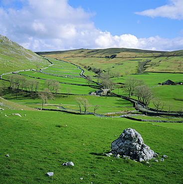
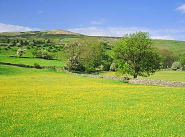
Malhamdale (Malham Dale), Yorkshire Dales National Park, North Yorkshire, England, UK, Europe
Stonehenge, Ancient ruins, Wiltshire, England, UK, Europe
The Giant's Causeway, County Antrim, Ulster, Northern Ireland, UK, Europe
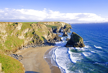
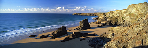
Bedruthan Steps, north coast, Cornwall, England, UK
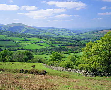
Fields in the valleys near Brecon, Powys, Wales, UK, Europe
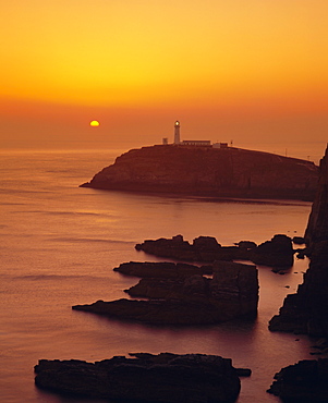
South Stack at sunset, Anglesey, Gwynedd, North Wales, UK, Europe

Edinburgh Castle, Edinburgh, Lothian, Scotland, UK, Europe
Edinburgh Castle, Edinburgh, Scotland, UK, Europe
Edinburgh Castle, Edinburgh, Lothian, Scotland, UK, Europe
Jenny's Cove, Lundy Island, Devon, England, UK
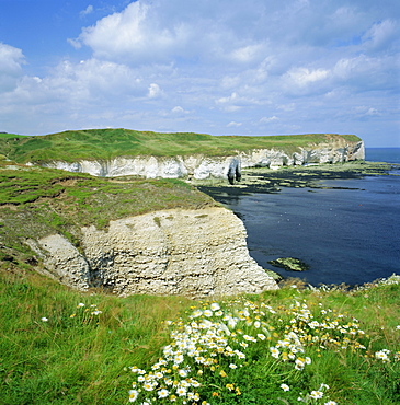
Selwicks Bay, Flamborough Head, coast of Humberside, England, UK, Europe
Wild flower meadow, Swaledale, Yorkshire Dales National Park, North Yorkshire, England, UK, Europe
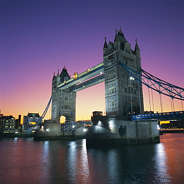
Evening, Tower Bridge and River Thames, London, England, UK, Europe
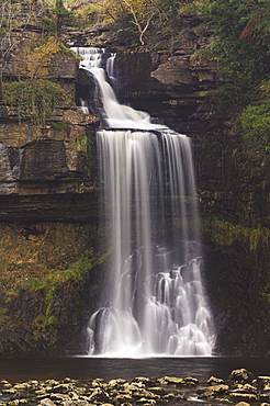
Waterfall, Mosedale Beck, Wastwater, Lake District, Cumbria, England, UK, Europe

Grange and River Derwent, Lake District National Park, Cumbria, England, UK, Europe
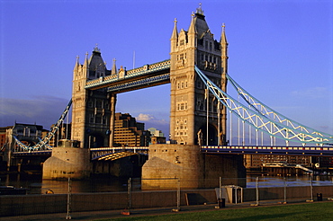
Tower Bridge, London, England, UK, Europe
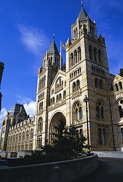
The Natural History Museum, South Kensington, London, England, UK, Europe
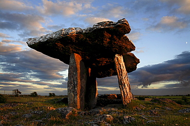
Poulnabrone dolmen megalithic tomb, Burren, County Clare, Munster, Republic of Ireland (Eire), EuropeThe Burren (from Irish: Boireann, meaning - great rock) is a unique karst landscape in northwest County Clare, Ireland. The limestone area measures 300 square kilometres and is roughly enclosed within the circle comprised by the villages Ballyvaughan, Kinvarra, Gort, Corrofin, Kilfenora, Lisdoonvarna and the Black Head lighthouse. The definitive article (ie "The" Burren) has only been added to the name by academics in the last few decades as it has always been traditionally called Boireann or Boirinn in Irish and Burren in English.
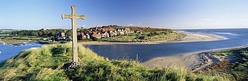
View of the village of Alnmouth with River Aln flowing into the North Sea, fringed by beautiful beaches, near Alnwick, Northumberland, England, United Kingdom, Europe
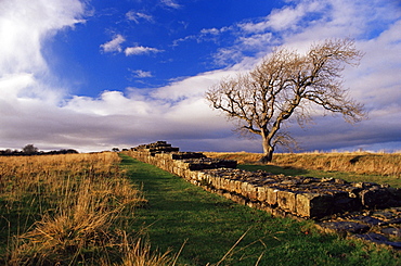
Black Carts, Roman Wall, Hadrian's Wall, UNESCO World Heritage Site, Northumberland (Northumbria), England, United Kingdom, Europe
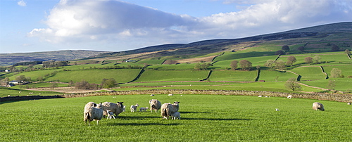
Sheep with lambs in fields below the high Pennines, Eden Valley, Cumbria, England, United Kingdom, Europe
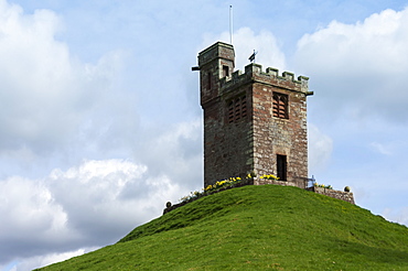
Bell Tower of St. Oswalds Church, situated on a hill above the Church, Kirkoswald, Eden Valley, Cumbria, England, United Kingdom, Europe
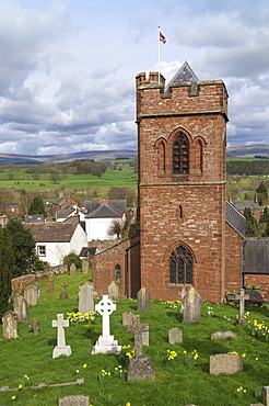
St. Nicholas Church, mid 19th century, Crucifixion Window by Mayer of Munich, Lazonby Village, Pennine Ridge beyond, Eden Valley, Cumbria, England, United Kingdom, Europe
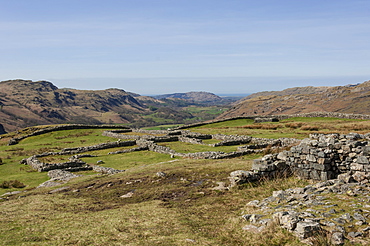
Hardknott Roman Fort interior looking west along the Eskdale Valley to the Solway Firth, South Lakes, Lake District National Park, Cumbria, England, United Kingdom, Europe
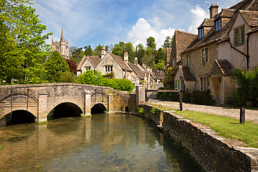
Cotswold cottages on By Brook, Castle Combe, Cotswolds, Wiltshire, England, United Kingdom, Europe
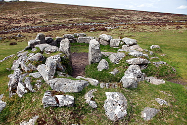
Ruins of early Bronze Age house, about 3500 years old, Grimspound, Dartmoor National Park, Devon, England, United Kingdom, Europe
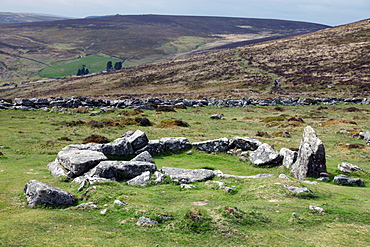
Ruins of early Bronze Age house, about 3500 years old, Grimspound, Dartmoor National Park, Devon, England, United Kingdom, Europe
The Old Mill Museum and stone bridge over River Eye, Lower Slaughter, Cotswolds, Gloucestershire, England, United Kingdom, Europe
Cotswold stone cottages, Snowshill, Cotswolds, Gloucestershire, England, United Kingdom, Europe
Higher Tor on Belstone Ridge on a winter morning, Dartmoor, Devon, England, United Kingdom, Europe
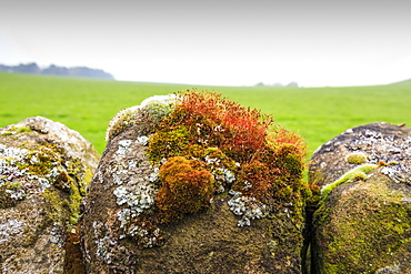
Moss and lichen on a dry stone wall near Elton on a murky spring day, Peak District National Park, Derbyshire, England, United Kingdom, Europe
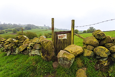
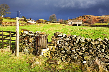
Footpath gate and dry stone wall near Elton on a murky spring day, Peak District National Park, Derbyshire, England, United Kingdom, Europe
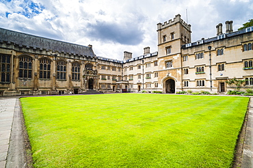
Exeter College, University of Oxford, Oxfordshire, England, United Kingdom, Europe
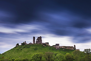
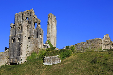
Corfe Castle at night, Corfe, Dorset, England, United Kingdom, Europe
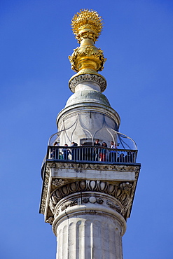
The Monument to the Great Fire of London of 1666, by Sir Christopher Wren and Robert Hooke, City of London, England, United Kingdom, Europe
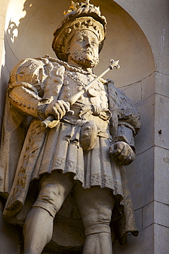
Henry VIII Statue at the Gatehouse of St. Bartholomews Hospital (Bart's) in West Smithfield, London, England, United Kingdom, Europe
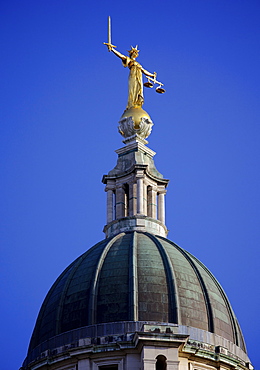
Scales of Justice above the Old Bailey Law Courts (Central Criminal Court) on former site of Newgate Prison, London, England, United Kingdom, Europe
Thornton Force, Ingleton waterfalls walk, Yorkshire Dales National Park, North Yorkshire, Yorkshire, England, United Kingdom, Europe
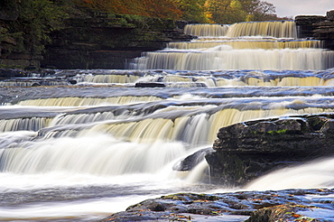
Lower Aysgarth Falls and autumn colours, near Hawes, Wensleydale, Yorkshire Dales National Park, North Yorkshire, Yorkshire, England, United Kingdom, Europe
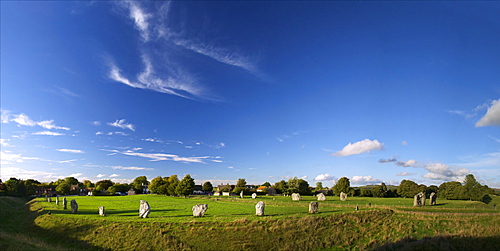
Panoramic photo of Megalithic stone circle, Avebury, UNESCO World Heritage Site, Wiltshire, England. United Kingdom, Europe
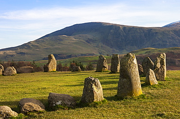
Castlerigg Stone Circle, a 40 stone circle from 3200 BC, Keswick, Lake District National Park, Cumbria, England, United Kingdom, Europe
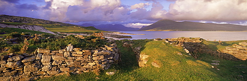
View towards Isle of Lewis from ruins of Blackhouses, Paible, Taransay, Outer Hebrides, Scotland, United Kingdom, Europe
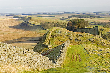
Looking east from Holbank Crags showing course of the Roman wall past Housesteads Wood to Sewingshields Crag, Hadrian's Wall, UNESCO World Heritage Site, Northumbria (Northumberland), England, United Kingdom, Europe
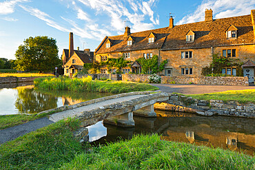
Stone bridge and cotswold cottages on River Eye, Lower Slaughter, Cotswolds, Gloucestershire, England, United Kingdom, Europe
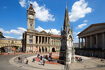
Birmingham Museum and Art Gallery and Town Hall, Chamberlain Square, Birmingham, West Midlands, England, United Kingdom, Europe
Dry stone wall and grazing sheep, Lake District National Park, UNESCO World Heritage Site, Cumbria, England, United Kingdom, Europe
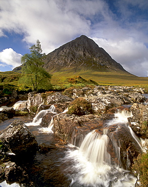
Waterfall on River Coupall, Buachaille Etive Mor in background, Glen Etive, near Glencoe, Highland region, Scotland, United Kingdom, Europe
Loch Druidibeg Nature Reserve at sunset, with Hecla, Ben Corodale and Beinn Mhor behind, South Uist, Outer Hebrides, Scotland, United Kingdom, Europe
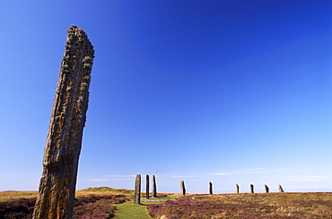
Ring of Brodgar, stone circle dating from between 2500 and 2000 BC, 27 out of 60 stones still standing, UNESCO World Heritage Site, Mainland, Orkney islands, Scotland, United Kingdom, Europe
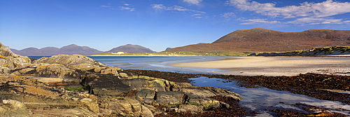
Traigh Luskentyre (Luskentyre beach) from Seilebost, west coast of South Harris, Harris, Outer Hebrides, Scotland, United Kingdom, Europe
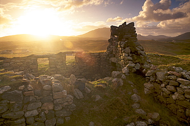
Old blackhouse ruin near Timsgarry (Timsgearraidh) at sunset, Isle of Lewis, Outer Hebrides, Scotland, United Kingdom, Europe
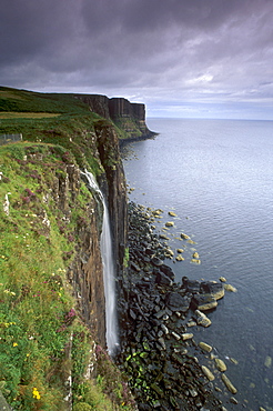
Kilt Rock, famous basaltic cliff near Staffin, Trotternish, Isle of Skye, Inner Hebrides, Highland region, Scotland, United Kingdom, Europe
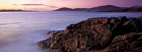
Sunset over Sound of Taransay, west coast of South Harris, Outer Hebrides, Scotland, United Kingdom, Europe

Traigh Luskentyre (Luskentyre beach) from Seilebost, west coast of South Harris, Harris, Outer Hebrides, Scotland, United Kingdom, Europe
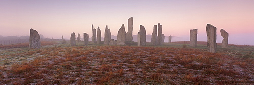
Callanish (Callanais) Stone Circle dating from Neolithic period between 3000 and 1500 BC, at dawn, Isle of Lewis, Outer Hebrides, Scotland, United Kingdom, Europe
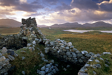
Old blackhouse ruin near Timsgarry (Timsgearraidh) at sunset, Isle of Lewis, Outer Hebrides, Scotland, United Kingdom, Europe
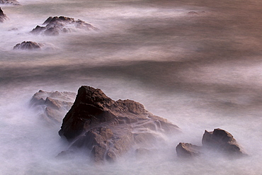
Rocks and water, west coast of Lewis, Isle of Lewis, Outer Hebrides, Scotland, United Kingdom, Europe
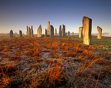
Callanish (Callanais) Stone Circle dating from Neolithic period between 3000 and 1500 BC, at dawn, Isle of Lewis, Outer Hebrides, Scotland, United Kingdom, Europe
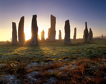
Callanish (Callanais) Standing Stones, erected by Neolithic people between 3000 and 1500 BC, Isle of Lewis, Outer Hebrides, Scotland, United Kingdom, Europe
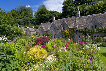
Traditional Cotswold stone cottages with colourful flower gardens, Bibury, Gloucestershire, Cotswolds, England, United Kingdom, Europe
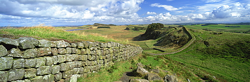
View along Hadrian's Wall from Hotbank Crags, UNESCO World Heritage Site, near Hexham, Northumberland, England, United Kingdom, Europe
Widemouth Bay at sunrise, with offshore rocks and red storm clouds overhead, near Bude, Cornwall, England, United Kingdom, Europe
View of Bedruthan Steps and beach, near Newquay, Cornwall, England, United Kingdom, Europe
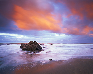
Widemouth Bay at sunrise, with offshore rocks and red storm clouds overhead, near Bude, Cornwall, England, United Kingdom, Europe
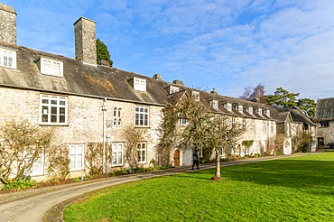
Historic medieval buildings in courtyard of Great Hall, Dartington Hall estate, south Devon, England, United Kingdom, Europe
Stile in a dry stone wall at Storiths, North Yorkshire, Yorkshire, England, United Kingdom, Europe
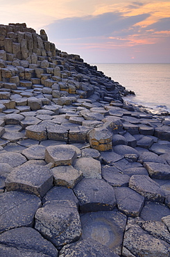
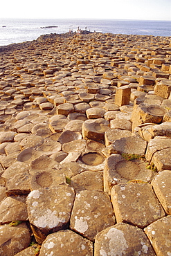
Hexagonal basalt columns of the Giant's Causeway, UNESCO World Heritage Site, and Area of Special Scientific Interest, near Bushmills, County Antrim, Ulster, Northern Ireland, United Kingdom, Europe
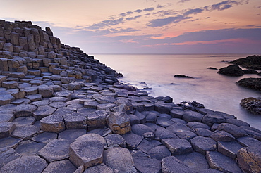
Hexagonal basalt columns of the Giant's Causeway, UNESCO World Heritage Site, and Area of Special Scientific Interest, near Bushmills, County Antrim, Ulster, Northern Ireland, United Kingdom, Europe
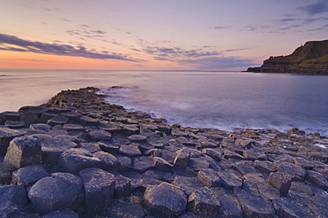
Hexagonal basalt columns of the Giant's Causeway, UNESCO World Heritage Site and Area of Special Scientific Interest, near Bushmills, County Antrim, Ulster, Northern Ireland, United Kingdom, Europe
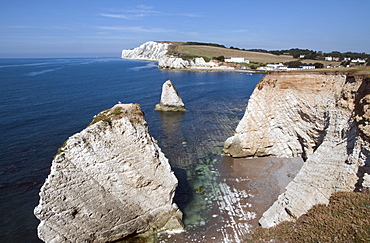
Freshwater Bay and Tennyson Down from Afton Down, Isle of Wight, England, United Kingdom, Europe
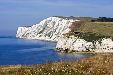
Tennyson Down, Black Rock and Highdown Cliffs from Freshwater Bay, Isle of Wight, England, United Kingdom, Europe
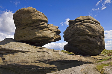
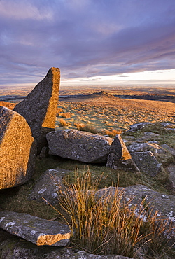
The Wain Stones (Kissing Stones) on Bleaklow Moor, on the Pennine Way footpath, Peak District National Park, Derbyshire, England, United Kingdom, Europe
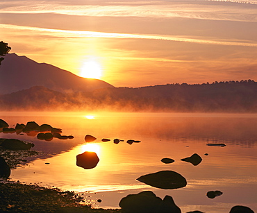
Mist rising on Derwent Water at sunrise, Lake District National Park, Cumbria, England, United Kingdom, Europe
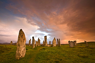
Standing Stones of Callanish at dawn, Callanish, near Carloway, Isle of Lewis, Outer Hebrides, Scotland, United Kingdom, Europe
Corfe Castle, Isle of Purbeck, Dorset, England, United Kingdom, Europe