Results
50 results found
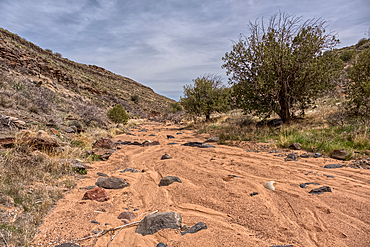
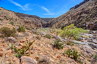
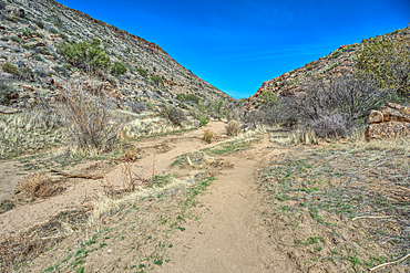
Silver Creek Canyon in the Agua Fria National Monument, Black Canyon City Arizona, USA
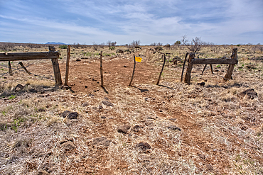
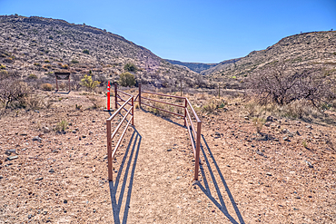
An entry gate to Silver Creek Canyon in Agua Fria National Monument Arizona, USA
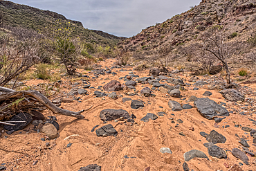
Silver Creek Canyon in the Agua Fria National Monument, Black Canyon City Arizona, USA
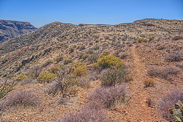
Silver Creek Canyon in the Agua Fria National Monument. Located north of Black Canyon City Arizona
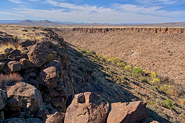
Silver Creek Canyon in the Agua Fria National Monument. Located north of Black Canyon City Arizona
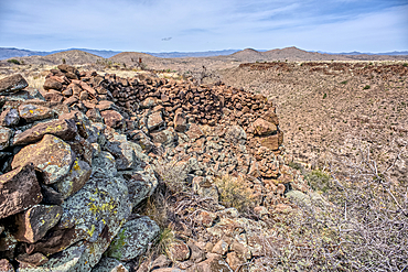
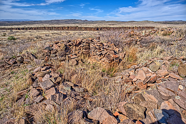
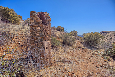
Ancient wall of the Fort Silver Indian Ruins overlooking Silver Creek Canyon in Agua Fria National Monument of Arizona
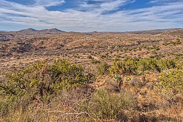
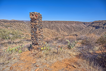
The Pueblo La Plata Indian Ruins near Silver Creek Canyon in the Agua Fria National Monument of Arizona. Located north of Black Canyon City
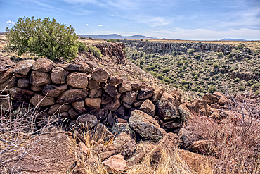
Ancient wall of the Fort Silver Indian Ruins overlooking Silver Creek Canyon in Agua Fria National Monument of Arizona
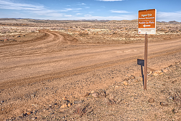
Road sign along Bloody Basin Road in the Agua Fria National Monument of Arizona directing the way to the Pueblo La Plata Indian Ruins
The primitive Bloody Basin Road winding thru the Agua Fria National Monument north of Black Canyon City Arizona
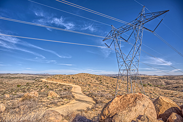
High Tension Power Lines stretching across Bloody Basin in Agua Fria National Monument north of Black Canyon City Arizona
Look back up the freeway exit ramp for Bloody Basin Road in the Agua Fria National Monument of Arizona, Black Canyon City, USA
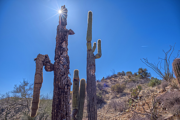
A Saguaro covered scenic ridge overlooking the Agua Fria River in the Agua Fria National Monument of Arizona, USA
Path leading to a scenic overlook in the Agua Fria National Monument near the abandoned Richinbar Mine, Arizona, USA
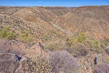
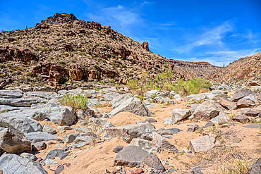
The Agua Fria River Canyon in the Agua Fria National Monument north of Black Canyon City Arizona, USA
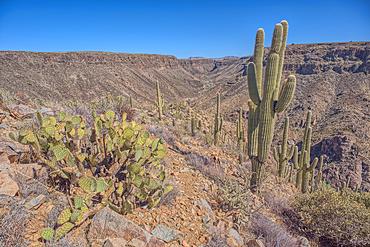
A Saguaro covered scenic ridge overlooking the Agua Fria River in the Agua Fria National Monument of Arizona, USA
Remnants of the Richinbar Mine within the Agua Fria National Monument, Black Canyon City, Arizona, USA
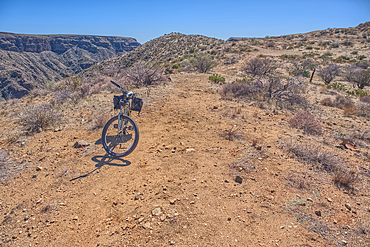
A bicycle parked near the abandoned Richinbar Mine in the Agua Fria National Monument, Arizona, USA
Remnants of the Richinbar Mine within the Agua Fria National Monument, Black Canyon City, Arizona, USA
Remnants of the Richinbar Mine within the Agua Fria National Monument, Black Canyon City, Arizona, USA
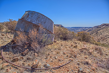
Remnants of the Richinbar Mine within the Agua Fria National Monument, Black Canyon City, Arizona, USA
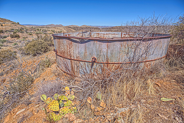
Remnants of the Richinbar Mine within the Agua Fria National Monument, Black Canyon City, Arizona, USA
Remnants of the Richinbar Mine within the Agua Fria National Monument, Black Canyon City, Arizona, USA
Remnants of the Richinbar Mine within the Agua Fria National Monument, Black Canyon City, Arizona, USA
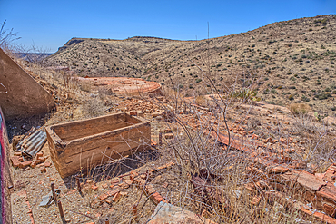
Remnants of the Richinbar Mine within the Agua Fria National Monument, Black Canyon City, Arizona, USA
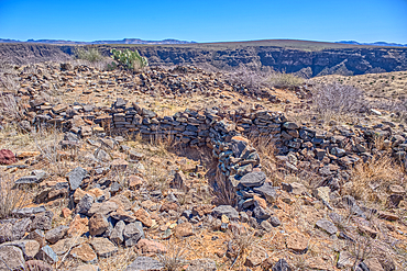
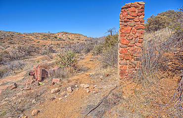
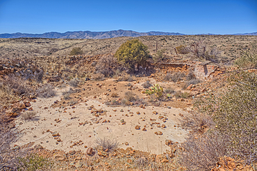
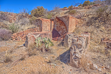
Ancient Indian Ruins near the historic Richinbar Mine in the Agua Fria National Monument, Black Canyon City, Arizona, USA
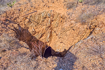
Open mine shaft at the Richinbar Mine within the Agua Fria National Monument, Black Canyon City, Arizona, USA
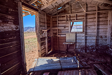
An abandoned cabin next to an active cattle corral in the Agua Fria National Monument, Black Canyon City, Arizona, USA
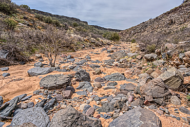
The granite riverbed of the Agua Fria River Canyon in the Agua Fria National Monument of Arizona.
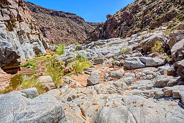
The granite riverbed of the Agua Fria River Canyon in the Agua Fria National Monument of Arizona.
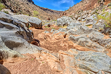
The granite riverbed of the Agua Fria River Canyon in the Agua Fria National Monument of Arizona.
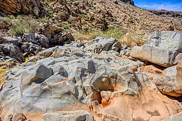
The granite riverbed of the Agua Fria River Canyon in the Agua Fria National Monument of Arizona.
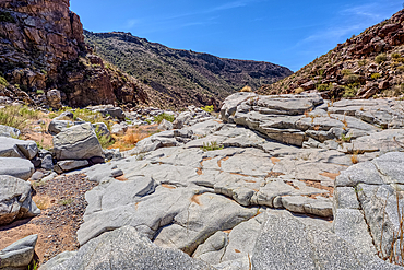
The granite riverbed of the Agua Fria River Canyon in the Agua Fria National Monument of Arizona.
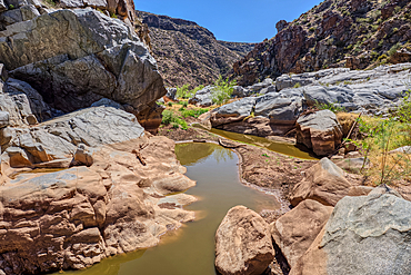
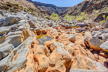
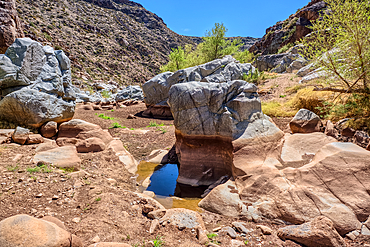
An ephemeral pool of water in the granite riverbed of the Agua Fria River Canyon in the Agua Fria National Monument of Arizona.
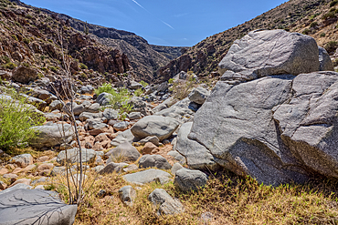
The granite riverbed of the Agua Fria River Canyon in the Agua Fria National Monument of Arizona.
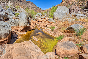
An ephemeral pool of water in the granite riverbed of the Agua Fria River Canyon in the Agua Fria National Monument of Arizona.
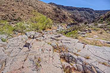
The granite riverbed of the Agua Fria River Canyon in the Agua Fria National Monument of Arizona.
The granite riverbed of the Agua Fria River Canyon in the Agua Fria National Monument of Arizona.
Entrance to the Badger Springs Trailhead in the Agua Fria National Monument of Arizona.
Badger Springs Creek Canyon in the Agua Fria National Monument of Arizona.
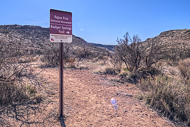
Sign marking the Badger Springs Trail in the Agua Fria National Monument of Arizona.
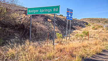
Sign marking Badger Springs Road off of I-17 Arizona. This road leads to a hiking trail in the Agua Fria National Monument.
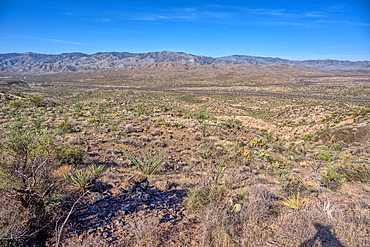
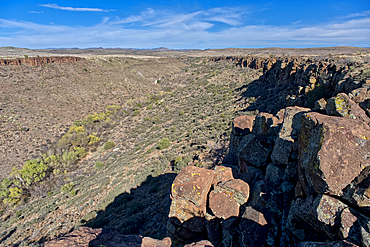
View of Black Canyon on the west side of the Agua Fria National Monument of Arizona with the Bradshaw Mountains in the distance.
Silver Creek Canyon in the Agua Fria National Monument, Black Canyon City Arizona, USA
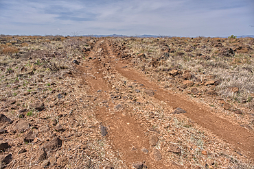
A primitive road in the Agua Fria National Monument that branches off from Forest Service Road 9023 near Silver Creek Canyon Arizona
The granite riverbed of the Agua Fria River Canyon in the Agua Fria National Monument of Arizona.
The granite riverbed of the Agua Fria River Canyon in the Agua Fria National Monument of Arizona.
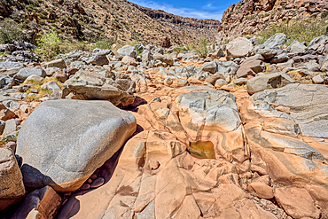
The granite riverbed of the Agua Fria River Canyon in the Agua Fria National Monument of Arizona.
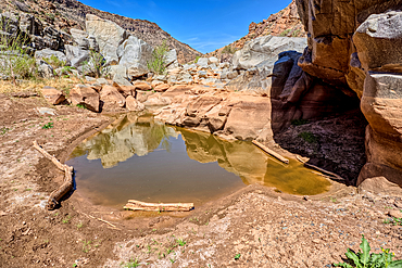
An ephemeral pool of water in the granite riverbed of the Agua Fria River Canyon in the Agua Fria National Monument of Arizona.
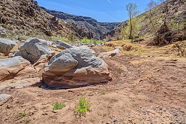
The granite riverbed of the Agua Fria River Canyon in the Agua Fria National Monument of Arizona.