Results
28 results found
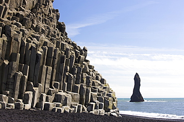
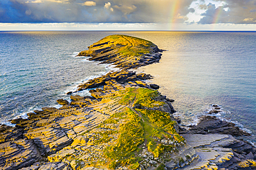
Basalt cliffs and rock stack, Halsenifs Hellir Beach, near Vik i Myrdal, South Iceland, Iceland, Polar Regions
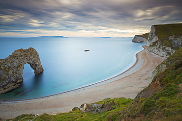
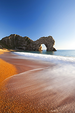
Durdle Door, an eroded rock arch, and the wide sweeping beach, Jurassic Coast, UNESCO World Heritage Site, Dorset, England, United Kingdom, Europe
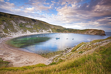
Lulworth Cove, a perfect horseshoe-shaped bay, Jurassic Coast, UNESCO World Heritage Site, Dorset, England, United Kingdom, Europe
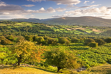
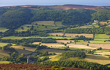
Moorland, rolling fields and Black Mountains of the Brecon Beacons, Powys, Wales, United Kingdom, Europe
Churches and rolling countryside in the Vale of Porlock, Exmoor, Somerset, England, United Kingdom, Europe
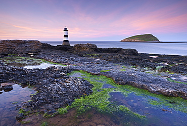
Dusk over Penmon Point Lighthouse and Puffin Island, Isle of Anglesey, Wales, United Kingdom, Europe
Waves break onto Durdle Door beach in winter, Jurassic Coast, UNESCO World Heritage Site, Dorset, England, United Kingdom, Europe
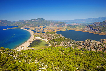
Aerial view of Dalyan, Dalaman, Anatolia, Turkey, Asia Minor, Eurasia
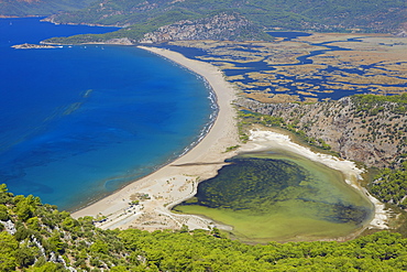
Aerial view of Dalyan, Dalaman, Anatolia, Turkey, Asia Minor, Eurasia
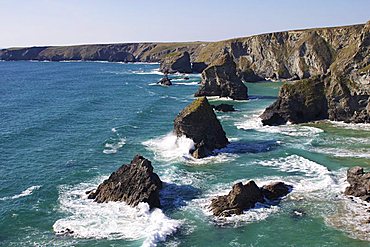
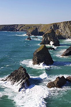
Bedruthan Steps, Cornwall, England, United Kingdom, Europe
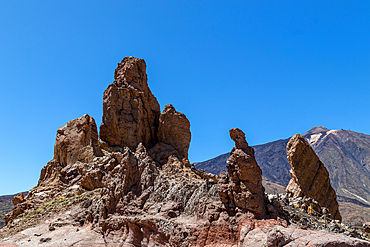
Rock formations against a clear blue sky with mountains in the background, showcasing natural erosion and geological features in the Teide National Park,UNESCO World Heritage Site, Tenerife, Canary Islands, Spain, Atlantic, Europe
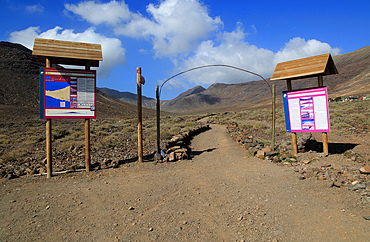
Start of footpath trail from Gran Valle to Cofete, Jandia peninsula, Fuerteventura, Canary Islands, Spain, Atlantic, Europe
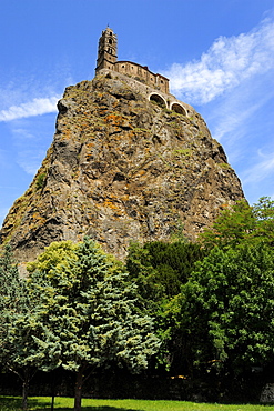
Saint Michel d'Aiguilhe Chapel situated on the top of volcanic rock, Le Puy en Velay, Haute-Loire, Massif Central, France, Europe

Cabo de Sao Vicente (Cape St. Vincent), Algarve, Portugal, Europe
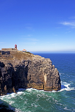
Cabo de Sao Vicente (Cape St. Vincent), Algarve, Portugal, Europe

Cabo de Sao Vicente (Cape St. Vincent), Algarve, Portugal, Europe
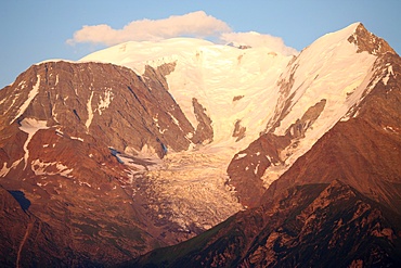
Mont Blanc mountain range and Bionnassay glacier, St. Gervais, Haute-Savoie, French Alps, France, Europe
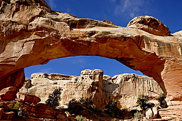
Hickman Bridge, Capitol Reef National Park, Utah, United States of America, North America
Bedruthan Steps, Cornwall, England, United Kingdom, Europe
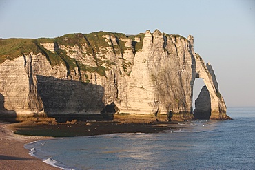
Cliffs at Etretat, Cote d'Albatre, Seine-Maritime, Normandy, France, Europe
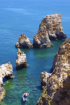
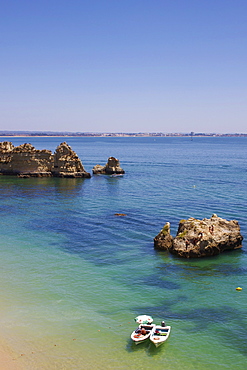
Ponta da Piedade, Lagos, Algarve, Portugal, Europe
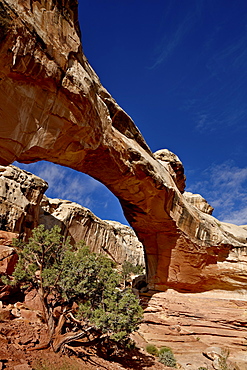
Hickman Bridge, Capitol Reef National Park, Utah, United States of America, North America
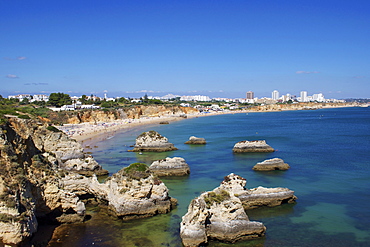
Praia do Vau, Portimao, Algarve, Portugal, Europe
Praia Dona Ana, Lagos, Algarve, Portugal, Europe
Porous sand stone rocks on Jalandhar Beach near the south pole point in Diu, India, Asia
Porous sand stone rocks on Jalandhar Beach near the south pole point in Diu, India, Asia
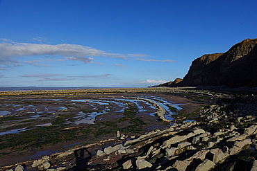
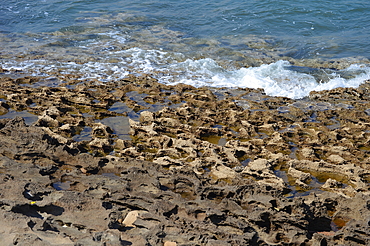
The intertidal zone of the Quantock Coast, West Somerset, contains an abundance of geology and wildlife. It is a Site of Special Scientific Interest (SSSI) and is of international geological importance.
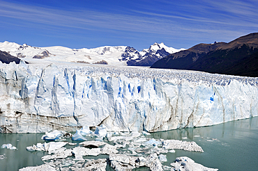
Perito Moreno Glacier, UNESCO World Heritage Site, around El Calafate, Santa Cruz province, Patagonia, Argentina, South America
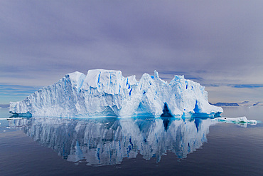
Iceberg in the Weddell Sea on the eastern side of the Antarctic Peninsula during the summer months, Southern Ocean, Polar Regions
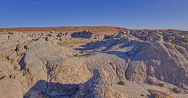
Goblin Garden west of Hamilili Point in Petrified Forest National Park, Arizona, United States of America, North America

Rills formed in the sandy beach at low tide as found on Bigge Island, Kimberley, Western Australia, Australia, Pacific
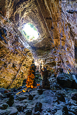
Castellana caves (Castellana Grotte), Apulia, Italy, Europe
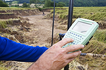
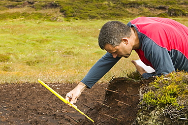
A differential GPS being used in real time kinematic survey, to survey the extent of the Durham canyon flooding feature, County Durham, England, United Kingdom, Europe

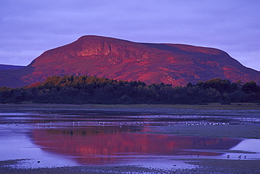
Andalucian campagna near Montellano, Spain, at dawn
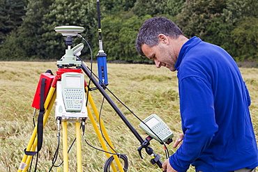
A differential GPS being used in real time kinematic survey, to survey the extent of the Durham canyon flooding feature, County Durham, England, United Kingdom, Europe
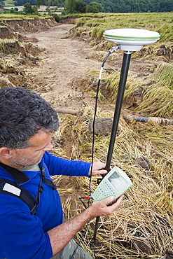
A differential GPS being used in real time kinematic survey, to survey the extent of the Durham canyon flooding feature, County Durham, England, United Kingdom, Europe
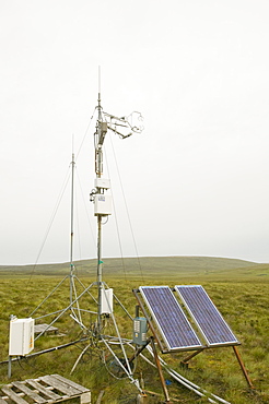
Scientific instruments to measure the carbon balance from peat bogs which is changing due to climate change in the north Pennines at Moorhouse, Cumbria, England, United Kingdom, Europe

pollution smoke from incinerator dundee scotland
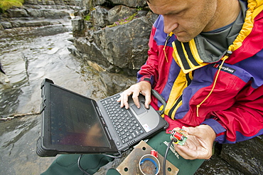
A scientist studying sediment load in a stream at Moorhouse in the north Pennines, Cumbria, England, United Kingdom, Europe
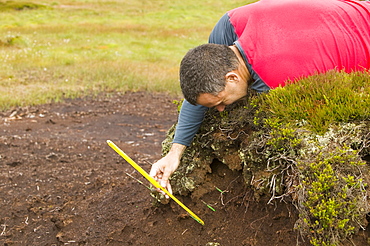
A scientist looking at peat erosion in the north Pennines, Cumbria, England, United Kingdom, Europe
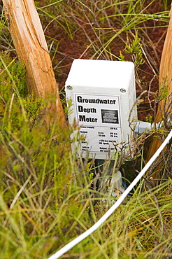
Scientific instruments to measure the carbon balance from peat bogs which is changing due to climate change in the north Pennines at Moorhouse, Cumbria, England, United Kingdom, Europe
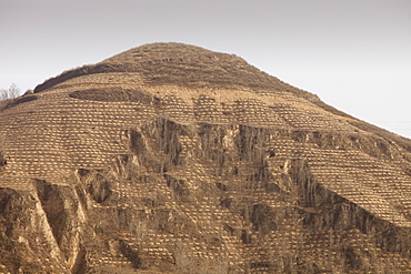
Trees planted in Loess deposits in Shanxi province, northern China, Asia
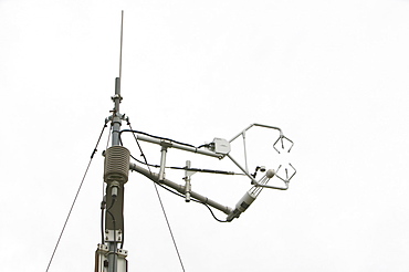
Scientific instruments to measure the carbon balance from peat bogs which is changing due to climate change in the north Pennines at Moorhouse, Cumbria, England, United Kingdom, Europe

Andalucian campagna near Montellano, Spain, at dawn
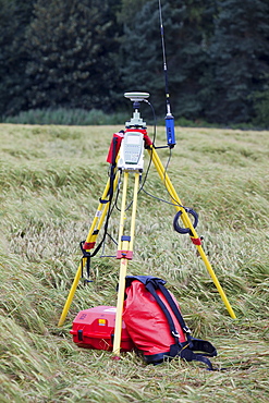
A differential GPS being used in real time kinematic survey, to survey the extent of the Durham canyon flooding feature, County Durham, England, United Kingdom, Europe
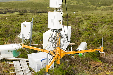
Scientific instruments to measure the carbon balance from peat bogs which is changing due to climate change in the north Pennines at Moorhouse, Cumbria, England, United Kingdom, Europe

stone and rock
scots pine
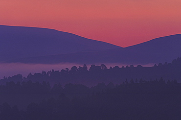
mountains creag liath at dawn november golspie, sutherland,scotland
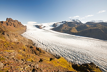
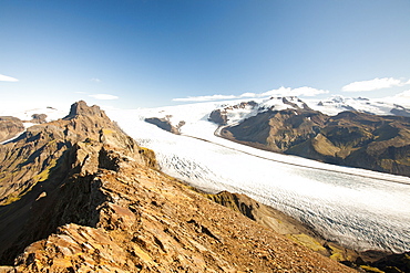
Skaftafellsjokull in the Skaftafell National Park, Iceland, Polar Regions
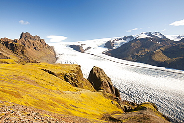
Skaftafellsjokull in the Skaftafell National Park, Iceland, Polar Regions
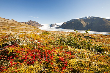
Skaftafellsjokull in the Skaftafell National Park, Iceland, Polar Regions
A scientist looking at peat erosion in the north Pennines, Cumbria, England, United Kingdom, Europe
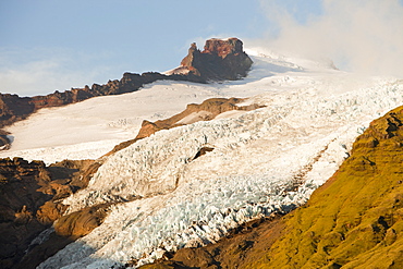
Glacier descending from the Vatnajokull ice sheet, Iceland, Polar Regions
Skaftafellsjokull in the Skaftafell National Park, Iceland, Polar Regions

Gorge and river with decidual forest in autumn. Arbayun gorge. Navarre, Spain, Europe.
Coastal landscape. Punta Sonabia o La Ballena (The whale),Cantabria, Spain, Europe.
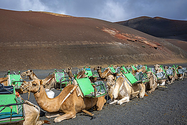
Echadero de Camellos, Camels wait for the next ride with tourists, Timanfaya National Park, Ruta de Los Volcanes, Lanzarote, Spain

Tourists riding camels, in Timanfaya National Park, Lanzarote, Canary Islands, Spain

Gorge and river with decidual forest in autumn. Arbayun gorge. Navarre, Spain, Europe.
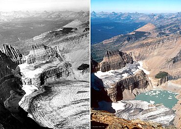
Grinnell Glacier, Glacier NP, 1938/1981
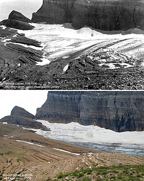
Grinnell Glacier, Glacier NP, 1936/2010

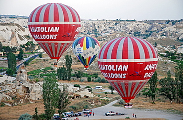
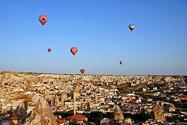
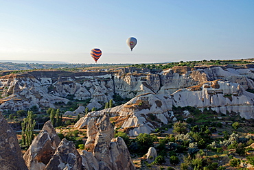
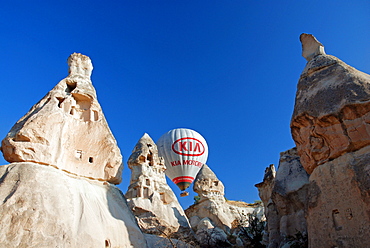
Hot-air ballon, Cappadocia, Turkey

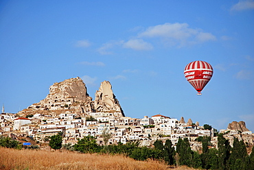
Hot-air ballon, Uchisar, Cappadocia, Turkey

Hot-air ballon, Cappadocia, Turkey

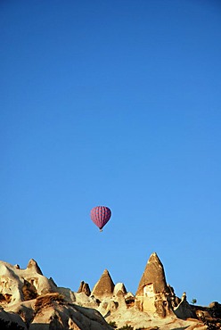
Hot-air ballon, Cappadocia, Turkey
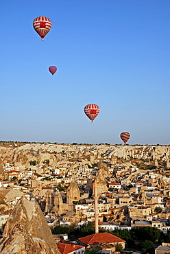
Hot-air ballon, Cappadocia, Turkey

Hot-air ballon, Cappadocia, Turkey

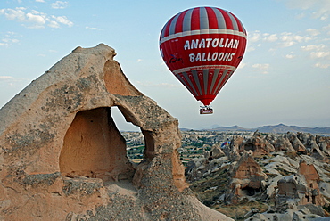
Hot-air ballon, Cappadocia, Turkey

Hot-air ballon, Uchisar, Cappadocia, Turkey
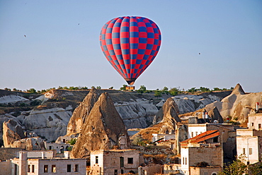
Hot-air ballon, Cappadocia, Turkey

Hot-air ballon, Cappadocia, Turkey
Hot-air ballon, Cappadocia, Turkey
Hot-air ballon, Cappadocia, Turkey
Hot-air ballon, Uchisar, Cappadocia, Turkey
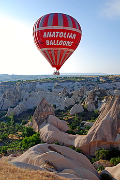
Hot-air ballon, Cappadocia, Turkey

Hot-air ballon, Cappadocia, Turkey
Hot-air ballon, Cappadocia, Turkey
Hot-air ballon, Cappadocia, Turkey
Hot-air ballon, Cappadocia, Turkey

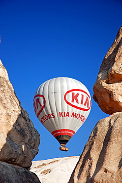
Hot-air ballon, Cappadocia, Turkey
Hot-air ballon, Cappadocia, Turkey
Hot-air ballon, Cappadocia, Turkey

Hot-air ballon, Cappadocia, Turkey
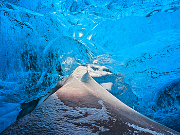
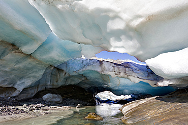
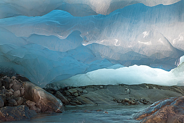
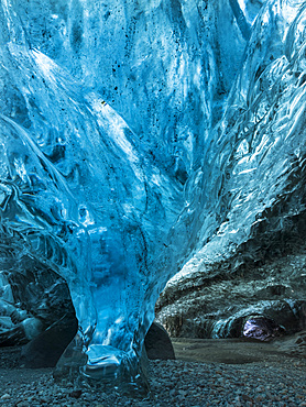
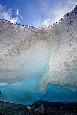
Glacial cave in the Breidamerkurjoekull Glacier in Vatnajoekull National Park. europe, northern europe, iceland, February
Ice cave and glacier snout of Schlatenkees, source of the creek Schlatenbach. parts of the have collapsed and melted away. Therefore an ice cave with two openings exists. The Schlatenkees is one of the biggest glaciers in Austria and retreating rapidly. Glacial till, moraine debris and roche moutonnee are visible, Europe, central europe, austria, East Tyrol

Glacial cave in the Breidamerkurjoekull Glacier in Vatnajoekull National Park. Entrance to the Ice Cave europe, northern europe, iceland, February
Ice cave in the glacier Breidamerkurjoekull in Vatnajoekull National Park. Entrance to the Ice Cave. europe, northern europe, iceland, February

Glacial cave in the Breidamerkurjoekull Glacier in Vatnajoekull National Park. Entrance to the Ice Cave europe, northern europe, iceland, February
Ice cave and glacier snout of Schlatenkees, source of the creek Schlatenbach. parts of the have collapsed and melted away. Therefore an ice cave with two openings exists. The Schlatenkees is one of the biggest glaciers in Austria and retreating rapidly. Glacial till, moraine debris and roche moutonnee are visible, Europe, central europe, austria, East Tyrol

Ice cave in the glacier Breidamerkurjoekull in Vatnajoekull National Park. Tourists at the entrance to the Ice Cave. europe, northern europe, iceland, February
Ice cave in the glacier Breidamerkurjoekull in Vatnajoekull National Park. europe, northern europe, iceland, February

Glacial cave in the Breidamerkurjoekull Glacier in Vatnajoekull National Park. europe, northern europe, iceland, February
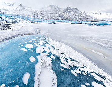
Glacier Skaftafelljoekull in the Vatnajoekull NP during winter. europe, northern europe, iceland, February
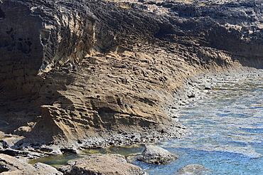
Glacier snout of Schlatenkees. The Schlatenkees is one of the biggest glaciers in Austria and retreating rapidly. contact zone of glacier and bedrock or moraine is visible, Europe, central europe, austria, East Tyrol

Majestic view of Giant Cleft, Cathedral Lakes Provincial Park, British Columbia, Canada

Bowleaze Cove, Weymouth, Dorset, England
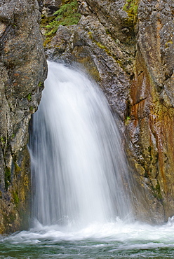
Cat Creek Falls, Kananaskis, Alberta
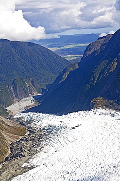
Glacier In The Mountains, New Zealand
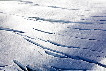
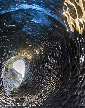
Cracks In The Ice