Results
30 results found
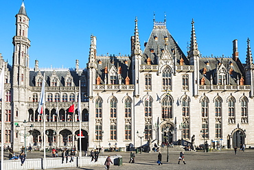
Provincial Government building, Market Square, Historic center of Bruges, UNESCO World Heritage Site, Belgium, Europe
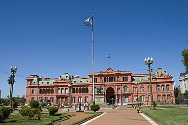
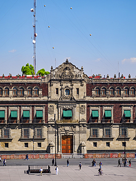
Casa Rosada (Presidential Palace) where Eva Peron (Evita) used to appear on the left hand balcony, and Juan Peron appeared on central balcony, Plaza de Mayo, Buenos Aires, Argentina, South America
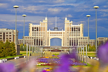
KazMunaiGas building, home to the Oil and Gas Ministry, with Khan Shatyr shopping and entertainment center behind, Astana, Kazakhstan, Central Asia, Asia
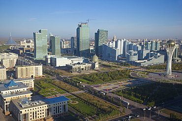
View of city center looking towards Nurzhol bulvar, central boulevard of the new governmental and administrative zone and the Bayterek Tower, with the Khan Shatyr shopping and entertainment center on the left, Astana, Kazakhstan, Central Asia, Asia
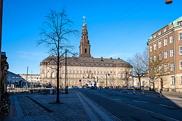
Copenhagen, Denmark ��� View of Christiansborg Palace, home to Denmark���s Parliament, Supreme Court, and Royal Reception Rooms, symbolizing centuries of political and royal power.
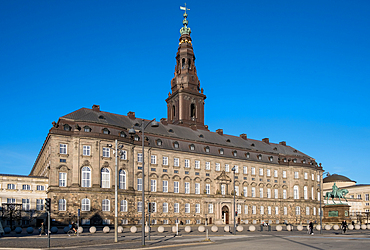
Copenhagen, Denmark ��� View of Christiansborg Palace, home to Denmark���s Parliament, Supreme Court, and Royal Reception Rooms, symbolizing centuries of political and royal power.
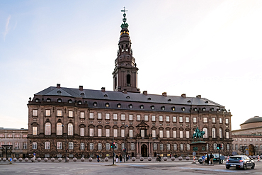
Copenhagen, Denmark ��� View of Christiansborg Palace, home to Denmark���s Parliament, Supreme Court, and Royal Reception Rooms, symbolizing centuries of political and royal power.
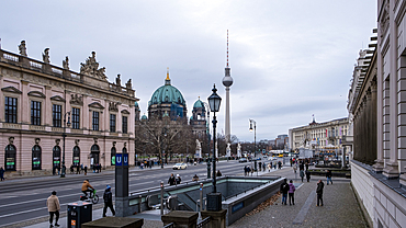
View of the bustling city center along Unter den Linden, Berlin TV Tower and Berlin Cathedral, Berlin, Germany
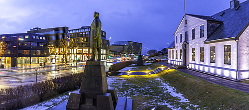
View of Hannes Hafstein statue and Prime Minister's Office in city centre of Reykjavik at dusk, Reykjavik, Iceland
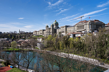
Cityscape of the Old City, the medieval center of Bern, UNESCO World Heritage Site, viewed from across the Aare River with the Parliament Building in the background, Bern, Switzerland, Europe
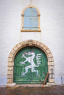
Emblem or mascot of the city. Detail, facade of Landeszeughaus (Armoury or arsenal), from Landhaushof courtyard, Graz, Austria
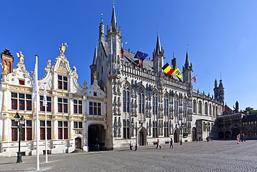
Grote Markt square, Civiele Griffie, records office and Stadhuis, city hall, old town of Bruges, UNESCO World Heritage Site, West Flanders, Flemish Region, Bruges, Belgium, Europe
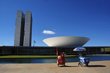
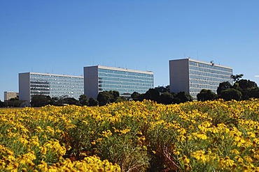
Iceman in front of the congress building (congresso nacional) in Brasilia, Brazil. The building was designed by the Architect Oscar Niemeyer.
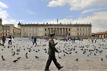
Soldier in front of National Capitol, Capitolio Nacional, Bolivar Square, Plaza de Bolivar, Bogota, Colombia, South America
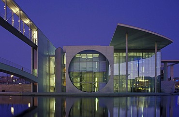
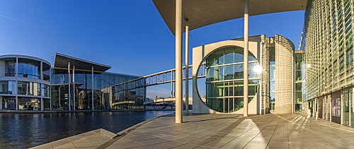
Marie-Elisabeth-Lueders-Haus building with the Spree river, parliament building with the Library of Parliament, Parliamentary Archives and the scientific service center of the German Parliament, Regierungsviertel government quarter, Tiergarten district, B

Panoramic view of the Siegessaeule, Victory Column, towards east with the government district, the Reichstag building, Brandenburg Gate, TV Tower, skyscrapers in Potsdamer Platz, Potsdam Square, Mitte district, Berlin, Germany, Europe
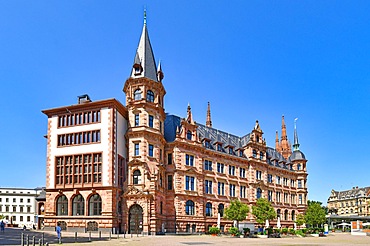
Wiesbaden, Germany, July 2021: Back side of city hall building called New Town Hall at market square, Europe
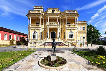
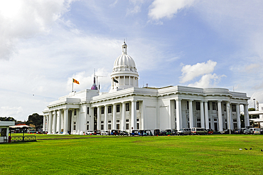
Cultural center Rio Negro Palace, Former seat of government, Manaus, Amazonia State, Brazil, South America
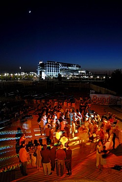
Bundespressestrand' city beach, salsa event, beach on the River Spree in the government district, Berlin, Germany, Europe

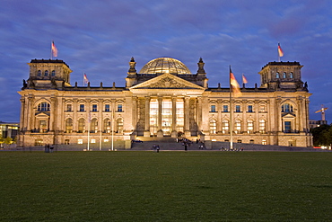
Panoramic view of tourists on bicycles in front of the Reichstag or German Parliament Buildings, Berlin, Germany, Europe
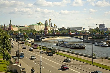
View from the Bridge over the Moscva to Down Town, the Kreml and the Government Buildings, Moscow, Russia, East Europe, Europe
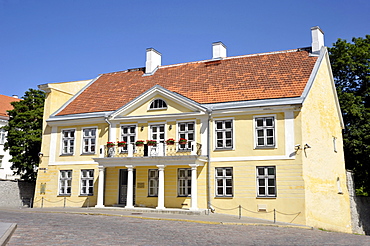
Historic town centre, Embassy of the Federal Republic of Germany, Tallinn, formerly Reval, Estonia, Baltic States, Northern Europe
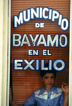
Bayamo Municipal Center, Little Havana section of Miami, Florida. Dade County, Florida and the city of Miami are a melting pot for Haitian, Cuban and Hispanic immigrants in general.
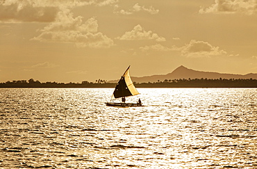
The Louisiade Archipelago is a string of ten larger volcanic islands frequently fringed by coral reefs, and 90 smaller coral islands located 200 km southeast of New Guinea, stretching over more than 160 km and spread over an ocean area of 26,000 km? between the Solomon Sea to the north and the Coral Sea to the south. The aggregate land area of the islands is about 1,790 km? (690 square miles), with Vanatinai (formerly Sudest or Tagula as named by European claimants on Western maps) being the largest.Sideia Island and Basilaki Island lie closest to New Guinea, while Misima, Vanatinai, and Rossel islands lie further east. The archipelago is divided into the Local Level Government (LLG) areas Louisiade Rural (western part, with Misima), and Yaleyamba (western part, with Rossell and Tagula islands. The LLG areas are part of Samarai-Murua District district of Milne Bay. The seat of the Louisiade Rural LLG is Bwagaoia on Misima Island, the population center of the archipelago.
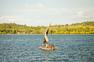
The Louisiade Archipelago is a string of ten larger volcanic islands frequently fringed by coral reefs, and 90 smaller coral islands located 200 km southeast of New Guinea, stretching over more than 160 km and spread over an ocean area of 26,000 km? between the Solomon Sea to the north and the Coral Sea to the south. The aggregate land area of the islands is about 1,790 km? (690 square miles), with Vanatinai (formerly Sudest or Tagula as named by European claimants on Western maps) being the largest. Sideia Island and Basilaki Island lie closest to New Guinea, while Misima, Vanatinai, and Rossel islands lie further east. The archipelago is divided into the Local Level Government (LLG) areas Louisiade Rural (western part, with Misima), and Yaleyamba (western part, with Rossell and Tagula islands. The LLG areas are part of Samarai-Murua District district of Milne Bay. The seat of the Louisiade Rural LLG is Bwagaoia on Misima Island, the population center of the archipelago.

Nimoa Island - here the island mission will impress. The five-sided church features murals of island life and all mission buildings are surrounded by well maintained paths and gardens filled with flowering plants. Edged by jungle-covered mountains, postcard beaches and crystal clear waters - an island paradise indeed! The Louisiade Archipelago is a string of ten larger volcanic islands frequently fringed by coral reefs, and 90 smaller coral islands located 200 km southeast of New Guinea, stretching over more than 160 km and spread over an ocean area of 26,000 km? between the Solomon Sea to the north and the Coral Sea to the south. The aggregate land area of the islands is about 1,790 km? (690 square miles), with Vanatinai (formerly Sudest or Tagula as named by European claimants on Western maps) being the largest. Sideia Island and Basilaki Island lie closest to New Guinea, while Misima, Vanatinai, and Rossel islands lie further east. The archipelago is divided into the Local Level Government (LLG) areas Louisiade Rural (western part, with Misima), and Yaleyamba (western part, with Rossell and Tagula islands. The LLG areas are part of Samarai-Murua District district of Milne Bay. The seat of the Louisiade Rural LLG is Bwagaoia on Misima Island, the population center of the archipelago.
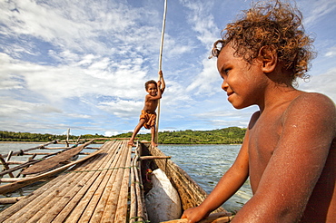
Children playing with a outrigger canoe in the village of Hessessai Bay at PanaTinai (Panatinane)island in the Louisiade Archipelago in Milne Bay Province, Papua New Guinea. The island has an area of 78 km2. The Louisiade Archipelago is a string of ten larger volcanic islands frequently fringed by coral reefs, and 90 smaller coral islands located 200 km southeast of New Guinea, stretching over more than 160 km and spread over an ocean area of 26,000 km? between the Solomon Sea to the north and the Coral Sea to the south. The aggregate land area of the islands is about 1,790 km? (690 square miles), with Vanatinai (formerly Sudest or Tagula as named by European claimants on Western maps) being the largest. Sideia Island and Basilaki Island lie closest to New Guinea, while Misima, Vanatinai, and Rossel islands lie further east. The archipelago is divided into the Local Level Government (LLG) areas Louisiade Rural (western part, with Misima), and Yaleyamba (western part, with Rossell and Tagula islands. The LLG areas are part of Samarai-Murua District district of Milne Bay. The seat of the Louisiade Rural LLG is Bwagaoia on Misima Island, the population center of the archipelago.PanaTinai (Panatinane) is an island in the Louisiade Archipelago in Milne Bay Province, Papua New Guinea.

Nimoa Island - here the island mission will impress. The five-sided church features murals of island life and all mission buildings are surrounded by well maintained paths and gardens filled with flowering plants. Edged by jungle-covered mountains, postcard beaches and crystal clear waters - an island paradise indeed! The Louisiade Archipelago is a string of ten larger volcanic islands frequently fringed by coral reefs, and 90 smaller coral islands located 200 km southeast of New Guinea, stretching over more than 160 km and spread over an ocean area of 26,000 km? between the Solomon Sea to the north and the Coral Sea to the south. The aggregate land area of the islands is about 1,790 km? (690 square miles), with Vanatinai (formerly Sudest or Tagula as named by European claimants on Western maps) being the largest. Sideia Island and Basilaki Island lie closest to New Guinea, while Misima, Vanatinai, and Rossel islands lie further east. The archipelago is divided into the Local Level Government (LLG) areas Louisiade Rural (western part, with Misima), and Yaleyamba (western part, with Rossell and Tagula islands. The LLG areas are part of Samarai-Murua District district of Milne Bay. The seat of the Louisiade Rural LLG is Bwagaoia on Misima Island, the population center of the archipelago.
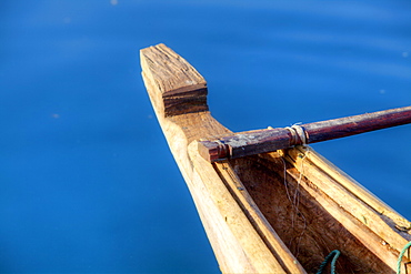
Nimoa Island - here the island mission will impress. The five-sided church features murals of island life and all mission buildings are surrounded by well maintained paths and gardens filled with flowering plants. Edged by jungle-covered mountains, postcard beaches and crystal clear waters - an island paradise indeed! The Louisiade Archipelago is a string of ten larger volcanic islands frequently fringed by coral reefs, and 90 smaller coral islands located 200 km southeast of New Guinea, stretching over more than 160 km and spread over an ocean area of 26,000 km? between the Solomon Sea to the north and the Coral Sea to the south. The aggregate land area of the islands is about 1,790 km? (690 square miles), with Vanatinai (formerly Sudest or Tagula as named by European claimants on Western maps) being the largest. Sideia Island and Basilaki Island lie closest to New Guinea, while Misima, Vanatinai, and Rossel islands lie further east. The archipelago is divided into the Local Level Government (LLG) areas Louisiade Rural (western part, with Misima), and Yaleyamba (western part, with Rossell and Tagula islands. The LLG areas are part of Samarai-Murua District district of Milne Bay. The seat of the Louisiade Rural LLG is Bwagaoia on Misima Island, the population center of the archipelago.
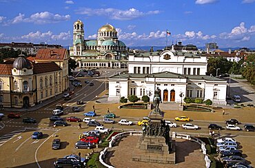
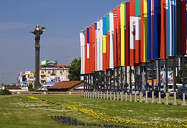
BULGARIA Sofia Liberation Monument Bulgarian Parliament Building Science Academy and Alexander Nevsky Cathedral. Travel Tourism Holiday Vacation Explore Recreation Leisure Sightseeing Tourist Attraction Tour Building Architecture Architectural Sofia Capital City Bulgaria Bulgarian East Eastern Europe European Calendar Vivid Vibrant Summer Bright Sunny Sun Blue Sky Liberation Monument Parliament Government History Historic Historical Magnificent National Assembly Cars Traffic Building Architecture Architectural Alexander Nevsky Nevski Cathedral Church Churches Religion Religious Christianity Orthodox Holy Divine Christian Theology Pray Prayer Worship Worshipping Worshiping Calendar Vivid Vibrant Fluffy Cloud Centre Center Landscape Panorama Panoramic Science Academy University Eastern Europe

