Results
5 results found
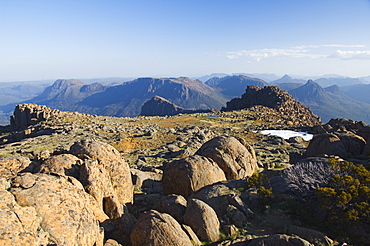
View from the top of Mount Ossa, 1617m, Tasmania's highest mountain on the Overland Track, Cradle Mountain Lake St. Clair National Park, part of Tasmanian Wilderness, UNESCO World Heritage Site, Tasmania, Australia, Pacific
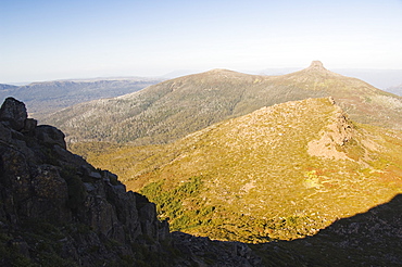
View of Mount Pelion East, 1433m, from Mount Ossa, 1617m, Tasmania's highest mountain on the Overland Track, Cradle Mountain Lake St. Clair National Park, part of Tasmanian Wilderness, UNESCO World Heritage Site, Tasmania, Australia, Pacific
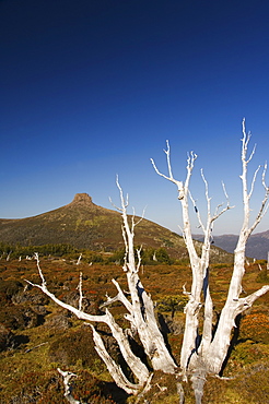
Mount Pelion East 1433m, from Mount Ossa 1617m, Tasmania's highest mountain on the overland track in Cradle Mountain Lake St. Clair National Park, part of Tasmanian Wilderness, UNESCO World Heritage Site, Tasmania, Australia, Pacific
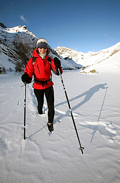
A trekker heads up into the wilderness of the highest part of the Ecrins Massif in deep winter snow, above the village of Pelvoux, near Briancon, western Alps, Hautes Alpes, south west France, Europe
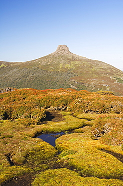
View from Mount Ossa, 1617m, Tasmania's highest mountain on the Overland Track, Cradle Mountain Lake St. Clair National Park, part of Tasmanian Wilderness, UNESCO World Heritage Site, Tasmania, Australia, Pacific
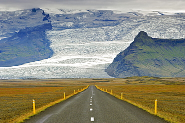
The ring road and slopes of Iceland's highest mountain Hvannadalshnukur, 2110m, part of Oraefajokull glacier, in the southeast, Iceland, Polar Regions
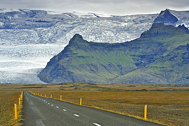
The ring road and slopes of Iceland's highest mountain Hvannadalshnukur, 2110m, part of Oraefajokull glacier, in the southeast, Iceland, Polar Regions
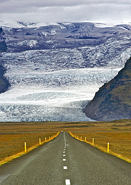
The ring road and slopes of Iceland's highest mountain Hvannadalshnukur, 2110m, part of Oraefajokull glacier, in the southeast, Iceland, Polar Regions
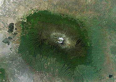
Satellite view of Mount Kilimanjaro, Tanzania. This dormant volcano is the highest mountain in Africa. It is part of the Kilimanjaro National Park. This image was compiled from data acquired by Landsat satellites.
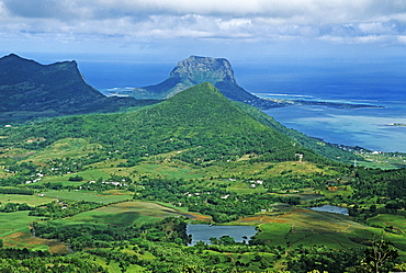
View from Black River Peak to the southern part of Mauritius island, Africa
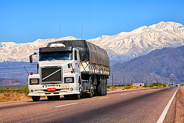
The province of Mendoza is part of all Argentine provinces that are vertically crossed by the Cordillera de Los Andes. The Principal Cordillera is the result of an early folding, with an average height of about 6500 meters. It has two distinct sectors: in the north and to the provincial Diamond Rio is characterized by a high narrow strip, which finds its highest expression in the Cerro Aconcagua 6962 m. In the southern provinces, from Diamond Rio to the South forms a wider and less high orographic belt.
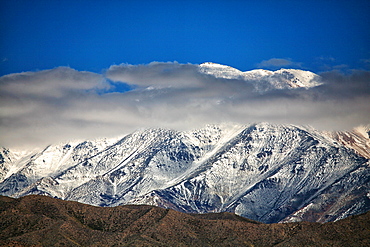
The province of Mendoza is part of all Argentine provinces that are vertically crossed by the Cordillera de Los Andes. The Principal Cordillera is the result of an early folding, with an average height of about 6500 meters. It has two distinct sectors: in the north and to the provincial Diamond Rio is characterized by a high narrow strip, which finds its highest expression in the Cerro Aconcagua 6962 m. In the southern provinces, from Diamond Rio to the South forms a wider and less high orographic belt.