Results
1 2 3 … 31 Next »
3010 results found
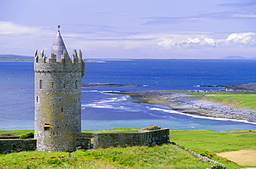
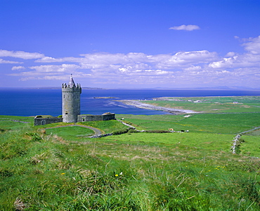
Doonagoore Castle, County Clare, Munster, Republic of Ireland (Eire), Europe
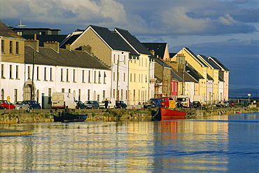
Long Walk view of Claddagh Quay, Galway Town, Co Galway, Ireland
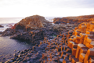
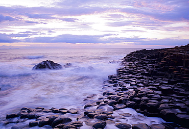
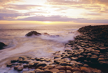
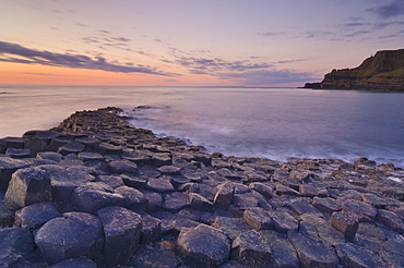
Giant's Causeway, County Antrim, Northern Ireland, UK, Europe
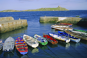
Dalkey Island and Coliemore Harbour, Dublin, Ireland, Europe
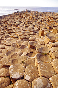
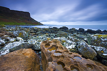
Giant's Causeway, County Antrim, Northern Ireland, UK, Europe
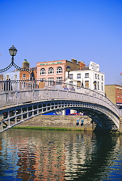
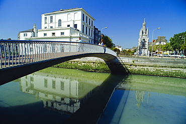
Halfpenny Bridge and River Liffey, Dublin, Ireland/Eire

The Four Courts and River Liffey, Dunlin, Ireland/Eire
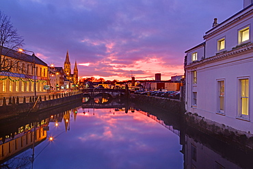
The Port of Cork City, Ireland
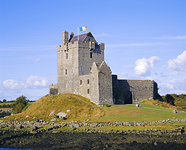
Dunguaire Castle, Kinvarra Bay, Co Galway, Ireland

Statue of James Joyce, Dublin, County Dublin, Ireland, Eire
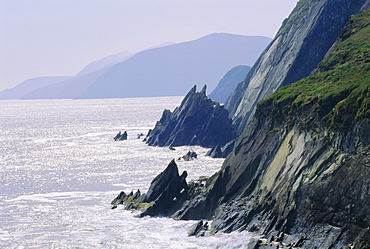
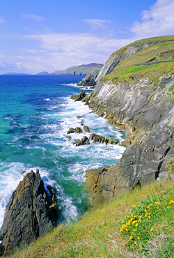
Slea Head, Dingle Peninsula, Co. Kerry, Ireland/Eire
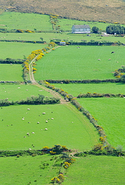
Fields near Dingle, Co. Kerry, Ireland/Eire
The Giant's Causeway, Co Antrim, Northern Ireland
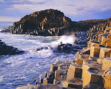
The Giant's Causeway, Co Antrim, Northern Ireland
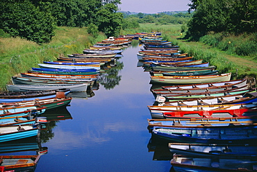
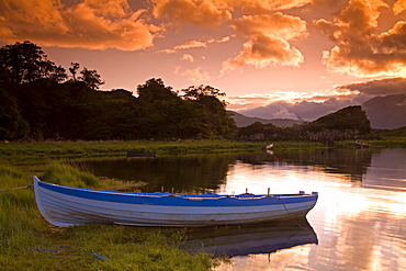
Boats, Killarney, County Kerry, Munster, Republic of Ireland (Eire), Europe
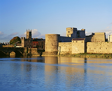
King John's Castle and the River Shannon, Limerick, County Limerick, Munster, Republic of Ireland (Eire), Europe
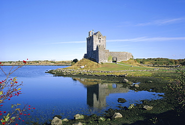
Dunguaire Castle, Kinvarra Bay, County Galway, Connacht, Republic of Ireland (Eire), Europe
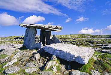
Poulnabrone Dolmen, ancient tomb, The Burren, County Clare, Munster, Republic of Ireland (Eire), Europe
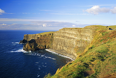
Cliffs of Moher, coast, County Clare, Munster, Republic of Ireland (Eire), Europe
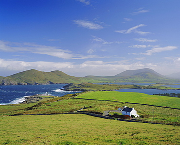
Valentia Island, County Kerry, Munster, Republic of Ireland (Eire), Europe
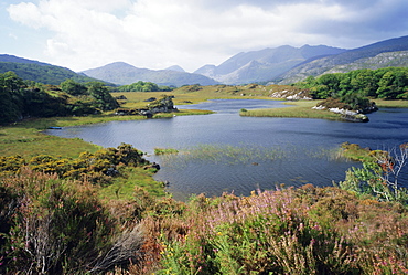
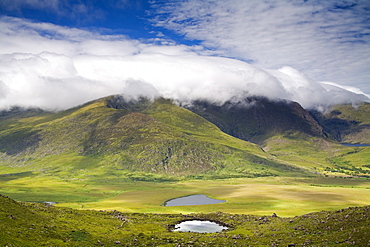
Upper Lake and Macgillycuddy's Reeks, Ring of Kerry, Killarney, County Kerry, Munster, Republic of Ireland (Eire), Europe
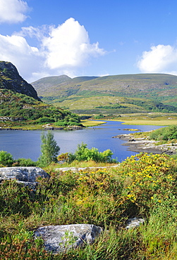
Ring of Kerry between Upper Lake and Muckross Lake, Killarney, County Kerry, Munster, Republic of Ireland (Eire), Europe
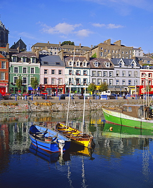
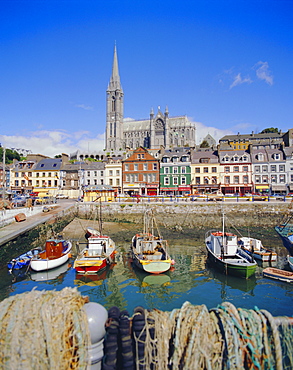
Cobh Harbour, Cork, County Cork, Munster, Republic of Ireland (Eire), Europe
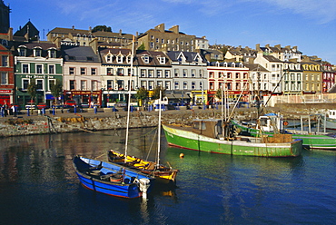
Cobh Harbour, County Cork, Munster, Republic of Ireland (Eire), Europe
The Port of Cork City, Cork, County Cork, Munster, Republic of Ireland (Eire), Europe
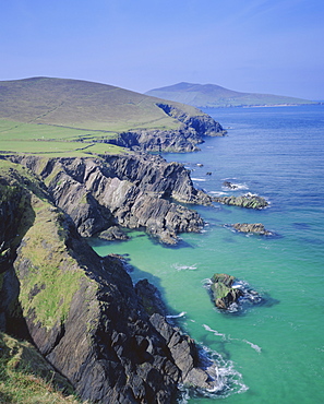
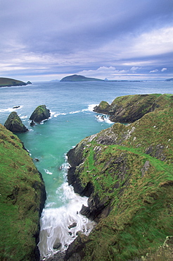
Slea Head, Dingle Peninsula, County Kerry, Munster, Republic of Ireland (Eire), Europe
Slea Head, Dingle Peninsula, County Kerry, Munster, Republic of Ireland (Eire), Europe
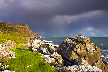
The Giant's Causeway, County Antrim, Ulster, Northern Ireland, UK, Europe
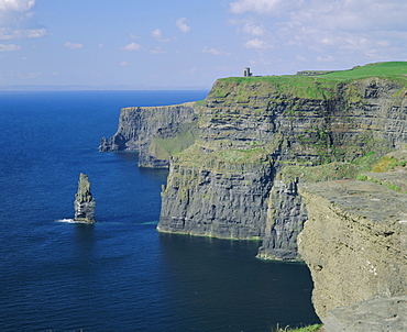
The Cliffs of Moher, County Clare, Munster, Republic of Ireland (Eire), Europe
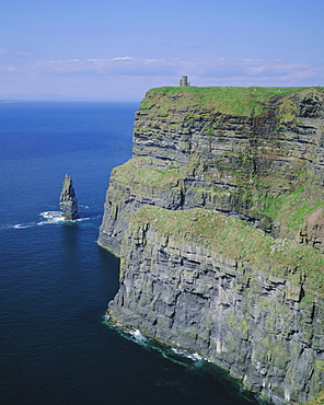
The Cliffs of Moher, County Clare, Munster, Republic of Ireland (Eire), Europe
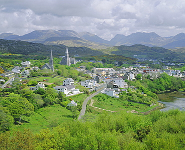
Clifden, Connemara, County Galway, Connacht, Republic of Ireland (Eire), Europe
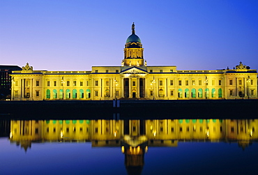
Custom House, Dublin, County Dublin, Republic of Ireland (Eire), Europe
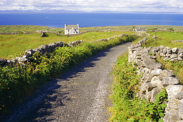
Country road, Inishmore, Aran Islands, County Galway, Connacht, Republic of Ireland (Eire), Europe
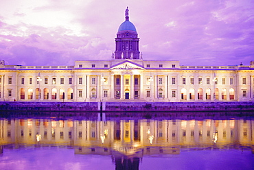
The Custom House, Dublin, Ireland
Footbridge leading into Grand Parade, O'Sullivan's Quay, Cork City, Ireland
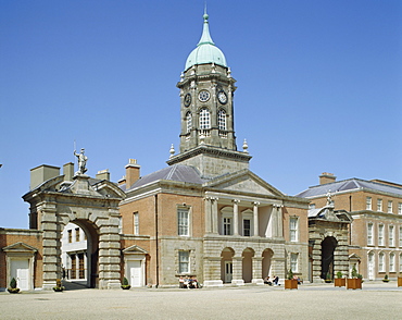
Dublin Castle, Dublin, County Dublin, Republic of Ireland (Eire), Europe
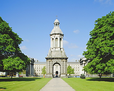
Trinity College, Dublin, County Dublin, Republic of Ireland (Eire), Europe
Trinity College, Dublin, Ireland/Eire
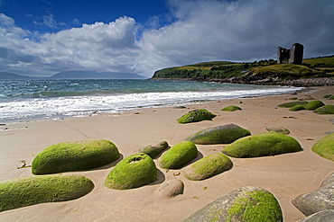
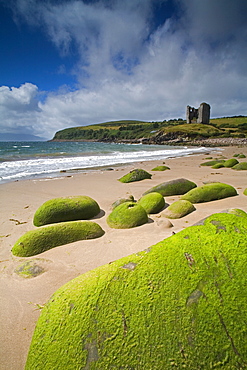
Doolin Tower, Doonagore Catle and South Sound, County Clare (Co. Clare), Munster, Republic of Ireland (Eire), Europe
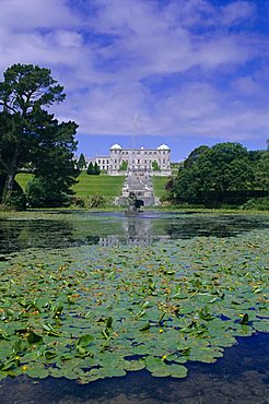
Powerscourt Estate and gardens, County Wicklow, Leinster, Republic of Ireland (Eire), Europe
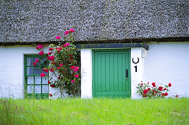
Single storey house, County Clare, Munster, Republic of Ireland (Eire), Europe
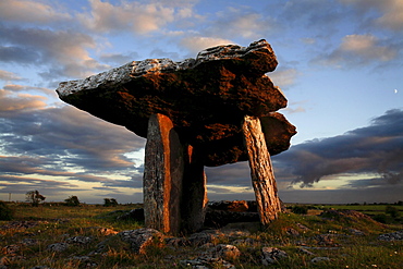
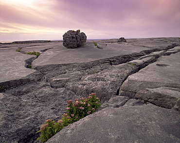
Poulnabrone dolmen megalithic tomb, Burren, County Clare, Munster, Republic of Ireland (Eire), EuropeThe Burren (from Irish: Boireann, meaning - great rock) is a unique karst landscape in northwest County Clare, Ireland. The limestone area measures 300 square kilometres and is roughly enclosed within the circle comprised by the villages Ballyvaughan, Kinvarra, Gort, Corrofin, Kilfenora, Lisdoonvarna and the Black Head lighthouse. The definitive article (ie "The" Burren) has only been added to the name by academics in the last few decades as it has always been traditionally called Boireann or Boirinn in Irish and Burren in English.
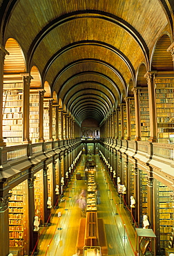
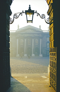
Gallery of the Old Library, Trinity College, Dublin, County Dublin, Eire (Ireland), Europe
Coast at Slea Head and the Blasket Islands, County Kerry, Munster, Eire (Republic of Ireland), Europe
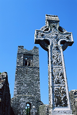
High cross, church of Slane Friary, County Meath, Leinster, Republic of Ireland (Eire), Europe
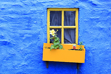
Cottage window, Kinsale Town, County Cork, Munster, Republic of Ireland, Europe
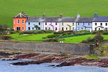
Row of cottages at Roches Point, Whitegate Village, County Cork, Munster, Republic of Ireland, Europe
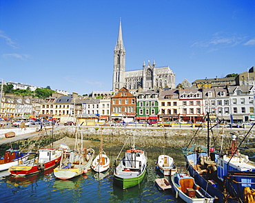
St. Colman's Cathedral, Cobh Town, County Cork, Munster, Republic of Ireland, Europe
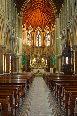
St. Finbarre's Cathedral, Cork City, County Cork, Munster, Republic of Ireland, Europe
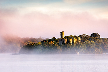
Mist at sunrise at McDermott's Castle on Lough Key or Castle Island in County Roscommon, Connacht, Republic of Ireland, Europe
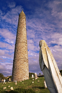
Statue of the Virgin, Round tower, 30m tall, of St. Declan's cathedral, dating from 12th century, Ardmore, County Waterford, Munster, Republic of Ireland (Eire), Europe
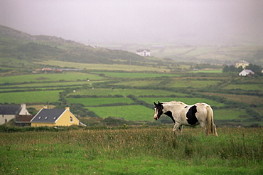
Tinker horse near Allihies, Beara Peninsula, County Cork, Munster, Republic of Ireland (Eire), Europe
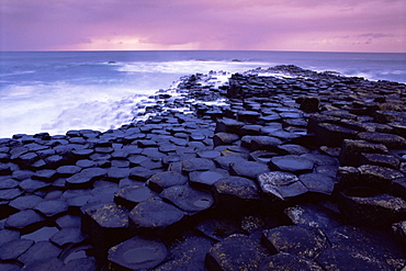
Giant's Causeway, UNESCO World Heritage Site, Causeway Coast, Antrim, Ulster, Northern Ireland, United Kingdom, Europe
Limestone rocks near the sea, at sunset, The Burren, County Clare, Munster, Republic of Ireland (Eire), Europe
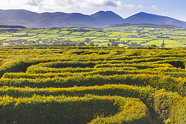
The Peace Maze, Castlewellan, County Down, Ulster, Northern Ireland, United Kingdom, Europe
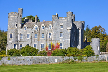
Castlewellan Castle, Castlewellan, County Down, Ulster, Northern Ireland, United Kingdom, Europe
Break in the clouds over Maumturk Mountains, Joyce Country, Connemara, County Galway, Connacht, Republic of Ireland (Eire), Europe
Ballynahinch Lake and the Twelve Pins, near Clifden, Connemara, County Galway, Connacht, Republic of Ireland (Eire), Europe
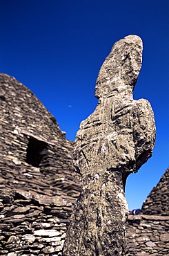
Early Christian cross and stone huts, Great Skellig monastery, dating from between the 6th and 12th centuries, Skellig Michael, UNESCO World Heritage Site, Kerry, Munster, Republic of Ireland (Eire), Europe
Marine Hotel at sunset, Glandore, County Cork, Munster, Republic of Ireland (Eire), Europe
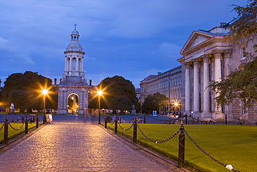
Trinity College, early evening, Dublin, Republic of Ireland, Europe
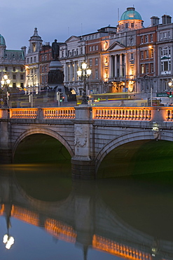
O'Connell Bridge, reflection, early evening, Dublin, Republic of Ireland, Europe
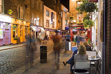
Cafe, Temple Bar, evening, Dublin, Republic of Ireland, Europe
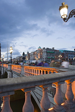
O'Connell Bridge, early evening, Dublin, Republic of Ireland, Europe
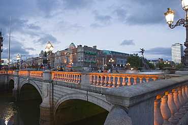
O'Connell Bridge, early evening, Dublin, Republic of Ireland, Europe
Upper Lake, Killarney National Park, County Kerry, Munster, Republic of Ireland, Europe
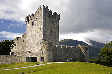
Ross Castle, Killarney National Park, County Kerry, Munster, Republic of Ireland, Europe
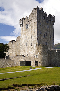
Ross Castle, Killarney National Park, County Kerry, Munster, Republic of Ireland, Europe
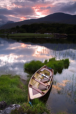
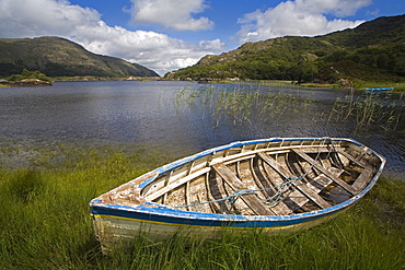
Boat, Upper Lake, Killarney National Park, County Kerry, Munster, Republic of Ireland, Europe
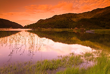
Upper Lake, Killarney National Park, County Kerry, Munster, Republic of Ireland, Europe
Boat, Upper Lake, Killarney National Park, County Kerry, Munster, Republic of Ireland, Europe
Mount Brandon, Connor Pass, Dingle Peninsula, County Kerry, Munster, Republic of Ireland, Europe
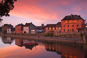
John's Quay and River Nore, Kilkenny City, County Kilkenny, Leinster, Republic of Ireland, Europe
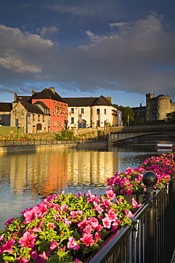
John's Quay and River Nore, Kilkenny City, County Kilkenny, Leinster, Republic of Ireland, Europe

John's Quay and River Nore, Kilkenny City, County Kilkenny, Leinster, Republic of Ireland, Europe

Kilcash church and burial ground, County Tipperary, Munster, Republic of Ireland, Europe
Minnard Beach, Dingle, County Kerry, Munster, Republic of Ireland, Europe
Minnard Beach, Dingle, County Kerry, Munster, Republic of Ireland, Europe

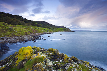
Beautiful Ballintoy Harbour on the Causeway Coast, County Antrim, Ulster, Northern Ireland, United Kingdom, Europe
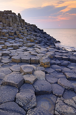
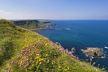
Hexagonal basalt columns of the Giant's Causeway, UNESCO World Heritage Site, and Area of Special Scientific Interest, near Bushmills, County Antrim, Ulster, Northern Ireland, United Kingdom, Europe
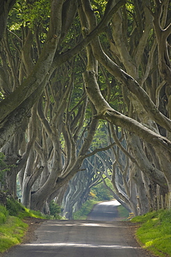
Tree lined road known as the Dark Hedges near Stanocum, County Antrim, Ulster, Northern Ireland, United Kingdom, Europe
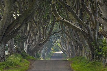
Tree lined road known as the Dark Hedges near Stanocum, County Antrim, Ulster, Northern Ireland, United Kingdom, Europe
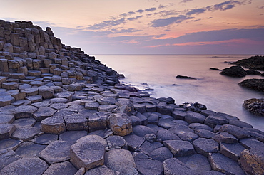
Hexagonal basalt columns of the Giant's Causeway, UNESCO World Heritage Site, and Area of Special Scientific Interest, near Bushmills, County Antrim, Ulster, Northern Ireland, United Kingdom, Europe
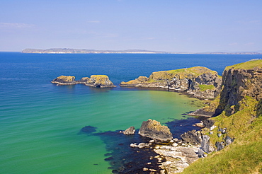
Carrick Island in Larrybane Bay, with a limestone headland, and Rathlin Island in the background, on the North Antrim Causeway Coast Way, County Antrim, Ulster, Northern Ireland, United Kingdom Europe
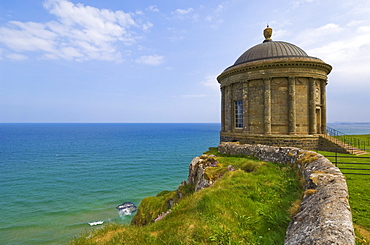
The Mussenden temple perched on a cliff edge, part of the Downhill Estate, County Londonderry, Ulster, Northern Ireland, United Kingdom, Europe
Hexagonal basalt columns of the Giant's Causeway, UNESCO World Heritage Site and Area of Special Scientific Interest, near Bushmills, County Antrim, Ulster, Northern Ireland, United Kingdom, Europe
Pink sea thrift on cliff top, North Antrim coast path to the Giant's Causeway, County Antrim, Ulster, Northern Ireland, United Kingdom, Europe
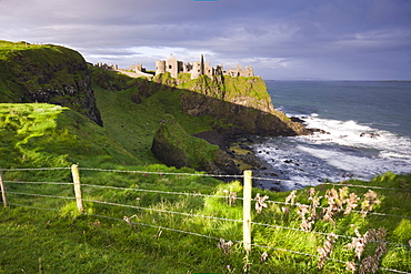
Dunluce Castle on the clifftops of County Antrim, Ulster, Northern Ireland, United Kingdom, Europe
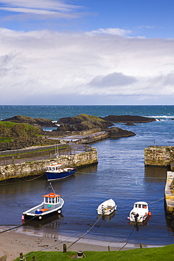
Ballintoy Harbour, Causeway Coast, County Antrim, Ulster, Northern Ireland, United Kingdom, Europe
Fair Head from Murlough Bay, Causeway Coast, County Antrim, Ulster, Northern Ireland, United Kingdom, Europe
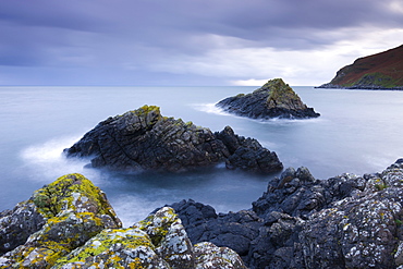
Murlough Bay islands, Causeway Coast, County Antrim, Ulster, Northern Ireland, United Kingdom, Europe
Murlough Bay on the Causeway Coast, County Antrim, Ulster, Northern Ireland, United Kingdom, Europe
Stormy skies over Fair Head on the Causeway Coast, County Antrim, Ulster, Northern Ireland, United Kingdom, Europe
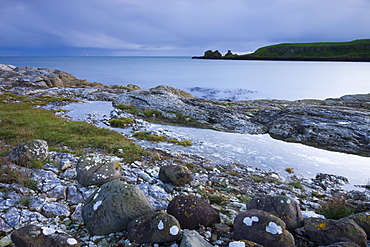
Rocky coastline near Portmuck on Islandmagee, County Antrim, Ulster, Northern Ireland, United Kingdom, Europe
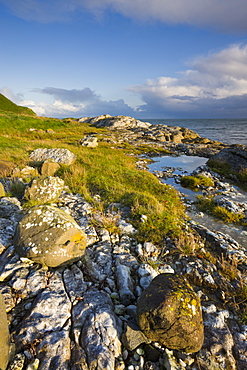
Coastline near Portmuck on Islandmagee, Ulster, Northern Ireland, United Kingdom, Europe
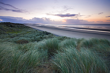
Sand dunes at Murlough Nature Reserve, with views to Dundrum Bay, County Down, Ulster, Northern Ireland, United Kingdom, Europe
Ferns growing amongst the sand dunes at Murlough Nature Reserve, with views to Dundrum Bay and the Mountains of Mourne beyond, County Down, Ulster, Northern Ireland, United Kingdom, Europe
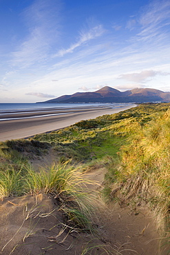
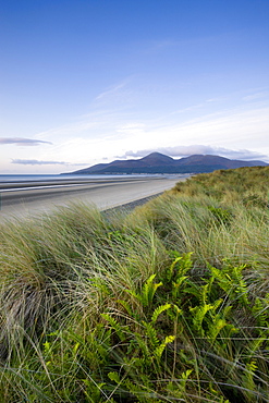
Sand dunes at Murlough Nature Reserve, with views to Dundrum Bay and the Mountains of Mourne beyond, County Down, Ulster, Northern Ireland, United Kingdom, Europe
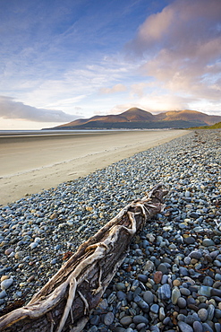
Drfitwood on Dundrum Bay looking towards the Mountains of Mourne, County Down, Ulster, Northern Ireland, United Kingdom, Europe
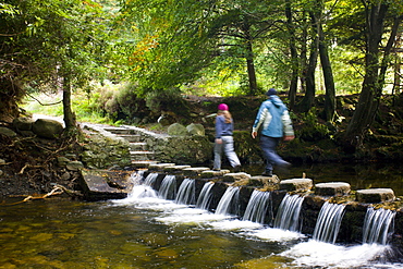
Walkers crossing stepping stones over a cascading stream in Tollymore Forest Park, County Down, Ulster, Northern Ireland, United Kingdom, Europe