Results
61 results found
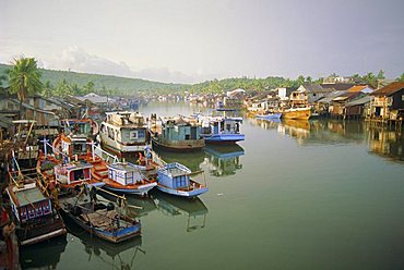
Fishing trawlers in the harbour, Phu Quoc island in south west of the country, Vietnam
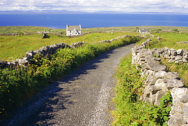
Country road, Inishmore, Aran Islands, County Galway, Connacht, Republic of Ireland (Eire), Europe

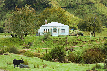
Small working country library, near Dargaville, Northland, North Island, New Zealand, Pacific
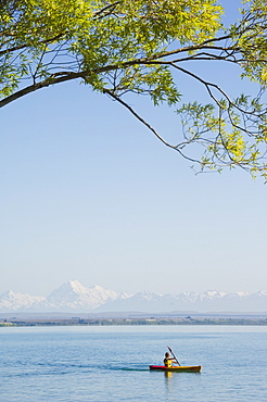
Kayaking on Lake Benmore with Aoraki (Mount Cook), 3754m, Australasia's highest mountain, in the distance, Mackenzie Country, South Island, New Zealand, Pacific
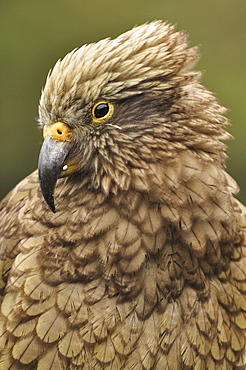
Kea (Nestor notabilis), Arthur's Pass, Canterbury high country, South Island, New Zealand, Pacific
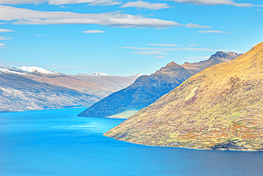
Lake Wakatipu and the Remarkables mountain range, high angle view, Queenstown, South Island, New Zealand
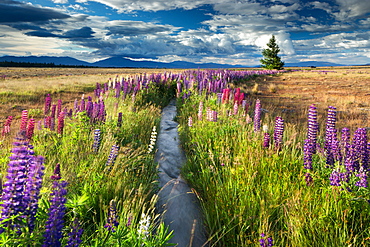
Lupin lined stream, near Lake Tekapo, Mackenzie Country, South Island, New Zealand, Pacific
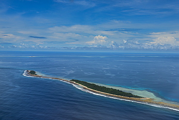
Aerial of the country of Tuvalu, South Pacific
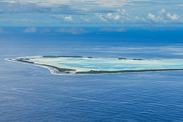
Aerial of the country of Tuvalu, South Pacific
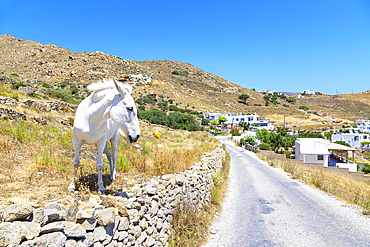
White horse standing near country road, Serifos Island, Cyclades, Greek Islands, Greece, Europe
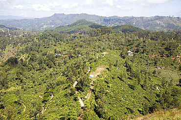
View over Newburgh tea estate, Ella, Badulla District, Uva Province, Sri Lanka, Asia
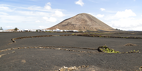
Volcano cone and black volcanic soil farmland, Monta Tinache, near Tinajo, Lanzarote, Canary Islands, Spain, Atlantic, Europe
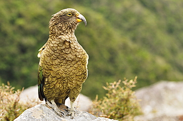
Kea (Nestor notabilis), Arthur's Pass, Canterbury high country, South Island, New Zealand, Pacific
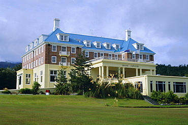
The Grand Chateau, one of the country's best known hotels, Whakapapa village, below Mount Ruapeho, Tongariro National Park, North Island, New Zealand, Pacific

Cyclists on country road, Alaro, Mallorca, Balearic Islands, Spain, Europe
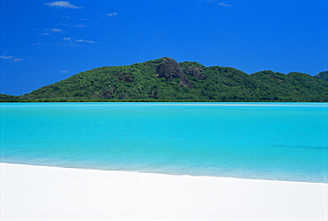
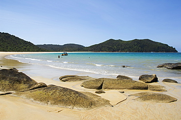
Whitehaven Beach, one of the finest in the country, on the east coast of Whitsunday Island, Whitsunday Group, Queensland, Australia
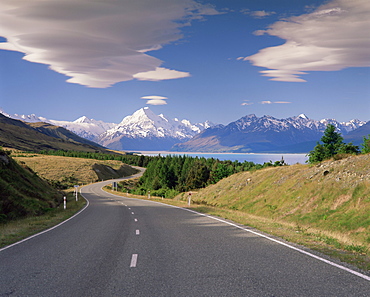
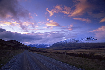
Road leading to Mount Cook National Park, Mount Cook (Aoraki), Southern Alps, Mackenzie Country, South Canterbury, Canterbury, South Island, New Zealand, Pacific
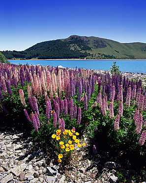
Wild lupin flowers (Lupinus) beside Lake Tekapo, Mackenzie Country, South Canterbury, Canterbury, South Island, New Zealand, Pacific
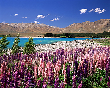
Wild lupin flowers (Lupinus) beside Lake Tekapo, Mackenzie Country, South Canterbury, Canterbury, South Island, New Zealand, Pacific
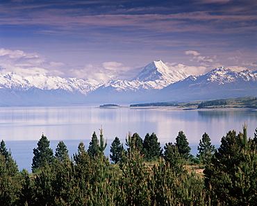
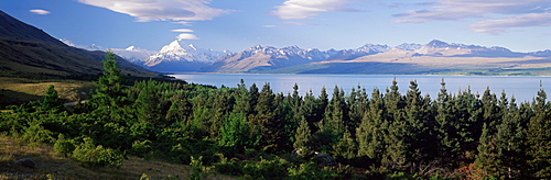
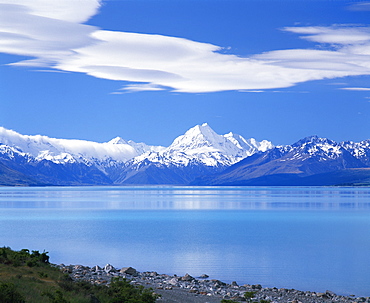
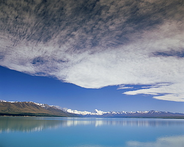
Mount Cook (Aoraki) viewed across Lake Pukaki, Mackenzie Country, South Canterbury, Canterbury, South Island, New Zealand, Pacific
Snow covered Mount Cook (Aoraki) viewed across Lake Pukaki, Southern Alps, Mackenzie Country, South Canterbury, Canterbury, South Island, New Zealand, Pacific
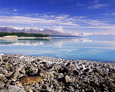
Mount Cook (Aoraki) viewed across Lake Pukaki, Mackenzie Country, South Canterbury, Canterbury, South Island, New Zealand, Pacific
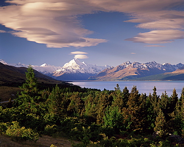
Lenticular cloud over Mount Cook (Aoraki), Mackenzie Country, South Canterbury, South Island, New Zealand, Pacific
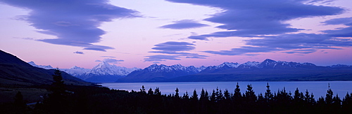
Lenticular cloud over Mount Cook (Aoraki), Mackenzie Country, South Canterbury, South Island, New Zealand, Pacific
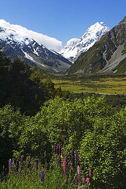
Lupins in flower below Aoraki (Mount Cook), 3755m, the highest peak in New Zealand, Te Wahipounamu UNESCO World Heritage Site, Aoraki (Mount Cook) National Park, Southern Alps, Mackenzie Country, South Island, New Zealand, Pacific
Mount Cook (Aoraki), Mount Cook National Park, UNESCO World Heritage Site, Southern Alps, Mackenzie Country, Canterbury, South Island, New Zealand, Pacific
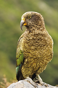
Kea (Nestor notabilis), Arthur's Pass, Canterbury high country, South Island, New Zealand, Pacific
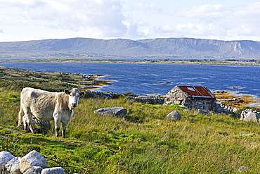
Landscape viewed from country road at the north of Lettermore island, west coast, Connemara, County Galway, Connacht, Republic of Ireland
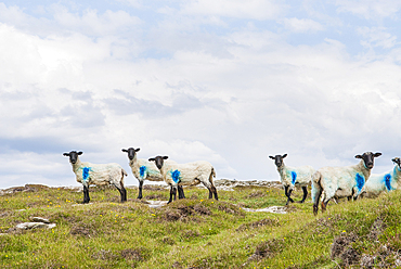
Sheep at Inishbofin island, Connemara, County Galway, Connacht, Republic of Ireland
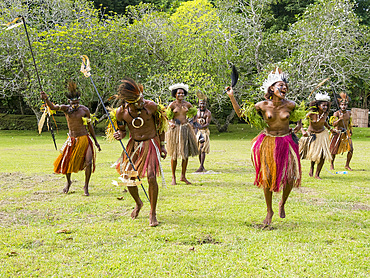
Six different groups of native warriors, drummers, and dancers perform on Kwato Island, Papua New Guinea, Pacific
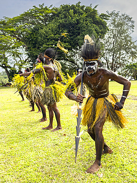
Six different groups of native warriors, drummers, and dancers perform on Kwato Island, Papua New Guinea, Pacific
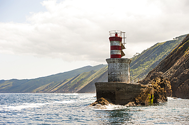
Beacon at the entrance of channel mouth of Pasaia, San Sebastian, Bay of Biscay, province of Gipuzkoa, Basque Country, Spain, Europe
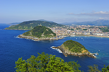
La Concha Bay viewed from the Monte Igeldo, San Sebastian, Bay of Biscay, province of Gipuzkoa, Basque Country, Spain, Europe
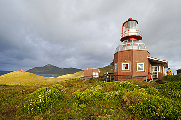
Lighthouse of Horn island with Cape Horn in the background, Tierra del Fuego, Patagonia, Chile, South America
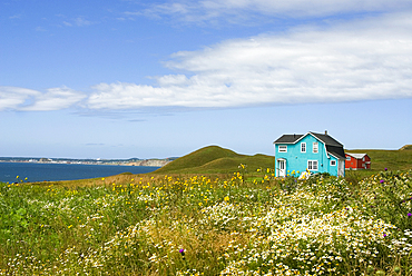
Wooden house, Havre aux Maisons island, Magdalen Islands, Gulf of Saint Lawrence, Quebec province, Canada, North America
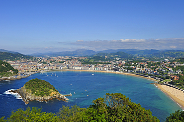
La Concha Bay viewed from the Monte Igeldo, San Sebastian, Bay of Biscay, province of Gipuzkoa, Basque Country, Spain, Europe

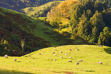
Willow trees, Lake Pearson, Canterbury high country, South Island, New Zealand, Pacific
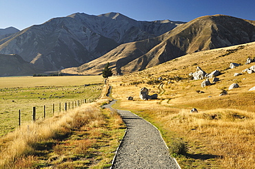
Castle Hill, Canterbury high country, South Island, New Zealand, Pacific
Country road, Rakaia Gorge, South Island, New Zealand, Pacific
Aoraki (Mount Cook), viewed across Lake Pukaki, Mackenzie Country, South Canterbury, South Island, New Zealand, Pacific
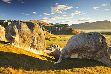
Castle Hill, Canterbury high country, South Island, New Zealand, Pacific
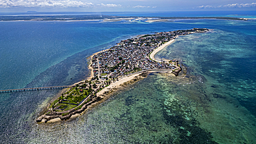
Aerial of the Island of Mozambique, UNESCO World Heritage Site, Mozambique, Africa
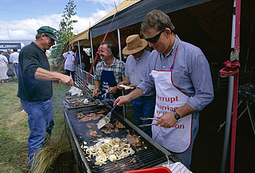
Barbie or barbeque at the Mayfield country show on the Canterbury Plains, Mayfield, Canterbury, South Island, New Zealand, Pacific

Old country estate, Muhu, an island to the west of Tallinn, Estonia, Baltic States, Europe
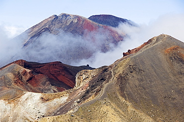
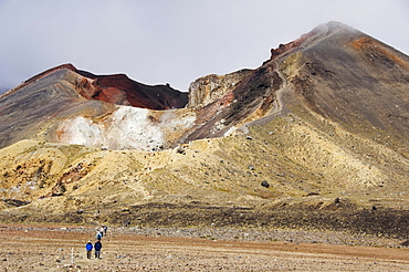
Mount Ngauruhoe, 2287m, and Red Crater on the Tongariro Crossing, Tongariro National Park, the oldest national park in the country, UNESCO World Heritage Site, Taupo Volcanic Zone, North Island, New Zealand, Pacific
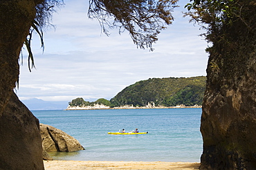
Kayak at Watering Cove, Abel Tasman National Park, the smallest national park in the country, named after the Dutchman, the first European to discover New Zealand in 1642, Nelson, South Island, New Zealand, Pacific
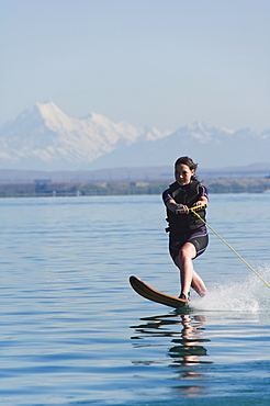
Water skier on Lake Benmore and a distant Aoraki (Mount Cook), 3754m, Australasia's highest mountain, Mackenzie Country, Otago, South Island, New Zealand, Pacific
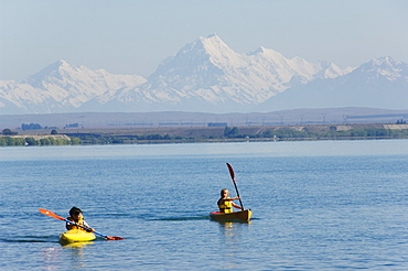
Kayaking on Lake Benmore and a distant Aoraki (Mount Cook), 3754m, Australasia's highest mountain, Southern Alps, Mackenzie Country, Otago, South Island, New Zealand, Pacific
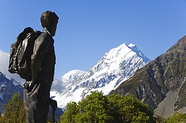
A statue of Sir Edmund Hillary, the first man to climb Mount Everest, in front of the Hermitage Hotel and Aoraki (Mount Cook), 3755m, the highest peak in New Zealand, Te Wahipounamu UNESCO World Heritage Site, Aoraki (Mount Cook) National Park, Southern Alps, Mackenzie Country, South Island, New Zealand, Pacific
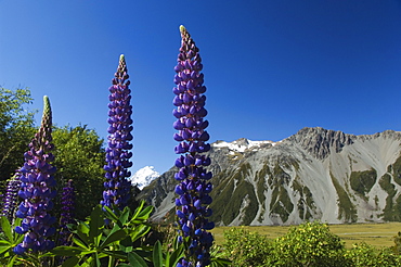
Lupins in flower below Aoraki (Mount Cook), 3755m, the highest peak in New Zealand, Te Wahipounamu UNESCO World Heritage Site, Aoraki (Mount Cook) National Park, Southern Alps, Mackenzie Country, South Island, New Zealand, Pacific
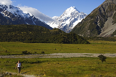
Hikers below Aoraki (Mount Cook), 3755m, the highest peak in New Zealand, Te Wahipounamu UNESCO World Heritage Site, Aoraki (Mount Cook) National Park, Southern Alps, Mackenzie Country, South Island, New Zealand, Pacific
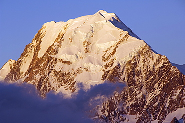
Sunset on the West Face of Aoraki (Mount Cook), 3755m, the highest peak in New Zealand, Te Wahipounamu UNESCO World Heritage Site, Aoraki (Mount Cook) National Park, Southern Alps, Mackenzie Country, South Island, New Zealand, Pacific
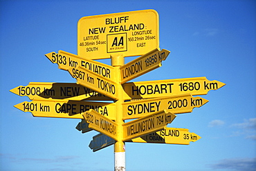
Signposts to cities around the world at most southerly point in the country, Bluff, Southland, South Island, New Zealand, Pacific
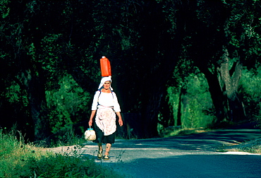
A local woman walking while carrying a can on her head and a pot in her hand, Corfu Island, Greek Islands
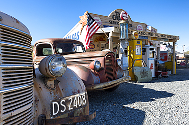
Three Creeks Trading Company, Burkes Pass, Mackenzie Country, Canterbury, South Island, New Zealand, Pacific
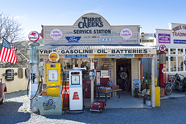
Three Creeks Trading Company, Burkes Pass, Mackenzie Country, Canterbury, South Island, New Zealand, Pacific
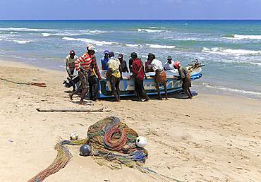
Traditional fishing hauling nets, Nilavelli beach, near Trincomalee, Eastern province, Sri Lanka, Asia

Traditional fishing hauling nets, Nilavelli beach, near Trincomalee, Eastern province, Sri Lanka, Asia
Onetahuti Beach in Abel Tasman National Park, the smallest national park in the country, named after the Dutch explorer the first European to discover New Zealand in 1642, Nelson, South Island, New Zealand, Pacific
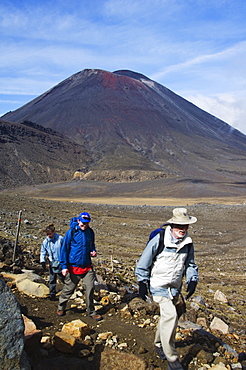
Hikers in front of Mount Ngauruhoe, 2287m, on the Tongariro Crossing, Tongariro National Park, the oldest national park in the country, UNESCO World Heritage Site, Taupo Volcanic Zone, North Island, New Zealand, Pacific
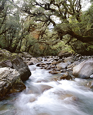
High country forest, overhanging with mosses, Gulliver River, on Grave-Talbot Track, Fiordland National Park, Otago, South Island, New Zealand, Pacific
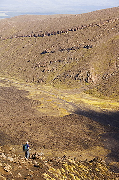
Hikers at Red Crater on the Tongariro Crossing, Tongariro National Park, the oldest national park in the country, UNESCO World Heritage Site, Taupo Volcanic Zone, North Island, New Zealand, Pacific
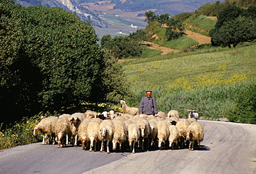
Shepherd on a country road, Castelvetrano, island of Sicily, Italy, Mediterranean, Europe
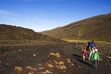
A family walking the Tongariro Crossing, Tongariro National Park, the oldest national park in the country, UNESCO World Heritage Site, Taupo Volcanic Zone, North Island, New Zealand, Pacific
Hikers walking through a lava field on the Tongariro Crossing, Tongariro National Park, the oldest national park in the country, UNESCO World Heritage Site, Taupo Volcanic Zone, North Island, New Zealand, Pacific

Quadbiking around a cross country circuit, Rotorua, North Island, New Zealand, Pacific
Mudstone Hill Farmland, King Country, North Island, New Zealand, Pacific
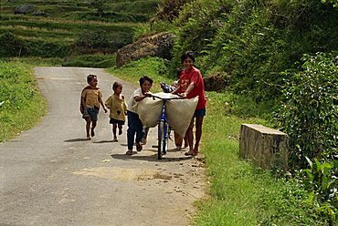
Small group of children carrying load on bicycle and walking up a country road, Toraja area, island of Sulawesi, Indonesia, Southeast Asia, Asia
Mudstone Hill Farmland, King Country, North Island, New Zealand, Pacific
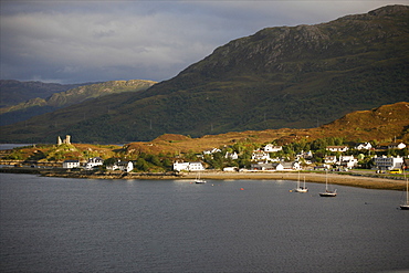
View of the Isle of Skye, Kyle of Lochalsh, Loch Duich, in the west part of the country, from the Royal Scotsman train, Scotland, United Kingdom, Europe
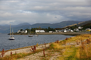
View of the Isle of Skye, Kyle of Lochalsh, Loch Duich, in the west part of the country, from the Royal Scotsman train, Scotland, United Kingdom, Europe
Country Side, Mountain Vilage, 03/04/2009. Landscape view from the road in the area of Praia on Sao Tiago Island, Cape Verde. Native woman standing on hill side in mid day. . Praia, Sao Tiago Island. Cape Verde

Antonio Peak, 03/04/2009. Views of the surrounding country side of Assomada, Praia on Sao Tiago Island of the Cape Verde. Volcanic landscape and road. Praia, Sao Tiago Island. Cape Verde
Country Side, Mountain Vilage, 03/04/2009. Landscape view from the road in the area of Praia on Sao Tiago Island, Cape Verde. Praia, Sao Tiago Island. Cape Verde
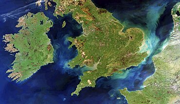
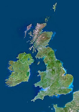
British Isles and northern France, satellite image
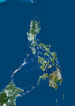
Philippines, Asia, True Colour Satellite Image. Satellite view of the Philippines. This image was compiled from data acquired by LANDSAT 5 & 7 satellites.
United Kingdom, Europe, True Colour Satellite Image With Border. Satellite view of Bulgaria (with border). This image was compiled from data acquired by LANDSAT 5 & 7 satellites.
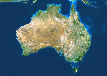
Australia, True Colour Satellite Image. Australia, true colour satellite image. This image was compiled from data acquired by LANDSAT 5 & 7 satellites.
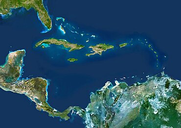
Caribbean Islands, True Colour Satellite Image. Caribbean Islands, true colour satellite image. This image was compiled from data acquired by LANDSAT 5 & 7 satellites.

Puerto Rico And The Virgin Islands, True Colour Satellite Image. Puerto Rico and the Virgin Islands. True colour satellite image showing Puerto Rico (west) and the Virgin islands (east). Composite image using data from LANDSAT 5 & 7satellites.
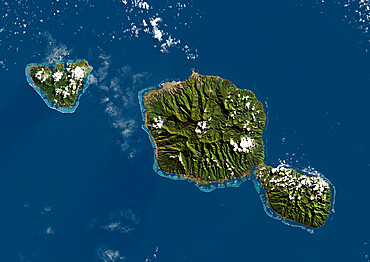
Tahiti, French Polynesia, French Overseas, Oceania, True Colour Satellite Image
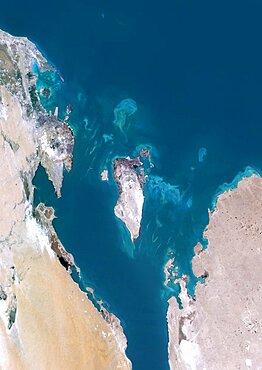
Bahrain, Middle East, Asia, True Colour Satellite Image. Satellite view of Bahrain . This image was compiled from data acquired by LANDSAT 5 & 7 satellites.

Haiti And Dominican Republic, True Colour Satellite Image. Haiti and Dominican Republic, true colour satellite image. This image was compiled from data acquired by LANDSAT 5 & 7 satellites.
Guadeloupe, French Overseas, Caribbean, True Colour Satellite Image. Satellite view of Guadeloupe, France. This image was compiled from data acquired by LANDSAT 5 & 7 satellites.
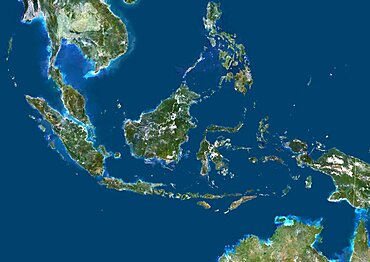
Indonesia, Asia, True Colour Satellite Image With Border. Satellite view of Indonesia (with border). This image was compiled from data acquired by LANDSAT 5 & 7 satellites.
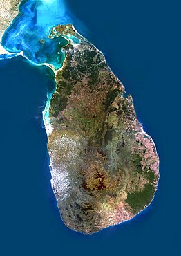
Sri Lanka, Asia, True Colour Satellite Image. Satellite view of Sri Lanka. This image was compiled from data acquired by LANDSAT 5 & 7 satellites.
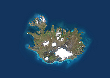
Iceland, True Colour Satellite Image. Iceland, true colour satellite image
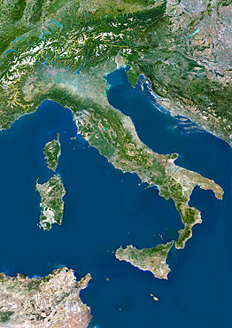
Italy, True Colour Satellite Image With Border. Italy, true colour satellite image with border
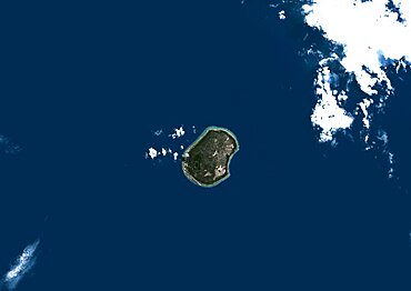
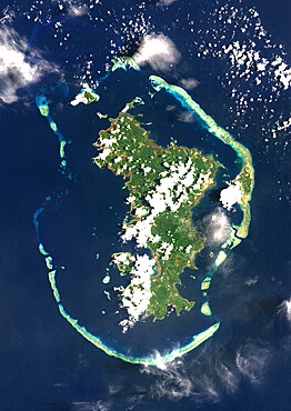
Nauru, True Colour Satellite Image. Nauru. True colour satellite image of Nauru, an island nation in Micronesia in the South Pacific. This image was taken on 29 June 1999, by the LANDSAT 7 satellite.
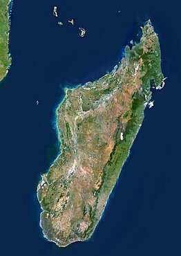
Madagascar, True Colour Satellite Image. Madagascar, true colour satellite image. This image was compiled from data acquired by LANDSAT 5 & 7 satellites.
Saint Vincent And The Grenadines, True Colour Satellite Image
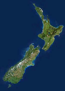
New Zealand, True Colour Satellite Image. New Zealand, true colour satellite image. This image was compiled from data acquired by LANDSAT 5 & 7 satellites.
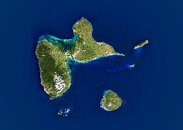
Mayotte, Africa, True Colour Satellite Image. Satellite view of Mayotte, an overseas collectivity of France, in the northern Mozambique Channel in the Indian Ocean. This image was compiled from data acquired by LANDSAT 5 & 7 satellites.
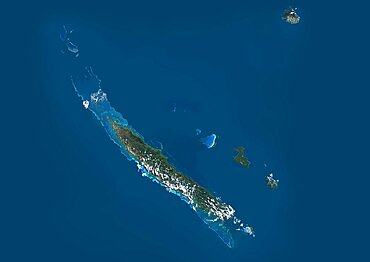
New Caledonia, French Overseas, Oceania, True Colour Satellite Image. Satellite view of New Caledonia, France. This image was compiled from data acquired by LANDSAT 5 & 7 satellites.
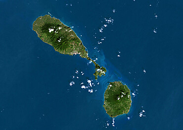
Saint Kits And Nevis, True Colour Satellite Image
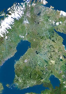
Finland, Europe, True Colour Satellite Image With Border. Satellite view of Finland (with border). This image was compiled from data acquired by LANDSAT 5 & 7 satellites.
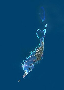
Palau, Micronesia, Oceania, True Colour Satellite Image. Satellite view of Palau, Micronesia, in the North Pacific ocean. This image was compiled from data acquired by LANDSAT 5 & 7 satellites.
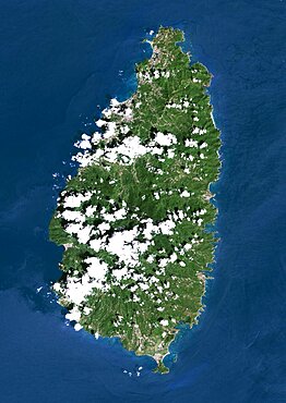
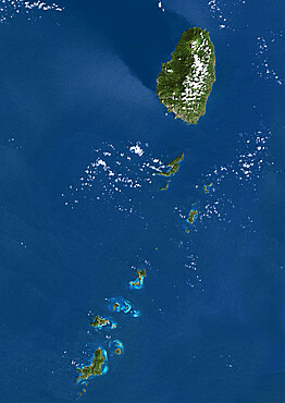
Saint Lucia, True Colour Satellite Image. Saint Lucia, true colour satellite image taken on 16 October 2000, by the LANDSAT 7 satellite.
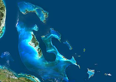
Bahamas, True Colour Satellite Image. Satellite view of the Bahamas. This image was compiled from data acquired by LANDSAT 5 & 7 satellites.
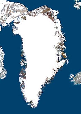
Greenland, True Colour Satellite Image With Mask. Satellite view of Greenland (with mask). This image was compiled from data acquired by LANDSAT 5 & 7 satellites.