Results
11 results found
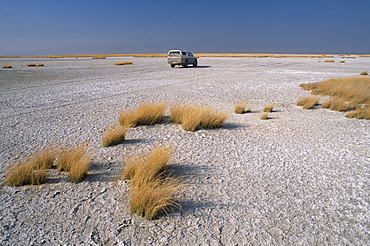
A 4x4 in the salt pans of Makgadikgadi Pan National Park, Makgadikgadi Pan, the largest salt flat complex in the world covering 16000 square kilometers, central Botswana, Africa
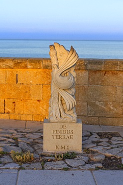
Kilometer zero, Basilica of Santa Maria de Finibus Terrae, Santa Maria di Leuca, Castrignano del Capo, Lecce, Salento, Apulia, Italy
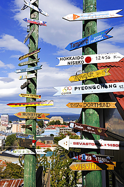
Sign post showing distance of some cities across the world from Punta Arenas, Strait of Magellan, Peninsula of Brunswick, Chile, South America
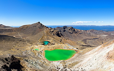
The Tongariro Crossing crosses 19 kilometers of the barren, volcanic desert, Tongariro National Park, UNESCO World Heritge Site, North Island, New Zealand, Pacific

The Yellow River (Huang He) at 5464 kilometers, the second longest river in China, after the Yangtze, and the sixth-longest in the world, at sunrise, Sichuan Province, China, Asia

The Monastery of Ayia Triada of the Moutari on the Akrotiri Peninsula, sixteen kilometers from Hania on the north coast of Crete, Greek Islands, Greece, Europe

The Monastery of Ayia Triada of the Moutari on the Akrotiri Peninsula, sixteen kilometers from Hania on the north coast of Crete, Greek Islands, Greece, Europe
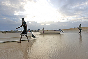
Hardest hit was a 650 kilometers stretch of the somali coastline between garacad (mudung region) and xaafuun (bari region), which forms part of the puntland province near the horn of africa. The tsunami resulted in the death of some 300 people and extensive destruction of shelters, houses and water sources as well as fishing gear. The livelihoods of many people residing in towns and small villages along the somali indian ocean coastline, particularly in the northern regions, were devastated
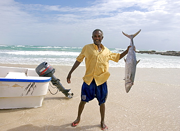
Hardest hit was a 650 kilometers stretch of the somali coastline between garacad (mudung region) and xaafuun (bari region), which forms part of the puntland province near the horn of africa. The tsunami resulted in the death of some 300 people and extensive destruction of shelters, houses and water sources as well as fishing gear. The livelihoods of many people residing in towns and small villages along the somali indian ocean coastline, particularly in the northern regions, were devastated
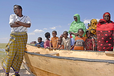
Hardest hit was a 650 kilometers stretch of the somali coastline between garacad (mudung region) and xaafuun (bari region), which forms part of the puntland province near the horn of africa. The tsunami resulted in the death of some 300 people and extensive destruction of shelters, houses and water sources as well as fishing gear. The livelihoods of many people residing in towns and small villages along the somali indian ocean coastline, particularly in the northern regions, were devastated

Hardest hit was a 650 kilometers stretch of the somali coastline between garacad (mudung region) and xaafuun (bari region), which forms part of the puntland province near the horn of africa. The tsunami resulted in the death of some 300 people and extensive destruction of shelters, houses and water sources as well as fishing gear. The livelihoods of many people residing in towns and small villages along the somali indian ocean coastline, particularly in the northern regions, were devastated
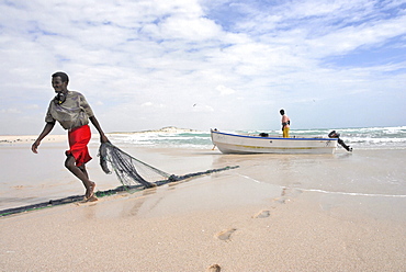
Hardest hit was a 650 kilometers stretch of the somali coastline between garacad (mudung region) and xaafuun (bari region), which forms part of the puntland province near the horn of africa. The tsunami resulted in the death of some 300 people and extensive destruction of shelters, houses and water sources as well as fishing gear. The livelihoods of many people residing in towns and small villages along the somali indian ocean coastline, particularly in the northern regions, were devastated
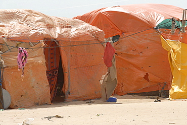
Hardest hit was a 650 kilometers stretch of the somali coastline between garacad (mudung region) and xaafuun (bari region), which forms part of the puntland province near the horn of africa. The tsunami resulted in the death of some 300 people and extensive destruction of shelters, houses and water sources as well as fishing gear. The livelihoods of many people residing in towns and small villages along the somali indian ocean coastline, particularly in the northern regions, were devastated

Hardest hit was a 650 kilometers stretch of the somali coastline between garacad (mudung region) and xaafuun (bari region), which forms part of the puntland province near the horn of africa. The tsunami resulted in the death of some 300 people and extensive destruction of shelters, houses and water sources as well as fishing gear. The livelihoods of many people residing in towns and small villages along the somali indian ocean coastline, particularly in the northern regions, were devastated

Hardest hit was a 650 kilometers stretch of the somali coastline between garacad (mudung region) and xaafuun (bari region), which forms part of the puntland province near the horn of africa. The tsunami resulted in the death of some 300 people and extensive destruction of shelters, houses and water sources as well as fishing gear. The livelihoods of many people residing in towns and small villages along the somali indian ocean coastline, particularly in the northern regions, were devastated
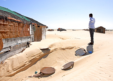
Hardest hit was a 650 kilometers stretch of the somali coastline between garacad (mudung region) and xaafuun (bari region), which forms part of the puntland province near the horn of africa. The tsunami resulted in the death of some 300 people and extensive destruction of shelters, houses and water sources as well as fishing gear. The livelihoods of many people residing in towns and small villages along the somali indian ocean coastline, particularly in the northern regions, were devastated

Hardest hit was a 650 kilometers stretch of the somali coastline between garacad (mudung region) and xaafuun (bari region), which forms part of the puntland province near the horn of africa. The tsunami resulted in the death of some 300 people and extensive destruction of shelters, houses and water sources as well as fishing gear. The livelihoods of many people residing in towns and small villages along the somali indian ocean coastline, particularly in the northern regions, were devastated

Hardest hit was a 650 kilometers stretch of the somali coastline between garacad (mudung region) and xaafuun (bari region), which forms part of the puntland province near the horn of africa. The tsunami resulted in the death of some 300 people and extensive destruction of shelters, houses and water sources as well as fishing gear. The livelihoods of many people residing in towns and small villages along the somali indian ocean coastline, particularly in the northern regions, were devastated

Hardest hit was a 650 kilometers stretch of the somali coastline between garacad (mudung region) and xaafuun (bari region), which forms part of the puntland province near the horn of africa. The tsunami resulted in the death of some 300 people and extensive destruction of shelters, houses and water sources as well as fishing gear. The livelihoods of many people residing in towns and small villages along the somali indian ocean coastline, particularly in the northern regions, were devastated
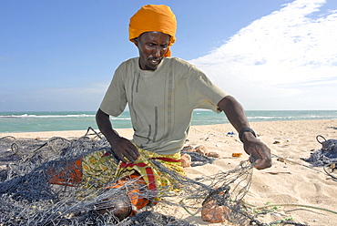
Hardest hit was a 650 kilometers stretch of the somali coastline between garacad (mudung region) and xaafuun (bari region), which forms part of the puntland province near the horn of africa. The tsunami resulted in the death of some 300 people and extensive destruction of shelters, houses and water sources as well as fishing gear. The livelihoods of many people residing in towns and small villages along the somali indian ocean coastline, particularly in the northern regions, were devastated
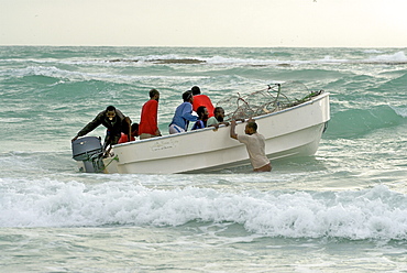
Hardest hit was a 650 kilometers stretch of the somali coastline between garacad (mudung region) and xaafuun (bari region), which forms part of the puntland province near the horn of africa. The tsunami resulted in the death of some 300 people and extensive destruction of shelters, houses and water sources as well as fishing gear. The livelihoods of many people residing in towns and small villages along the somali indian ocean coastline, particularly in the northern regions, were devastated
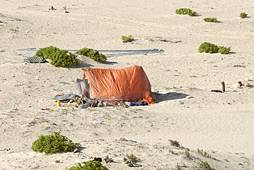
Hardest hit was a 650 kilometers stretch of the somali coastline between garacad (mudung region) and xaafuun (bari region), which forms part of the puntland province near the horn of africa. The tsunami resulted in the death of some 300 people and extensive destruction of shelters, houses and water sources as well as fishing gear. The livelihoods of many people residing in towns and small villages along the somali indian ocean coastline, particularly in the northern regions, were devastated
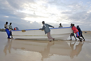
Hardest hit was a 650 kilometers stretch of the somali coastline between garacad (mudung region) and xaafuun (bari region), which forms part of the puntland province near the horn of africa. The tsunami resulted in the death of some 300 people and extensive destruction of shelters, houses and water sources as well as fishing gear. The livelihoods of many people residing in towns and small villages along the somali indian ocean coastline, particularly in the northern regions, were devastated
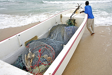
Hardest hit was a 650 kilometers stretch of the somali coastline between garacad (mudung region) and xaafuun (bari region), which forms part of the puntland province near the horn of africa. The tsunami resulted in the death of some 300 people and extensive destruction of shelters, houses and water sources as well as fishing gear. The livelihoods of many people residing in towns and small villages along the somali indian ocean coastline, particularly in the northern regions, were devastated
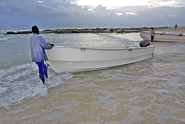
Hardest hit was a 650 kilometers stretch of the somali coastline between garacad (mudung region) and xaafuun (bari region), which forms part of the puntland province near the horn of africa. The tsunami resulted in the death of some 300 people and extensive destruction of shelters, houses and water sources as well as fishing gear. The livelihoods of many people residing in towns and small villages along the somali indian ocean coastline, particularly in the northern regions, were devastated

Hardest hit was a 650 kilometers stretch of the somali coastline between garacad (mudung region) and xaafuun (bari region), which forms part of the puntland province near the horn of africa. The tsunami resulted in the death of some 300 people and extensive destruction of shelters, houses and water sources as well as fishing gear. The livelihoods of many people residing in towns and small villages along the somali indian ocean coastline, particularly in the northern regions, were devastated
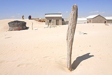
Hardest hit was a 650 kilometers stretch of the somali coastline between garacad (mudung region) and xaafuun (bari region), which forms part of the puntland province near the horn of africa. The tsunami resulted in the death of some 300 people and extensive destruction of shelters, houses and water sources as well as fishing gear. The livelihoods of many people residing in towns and small villages along the somali indian ocean coastline, particularly in the northern regions, were devastated
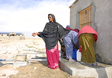
Hardest hit was a 650 kilometers stretch of the somali coastline between garacad (mudung region) and xaafuun (bari region), which forms part of the puntland province near the horn of africa. The tsunami resulted in the death of some 300 people and extensive destruction of shelters, houses and water sources as well as fishing gear. The livelihoods of many people residing in towns and small villages along the somali indian ocean coastline, particularly in the northern regions, were devastated

Hardest hit was a 650 kilometers stretch of the somali coastline between garacad (mudung region) and xaafuun (bari region), which forms part of the puntland province near the horn of africa. The tsunami resulted in the death of some 300 people and extensive destruction of shelters, houses and water sources as well as fishing gear. The livelihoods of many people residing in towns and small villages along the somali indian ocean coastline, particularly in the northern regions, were devastated
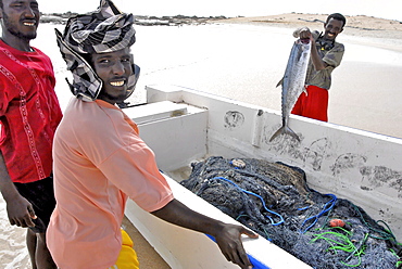
Hardest hit was a 650 kilometers stretch of the somali coastline between garacad (mudung region) and xaafuun (bari region), which forms part of the puntland province near the horn of africa. The tsunami resulted in the death of some 300 people and extensive destruction of shelters, houses and water sources as well as fishing gear. The livelihoods of many people residing in towns and small villages along the somali indian ocean coastline, particularly in the northern regions, were devastated
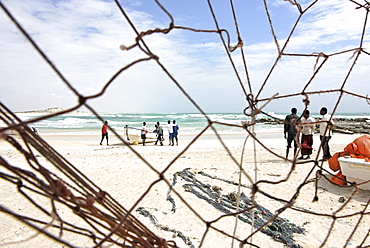
Hardest hit was a 650 kilometers stretch of the somali coastline between garacad (mudung region) and xaafuun (bari region), which forms part of the puntland province near the horn of africa. The tsunami resulted in the death of some 300 people and extensive destruction of shelters, houses and water sources as well as fishing gear. The livelihoods of many people residing in towns and small villages along the somali indian ocean coastline, particularly in the northern regions, were devastated
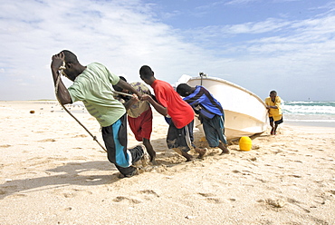
Hardest hit was a 650 kilometers stretch of the somali coastline between garacad (mudung region) and xaafuun (bari region), which forms part of the puntland province near the horn of africa. The tsunami resulted in the death of some 300 people and extensive destruction of shelters, houses and water sources as well as fishing gear. The livelihoods of many people residing in towns and small villages along the somali indian ocean coastline, particularly in the northern regions, were devastated

Hardest hit was a 650 kilometers stretch of the somali coastline between garacad (mudung region) and xaafuun (bari region), which forms part of the puntland province near the horn of africa. The tsunami resulted in the death of some 300 people and extensive destruction of shelters, houses and water sources as well as fishing gear. The livelihoods of many people residing in towns and small villages along the somali indian ocean coastline, particularly in the northern regions, were devastated
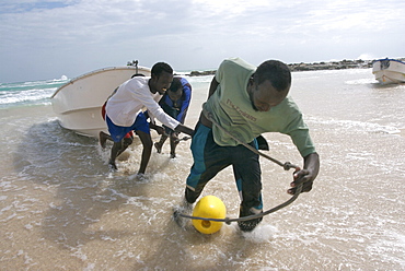
Hardest hit was a 650 kilometers stretch of the somali coastline between garacad (mudung region) and xaafuun (bari region), which forms part of the puntland province near the horn of africa. The tsunami resulted in the death of some 300 people and extensive destruction of shelters, houses and water sources as well as fishing gear. The livelihoods of many people residing in towns and small villages along the somali indian ocean coastline, particularly in the northern regions, were devastated
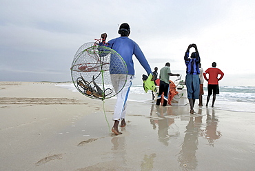
Hardest hit was a 650 kilometers stretch of the somali coastline between garacad (mudung region) and xaafuun (bari region), which forms part of the puntland province near the horn of africa. The tsunami resulted in the death of some 300 people and extensive destruction of shelters, houses and water sources as well as fishing gear. The livelihoods of many people residing in towns and small villages along the somali indian ocean coastline, particularly in the northern regions, were devastated

Hardest hit was a 650 kilometers stretch of the somali coastline between garacad (mudung region) and xaafuun (bari region), which forms part of the puntland province near the horn of africa. The tsunami resulted in the death of some 300 people and extensive destruction of shelters, houses and water sources as well as fishing gear. The livelihoods of many people residing in towns and small villages along the somali indian ocean coastline, particularly in the northern regions, were devastated

Hardest hit was a 650 kilometers stretch of the somali coastline between garacad (mudung region) and xaafuun (bari region), which forms part of the puntland province near the horn of africa. The tsunami resulted in the death of some 300 people and extensive destruction of shelters, houses and water sources as well as fishing gear. The livelihoods of many people residing in towns and small villages along the somali indian ocean coastline, particularly in the northern regions, were devastated
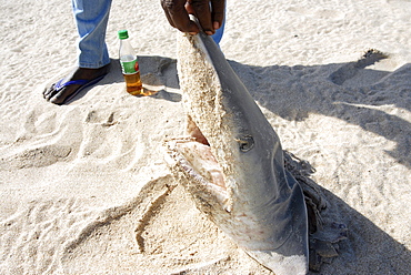
Hardest hit was a 650 kilometers stretch of the somali coastline between garacad (mudung region) and xaafuun (bari region), which forms part of the puntland province near the horn of africa. The tsunami resulted in the death of some 300 people and extensive destruction of shelters, houses and water sources as well as fishing gear. The livelihoods of many people residing in towns and small villages along the somali indian ocean coastline, particularly in the northern regions, were devastated., /shark fishing is main source of income for many of the somalis fishermen
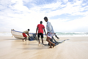
Hardest hit was a 650 kilometers stretch of the somali coastline between garacad (mudung region) and xaafuun (bari region), which forms part of the puntland province near the horn of africa. The tsunami resulted in the death of some 300 people and extensive destruction of shelters, houses and water sources as well as fishing gear. The livelihoods of many people residing in towns and small villages along the somali indian ocean coastline, particularly in the northern regions, were devastated

Hardest hit was a 650 kilometers stretch of the somali coastline between garacad (mudung region) and xaafuun (bari region), which forms part of the puntland province near the horn of africa. The tsunami resulted in the death of some 300 people and extensive destruction of shelters, houses and water sources as well as fishing gear. The livelihoods of many people residing in towns and small villages along the somali indian ocean coastline, particularly in the northern regions, were devastated
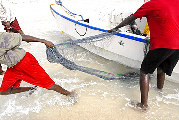
Hardest hit was a 650 kilometers stretch of the somali coastline between garacad (mudung region) and xaafuun (bari region), which forms part of the puntland province near the horn of africa. The tsunami resulted in the death of some 300 people and extensive destruction of shelters, houses and water sources as well as fishing gear. The livelihoods of many people residing in towns and small villages along the somali indian ocean coastline, particularly in the northern regions, were devastated

Hardest hit was a 650 kilometers stretch of the somali coastline between garacad (mudung region) and xaafuun (bari region), which forms part of the puntland province near the horn of africa. The tsunami resulted in the death of some 300 people and extensive destruction of shelters, houses and water sources as well as fishing gear. The livelihoods of many people residing in towns and small villages along the somali indian ocean coastline, particularly in the northern regions, were devastated
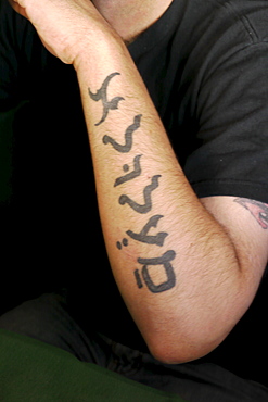
SYRIA Maalula, the last remaining village in Syria where Aramaic is still spoken. This is not part of Wadi al-Nasarah, being a 150 kilometers to the south, but is nevertheless interesting as the majority of the population are Christians, who enjoy the Convent and shrine of saint Tecla being in their midst
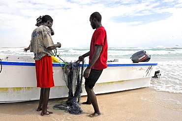
Hardest hit was a 650 kilometers stretch of the somali coastline between garacad (mudung region) and xaafuun (bari region), which forms part of the puntland province near the horn of africa. The tsunami resulted in the death of some 300 people and extensive destruction of shelters, houses and water sources as well as fishing gear. The livelihoods of many people residing in towns and small villages along the somali indian ocean coastline, particularly in the northern regions, were devastated

Hardest hit was a 650 kilometers stretch of the somali coastline between garacad (mudung region) and xaafuun (bari region), which forms part of the puntland province near the horn of africa. The tsunami resulted in the death of some 300 people and extensive destruction of shelters, houses and water sources as well as fishing gear. The livelihoods of many people residing in towns and small villages along the somali indian ocean coastline, particularly in the northern regions, were devastated
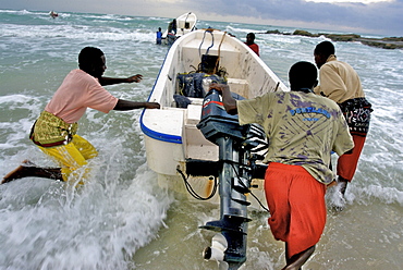
Hardest hit was a 650 kilometers stretch of the somali coastline between garacad (mudung region) and xaafuun (bari region), which forms part of the puntland province near the horn of africa. The tsunami resulted in the death of some 300 people and extensive destruction of shelters, houses and water sources as well as fishing gear. The livelihoods of many people residing in towns and small villages along the somali indian ocean coastline, particularly in the northern regions, were devastated
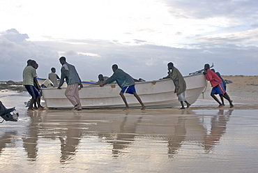
Hardest hit was a 650 kilometers stretch of the somali coastline between garacad (mudung region) and xaafuun (bari region), which forms part of the puntland province near the horn of africa. The tsunami resulted in the death of some 300 people and extensive destruction of shelters, houses and water sources as well as fishing gear. The livelihoods of many people residing in towns and small villages along the somali indian ocean coastline, particularly in the northern regions, were devastated
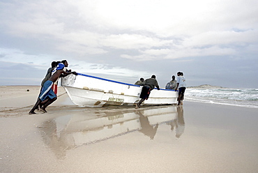
Hardest hit was a 650 kilometers stretch of the somali coastline between garacad (mudung region) and xaafuun (bari region), which forms part of the puntland province near the horn of africa. The tsunami resulted in the death of some 300 people and extensive destruction of shelters, houses and water sources as well as fishing gear. The livelihoods of many people residing in towns and small villages along the somali indian ocean coastline, particularly in the northern regions, were devastated
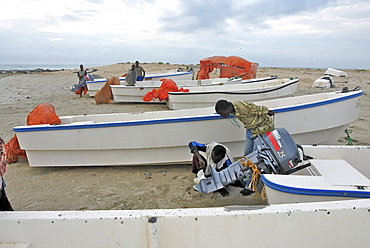
Hardest hit was a 650 kilometers stretch of the somali coastline between garacad (mudung region) and xaafuun (bari region), which forms part of the puntland province near the horn of africa. The tsunami resulted in the death of some 300 people and extensive destruction of shelters, houses and water sources as well as fishing gear. The livelihoods of many people residing in towns and small villages along the somali indian ocean coastline, particularly in the northern regions, were devastated
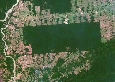
Color satellite image of the indigenous territory Igarape Lage, Rondonia, Brazil, covering an area of 688,000 square kilometers. Image collected on September 25, 2020 by Sentinel-2 satellites.
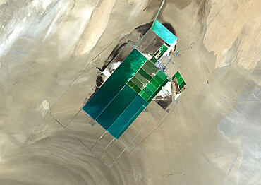
The satellite image shows potash evaporation ponds in Lop Nur, a former salt lake in the Xinjiang Region, that spread over 20 kilometers
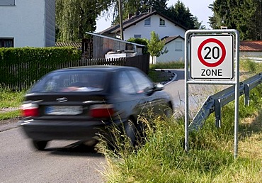
Markt Schwaben, GER, 26. June 2006 - A car passes a sign which marks the begin of a speed limited zone in Markt Schwaben Bavaria Germany.
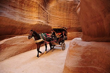
Coach with tourists in the Siq, the one kilometer long canyon that leads to the Nabataean city Petra, Unesco World Heritage Site, near Wadi Musa, Jordan, Middle East, Orient
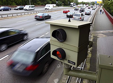
Radar controlled speed monitoring with a speed camera, on the federal road B223, Konrad-Adenauer-Allee, in a 60 kilometers per hour speed-limit zone, Oberhausen, North Rhine-Westphalia, Germany, Europe
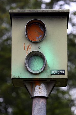
Sabotage, speed camera damaged by a paint attack, on the federal road B227, Wuppertaler Strasse, in a 70 kilometers per hour speed-limit zone, Essen, North Rhine-Westphalia, Germany, Europe
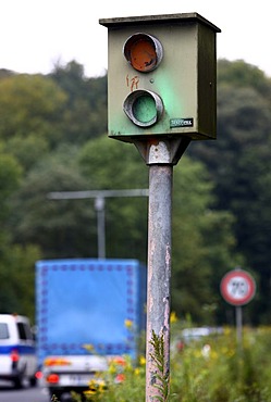
Sabotage, speed camera damaged by a paint attack, on the federal road B227, Wuppertaler Strasse, in a 70 kilometers per hour speed-limit zone, Essen, North Rhine-Westphalia, Germany, Europe

Official sign to warn of a radar control with a TraffiTower speed camera, on the federal road B224, Braukstrasse, in a 70 kilometers per hour speed-limit zone, Bottrop, North Rhine-Westphalia, Germany, Europe
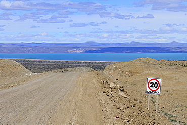
Gravel road Ruta 40 with speed limit 20 Km/h, behind Lago Cardiel and Andes, near Perito Moreno, province Santa Cruz, Patagonia, Argentina, South America

Plaque in pavement with map and zero kilometre, zero kilometre stone, fundamental point, inscription, Plaza Puerta del Sol, Madrid, Spain, Europe
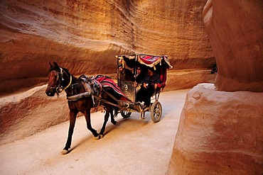
Coach with tourists in the Siq, the one kilometer long canyon that leads to the Nabataean city Petra, Unesco World Heritage Site, near Wadi Musa, Jordan, Middle East, Orient
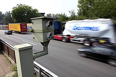
Radar controlled speed monitoring with a speed camera, on the Autobahn A40 motorway, Ruhrschnellweg, in a 100 kilometers per hour speed-limit zone, Essen, North Rhine-Westphalia, Germany, Europe
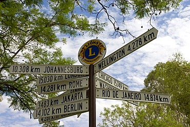
Signpost showing kilometer distances to various directions, Alice Springs, Northern Territory, Australia
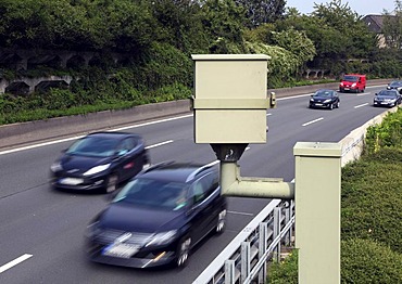
Radar controlled speed monitoring with a speed camera, on the Autobahn A40 motorway, Ruhrschnellweg, in a 100 kilometers per hour speed-limit zone, Essen, North Rhine-Westphalia, Germany, Europe
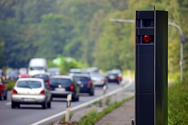
Radar controlled speed monitoring with a TraffiTower speed camera, on the federal road B224, Braukstrasse, in a 70 kilometers per hour speed-limit zone, Bottrop, North Rhine-Westphalia, Germany, Europe
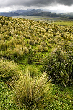
Cotopaxi is a volcano of Ecuador. Located in Canton Latacunga in Cotopaxi Province. With an elevation of 5.897msnm is the second most height of the country (being preceded by the Chimborazo) and one of the highest active volcanoes in the world (the highest active volcano is the Ojos del Salado on the border between Chile and Argentina) . It is located 33 kilometers northeast of the city of Latacunga, 50 km south of the state.

Modern architecture and towers, skyscrapers in La Defense. La Defense is a major business district, three kilometers west of the city limits of Paris, France
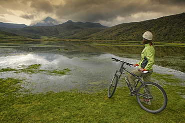
Cotopaxi is a volcano of Ecuador. Located in Canton Latacunga in Cotopaxi Province. With an elevation of 5.897msnm is the second most height of the country (being preceded by the Chimborazo) and one of the highest active volcanoes in the world (the highest active volcano is the Ojos del Salado on the border between Chile and Argentina) . It is located 33 kilometers northeast of the city of Latacunga, 50 km south of the state.

India, Jammu and Kashmir, Ladakh. A portrait of a novice monk of The Drukpa Kagyud Primary School. The school is part of Hemis Buddhist Monastery located 45 kilometers from Leh in Ladakh, Northern India.

India, Jammu and Kashmir, Ladakh. A group of novice monks pose for a portrait at The Drukpa Kagyud Primary School. The school is part of Hemis Buddhist Monastery located 45 kilometers from Leh in Ladakh, Northern India.
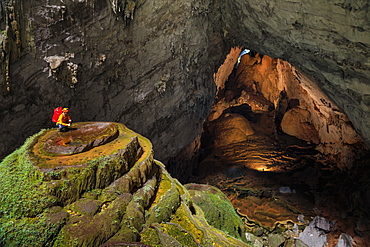
A cave explorer on a speleothem at the first doline, or skylight, in Hang Son Doong while two other explorers illuminate a large passage leading to the second doline 1.5 kilometers away.
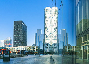
Modern architecture and towers, skyscrapers in La Defense. La Defense is a major business district, three kilometers west of the city limits of Paris, France

Modern architecture and towers, skyscrapers in La Defense. La Defense is a major business district, three kilometers west of the city limits of Paris, France
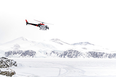
A German BGR helicopter used in Terre Victoria to transport geologists to specific research points. These are one-off scientific programs, involving the collaboration of several countries, in this case Germany and Italy. The Germans set up a base camp several dozen kilometers from the Italian Mario Zucchelli station, using Italian logistical resources such as the Laura Bassi icebreaker to transport the helicopter, the equipment needed to set up the base camp, scientific equipment and, of course, personnel. All of this was delivered to the Mario Zucchelli station for onward transport by helicopter to the search site. Victoria Land, Antarctica

Landscape of Svalbard in Norway, also known as Spitsbergen. This territory stretches from latitude 75 to 80 degrees to the pack ice a few hundred kilometers from the North Pole. Melting ice, premature global warming. Exploration boat in Madeleine Bay. Young explorer on deck.

Landscape of Svalbard in Norway, also known as Spitsbergen. This territory stretches from latitude 75 to 80 degrees to the pack ice a few hundred kilometers from the North Pole. Melting ice, early global warming. Front of a glacier fracturing at the edge of a fjord.

Landscape of Svalbard in Norway, also known as Spitsbergen. This territory stretches from latitude 75 to 80 degrees to the pack ice a few hundred kilometers from the North Pole.
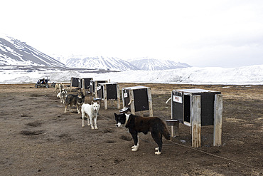
Dogsledding. Landscape of Svalbard in Norway, also known as Spitsbergen. This territory stretches from latitude 75 to 80 degrees to the pack ice a few hundred kilometers from the North Pole.

Landscape of Svalbard in Norway, also known as Spitsbergen. This territory stretches from latitude 75 to 80 degrees to the pack ice a few hundred kilometers from the North Pole. Melting ice, early global warming. Coastal scenery as you climb towards latitude 80 degrees. Trapper's hut, professional hunter's hut

Landscape of Svalbard in Norway, also known as Spitsbergen. This territory stretches from latitude 75 to 80 degrees to the pack ice a few hundred kilometers from the North Pole. Melting ice, early global warming. Baie de la Madeleine here, a coastal landscape rising to 80 degrees latitude, where blocks of ice and small icebergs detached from glaciers drift on the water. Old steam train in front of Ny-Alesund weather station

Landscape of Svalbard in Norway, also known as Spitsbergen. This territory stretches from latitude 75 to 80 degrees to the pack ice a few hundred kilometers from the North Pole. Melting ice, premature global warming. Exploration boat in Magdalen Bay. Explorer sailboat.

Landscape of Svalbard in Norway, also known as Spitsbergen. This territory stretches from latitude 75 to 80 degrees to the pack ice a few hundred kilometers from the North Pole. melting ice, early global warming. Baie de la Madeleine, a coastal landscape rising towards latitude 80 degrees, where blocks of ice and small icebergs detached from glaciers drift on the water.

Landscape of Svalbard in Norway, also known as Spitsbergen. This territory stretches from latitude 75 to 80 degrees to the pack ice a few hundred kilometers from the North Pole. Melting ice, early global warming.

Landscape of Svalbard in Norway, also known as Spitsbergen. This territory stretches from latitude 75 to 80 degrees to the pack ice a few hundred kilometers from the North Pole. Melting ice, premature global warming. Exploration boat in Baie de la Madeleine.

Landscape of Svalbard in Norway, also known as Spitsbergen. This territory stretches from latitude 75 to 80 degrees to the pack ice a few hundred kilometers from the North Pole. Melting ice, early global warming. Front of a glacier fracturing at the edge of a fjord. Explorers' sailboat at the ice edge
