Results
5 results found
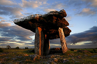
Poulnabrone dolmen megalithic tomb, Burren, County Clare, Munster, Republic of Ireland (Eire), EuropeThe Burren (from Irish: Boireann, meaning - great rock) is a unique karst landscape in northwest County Clare, Ireland. The limestone area measures 300 square kilometres and is roughly enclosed within the circle comprised by the villages Ballyvaughan, Kinvarra, Gort, Corrofin, Kilfenora, Lisdoonvarna and the Black Head lighthouse. The definitive article (ie "The" Burren) has only been added to the name by academics in the last few decades as it has always been traditionally called Boireann or Boirinn in Irish and Burren in English.
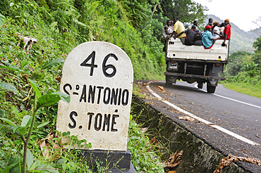
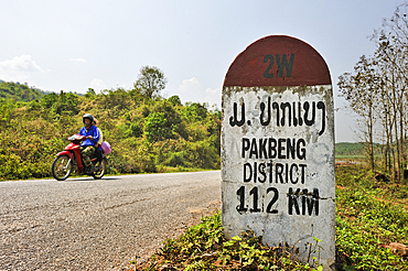
Kilometre-marker on the road toward the south,Sao Tome Island, Republic of Sao Tome and Principe,Africa
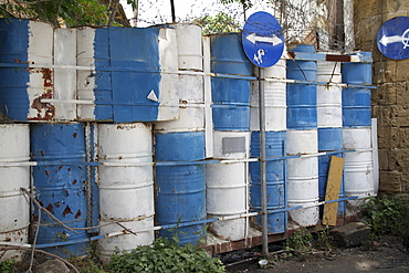
Cyprus. Abandoned houses along th Green Line in Nicosia dividing the Republic of Cyprus and Turkish controlled northern part. The United Nations Buffer Zone in Cyprus runs for more than 180.5?kilometres (112.2?mi) along what is known as the Green Line and has an area of 346?square kilometres (134?sq?mi). The zone partitions the island of Cyprus into a southern area effectively controlled by the government of the Republic of Cyprus (which is the de jure government for the entire island save for the British Sovereign Base Areas), and the northern area controlled by the Turkish army
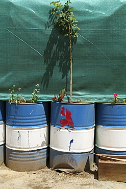
Cyprus. Abandoned houses along th Green Line in Nicosia dividing the Republic of Cyprus and Turkish controlled northern part. The United Nations Buffer Zone in Cyprus runs for more than 180.5?kilometres (112.2?mi) along what is known as the Green Line and has an area of 346?square kilometres (134?sq?mi). The zone partitions the island of Cyprus into a southern area effectively controlled by the government of the Republic of Cyprus (which is the de jure government for the entire island save for the British Sovereign Base Areas), and the northern area controlled by the Turkish army
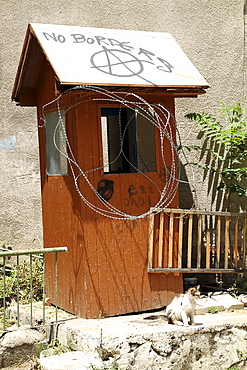
Cyprus. Abandoned houses along th Green Line in Nicosia dividing the Republic of Cyprus and Turkish controlled northern part. The United Nations Buffer Zone in Cyprus runs for more than 180.5?kilometres (112.2?mi) along what is known as the Green Line and has an area of 346?square kilometres (134?sq?mi). The zone partitions the island of Cyprus into a southern area effectively controlled by the government of the Republic of Cyprus (which is the de jure government for the entire island save for the British Sovereign Base Areas), and the northern area controlled by the Turkish army
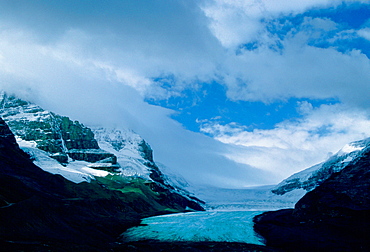
A general view of the Athabasca Glacier, a six kilometre tongue of ice flowing from the Columbia Icefield. It is the best-known glacier in the Canadian Rockies and is situated in Jasper National Park, Alberta, Canada.
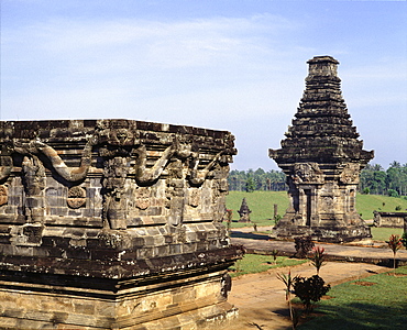
Candi Penataran, dating from the 12th century, lies about 10 kilometres to the north of Blitar, and is the largest in East Java, Indonesia, Southeast Asia, Asia
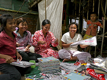
CAMBODIA Women trained by CSARO to make handicrafts from recycled materials. Some are former waste pickers whose lives have been improved by the project. Kim Savoeun, 49, is the mother of 2 of the girls working here. The settlement slum of San Sok, 10 kilometres outsdie Phnom Penh
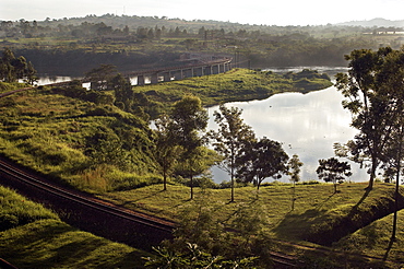
With a surface area of 68,800-úsquare kilometres (26,600-úsq-úmi), Lake Victoria is AfricaG®ös largest lake, and the largest tropical lake in the world. The Rail track meanders across Lake Victoria, just upstream from where the Victoria Nile river forms. This is the furthest point, and considered the source of the River Nile, the worldG®ös longest river. Jinja, Uganda, East Africa
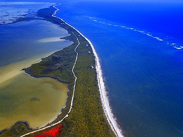
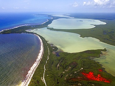
Aerial view of Punta Allen Sian Ka'an Reserve, Yucatan Peninsula, Mexico. Red lagoon near Boca Paila Bridge.
In the language of the Mayan peoples who once inhabited this region, Sian Ka'an means Origin of the Sky. Located on the east coast of the Yucatán peninsula, this biosphere reserve contains tropical forests, mangroves and marshes, as well as a large marine section intersected by a barrier reef. It provides a habitat for a remarkably rich flora and a fauna comprising more than 300 species of birds, as well as a large number of the region's characteristic terrestrial vertebrates, which cohabit in the diverse environment formed by its complex hydrological system.
Along its roughly 120 kilometres of coastline, the property covers over 400,000 hectares of land ranging from sea level to only ten m.a.s.l. The property boasts diverse tropical forests, palm savannah, one of the most pristine wetlands in the region, lagoons, extensive mangrove stands, as well as sandy beaches and dunes. The 120,000 hectares of marine area protect a valuable part of the Mesoamerican Barrier Reef and seagrass beds in the shallow bays. The lush green of the forests and the many shades of blue of the lagoons and the Caribbean Sea under a wide sky offer fascinating visual impressions.
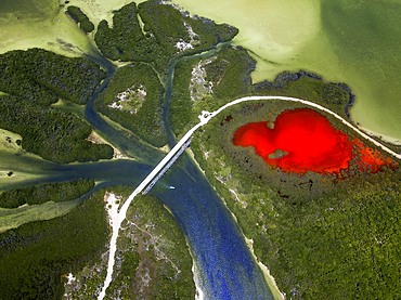
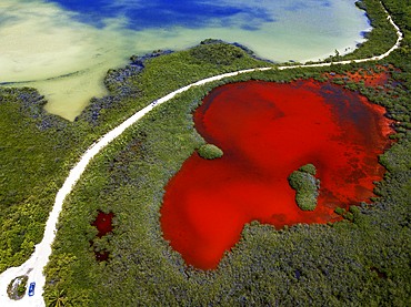

Palms and old pier in Punta Allen Sian Ka'an Reserve, Yucatan Peninsula, Mexico.
In the language of the Mayan peoples who once inhabited this region, Sian Ka'an means Origin of the Sky. Located on the east coast of the Yucatán peninsula, this biosphere reserve contains tropical forests, mangroves and marshes, as well as a large marine section intersected by a barrier reef. It provides a habitat for a remarkably rich flora and a fauna comprising more than 300 species of birds, as well as a large number of the region's characteristic terrestrial vertebrates, which cohabit in the diverse environment formed by its complex hydrological system.
Along its roughly 120 kilometres of coastline, the property covers over 400,000 hectares of land ranging from sea level to only ten m.a.s.l. The property boasts diverse tropical forests, palm savannah, one of the most pristine wetlands in the region, lagoons, extensive mangrove stands, as well as sandy beaches and dunes. The 120,000 hectares of marine area protect a valuable part of the Mesoamerican Barrier Reef and seagrass beds in the shallow bays. The lush green of the forests and the many shades of blue of the lagoons and the Caribbean Sea under a wide sky offer fascinating visual impressions.
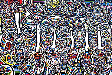
The East Side Gallery along Muehlenstrasse, the longest preserved piece of Berlin Wall, with 1.3 kilometres length the longest open air gallery of the world, Berlin Wall Trail, Friedrichshain, Berlin, Germay, Europe
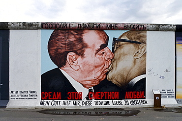
The East Side Gallery along Muehlenstrasse, the longest preserved piece of Berlin Wall, with 1.3 kilometres length the longest open air gallery of the world, Berlin Wall Trail, Friedrichshain, Berlin, Germay, Europe
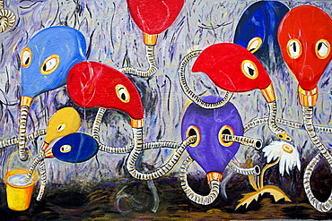
The East Side Gallery along Muehlenstrasse, the longest preserved piece of Berlin Wall, with 1.3 kilometres length the longest open air gallery of the world, Berlin Wall Trail, Friedrichshain, Berlin, Germay, Europe
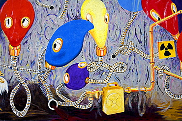
The East Side Gallery along Muehlenstrasse, the longest preserved piece of Berlin Wall, with 1.3 kilometres length the longest open air gallery of the world, Berlin Wall Trail, Friedrichshain, Berlin, Germay, Europe
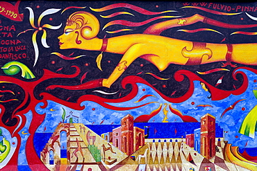
The East Side Gallery along Muehlenstrasse, the longest preserved piece of Berlin Wall, with 1.3 kilometres length the longest open air gallery of the world, Berlin Wall Trail, Friedrichshain, Berlin, Germay, Europe

The East Side Gallery along Muehlenstrasse, the longest preserved piece of Berlin Wall, with 1.3 kilometres length the longest open air gallery of the world, Berlin Wall Trail, Friedrichshain, Berlin, Germay, Europe
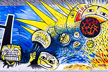
The East Side Gallery along Muehlenstrasse, the longest preserved piece of Berlin Wall, with 1.3 kilometres length the longest open air gallery of the world, Berlin Wall Trail, Friedrichshain, Berlin, Germay, Europe
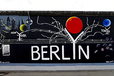
The East Side Gallery along Muehlenstrasse, the longest preserved piece of Berlin Wall, with 1.3 kilometres length the longest open air gallery of the world, Berlin Wall Trail, Friedrichshain, Berlin, Germay, Europe
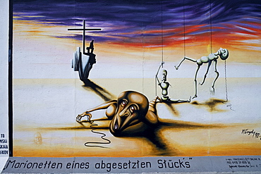
The East Side Gallery along Muehlenstrasse, the longest preserved piece of Berlin Wall, with 1.3 kilometres length the longest open air gallery of the world, Berlin Wall Trail, Friedrichshain, Berlin, Germay, Europe
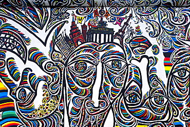
The East Side Gallery along Muehlenstrasse, the longest preserved piece of Berlin Wall, with 1.3 kilometres length the longest open air gallery of the world, Berlin Wall Trail, Friedrichshain, Berlin, Germay, Europe
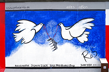
The East Side Gallery along Muehlenstrasse, the longest preserved piece of Berlin Wall, with 1.3 kilometres length the longest open air gallery of the world, Berlin Wall Trail, Friedrichshain, Berlin, Germay, Europe
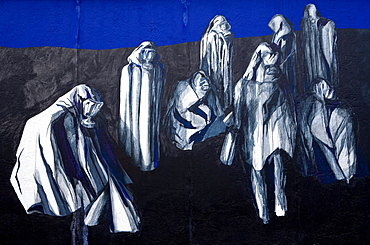
The East Side Gallery along Muehlenstrasse, the longest preserved piece of Berlin Wall, with 1.3 kilometres length the longest open air gallery of the world, Berlin Wall Trail, Friedrichshain, Berlin, Germay, Europe
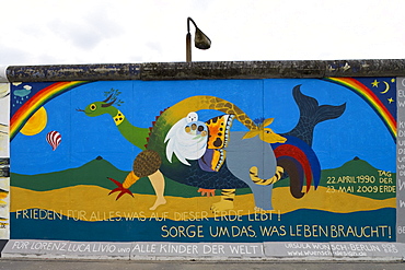
The East Side Gallery along Muehlenstrasse, the longest preserved piece of Berlin Wall, with 1.3 kilometres length the longest open air gallery of the world, Berlin Wall Trail, Friedrichshain, Berlin, Germay, Europe
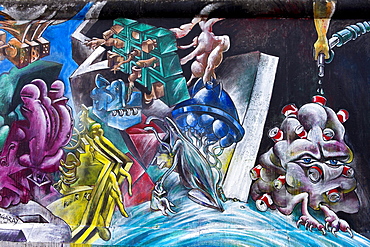
The East Side Gallery along Muehlenstrasse, the longest preserved piece of Berlin Wall, with 1.3 kilometres length the longest open air gallery of the world, Berlin Wall Trail, Friedrichshain, Berlin, Germay, Europe
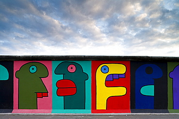
The East Side Gallery along Muehlenstrasse, the longest preserved piece of Berlin Wall, with 1.3 kilometres length the longest open air gallery of the world, Berlin Wall Trail, Friedrichshain, Berlin, Germay, Europe
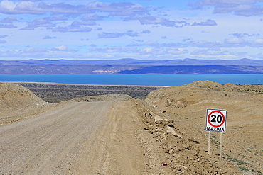
Gravel road Ruta 40 with speed limit 20 Km/h, behind Lago Cardiel and Andes, near Perito Moreno, province Santa Cruz, Patagonia, Argentina, South America

Plaque in pavement with map and zero kilometre, zero kilometre stone, fundamental point, inscription, Plaza Puerta del Sol, Madrid, Spain, Europe
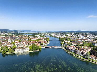
Aerial view of Lake Constance and the Seerhein, also Rhine funnel with the city of Constance and the old Rhine bridge, where the Rhine officially begins at kilometre zero, district of Constance, Baden-Württemberg, Germany, Europe
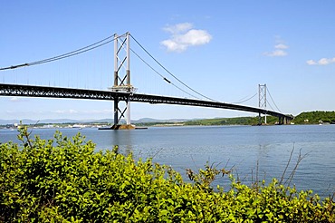
Street Bridge, a two-kilometre-long bridge crossing the firth of Forth Fjord near Edinburgh, Scotland, Great Britain, Europe
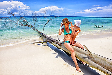
Ko Poda is an island off the west coast of Thailand, in Krabi Province, about 8 kilometres (5 mi) from Ao Nang. It is part of the Mu Ko Poda, or Poda Group Islands, which are under the administration of Hat Nopharat Thara-Mu Ko Phi Phi National Park. The group consists of Ko Poda, Ko Kai, Ko Mo and Ko Thap.

Three participants of the UTMB are running in the hills of Chamonix. The famous peaks of the Mont Blanc range are in the background. The Ultra-Trail du Mont-Blanc (also referred to as UTMB) is a single-stage mountain ultramarathon. It takes place once a year in the Alps, across France, Italy and Switzerland. The distance is approximately 166 kilometres (103 mi), with a total elevation gain of around 9,600 m. It is widely regarded as one of the most difficult foot races in Europe. It's certainly one of the largest with over two thousand starters. The combined participation in all of the events is approaching 10 thousand runners. While the best runners complete the loop in slightly more than 20 hours, most runners take 30 to 45 hours to reach the finish line.

An elderly woman is running in the hills of Chamonix. She is close to finishing the extremely exhausting UTMB race. The Ultra-Trail du Mont-Blanc (also referred to as UTMB) is a single-stage mountain ultramarathon. It takes place once a year in the Alps, across France, Italy and Switzerland. The distance is approximately 166 kilometres (103 mi), with a total elevation gain of around 9,600 m. It is widely regarded as one of the most difficult foot races in Europe. It's certainly one of the largest with over two thousand starters. The combined participation in all of the events is approaching 10 thousand runners. While the best runners complete the loop in slightly more than 20 hours, most runners take 30 to 45 hours to reach the finish line.
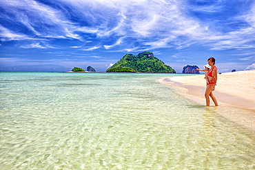
Ko Poda is an island off the west coast of Thailand, in Krabi Province, about 8 kilometres (5 mi) from Ao Nang. It is part of the Mu Ko Poda, or Poda Group Islands, which are under the administration of Hat Nopharat Thara-Mu Ko Phi Phi National Park. The group consists of Ko Poda, Ko Kai, Ko Mo and Ko Thap.
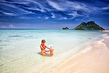
Ko Poda is an island off the west coast of Thailand, in Krabi Province, about 8 kilometres (5 mi) from Ao Nang. It is part of the Mu Ko Poda, or Poda Group Islands, which are under the administration of Hat Nopharat Thara-Mu Ko Phi Phi National Park. The group consists of Ko Poda, Ko Kai, Ko Mo and Ko Thap.
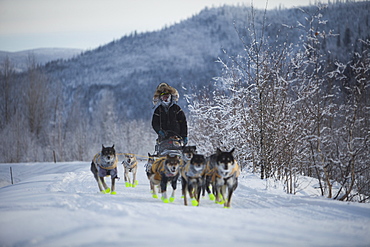
The Yukon Quest International Sled Dog Race is considerate by some to be the world?s toughest, and just finishing can be the reward. This year the start line was in Whitehorse, Yukon, where the 1,000 miles (1,600 kilometres) of trail follow the old trav
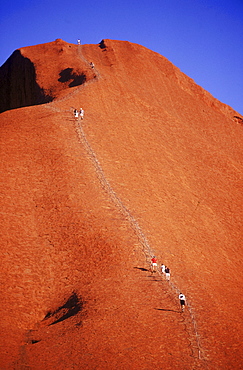
Hikers make their way up Uluru or Mt. Ayers in the Australian Outback. Located in the centre of Australia, Uluru (Ayers Rock) is the world's biggest monolith. It's 3.6 kilometres long, 2 kilometres wide and has a 9.4 kilometre circumference. Made of arkosic sandstone, Uluru changes colour in different lights, particularly at sunrise and sunse.
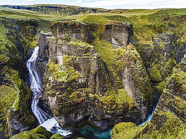
Fjadrargljufur is a magnificent and massive canyon, about 100 meters deep and about two kilometres long. The canyon has sheer walls; Skaftarhreppur, Southern Region, Iceland
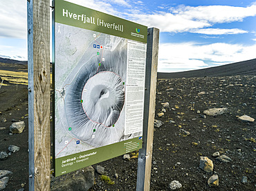
The Hverfjall crater, a tephra cone or tuff ring volcano in Northern Iceland. The crater is approximately 1 kilometre in diameter; Skutustadahreppur, Northeastern Region, Iceland
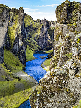
Fjadrargljufur is a magnificent and massive canyon, about 100 meters deep and about two kilometres long. The canyon has sheer walls; Skaftarhreppur, Southern Region, Iceland
Close-Up Of Road Sign Directions To Restaurant In Killarney National Park; Killarney County Kerry Ireland
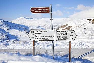
Road Sign Directions To Various Locations In Killarney National Park; Killarney County Kerry Ireland
