Results
3 results found
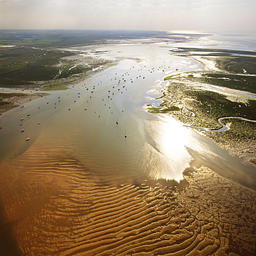
Aerial image of Blakeney Point, Norfolk, England, United Kingdom, Europe
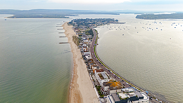
Aerial view of Sandbanks, a narrow spit of land extending into Poole Harbour, with Studland and Brownsea Island beyond, Dorset, England, United Kingdom, Europe
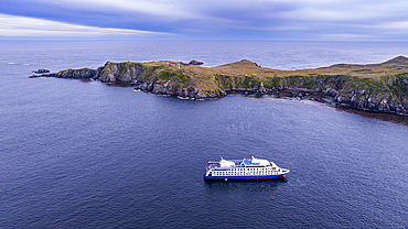
Aerial of a cruise ship anchoring at Cape Horn, southern most point in South America, Hornos island, Tierra del Fuego, Chile, South America
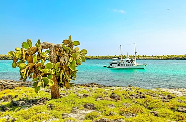
Opuntia (Prickly Pear) cacti on South Plaza island, Galapagos, UNESCO World Heritage Site, Ecuador, South America
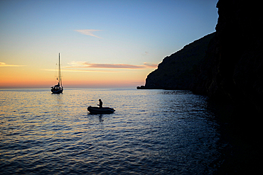
Sailing boat at sunset in Torrent de Pareis, Mallorca, Spain
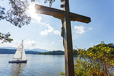
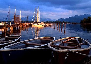
Cross on the Jakob island, Staffelsee, with sailing boat, near Murnau, Blue Land, district Garmisch-Partenkirchen, Bavarian alpine foreland, Upper Bavaria, Bavaria, Germany, Europe

Anchoring boats on Lake of Annecy, Lac d'Annecy, Duingt, Haute-Savoie France

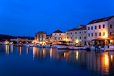
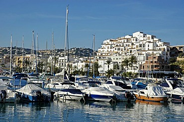
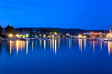
Harbour of Hvar, Island Hvar, Dalmatia, Croatia
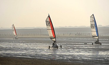
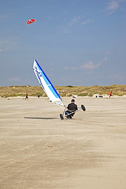
Sand yacht land sailing on the coast of Brittany, France, Europe
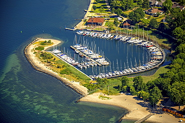
Neustädter Segelverein e.V. sailing club, Bay of Lübeck, Neustadt in Holstein, Schleswig-Holstein, Germany, Europe

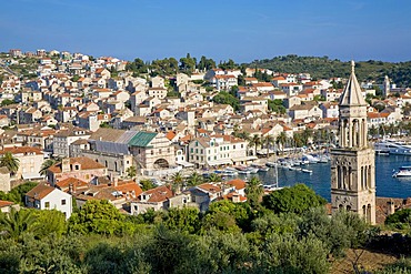
Look of the fortress Spanjola on the harbour of Hvar, Island Hvar, Dalmatia, Croatia
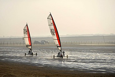
Two sail wagons on the beach, land sailing, sand yachting, Weston super Mare, Somerset, England, Great Britain, Europe
Harbour of Stari Grad, Island Hvar, Dalmatia, Croatia
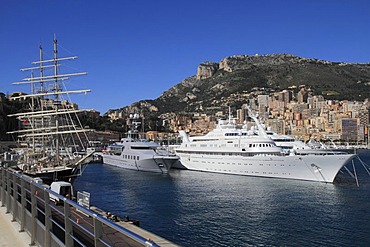
Windjammer Tenacious, motoryachts Skat, Atlantis II and Lady Moura at Port Hercule, Monaco, Cote d'Azur, Mediterranean, Europe
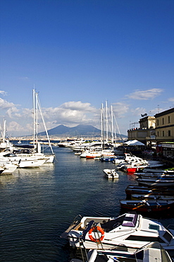
Volcano Vesuvio from small port of Borgo Marinaro, Naples, Campania, Italy, Europe
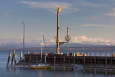
Magische Saeule, magic column, on the pier in Meersburg on Lake Constance with the Alpstein massif at back during foehn weather conditions, Baden-Wuerttemberg, Germany, Europe

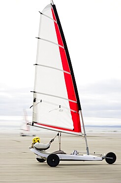
Person in sail wagon on the beach, silhouette, land sailing, sand yachting, Weston super Mare, Somerset, England, Great Britain, Europe

The Port of Queensferry with the Forth Railway Bridge, Scotland, United Kingdom, Europe
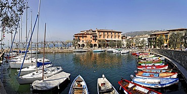
Harbour with sailing ships and small fishing boats, Torri del Benaco, Garda lake, Italy

Church and the small boat harbour, Lazise, Garda lake, Italytalien

Port of Marsaxlokk

Look of the fortress Spanjola on the harbour of Hvar, Island Hvar, Dalmatia, Croatia
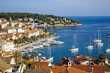
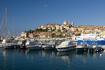
Harbour of Hvar, Island Hvar, Dalmatia, Croatia
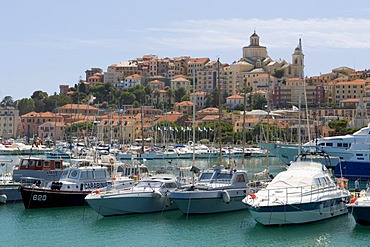
Harbour of Hvar, Island Hvar, Dalmatia, Croatia
Port, Moraira, Costa Blanca, Spain
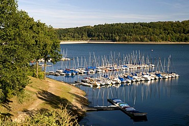
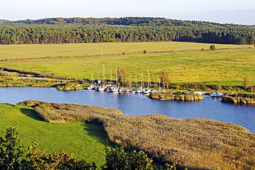
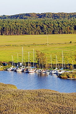
Marina of the Sorpestausees reservoir, Naturpark Homert nature preserve, Sauerland region, North Rhine-Westphalia, Germany, Europe
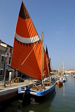
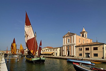
Maritime museum Museo della Marineria in the harbour, Cesenatico, on the Adriatic Sea, Adriatic coast, Emilia Romagna, Itay, Europe
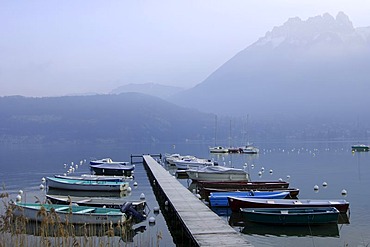
Landing stage for boats at the Lake of Annecy, Lac d'Annecy, Duingt, Haute-Savoie France
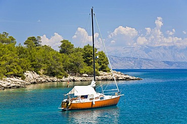
Sailboats near Torbole, sailing, sailing yacht, Lake Garda, Italy, Europe
Husum Harbour from the Nordtor or north gate, Husum, North Friesland, Schleswig-Holstein, Germany, Europe, PublicGround

Sailing vessel, Stockholm, Sweden, Scandinavia, Europe
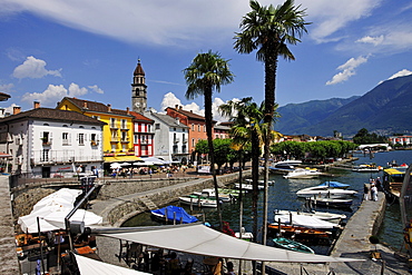
Promenade of Ascona with marina on Lago Maggiore lake, Ticino, Switzerland, Europe
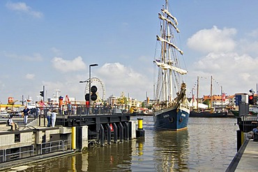
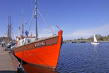
Three-master Antiqua entering the lock, Bremerhaven, Bremen, Germany
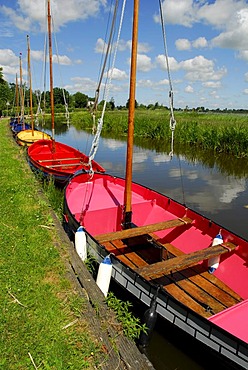
Colourful boats in the green landscape between Gouda, Bodegraven, Reeuwijk and Oudewater, Reeuwijkse Plassen, South-Holland, Zuid-Holland, Nederland, The Netherlands
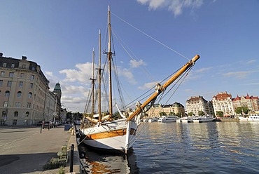
Swedish sailing ship, Nybrokajen quay, Stockholm, Sweden, Scandinavia, Europe

Harbour of Cannes, France, Europe

Boat harbour for private crafts, island of Juist, Lower Saxony, Northern Germany, Europe

Harbour of Hvar, Island Hvar, Dalmatia, Croatia
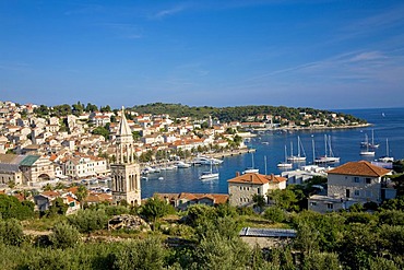
Harbour of Hvar, Island Hvar, Dalmatia, Croatia
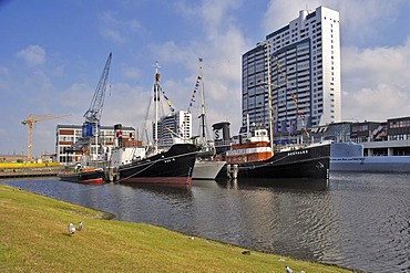
Four ships, Bremerhaven, Bremen, Germany
Harbour of Stari Grad, Island Hvar, Dalmatia, Croatia
Harbour in the seaside resort of Baabe, Ruegen Island, Mecklenburg-Western Pomerania, Germany, Europe
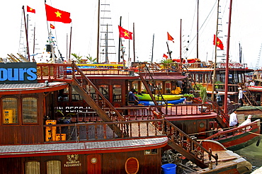
Traditional Vietnamese junks, boats in the port of Halong Bay, Vietnam, Southeast Asia
Three sail wagons on the beach, land sailing, sand yachting, Weston super Mare, Somerset, England, Great Britain, Europe
Maritime museum Museo della Marineria in the harbour, Cesenatico, on the Adriatic Sea, Adriatic coast, Emilia Romagna, Itay, Europe
Small sailboat, Island Hvar, Dalmatia, Croatia
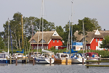
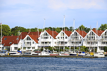
Yachts on the Darss peninsula in the marina of Ahrenshoop-Althagen in front of typical boathouses, Mecklenburg-Western Pomerania, Germany, Europe
Harbour in the seaside resort of Baabe, Ruegen Island, Mecklenburg-Western Pomerania, Germany, Europe
Small boats moored on the Chiemsee lake and Bavarian Alps, Chiemgau, Upper Bavaria, Germany, Europe
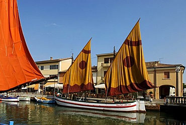
Maritime museum Museo della Marineria in the harbour, Cesenatico, on the Adriatic Sea, Adriatic coast, Emilia Romagna, Itay, Europe
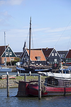
Marken fishing village, North Holland province, Netherlands, Europe

Yacht Harbour with Ships, Jalta, Crimea, Ukraine, South-Easteurope, Europe,

Port and citadel of Calvi, Balagne, Corsica, France, Europe
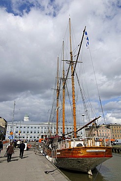
Ship in Helsinki port, Helsinki, Finland, Europe
Port in front of historic town, Porto Maurizio, Imperia, Riviera, Liguria, Italy, Europe
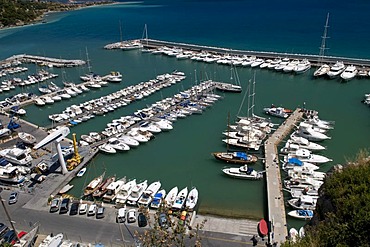
Marina, Alassio, Italian Riviera, Liguria, Italy
Port in front of historic town, Porto Maurizio, Imperia, Riviera, Liguria, Italy, Europe

Yacht Harbour with Ships, Jalta, Crimea, Ukraine, South-Easteurope, Europe,
Boat, port, Kappeln, Schlei Inlet, Schleswig-Holstein, Germany, Europe
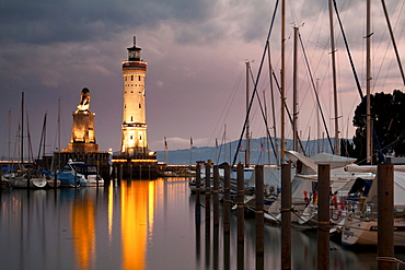
Lighthouse and the Bavarian lion, symbol of the city, at the harbour entrance of Lindau on Lake Constance, Bavaria, Germany, Europe
White wooden houses at the marina in Stavanger, Norway, Scandinavia, Northern Europe
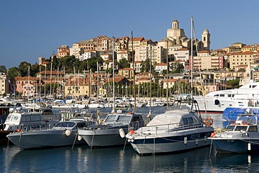
Port in front of historic town, Porto Maurizio, Imperia, Riviera, Liguria, Italy, Europe
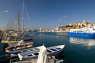
Port in front of historic town, Porto Maurizio, Imperia, Riviera, Liguria, Italy, Europe

Marken fishing village, North Holland province, Netherlands, Europe
Yachts, sailboats on the landing stage in Moritzdorf, Ruegen Island, Mecklenburg-Western Pomerania, Germany, Europe
Small group of people traveling in boats in a vast sea, Nassau, Bahamas
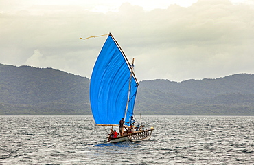
The Louisiade Archipelago is a string of ten larger volcanic islands frequently fringed by coral reefs, and 90 smaller coral islands located 200 km southeast of New Guinea, stretching over more than 160 km and spread over an ocean area of 26,000 km? between the Solomon Sea to the north and the Coral Sea to the south. The aggregate land area of the islands is about 1,790 km? (690 square miles), with Vanatinai (formerly Sudest or Tagula as named by European claimants on Western maps) being the largest.Sideia Island and Basilaki Island lie closest to New Guinea, while Misima, Vanatinai, and Rossel islands lie further east. The archipelago is divided into the Local Level Government (LLG) areas Louisiade Rural (western part, with Misima), and Yaleyamba (western part, with Rossell and Tagula islands. The LLG areas are part of Samarai-Murua District district of Milne Bay. The seat of the Louisiade Rural LLG is Bwagaoia on Misima Island, the population center of the archipelago.
The Louisiade Archipelago is a string of ten larger volcanic islands frequently fringed by coral reefs, and 90 smaller coral islands located 200 km southeast of New Guinea, stretching over more than 160 km and spread over an ocean area of 26,000 km? between the Solomon Sea to the north and the Coral Sea to the south. The aggregate land area of the islands is about 1,790 km? (690 square miles), with Vanatinai (formerly Sudest or Tagula as named by European claimants on Western maps) being the largest. Sideia Island and Basilaki Island lie closest to New Guinea, while Misima, Vanatinai, and Rossel islands lie further east. The archipelago is divided into the Local Level Government (LLG) areas Louisiade Rural (western part, with Misima), and Yaleyamba (western part, with Rossell and Tagula islands. The LLG areas are part of Samarai-Murua District district of Milne Bay. The seat of the Louisiade Rural LLG is Bwagaoia on Misima Island, the population center of the archipelago.
Nimoa Island - here the island mission will impress. The five-sided church features murals of island life and all mission buildings are surrounded by well maintained paths and gardens filled with flowering plants. Edged by jungle-covered mountains, postcard beaches and crystal clear waters - an island paradise indeed! The Louisiade Archipelago is a string of ten larger volcanic islands frequently fringed by coral reefs, and 90 smaller coral islands located 200 km southeast of New Guinea, stretching over more than 160 km and spread over an ocean area of 26,000 km? between the Solomon Sea to the north and the Coral Sea to the south. The aggregate land area of the islands is about 1,790 km? (690 square miles), with Vanatinai (formerly Sudest or Tagula as named by European claimants on Western maps) being the largest. Sideia Island and Basilaki Island lie closest to New Guinea, while Misima, Vanatinai, and Rossel islands lie further east.
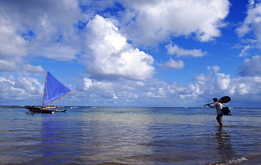
Hawaii, Kauai, Hanalei Bay, Man with paddle wading out into water to sailing canoe.
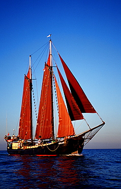
Sailing Ship, Tall Ship Adelaar, Indonesia, Indian Ocean, Komodo National Park
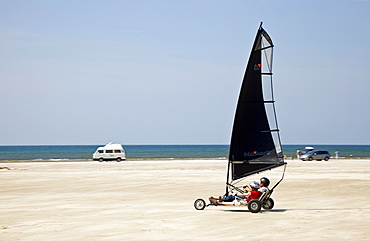
View of beach sailors at Fano beach, Denmark
View of beach sailors at Fano beach, Denmark