Results
40 results found
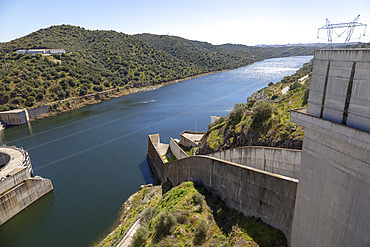
Barragem do Alqueva dam, part of the multipurpose water management project on the Rio Guadiana river, hydro-electricity generation electricity power lines, Moura, Portugal, Europe
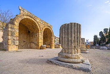
Colonial Forum of Tarraco, UNESCO, Tarragona, Catalonia, Spain
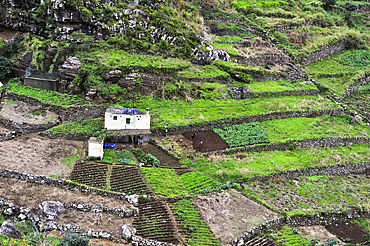
Terrace cultivation on the heights of Machico, Madeira island, Atlantic Ocean, Portugal
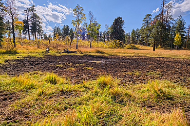
Greenland Lake reduced to a mud hole, Grand Canyon North Rim, UNESCO, Arizona, United States of America
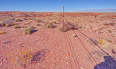
The boundary fence on the east side of Petrified Forest National Park, Arizona, United States of America
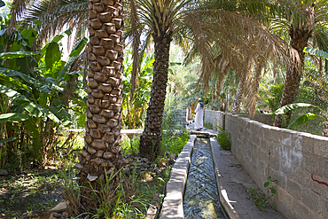
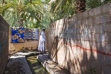
Irrigation canal in palm grove. Birkat Al Mouz, Al Dakhliya region, Falaj irrigation system (Falaj Al-Khatmeen), UNESCO, Oman, Arabian Peninsula
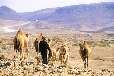
Bedouin and camels, Dhofar, Sultanate of Oman, Arabian Peninsula

Solar panels in middle of lush green nature, green energy, Italy
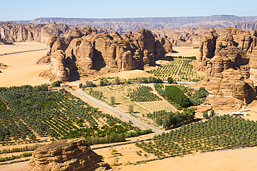
Aerial view of Palm grove and farms in the area of AlUla, Medina Province, Saudi Arabia
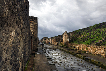
The archaeological ruins of Pompeii, UNESCO, Campania, Italy
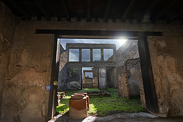
The archaeological ruins of Pompeii, UNESCO, Campania, Italy
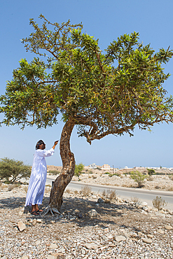
Boswellia sacra (frankincense) (olibanum-tree), Sultanate of Oman
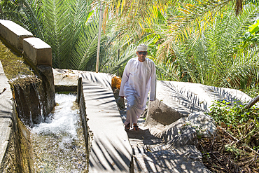
Man walking along irrigation canals (Falaj) to supply the palm grove downstream from village of Misfat (Misfah) Al Abriyeen in Jebel Akhdar, Oman
Irrigation canal, Falaj irrigation system (Falaj Al-Khatmeen), UNESCO, palm grove, Birkat Al Mouz, Al Dakhliya region, Jebel Akhdar foothills, Oman
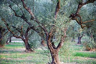
Olive trees in grove (orchard), Greece
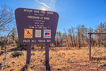
An information sign on the summit of Apache Maid Mountai, Coconino National Forest, Arizona, United States of America
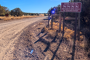
A warning sign stating that the road can be closed seasonally, Coconino National Forest, Arizona, United States of America

Ball court near the high temple at the Mesoamerican archaeological site of Lamanai (Submerged Crocodile), Belize
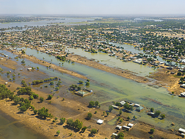
Aerial of N´Djamena, capital of Chad and the Chari River, Chad
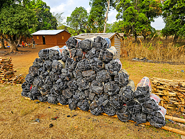
Coal (charcoal), Eastern Central African Republic
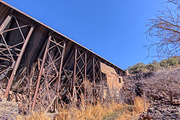
View from below the historic Bainbridge Steel Dam near Ash Fork, Kaibab National Forest, Arizona, United States of America
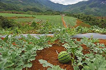
Watermelon crop on lands bought or rented by China for Chinese market, Nong Khiaw area, northern Laos

Market gardening nearby Luang Prabang, Laos
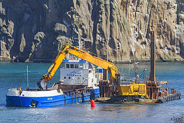
Dredging the harbor on remote Heimaey Island, Iceland
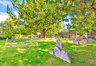
Burial Ground for Slaves and Free Blacks up to 1854, containing 180 graves, St. Peter's Churchyard, St. George, Bermuda
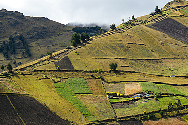
Cotopaxi Province, Ecuador
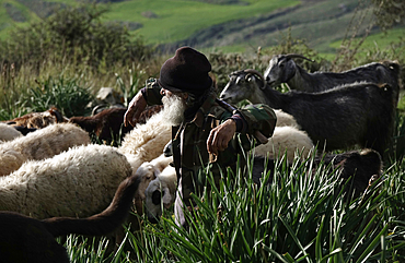
Shepherd with his flock, southern Cyprus
Rana El Zein, Deputy Director at AFALULA, and White saxaul (Haloxylon persicum), Sharaan Nature Reserve, AlUla, Medina Province, Saudi Arabia
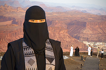
Woman responsible for ensuring visitor safety and good behavior at the Viewpoint, Harrat volcanic plateau, AlUla, Medina Province, Saudi Arabia
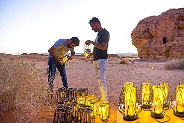
Employees lighting hundreds of lanterns scattered around the site for night tours of Hegra, UNESCO, AlUla, Medina Province, Saudi Arabia

Farmer carrying fodder on donkey back, Rif region, Morocco
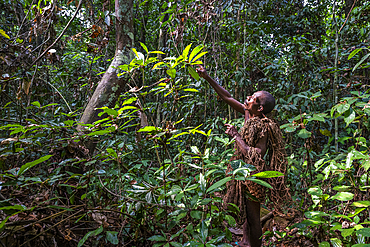
Pygmy man going net hunting, Dzanga Sangha National Park, UNESCO, Central African Republic
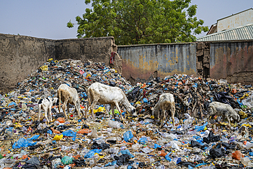
Extremely dirty waste area in the Fadar Daurama Emir's palace, Daura Emirate, Katsina state, Nigeria
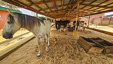
Emir´s horse, Fadar Daurama Emir's palace, Daura Emirate, Katsina state, Nigeria
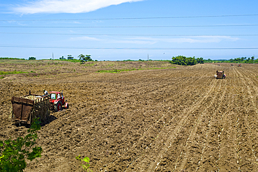
Planting sugar-cane seed cuttings, Artemisa Province, Cuba, West Indies, Caribbean, Central America
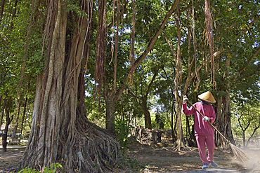
Sweeper at Prambanan Temple Compounds, UNESCO World Heritage Site, region of Yogyakarta, Java island, Indonesia, Southeast Asia, Asia
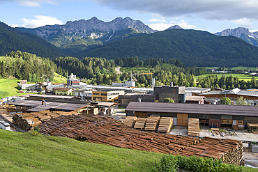
Sawmill Ligna S.a.s, Rasun di Sotto, South Tyrol (Alto Adige), Italy
Palm plantation colonized by invasive Sodom apple plant (Calotropis procera), Sharaan Nature Reserve, AlUla, Medina Province, Saudi Arabia
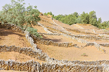
System of protection against invasion of desert sand in palm grove of Zagora, Draa River valley, Province of Zagora, Region Draa-Tafilalet, Morocco
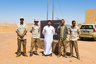
Guide and Ranger team of the Sharaan Nature Reserve, AlUla, Medina Province, Saudi Arabia
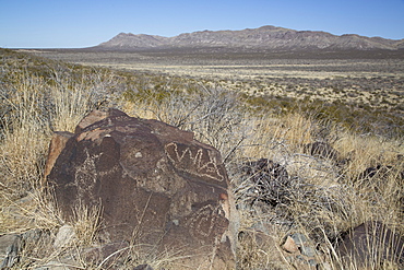
Bureau of Land Management, Three Rivers Petroglyph Site, rock carvings created by the Jornada Mogollon people during the 15th century, New Mexico, United States of America, North America

Group of people alpine skiing, powder skiing, avalanche assessment on a ski tour, risk management with groups, Vorderes Galmihorn, Obergoms, Berner Oberland, Switzerland
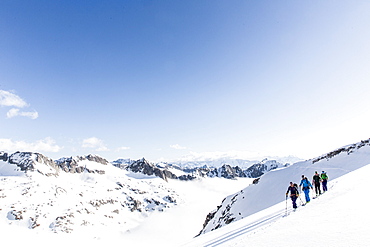
group ski touring, avalanche assessment on a skitour, risk management with groups, Heji Zwaechte, Obergoms, Berner Oberland, Switzerland
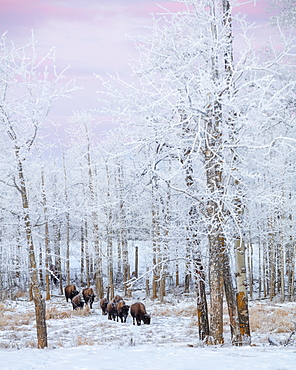
Bison Walking In The Early Morning Through The Snow, Elk Island National Park, Alberta, Canada

Farmer standing in a canola field using a tablet and inspecting the yield at sunrise; Alberta, Canada
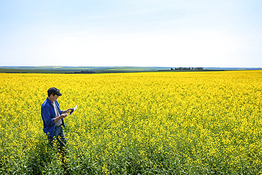
Farmer standing in a canola field using a tablet and inspecting the yield; Alberta, Canada
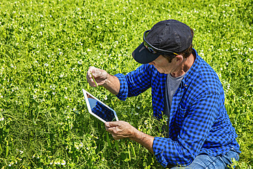
Farmer crouching in a pea field using a tablet and inspecting the yield; Alberta, Canada
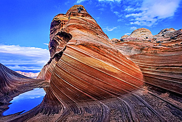
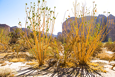
Spectacular formation of vibrant colors in swirls of fragile sandstone is known as The Wave and is located in the Coyote Buttes section of Vermilion Cliffs National Monument. An unmarked wilderness trail limits hikers and requires a permit from the Bureau of Land Management, Arizona, United States of America

Palmerston North, New Zealand; Wind Turbines In A Field
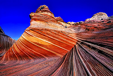
Spectacular formation of vibrant colors in swirls of fragile sandstone is known as The Wave and is located in the Coyote Buttes section of Vermilion Cliffs National Monument. An unmarked wilderness trail limits hikers and requires a permit from the Bureau of Land Management, Arizona, United States of America
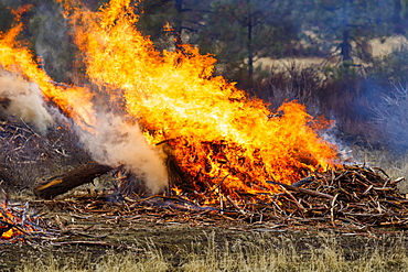
Forest fire prescribed burn, Dairy, Oregon, United States of America

Forest fire prescribed burn, Dairy, Oregon, United States of America

Palmerston North, New Zealand; Wind Turbines

Pincher Creek, Alberta, Canada; Wind Turbines In A Row In A Wheat Field

Palmerston North, New Zealand; Wind Turbines In A Field

Windmill In Winter; Sunderland, Tyne And Wear, England
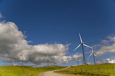
Wind Turbines In A Field With A Road Going Through; Palmerston North, New Zealand

Wind Turbines In A Field; Palmerston North, New Zealand