Results
36 results found
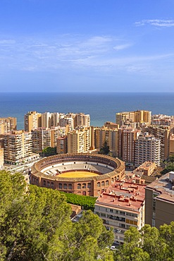
Malaga, Andalusia, Spain
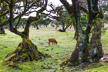
Pluri-centenarian laurel trees around Fanal, Paul da Serra plateau, Madeira island, Atlantic Ocean, Portugal
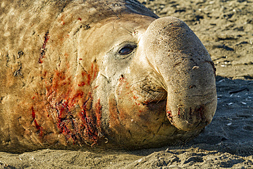
Bull southern elephant seal (Mirounga leonina) on South Georgia Island, Southern Ocean
Al Hajir seen from track (Al Barida Road) on western slope of Djebel Ahkdar below Sharaf al Alamayn Pass, 2036m, Oman, Arabian Peninsula
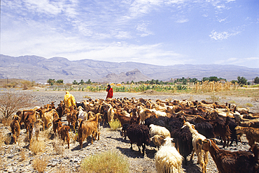
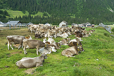
Bedouin and cattle, Samhan Djebel, Dhofar, Sultanate of Oman, Arabian Peninsula

Blooming flowers, Riserva Naturale di Punta Bianca, Palma di Montechiaro, Agrigento, Sicily, Italy
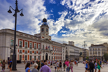
Puerta del Sol, Madrid, Spain
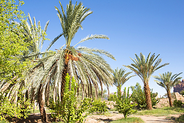
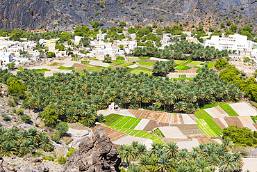
Date palm grove in the oasis of AlUla, Medina Province, Saudi Arabia
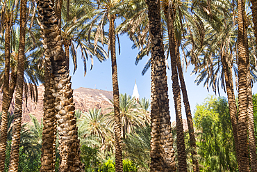
Date palm grove in the oasis of AlUla, Medina Province, Saudi Arabia
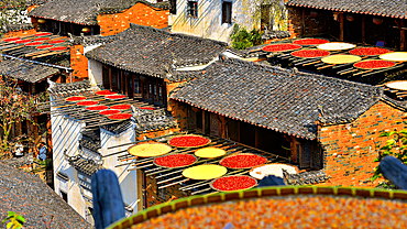
Chillies and corn being sun dried, Huangling, ancient village dating back to the Ming Dynasty, Wuyuan County, Shangrao City, Jiangxi Province, China
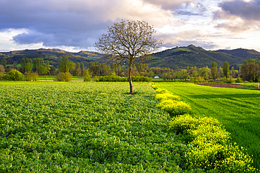
Lone tree in the fields, Gubbio, Umbria, Italy
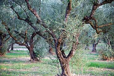
Olive trees in grove (orchard), Greece
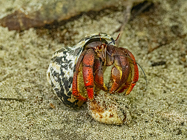
Caribbean land hermit crab (Coenobita clypeatus), Half Moon Caye, UNESCO, Mesoamerican Barrier Reef, Belize
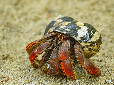
Caribbean land hermit crab (Coenobita clypeatus), Half Moon Caye, UNESCO, Mesoamerican Barrier Reef, Belize

Village in High-Atlas, Morocco
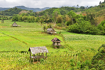
Corn and rice fields in the area around Nong Khiaw, Luang Prabang Province, Laos

Sheep grazing on remote Heimaey Island, Iceland
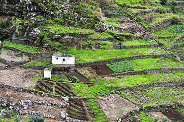
Terrace cultivation on the heights of Machico, Madeira island, Atlantic Ocean, Portugal
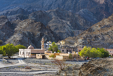
Al Bardah, village on edge of Wadi Bani Awf, NE slope of Jebel Akhdar, Western Hajar Mountains, Al-Dakhiliyah region, Oman, Arabian Peninsula
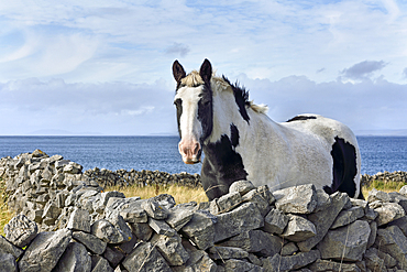
Pinto pony in enclosure of dry stone walls, Inishmore, largest of the Aran Islands, Galway Bay, County Galway, Connacht, Republic of Ireland
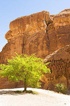
Isolated tree among sandstone rock formation in the desert canyons of the Ashar Valley, Medina Province, Saudi Arabia
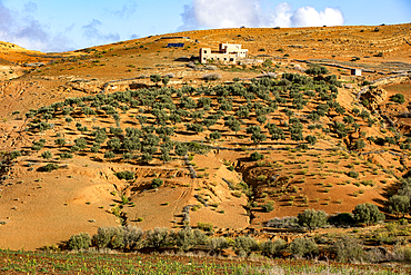
Semi-arid landscape with olive trees near Tazert, Al Haouz province, Morocco
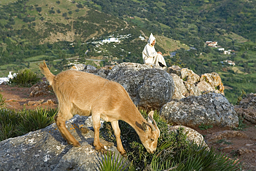
Goat and shepherd above Chefchaouen, Rif region, Morocco
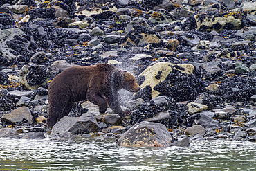
Adult brown bear (Ursus arctos) shaking water from its fur near whale carcass in Glacier Bay National Park, Alaska, United States of America

Surroundings of the village of Tighza under a thin layer of snow, Ounila River valley, Ouarzazate Province, region of Draa-Tafilalet, Morocco
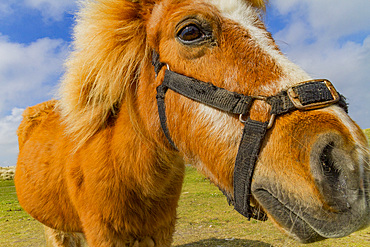
Adult Shetland pony (Equus ferus caballus) in the Shetland Isles, Scotland, United Kingdom
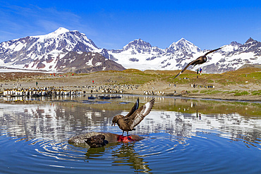
An adult brown skua (Catharacta antarctica) feeding on a dead elephant seal pup at St. Andrews Bay, South Georgia
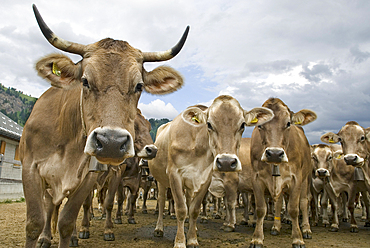
Brune Suisse cows, cattle farm Pian Segno, Blenio vallee, Canton Ticino, Switzerland
Brune Suisse cows, cattle farm Pian Segno, Blenio vallee, Canton Ticino, Switzerland
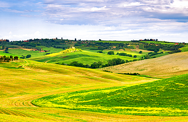
Rolling hills of Val d'Orcia, UNESCO, Tuscany, Italy
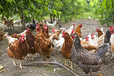
Rearing laying hens in a cherry orchard, Lerchnhof Farm Inn, Valdaora di Sotto, South Tyrol (Alto Adige), Italy
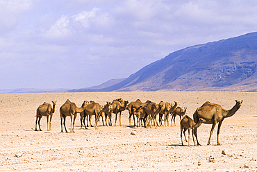
Camels, Dhofar, Sultanate of Oman, Arabian Peninsula
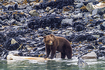
Adult brown bear (Ursus arctos) feeding on humpback whale carcass in Glacier Bay National Park, Alaska, United States of America
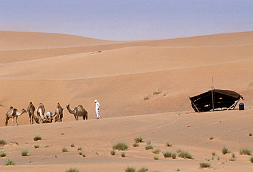
Camel herder and bedouin life in the desert at Al Ain in Abu Dhabi, United Arab Emirates
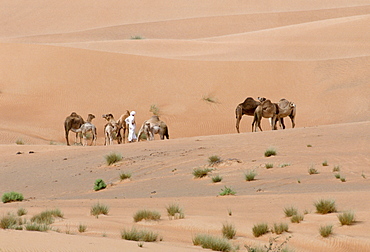
Camel herder and bedouin life in the desert at Al Ain, Abu Dhabi, United Arab Emirates
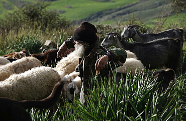
Shepherd with his flock, southern Cyprus
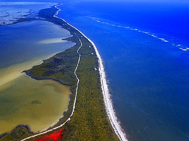
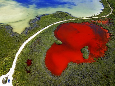
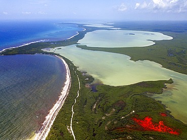
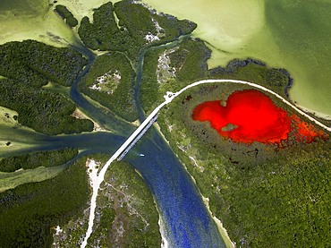
Aerial view of Punta Allen Sian Ka'an Reserve, Yucatan Peninsula, Mexico. Red lagoon near Boca Paila Bridge.
In the language of the Mayan peoples who once inhabited this region, Sian Ka'an means Origin of the Sky. Located on the east coast of the Yucatán peninsula, this biosphere reserve contains tropical forests, mangroves and marshes, as well as a large marine section intersected by a barrier reef. It provides a habitat for a remarkably rich flora and a fauna comprising more than 300 species of birds, as well as a large number of the region's characteristic terrestrial vertebrates, which cohabit in the diverse environment formed by its complex hydrological system.
Along its roughly 120 kilometres of coastline, the property covers over 400,000 hectares of land ranging from sea level to only ten m.a.s.l. The property boasts diverse tropical forests, palm savannah, one of the most pristine wetlands in the region, lagoons, extensive mangrove stands, as well as sandy beaches and dunes. The 120,000 hectares of marine area protect a valuable part of the Mesoamerican Barrier Reef and seagrass beds in the shallow bays. The lush green of the forests and the many shades of blue of the lagoons and the Caribbean Sea under a wide sky offer fascinating visual impressions.
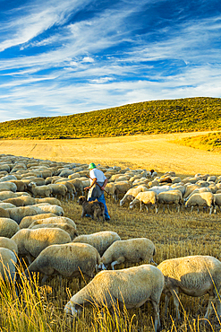
Flock of sheep and shepherd in a cereal land. Tierra Estella county. Navarre, Spain, Europe
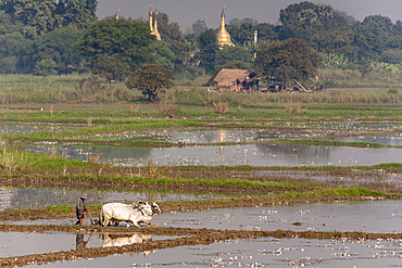
Farmer and oxen ploughing paddy fields, near Mandalay, Myanmar, (Burma)
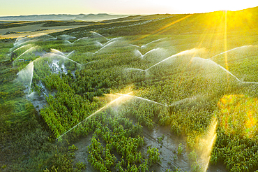
Farmland with watering. Aerial view. Navarre, Spain, Europe
Aerial view of Punta Allen Sian Ka'an Reserve, Yucatan Peninsula, Mexico. Red lagoon near Boca Paila Bridge.
In the language of the Mayan peoples who once inhabited this region, Sian Ka'an means Origin of the Sky. Located on the east coast of the Yucatán peninsula, this biosphere reserve contains tropical forests, mangroves and marshes, as well as a large marine section intersected by a barrier reef. It provides a habitat for a remarkably rich flora and a fauna comprising more than 300 species of birds, as well as a large number of the region's characteristic terrestrial vertebrates, which cohabit in the diverse environment formed by its complex hydrological system.
Along its roughly 120 kilometres of coastline, the property covers over 400,000 hectares of land ranging from sea level to only ten m.a.s.l. The property boasts diverse tropical forests, palm savannah, one of the most pristine wetlands in the region, lagoons, extensive mangrove stands, as well as sandy beaches and dunes. The 120,000 hectares of marine area protect a valuable part of the Mesoamerican Barrier Reef and seagrass beds in the shallow bays. The lush green of the forests and the many shades of blue of the lagoons and the Caribbean Sea under a wide sky offer fascinating visual impressions.

Cereal land. Tierra Estella county, Navarre, Spain, Europe

Palms and old pier in Punta Allen Sian Ka'an Reserve, Yucatan Peninsula, Mexico.
In the language of the Mayan peoples who once inhabited this region, Sian Ka'an means Origin of the Sky. Located on the east coast of the Yucatán peninsula, this biosphere reserve contains tropical forests, mangroves and marshes, as well as a large marine section intersected by a barrier reef. It provides a habitat for a remarkably rich flora and a fauna comprising more than 300 species of birds, as well as a large number of the region's characteristic terrestrial vertebrates, which cohabit in the diverse environment formed by its complex hydrological system.
Along its roughly 120 kilometres of coastline, the property covers over 400,000 hectares of land ranging from sea level to only ten m.a.s.l. The property boasts diverse tropical forests, palm savannah, one of the most pristine wetlands in the region, lagoons, extensive mangrove stands, as well as sandy beaches and dunes. The 120,000 hectares of marine area protect a valuable part of the Mesoamerican Barrier Reef and seagrass beds in the shallow bays. The lush green of the forests and the many shades of blue of the lagoons and the Caribbean Sea under a wide sky offer fascinating visual impressions.
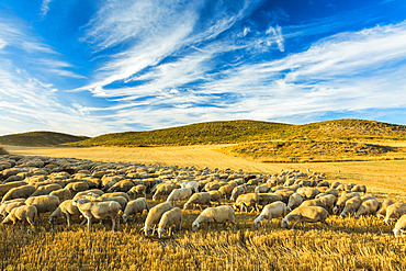
Flock of sheep in a cereal land. Tierra Estella county. Navarre, Spain, Europe

Farmland with vineyard and road. Iguzquiza, Navarre, Spain, Europe
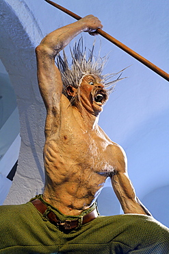
Attacking Celtic warrior with spear, war cry, life-like figure, Keltenmuseum Celtic museum, Hallein, Salzburger Land region, Salzburg, Austria, Europe
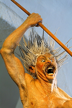
Attacking Celtic warrior with spear, war cry, life-like figure, Keltenmuseum Celtic museum, Hallein, Salzburger Land region, Salzburg, Austria, Europe
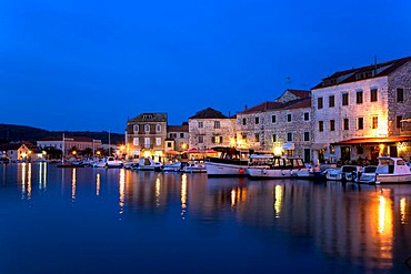
Harbour of Stari Grad, Island Hvar, Dalmatia, Croatia
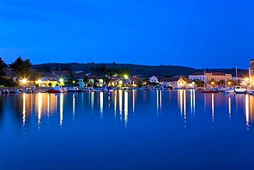
Harbour of Stari Grad, Island Hvar, Dalmatia, Croatia

Nimoa Island - here the island mission will impress. The five-sided church features murals of island life and all mission buildings are surrounded by well maintained paths and gardens filled with flowering plants. Edged by jungle-covered mountains, postcard beaches and crystal clear waters - an island paradise indeed! The Louisiade Archipelago is a string of ten larger volcanic islands frequently fringed by coral reefs, and 90 smaller coral islands located 200 km southeast of New Guinea, stretching over more than 160 km and spread over an ocean area of 26,000 km? between the Solomon Sea to the north and the Coral Sea to the south. The aggregate land area of the islands is about 1,790 km? (690 square miles), with Vanatinai (formerly Sudest or Tagula as named by European claimants on Western maps) being the largest. Sideia Island and Basilaki Island lie closest to New Guinea, while Misima, Vanatinai, and Rossel islands lie further east. The archipelago is divided into the Local Level Government (LLG) areas Loui!

Nimoa Island - here the island mission will impress. The five-sided church features murals of island life and all mission buildings are surrounded by well maintained paths and gardens filled with flowering plants. Edged by jungle-covered mountains, postcard beaches and crystal clear waters - an island paradise indeed! The Louisiade Archipelago is a string of ten larger volcanic islands frequently fringed by coral reefs, and 90 smaller coral islands located 200 km southeast of New Guinea, stretching over more than 160 km and spread over an ocean area of 26,000 km? between the Solomon Sea to the north and the Coral Sea to the south. The aggregate land area of the islands is about 1,790 km? (690 square miles), with Vanatinai (formerly Sudest or Tagula as named by European claimants on Western maps) being the largest. Sideia Island and Basilaki Island lie closest to New Guinea, while Misima, Vanatinai, and Rossel islands lie further east. The archipelago is divided into the Local Level Government (LLG) areas Loui!

Nimoa Island - here the island mission will impress. The five-sided church features murals of island life and all mission buildings are surrounded by well maintained paths and gardens filled with flowering plants. Edged by jungle-covered mountains, postcard beaches and crystal clear waters - an island paradise indeed! The Louisiade Archipelago is a string of ten larger volcanic islands frequently fringed by coral reefs, and 90 smaller coral islands located 200 km southeast of New Guinea, stretching over more than 160 km and spread over an ocean area of 26,000 km? between the Solomon Sea to the north and the Coral Sea to the south. The aggregate land area of the islands is about 1,790 km? (690 square miles), with Vanatinai (formerly Sudest or Tagula as named by European claimants on Western maps) being the largest. Sideia Island and Basilaki Island lie closest to New Guinea, while Misima, Vanatinai, and Rossel islands lie further east. The archipelago is divided into the Local Level Government (LLG) areas Louisiade Rural (western part, with Misima), and Yaleyamba (western part, with Rossell and Tagula islands. The LLG areas are part of Samarai-Murua District district of Milne Bay. The seat of the Louisiade Rural LLG is Bwagaoia on Misima Island, the population center of the archipelago.
Nimoa Island - here the island mission will impress. The five-sided church features murals of island life and all mission buildings are surrounded by well maintained paths and gardens filled with flowering plants. Edged by jungle-covered mountains, postcard beaches and crystal clear waters - an island paradise indeed! The Louisiade Archipelago is a string of ten larger volcanic islands frequently fringed by coral reefs, and 90 smaller coral islands located 200 km southeast of New Guinea, stretching over more than 160 km and spread over an ocean area of 26,000 km? between the Solomon Sea to the north and the Coral Sea to the south. The aggregate land area of the islands is about 1,790 km? (690 square miles), with Vanatinai (formerly Sudest or Tagula as named by European claimants on Western maps) being the largest. Sideia Island and Basilaki Island lie closest to New Guinea, while Misima, Vanatinai, and Rossel islands lie further east.

Nimoa Island - here the island mission will impress. The five-sided church features murals of island life and all mission buildings are surrounded by well maintained paths and gardens filled with flowering plants. Edged by jungle-covered mountains, postcard beaches and crystal clear waters - an island paradise indeed! The Louisiade Archipelago is a string of ten larger volcanic islands frequently fringed by coral reefs, and 90 smaller coral islands located 200 km southeast of New Guinea, stretching over more than 160 km and spread over an ocean area of 26,000 km? between the Solomon Sea to the north and the Coral Sea to the south. The aggregate land area of the islands is about 1,790 km? (690 square miles), with Vanatinai (formerly Sudest or Tagula as named by European claimants on Western maps) being the largest. Sideia Island and Basilaki Island lie closest to New Guinea, while Misima, Vanatinai, and Rossel islands lie further east. The archipelago is divided into the Local Level Government (LLG) areas Louisiade Rural (western part, with Misima), and Yaleyamba (western part, with Rossell and Tagula islands. The LLG areas are part of Samarai-Murua District district of Milne Bay. The seat of the Louisiade Rural LLG is Bwagaoia on Misima Island, the population center of the archipelago.

Nimoa Island - here the island mission will impress. The five-sided church features murals of island life and all mission buildings are surrounded by well maintained paths and gardens filled with flowering plants. Edged by jungle-covered mountains, postcard beaches and crystal clear waters - an island paradise indeed! The Louisiade Archipelago is a string of ten larger volcanic islands frequently fringed by coral reefs, and 90 smaller coral islands located 200 km southeast of New Guinea, stretching over more than 160 km and spread over an ocean area of 26,000 km? between the Solomon Sea to the north and the Coral Sea to the south. The aggregate land area of the islands is about 1,790 km? (690 square miles), with Vanatinai (formerly Sudest or Tagula as named by European claimants on Western maps) being the largest. Sideia Island and Basilaki Island lie closest to New Guinea, while Misima, Vanatinai, and Rossel islands lie further east. The archipelago is divided into the Local Level Government (LLG) areas Louisiade Rural (western part, with Misima), and Yaleyamba (western part, with Rossell and Tagula islands. The LLG areas are part of Samarai-Murua District district of Milne Bay. The seat of the Louisiade Rural LLG is Bwagaoia on Misima Island, the population center of the archipelago.

Nimoa Island - here the island mission will impress. The five-sided church features murals of island life and all mission buildings are surrounded by well maintained paths and gardens filled with flowering plants. Edged by jungle-covered mountains, postcard beaches and crystal clear waters - an island paradise indeed! The Louisiade Archipelago is a string of ten larger volcanic islands frequently fringed by coral reefs, and 90 smaller coral islands located 200 km southeast of New Guinea, stretching over more than 160 km and spread over an ocean area of 26,000 km? between the Solomon Sea to the north and the Coral Sea to the south. The aggregate land area of the islands is about 1,790 km? (690 square miles), with Vanatinai (formerly Sudest or Tagula as named by European claimants on Western maps) being the largest. Sideia Island and Basilaki Island lie closest to New Guinea, while Misima, Vanatinai, and Rossel islands lie further east. The archipelago is divided into the Local Level Government (LLG) areas Loui!

A woman smiles as she waters a tomato plant with rain water with an autumn view of the Colorado mountains. Her daughter stands under an umbrella with the sun shining behind her.
![[DC] Alaska, Frederick Sound, humpback Whales double breach Inside Passage land background clouds Megaptera novaeangliae D1960](https://everywhereyouwant.com/zoom/RM/RH/HORIZONTAL/1116-39013.jpg)
[DC] Alaska, Frederick Sound, humpback Whales double breach Inside Passage land background clouds Megaptera novaeangliae D1960
A young couple standing in front of a waterfall on private land on the island of Kauai, Kauai, Hawaii, United States of America

French Polynesia, Bora Bora, Chairs And Umbrella On Deserted Beach, Blue Sky, Water, White Sand
Hawaii, Underside breaching Humpback Whale (Megaptera novaeangliae) D1947
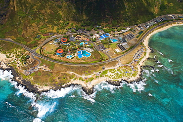
Hawaii, Oahu, Aerial view of Sea Life Park and Makapu'u Beach.
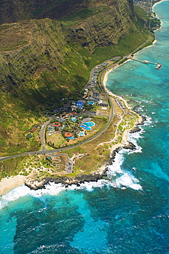
Hawaii, Oahu, Aerial view of Sea Life Park and Makapu'u Beach.
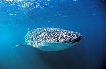
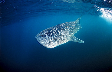
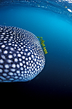
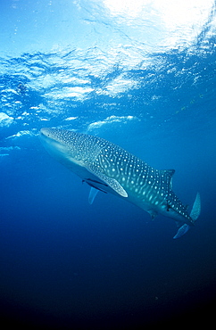
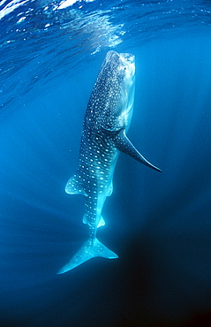
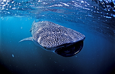
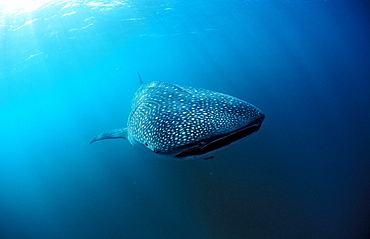
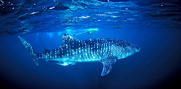
Whale shark, Rhincodon thypus, Australia, Western Australia, Ningaloo Reef, Indian Ocean
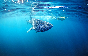
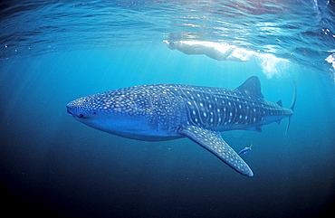
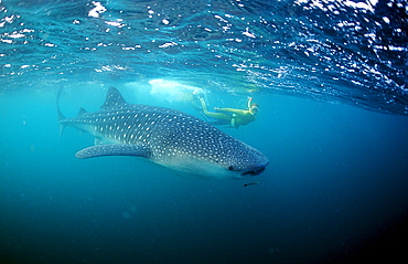
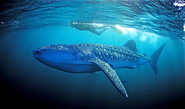
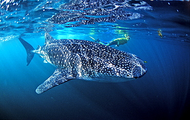
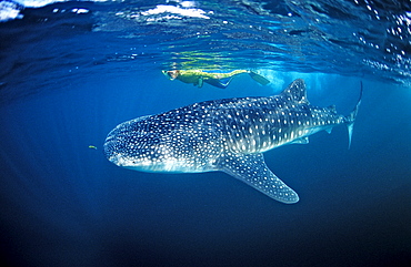
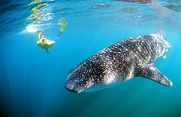
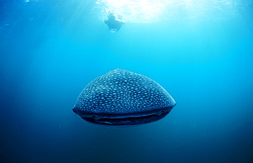
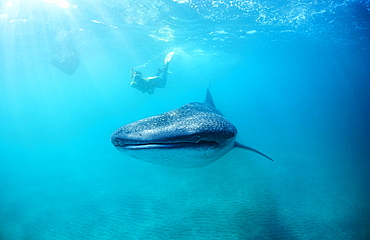
Female snorkeler swims with Whale shark, Rhincodon thypus, Australia, Western Australia, Ningaloo Reef, Indian Ocean
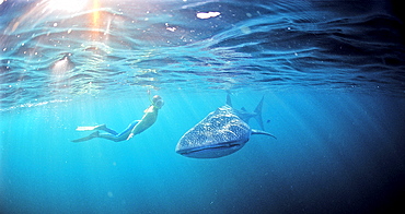
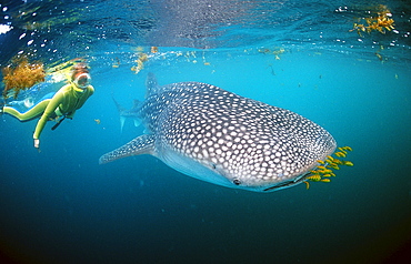
Female snorkeler swims with Whale shark, Rhincodon thypus, Australia, Western Australia, Ningaloo Reef, Indian Ocean
Female snorkeler swims with Whale shark, Rhincodon thypus, Seychelles, Africa, Indian Ocean
Female snorkeler swims with Whale shark, Rhincodon thypus, Thailand, Asia, Indian Ocean
Whale shark, Rhincodon thypus, Mauritius, Africa, Indian Ocean

Female snorkeler swims with Whale shark, Rhincodon thypus, Palau, Micronesia, Indian Ocean
Female snorkeler swims with Whale shark, Rhincodon thypus, Madagascar, Africa, Indian Ocean
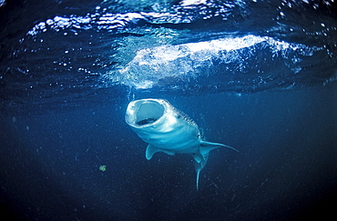
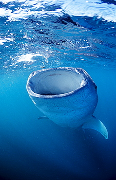
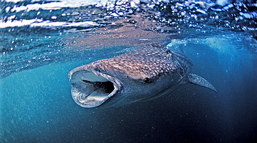
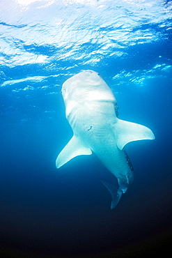
Eating Whale shark, Rhincodon thypus, Australia, Western Australia, Ningaloo Reef, Indian Ocean
Female snorkeler swims with Whale shark, Rhincodon thypus, Djibouti, Djibuti, Africa, Afar Triangle, Gulf of Aden, Gulf of Tadjourah
Female snorkeler swims with Whale shark, Rhincodon thypus, Djibouti, Djibuti, Africa, Afar Triangle, Gulf of Aden, Gulf of Tadjourah
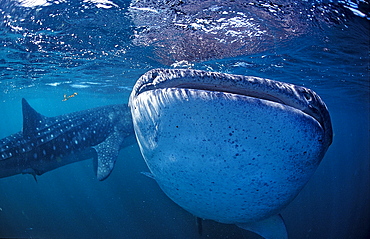
Eating Whale shark, Rhincodon thypus, Djibouti, Djibuti, Africa, Afar Triangle, Gulf of Aden, Gulf of Tadjourah
Female snorkeler swims with Whale shark, Rhincodon thypus, Djibouti, Djibuti, Africa, Afar Triangle, Gulf of Aden, Gulf of Tadjourah
Female snorkeler swims with Whale shark, Rhincodon thypus, Djibouti, Djibuti, Africa, Afar Triangle, Gulf of Aden, Gulf of Tadjourah
Whale shark with yellow pilot fishes, Rhincodon thypus, Djibouti, Djibuti, Africa, Afar Triangle, Gulf of Aden, Gulf of Tadjourah
Eating Whale shark, Rhincodon thypus, Djibouti, Djibuti, Africa, Afar Triangle, Gulf of Aden, Gulf of Tadjourah
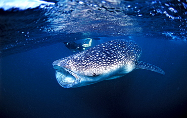
Female snorkeler swims with Whale shark, Rhincodon thypus, Djibouti, Djibuti, Africa, Afar Triangle, Gulf of Aden, Gulf of Tadjourah
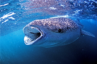
Eating Whale shark, Rhincodon thypus, Djibouti, Djibuti, Africa, Afar Triangle, Gulf of Aden, Gulf of Tadjourah
Eating Whale shark, Rhincodon thypus, Mauritius, Africa, Indian Ocean
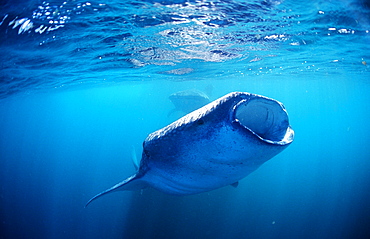
Two eating Whale sharks, Rhincodon thypus, Djibouti, Djibuti, Africa, Afar Triangle, Gulf of Aden, Gulf of Tadjourah
Eating Whale shark, Rhincodon thypus, Djibouti, Djibuti, Africa, Afar Triangle, Gulf of Aden, Gulf of Tadjourah
Eating Whale shark, Rhincodon thypus, Djibouti, Djibuti, Africa, Afar Triangle, Gulf of Aden, Gulf of Tadjourah
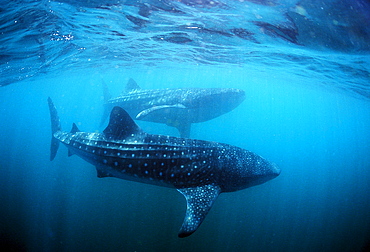
Two Whale sharks, Rhincodon thypus, Djibouti, Djibuti, Africa, Afar Triangle, Gulf of Aden, Gulf of Tadjourah
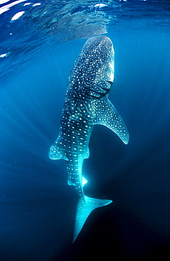
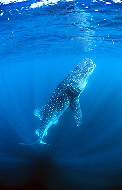
Whale shark, Rhincodon thypus, Djibouti, Djibuti, Africa, Afar Triangle, Gulf of Aden, Gulf of Tadjourah
Eating Whale shark, Rhincodon thypus, Australia, Western Australia, Ningaloo Reef, Indian Ocean
Two Whale sharks, Rhincodon thypus, Djibouti, Djibuti, Africa, Afar Triangle, Gulf of Aden, Gulf of Tadjourah
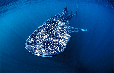
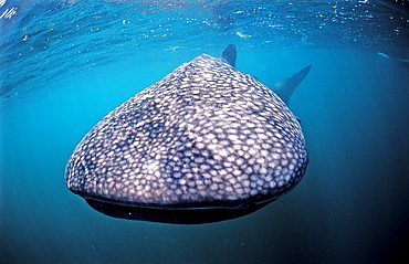
Whale shark, Rhincodon thypus, Djibouti, Djibuti, Africa, Afar Triangle, Gulf of Aden, Gulf of Tadjourah
Eating Whale shark, Rhincodon thypus, Djibouti, Djibuti, Africa, Afar Triangle, Gulf of Aden, Gulf of Tadjourah

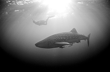
Female snorkeler swims with Whale shark, Rhincodon thypus, Djibouti, Djibuti, Africa, Afar Triangle, Gulf of Aden, Gulf of Tadjourah
Whale shark, Rhincodon thypus, Kenya, Kenia, East Africa, Indian Ocean
Female snorkeler swims with Whale shark, Rhincodon thypus, Seychelles, Africa, Indian Ocean
Eating Whale shark, Rhincodon thypus, Reunion, La R?union, France, Indian Ocean
Female snorkeler swims with Whale shark, Rhincodon thypus, Australia, Western Australia, Ningaloo Reef, Indian Ocean
Female snorkeler swims with Whale shark, Rhincodon thypus, Seychelles, Africa, Indian Ocean
Whale shark, Rhincodon thypus, Djibouti, Djibuti, Africa, Afar Triangle, Gulf of Aden, Gulf of Tadjourah