Results
53 results found
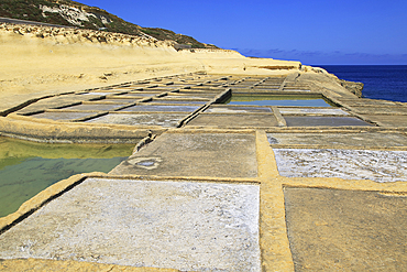
Historic ancient salt pans on coast near Marsalforn, island of Gozo, Malta, Mediterranean, Europe
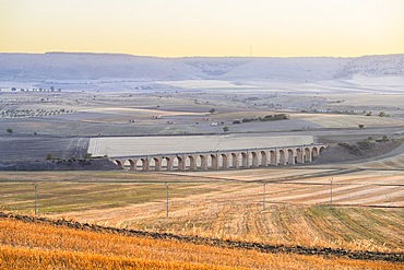
Ponte dei 21 Archi (Bridge of 21 Arches), Spinazzola, Barletta-Andria-Trani, Apulia, Italy
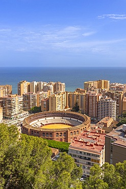
Malaga, Andalusia, Spain

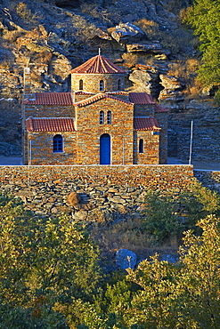
Rock church of Madonna della Stella, Gravina, Bari, Alta Murgia, Apulia, Italy

Escargot (edible land snails) for sale at local market in Paris, France, Europe
Kea Island, Cyclades, Greek Islands, Greece, Europe
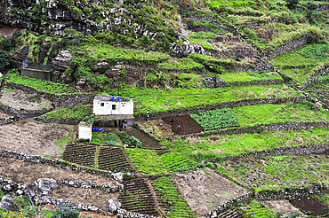
Terrace cultivation on the heights of Machico, Madeira island, Atlantic Ocean, Portugal
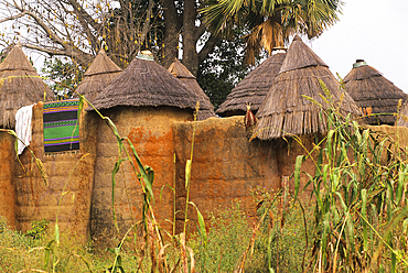
Fortified house, known as Tata Somba ('Somba house') in a Tammari (also known as Batammariba, Tamberma, Somba, Otamari) village, Atakora department, Benin, Gulf of Guinea, West Africa
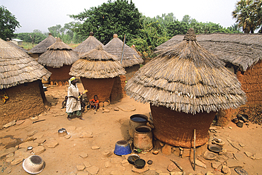
Taneka (or Tanewa, Tangba, Tongba) village, near Djougou, Donga department , Benin, Gulf of Guinea, West Africa
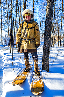
Traditional dressed Evenki hunter with snow shoes before a traditional Evenki Yurt in Tura, Krasnoyarsk Krai, Evenki state, Russia
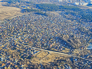
Aerial of the satellitte cities of Moscow, Russia

View of reflections in the Nile River at dawn at Al Daba 'Eya near Luxor, Luxor, Egypt, Africa
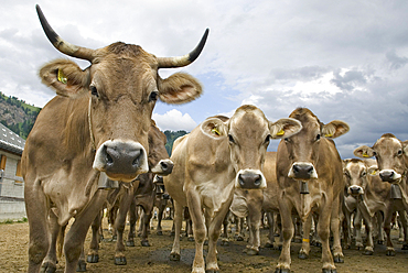
Brune Suisse cows, cattle farm Pian Segno, Blenio vallee, Canton Ticino, Switzerland
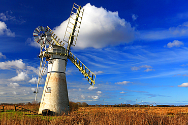
Thurne Mill, Norfolk Broads, Norfolk
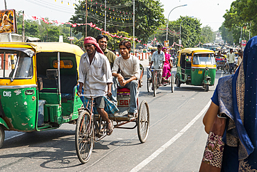
Rickshaws in a street of Delhi, India, Asia
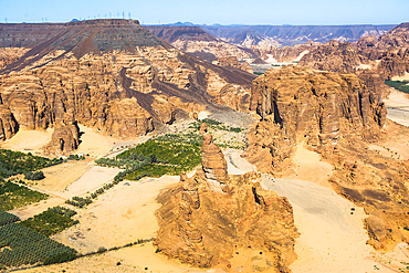
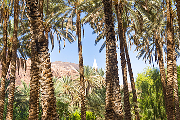
Aerial view of Palm grove and farms in AlUla's Ashar Valley, Medina Province, Saudi Arabia
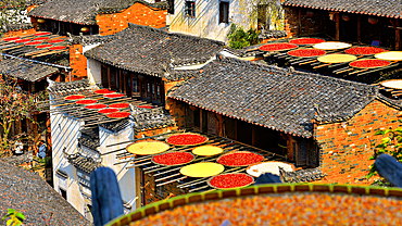
Chillies and corn being sun dried, Huangling, ancient village dating back to the Ming Dynasty, Wuyuan County, Shangrao City, Jiangxi Province, China
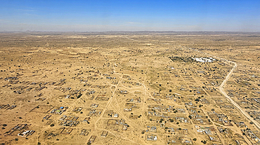
Aerial of Abeche, Chad
Aerial of N´Djamena, capital of Chad and the Chari River, Chad
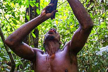
Pygmy man extracting water from a tree branch, Dzanga Sangha National Park, UNESCO, Central African Republic
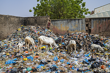
Extremely dirty waste area in the Fadar Daurama Emir's palace, Daura Emirate, Katsina state, Nigeria
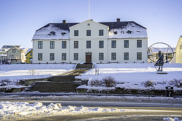
View of Reykjavik Junior College in the city centre on a sunny day in winter, Reykjavik, Iceland

The spectacular scenery of the north coast and volcanic highlands of Saint Anthony, Cape Verde
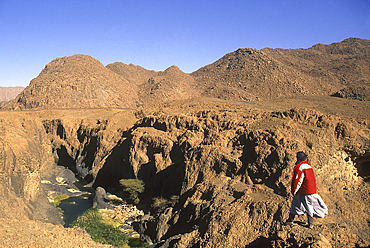
Man on the edge of a canyon, around Timia, village of Avdz?r, Niger, Western Africa
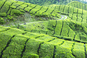
BOH Sungai Palas tea plantation, Cameron Highlands, Pahang, Malaysia
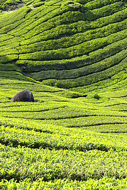
BOH Sungai Palas tea plantation, Cameron Highlands, Pahang, Malaysia
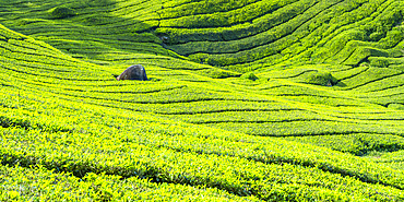
BOH Sungai Palas tea plantation, Cameron Highlands, Pahang, Malaysia
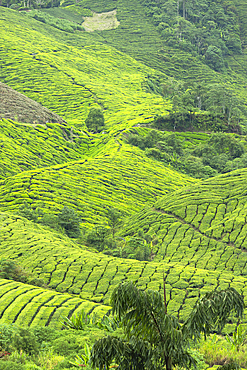
BOH Sungai Palas tea plantation, Cameron Highlands, Pahang, Malaysia
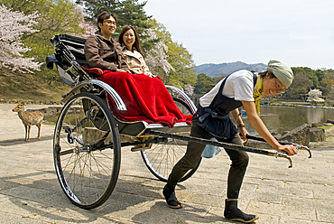
Tourist pulled rickshaw in front of the pavilion Ukimido, Sagi-ike pond, flowering cherry trees, Nara, Japan
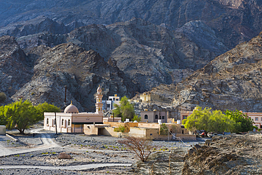
Al Bardah, village on edge of Wadi Bani Awf, NE slope of Jebel Akhdar, Western Hajar Mountains, Al-Dakhiliyah region, Oman, Arabian Peninsula

Convent of San Antonio de Padua, Izamal, Yucatan State, Mexico
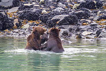
Adult brown bear pair (Ursus arctos) mock-fighting at Scidmore Cut in Glacier Bay National Park, Alaska, United States of America
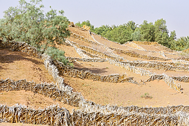
System of protection against invasion of desert sand in palm grove of Zagora, Draa River valley, Province of Zagora, Region Draa-Tafilalet, Morocco
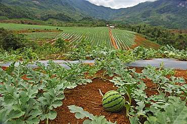
Watermelon crop on lands bought or rented by China for Chinese market, Nong Khiaw area, northern Laos
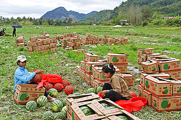
Watermelon harvest on lands bought or rented by China for Chinese market, Nong Khiaw area, northern Laos

Market gardening nearby Luang Prabang, Laos
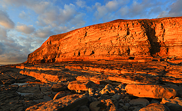
Golden evening light on the limestone cliffs, Dunraven Bay, Southerndown, Vale of Glamorgan, Wales, United Kingdom
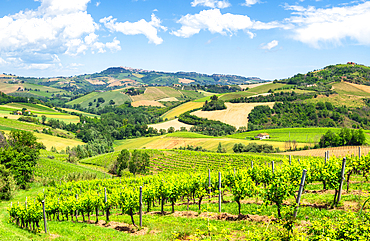
Rolling hills and vineyards of Marche region, Italy
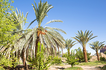
Date palm grove in the oasis of AlUla, Medina Province, Saudi Arabia
Date palm grove in the oasis of AlUla, Medina Province, Saudi Arabia
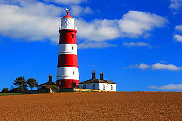
Happisburgh Lighthouse, Norfolk
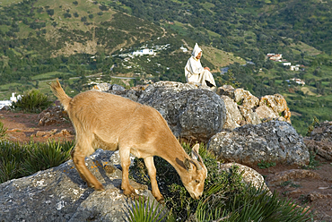
Goat and shepherd above Chefchaouen, Rif region, Morocco

Caribbean land hermit crab (Coenobita clypeatus), Half Moon Caye, UNESCO, Mesoamerican Barrier Reef, Belize
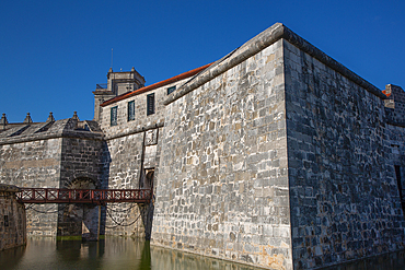
Havana Castle of the Royal Force (Castillo de la Real Fuerza), Havana Old Town, UNESCO, Havana, Cuba
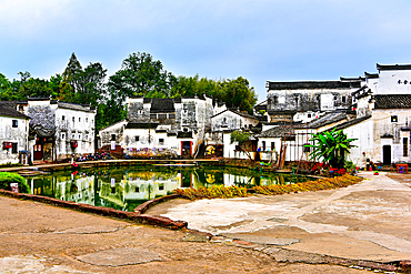
Central Bell Pond, with the land and pond in Yin Yang formation at Zhuge Bagua village, Lanxi County, Jinhua, Zhejiang Province, China
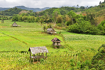
Corn and rice fields in the area around Nong Khiaw, Luang Prabang Province, Laos
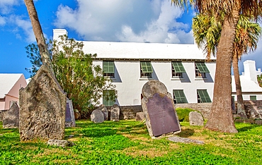
Burial Ground for Slaves and Free Blacks up to 1854, containing 180 graves, St. Peter's Churchyard, St. George, Bermuda

View of a village of Puning City, Guangdong Province, China

Surroundings of the village of Tighza under a thin layer of snow, Ounila River valley, Ouarzazate Province, region of Draa-Tafilalet, Morocco

Village in High-Atlas, Morocco
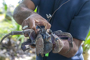
Local guide holding an adult coconut crab (Birgus latro), on land on Gam Island, Raja Ampat, Indonesia, Southeast Asia, Asia
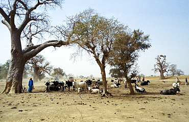
Local people tend cattle in the Sahara Desert in Upper Volta, now named Burkina Faso
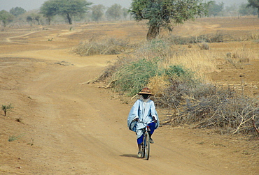
A local man wearing a sunhat rides a bicycle on the road to Sebba through the desert drought areas of Burkina Faso (formerly Upper Volta)
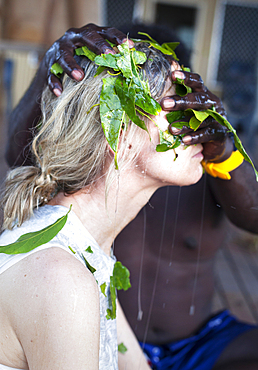
Aboriginal Yolngu elder applying local plants to sand bite wounds, East Arnhem Land, Northern Territory, Australia, Pacific
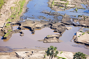
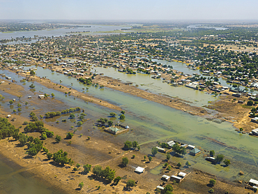
In mid January 2015, a three day period of excessive rain brought unprecedented floods to the small poor African country of Malawi. It displaced nearly quarter of a million people, devastated 64,000 hectares of land, and killed several hundred people. This shot taken from the air shows flood waters and farmland destroyed by the floods, with local farmers crossing their devastated fields.
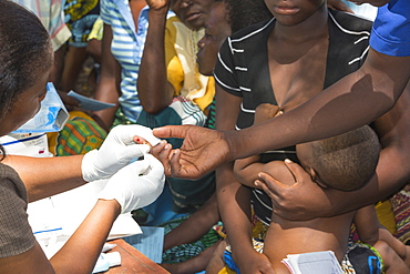
In mid January 2015, a three day period of excessive rain brought unprecedented floods to the small poor African country of Malawi. It displaced nearly quarter of a million people, devastated 64,000 hectares of land, and killed several hundred people. This shot shows A Medicin Sans Frontieres clinic in Makhanga testing local people for malaria, many of whom proved positive for the disease, as a result of the drying up flood waters providing ideal breeding grounds for mosquitoes.
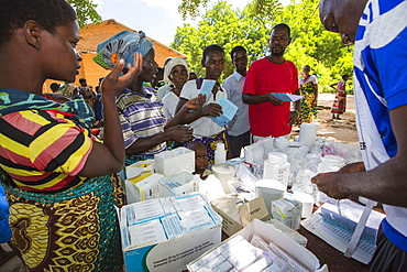
January 2015 saw a three day period of excessive rain which brought unprecedented floods to the small poor African country of Malawi. It displaced nearly quarter of a million people, devastated 64,000 hectares of land, and killed several hundred people. This shot shows A Medicin Sans Frontieres clinic in Makhanga providing Malaria treatment drugs to local people, many of whom now have malaria, as a result of the drying up flood waters providing ideal breeding grounds for mosquitoes.
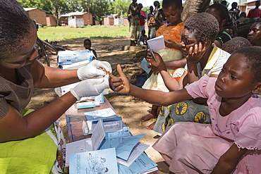
January 2015 saw a three day period of excessive rain which brought unprecedented floods to the small poor African country of Malawi. It displaced nearly quarter of a million people, devastated 64,000 hectares of land, and killed several hundred people. This shot shows A Medicin Sans Frontieres clinic in Makhanga testing local people, many of whom now have malaria, as a result of the drying up flood waters providing ideal breeding grounds for mosquitoes.
Young people in traditional costumes for tourist presentations. Shigansk is a settlement on the lower reaches of the Lena, where it crosses the Arctic Circle on its way to the Arctic Ocean. It was founded in 1632. The population lives mainly from fur hunt
Smallholder looking over the wooden gate to the neighbouring fields cultivated by a great land owner, soybean plantation, Gran Chaco, Santiago del Estero province, Argentina, South America

Market Swabia, DEU, 16.10.2005 - overcrowded waste paper containers are located in the Bavarian market Swabia. | Market Swabia, GER, 16. Oct. 2005 - Overfilled container for waste PAPERs into the bavarian small town market Swabia.
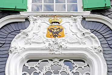
Rococo portal, local heritage museum, Remscheid-Hasten, Bergisches Land, North Rhine-Westphalia, , Germany
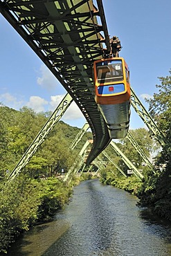
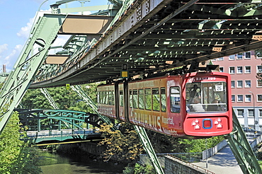
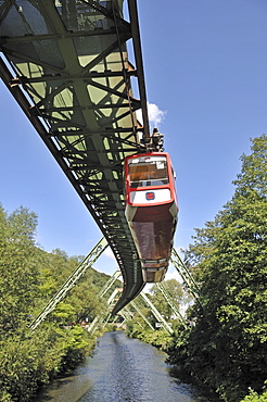
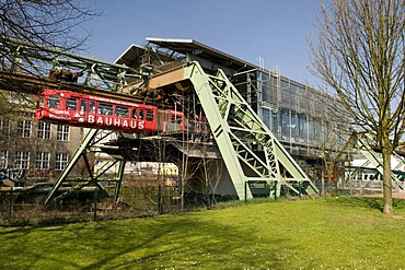
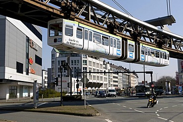
Elevated suspended monorail, Wuppertal, Bergisches Land region, North Rhine-Westphalia, Germany, Europe
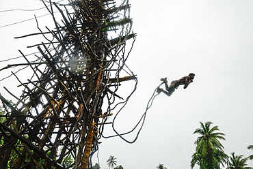
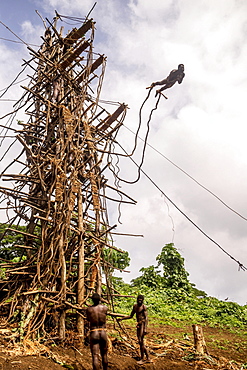
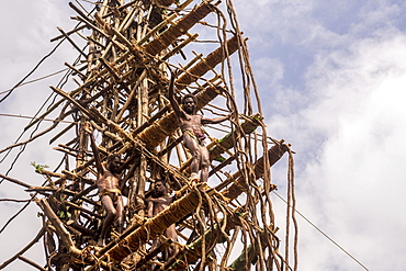
Land diving, Naghol ceremony in the village of Rangsuksuk, Island of Pentecost, Vanuatu, South Sea, Oceania
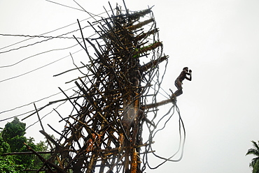
Land diving, Naghol ceremony in the village of Rangsuksuk, Island of Pentecost, Vanuatu, South Sea, Oceania
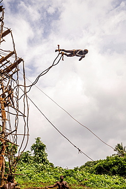
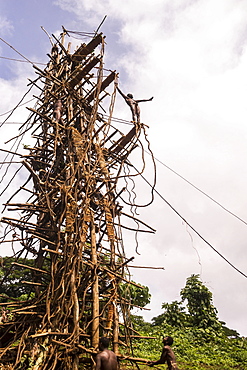
Land diver preparing to jump, Pentecost Island, Vanuatu, Oceania
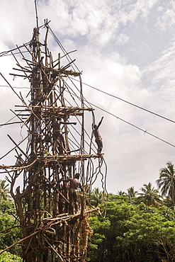
Land diver preparing to jump, Pentecost Island, Vanuatu, Oceania
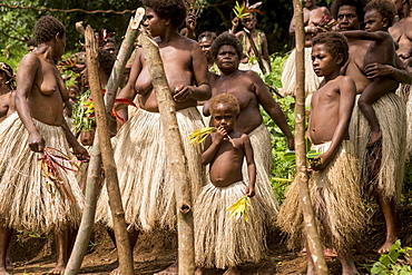
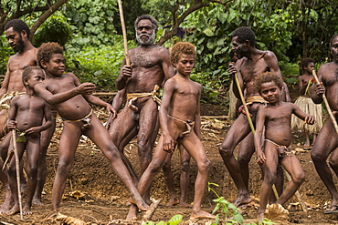
Women of the Sa people dancing at the Land diving ceremony, Pentecost Island, Vanuatu, Oceania
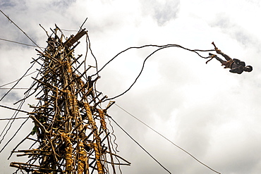
Land diver jumping, Pentecost Island, Vanuatu, Oceania
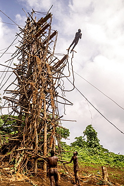
Land diver jumping, Pentecost Island, Vanuatu, Oceania
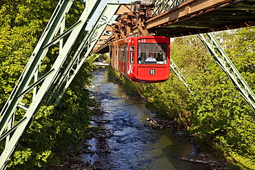
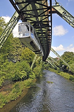
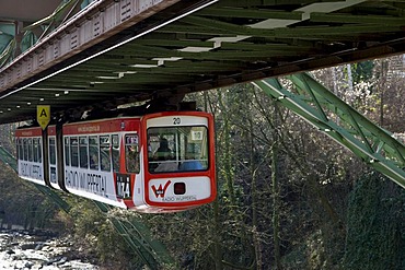
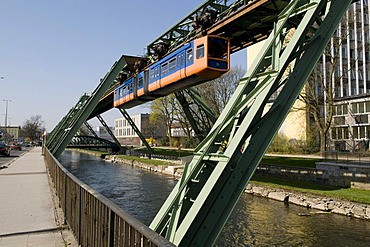
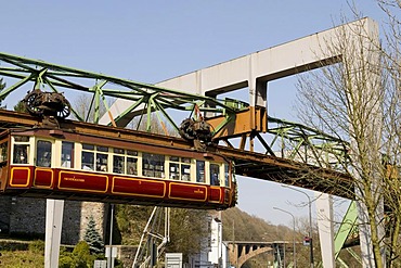
Suspension railway above the river Wupper, Wuppertal, Bergisches Land, North Rhine-Westphalia, Germany, Europe
Land diver jumping, Pentecost Island, Vanuatu, Oceania
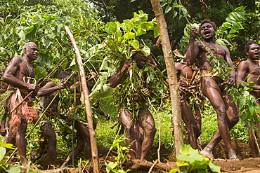
Men of the Sa people dancing at the Land diving ceremony, Pentecost Island, Vanuatu, Oceania
Men and boys of the Sa people dancing at the Land diving ceremony, Pentecost Island, Vanuatu, Oceania
Land diver preparing to jump, Pentecost Island, Vanuatu, Oceania
Land diver preparing to jump, Pentecost Island, Vanuatu, Oceania
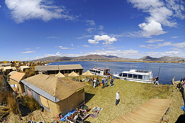
Uros, floating island, Lake Titicaca, Peru, South America, Latin America
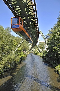
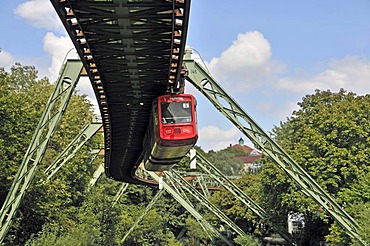
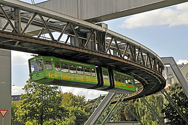
Wuppertal Floating Tram suspended monorail, Wuppertal, Bergisches Land region, North Rhine-Westphalia, Germany, Europe
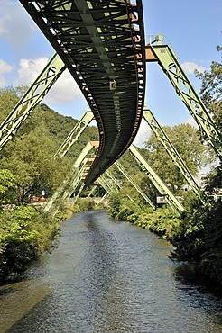
Supporting system, Wuppertal Floating Tram suspended monorail, Wuppertal, Bergisches Land region, North Rhine-Westphalia, Germany, Europe
Monorail above the Wupper River, Wuppertal, Bergisches Land, North Rhine-Westphalia, Germany, Europe
Wuppertal Floating Tram suspended monorail, Wuppertal, Bergisches Land region, North Rhine-Westphalia, Germany, Europe
Elevated suspended monorail, Wuppertal, Bergisches Land region, North Rhine-Westphalia, Germany, Europe
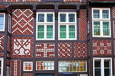
Facade of the historic timber framed Local History Museum in the historic city centre of Buxtehude, Altes Land area, Lower Saxony, Germany, Europe
Monorail above the Wupper River, Wuppertal, Bergisches Land, North Rhine-Westphalia, Germany, Europe
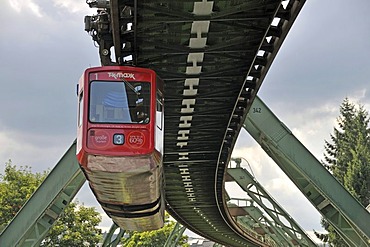
Wuppertal Floating Tram suspended monorail, Wuppertal, Bergisches Land region, North Rhine-Westphalia, Germany, Europe
Schwebebahn, suspended monorail, Wuppertal, Bergisches Land, North Rhine-Westphalia, Germany, Europe
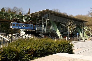
Schwebebahn, suspended monorail station, Zoo Stadion, Wuppertal, Bergisches Land, North Rhine-Westphalia, Germany, Europe
Schwebebahn, suspended monorail station, Wuppertal, Bergisches Land, North Rhine-Westphalia, Germany, Europe
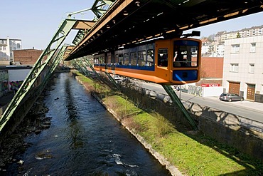
Schwebebahn, suspended monorail over the Wupper River, Wuppertal, Bergisches Land, North Rhine-Westphalia, Germany, Europe
Monorail, Wuppertal, Bergisches Land, North Rhine-Westphalia, Germany, Europe
Schwebebahn, suspended monorail, Wuppertal, Bergisches Land, North Rhine-Westphalia, Germany, Europe
Schwebebahn, suspended monorail, Wuppertal, Bergisches Land, North Rhine-Westphalia, Germany, Europe
Schwebebahn, suspended monorail, Wuppertal, Bergisches Land, North Rhine-Westphalia, Germany, Europe

Schwebebahn, suspended monorail, Wuppertal, Bergisches Land, North Rhine-Westphalia, Germany, Europe
Crest, Haus Cleff house, Heimatmuseum museum for local history, historical center, Haste, Remscheid, Bergisches Land region, North Rhine-Westphalia, Germany, Europe
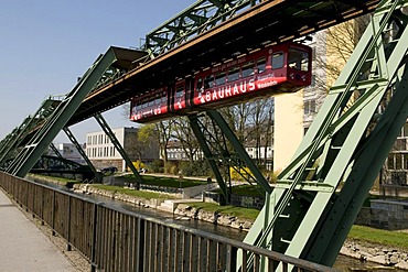
Schwebebahn, suspended monorail over the Wupper River, Wuppertal, Bergisches Land, North Rhine-Westphalia, Germany, Europe
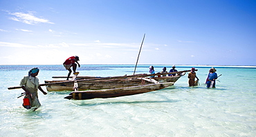
A fishing boat brings brightly dressed women to the beach, Zanzibar, Tanzania, Africa
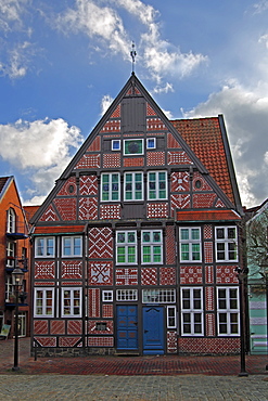
Museum of local history and city museum, historic timber framed house in the historic district of Buxtehude, Altes Land area, Lower Saxony, Germany, Europe
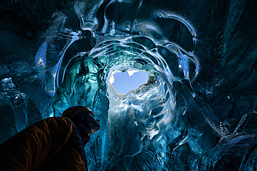
Explorer in the blue ice caves in Jˆkuls·rlÛn glacier, Iceland, North Atlantic Ocean
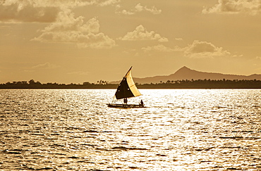
The Louisiade Archipelago is a string of ten larger volcanic islands frequently fringed by coral reefs, and 90 smaller coral islands located 200 km southeast of New Guinea, stretching over more than 160 km and spread over an ocean area of 26,000 km? between the Solomon Sea to the north and the Coral Sea to the south. The aggregate land area of the islands is about 1,790 km? (690 square miles), with Vanatinai (formerly Sudest or Tagula as named by European claimants on Western maps) being the largest.Sideia Island and Basilaki Island lie closest to New Guinea, while Misima, Vanatinai, and Rossel islands lie further east. The archipelago is divided into the Local Level Government (LLG) areas Louisiade Rural (western part, with Misima), and Yaleyamba (western part, with Rossell and Tagula islands. The LLG areas are part of Samarai-Murua District district of Milne Bay. The seat of the Louisiade Rural LLG is Bwagaoia on Misima Island, the population center of the archipelago.