Results
49 results found

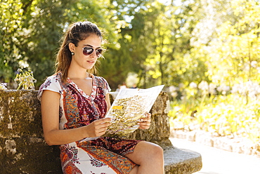
Young woman reading map on a Vespa moped, Rome, Lazio, Italy, Europe

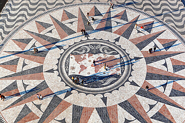
Pavement on the Tagus riverbank in front of the Padrao dos Descobrimentos, Compass rose and world map, Belem, Lisbon, Portugal, Europe
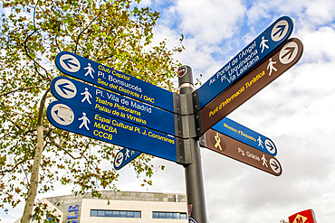
Street sign directions, Barcelona, Catalonia, Spain, Europe
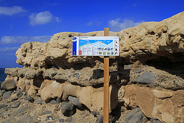
Interesting geological rock formations at Ajuy, Fuerteventura, Canary Islands, Spain, Atlantic, Europe
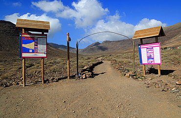
Start of footpath trail from Gran Valle to Cofete, Jandia peninsula, Fuerteventura, Canary Islands, Spain, Atlantic, Europe
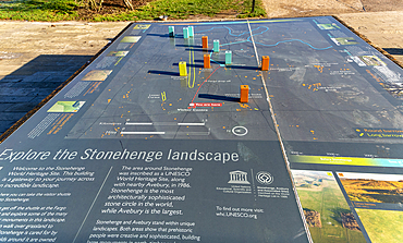
Information map about the prehistoric landscape of Stonehenge, Wiltshire, England, United Kingdom, Europe
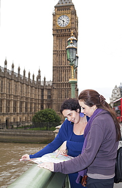
Two young women looking at map, with Big Ben in background, London, England, United Kingdom, Europe
Tourist viewing map, Quinta da Regaleira, Sintra, Portugal, Europe

Senior tourists sightseeing in St. Peters Square, Rome, Lazio, Italy, Europe
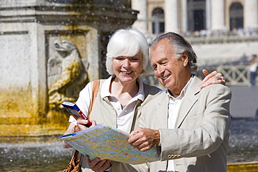
Senior tourists sightseeing in St. Peters Square, Rome, Italy, Europe

Senior tourists sightseeing, Rome, Lazio, Italy, Europe
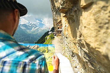
Man looks at map of hiking trails, Aescher-Wildkirchli Gasthaus, Ebenalp, Appenzell Innerrhoden, Switzerland, Europe
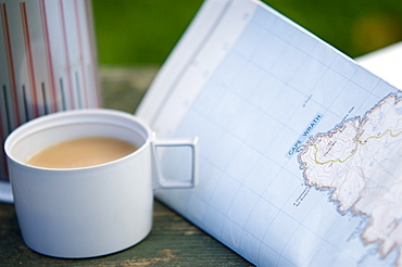
Tea and walkers map with flask, United Kingdom, Europe
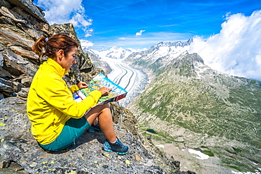
Woman looking at map sitting on rocks at Eggishorn viewpoint above Aletsch Glacier, Bernese Alps, canton of Valais, Switzerland, Europe
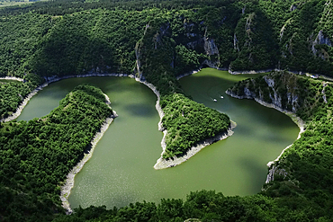
Meanders of the Uvac River, Serbia, Europe
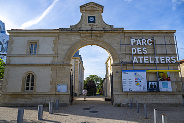
Parc des Ateliers, Arles, Bouches du Rhone, Provence-Alpes-Cote d'Azur, France, Europe
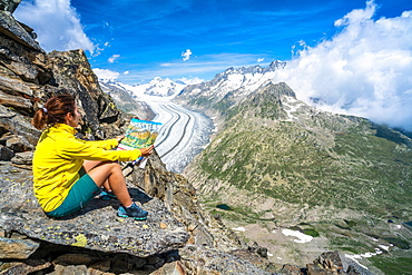
Woman looking at map sitting on rocks at Eggishorn viewpoint above Aletsch Glacier, Bernese Alps, canton of Valais, Switzerland, Europe
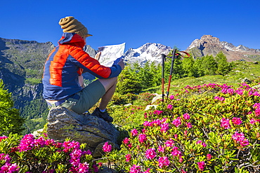
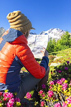
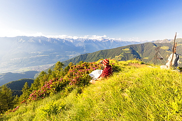
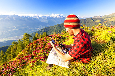
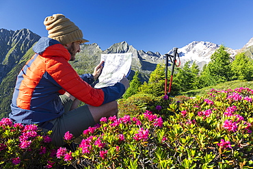
Tourist reading hiking map beside rhododendron flowers, Mount Scermendone, Valmasino, Valtellina, Lombardy, Italy, Europe
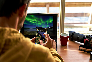
One man looking at maps on smart phone while working with laptop computer, Lofoten Islands, Norway, Scandinavia, Europe

Two friends, one African and one Caucasian, sharing a map together whilst on holiday, Portugal, Europe

Two friends, one African and one Caucasian, sharing a map together whilst on holiday, Portugal, Europe

Vilnius Airport, Vilnius, Lithuania, Europe

Coronavirus (Covid-19), global pandemic, World map with surgical mask and Bible, Koran and Torah, Interreligious dialogue, France, Europe
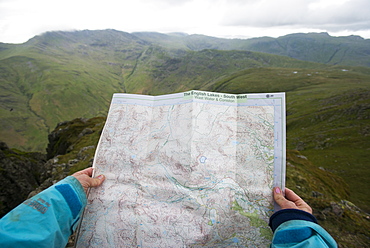
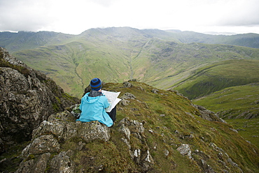
A woman checks her map while looking towards Great Langdale valley from the Langdale Pikes, Lake District, Cumbria, England, United Kingdom, Europe
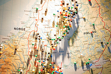
Travel plans with straight pins on the Scandinavian map, Scandinavia, Europe
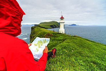
Hiker on cliffs looks at the map next to lighthouse, Mykines island, Faroe Islands, Denmark, Europe
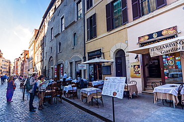
The Jewish Ghetto, Rome, Lazio, Italy, Europe

Two friends, one African and one Caucasian, sharing a map together whilst on holiday, Portugal, Europe
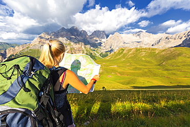
Hiker reading map with Marmolada in the background, San Nicolo Pass, Fassa Valley, Trentino, Dolomites, Italy, Europe

Photographer using laptop and smart phone planning the photo travels, Lofoten Islands, Norway, Scandinavia, Europe
Hiker looking at map, Scermendone Alp, Sondrio province, Valtellina, Rhaetian Alps, Lombardy, Italy, Europe

Ponte Vecchio, Florence (Firenze), UNESCO World Heritage Site, Tuscany, Italy, Europe
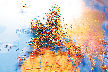
Pinned map of Europe

Hiker reading map near San Nicolo Pass, Fassa Valley, Trentino, Dolomites, Italy, Europe
A woman checks her map while looking towards Great Langdale valley from the Langdale Pikes, Lake District National Park, Cumbria, England, United Kingdom, Europe
Hiker with binoculars and map looks towards Rhaetian Alps and Monte Disgrazia from Pizzo Berro, Bitto Valley, Lombardy, Italy, Europe
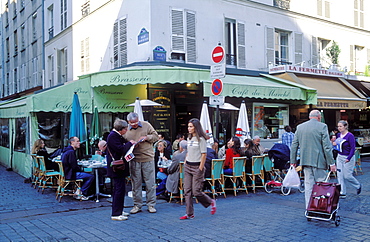
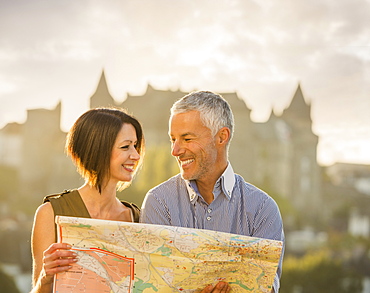
Older couple reading a map on Rue Cler, Paris, France, Europe
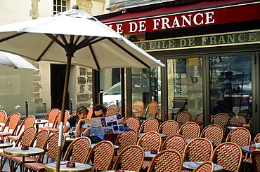
Couple reading a street map at an empty cafe, Paris, France, Europe
A woman stops near Stickle Pike in The Lake District to check her bearings on a map, Cumbria, England, United Kingdom, Europe
Hiker sitting near rhododendrons on Pizzo Berro looks at the compass and map, Bitto Valley, Lombardy, Italy, Europe
Hiker surrounded by rhododendrons looks at map, Scermendone Alp, Sondrio province, Valtellina, Rhaetian Alps, Lombardy, Italy, Europe
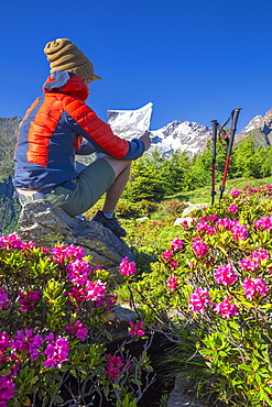
Tourist reading hiking map beside rhododendron flowers, Mount Scermendone, Valmasino, Valtellina, Lombardy, Italy, Europe
Hiker with map and binoculars looks towards Rhaetian Alps and Monte Disgrazia from Pizzo Berro, Bitto Valley, Lombardy, Italy, Europe
Checking a map on the way down from Helvellyn towards Grisedale Tarn in the English Lake District, Lake District National Park, Cumbria, England, United Kingdom, Europe
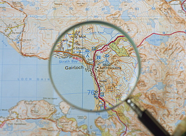
Magnifying glass above an Ordnance Survey map, Scotland, United Kingdom, Europe

Old Map of Europe
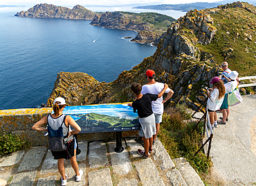
Viewpoint looking north, Isla del Faro, Cies Islands, Atlantic Islands Galicia Maritime Terrestrial National Park, Galicia, Spain, Europe

Big Ben and young couple looking at map, London, England, United Kingdom, Europe

Sculpture at starting point of South West Coast Path, Minehead, Somerset, England, United Kingdom, Europe
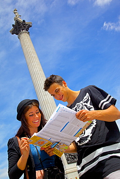
Young couple looking at map with Nelson's Column behind, Trafalgar Square, London, England, United Kingdom, Europe
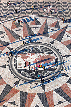
Pavement map showing routes of Portugese explorers below Monument to the Discoveries, Belem, Lisbon, Portugal, Europe
Pavement map showing routes of Portugese explorers below Monument to the Discoveries, Belem, Lisbon, Portugal, Europe
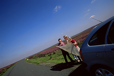
Motorists looking at the map, North Yorkshire Moors, Yorkshire, England, United Kingdom, Europe
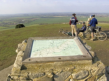
Mountain bikers, summit of the Ridgeway Path, Ivinghoe Beacon, The Chilterns, Buckinghamshire, England, United Kingdom, Europe

Couple looking at map in front of Roman amphitheatre, UNESCO World Heritage Site, Arles, Provence, France, Europe
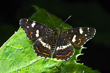
The Map (Araschnia levana) - Summer brood;North West Bulgaria;Europe

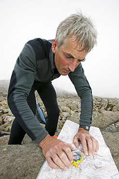
A mountaineer checks his map whilst looking towards the Angels Peak and Braeriach across the Lairig Ghru from the summit of Ben Macdui in winter, Cairngorms, Scotland, United Kingdom, Europe
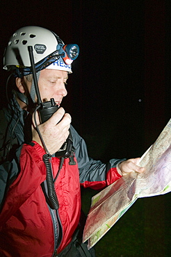
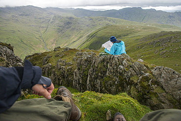
The Langdale Ambleside Mountain Rescue Team on a night search on Crinkle Crags in the Lake District, Cumbria, England, United Kingdom, Europe

A man reading a map in bluebell woodland near Coniston, Lake District, Cumbria, England, United Kingdom, Europe

Information at the Sellafield nuclear power station visitor centre, Cumbria, England, United Kingdom, Europe
The capped off reactor at the Sellafield nuclear power station following the nuclear accident, Cumbria, England, United Kingdom, Europe
A man navigating on Scafell Pike in the Lake District National Park, Cumbria, England, United Kingdom, Europe

Caucasian couples sitting on bench near train reading map

Caucasian couple reading map near train and pointing
Caucasian couple reading map
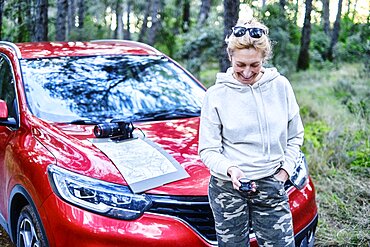
Young adult caucasian woman orienting herself with a map and a compass close to a car parked in a forestry path. Travels concept. Ayegui, Navarre, Spain, Europe.
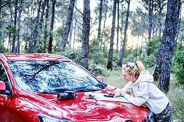
Young adult caucasian woman orienting herself with a map and a compass close to a car parked in a forestry path. Travels concept. Ayegui, Navarre, Spain, Europe.
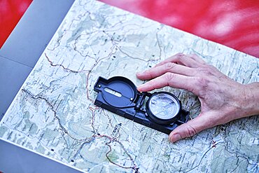
Young adult caucasian woman orienting herself with a map and a compass close to a car parked in a forestry path. Travels concept. Ayegui, Navarre, Spain, Europe.
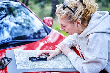
Young adult caucasian woman orienting herself with a map and a compass close to a car parked in a forestry path. Travels concept. Ayegui, Navarre, Spain, Europe.
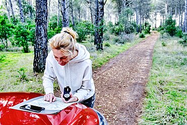
Young adult caucasian woman orienting herself with a map and a compass close to a car parked in a forestry path. Travels concept. Ayegui, Navarre, Spain, Europe.
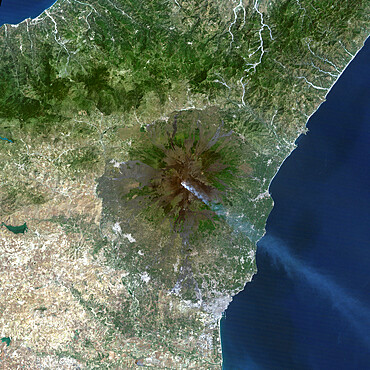
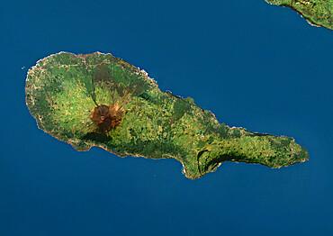
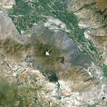
Mount Etna'S Smoke Plume In 1987, Italy, True Colour Satellite Image

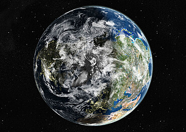
Globe Europe, True Colour Satellite Image. True colour satellite image of the whole earth, showing Europe at centre. The picture is a composite created from thousands of separate images recorded by LANDSAT 5 & 7 satellites. Print size 42x42cm.
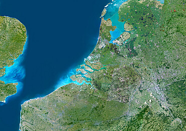
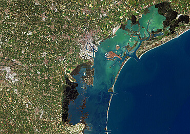
Rhine, Meuse And Scheldt Delta, Netherlands, True Colour Satellite Image. True colour satellite image of the Rhine-Meuse-Scheldt delta in the Netherlands
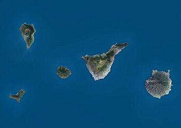
Satellite view of La Palma, Tenerife and Gran Canaria, Canary Islands, Spain. The smallest islands of La Gomera and El Hierro are also shown. This image was compiled from data acquired by Landsat 8 satellite in 2014.
Satellite view of Pico Island, Azores, Portugal. Volcano Mount Pico, to the West, is the highest point in Portugal, at 2351 m, and the most famous landmark in the Azores. This image was compiled from data acquired by Landsat satellites.
Globe Centred On The North Pole, True Colour Satellite Image
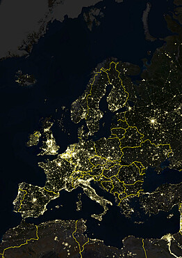
Europe At Night With Country Borders, True Colour Satellite Image. True colour satellite image of Europe at night with country borders. This image in Lambert Conformal Conic projection was compiled from data acquired by LANDSAT 5 & 7 satellites.
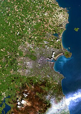
Dublin, Ireland, True Colour Satellite Image. Dublin, Republic of Ireland. True colour satellite image of Dublin, capital city of the Republic of Ireland. Composite of 2 image taken on 1st & 24 May 2001, using LANDSAT 7 data.
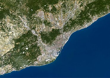
Barcelona, Spain, True Colour Satellite Image. Barcelona, Spain. True colour satellite image of Barcelona, taken on 10 August 2000, using LANDSAT 7 data.

Satellite view of Crete, Greece. Crete is the largest and most populous of the Greek islands. This image was compiled from data acquired by Landsat 8 satellite in 2014.
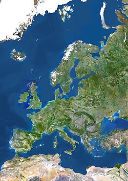
Europe, True Colour Satellite Image. True colour satellite image of Europe. This image in Lambert Conformal Conic projection was compiled from data acquired by LANDSAT 5 & 7 satellites.
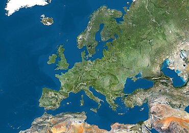
Satellite view of Europe. This image was compiled from data acquired by Landsat 7 & 8 satellites.
Venice, Italy, True Colour Satellite Image. Venice, France. True colour satellite image of the city of Venice that stretches across numerous small islands in the marshy Venetian Lagoon. Image taken on 26 August 2001 using LANDSAT 7 data.
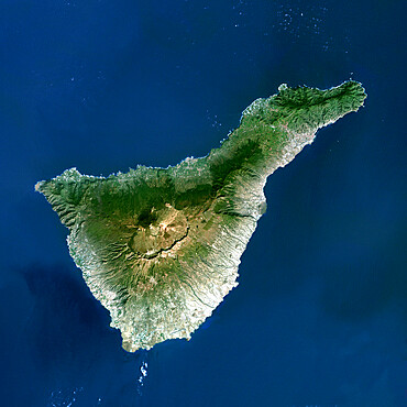
Satellite view of Tenerife, Canary Islands, Spain. It is the largest and most populous island of the seven Canary Islands. Volcano Mount Teide at center is the highest point of Spain, at 3718 m. This image was compiled from data acquired by Landsat 8 satellite in 2014.
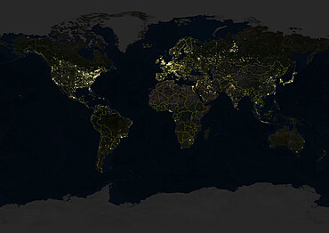
Whole Earth At Night With Country Borders, True Colour Satellite Image. True colour satellite image of the whole Earth at night with country borders. This image in Miller projection was compiled from data acquired by LANDSAT 5 & 7 satellites.
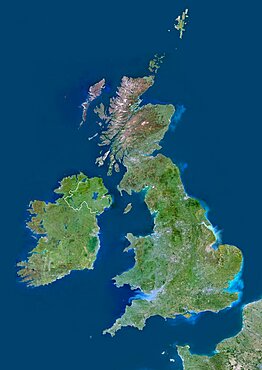
United Kingdom, Europe, True Colour Satellite Image With Border. Satellite view of Bulgaria (with border). This image was compiled from data acquired by LANDSAT 5 & 7 satellites.
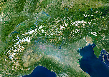
The Alps, Europe, True Colour Satellite Image. The Alps, seen from space. Mosaic of satellite images of the Alps, using LANDSAT data
Karymsky Volcano, Russia, True Colour Satellite Image. Karymsky volcano, Russia, true colour satellite image
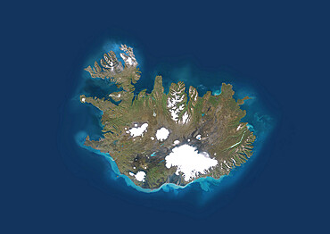
Iceland, True Colour Satellite Image. Iceland, true colour satellite image
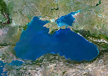
Black Sea, Europe, True Colour Satellite Image. True colour satellite image of the Black Sea
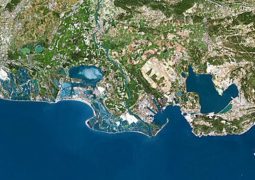
Rhone Delta, France, True Colour Satellite Image. True colour satellite image of the Rhone Delta in southern France
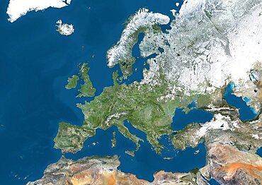
Satellite view of Europe in winter, with partial snow cover. This image was compiled from data acquired by Landsat 7 & 8 satellites.
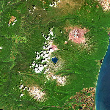
Ararat Volcano, Turkey, True Colour Satellite Image
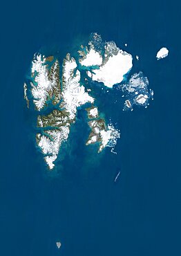
Satellite view of Svalbard, Norway. It is a Norwegian archipelago in the Arctic Ocean. This image was compiled from data acquired by Landsat satellites.
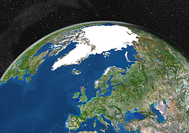
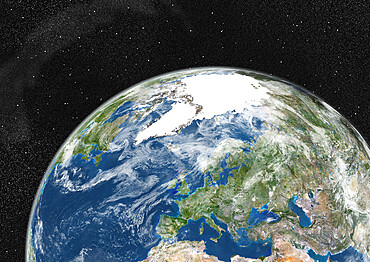
Globe Showing Europe, True Colour Satellite Image. True colour satellite image of the Earth showing Greenland, the North Pole and Europe. This image in orthographic projection was compiled from data acquired by LANDSAT 5 & 7 satellites.
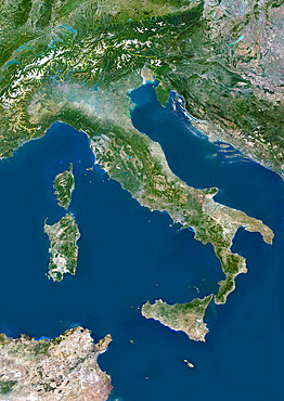
Italy, True Colour Satellite Image With Border. Italy, true colour satellite image with border
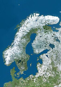
Satellite view of Northern Europe showing Scandinavia and the Baltic States in winter, with partial snow cover. This image was compiled from data acquired by Landsat 7 & 8 satellites.
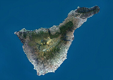
Teide Volcano, Canary Islands, Spain, True Colour Satellite Image
Siljan Meteor Impact Crater, Sweden, True Colour Satellite Image. True colour satellite image of Siljan impact structure, Sweden (diameter : 55 km). Image using LANDSAT data.
Globe Showing Europe, True Colour Satellite Image