Results
68 results found
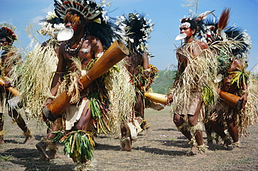
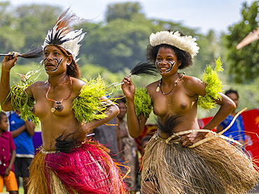
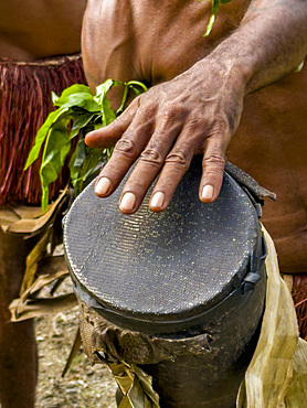
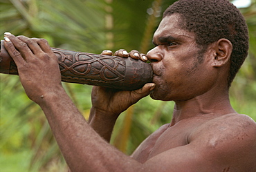
Dancers from Daru island carrying kundu drums at a sing-sing, Port Moresby, Papua New Guinea, Pacific
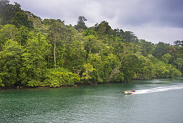
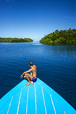
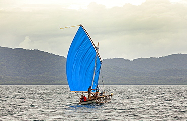
Little boat on a river in the jungle of Manus or Admirality islands, Papua New Guinea
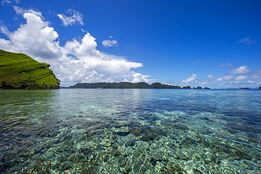
Raja Ampat archipelago, West Papua, Indonesia, New Guinea, Southeast Asia, Asia
Raja Ampat archipelago, West Papua, Indonesia, New Guinea, Southeast Asia, Asia
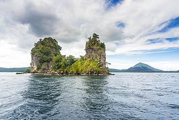
The Beehives (Dawapia Rocks) in Simpson Harbour, Rabaul, East New Britain, Papua New Guinea, Pacific
The Beehives (Dawapia Rocks) in Simpson Harbour, Rabaul, East New Britain, Papua New Guinea, Pacific
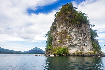
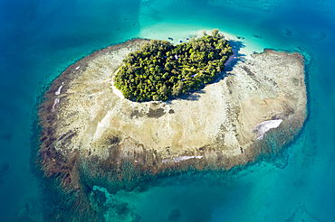
Little island off the coast of Rabaul, East New Britain, Papua New Guinea, Pacific

Little island off the coast of Rabaul, East New Britain, Papua New Guinea, Pacific

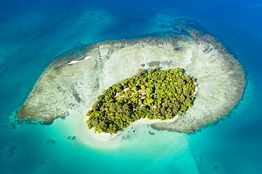
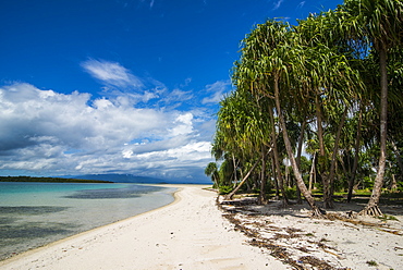
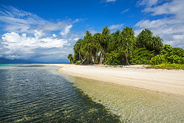
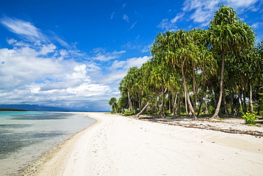
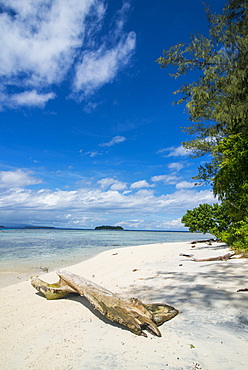
Aerial View of Lissenung Island, New Ireland, Papua New Guinea
Little island off the coast of Rabaul, East New Britain, Papua New Guinea, Pacific

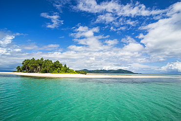
Aerial View of Lissenung Island, New Ireland, Papua New Guinea

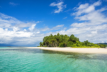
Aerial View of Lissenung Island, New Ireland, Papua New Guinea
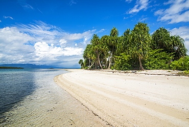
Aerial View of Lissenung Island, New Ireland, Papua New Guinea
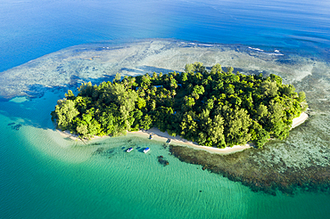
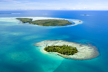
Aerial View of Restorf Island, Kimbe Bay, New Britain, Papua New Guinea
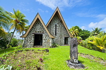
Stone church on Kvato island, Papua New Guinea, Pacific
Aerial View of Lissenung Island, New Ireland, Papua New Guinea

Aerial View of Lissenung Island, New Ireland, Papua New Guinea

Aerial View of Lissenung Island, New Ireland, Papua New Guinea

Aerial View of Lissenung Island, New Ireland, Papua New Guinea
Aerial View of Lissenung Island, New Ireland, Papua New Guinea
Aerial View of Lissenung Island, New Ireland, Papua New Guinea
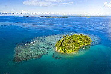
Aerial View of Lissenung Island, New Ireland, Papua New Guinea

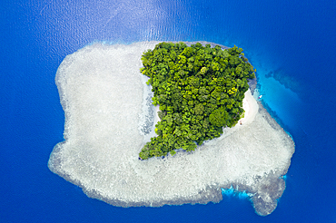
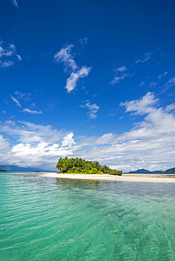
The stunning little island of Ral off the coast of Kavieng, New Ireland, Papua New Guinea, Pacific
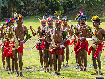
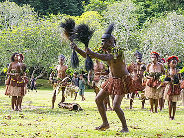
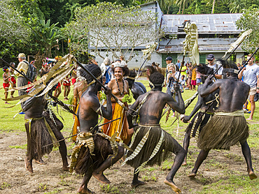
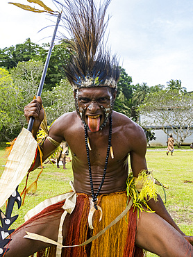
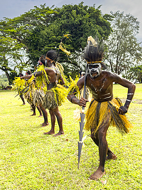
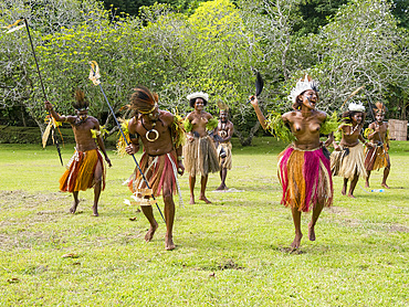
Six different groups of native warriors, drummers, and dancers perform on Kwato Island, Papua New Guinea, Pacific
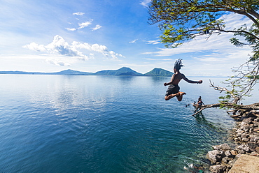
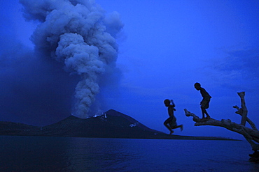
Man jumping in the bay of Rabaul with Volcano Tavurvur in the background, East New Britain, Papua New Guinea, Pacific
View over Rabaul, East New Britain, Papua New Guinea, Pacific
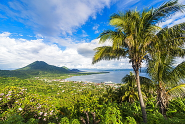
View over Rabaul, East New Britain, Papua New Guinea, Pacific

Turquoise water and white sand beach at the stunning little island of Ral off the coast of Kavieng, New Ireland, Papua New Guinea, Pacific

Turquoise water and white sand beach at the stunning little island of Ral off the coast of Kavieng, New Ireland, Papua New Guinea, Pacific
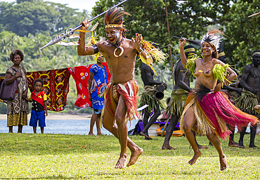
Six different groups of native warriors, drummers, and dancers perform on Kwato Island, Papua New Guinea, Pacific
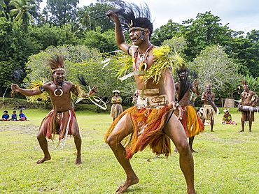
Six different groups of native warriors, drummers, and dancers perform on Kwato Island, Papua New Guinea, Pacific
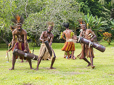
Six different groups of native warriors, drummers, and dancers perform on Kwato Island, Papua New Guinea, Pacific
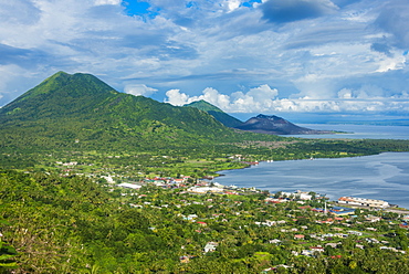
View over Rabaul, East New Britain, Papua New Guinea, Pacific
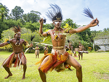
Six different groups of native warriors, drummers, and dancers perform on Kwato Island, Papua New Guinea, Pacific
Six different groups of native warriors, drummers, and dancers perform on Kwato Island, Papua New Guinea, Pacific
Six different groups of native warriors, drummers, and dancers perform on Kwato Island, Papua New Guinea, Pacific
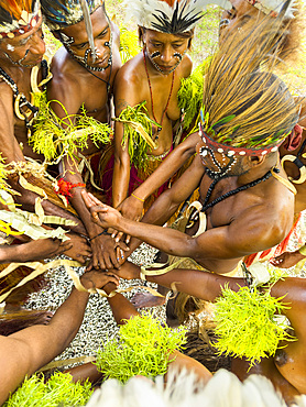
Six different groups of native warriors, drummers, and dancers perform on Kwato Island, Papua New Guinea, Pacific
Six different groups of native warriors, drummers, and dancers perform on Kwato Island, Papua New Guinea, Pacific
Six different groups of native warriors, drummers, and dancers perform on Kwato Island, Papua New Guinea, Pacific
Six different groups of native warriors, drummers, and dancers perform on Kwato Island, Papua New Guinea, Pacific
Six different groups of native warriors, drummers, and dancers perform on Kwato Island, Papua New Guinea, Pacific
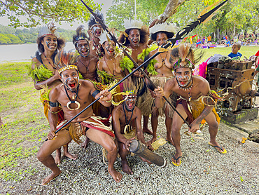
Six different groups of native warriors, drummers, and dancers perform on Kwato Island, Papua New Guinea, Pacific
Six different groups of native warriors, drummers, and dancers perform on Kwato Island, Papua New Guinea, Pacific
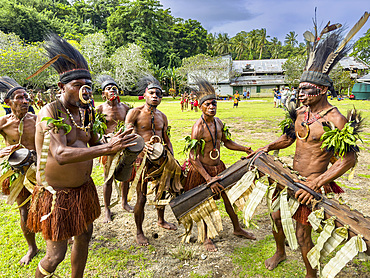
Six different groups of native warriors, drummers, and dancers perform on Kwato Island, Papua New Guinea, Pacific

Turquoise water and a white beach on Christmas Island, Buka, Bougainville, Papua New Guinea, Pacific
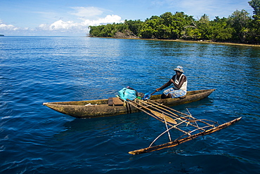
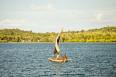
Fisherman in the outer islands, Buka, Bougainville, Papua New Guinea, Pacific

Turquoise water and a white beach on Christmas Island, Buka, Bougainville, Papua New Guinea, Pacific

Turquoise water and white sand beach, White Island, Buka, Bougainville, Papua New Guinea, Pacific

Turquoise water and a white beach on Christmas Island, Buka, Bougainville, Papua New Guinea, Pacific
View over Rabaul, East New Britain, Papua New Guinea, Pacific
Turquoise water and white sand beach, White Island, Buka, Bougainville, Papua New Guinea, Pacific
Turquoise water and white sand beach, White Island, Buka, Bougainville, Papua New Guinea, Pacific
Turquoise water and white sand beach, White Island, Buka, Bougainville, Papua New Guinea, Pacific
Turquoise water and white sand beach, White Island, Buka, Bougainville, Papua New Guinea, Pacific
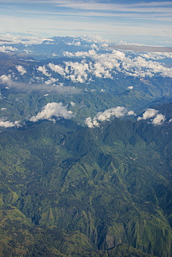
Aerial of the western highlands of Papua New Guinea, Pacific
Turquoise water and white sand beach, White Island, Buka, Bougainville, Papua New Guinea, Pacific
Turquoise water and white sand beach, White Island, Buka, Bougainville, Papua New Guinea, Pacific
Turquoise water and a white beach on Christmas Island, Buka, Bougainville, Papua New Guinea, Pacific
Turquoise water and white sand beach, White Island, Buka, Bougainville, Papua New Guinea, Pacific

Traditionally built huts in the Nusa Island retreat, Kavieng, New Ireland, Papua New Guinea, Pacific
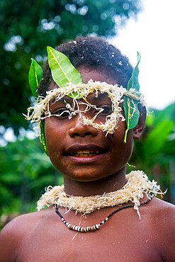
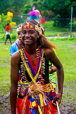
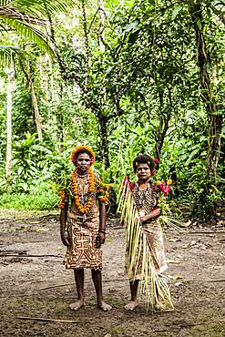
Traditional dressed boy in a war ceremony, Manus Island, Admiralty Islands, Papua New Guinea, Pacific
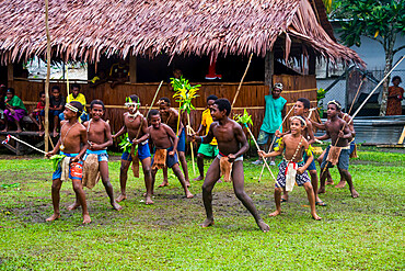
Young people practicing traditional dance, Manus Island, Admiralty Islands, Papua New Guinea, Pacific

Yali woman carrying wood on her head, Irian Jaya, Island of New Guinea, Indonesia, Southeast Asia, Asia
Piramat, Irian Jaya, Island of New Guinea, Indonesia, Southeast Asia, Asia
Young people practising traditional dance, Manus Island, Admiralty Islands, Papua New Guinea, Pacific
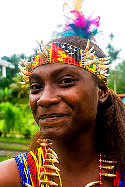
Traditional dressed girl in a war ceremony, Manus Island, Admiralty Islands, Papua New Guinea, Pacific
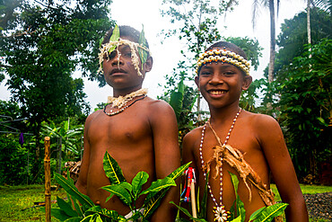
Traditional dressed boys in a war ceremony, Manus Island, Admiralty Islands, Papua New Guinea, Pacific
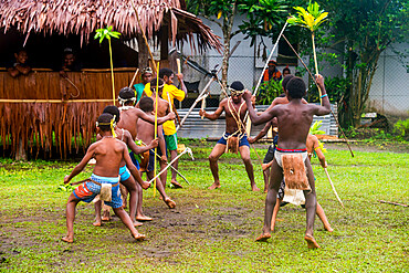
Young people practicing traditional dance, Manus Island, Admiralty Islands, Papua New Guinea, Pacific

Island close to Kavieng, New Ireland, Kavieng, Papua New Guinea, Pacific
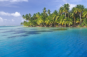
Coconut tree grove, Ifalik Island, Papua New Guinea, South Pacific Ocean.

Coconut tree grove, Ifalik Island, Papua New Guinea, South Pacific Ocean.

Spinner dolphins (Stenella longirostris), Kimbe Bay, West New Britain Island, Papua New Guinea, South Pacific

Bottlenose dolphins (Tursiops truncatus) surfacing, Cape Hoskins, West New Britain Island, Papua New Guinea, South Pacific

Spinner dolphins (Stenella longirostris) underwater, Kimbe Bay, West New Britain Island, Papua New Guinea, South Pacific

Spinner dolphins (Stenella longirostris) surfacing, May Reef, West New Britain Island, Papua New Guinea, South Pacific
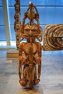
New Ireland Malagan funerary statue in at the Metropolitan Museum of Art museum, New York, USA. New Ireland is part of the Bismarck Archipelago, situated north of New Guinea, and has an estimated population of 100,000. The Dutch first encountered the island in 1616, and today New Ireland is a province of Papua New Guinea. Nineteen different languages are spoken on the island, and it is divided by a chain of mountains into three distinct regions: northern, central, and southeastern. The art of New Ireland traditionally centered on mortuary ceremonies and feasts to honor the dead. In northern New Ireland, the name given to these elaborate ceremonies is malagan, which is also the term used for the carved and painted sculptures associated with the ceremonies.
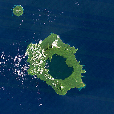
Long Island Volcano, Papua New Guinea, True Colour Satellite Image
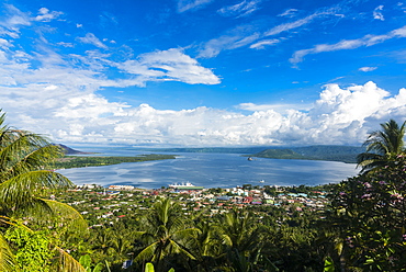
Papua New Guinea

Aerial view of two islands, Duke of York Island, West New Britain, Papua New Guinea, Melanesia

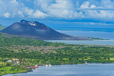
Tarvuvur, Volcano, Rabaul, Matupit, East New Britain, Papua New Guinea, Melanesia
Children on Matupit Island. They have never known their island other then covered in ash, Tavurvur Volcano, Rabaul, East New Britain, Papua New Guinea, Pacific

The only source of income for people on Matupit island are the eggs from the Megapode bird, a small bird, that lays massive eggs in the hot volcanic ash and trusts the volcano to incubate them. One egg costs 2 Kina, 50 Euro cent, on the market, Tavurvur Volcano, Rabaul, East New Britain, Papua New Guinea, Pacific
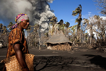
Daily life on Matupit island, Tavurvur Volcano, Rabaul, East New Britain, Papua New Guinea, Melanesia- Pacific
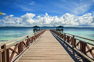
Landing stage, Arborek Island, Raja-Ampat, Western New Guinea, Indonesia, Asia

Bungalows, Papua Diving Resort, Kri Island in the Dampier Strait, West Papua, Indonesia, Asia

Papua Diving Resort, Raja-Ampat, Kri, Dampier Strait, Western New Guinea, Indonesia, Asia

Forested limestone cliffs, Gam, Dampier Strait, Raja Ampat, Western New Guinea, Indonesia, Asia

Man snorkeling in the clear waters, Buka, Papua New Guinea, Oceania

Coconut trees (Cocos nucifera), Arborek Island, Raja-Ampat, Western New Guinea, Indonesia, Asia
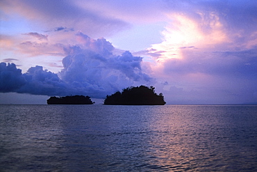
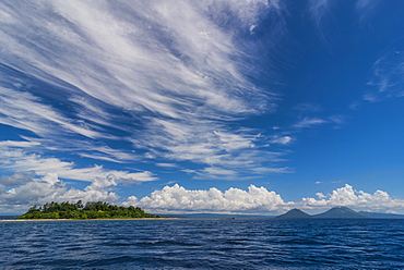
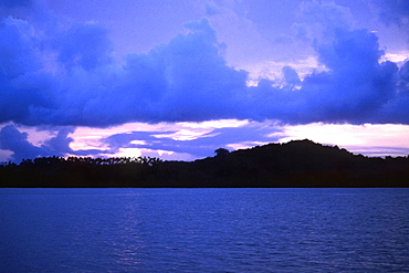
Cloudscape over the sea, Bismarck Sea, Papua New Guinea
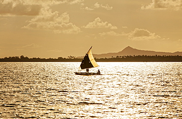
Sunset over an ocean, New Britain, Papua New Guinea
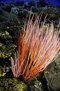
Close-up of Red Whip Coral underwater, New Britain Island, Papua New Guinea
The Louisiade Archipelago is a string of ten larger volcanic islands frequently fringed by coral reefs, and 90 smaller coral islands located 200 km southeast of New Guinea, stretching over more than 160 km and spread over an ocean area of 26,000 km? between the Solomon Sea to the north and the Coral Sea to the south. The aggregate land area of the islands is about 1,790 km? (690 square miles), with Vanatinai (formerly Sudest or Tagula as named by European claimants on Western maps) being the largest.Sideia Island and Basilaki Island lie closest to New Guinea, while Misima, Vanatinai, and Rossel islands lie further east. The archipelago is divided into the Local Level Government (LLG) areas Louisiade Rural (western part, with Misima), and Yaleyamba (western part, with Rossell and Tagula islands. The LLG areas are part of Samarai-Murua District district of Milne Bay. The seat of the Louisiade Rural LLG is Bwagaoia on Misima Island, the population center of the archipelago.
The Louisiade Archipelago is a string of ten larger volcanic islands frequently fringed by coral reefs, and 90 smaller coral islands located 200 km southeast of New Guinea, stretching over more than 160 km and spread over an ocean area of 26,000 km? between the Solomon Sea to the north and the Coral Sea to the south. The aggregate land area of the islands is about 1,790 km? (690 square miles), with Vanatinai (formerly Sudest or Tagula as named by European claimants on Western maps) being the largest. Sideia Island and Basilaki Island lie closest to New Guinea, while Misima, Vanatinai, and Rossel islands lie further east. The archipelago is divided into the Local Level Government (LLG) areas Louisiade Rural (western part, with Misima), and Yaleyamba (western part, with Rossell and Tagula islands. The LLG areas are part of Samarai-Murua District district of Milne Bay. The seat of the Louisiade Rural LLG is Bwagaoia on Misima Island, the population center of the archipelago.

Nimoa Island - here the island mission will impress. The five-sided church features murals of island life and all mission buildings are surrounded by well maintained paths and gardens filled with flowering plants. Edged by jungle-covered mountains, postcard beaches and crystal clear waters - an island paradise indeed! The Louisiade Archipelago is a string of ten larger volcanic islands frequently fringed by coral reefs, and 90 smaller coral islands located 200 km southeast of New Guinea, stretching over more than 160 km and spread over an ocean area of 26,000 km? between the Solomon Sea to the north and the Coral Sea to the south. The aggregate land area of the islands is about 1,790 km? (690 square miles), with Vanatinai (formerly Sudest or Tagula as named by European claimants on Western maps) being the largest. Sideia Island and Basilaki Island lie closest to New Guinea, while Misima, Vanatinai, and Rossel islands lie further east. The archipelago is divided into the Local Level Government (LLG) areas Loui!

Nimoa Island - here the island mission will impress. The five-sided church features murals of island life and all mission buildings are surrounded by well maintained paths and gardens filled with flowering plants. Edged by jungle-covered mountains, postcard beaches and crystal clear waters - an island paradise indeed! The Louisiade Archipelago is a string of ten larger volcanic islands frequently fringed by coral reefs, and 90 smaller coral islands located 200 km southeast of New Guinea, stretching over more than 160 km and spread over an ocean area of 26,000 km? between the Solomon Sea to the north and the Coral Sea to the south. The aggregate land area of the islands is about 1,790 km? (690 square miles), with Vanatinai (formerly Sudest or Tagula as named by European claimants on Western maps) being the largest. Sideia Island and Basilaki Island lie closest to New Guinea, while Misima, Vanatinai, and Rossel islands lie further east. The archipelago is divided into the Local Level Government (LLG) areas Loui!

Nimoa Island - here the island mission will impress. The five-sided church features murals of island life and all mission buildings are surrounded by well maintained paths and gardens filled with flowering plants. Edged by jungle-covered mountains, postcard beaches and crystal clear waters - an island paradise indeed! The Louisiade Archipelago is a string of ten larger volcanic islands frequently fringed by coral reefs, and 90 smaller coral islands located 200 km southeast of New Guinea, stretching over more than 160 km and spread over an ocean area of 26,000 km? between the Solomon Sea to the north and the Coral Sea to the south. The aggregate land area of the islands is about 1,790 km? (690 square miles), with Vanatinai (formerly Sudest or Tagula as named by European claimants on Western maps) being the largest. Sideia Island and Basilaki Island lie closest to New Guinea, while Misima, Vanatinai, and Rossel islands lie further east. The archipelago is divided into the Local Level Government (LLG) areas Louisiade Rural (western part, with Misima), and Yaleyamba (western part, with Rossell and Tagula islands. The LLG areas are part of Samarai-Murua District district of Milne Bay. The seat of the Louisiade Rural LLG is Bwagaoia on Misima Island, the population center of the archipelago.
Nimoa Island - here the island mission will impress. The five-sided church features murals of island life and all mission buildings are surrounded by well maintained paths and gardens filled with flowering plants. Edged by jungle-covered mountains, postcard beaches and crystal clear waters - an island paradise indeed! The Louisiade Archipelago is a string of ten larger volcanic islands frequently fringed by coral reefs, and 90 smaller coral islands located 200 km southeast of New Guinea, stretching over more than 160 km and spread over an ocean area of 26,000 km? between the Solomon Sea to the north and the Coral Sea to the south. The aggregate land area of the islands is about 1,790 km? (690 square miles), with Vanatinai (formerly Sudest or Tagula as named by European claimants on Western maps) being the largest. Sideia Island and Basilaki Island lie closest to New Guinea, while Misima, Vanatinai, and Rossel islands lie further east.
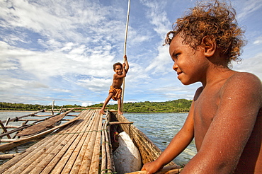
Children playing with a outrigger canoe in the village of Hessessai Bay at PanaTinai (Panatinane)island in the Louisiade Archipelago in Milne Bay Province, Papua New Guinea. The island has an area of 78 km2. The Louisiade Archipelago is a string of ten larger volcanic islands frequently fringed by coral reefs, and 90 smaller coral islands located 200 km southeast of New Guinea, stretching over more than 160 km and spread over an ocean area of 26,000 km? between the Solomon Sea to the north and the Coral Sea to the south. The aggregate land area of the islands is about 1,790 km? (690 square miles), with Vanatinai (formerly Sudest or Tagula as named by European claimants on Western maps) being the largest. Sideia Island and Basilaki Island lie closest to New Guinea, while Misima, Vanatinai, and Rossel islands lie further east. The archipelago is divided into the Local Level Government (LLG) areas Louisiade Rural (western part, with Misima), and Yaleyamba (western part, with Rossell and Tagula islands. The LLG areas are part of Samarai-Murua District district of Milne Bay. The seat of the Louisiade Rural LLG is Bwagaoia on Misima Island, the population center of the archipelago.PanaTinai (Panatinane) is an island in the Louisiade Archipelago in Milne Bay Province, Papua New Guinea.

Nimoa Island - here the island mission will impress. The five-sided church features murals of island life and all mission buildings are surrounded by well maintained paths and gardens filled with flowering plants. Edged by jungle-covered mountains, postcard beaches and crystal clear waters - an island paradise indeed! The Louisiade Archipelago is a string of ten larger volcanic islands frequently fringed by coral reefs, and 90 smaller coral islands located 200 km southeast of New Guinea, stretching over more than 160 km and spread over an ocean area of 26,000 km? between the Solomon Sea to the north and the Coral Sea to the south. The aggregate land area of the islands is about 1,790 km? (690 square miles), with Vanatinai (formerly Sudest or Tagula as named by European claimants on Western maps) being the largest. Sideia Island and Basilaki Island lie closest to New Guinea, while Misima, Vanatinai, and Rossel islands lie further east. The archipelago is divided into the Local Level Government (LLG) areas Louisiade Rural (western part, with Misima), and Yaleyamba (western part, with Rossell and Tagula islands. The LLG areas are part of Samarai-Murua District district of Milne Bay. The seat of the Louisiade Rural LLG is Bwagaoia on Misima Island, the population center of the archipelago.