Results
48 results found
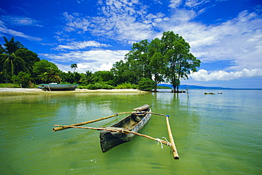
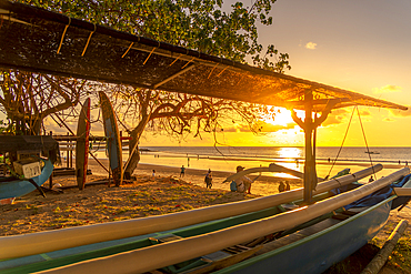
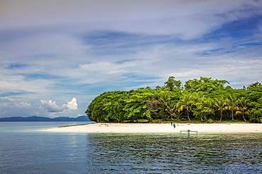
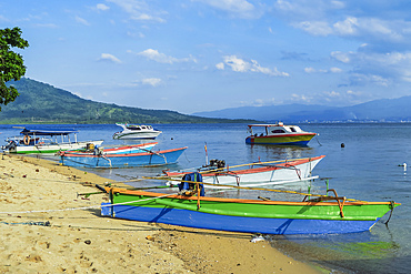
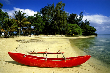
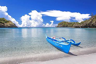
Outrigger canoe and beach, Ujong Kulon Reserve, Handeuleum Island, western Java, Indonesia
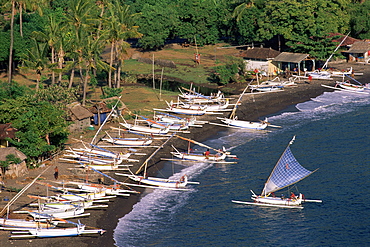
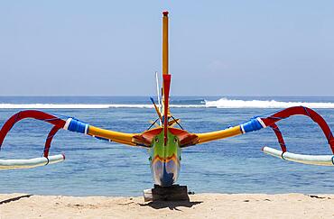
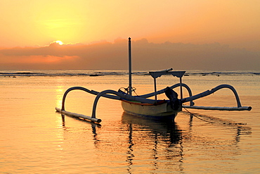
Outrigger canoes on Amed beach, Bali, Indonesia, Asia
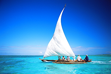
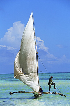
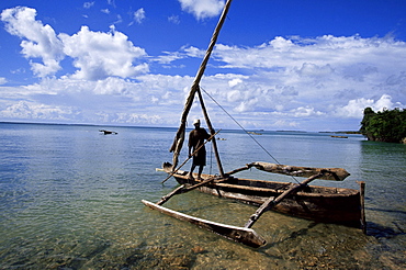
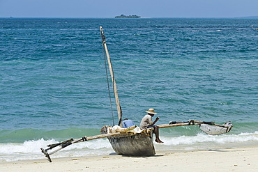
Outrigger canoe with sail on Indian Ocean, off Jambiani, Zanzibar, Tanzania, East Africa, Africa
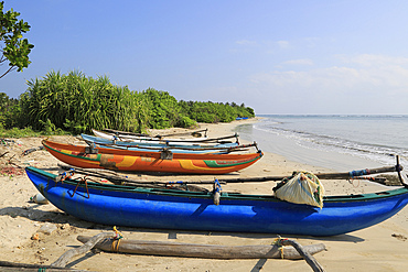
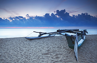
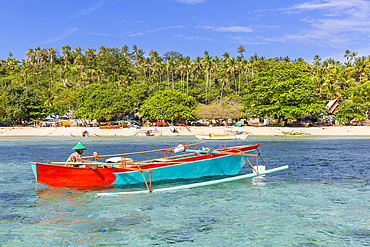
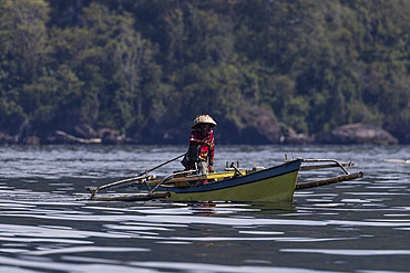
Outrigger fishing canoes on tropical beach at Pasikudah Bay, Eastern Province, Sri Lanka, Asia
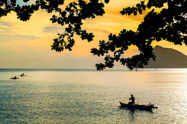
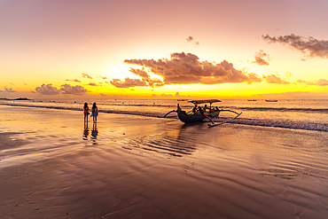
Oruwa (outrigger canoe) on beach at sunset, Negombo, North Western Province, Sri Lanka, Asia
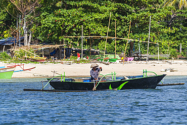
A lone bangka (outrigger canoe) bathed in warm dawn light berthed by Panglao Beach, Bohol Island, Philippines, Southeast Asia, Asia
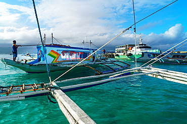
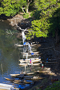
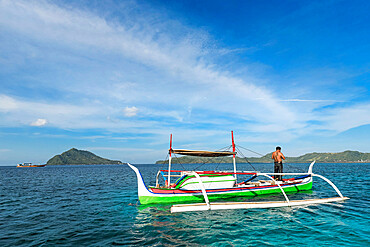
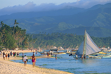
Bangkas (outrigger canoes) and the old ferry compete for landing space at the harbour, Borocay Island, Philippines, Southeast Asia, Asia
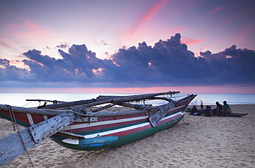
Oruwa (outrigger canoe) on beach at sunset, Negombo, North Western Province, Sri Lanka, Asia
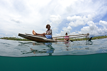
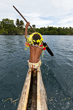
Women in Outrigger Canoe, Tufi, Cape Nelson, Papua New Guinea
Women in Outrigger Canoe, Cape Nelson, Oro Province, Papua New Guinea
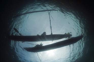
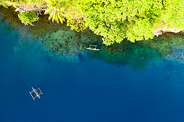
Outrigger Canoe from below, Tufi, Cape Nelson, Papua New Guinea
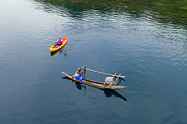
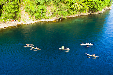
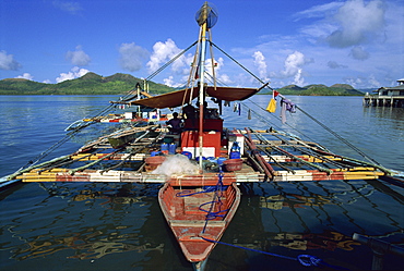
Outrigger Canoes at Tufi Harbor, Cape Nelson, Oro Province, Papua New Guinea
Residents in Outrigger Canoe, Tufi, Cape Nelson, Papua New Guinea
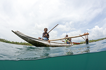
Family in Outrigger Canoe, Tufi, Cape Nelson, Papua New Guinea
Residents in Outrigger Canoe, Tufi, Cape Nelson, Papua New Guinea
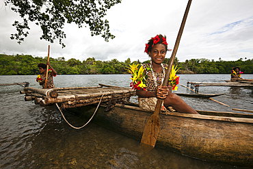
Kofure Girl in Outrigger Canoe, Tufi, Oro Province, Papua New Guinea
Kofure Girl in Outrigger Canoe, Tufi, Oro Province, Papua New Guinea
Outrigger Canoes at Tufi Harbor, Cape Nelson, Oro Province, Papua New Guinea
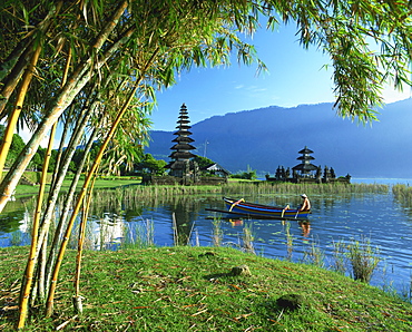
Outrigger canoe on Lake Bratan near Candikuning Temple on Bali, Indonesia, Southeast Asia, Asia

Outrigger canoe and fisherman in silhouette at sunrise off Jambiani, Zanzibar, Tanzania, East Africa, Africa
Dugout canoe on the Wailua River. Kauai, Hawaii, United States of America, Pacific

View of fishing outrigger overlooking Kuta Beach, Kuta, Bali, Indonesia, South East Asia, Asia
View of fishing outrigger overlooking Kuta Beach at sunset, Kuta, Bali, Indonesia, South East Asia, Asia
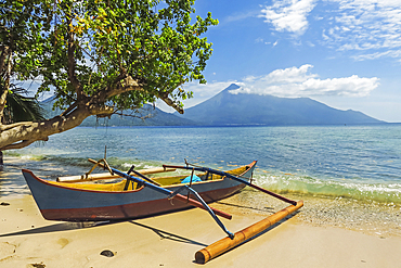
Outrigger canoe moored on Kalea Beach with active Karangetang volcano beyond, Kalea, Siau Island, Sangihe Archipelago, North Sulawesi, Indonesia, Southeast Asia, Asia
Fisherman hauling up his outrigger canoe on the beach of Ambatoloaka, Nosy Be island, Republic of Madagascar, Indian Ocean
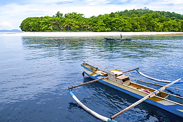
A local fisherman and a traditional outrigger canoe off the beach, Molana Island, Ambon, Maluku, Spice Islands, Indonesia, Southeast Asia, Asia
An outrigger canoe on a deserted beach, Pulau Molana Island, Ambon, Maluku, Spice Islands, Indonesia, Southeast Asia, Asia
Outrigger canoe off Bahuis Island and the southern tip of Siau, Siau Island, Sangihe Archipelago, North Sulawesi, Indonesia, Southeast Asia, Asia
Fishermen paddle outrigger canoes at sunset off Kalea Beach, Kalea, Siau Island, Sangihe Archipelago, North Sulawesi, Indonesia, Southeast Asia, Asia

Outrigger canoes on Pulisan beach with Tangkoko mountain and national park beyond, Pulisan, Minahasa Highlands, North Sulawesi, Indonesia, Southeast Asia, Asia
Outrigger canoe and tour boat off Mahoro Island, Pahepa Island beyond, Mahoro, Siau, Sangihe Archipelago, North Sulawesi, Indonesia, Southeast Asia, Asia
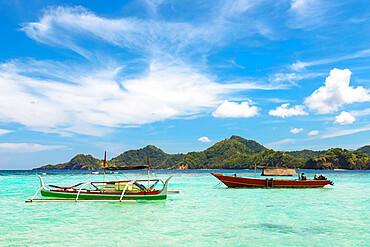
Outrigger canoes and launches at this coral fringed holiday island and scuba diving destination, Bunaken Island, Sulawesi, Indonesia, Southeast Asia, Asia
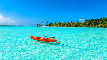
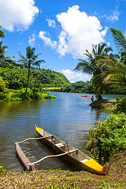
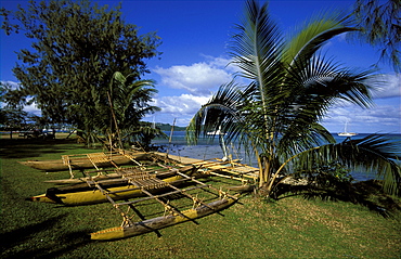
Outrigger canoe in the lagoon of Maupiti, Society Islands, French Polynesia, South Pacific, Pacific
View of fishing outrigger on Kuta Beach at sunset, Kuta, Bali, Indonesia, South East Asia, Asia
View of fishing outrigger on Kuta Beach, Kuta, Bali, Indonesia, South East Asia, Asia
Local fisherman in outrigger boat in the shallow reefs off Bangka Island, off the northeastern tip of Sulawesi, Indonesia, Southeast Asia, Asia
View of fishing outrigger on Kuta Beach at sunset, Kuta, Bali, Indonesia, South East Asia, Asia
Local fisherman in outrigger boat in the shallow reefs off Bangka Island, off the northeastern tip of Sulawesi, Indonesia, Southeast Asia, Asia
Outrigger canoeists visting cruise ship, Nosy Be, Madagascar, Indian Ocean, Africa
Tourists and outrigger canoes on White Sun Beach, at the resort of Boracay Island, off Panay, the Philippines, Southeast Asia, Asia
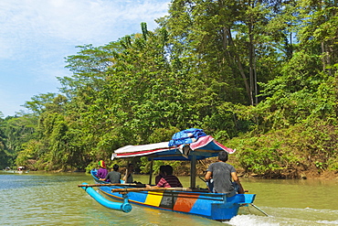
Canoe on river trip to the popular Green Canyon beauty spot, near the south coast, Cijulang River, Pangandaran, Java, Indonesia, Southeast Asia, Asia
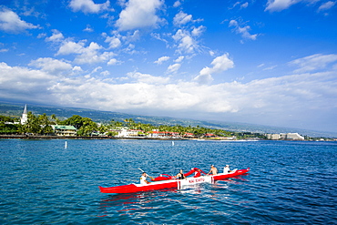
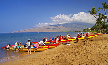
Locals working out in their outrigger canoes, Kailua-Kona, Big Island, Hawaii, United States of America, Pacific
Early morning bangka taxis (outrigger canoes), Coron Harbour, Busuanga island, Philippines, Southeast Asia, Asia
Fisherman in an outrigger canoe, Bangka Island, off the northeastern tip of Sulawesi, Indonesia, Southeast Asia, Asia
Sailing boat, Kiwengwa beach, Zanzibar, Tanzania, East Africa, Africa

Men in outrigger canoes selling model boats with red sails, Nosy Be, Madagascar, Africa
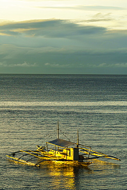
Fishing banca (outrigger boat), Coron, Basuanga Island, Palawan, Philippines, Southeast Asia, Asia
Traditional sailing boat and rowing boat in the turquoise water of the Indian Ocean, Madagascar, Africa
Fisherman on a boat, Zanzibar, Tanzania, East Africa, Africa
Traditional rowing boat in the turquoise water of the Indian Ocean, Madagascar, Africa
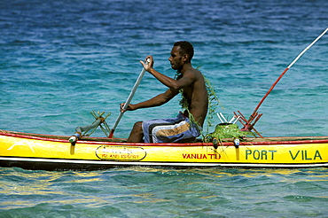
Outrigger canoes and yachts on Vila Bay, Port Vila, Efate Island, Vanuatu
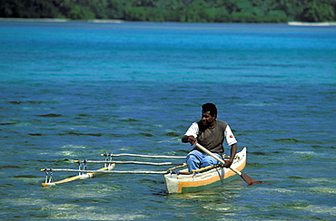
Man in outrigger canoe going to work on the small resort island of Erakor in Erakor Lagoonjust south of the capital, Efate Island, Port Vila, Vanuatu
Outrigger canoe moored on the resort island of ERAKOR in Erakor Lagoon, just south of the capital, Efate Island, Port Vila, Vanuatu
Canoe on Vila bay, just off Port Vila, Port Vila, Efate Island, Vanautu
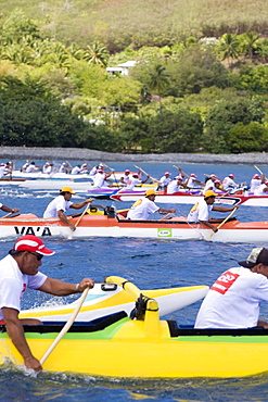
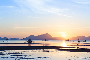
French Polynesia, Windward Islands, Tahiti, Outriggers Passing By At Dusk, Moorea Lagoon At Back

Traditional marshalhese canoe, Majuro, Marshall Islands, Pacific

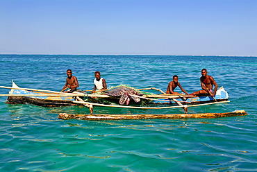
Marshalhese men steering a traditional outrigger canoe, Ailuk atoll, Marshall Islands, Pacific

Marshalhese men steering a traditional outrigger canoe, Ailuk atoll, Marshall Islands, Pacific

Marshalhese men steering a traditional outrigger canoe, Ailuk atoll, Marshall Islands, Pacific

Riding a traditional outrigger canoe, Ailuk atoll, Marshall Islands, Pacific

Guam, Micronesia: outrigger canoe paddlers at sunset at Tumon Bay resort area.
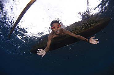
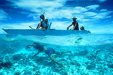
Local children swimming from small outrigger canoes using home made goggles, Alor Island, Nusa Tenggara, Indonesia, Pacific Ocean
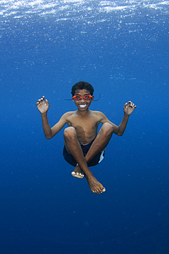
Local children swimming from small outrigger canoes using home made goggles, Alor Island, Nusa Tenggara, Indonesia, Pacific Ocean
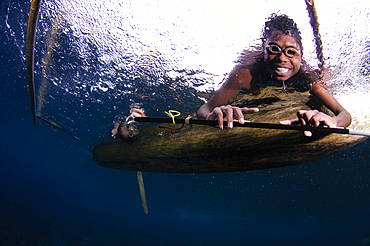
Local children swimming from small outrigger canoes using home made goggles, Alor Island, Nusa Tenggara, Indonesia, Pacific Ocean
Ogasawara Island, Japan
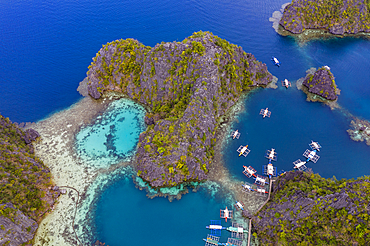
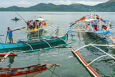
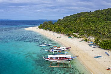
Aerial view of traditional Filipino Banca outrigger canoes lying in the lagoon near Lake Kayangan, Banuang Daan, Coron, Palawan, Philippines, Asia
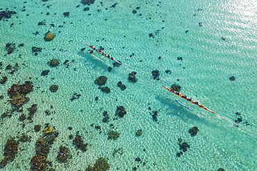
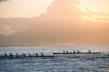
Aerial view of two outrigger racing canoes in the Moorea Lagoon, Avamotu, Moorea, Windward Islands, French Polynesia, South Pacific
Aerial view of traditional Filipino Banca outrigger canoes on Nagosa Beach, Cobrador Island, Romblon, Romblon, Philippines, Asia
People with outrigger canoes on the beach of North Kihei, Maui, Hawaii, USA, America
Men in canoos paddling, Ua Pou, Marquesas, Polynesia, Oceania
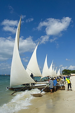
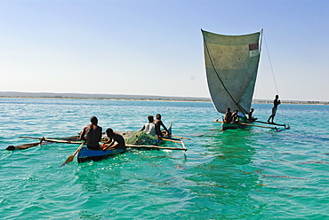
Preparations for a regatta with Ngalawa, traditional double-outrigger canoes, on the beach of Stone Town, Zanzibar, Tanzania, Africa
Fisherman sitting on a Ngalawa, a traditional double-outrigger canoe, Zanzibar, Tanzania, Africa
Sunset view from Corong Corong beach near El Nido, Bacuit archipelago, Palawan island, Philippines, Asia
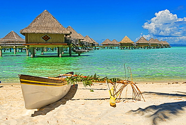
Polynesian outrigger canoe in front of pile bungalow complex, South Pacific, Bora Bora, French Polynesia, Oceania
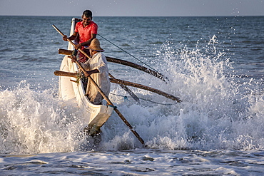
Fishermen breaking the waves at Kahandamodara beach, Sri Lanka, Asia
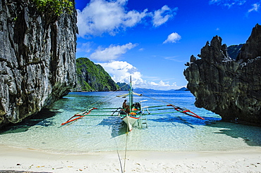
Outrigger boat on a little white beach and crystal clear water in the Bacuit archipelago, Palawan, Philippines, Asia

Outrigger boats in the crystal clear water in the Bacuit archipelago, Palawan, Philippines, Asia
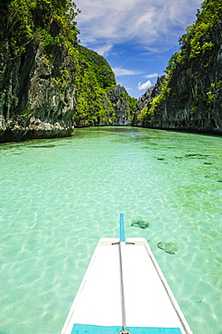
Front of an outrigger boat in the crystal clear water in the Bacuit archipelago, Palawan, Philippines, Asia

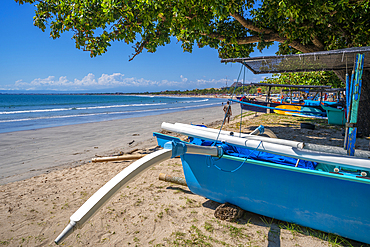
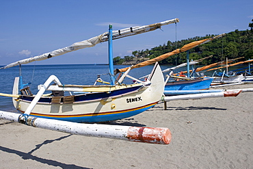
Brightly painted fishing outriggers on the beach at Sanur, Bali, Indonesia, Asia
Young woman relaxing on traditional outrigger boat, enjoying the turquoise waters of daku island in siargao, philippines
Brightly painted fishing outriggers on the beach at Sanur, Bali, IndonesiaIndonesia, Bali, Sanur, fishing outriggers on the beach of Sanur

Jukung, Balinese fishing boat at sunrise on the beach, Indonesia, Asia
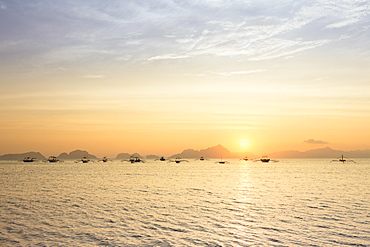
Outrigger canoes at sunset, view from Corong Corong beach near El Nido, Bacuit archipelago, Palawan island, Philippines, Asia
Brightly painted fishing outriggers on the beach at Sanur, Bali, Indonesia, Asia
Local fishing boats, outrigger canoes on Sengiggi Beach, Lombok Island, Lesser Sunda Islands, Indonesia

Sunrise, outrigger canoes in the sea, Lovina Beach, Bali, Indonesia, Asia
Fishing boat, beach, sunrise, Sanur, Bali, Indonesia, Asia
Canoe on the beach, Waikiki Beach, Honolulu, Oahu, Hawaii Islands, USA
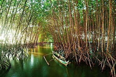
Canoe between mangrove Philippines trees at daytime, New Washington, Aklan, Philippines

Majestic scenery with Mayon Volcano and man in canoe on lake at dusk, Legazpi City, Albay Province, Philippines

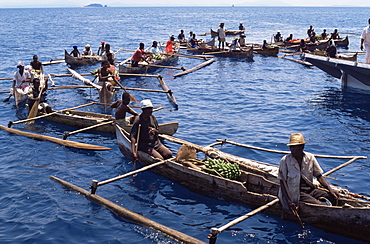
Nimoa Island - here the island mission will impress. The five-sided church features murals of island life and all mission buildings are surrounded by well maintained paths and gardens filled with flowering plants. Edged by jungle-covered mountains, postcard beaches and crystal clear waters - an island paradise indeed! The Louisiade Archipelago is a string of ten larger volcanic islands frequently fringed by coral reefs, and 90 smaller coral islands located 200 km southeast of New Guinea, stretching over more than 160 km and spread over an ocean area of 26,000 km? between the Solomon Sea to the north and the Coral Sea to the south. The aggregate land area of the islands is about 1,790 km? (690 square miles), with Vanatinai (formerly Sudest or Tagula as named by European claimants on Western maps) being the largest. Sideia Island and Basilaki Island lie closest to New Guinea, while Misima, Vanatinai, and Rossel islands lie further east. The archipelago is divided into the Local Level Government (LLG) areas Loui!

Nimoa Island - here the island mission will impress. The five-sided church features murals of island life and all mission buildings are surrounded by well maintained paths and gardens filled with flowering plants. Edged by jungle-covered mountains, postcard beaches and crystal clear waters - an island paradise indeed! The Louisiade Archipelago is a string of ten larger volcanic islands frequently fringed by coral reefs, and 90 smaller coral islands located 200 km southeast of New Guinea, stretching over more than 160 km and spread over an ocean area of 26,000 km? between the Solomon Sea to the north and the Coral Sea to the south. The aggregate land area of the islands is about 1,790 km? (690 square miles), with Vanatinai (formerly Sudest or Tagula as named by European claimants on Western maps) being the largest. Sideia Island and Basilaki Island lie closest to New Guinea, while Misima, Vanatinai, and Rossel islands lie further east. The archipelago is divided into the Local Level Government (LLG) areas Loui!

Nimoa Island - here the island mission will impress. The five-sided church features murals of island life and all mission buildings are surrounded by well maintained paths and gardens filled with flowering plants. Edged by jungle-covered mountains, postcard beaches and crystal clear waters - an island paradise indeed! The Louisiade Archipelago is a string of ten larger volcanic islands frequently fringed by coral reefs, and 90 smaller coral islands located 200 km southeast of New Guinea, stretching over more than 160 km and spread over an ocean area of 26,000 km? between the Solomon Sea to the north and the Coral Sea to the south. The aggregate land area of the islands is about 1,790 km? (690 square miles), with Vanatinai (formerly Sudest or Tagula as named by European claimants on Western maps) being the largest. Sideia Island and Basilaki Island lie closest to New Guinea, while Misima, Vanatinai, and Rossel islands lie further east. The archipelago is divided into the Local Level Government (LLG) areas Louisiade Rural (western part, with Misima), and Yaleyamba (western part, with Rossell and Tagula islands. The LLG areas are part of Samarai-Murua District district of Milne Bay. The seat of the Louisiade Rural LLG is Bwagaoia on Misima Island, the population center of the archipelago.
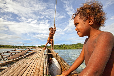
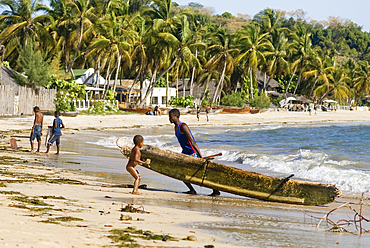
Children playing with a outrigger canoe in the village of Hessessai Bay at PanaTinai (Panatinane)island in the Louisiade Archipelago in Milne Bay Province, Papua New Guinea. The island has an area of 78 km2. The Louisiade Archipelago is a string of ten larger volcanic islands frequently fringed by coral reefs, and 90 smaller coral islands located 200 km southeast of New Guinea, stretching over more than 160 km and spread over an ocean area of 26,000 km? between the Solomon Sea to the north and the Coral Sea to the south. The aggregate land area of the islands is about 1,790 km? (690 square miles), with Vanatinai (formerly Sudest or Tagula as named by European claimants on Western maps) being the largest. Sideia Island and Basilaki Island lie closest to New Guinea, while Misima, Vanatinai, and Rossel islands lie further east. The archipelago is divided into the Local Level Government (LLG) areas Louisiade Rural (western part, with Misima), and Yaleyamba (western part, with Rossell and Tagula islands. The LLG areas are part of Samarai-Murua District district of Milne Bay. The seat of the Louisiade Rural LLG is Bwagaoia on Misima Island, the population center of the archipelago.PanaTinai (Panatinane) is an island in the Louisiade Archipelago in Milne Bay Province, Papua New Guinea.

Nimoa Island - here the island mission will impress. The five-sided church features murals of island life and all mission buildings are surrounded by well maintained paths and gardens filled with flowering plants. Edged by jungle-covered mountains, postcard beaches and crystal clear waters - an island paradise indeed! The Louisiade Archipelago is a string of ten larger volcanic islands frequently fringed by coral reefs, and 90 smaller coral islands located 200 km southeast of New Guinea, stretching over more than 160 km and spread over an ocean area of 26,000 km? between the Solomon Sea to the north and the Coral Sea to the south. The aggregate land area of the islands is about 1,790 km? (690 square miles), with Vanatinai (formerly Sudest or Tagula as named by European claimants on Western maps) being the largest. Sideia Island and Basilaki Island lie closest to New Guinea, while Misima, Vanatinai, and Rossel islands lie further east. The archipelago is divided into the Local Level Government (LLG) areas Louisiade Rural (western part, with Misima), and Yaleyamba (western part, with Rossell and Tagula islands. The LLG areas are part of Samarai-Murua District district of Milne Bay. The seat of the Louisiade Rural LLG is Bwagaoia on Misima Island, the population center of the archipelago.

Nimoa Island - here the island mission will impress. The five-sided church features murals of island life and all mission buildings are surrounded by well maintained paths and gardens filled with flowering plants. Edged by jungle-covered mountains, postcard beaches and crystal clear waters - an island paradise indeed! The Louisiade Archipelago is a string of ten larger volcanic islands frequently fringed by coral reefs, and 90 smaller coral islands located 200 km southeast of New Guinea, stretching over more than 160 km and spread over an ocean area of 26,000 km? between the Solomon Sea to the north and the Coral Sea to the south. The aggregate land area of the islands is about 1,790 km? (690 square miles), with Vanatinai (formerly Sudest or Tagula as named by European claimants on Western maps) being the largest. Sideia Island and Basilaki Island lie closest to New Guinea, while Misima, Vanatinai, and Rossel islands lie further east. The archipelago is divided into the Local Level Government (LLG) areas Louisiade Rural (western part, with Misima), and Yaleyamba (western part, with Rossell and Tagula islands. The LLG areas are part of Samarai-Murua District district of Milne Bay. The seat of the Louisiade Rural LLG is Bwagaoia on Misima Island, the population center of the archipelago.

Nimoa Island - here the island mission will impress. The five-sided church features murals of island life and all mission buildings are surrounded by well maintained paths and gardens filled with flowering plants. Edged by jungle-covered mountains, postcard beaches and crystal clear waters - an island paradise indeed! The Louisiade Archipelago is a string of ten larger volcanic islands frequently fringed by coral reefs, and 90 smaller coral islands located 200 km southeast of New Guinea, stretching over more than 160 km and spread over an ocean area of 26,000 km? between the Solomon Sea to the north and the Coral Sea to the south. The aggregate land area of the islands is about 1,790 km? (690 square miles), with Vanatinai (formerly Sudest or Tagula as named by European claimants on Western maps) being the largest. Sideia Island and Basilaki Island lie closest to New Guinea, while Misima, Vanatinai, and Rossel islands lie further east. The archipelago is divided into the Local Level Government (LLG) areas Loui!
Polynesian men collect shells from an outrigger on Tubuai Island, French Polynesia
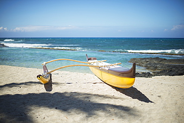
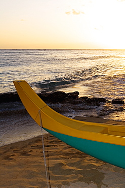
Outrigger Canoe On The Beach, Island Of Hawaii, Hawaii, United States Of America

A woman lays on a hammock on a tropical beach with an outrigger canoe moored along the shore, Andaman Islands, India