Results
21 results found
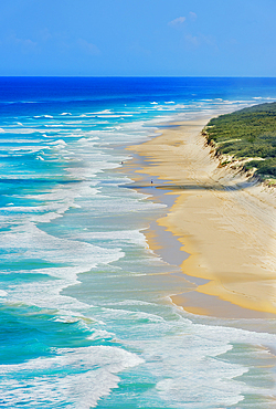
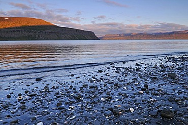
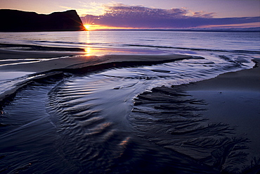
Seventy Five Mile Beach, Great Sandy National Park, Fraser Island, World Heritage Area, Queensland, Australia
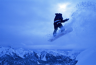
Snowboarder heads down, Paradise area, Mount Rainier, Washington State, United States of America (U.S.A.), North America
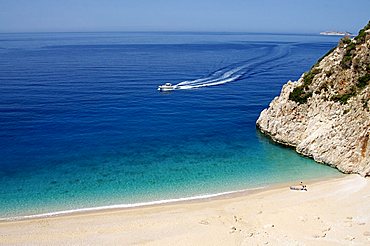
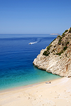
Kaputas beach at Kalkan area, Anatolia, Turkey, Asia Minor, Eurasia
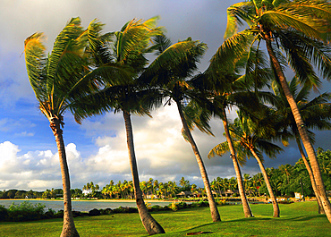
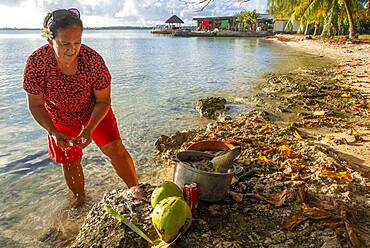
Palm trees, First Landing Beach Resort, Viti Levu, Fiji, South Pacific
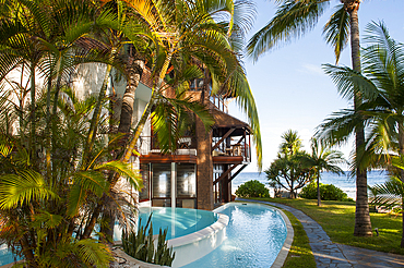
Luxurious hotel Le Saint Alexis, Boucan Canot beach, Saint-Gilles-les-Bains, Reunion
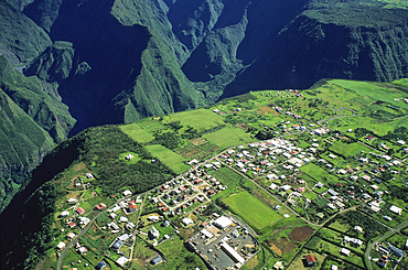
Cilaos River canyon, Reunion
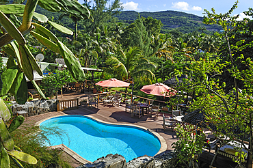
Tainos Cottages' charming hotel, Deshaies, Basse-Terre, Guadeloupe
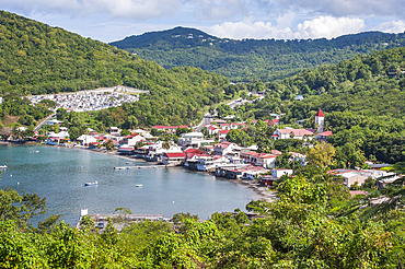
Deshaies, coastal village on Basse-Terre, Guadeloupe
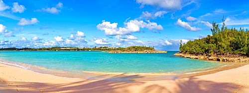
Turtle Bay, a popular sandy beach in Cooper's Island, St. George's parish, Bermuda, North Atlantic

Petrified forest, Agia Marina, Agios Nikolaos Geopark, beach with turquoise water in the south of Greece, Greece
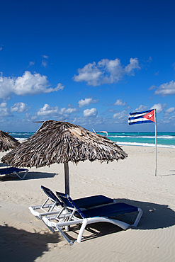
Varadero Beach, Varadero, Matanzas Province, Cuba

The surfers' paradise and volcanic black sand beach at Piha, showing Lion Rock, a monolith housing many Maori carvings, Auckland area, North Island, New Zealand, Pacific

Statue on bridge leading to Valdstejn Castle, Hruba Skala, Bohemian Paradise Protected Landscape Area, Semily District, Liberec Region, Bohemia, Czech Republic (Czechia), Europe
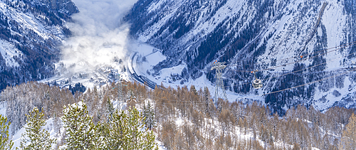
View of snow covered Aosta Valley from Pavillon du Mont Frety in winter, Courmayeur, Aosta Valley, Italian Alps, Italy
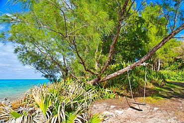
Swing at Glass Beach in Sandys Parish, Bermuda
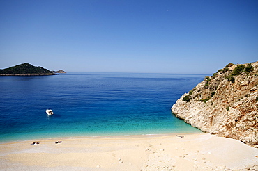
Kaputas beach at Kalkan area, Anatolia, Turkey, Asia Minor, Eurasia
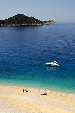
Kaputas beach at Kalkan area, Anatolia, Turkey, Asia Minor, Eurasia
Kaputas beach at Kalkan area, Anatolia, Turkey, Asia Minor, Eurasia
Hiking area, alpine meadow summer flowers, Slovensky Raj, Paradise National Park, Slovakia, Europe

Desert flora beneath Camelback Mountain, Echo Canyon Recreation Area, Paradise Valley, Phoenix, Arizona, United States of America, North America
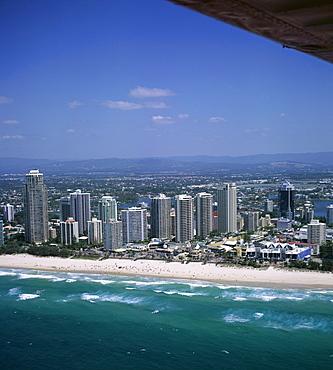
Aerial view of central area of Surfers Paradise, Gold Coast, Queensland, Australia, Pacific
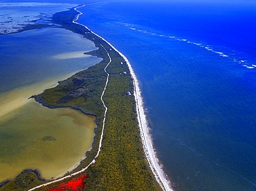
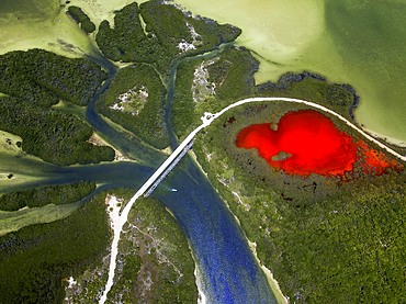
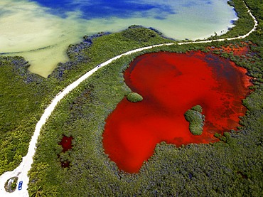
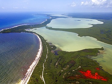
Aerial view of Punta Allen Sian Ka'an Reserve, Yucatan Peninsula, Mexico. Red lagoon near Boca Paila Bridge.
In the language of the Mayan peoples who once inhabited this region, Sian Ka'an means Origin of the Sky. Located on the east coast of the Yucatán peninsula, this biosphere reserve contains tropical forests, mangroves and marshes, as well as a large marine section intersected by a barrier reef. It provides a habitat for a remarkably rich flora and a fauna comprising more than 300 species of birds, as well as a large number of the region's characteristic terrestrial vertebrates, which cohabit in the diverse environment formed by its complex hydrological system.
Along its roughly 120 kilometres of coastline, the property covers over 400,000 hectares of land ranging from sea level to only ten m.a.s.l. The property boasts diverse tropical forests, palm savannah, one of the most pristine wetlands in the region, lagoons, extensive mangrove stands, as well as sandy beaches and dunes. The 120,000 hectares of marine area protect a valuable part of the Mesoamerican Barrier Reef and seagrass beds in the shallow bays. The lush green of the forests and the many shades of blue of the lagoons and the Caribbean Sea under a wide sky offer fascinating visual impressions.

Palms and old pier in Punta Allen Sian Ka'an Reserve, Yucatan Peninsula, Mexico.
In the language of the Mayan peoples who once inhabited this region, Sian Ka'an means Origin of the Sky. Located on the east coast of the Yucatán peninsula, this biosphere reserve contains tropical forests, mangroves and marshes, as well as a large marine section intersected by a barrier reef. It provides a habitat for a remarkably rich flora and a fauna comprising more than 300 species of birds, as well as a large number of the region's characteristic terrestrial vertebrates, which cohabit in the diverse environment formed by its complex hydrological system.
Along its roughly 120 kilometres of coastline, the property covers over 400,000 hectares of land ranging from sea level to only ten m.a.s.l. The property boasts diverse tropical forests, palm savannah, one of the most pristine wetlands in the region, lagoons, extensive mangrove stands, as well as sandy beaches and dunes. The 120,000 hectares of marine area protect a valuable part of the Mesoamerican Barrier Reef and seagrass beds in the shallow bays. The lush green of the forests and the many shades of blue of the lagoons and the Caribbean Sea under a wide sky offer fascinating visual impressions.
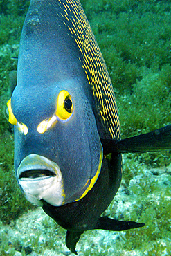
French angelfish, Pomacanthus paru, Ilha rata, Fernando de Noronha national marine sanctuary, Pernambuco, Brazil (S. Atlantic)
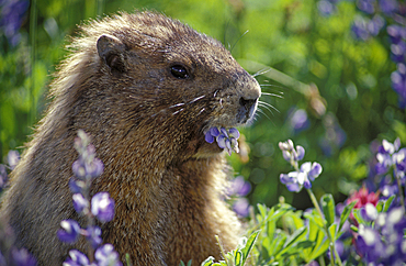
Hoary Marmot (Marmata caligata) eating Lupine flowers along Alta Vista Trail in the Paradise area of Mount Rainier National Park, Washington..
Fakarava lighthouse, Tuamotus Archipelago French Polynesia, Tuamotu Islands, South Pacific.
Local fisher woman in Fakarava island, Tuamotus Archipelago French Polynesia, Tuamotu Islands, South Pacific.
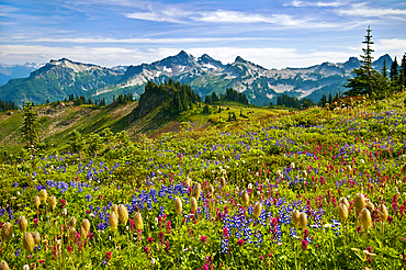
Wildflowers in meadow and view to Tatoosh Range from Skyline Trail in Paradise area; Mount Rainier National Park, Washington.
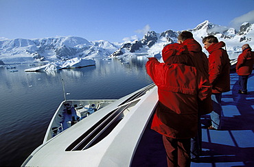
Tourists on cruise ship in Paradise Bay, Graham Land, Antarctic Peninsula, Antarctica
Entrance, Hard Rock Cafe, Surfers Paradise, Gold Coast, New South Wales, Australia

Aerial, Sportparadies sports paradise, Schalke Feld, Veltins-Arena stadium, S04 football club, Buer, Gelsenkirchen, Ruhrgebiet area, North Rhine-Westphalia, Germany, Europe
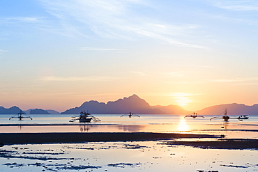
Sunset view from Corong Corong beach near El Nido, Bacuit archipelago, Palawan island, Philippines, Asia
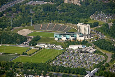
Aerial, Sportparadies sports paradise, Schalke Feld, Veltins-Arena stadium, S04 football club, Buer, Gelsenkirchen, Ruhrgebiet area, North Rhine-Westphalia, Germany, Europe
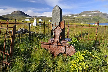
Old cemetery, Hesteyri, Hesteyrarfjoerur or Joekulfirir, Hornstrandir hiking paradise, Westfjords, Iceland, Europe
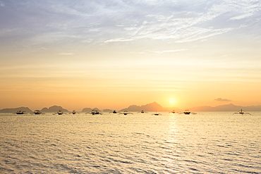
Outrigger canoes at sunset, view from Corong Corong beach near El Nido, Bacuit archipelago, Palawan island, Philippines, Asia
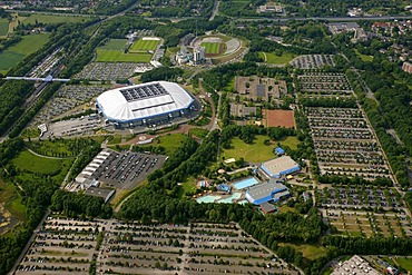
Aerial, Sportparadies sports paradise, Schalke Feld, Veltins-Arena stadium, S04 football club, Buer, Gelsenkirchen, Ruhrgebiet area, North Rhine-Westphalia, Germany, Europe
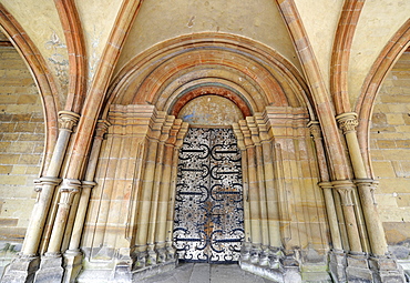
Portal, Monastery Church, Paradise, covered entrance, Maulbronn Monastery, Cistercian Abbey, UNESCO World Heritage Site, Kraichgau, Baden-Wuerttemberg, Germany, Europe

Angelica (Angelica archangelica), old house, Hesteyri, Hesteyrarfjoerur or Joekulfirir, Hornstrandir hiking paradise, Westfjords, Iceland, Europe

Marram grass, Hesteyri, Hesteyrarfjoerur or Joekulfirir, Hornstrandir hiking paradise, Westfjords, Iceland, Europe
Hesteyrarfjoerur or Joekulfirir, Hornstrandir hiking paradise, Westfjords, Iceland, Europe
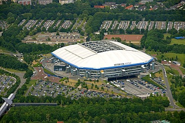
Aerial, Sportparadies sports paradise, Schalke Feld, Veltins-Arena stadium, S04 football club, Buer, Gelsenkirchen, Ruhrgebiet area, North Rhine-Westphalia, Germany, Europe
Beach with sea shells, mid-summer night, Hesteyri, Hesteyrarfjoerur or Joekulfirir, Hornstrandir hiking paradise, Westfjords, Iceland, Europe
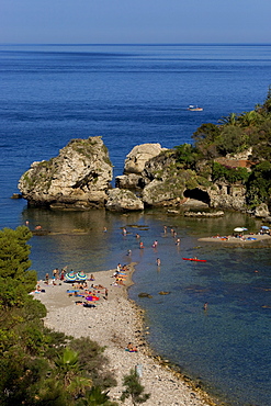
Bay, swimming paradise, Isole Bella, Taormina, province of Messina, Sicily, Italy, Europe
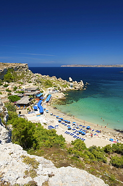
Paradise Bay in Cirkewwa, Malta, Europe
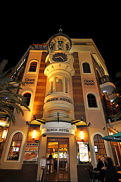
Clock Hotel, night shot, Surfers Paradise, Gold Coast, New South Wales, Australia
Sunset on the estuary of Horna creek in Hloeuvik bay, Hornstrandir peninsula, a hikers' paradise, West Fjords, Iceland, Europe

Old houses, Hesteyri, Hesteyrarfjoerur or Joekulfirir, Hornstrandir hiking paradise, Westfjords, Iceland, Europe

Aerial, Sportparadies sports paradise, Schalke Feld, Veltins-Arena stadium, S04 football club, Buer, Gelsenkirchen, Ruhrgebiet area, North Rhine-Westphalia, Germany, Europe

Old house, Hesteyri, Hesteyrarfjoerur or Joekulfirir, Hornstrandir hiking paradise, Westfjords, Iceland, Europe
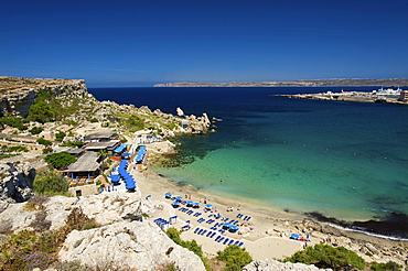
Paradise Bay in Cirkewwa, Malta, Europe
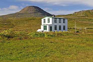
LÊknishusi, the old house of the doctor, Hesteyri, Hesteyrarfjoerur or Joekulfirir, Hornstrandir hiking paradise, Westfjords, Iceland, Europe

Angelica (Angelica archangelica), old house, Hesteyri, Hesteyrarfjoerur or Joekulfirir, Hornstrandir hiking paradise, Westfjords, Iceland, Europe
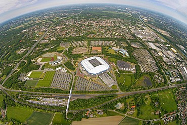
Aerial, Sportparadies sports paradise, Schalke Feld, Veltins-Arena stadium, S04 football club, Buer, Gelsenkirchen, Ruhrgebiet area, North Rhine-Westphalia, Germany, Europe

Nimoa Island - here the island mission will impress. The five-sided church features murals of island life and all mission buildings are surrounded by well maintained paths and gardens filled with flowering plants. Edged by jungle-covered mountains, postcard beaches and crystal clear waters - an island paradise indeed! The Louisiade Archipelago is a string of ten larger volcanic islands frequently fringed by coral reefs, and 90 smaller coral islands located 200 km southeast of New Guinea, stretching over more than 160 km and spread over an ocean area of 26,000 km? between the Solomon Sea to the north and the Coral Sea to the south. The aggregate land area of the islands is about 1,790 km? (690 square miles), with Vanatinai (formerly Sudest or Tagula as named by European claimants on Western maps) being the largest. Sideia Island and Basilaki Island lie closest to New Guinea, while Misima, Vanatinai, and Rossel islands lie further east. The archipelago is divided into the Local Level Government (LLG) areas Loui!

Nimoa Island - here the island mission will impress. The five-sided church features murals of island life and all mission buildings are surrounded by well maintained paths and gardens filled with flowering plants. Edged by jungle-covered mountains, postcard beaches and crystal clear waters - an island paradise indeed! The Louisiade Archipelago is a string of ten larger volcanic islands frequently fringed by coral reefs, and 90 smaller coral islands located 200 km southeast of New Guinea, stretching over more than 160 km and spread over an ocean area of 26,000 km? between the Solomon Sea to the north and the Coral Sea to the south. The aggregate land area of the islands is about 1,790 km? (690 square miles), with Vanatinai (formerly Sudest or Tagula as named by European claimants on Western maps) being the largest. Sideia Island and Basilaki Island lie closest to New Guinea, while Misima, Vanatinai, and Rossel islands lie further east. The archipelago is divided into the Local Level Government (LLG) areas Loui!

Nimoa Island - here the island mission will impress. The five-sided church features murals of island life and all mission buildings are surrounded by well maintained paths and gardens filled with flowering plants. Edged by jungle-covered mountains, postcard beaches and crystal clear waters - an island paradise indeed! The Louisiade Archipelago is a string of ten larger volcanic islands frequently fringed by coral reefs, and 90 smaller coral islands located 200 km southeast of New Guinea, stretching over more than 160 km and spread over an ocean area of 26,000 km? between the Solomon Sea to the north and the Coral Sea to the south. The aggregate land area of the islands is about 1,790 km? (690 square miles), with Vanatinai (formerly Sudest or Tagula as named by European claimants on Western maps) being the largest. Sideia Island and Basilaki Island lie closest to New Guinea, while Misima, Vanatinai, and Rossel islands lie further east. The archipelago is divided into the Local Level Government (LLG) areas Louisiade Rural (western part, with Misima), and Yaleyamba (western part, with Rossell and Tagula islands. The LLG areas are part of Samarai-Murua District district of Milne Bay. The seat of the Louisiade Rural LLG is Bwagaoia on Misima Island, the population center of the archipelago.
Nimoa Island - here the island mission will impress. The five-sided church features murals of island life and all mission buildings are surrounded by well maintained paths and gardens filled with flowering plants. Edged by jungle-covered mountains, postcard beaches and crystal clear waters - an island paradise indeed! The Louisiade Archipelago is a string of ten larger volcanic islands frequently fringed by coral reefs, and 90 smaller coral islands located 200 km southeast of New Guinea, stretching over more than 160 km and spread over an ocean area of 26,000 km? between the Solomon Sea to the north and the Coral Sea to the south. The aggregate land area of the islands is about 1,790 km? (690 square miles), with Vanatinai (formerly Sudest or Tagula as named by European claimants on Western maps) being the largest. Sideia Island and Basilaki Island lie closest to New Guinea, while Misima, Vanatinai, and Rossel islands lie further east.

Nimoa Island - here the island mission will impress. The five-sided church features murals of island life and all mission buildings are surrounded by well maintained paths and gardens filled with flowering plants. Edged by jungle-covered mountains, postcard beaches and crystal clear waters - an island paradise indeed! The Louisiade Archipelago is a string of ten larger volcanic islands frequently fringed by coral reefs, and 90 smaller coral islands located 200 km southeast of New Guinea, stretching over more than 160 km and spread over an ocean area of 26,000 km? between the Solomon Sea to the north and the Coral Sea to the south. The aggregate land area of the islands is about 1,790 km? (690 square miles), with Vanatinai (formerly Sudest or Tagula as named by European claimants on Western maps) being the largest. Sideia Island and Basilaki Island lie closest to New Guinea, while Misima, Vanatinai, and Rossel islands lie further east. The archipelago is divided into the Local Level Government (LLG) areas Louisiade Rural (western part, with Misima), and Yaleyamba (western part, with Rossell and Tagula islands. The LLG areas are part of Samarai-Murua District district of Milne Bay. The seat of the Louisiade Rural LLG is Bwagaoia on Misima Island, the population center of the archipelago.

Nimoa Island - here the island mission will impress. The five-sided church features murals of island life and all mission buildings are surrounded by well maintained paths and gardens filled with flowering plants. Edged by jungle-covered mountains, postcard beaches and crystal clear waters - an island paradise indeed! The Louisiade Archipelago is a string of ten larger volcanic islands frequently fringed by coral reefs, and 90 smaller coral islands located 200 km southeast of New Guinea, stretching over more than 160 km and spread over an ocean area of 26,000 km? between the Solomon Sea to the north and the Coral Sea to the south. The aggregate land area of the islands is about 1,790 km? (690 square miles), with Vanatinai (formerly Sudest or Tagula as named by European claimants on Western maps) being the largest. Sideia Island and Basilaki Island lie closest to New Guinea, while Misima, Vanatinai, and Rossel islands lie further east. The archipelago is divided into the Local Level Government (LLG) areas Louisiade Rural (western part, with Misima), and Yaleyamba (western part, with Rossell and Tagula islands. The LLG areas are part of Samarai-Murua District district of Milne Bay. The seat of the Louisiade Rural LLG is Bwagaoia on Misima Island, the population center of the archipelago.

Nimoa Island - here the island mission will impress. The five-sided church features murals of island life and all mission buildings are surrounded by well maintained paths and gardens filled with flowering plants. Edged by jungle-covered mountains, postcard beaches and crystal clear waters - an island paradise indeed! The Louisiade Archipelago is a string of ten larger volcanic islands frequently fringed by coral reefs, and 90 smaller coral islands located 200 km southeast of New Guinea, stretching over more than 160 km and spread over an ocean area of 26,000 km? between the Solomon Sea to the north and the Coral Sea to the south. The aggregate land area of the islands is about 1,790 km? (690 square miles), with Vanatinai (formerly Sudest or Tagula as named by European claimants on Western maps) being the largest. Sideia Island and Basilaki Island lie closest to New Guinea, while Misima, Vanatinai, and Rossel islands lie further east. The archipelago is divided into the Local Level Government (LLG) areas Loui!
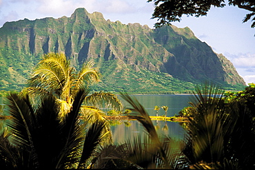
Hawaii, Oahu, Kaneohe fishponds at Heeia area, mountain in background
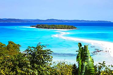
Sandbank linking two islands, Nosy Iranja, Nosy Be, Madagascar

Tara Pacific expedition - november 2017 Small coral island and adjacent reef, near Yanaba Island, Papua New Guinea, H: 452.3 m, mandatory credit line: Photo: Christoph Gerigk, drone pilot: Guillaume Bourdin - Tara Expeditions Foundation
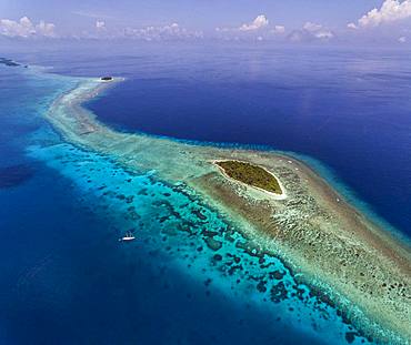
Tara Pacific expedition - november 2017 Small coral island and adjacent reef, near Yanaba Island, Papua New Guinea, H: 536,6 m, mandatory credit line: Photo: Christoph Gerigk, drone pilot: Guillaume Bourdin - Tara Expeditions Foundation

Misool landscape, Raja Ampat, Indonesia
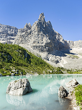
Ponta de Sorapis seen from Lago del Sorapis in the dolomites of the Veneto. These Dolomites are part of the UNESCO world heritage. Europe, Central Europe, Italy
Islet of white sand in the north of Mayotte's lagoon, bordering the Choisil pass.