Results
98 results found
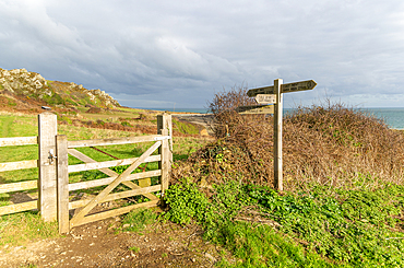
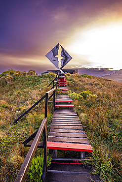
Coastal landscape with footpath sign, Prawle Point, Devon, England, United Kingdom, Europe
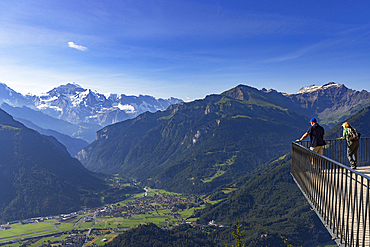
View of Jungfrau mountain from Harder Kulm, Interlaken, Jungfrau Region, Bernese Oberland, Switzerland
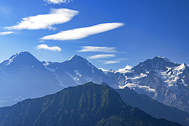
Jungfrau, Monch and Eiger mountains, Schynige Platte, Jungfrau Region, Bernese Oberland, Switzerland

View from Mirador de San Nicolas to The Alhambra, UNESCO, Mudejar architecture, Granada, Andalusia, Spain
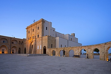
Basilica of Santa Maria de Finibus Terrae, Santa Maria di Leuca, Castrignano del Capo, Lecce, Salento, Apulia, Italy
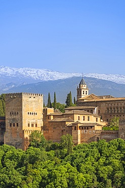
Mirador de San Nicolas, Islamic and Mudejar architecture, Alhambra, UNESCO, Granada, Andalusia, Spain
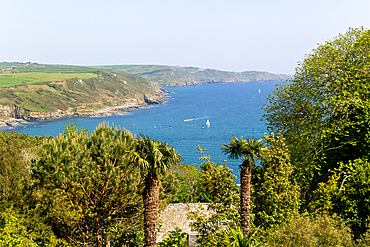
View of coast looking east towards Prawle Point from Sharpitor, Salcombe, south Devon, England, United Kingdom, Europe
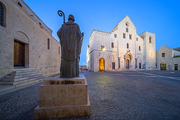
Basilica of St. Nicholas, Bari, Apulia, Italy
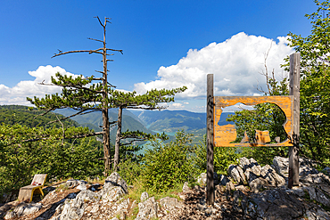
Banjska Stena viewpoint, Tara National Park, Serbia, Europe
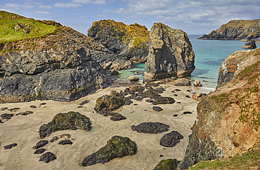
The stunning beach, rocks and cliffs at Kynance Cove, seen at at low tide, near the Lizard Point, Cornwall, England, United Kingdom, Europe
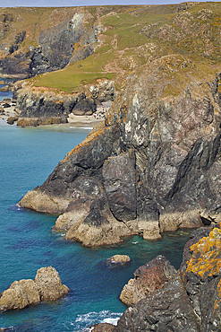
The stunning beach, rocks and cliffs at Kynance Cove, seen at at low tide, near the Lizard Point, Cornwall, England, United Kingdom, Europe
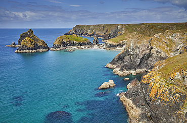
The stunning beach, rocks and cliffs at Kynance Cove, seen at at low tide, near the Lizard Point, Cornwall, England, United Kingdom, Europe
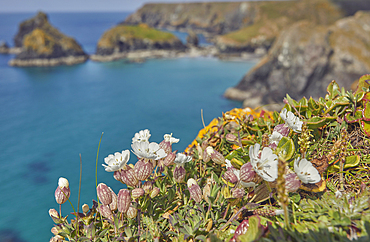
Sea Campion (Silene uniflora), on cliffs above Kynance Cove, near the Lizard Point, Cornwall, England, United Kingdom, Europe
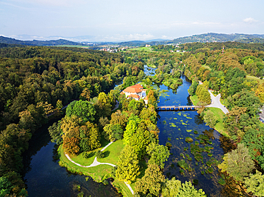
Aerial drone view of Otocec Castle, 13th to 17th century construction, Slovenia, Europe
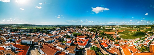
Aerial drone panoramic view of Obidos, a town in the Oeste region, historical province of Estremadura and Leiria district, Portugal, Europe
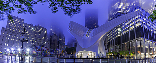
Exterior of the Oculus transportation hub at the World Trade Center, New York, USA
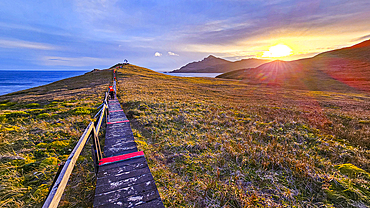
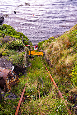
Boardwalk at Cape Horn, southern most point in South America, Hornos island, Tierra del Fuego, Chile, South America
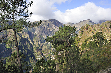
Eira do Serrado site above village Curral das Freiras (Nuns valley), Madeira island, Atlantic Ocean, Portugal
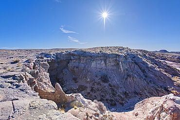
A dry waterfall west of Hamilili Point in Petrified Forest National Park, Arizona, United States of America, North America
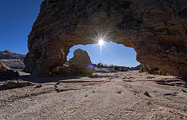
A small bentonite arch in Goblin Garden west of Hamilili Point in Petrified Forest National Park, Arizona, United States of America, North America
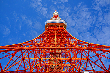
View of Tokyo Tower from its base against blue sky, Shibakoen, Minato City, Tokyo, Honshu, Japan
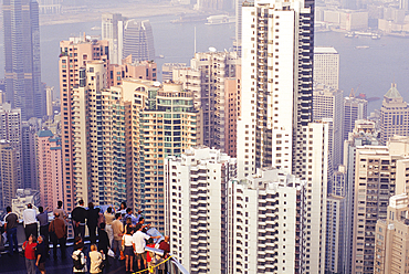
Terrace on Victoria Peak, looking over Central district,Hong-Kong Island,People's Republic of China,Asia
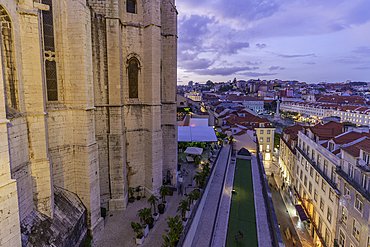
View of city rooftops and Carmo Archaeological Museum from Santa Justa Lift at sunset, Lisbon, Portugal, Europe

View of Lisbon Castle from Santa Justa Lift during golden hour, Lisbon, Portugal, Europe
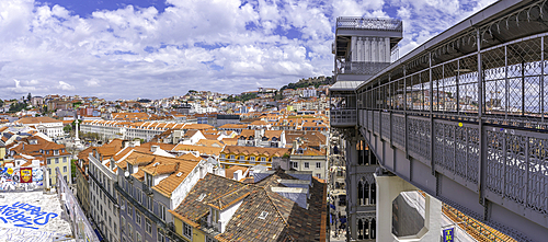
View of city skyline and Santa Justa Lift from Carmo Archaeological Museum on a sunny day, Lisbon, Portugal, Europe
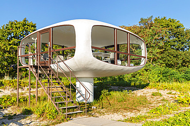
Müther Tower, Binz, Ruegen Island, Baltic Sea, Mecklenburg-Western Pomerania, Germany

View from the top of Greenwich Hill, United Kingdom
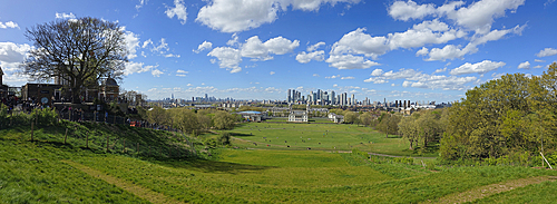
View from the top of Greenwich Hill, United Kingdom
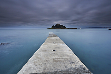
St Michael's Mount at dawn, seen from the boat landing at Marazion, near Penzance, Cornwall, Great Britain.
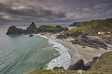
A view of Kynance Cove, near Lizard Point, Britain's most southerly point, Cornwall, Great Britain.

Summit Dome. Pico do Areeiro, Maderia
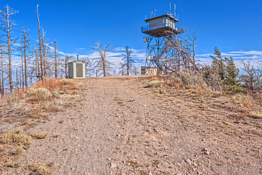
The fire watchtower on the summit of O'Leary Peak in the Coconino National Forest of Arizona. Adjacent to the Sunset Crater National Monument.
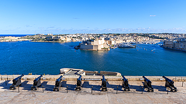
The Saluting Battery, Valletta, Malta
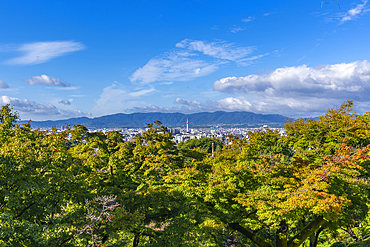
View of Kyoto and Nidec Kyoto Tower from Kiyomizu-dera Temple, Kiyomizu, Higashiyama Ward, Kyoto, Honshu, Japan
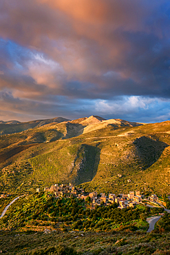
Vathia, abandoned village in the mountains of Mani Peninsula at sunset, Peloponnese, Greece
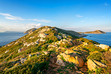
Cape Tainaron (Cape Matapan) landscape, the southernmost point of Greece, Mani Peninsula, Peloponnese, Greece
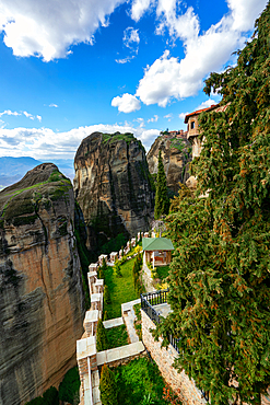
Meteora, ancient holy Monastery of Varlaam, UNESCO, Kalabaka, Greece
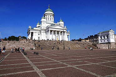
Lutheran Cathedral, Central Helsinki, Finland
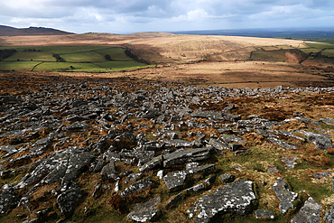
Looking west towards Yes Tor, the highest point on Dartmoor, England, United Kingdom
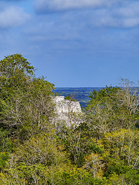
View towards Structure II from Structure I, Calakmul Archaeological Site, Campeche State, Mexico
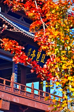
Pipa Pavilion, Jiujiang City, Jiangxi Province, China
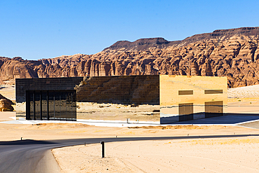
Maraya Theatre, architect Studio Gio Forma, mirrored structure seeming to disappear in AlUla's Ashar Valley, AlUla, Medina Province, Saudi Arabia
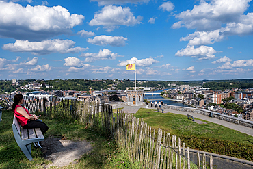
View from the Citadel of Namur of Namur, a city and municipality, capital of the province of Namur and Wallonia,Namur, Wallonia, Belgium
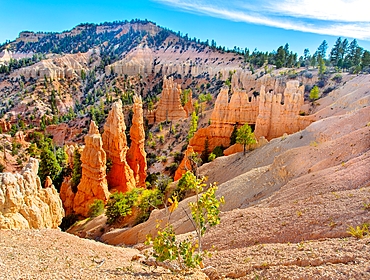
Hoodoos at Bryce Point, Bryce Canyon National Park, Utah, United States of America
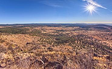
Coconino National Forest from the southwest summit of Apache Maid Mountain, Coconino National Forest, Arizona, United States of America
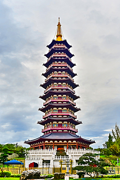
Wanfo (Ten Thousand Buddha) Pagoda, reconstructed 2014, Jinhua City, Zhejiang Province, China
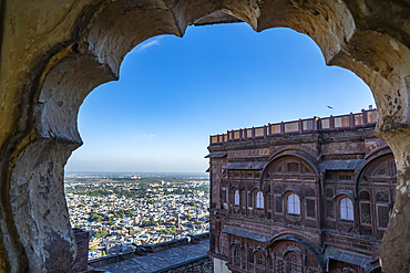
Mehrangarh Fort, Jodhpur, Rajasthan, India
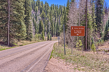
Directional sign pointing the way to Point Imperial and Cape Royal, Grand Canyon National Park, Arizona, USA
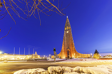
View of Hallgrimskirkja church illuminated at dusk in winter, Reykjavik, Iceland
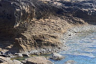
Porous sand stone rocks on Jalandhar Beach near the south pole point in Diu, India, Asia
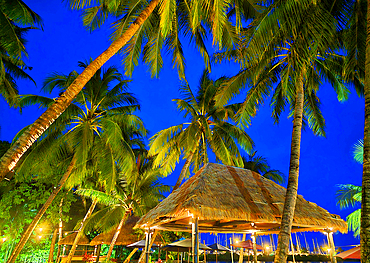
First Landing Beach Resort, Nalamu Beach at Vuda Point, near Nadi, Viti Levu, Fiji, South Pacific
First Landing Beach Resort, Nalamu Beach at Vuda Point, near Nadi, Viti Levu, Fiji, South Pacific
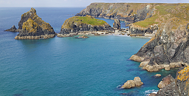
The stunning beach, rocks and cliffs at Kynance Cove, seen at at low tide, near the Lizard Point, Cornwall, England, United Kingdom, Europe
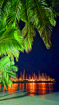
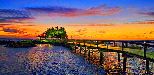
First Landing Beach Resort, Nalamu Beach at Vuda Point, near Nadi, Viti Levu, Fiji, South Pacific
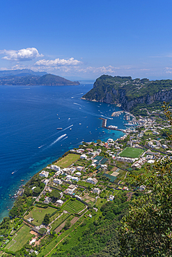
View of Grande Marina from Anacapri panorama view point, Anacapri, Isle of Capri, Bay of Naples, Campania, Italy, Mediterranean, Europe
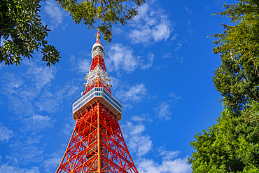
View of Tokyo Tower from its base against blue sky, Shibakoen, Minato City, Tokyo, Honshu, Japan
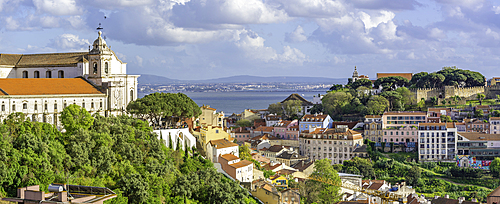
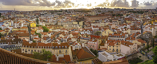
Panoramic view of Lisbon from Miradouro da Senhora do Monte scenic point on a sunny day in the Alfama District, Lisbon, Portugal, Europe

View of bullet train in Kanazawa Station, Kanazawa City, Ishikawa Prefecture, Honshu, Japan
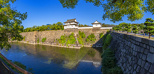
View of Sengan-yagura Turret and moat at Osaka Castle (Osaka-jo) on a sunny day, Chuo Ward, Osaka, Honshu, Japan
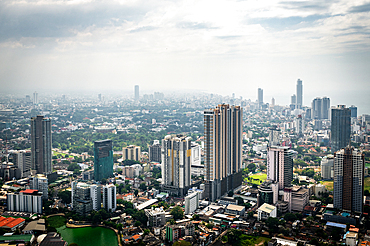
View over Colombo from the Lotus Tower, Colombo, Sri Lanka
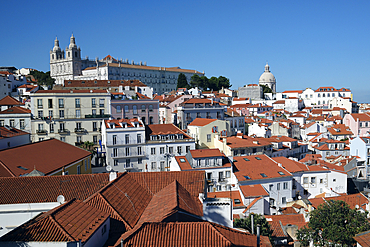
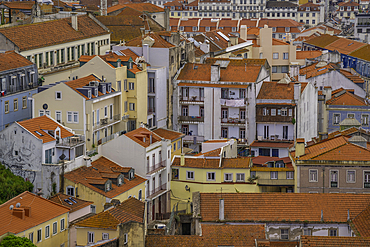
City view of Alfama district, Lisbon, Portugal
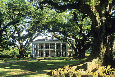
Oak Alley Plantation, Vacherie, Louisiana, USA
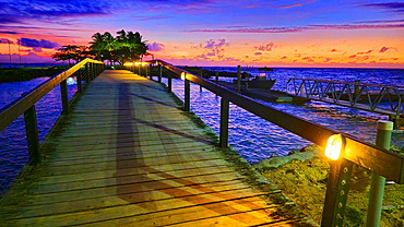
First Landing Beach Resort, Nalamu Beach at Vuda Point, near Nadi, Viti Levu, Fiji, South Pacific
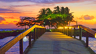
First Landing Beach Resort, Nalamu Beach at Vuda Point, near Nadi, Viti Levu, Fiji, South Pacific

First Landing Beach Resort, Nalamu Beach at Vuda Point, near Nadi, Viti Levu, Fiji, South Pacific
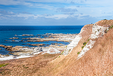
Point Kean Viewpoint. View of Rugged White Limestone Cliffs and Blue Sea at Kaikoura Peninsula, New Zealand
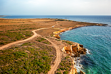
Su Tingiosu wild coast in Sardinia, drone aerial view, Sardinia, Italy, Mediterranean, Europe
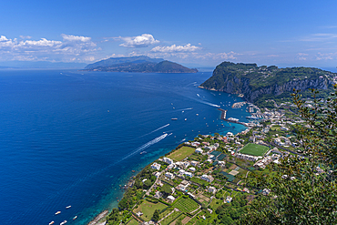
View of Grande Marina from Anacapri panorama view point, Anacapri, Isle of Capri, Bay of Naples, Campania, Italy, Mediterranean, Europe

Bryce Canyon amphitheater, Inspiration Point, Bryce Canyon National Park, Utah, United States of America, North America
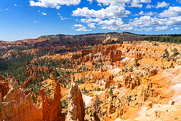
Scenic view of hoodoos and rock formations, Sunrise Point, Bryce Canyon National Park, Utah, United States of America, North America
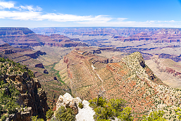
Grand Canyon, Grandview Point, Grand Canyon National Park, UNESCO World Heritage Site, Arizona, United States of America, North America
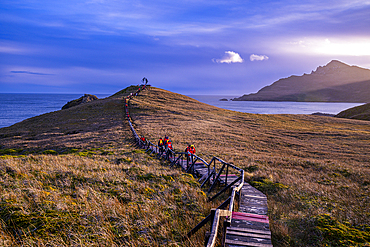
Boardwalk at Cape Horn, southern most point in South America, Hornos island, Tierra del Fuego, Chile, South America
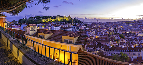
Panoramic view of Lisbon Castle from Miradouro da Senhora do Monte scenic point at dusk in the Alfama District, Lisbon, Portugal, Europe
Panoramic view of Lisbon Castle from Miradouro da Senhora do Monte scenic point at dusk in the Alfama District, Lisbon, Portugal, Europe
Panoramic view of Lisbon Castle from Miradouro da Senhora do Monte scenic point at sunset in the Alfama District, Lisbon, Portugal, Europe
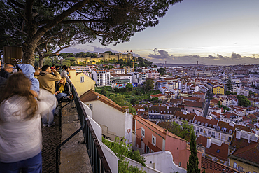
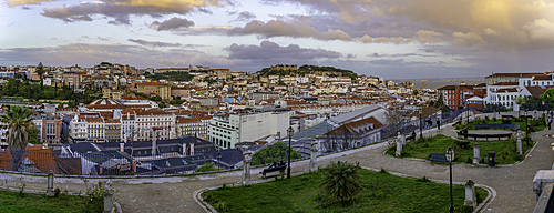
Panoramic view of Lisbon from Miradouro da Senhora do Monte scenic point at sunset in the Alfama District, Lisbon, Portugal, Europe
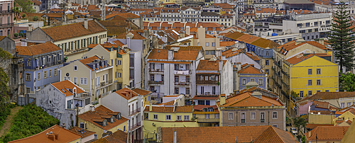
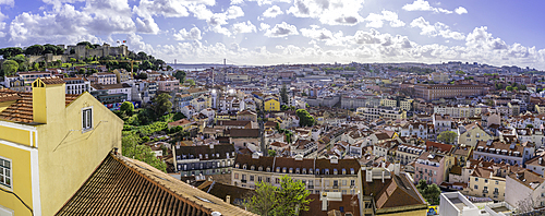
View of rooftops and colourful buildings from Miradouro da Senhora do Monte scenic point on a sunny day in the Alfama District, Lisbon, Portugal, Europe
View of rooftops and colourful buildings from Miradouro da Senhora do Monte scenic point on a sunny day in the Alfama District, Lisbon, Portugal, Europe
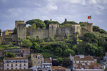
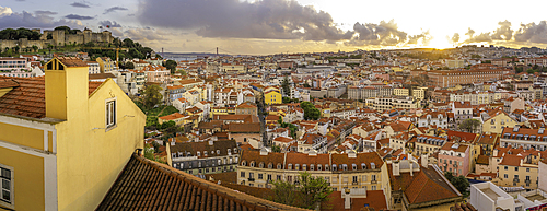
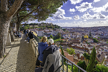
Panoramic view of Lisbon Castle from Miradouro da Senhora do Monte scenic point on a sunny day in the Alfama District, Lisbon, Portugal, Europe
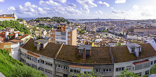
Panoramic view of Lisbon from Miradouro da Senhora do Monte scenic point on a sunny day in the Alfama District, Lisbon, Portugal, Europe

Panoramic view of Lisbon from Miradouro da Graca scenic point on a sunny day in the Alfama District, Lisbon, Portugal, Europe
Panoramic view of Lisbon from Miradouro da Graca scenic point on a sunny day in the Alfama District, Lisbon, Portugal, Europe
Panoramic view of Lisbon from Miradouro da Graca scenic point on a sunny day in the Alfama District, Lisbon, Portugal, Europe
View of Lisbon from Miradouro de Sao Pedro de Alcantara at sunset, Lisbon, Portugal, Europe

View of Monument to the Discoveries (Padrao dos Descobrimentos) and 25 April Bridge on a sunny day, Lisbon, Portugal, Europe
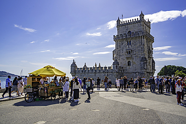
View of Belém Tower (Torre de Belém) on a sunny day, Lisbon, Portugal, Europe

View of city skyline from Santa Justa Lift on a sunny day, Lisbon, Portugal, Europe
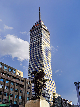
Torre Latinoamericana, Mexico City, Mexico
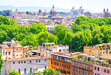
Rome skyline as seen from Gianicolo (Janiculum) Hill, Rome, Lazio, Italy
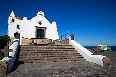
White church in Forio, Ischia, Phlegrean Islands, Gulf of Naples, Campania, Italy
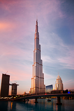
Burj Khalifa, world's tallest tower at sunset, Downtown Burj Dubai, Dubai,United Arab Emirates
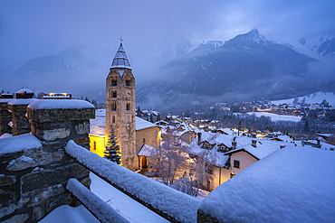
Church of Saint Pantalon, snow covered town centre and mountainous background in winter at dusk, Courmayeur, Aosta Valley, Italian Alps, Italy
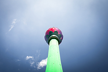
View of Lotus Tower from underneath, Colombo, Sri Lanka
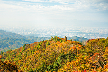
Breathtaking view of forested mountains with autumn colors and distant hills, viewed from Mount Hiei (Hiei San), Kyoto area, Honshu, Japan
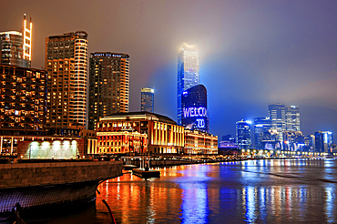
Brightly lit Shanghai city view at night shrouded in mist at the Bund, Shanghai, China. The low rise buildings are The Grand Halls which were previously warehouses built in 1902.
Cape Horn, southern most point in South America, Hornos island, Tierra del Fuego, Chile, South America
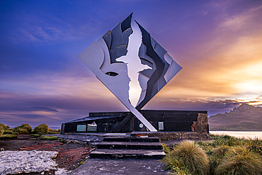
Monument of Cape Horn, southern most point in South America, Hornos island, Tierra del Fuego, Chile, South America
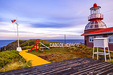
Lighthouse at Cape Horn, southern most point in South America, Hornos island, Tierra del Fuego, Chile, South America
Monument of Cape Horn, southern most point in South America, Hornos island, Tierra del Fuego, Chile, South America
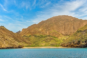
Pitt Point, a volcanic tuff formation on San Cristobal Island, Galapagos, UNESCO World Heritage Site, Ecuador, South America