Results
81 results found
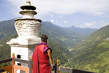
Buddhist monk looking over the Valley of the Puna Tsang River, Trongsa Dzong, Trongsa, Bhutan, Himalayas, Asia
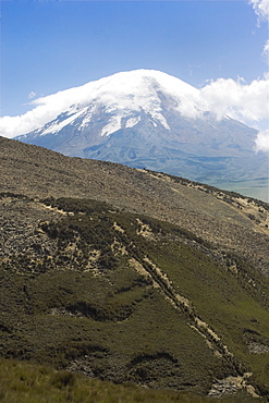
The west flank of 6310m Volcan Chimborazo, with its unique type of Andean high paramo (puna) made dry by the rain shadow, Chimborazo Province, Central Highlands, Ecuador, South America

Steel gateway sculptures outside New Art Gallery Te Puna o Waiwhetu, built 2003, Christchurch, Canterbury, South Island, New Zealand, Pacific
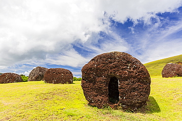
The red scoria quarry at Puna Pau, a cinder cone on the outskirts of Hanga Roa, Rapa Nui National Park, UNESCO World Heritage Site, Easter Island (Isla de Pascua), Chile, South America
Volcanic lava rocks, Campo de Piedra Pomez, El Penon, Puna, Catamarca, Argentina
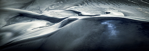
Patterns of pumice dunes, El Penon, Puna, Catamarca, Argentina
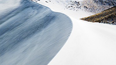
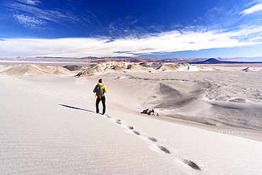
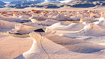
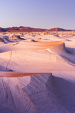
White pumice dunes, El Penon, Puna, Catamarca, Argentina
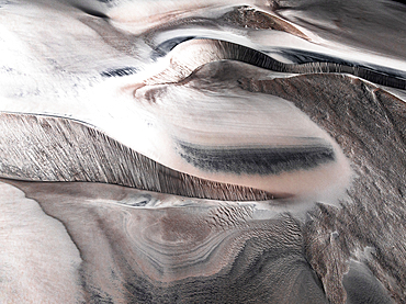
Details of white dunes, Campo de Piedra Pomez, El Penon, Puna, Catamarca, Argentina
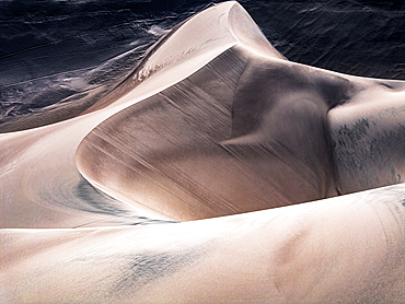
Pumice dunes, Campo de Piedra Pomez, El Penon, Puna, Catamarca, Argentina
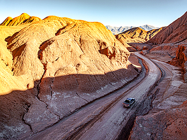
Car on a road alongside fossil cliffs, Labyrinth desert, Puna, Salta, Argentina
Empty desert road towards red rocky mountains, Salar de Arizaro salt flat, Puna, Argentina
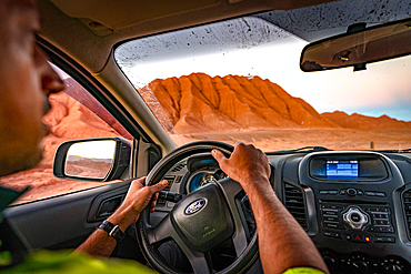
Man looking at the idyllic wild landscape from windscreen while driving an off road vehicle, Labyrinth Desert, Puna, Argentina
Pumice dunes, El Penon, Puna, Catamarca, Argentina
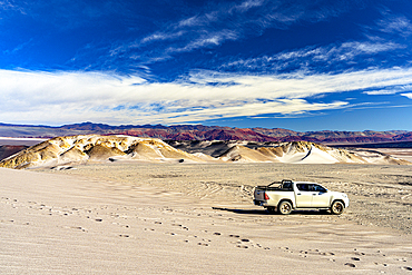
Pickup in the high-altitude desert, Campo de Piedra Pomez, El Penon, Puna, Catamarca, Argentina
Tourist photographing the white dunes, Campo de Piedra Pomez, El Penon, Puna, Catamarca, Argentina. (MR)
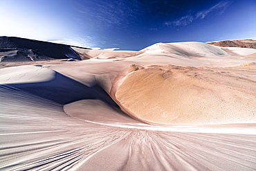
Rippled white dunes, Campo de Piedra Pomez, El Penon, Puna, Catamarca, Argentina
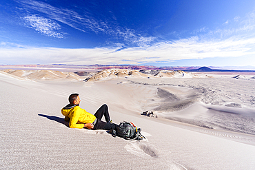
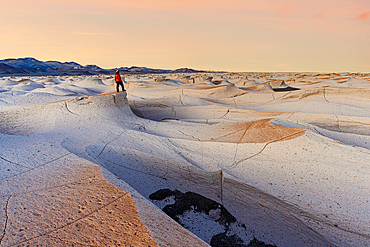
Man relaxing on white pumice dunes, Campo de Piedra Pomez, El Penon, Puna, Catamarca, Argentina. (MR)
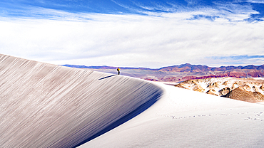
Tourist walking on white dunes, Campo de Piedra Pomez, El Penon, Puna, Catamarca, Argentina. (MR)
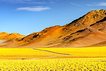
Path among yellow shrub fields, Puna, Argentina
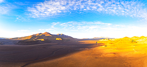
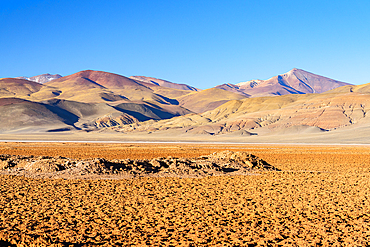
Arid high-altitude landscape, Puna, Argentina
High desert landscape of the Puna region, Argentina
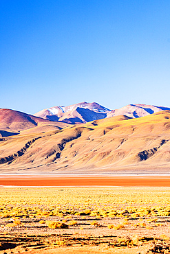
Cerro Galan and Laguna Diamante, Puna, Catamarca, Argentina
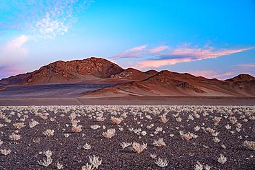
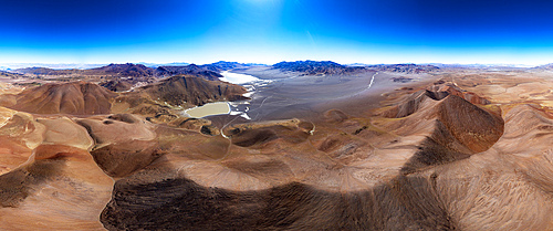
Volcanic desert, Antofagasta de la Sierra, Puna, Catamarca, Argentina
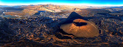
Aerial view of Alumbrera Volcano, Antofagasta de la Sierra, Puna, Catamarca, Argentina
Colorful highland landscape at Salar de Pocitos, Puna de Atacama, Argentina
Volcanic shaped rocks, Campo de Piedra Pomez, El Penon, Puna, Catamarca, Argentina
4x4 car driving among the red volcanic rocks and mountains in the Labyrinth Desert, Salta province, Puna, Argentina
Labyrinth desert, Puna, Salta, Argentina
Man looking at the Milky Way, Devil's Desert, Puna, Salta, Argentina
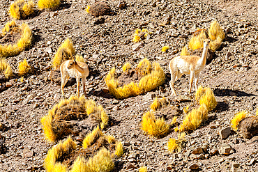
Vicunas, Vega de los Colorados, Puna, Catamarca, Argentina
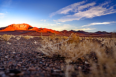
High desert landscape of the Puna region, Argentina
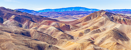
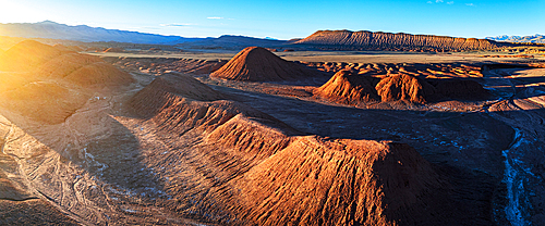
Rolling landscape around Cerro Galan caldera, Puna, Catamarca, Argentina
Cerro Galan caldera, Puna, Catamarca, Argentina
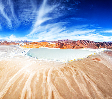
Laguna Diamante in Cerro Galan caldera, Puna, Catamarca, Argentina
Salt lake in the caldera of Cerro Galan, Puna, Catamarca, Argentina
Laguna Diamante inside Cerro Galan caldera, Puna, Catamarca, Argentina
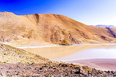
Antofagasta Volcano and Laguna Escondida, Antofagasta de la Sierra, Puna, Catamarca, Argentina
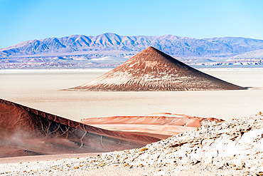
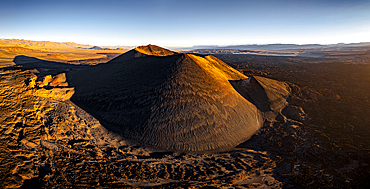
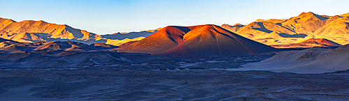
Surreal Arita Cone natural formation (Cono De Arita) at sunset, Salar de Arizaro salt flat, Puna, Argentina
Laguna Escondida, Antofagasta de la Sierra, Puna, Catamarca, Argentina
Volcano, El Penon, Catamarca, Puna, Argentina
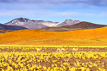
Vicuas among yellow shrubs, Puna, Argentina
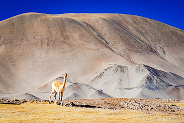
Vicuna on the high-altitude plateau, Puna, Argentina
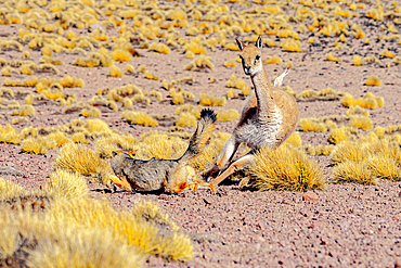
South American gray fox and vicuna interacting in the dry landscape, Puna, Argentina
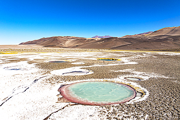
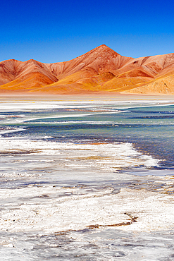
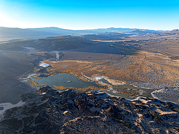
Salt ponds, Ojos del Campo, Salar de Antofalla, Puna, Catamarca, Argentina
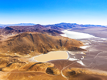
Aerial view of salt lagoons, Ojos del Campo, Salar de Antofalla, Puna, Catamarca, Argentina
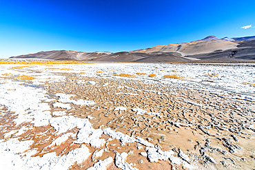
Cracked desert terrain, Salar de Antofalla, Puna, Catamarca, Argentina
Arid landscape, Salar de Pocitos, Puna de Atacama, Argentina
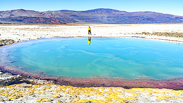
Tourist looking at saltwater pond, Ojos del Campo, Salar de Antofalla, Puna, Catamarca, Argentina
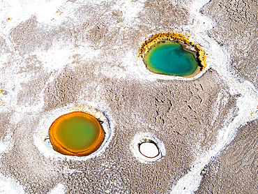
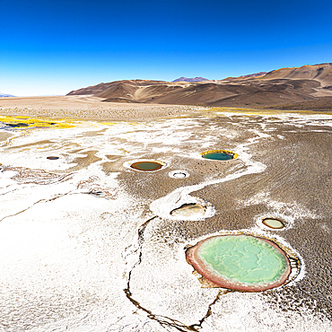
Small colorful lagoons, Ojos del Campo, Salar de Antofalla, Puna, Catamarca, Argentina
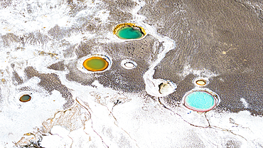
Colorful salt lagoons, Ojos del Campo, Salar de Antofalla, Puna, Catamarca, Argentina
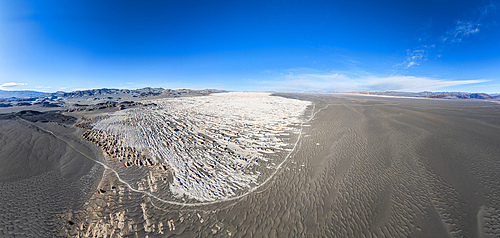
Aerial view of volcanic landscape, Campo de Piedra Pomez, El Penon, Puna, Catamarca, Argentina
Man looking at volcanic landscape, Campo de Piedra Pomez, El Penon, Puna, Catamarca, Argentina. (MR)
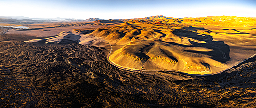
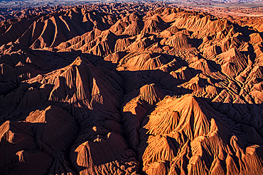
Colorful pumice fields at sunrise, Campo de Piedra Pomez, El Penon, Puna, Catamarca, Argentina
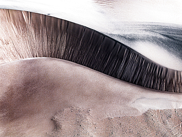
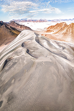
Shapes and details of Dunas Blancas, Campo de Piedra Pomez, El Penon, Puna, Catamarca, Argentina
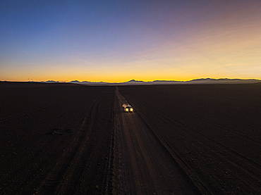
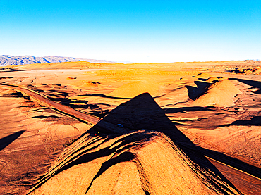
Off-road drive at twilight, Puna, Argentina
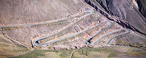
Winding mountain road with sharp bends, Purmamarca, Puna, Jujuy, Argentina
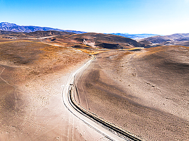
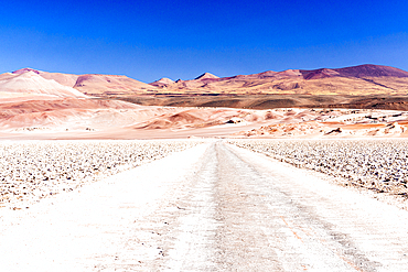
Ruta Nacional 40 through the barren landscape of the Puna de Atacama, Argentina
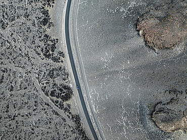
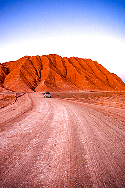
Car on a winding road in volcanic desert, Antofagasta de la Sierra, Puna, Catamarca, Argentina
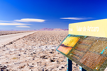
Informational sign board on side of an empty desert road in the wild dry landscape, Salar de Arizaro salt flat, Puna, Argentina
Dirt track through yellow slopes, Vega de los Colorados, Puna, Catamarca, Argentina
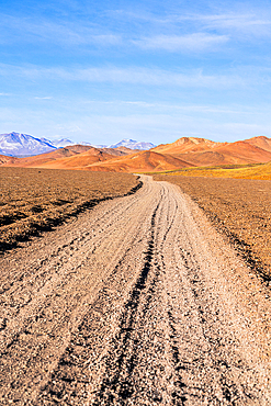
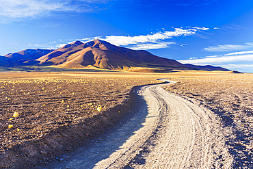
Remote dirt road in the red earth landscape, Puna, Argentina
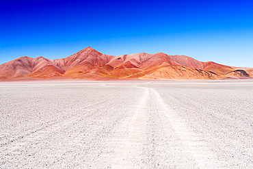
Winding track across the Andean altiplano, Puna, Argentina
Trail in the Altiplano near Galan volcano, Puna, Catamarca, Argentina
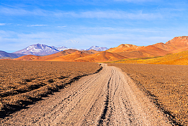
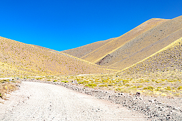
Dirt road in the arid highlands, Puna, Argentina
Clay hills of the Labyrinth desert, Puna, Salta, Argentina
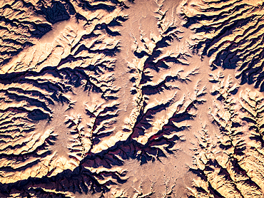
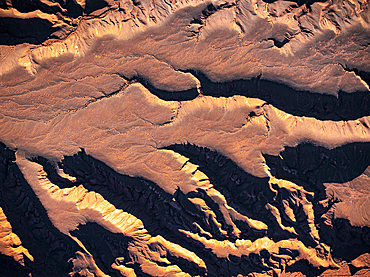
Red rock formations, aerial view, Labyrinth desert, Puna, Salta, Argentina
Details of red clay formations in the Labyrinth desert, Puna, Salta, Argentina
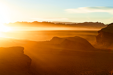
Idyllic sunrise over volcanic rock formations and mountains in the surreal Labyrinth Desert, Puna, Argentina
Eroded peaks of red clay, Labyrinth desert, Puna, Salta, Argentina
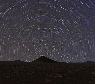
Star trail over Cono de Arita, Salar de Arizaro, Puna, Salta, Argentina
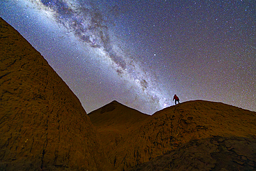
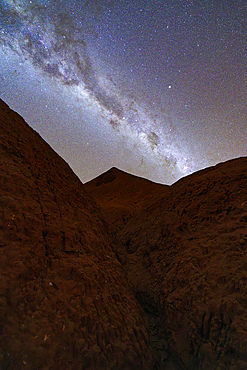
Milky Way, Devil's Desert or Desierto del Diablo, Puna, Salta, Argentina
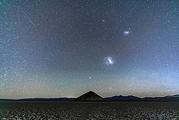
Cono de Arita beneath the Magellanic Clouds, Salar de Arizaro, Puna, Salta, Argentina
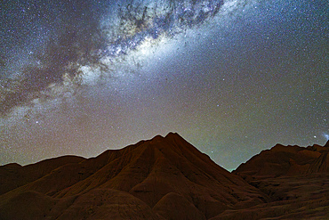
Milky Way over rock formations, Devil's Desert (Desierto del Diablo), Puna, Salta, Argentina
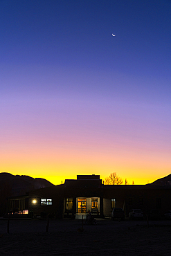
Remote lodge at sunset, El Penon, Catamarca, Puna, Argentina
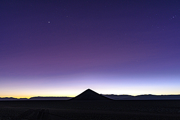
Silhouette of Cono de Arita at sunrise, Salar de Arizaro, Puna, Salta, Argentina
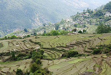
Terraced ricefields near Kuruthang, on the Puna Tsang Chu valley beside the road from Thimpu to Punakha, Bhutan, Asia
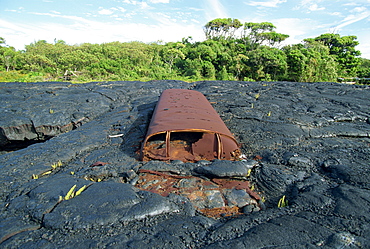
School bus near Kaimu buried in the 1988 basalt lava flows that covered a large area of the south east Puna coast and cut highway 130, Big Island, Hawaii, United States of America, North America
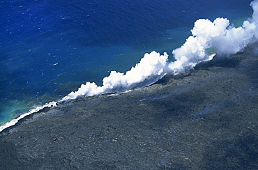
Steam cloud rising where lava from the Pu'u O'o cinder cone far inland enters sea on southeast Puna coast near Kaimu, Big Island, Hawaii, Hawaiian Islands, United States of America, Pacific, North America
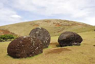
Pukaos, Puna Pao Quarry, Easter Island (Rapa Nui), Chile, South America
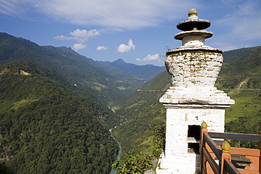
Puna Tsang River, Trongsa Dzong, Trongsa, Bhutan, Asia
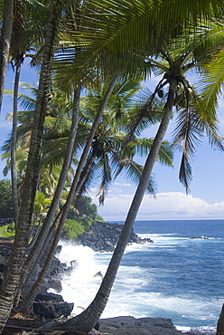
Puna (Black Sand) Beach, Island of Hawaii (Big Island), Hawaii, United States of America, Pacific, North America

Steaming geyser at the geyser field of El Tatio, Chile
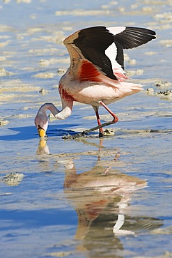
Puna or JamesÂ’s Flamingo (Phoenicoparrus jamesi), Laguna Hedionda, Potosi, Bolivia, South America
Puna or JamesÂ’s Flamingo (Phoenicoparrus jamesi), Laguna Hedionda, Potosi, Bolivia, South America
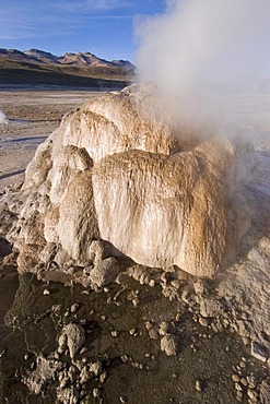
Geyser at the geyserfiel of El Tatio, Chile
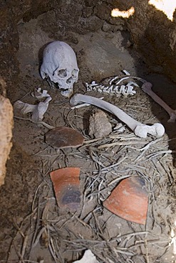
Mummy in a cave at San Juan del Rosario, Bolivia
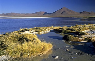
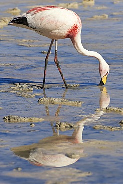
Flamingos at Laguna Colorada, National Park Eduardo Avaroa, Bolivia

Fourwheeldrive vehicle with tourists on the Salar de Uyuni, Bolivia

Sign at the chilean, bolivian border near Laguna verde, Chile
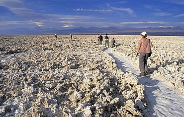
Tourists hiking on Salar de Atacama, Atacama Desert, Chile
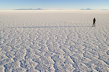
Person standing on Salar de Uyuni, Bolivia
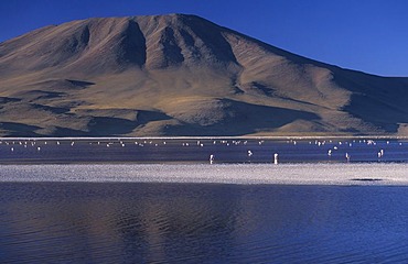
Flamingos at Laguna Colorada, National Park Eduardo Avaroa, Bolivia
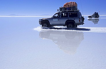
Fourwheeldrive vehicle driving over Salar de Uyuni, Bolivia
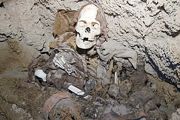
Mummy in a cave at San Juan del Rosario, Bolivia
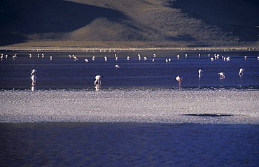
Flamingos at Laguna Colorada, National Park Eduardo Avaroa, Bolivia
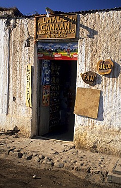
Streetscape in San Pedro de Atacama, Chile

Fourwheeldrive vehicle with tourists on the Salar de Uyuni, Bolivia
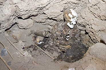
Mummy in a cave at San Juan del Rosario, Bolivia

Geyser at the geyserfiel of El Tatio, Chile
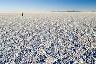
Person standing on Salar de Uyuni, Bolivia