Results
2 results found
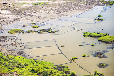
In mid January 2015, a three day period of excessive rain brought unprecedented floods to the small poor African country of Malawi. It displaced nearly quarter of a million people, devastated 64,000 hectares of land, and killed several hundred people. This shot taken from the air on a flight to Makhanga, which two months on, is still cut off by the floods when all rail and road connections were washed away, is looking down on the flood waters still sat on the flood plain, and the devastated farmland.
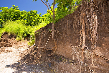
In mid January 2015, a three day period of excessive rain brought unprecedented floods to the small poor African country of Malawi. It displaced nearly quarter of a million people, devastated 64,000 hectares of land, and killed several hundred people. This shot shows tree roots exposed as the river bank was washed away near Chikwawa.
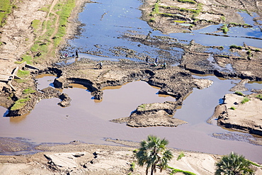
In mid January 2015, a three day period of excessive rain brought unprecedented floods to the small poor African country of Malawi. It displaced nearly quarter of a million people, devastated 64,000 hectares of land, and killed several hundred people. This shot taken from the air shows flood waters and farmland destroyed by the floods, with local farmers crossing their devastated fields.
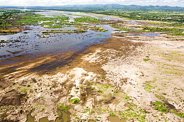
In mid January 2015, a three day period of excessive rain brought unprecedented floods to the small poor African country of Malawi. It displaced nearly quarter of a million people, devastated 64,000 hectares of land, and killed several hundred people. This shot shows the scale of the flood destruction, with ruined farmland, from the air.
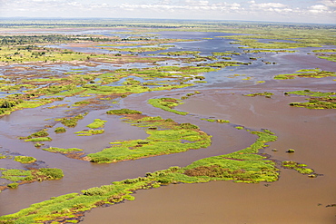
In mid January 2015, a three day period of excessive rain brought unprecedented floods to the small poor African country of Malawi. It displaced nearly quarter of a million people, devastated 64,000 hectares of land, and killed several hundred people. This shot taken from the air on a flight to Makhanga, which two months on, is still cut off by the floods when all rail and road connections were washed away, is looking down on the flood waters still sat on the flood plain.
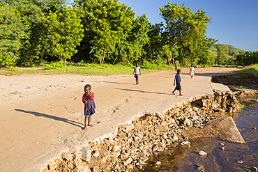
In mid January 2015, a three day period of excessive rain brought unprecedented floods to the small poor African country of Malawi. It displaced nearly quarter of a million people, devastated 64,000 hectares of land, and killed several hundred people. This shot shows a road and bridge washed away near Chikwawa.
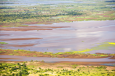
In mid January 2015, a three day period of excessive rain brought unprecedented floods to the small poor African country of Malawi. It displaced nearly quarter of a million people, devastated 64,000 hectares of land, and killed several hundred people. This shot taken from the air shows farmland buried under flood debris, and still flooded land.

In mid January 2015, a three day period of excessive rain brought unprecedented floods to the small poor African country of Malawi. It displaced nearly quarter of a million people, devastated 64,000 hectares of land, and killed several hundred people. This shot shows a drainage pipe that was washed away near Chikwawa.

Solar panels amongst Badland scenery in Death Valley which is the lowest, hottest, driest place in the USA, with an average annual rainfall of around 2 inches, some years it does not receive any rain at all.
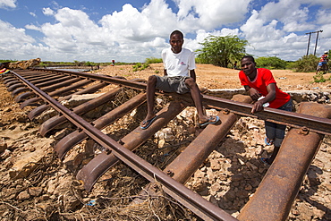
In mid January 2015, a three day period of excessive rain brought unprecedented floods to the small poor African country of Malawi. It displaced nearly quarter of a million people, devastated 64,000 hectares of land, and killed several hundred people. This shot shows a railway line that was washed away in Bangula.
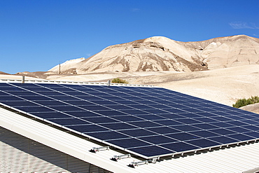
Solar panels amongst Badland scenery in Death Valley which is the lowest, hottest, driest place in the USA, with an average annual rainfall of around 2 inches, some years it does not receive any rain at all.
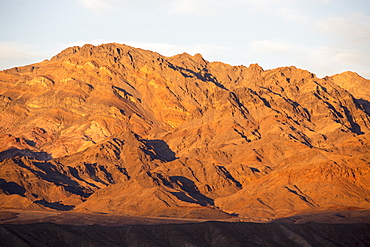
Badland scenery at Zabriskie Point at sunset in Death Valley which is the lowest, hottest, driest place in the USA, with an average annual rainfall of around 2 inches, some years it does not receive any rain at all.
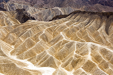
Badland scenery at Zabriskie Point in Death Valley which is the lowest, hottest, driest place in the USA, with an average annual rainfall of around 2 inches, some years it does not receive any rain at all.
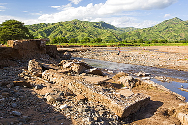
In mid January 2015, a three day period of excessive rain brought unprecedented floods to the small poor African country of Malawi. It displaced nearly quarter of a million people, devastated 64,000 hectares of land, and killed several hundred people. This shot shows a road bridge destroyed near Chikwawa.
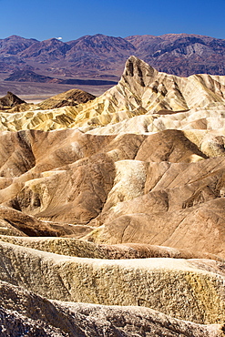
Badland scenery at Zabriskie Point in Death Valley which is the lowest, hottest, driest place in the USA, with an average annual rainfall of around 2 inches, some years it does not receive any rain at all.
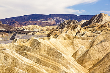
Badland scenery at Zabriskie Point in Death Valley which is the lowest, hottest, driest place in the USA, with an average annual rainfall of around 2 inches, some years it does not receive any rain at all.
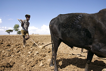
Example of farming activity in the area of hanamerant, meket, ethiopia.The Farmers have to fight against the lack of rain and erosion of the soil. They produce 1 crop a year wich sustain food a couple of months only
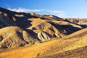
Badland scenery in Death Valley which is the lowest, hottest, driest place in the USA, with an average annual rainfall of around 2 inches, some years it does not receive any rain at all.
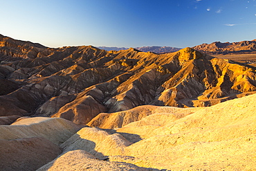
Badland scenery at sunset, Zabriskie Point in Death Valley which is the lowest, hottest, driest place in the USA, with an average annual rainfall of around 2 inches, some years it does not receive any rain at all.

The A591, the main road through the Lake District, completely destroyed by the floods from Storm Desmond, Cumbria, UK. The road was breached in several places by landslides and walls of flood debris twenty feet high. the road will probably be closed for months. Taken on Sunday 6th December 2015.
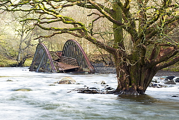
On Saturday 5th December 2015, Storm desmond crashed into the UK, producing the UK''s highest ever 24 hour rainfall total at 341.4mm. It flooded many towns including Keswick. This shots shows one of two railway bridges on the old Keswick railway line that were completely destroyed by the floods. It also shows a tree, now sat in the middle of the river, that used to be growing on the river bank. The force of water was such that it has scoured out huge areas of banking and realigned the river in places.'
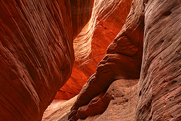
Striated corridors of Mystic Canyon are amazing to walk through and explore. Eons of erosion have created amazing feats of nature, Kanab, Utah, United States of America
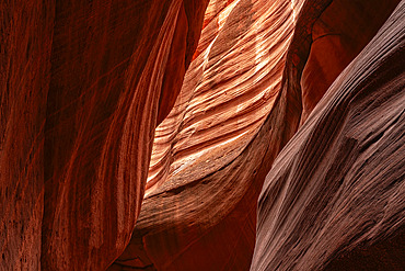
Striated corridors of Mystic Canyon are amazing to walk through and explore. Eons of erosion have created amazing feats of nature, Kanab, Utah, United States of America
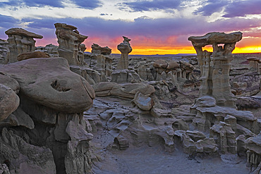
Hoodoos of Valley of Dreams take on fantastical shapes after eons of erosion from wind and rain. This hoodoo is named Alien Throne, with a beautiful sunset sky, Albuquerque, New Mexico, United States of America
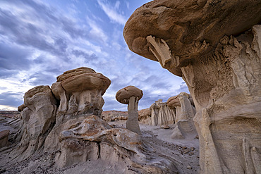
Hoodoos of Valley of Dreams take on fantastical shapes after eons of erosion from wind and rain, Albuquerque, New Mexico, United States of America
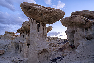
Hoodoos and formations of Valley of Dreams in a remote area of New Mexico. The hoodoos are formed by erosive forces like wind and rain, Albuquerque, New Mexico, United States of America

Trail through the striated corridors of Mystic Canyon, an amazing place to walk through and explore. Eons of erosion have created amazing feats of nature, Kanab, Utah, United States of America
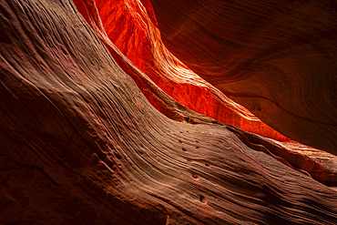
Sunlight illuminates the red striations of Mystic Canyon, an amazing place to walk through and explore. Eons of erosion have created amazing feats of nature, Kanab, Utah, United States of America
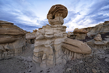
Hoodoos and formations in Valley of Dreams in a remote area of New Mexico at sunset. The hoodoos are formed by erosive forces like wind and rain, Albuquerque, New Mexico, United States of America
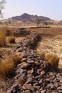
BURKINA FASO Environment Flooding Bund low rock walls built to prevent soil erosion by flash floods. Stones are placed along the contours on gentle slopes. Sometimes the bunds are reinforced by planting tough grasses along the lines. The stones and grass encourage rain water to infiltrate the soil and reduce the amount of rain water that is lost by run-off. Any soil that has been eroded by run-off is trapped by the bund. Topsoil and organic matter e.g. leaf litter is deposited here.Bunds are placed 10 to 25 metres apart African Western Africa Ecology Entorno Environmental Environnement Green Issues
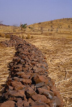
Burkina Faso Environment Flooding Bund low rock walls built to prevent soil erosion by flash floods. Stones are placed along the contours on gentle slopes. Sometimes the bunds are reinforced by planting tough grasses along the lines. The stones and grass encourage rain water to infiltrate the soil and reduce the amount of rain water that is lost by run-off. Any soil that has been eroded by run-off is trapped by the bund. Topsoil and organic matter e.g. leaf litter is deposited here.Bunds are placed 10 to 25 metres apart African Western Africa Ecology Entorno Environmental Green Issues Environnement
