Results
23 results found
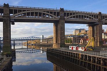
High Level Bridge, designed by Robert Stevenson in 1847, finished in 1849, structure of wrought Iron, railway and road bridge across the River Tyne, Redheugh Bridge beyond, Tyne and Wear, England, United Kingdom, Europe
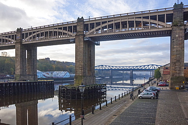
High Level Bridge, designed by Robert Stevenson in 1847, finished in 1849, structure of wrought iron, railway and road bridge across the River Tyne, and the Queen Elizabeth 2nd Metro Bridge, Tyne and Wear, England, United Kingdom, Europe
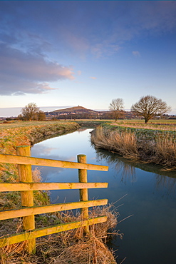
First light of morning on Glastonbury Tor viewed from the River Brue, Somerset Levels, Glastonbury, Somerset, England, United Kingdom, Europe
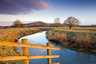
First light of a winter morning on Glastonbury Tor viewed from the River Brue on the Somerset Levels, Glastonbury, Somerset, England, United Kingdom, Europe
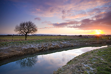
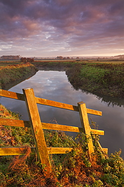
Sunrise over the River Brue on the Somerset Levels, Glastonbury, Somerset, England, United Kingdom, Europe
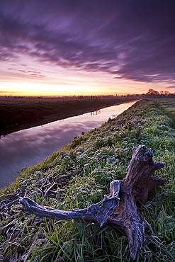
Frosty dawn beside the River Brue near Glastonbury, Somerset Levels, Somerset, England, United Kingdom, Europe

Sunrise over the Somerset Levels, River Brue near Glastonbury, Somerset, England, United Kingdom, Europe

Sunrise over the River Brue near Glastonbury, Somerset Levels, Somerset, England, United Kingdom, Europe
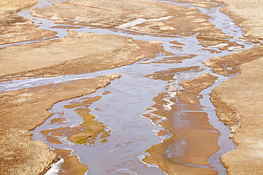
River Brue meandering through the Somerset Levels near Glastonbury, Somerset, England, United Kingdom, Europe
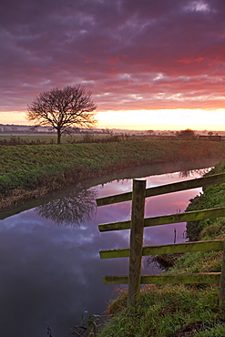
Somerset Levels sunrise over the River Brue near Glastonbury, Somerset, England, United Kingdom, Europe

Glastonbury Tor and the River Brue at sunrise, Somerset Levels, Somerset, England, United Kingdom, Europe
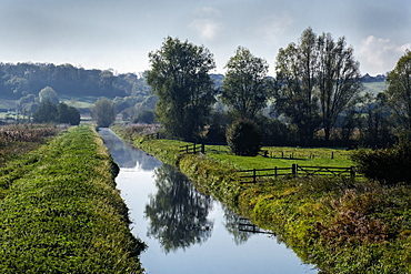
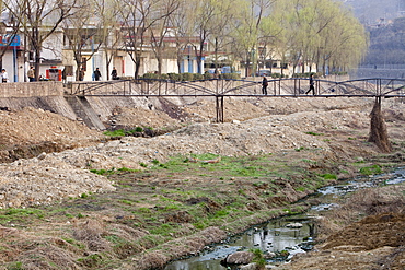
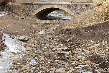
A drainage channel and farmland of the Somerset Levels, Ham Wall, Somerset, England, United Kingdom, Europe
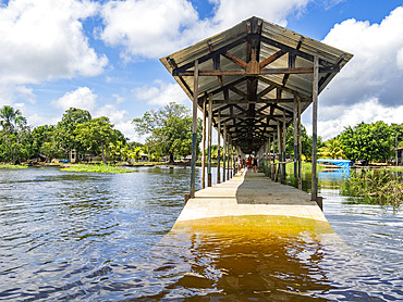
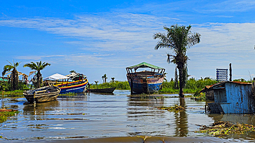
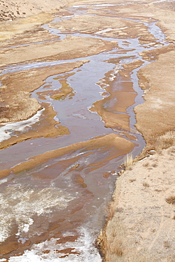
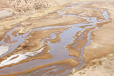
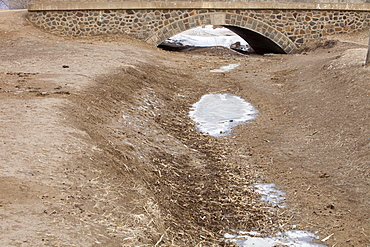
The second highest river level of the 21st century in a small village deep within the Pacaya Samiria Preserve, Peru.
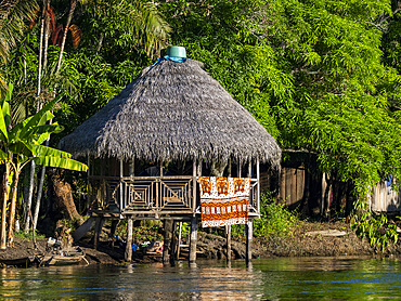
The second highest river level of the 21st century in a small village deep within the Pacaya Samiria Preserve, Peru.
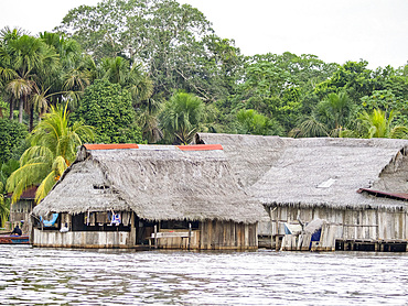
The second highest river level of the 21st century in a small village deep within the Pacaya Samiria Preserve, Peru.
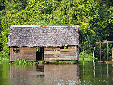
The second highest river level of the 21st century in a small village deep within the Pacaya Samiria Preserve, Peru.
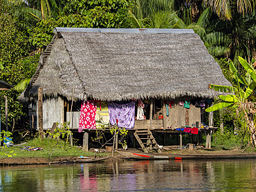
The second highest river level of the 21st century in a small village deep within the Pacaya Samiria Preserve, Peru.
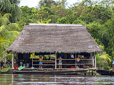
The second highest river level of the 21st century in a small village deep within the Pacaya Samiria Preserve, Peru.
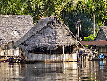
The second highest river level of the 21st century in a small village deep within the Pacaya Samiria Preserve, Peru.
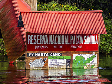
The second highest river level of the 21st century in a small village deep within the Pacaya Samiria Preserve, Peru.
Dhow harbour, Ujiji, Kigoma, Lake Tanganyika, Tanzania, East Africa, Africa

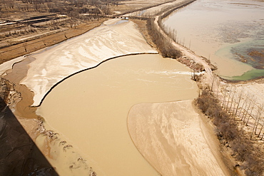
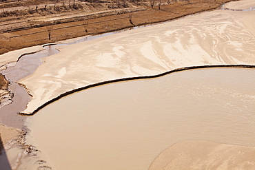
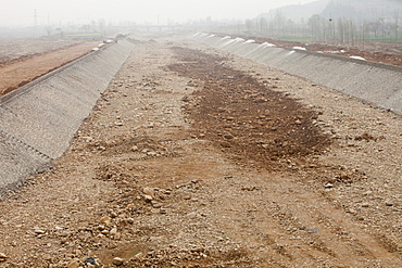
River bank land to be flooded, with new housing above reservoir level, Three Gorges Dam, Yangtze, China, Asia
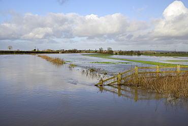
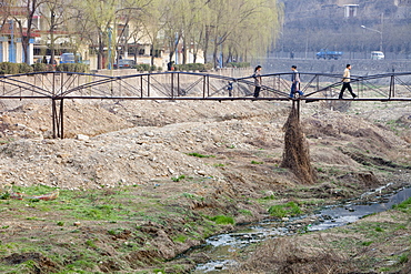
Hugely swollen River Parrett overflowing onto Aller Moor near Staithe after weeks of heavy rain, Somerset Levels, Somerset, England, United Kingdom, Europe
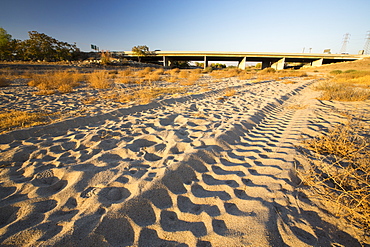
The dried up river bed of the Kern River in Bakersfield, California, USA. Following an unprecedented four year long drought, Bakersfield is now the driest city in the USA. Most of California is in exceptional drought, the highest level of drought classification. 428,000 acres of agricultural land have been taken out of production due to lack of water, thousands of agricultural workers have lost their jobs and one third of all children in California go to bed hungry.

The Thames barrier on the River Thames in London. It was constructed to protect the capital city from storm surge flooding. Recent predictions show it will probably be redundant in around twenty years due to increased stormy weather and sea level rise driven by climate change.

The Thames barrier on the River Thames in London. It was constructed to protect the capital city from storm surge flooding. Recent predictions show it will probably be redundant in around twenty years due to increased stormy weather and sea level rise driven by climate change.
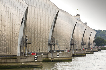
The Thames barrier on the River Thames in London. It was constructed to protect the capital city from storm surge flooding. Recent predictions show it will probably be redundant in around twenty years due to increased stormy weather and sea level rise driven by climate change.
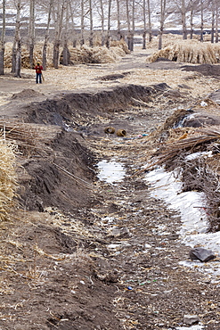
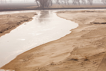
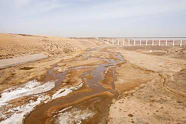
A dried up river in Inner Mongolia, China, Asia
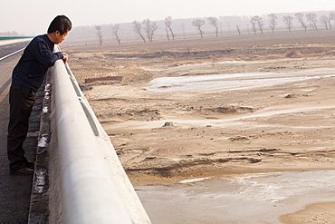
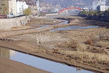
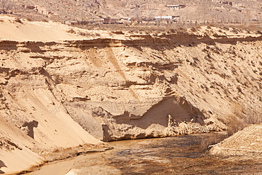
A river at a low level due to over-extraction, drought and climate change, just north of Beijing in Heilongjiang province, China, Asia

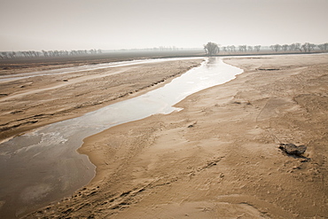
A completely dried up river in Shanxi province, China, Asia
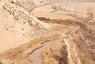
A critically low river in Shanxi province, China, Asia

A river at a low level due to over-extraction, drought and climate change, just north of Beijing in Heilongjiang province, China, Asia
A critically low river in Shanxi province, China, Asia
A critically low river in Shanxi province, China, Asia
A dried up river in Inner Mongolia, China, Asia

Build up of algae due to low water levels at Lake Eildon after an uprecedented ten years of drought, with only 29 percent capacity, Victoria, Australia, Pacific
A critically low river in Shanxi province, China, Asia
A critically low river in Shanxi province, China, Asia
A river at a low level due to over-extraction, drought and climate change, just north of Beijing in Heilongjiang province, China, Asia
River just north of Beijing in Heilongjiang province, China, Asia
A critically low river in Tongshuan in Shanxi, Northern China, Asia
A completely dried up river in Shanxi province, China, Asia
A critically low river in Shanxi province, China, Asia
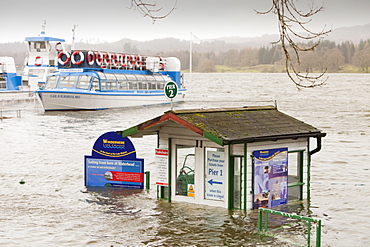
Lake Windermere in Ambleside and flooded buildings after the lake reached its highest ever recorded level, Lake District, Cumbria, England, United Kingdom, Europe
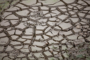
Mud cracks on a river bank in Shanxi province, China, Asia
A critically low river in Tongshuan in Shanxi, Northern China, Asia
A critically low river in Shanxi province, China, Asia
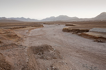
Dried up river in Inner Mongolia, Asia
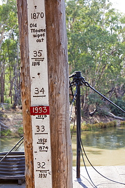
A marker showing flood levels on the Murray River at the port of Echuca, Victoria, Australia, Pacific
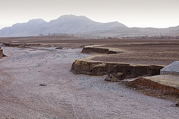
A dried up river in Inner Mongolia, China, Asia
A dried up river in Inner Mongolia, China, Asia
A critically low river in Shanxi province, China, Asia
A critically low river in Tongshuan in Shanxi, Northern China, Asia
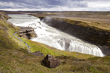
Gullfoss Waterfall and Gullfoss Gorge, on the Hvita River, Southwest Iceland
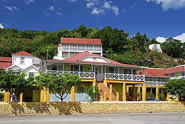
Jamaica Milk River Bath and Spa with one of the highest radioactivity levels of any mineral bath in the world.
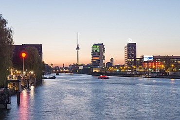
Skyline Berlin with the river Spree, View from Oberbaum bridge towards Media Spree, Skyscraper Living Levels, Mercedes, Berlin, Germany
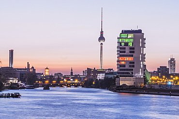
Skyline Berlin and river Spree, View from the Oberbaum bridge towards Media Spree, Skyscraper Living Levels, Mercedes, Berlin, Germany

Smoothly ground pebbles from the Isar River, Upper Bavaria, Germany, Europe
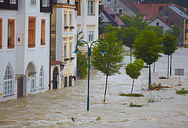
Enns floodwater in Steyr, Upper Austria, Austria, Europe
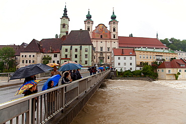
Onlookers, Enns floodwater in Steyr, Upper Austria, Austria, Europe
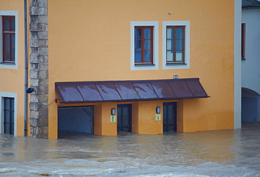
Enns floodwater in Steyr, Upper Austria, Austria, Europe
Cargo ships on the Rhine river at low water, river bed, Mt. Drachenfels, between Mehlem and Rolandswerth, North Rhine-Westphalia, Germany, Europe
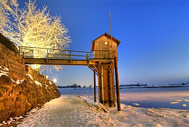
Gauging house at the Zollenspieker Faehrhaus in the Kirchwerder quarter, Hamburg, Germany, Europe
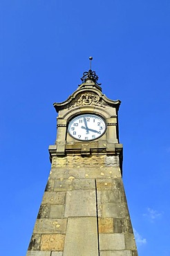
Water gauge, Art Noveau tower on the Rhine River shore to indicate the water level, Rhine Promenade, historic town centre, Duesseldorf, North Rhine-Westphalia, Germany, Europe
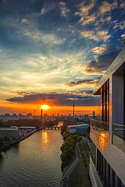
View from the Living Levels high-rise building on Berlin's East Side Gallery towards the city centre, Berlin, Germany, Europe
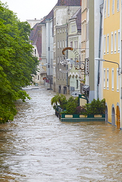
Enns floodwater in Steyr, Upper Austria, Austria, Europe
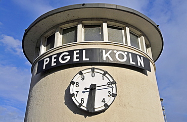
Tide scale of Cologne on the shore of the river Rhine, Cologne, North Rhine-Westphalia, Germany, Europe

View of the Rhine river at low water level, photomontage, Cologne, North Rhine-Westphalia, Germany, Europe, PublicGround

The water level of the Rhine River is nearly 9m, high water, Cologne, North Rhine-Westphalia, Germany, Europe
Excursion ship of the KD on the Rhine river at low water, river bed, Mt. Drachenfels, between Mehlem and Rolandswerth, North Rhine-Westphalia, Germany, Europe

Aerial view Summersville Lake, WV at low water levels
Water-level view of the new I64 bridge under construction over the Kanawha River in downtown Charleston, WV.
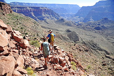
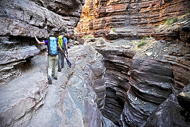
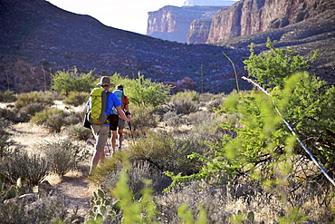
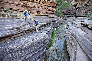
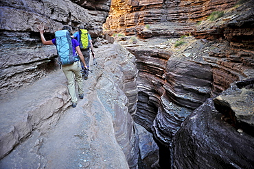
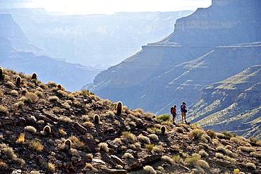
Hikers descend into Surprise Valley to access the lower canyon through a break in the 400-foot-tall Redwall on the Thunder River Trail in the Grand Canyon outside of Fredonia, Arizona November 2011. The 21.4-mile loop starts at the Bill Hall trailhead on the North Rim and descends 2000-feet in 2.5-miles through Coconino Sandstone to the level Esplanada then descends further into the lower canyon to access Thunder River, Tapeats Creek and Deer Creek.
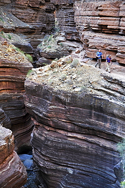
Hikers walk along Deer Creek Narrows in the Grand Canyon outside of Fredonia, Arizona November 2011. The 21.4-mile loop starts at the Bill Hall trailhead on the North Rim and descends 2000-feet in 2.5-miles through Coconino Sandstone to the level Esplanada then descends further into the lower canyon through a break in the 400-foot-tall Redwall to access Surprise Valley. Hikers connect Thunder River and Tapeats Creek to a route along the Colorado River and climb out Deer Creek.

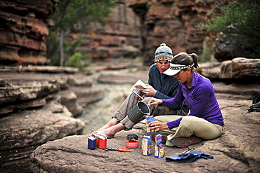
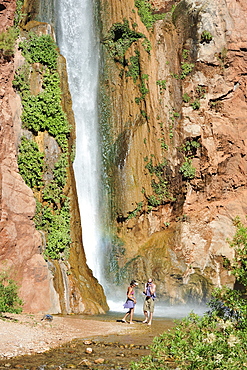
Male hiker filters water on a cliff-pinched patio near Deer Creek Falls in the Grand Canyon outside of Fredonia, Arizona November 2011. The 21.4-mile loop starts at the Bill Hall trailhead on the North Rim and descends 2000-feet in 2.5-miles through Coconino Sandstone to the level Esplanada then descends further into the lower canyon through a break in the 400-foot-tall Redwall to access Surprise Valley. Hikers connect Thunder River and Tapeats Creek to a route along the Colorado River and climb out Deer Creek.
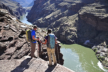
Hikers overlook the Colorado River as they exit the Deer Creek Narrows in the Grand Canyon outside of Fredonia, Arizona November 2011. The 21.4-mile loop starts at the Bill Hall trailhead on the North Rim and descends 2000-feet in 2.5-miles through Coconino Sandstone to the level Esplanada then descends further into the lower canyon through a break in the 400-foot-tall Redwall to access Surprise Valley. Hikers connect Thunder River and Tapeats Creek to a route along the Colorado River and climb out Deer Creek.
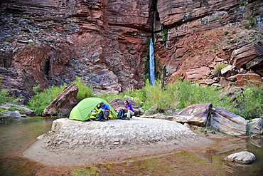
Hikers setup camp on a beach along the Colorado River near the plumeting 180-foot Deer Creek Falls in the Grand Canyon outside of Fredonia, Arizona November 2011. The 21.4-mile loop starts at the Bill Hall trailhead on the North Rim and descends 2000-feet in 2.5-miles through Coconino Sandstone to the level Esplanada then descends further into the lower canyon through a break in the 400-foot-tall Redwall to access Surprise Valley. Hikers connect Thunder River and Tapeats Creek to a route along the Colorado River and climb out Deer Creek.
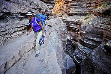
Hikers walk along Deer Creek Narrows in the Grand Canyon outside of Fredonia, Arizona November 2011. The 21.4-mile loop starts at the Bill Hall trailhead on the North Rim and descends 2000-feet in 2.5-miles through Coconino Sandstone to the level Esplanada then descends further into the lower canyon through a break in the 400-foot-tall Redwall to access Surprise Valley. Hikers connect Thunder River and Tapeats Creek to a route along the Colorado River and climb out Deer Creek.
Hikers walk along Deer Creek Narrows in the Grand Canyon outside of Fredonia, Arizona November 2011. The 21.4-mile loop starts at the Bill Hall trailhead on the North Rim and descends 2000-feet in 2.5-miles through Coconino Sandstone to the level Esplanada then descends further into the lower canyon through a break in the 400-foot-tall Redwall to access Surprise Valley. Hikers connect Thunder River and Tapeats Creek to a route along the Colorado River and climb out Deer Creek.

Hikers follow a route along the Colorado River that connect Tapeats Creek and Thunder River to Deer Creek in the Grand Canyon outside of Fredonia, Arizona November 2011. The 21.4-mile loop starts at the Bill Hall trailhead on the North Rim and descends 2000-feet in 2.5-miles through Coconino Sandstone to the level Esplanada then descends further into the lower canyon through a break in the 400-foot-tall Redwall to access Surprise Valley. Hikers connect Thunder River and Tapeats Creek to a route along the Colorado River and climb out Deer Creek.
Hikers cook dinner along Deer Creek Narrows in the Grand Canyon outside of Fredonia, Arizona November 2011. The 21.4-mile loop starts at the Bill Hall trailhead on the North Rim and descends 2000-feet in 2.5-miles through Coconino Sandstone to the level Esplanada then descends further into the lower canyon through a break in the 400-foot-tall Redwall to access Surprise Valley. Hikers connect Thunder River and Tapeats Creek to a route along the Colorado River and climb out Deer Creek.
Hikers climb out of Surprise Valley to the North Rim of the Grand Canyon outside of Fredonia, Arizona November 2011. The 21.4-mile loop starts at the Bill Hall trailhead on the North Rim and descends 2000-feet in 2.5-miles through Coconino Sandstone to the level Esplanada then descends further into the lower canyon through a break in the 400-foot-tall Redwall to access Surprise Valley. Hikers connect Thunder River and Tapeats Creek to a route along the Colorado River and climb out Deer Creek.
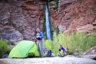
Hikers setup camp on a beach along the Colorado River near the plumeting 180-foot Deer Creek Falls in the Grand Canyon outside of Fredonia, Arizona November 2011. The 21.4-mile loop starts at the Bill Hall trailhead on the North Rim and descends 2000-feet in 2.5-miles through Coconino Sandstone to the level Esplanada then descends further into the lower canyon through a break in the 400-foot-tall Redwall to access Surprise Valley. Hikers connect Thunder River and Tapeats Creek to a route along the Colorado River and climb out Deer Creek.
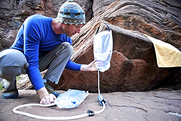
Male hiker filters water on a cliff-pinched patio near Deer Creek Falls in the Grand Canyon outside of Fredonia, Arizona November 2011. The 21.4-mile loop starts at the Bill Hall trailhead on the North Rim and descends 2000-feet in 2.5-miles through Coconino Sandstone to the level Esplanada then descends further into the lower canyon through a break in the 400-foot-tall Redwall to access Surprise Valley. Hikers connect Thunder River and Tapeats Creek to a route along the Colorado River and climb out Deer Creek.
Hikers swim in the pool below 180-foot Deer Creek Falls in the Grand Canyon outside of Fredonia, Arizona November 2011. The 21.4-mile loop starts at the Bill Hall trailhead on the North Rim and descends 2000-feet in 2.5-miles through Coconino Sandstone to the level Esplanada then descends further into the lower canyon through a break in the 400-foot-tall Redwall to access Surprise Valley. Hikers connect Thunder River and Tapeats Creek to a route along the Colorado River and climb out Deer Creek.
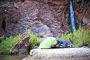
Hikers setup camp on a beach along the Colorado River near the plumeting 180-foot Deer Creek Falls in the Grand Canyon outside of Fredonia, Arizona November 2011. The 21.4-mile loop starts at the Bill Hall trailhead on the North Rim and descends 2000-feet in 2.5-miles through Coconino Sandstone to the level Esplanada then descends further into the lower canyon through a break in the 400-foot-tall Redwall to access Surprise Valley. Hikers connect Thunder River and Tapeats Creek to a route along the Colorado River and climb out Deer Creek.
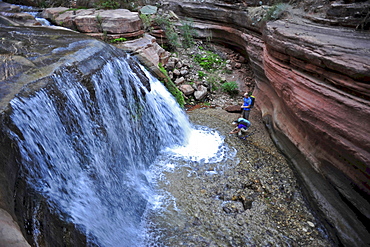
Hikers past small waterfalls along Deer Creek Narrows in the Grand Canyon outside of Fredonia, Arizona November 2011. The 21.4-mile loop starts at the Bill Hall trailhead on the North Rim and descends 2000-feet in 2.5-miles through Coconino Sandstone to the level Esplanada then descends further into the lower canyon through a break in the 400-foot-tall Redwall to access Surprise Valley. Hikers connect Thunder River and Tapeats Creek to a route along the Colorado River and climb out Deer Creek.
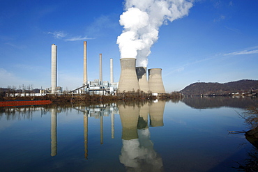
Water level view of a coal-fired power plant.
Hikers walk along Deer Creek Narrows in the Grand Canyon outside of Fredonia, Arizona November 2011. The 21.4-mile loop starts at the Bill Hall trailhead on the North Rim and descends 2000-feet in 2.5-miles through Coconino Sandstone to the level Esplanada then descends further into the lower canyon through a break in the 400-foot-tall Redwall to access Surprise Valley. Hikers connect Thunder River and Tapeats Creek to a route along the Colorado River and climb out Deer Creek.
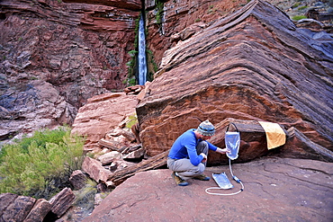
Male hiker filters water on a cliff-pinched patio near Deer Creek Falls in the Grand Canyon outside of Fredonia, Arizona November 2011. The 21.4-mile loop starts at the Bill Hall trailhead on the North Rim and descends 2000-feet in 2.5-miles through Coconino Sandstone to the level Esplanada then descends further into the lower canyon through a break in the 400-foot-tall Redwall to access Surprise Valley. Hikers connect Thunder River and Tapeats Creek to a route along the Colorado River and climb out Deer Creek.
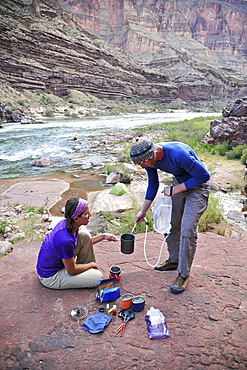
Hikers cook dinner on a cliff-pinched patio above camp and the Colorado River near Deer Creek Falls in the Grand Canyon outside of Fredonia, Arizona November 2011. The 21.4-mile loop starts at the Bill Hall trailhead on the North Rim and descends 2000-feet in 2.5-miles through Coconino Sandstone to the level Esplanada then descends further into the lower canyon through a break in the 400-foot-tall Redwall to access Surprise Valley. Hikers connect Thunder River and Tapeats Creek to a route along the Colorado River and climb out Deer Creek.
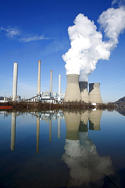
Water level view of a coal-fired power plant.
Female hiker cooks dinner on a cliff-pinched patio above camp and the Colorado River near Deer Creek Falls in the Grand Canyon outside of Fredonia, Arizona November 2011. The 21.4-mile loop starts at the Bill Hall trailhead on the North Rim and descends 2000-feet in 2.5-miles through Coconino Sandstone to the level Esplanada then descends further into the lower canyon through a break in the 400-foot-tall Redwall to access Surprise Valley. Hikers connect Thunder River and Tapeats Creek to a route along the Colorado River and climb out Deer Creek.
Hikers walk along Deer Creek Narrows in the Grand Canyon outside of Fredonia, Arizona November 2011. The 21.4-mile loop starts at the Bill Hall trailhead on the North Rim and descends 2000-feet in 2.5-miles through Coconino Sandstone to the level Esplanada then descends further into the lower canyon through a break in the 400-foot-tall Redwall to access Surprise Valley. Hikers connect Thunder River and Tapeats Creek to a route along the Colorado River and climb out Deer Creek.
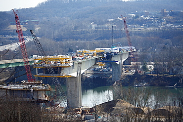
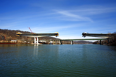
Eye-level view of the new I64 bridge under construction over the Kanawha River in downtown Charleston, WV.
Hikers follow a route along the Colorado River that connect Tapeats Creek and Thunder River to Deer Creek in the Grand Canyon outside of Fredonia, Arizona November 2011. The 21.4-mile loop starts at the Bill Hall trailhead on the North Rim and descends 2000-feet in 2.5-miles through Coconino Sandstone to the level Esplanada then descends further into the lower canyon through a break in the 400-foot-tall Redwall to access Surprise Valley. Hikers connect Thunder River and Tapeats Creek to a route along the Colorado River and climb out Deer Creek.
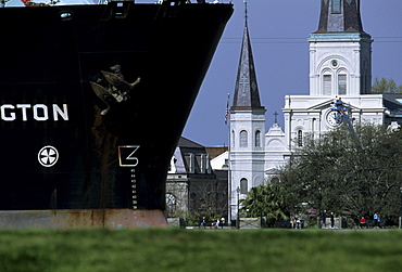
A freighter sailing down the Mississippi River past the French Quarter of New Orleans, Louisiana
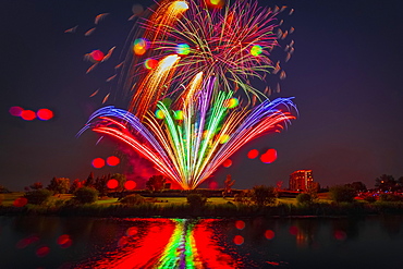
Colourful Fireworks Display Reflected In Water On Canada Day, Edmonton, Alberta, Canada
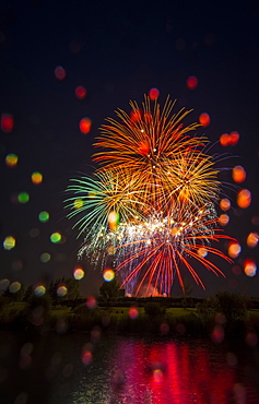
Colourful Fireworks Display Reflected In Water On Canada Day, Edmonton, Alberta, Canada
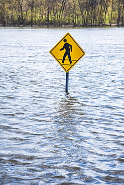
Pedestrian Crossing Sign In An Area Flooded By A River, Connecticut, United States Of America