Results
1 2 3 … 6 Next »
519 results found
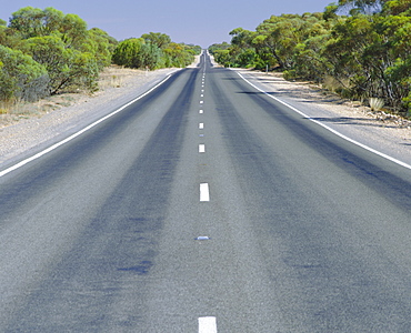
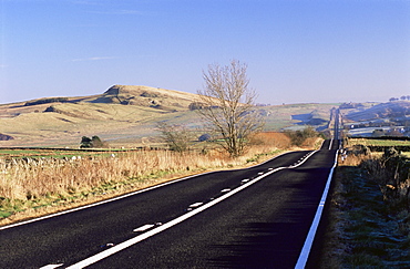
Long straight road, Hume highway, Victoria, Australia

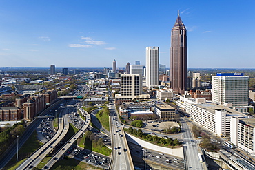
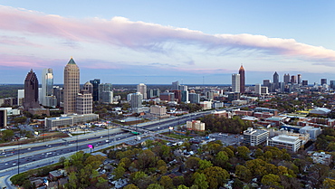
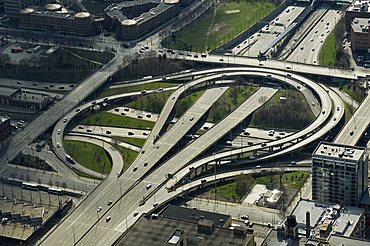
Aerial of highways leading to Atlanta, Georgia
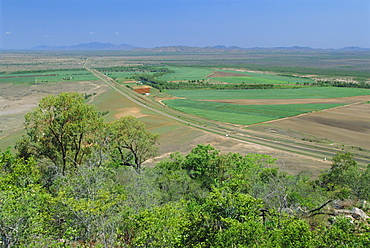
Sugar cane and other crops by the Bruce Highway south of Townsville, Queensland, Australia
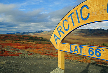
Arctic Circle crossing point on road across tundra, Dempster Highway, Yukon, Canada
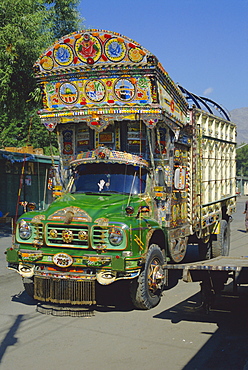
Typical decorated truck, Karakoram (Karakorum) Highway, Gilgit, Pakistan
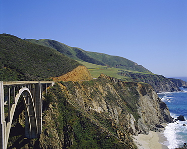
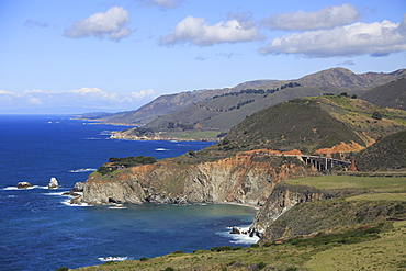
The coast and Bixby Bridge on the Pacific Highway, Route 1, California, USA
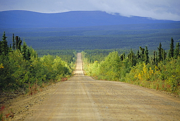
Taylor Highway, gravel road through pine forest only opens summer three months into 40 Mile goldfields area, E. Alaska, USA, North America
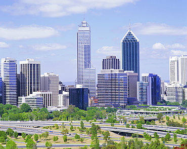
City skyline, Perth, Western Australia, Australia
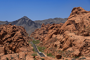
An RV Camper Van Recreational Vehicle travels the highway of Mouse's Tank Road through the Valley of Fire State Park, Nevada, United States of America, North America
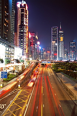
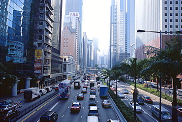
Gloucester Road at night, Causeway Bay, Hong Kong Island, Hong Kong, China, Asia
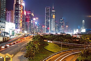
Causeway Bay at night, Hong Kong Island, Hong Kong, China, Asia
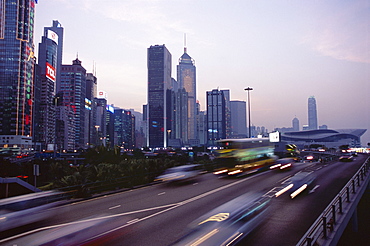
Expressway in the evening, Wan Chai, Hong Kong Island, Hong Kong, China, Asia
Roman Road, Sunny Rigg to east, Northumberland (Northumbria), England, United Kingdom, Europe

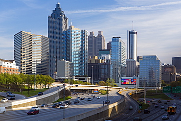
Elevated view over Interstate 85 passing the Atlanta skyline, Atlanta, Georgia, United States of America, North America
Interstate I-85 leading into Downtown Atlanta, Georgia, United States of America, North America
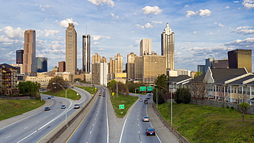
Elevated view over Freedom Parkway and the Downtown Atlanta skyline, Atlanta, Georgia, United States of America, North America
Interstate I-85 leading into Downtown Atlanta, Georgia, United States of America, North America
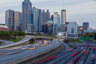
Elevated view over Interstate 85 passing the Midtown Atlanta skyline, Atlanta, Georgia, United States of America, North America

Elevated view over Freedom Parkway and the Downtown Atlanta skyline, Atlanta, Georgia, United States of America, North America
Elevated view over Interstate 85 passing the Atlanta skyline, Atlanta, Georgia, United States of America, North America
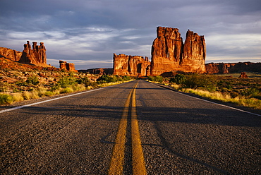
View of Courthouse Towers, The Organ and Three Gossips at dawn, Arches National Park, Utah, United States of America, North America
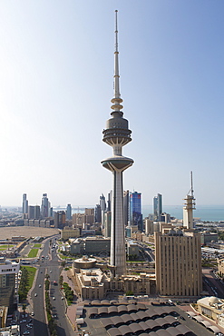
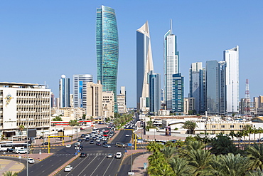
Elevated view of the modern city skyline and central business district, Kuwait City, Kuwait, Middle East

Elevated view of the modern city skyline and central business district, Kuwait City, Kuwait, Middle East
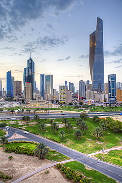
Elevated view of the modern city skyline and central business district, Kuwait City, Kuwait, Middle East

City skyline, Houston, Texas, United States of America, North America
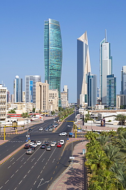
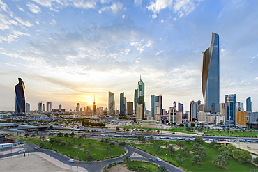
Elevated view of the modern city skyline and central business district with Liberation Tower, Kuwait City, Kuwait, Middle East

Elevated view of the modern city skyline and central business district, Kuwait City, Kuwait, Middle East
Elevated view of the modern city skyline and central business district, Kuwait City, Kuwait, Middle East
Elevated view of the modern city skyline and central business district, Kuwait City, Kuwait, Middle East
Car light trails and modern buildings near Beijing North Train Station, Xizhimen district, Beijing, China, Asia
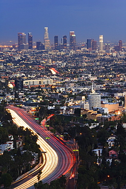
Downtown district skyscrapers and car lights on a city highway, Los Angeles, California, United States of America, North America
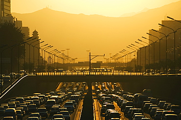
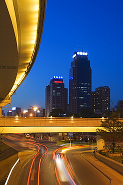
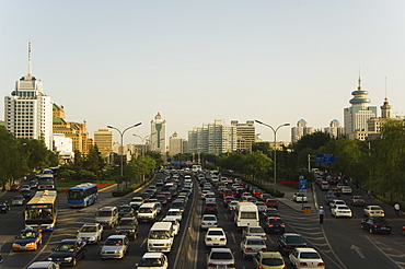
Sunset over city ring road during rush hour, Beijing, China, Asia
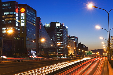
Car light trails and modern architecture on a city ring road, Beijing, China, Asia
Car light trails and modern architecture on a city ring road, Beijing, China, Asia
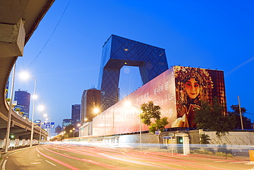
New CCTV Central Chinese Television building designed by Rem Koolhass of the Office for Metropolitan Architecture (OMA), in Guomao CBD, Beijing, China, Asia
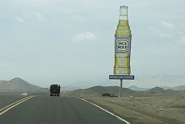
Transport truck on the Pan American highway in northern Peru, South AmericaInca Kola (The National Soda) sign on the side of the road
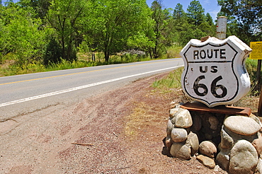
Road sign along historic Route 66, New Mexico, United States of America, North America
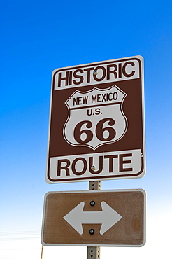
Road sign along historic Route 66, New Mexico, United States of America, North America
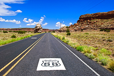
Road sign along historic Route 66, New Mexico, United States of America, North America
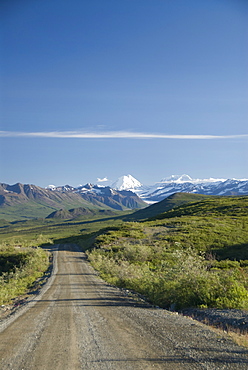
View down the Denali Highway, Alaska, United States of America, North America
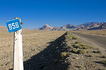
The Pamir highway, the Pamirs, Tajikistan, Central Asia
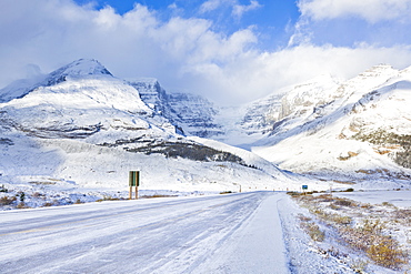
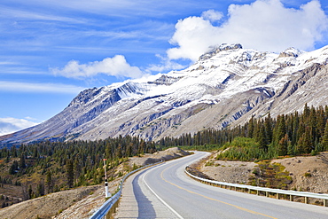
The Icefields Parkway road highway covered in ice at the Icefields Centre, Jasper National Park, UNESCO World Heritage Site, Alberta, Canadian Rockies, Canada, North America
The Icefields Parkway road highway through Jasper National Park, UNESCO World Heritage Site, Alberta, Canadian Rockies, Canada, North America
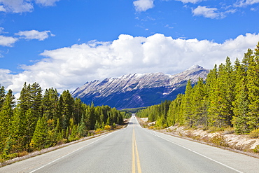
The Icefields Parkway road highway through Jasper National Park, UNESCO World Heritage Site, Alberta, Canadian Rockies, Canada, North America

Pamir Highway leading into wilderness, Kyrgyzstan, Central Asia
Aerial image of Silbury Hill, a prehistoric human-made chalk and clay mound near Avebury, UNESCO World Heritage Site, Wiltshire, England, United Kingdom, Europe
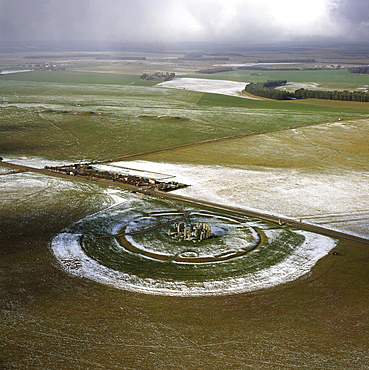
Aerial image of Stonehenge, prehistoric monument and stone circle in snow, UNESCO World Heritage Site, Salisbury Plain, Wiltshire, England, United Kingdom, Europe
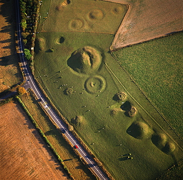
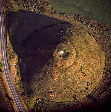
Aerial image of Winterbourne Poor Lot Round Barrows, Winterbourne Abbas, Dorset, England, United Kingdom, Europe
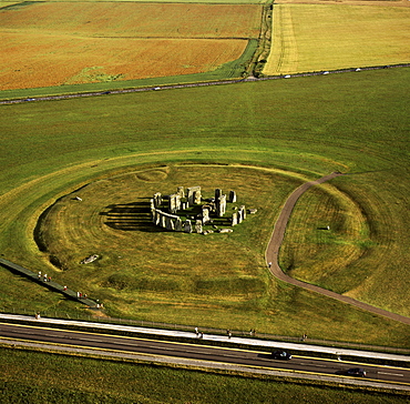
Aerial image of Stonehenge, prehistoric monument and stone circle, UNESCO World Heritage Site, Salisbury Plain, Wiltshire, England, United Kingdom, Europe
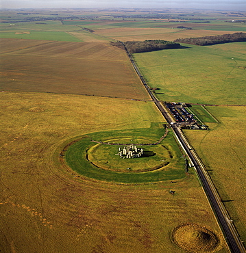
Aerial image of Stonehenge, prehistoric monument and stone circle, UNESCO World Heritage Site, Salisbury Plain, Wiltshire, England, United Kingdom, Europe
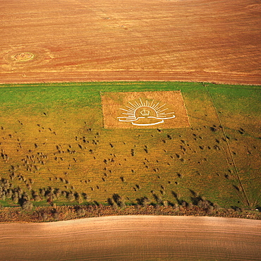
Aerial image of Lamb Down Military Badge, the badge of the Australian Commonwealth Military Forces, cut on a steep slope by the A36, Lamb Down, Wiltshire, England, United Kingdom, Europe
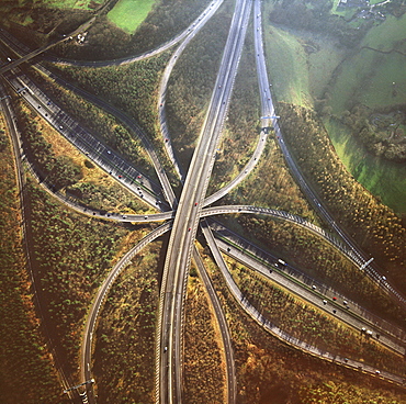
Aerial image of M25 and M23 Motorway Junction, Surrey, England, United Kingdom, Europe

Misty conditions at sunrise on a moorland road, Brecon Beacons National Park, Powys, Wales, United Kingdom, Europe
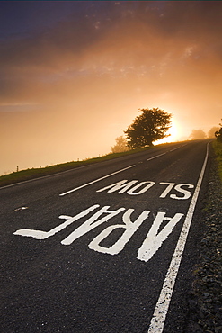
Painted road sign on a moorland road and misty sunrise, Brecon Beacons National Park, Powys, Wales, United Kingdom, Europe
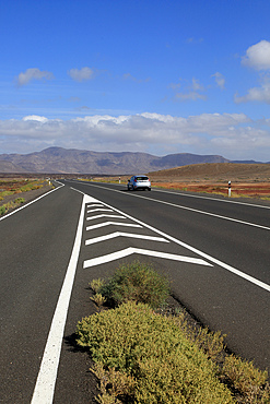
Chevron road lines on main highway through Malpais Grande National Park, Fuerteventura, Canary Islands, Spain, Atlantic, Europe
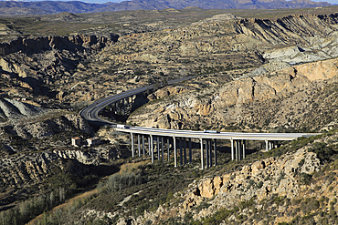
Motorway A7 road running through limestone desert, Paraje Natural de Karst en Yesos, Almeria, Andalusia, Spain, Europe
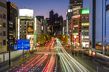
Traffic trails at night on busy road in Tokyo, Japan
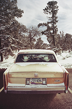
Vintage Cadillac, Snow, Snowy Trees, Parked, Route 66, Grand Canyon, USA
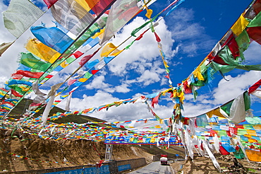
Prayer flags crossing the Friendship Highway between Lhasa and Kathmandu, Tibet, China, Asia
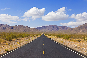
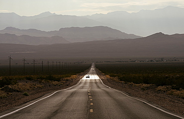
Straight road, Daylight Pass road, Highway 374 from Beatty Nevada, through the Grapevine mountains of the Amargosa Range to Death Valley, with Mesquite bushes along the roadside, Death Valley National Park, California Nevada border, United States of America, North America
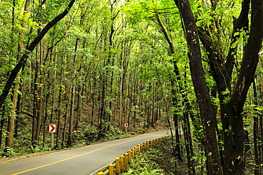
Mahogany forest, Bohol, Philippines, Southeast Asia, Asia
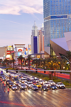
Hotels and casinos along the Strip, Las Vegas, Nevada, United States of America, North America
Sunset and highway on Prince Edward Island, Canada, North America

Empty Road, Highway 163, Monument Valley, Utah, United States of America, North America
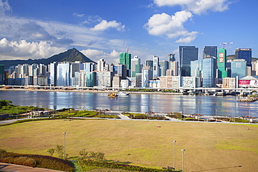
Runway Park on old Kai Tak airport and skyscrapers of Kwun Tong, Kai Tak, Kowloon, Hong Kong, China, Asia
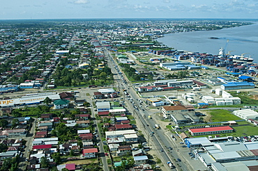
Aerial view of Paramaribo and the Suriname River, Paramaribo, Suriname, South America
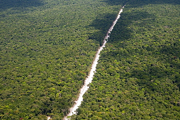
Main highway of Guyana cutting through the rainforest, Guyana, South America
Highway 190 through Death Valley National Park, California, United States of America, North America
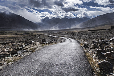
Road leading out of Kharsa village, Ladakh, India, Himalayas, Asia

Traffic over Lions Gate Bridge in the autumn, Vancouver British Columbia, Canada, North America
Big Sur Coastline, Bixby Creek Bridge, Route 1, Highway 1, Pacific Coast Highway, Pacific Ocean, California, United States of America, North America
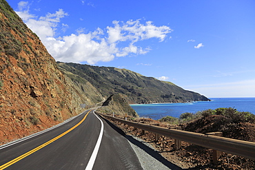
Big Sur Coastline, Route 1, Highway 1, Pacific Coast Highway, Pacific Ocean, California, United States of America, North America
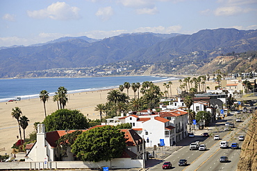
Pacific Coast Highway, Beach, Santa Monica, Malibu Mountains, Los Angeles, California, United States of America, North America
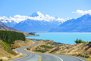
Mount Cook, Highway 80 S curve road and Lake Pukaki, Mount Cook National Park, UNESCO World Heritage Site, South Island, New Zealand, Pacific
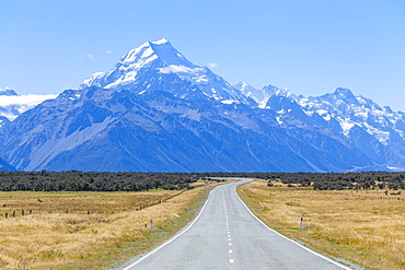
Mount Cook, empty road Highway 80, Mount Cook National Park, UNESCO World Heritage Site, South Island, New Zealand, Pacific
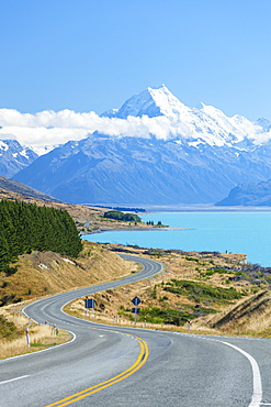
Mount Cook, Highway 80 S curve road and Lake Pukaki, Mount Cook National Park, UNESCO World Heritage Site, South Island, New Zealand, Pacific
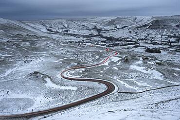
Car light trails on winding road in winter, Edale, Derbyshire, England, United Kingdom, Europe
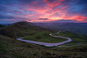
Sunset looking towards Rushup Edge and the winding Edale Road, Derbyshire, England, United Kingdom, Europe
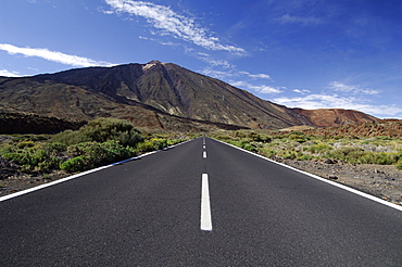
Mount Teide (Pico de Teide), Tenerife, Canary Islands, Spain
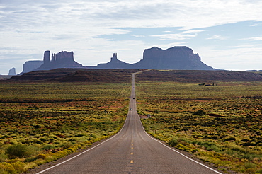
Highway 163 to Monument Valley, Utah, United States of America, North America
Downtown buildings in Fuchengmen area, Beijing, China, Asia
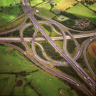
Aerial image of M25 and M11 Motorway Junction, Essex, England, United Kingdom, Europe
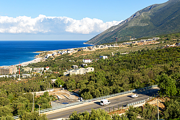
Large scale tourist development construction building work, Drymades Beach, Ionian Sea, Albanian Riviera, Dhermi, Albania, Europe
View of Chicago from the Sears Tower Sky Deck, Chicago, Illinois, USA
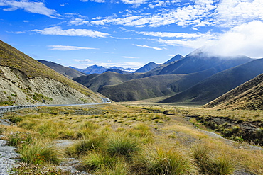
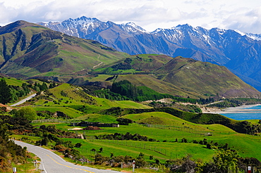
Beautiful scenery on the highway around the Lindis Pass, Otago, South Island, New Zealand, Pacific
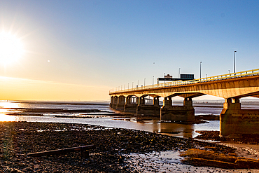
Sunset view of the Prince of Wales Bridge, the Second Severn Crossing, M4 motorway over the River Severn, reflections on water, clear skies, and warm sunlight, between England and Wales, United Kingdom, Europe
Highway to Milford Sound via Lake Tena Vu, South Island, New Zealand, Pacific
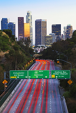
Pasadena Freeway (CA Highway 110) leading to Downtown Los Angeles, California, United States of America, North America
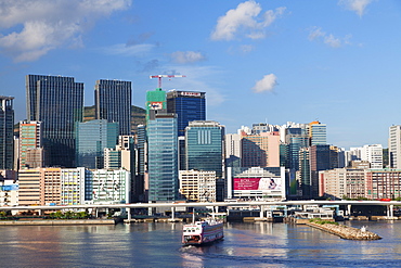
Skyscrapers of Kwun Tong, Kowloon, Hong Kong, China, Asia
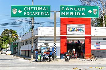
Vehicles road sign on highway 307, for Chetumal Escarcega and Cancun Merida, Bacalar, Quintana Roo, Mexico, North America
Connaught Road, Central, Hong Kong Island, Hong Kong, China, Asia
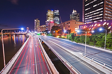
Highway in Brisbane, car light trails at night, Brisbane, Queensland, Australia, Pacific
Highway 190 through Death Valley National Park, California, United States of America, North America

City skyline and Interstate, Houston, Texas, United States of America, North America
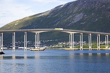
Tromso Bridge, cantilever road bridge in the city of Tromso, Norway, Scandinavia, Europe
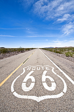
Historic Route 66 sign near Amboy, California, United States of America, North America
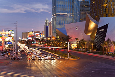
Hotels and casinos along The Strip, Las Vegas, Nevada, United States of America, North America
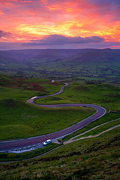
Amazing sunset looking towards Rushup Edge and the winding Edale Road, Derbyshire, England, United Kingdom, Europe
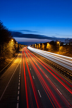
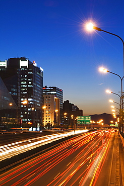
The M56 Motorway at night with traffic trails looking westbound, Cheshire, England, United Kingdom, Europe
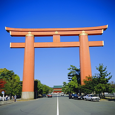
Heian-Jingu Shrine, Great Torii Gate, Kyoto, Japan