Results
50 results found
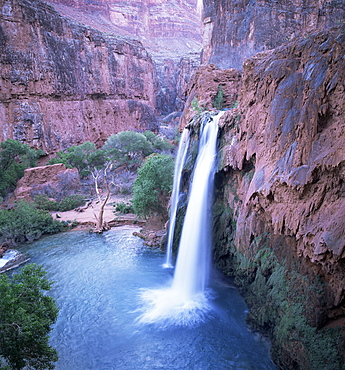
Havasu Falls, Grand Canyon, United States of America (U.S.A.), North America
The fast-flowing Tokumm Creek swollen by summer snowmelt, Marble Canyon, Kootenay National Park, UNESCO World Heritage Site, British Columbia (B.C.), Canada, North America
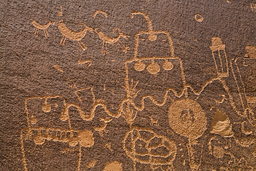
Petroglyphs, Barrier Canyon Style, Indian Creek Corridor, near Monticello, Utah, United States of America, North America
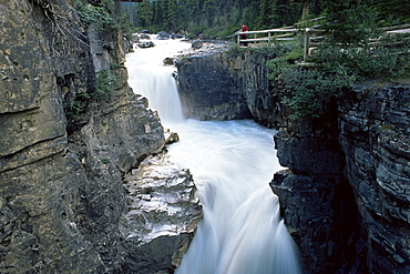
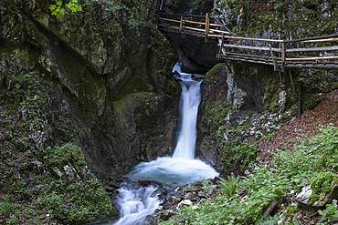
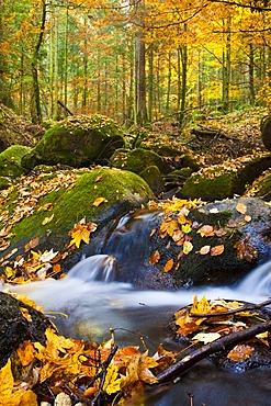
Johnston Canyon Creek, Banff National Park, Alberta, UNESCO World Heritage Site, Canada, North America
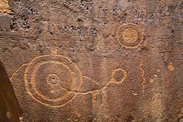
Petroglyphs, Barrier Canyon Style, Indian Creek Corridor, near Monticello, Utah, United States of America, North America
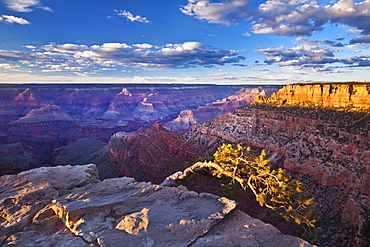
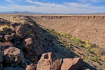
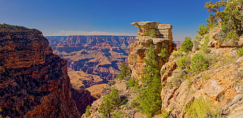
Pipe Creek Vista Point Overlook, South Rim, Grand Canyon National Park, UNESCO World Heritage Site, Arizona, United States of America, North America
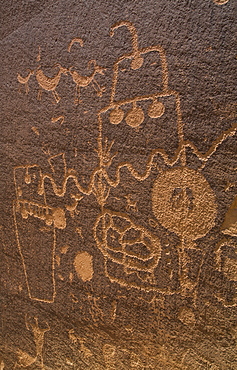
Petroglyphs, Barrier Canyon Style, Indian Creek Corridor, near Monticello, Utah, United States of America, North America
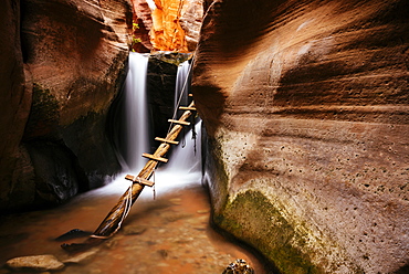
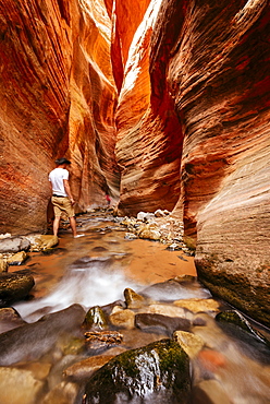
Kanarra Creek Canyon, Kanarraville, Utah, United States of America, North America

Petroglyphs, Barrier Canyon Style, Indian Creek Corridor, near Monticello, Utah, United States of America, North America
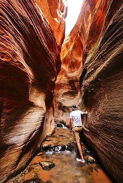
Kanarra Creek Canyon, Kanarraville, Utah, United States of America, North America
Kanarra Creek Canyon, Kanarraville, Utah, United States of America, North America
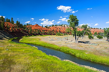
Red canyon in the background of a little creek, Devils Tower National Monument, Wyoming, United States of America, North America
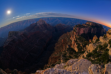
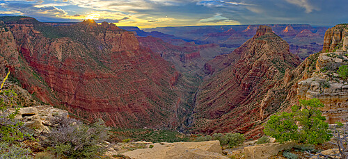
View from Cape Royal, below is Vishnu Creek running between Vishnu Temple on the left with Wotans Throne on the right at twilight with the Moon rising, Grand Canyon National Park, UNESCO World Heritage Site, Arizona, United States of America, North America
Hance Creek at sunset with Sinking Ship on the left and Coronado Butte right of center right, Grand Canyon, Grand Canyon National Park, UNESCO World Heritage Site, Arizona, United States of America, North America
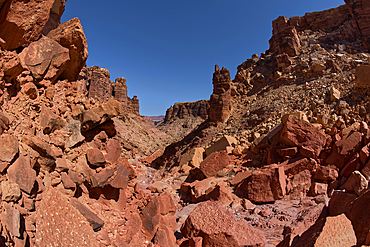
Giant boulders from a rock slide in a narrow section of the south fork of Soap Creek Canyon at Marble Canyon, Arizona, United States of America, North America
Silver Creek Canyon in the Agua Fria National Monument, Black Canyon City Arizona, USA
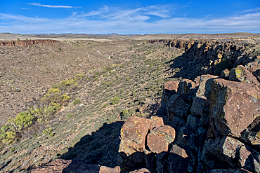
Silver Creek Canyon in the Agua Fria National Monument. Located north of Black Canyon City Arizona
Silver Creek Canyon in the Agua Fria National Monument. Located north of Black Canyon City Arizona
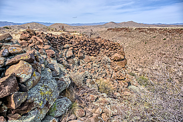
Ancient wall of the Fort Silver Indian Ruins overlooking Silver Creek Canyon in Agua Fria National Monument of Arizona
View of San Francisco Peaks from a cliff at the end of the Telephone Trail north of Sedona with Oak Creek Canyon on the left, Arizona, United States of America, North America
Photographer Skip Brown on a stand up paddle board at the mouth of Havasu Creek in the Grand Canyon, Arizona, United States of America, North America

Mountain creek with waterfalls near Maligne Canyon, Athabasca River Basin, Jasper National Park, UNESCO World Heritage Site, Alberta, Canadian Rockies, Canada, North America
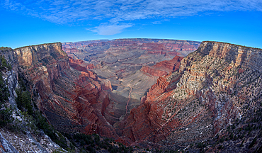
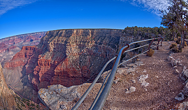
Monument Creek viewed from along the rim trail halfway between The Abyss and Monument Creek Vista Overlook with Mohave Point on right and Pima Point on the left in the distance, Grand Canyon, Arizona, United States of America, North America
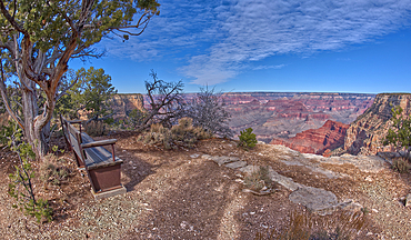
A bench along the rim trail overlooking Grand Canyon South Rim off Hermit Road halfway between Monument Creek Vista and The Abyss, Grand Canyon, Arizona, United States of America, North America
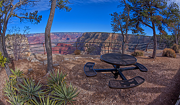
Steel picnic table along the rim trail overlooking Grand Canyon South Rim off Hermit Road halfway between Monument Creek Vista and The Abyss, Grand Canyon, Arizona, United States of America, North America

The Great Mohave Wall at Grand Canyon viewed just west of Monument Creek, part of the canyon below this cliff wall, Grand Canyon National Park, UNESCO World Heritage Site, Arizona, United States of America, North America

Wet Beaver Creek Canyon viewed from the south end of White Mesa in Coconino National Forest, Arizona, United States of America
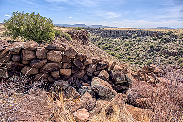
Ancient wall of the Fort Silver Indian Ruins overlooking Silver Creek Canyon in Agua Fria National Monument of Arizona
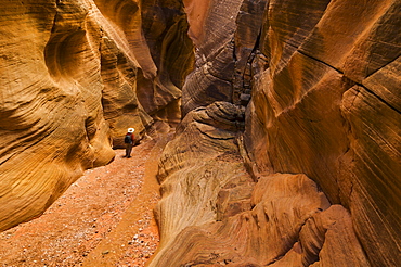
Hiker walking down the stream between eroded entrada sandstone slot canyon walls at Willis creek, Grand Staircase-Escalante National Monument, Kane County, Utah, United States of America, North America

Wet Beaver Creek Canyon in the Coconino National Forest, Arizona, United States of America
Stone pillars overlooking Papago Creek Canyon on the south rim of the Grand Canyon, Grand Canyon National Park, UNESCO World Heritage Site, Arizona, United States of America, North America
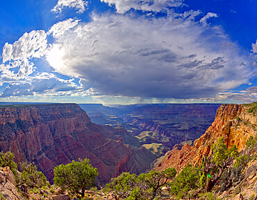
A late day storm viewed from the cliffs above Papago Creek at Grand Canyon, Grand Canyon National Park, UNESCO World Heritage Site, Arizona, United States of America, North America
An overlook halfway between the Abyss and Monument Creek Vista, Grand Canyon, Arizona, United States of America, North America
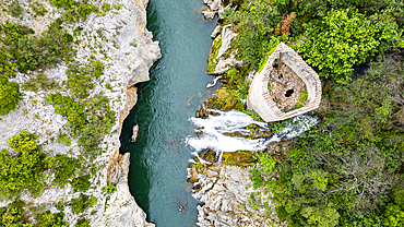
Aerial of an old watchtower in the Herault gorge, UNESCO World Heritage Site, Causses and Cevennes, Herault, Occitanie, France, Europe
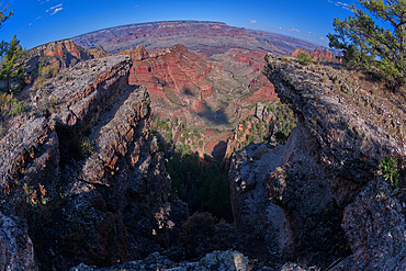
Fisheye view of a dry waterfall where the Hance Creek drains into Hance Canyon at Grand Canyon South Rim, Grand Canyon National Park, UNESCO World Heritage Site, Arizona, United States of America, North America

Hance Creek between Sinking Ship on the left and Coronado Butte right of center right at Grand Canyon, Grand Canyon National Park, UNESCO World Heritage Site, Arizona, United States of America, North America
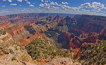
View of Grand Canyon from the south cliffs of Cape Final on the North Rim with Unkar Creek below and right of centre the pointed peak of Freya's Castle, Grand Canyon National Park, UNESCO World Heritage Site, Arizona, United States of America, North America
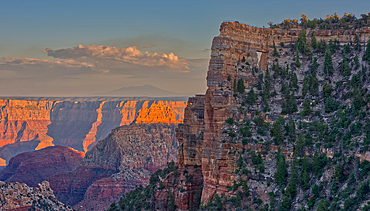
Closeup of Angel's Window at Cape Royal on North Rim above Unker Creek near sundown, with brown haze on the horizon smoke from a wildfire near the park, Grand Canyon National Park, UNESCO World Heritage Site, Arizona, United States of America, North America

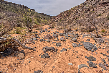
The North Fork Abyss of the Lower Soap Creek Canyon joining the confluence of the South Fork in Marble Canyon, Arizona, United States of America, North America

Angel's Window at Cape Royal on North Rim above Unker Creek near sundown, with smoke from a wildfire creating brown haze on the horizon, Gand Canyon National Park, UNESCO World Heritage Site, Arizona, United States of America, North America
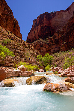
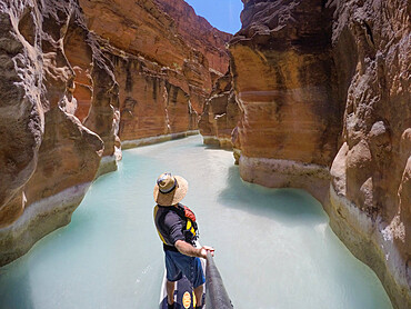
Hikers in Havasu Creek, Grand Canyon National Park, UNESCO World Heritage Site, Arizona, United States of America, North America

Grand Canyon viewed from a cliff overlooking Papago Creek with Papago Point on the right, Grand Canyon National Park, UNESCO World Heritage Site, Arizona, United States of America, North America

An overhead view of a slot canyon in the south fork of Soap Creek Canyon at Marble Canyon, Arizona, United States of America, North America
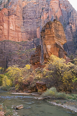
Zion National Park, Utah, United States of America, North America

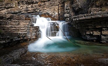
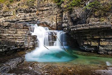
Cascade on the creek through Red Rock Canyon, Waterton Lakes National Park, Alberta, Canada, North America
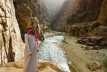
National Park of Al Mujeb, Jordan, Middle East
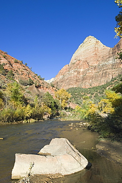
Zion National Park, Utah, United States of America, North America

Grand Canyon viewed from a cliff overlooking Papago Creek, with Papago Point just right of center, Grand Canyon National Park, UNESCO World Heritage Site, Arizona, United States of America, North America

Zion National Park, Utah, United States of America, North America
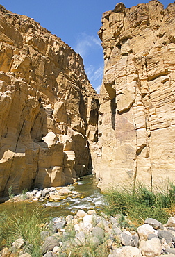
Wadi Mujib Gorge, Wadi Mujib, Jordan, Middle East
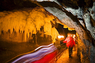
Hike with flaming torches in the Partnachklamm gorge near Garmisch Partenkirchen, Upper Bavaria, Germany
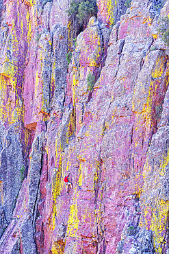
Man rock climbing, Oak Creek Canyon, Arizona, USA, North America

Man rock climbing, Oak Creek Canyon, Arizona, USA, North America
Icicles in Partnachklamm gorge near Garmisch Partenkirchen, Upper Bavaria, Germany, Europe
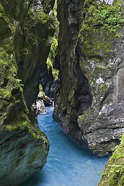
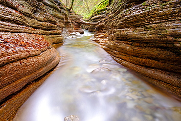
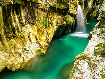
Tolmin gorge, gorge with moss-covered steep rock walls, wild stream with blue water, Slovenia, Europe
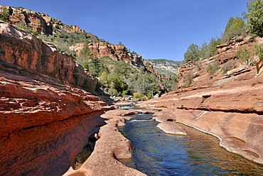
Oak Creek, Slide Rock State Park, Sedona, Red Rock Country, Arizona, USA
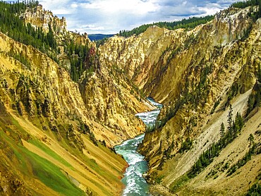
Lower Falls, most popular waterfall in Yellowstone, are located in head of the Grand Canyon in Yellowstone River. The yellow rocks gave name of Yellowstone National Park, Wyoming, United States
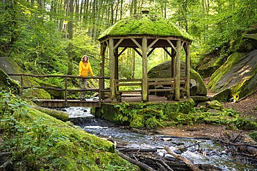
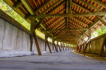
Hiker in the pavilion, the Moosalb stream in the forest in the Karlstal Gorge. Karlstal Gorge nature reserve, Karlstal, Palatinate Forest, Rhineland-Palatinate, Germany

Bridge over Dudh Koshi river, Sagarmatha National Park, Khumbu, Nepal
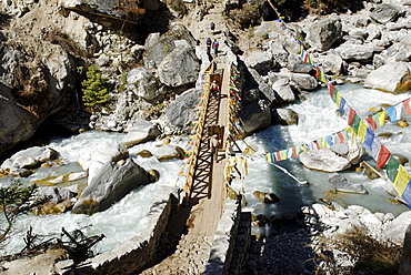
Bridge over Dudh Koshi river, Sagarmatha National Park, Khumbu, Nepal
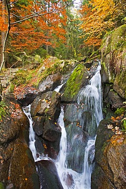
Gertelbachwasserfaelle water falls, Gertelbachschlucht gorge, Buehl, Buehlertal valley, Black Forest, Baden-Wuerttemberg, Germany, Europe

River in the Zemmgrund valley of the Naturpark Zillertaler Alpen mountain nature park, Zillertal, Tyrol, Austria, Europe
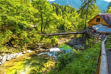
Wooden bridge and restaurant above radovna river flowing through vintgar gorge near bled, slovenia, during a sunny summer day
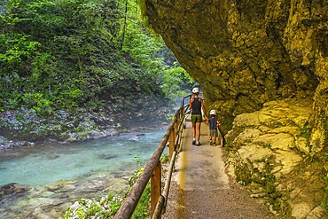
Tourists walking along the radovna river in vintgar gorge, near bled, slovenia, enjoying the stunning scenery and peaceful surroundings
Tourists wearing helmets are enjoying a summer walk along the stunning turquoise radovna river flowing through the vintgar gorge near bled, slovenia
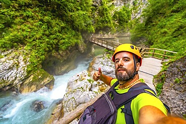
Tourist wearing helmet and backpack hiking in vintgar gorge, near bled, slovenia, making thumbs up sign by the radovna river
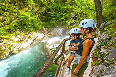
Mother carrying her son while observing stunning turquoise radovna river rapids flowing through vintgar gorge near bled, slovenia
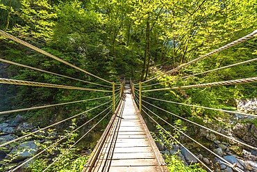
Wooden suspension bridge crossing over a clear stream in tolmin gorge, slovenia, surrounded by lush green foliage on a sunny summer day
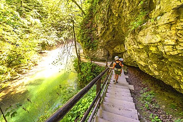
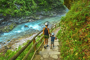
Tourists wearing helmets are walking down wooden stairs along the radovna river in vintgar gorge, a popular tourist destination near bled, slovenia

Mountain river Soca flows through narrow canyon, Soca Valley, Triglav National Park, Bovec, Slovenia, Europe

Mountain river Soca flows through narrow canyon, Soca Valley, Triglav National Park, Bovec, Slovenia, Europe

Mountain river Soca flows through narrow canyon, Soca Valley, Triglav National Park, Bovec, Slovenia, Europe

Huka Falls
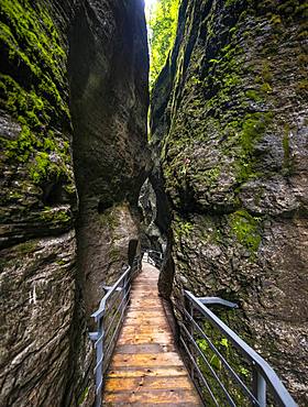
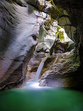
Moznica gorge, torrent in narrow canyon, Bovec, Soca valley, Triglav National Park, Slovenia, Europe
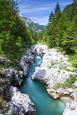
Soca River with crystal clear, turquoise blue water, Soca Valley, Triglav National Park, Kanin Mountains, Julian Alps, Slovenia, Europe
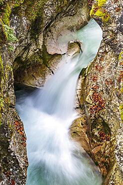
Gorge, stream, Taugl, Tauglbach, Tauglbachklamm, Hallein District, Salzburg, Austria, Europe

Gorge, stream, Taugl, Tauglbach, Tauglbachklamm, Hallein District, Salzburg, Austria, Europe
Aare Gorge at Haslital valley or Hasli Valley, Berner Oberland, Meiringen, Canton of Bern, Switzerland, Europe

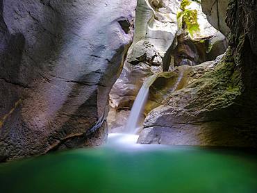
Waterfall in Soca Canyon, Soca valley, Triglav National Park, Slovenia, Europe
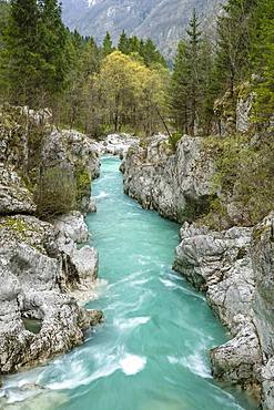
Emerald green wild river Soca flows through narrow canyon, Soca Valley, Triglav National Park, Bovec, Slovenia, Europe
Path along a rock face, mountain stream flowing through a narrow gorge, gorge with river, Wolfsklamm, Stans, Tyrol, Austria, Europe
High bridge, Georgenberg rock monastery and pilgrimage church, St. Georgenberg, Wolfsklamm, Stans bei Schwaz, Inntal, Tyrol, Austria, Europe
River Soca flows through narrow canyon, Soca Valley, Triglav National Park, Bovec, Slovenia, Europe
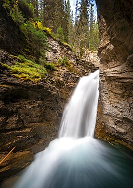
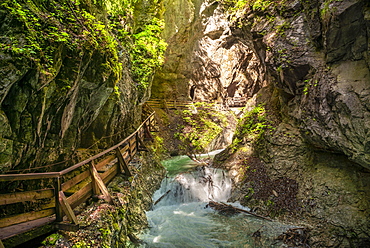
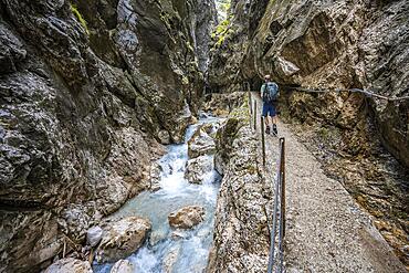
Waterfall, Lower Falls, Mountain River in a Gorge, Johnston Creek in Johnston Canyon, Bow Valley, Banff National Park, Rocky Mountains, Alberta, Canada, North America
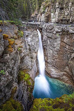
Waterfall, Upper Falls, mountain river in a gorge, Johnston Creek in Johnston Canyon, Bow Valley, Banff National Park, Rocky Mountains, Alberta, Canada, North America

Waterfall, Lower Falls, Mountain River in a Gorge, Johnston Creek in Johnston Canyon, Bow Valley, Banff National Park, Rocky Mountains, Alberta, Canada, North America
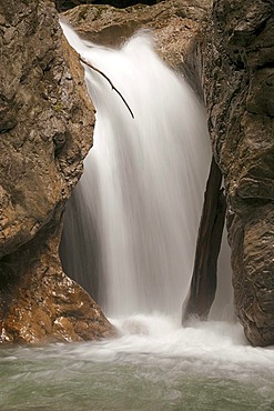
Waterfall at a mountain river, Johnston Creek in Johnston Canyon, Bow Valley, Banff National Park, Rocky Mountains, Alberta, Canada, North America
Climbers on their way through the Hoellentalklamm, narrow rock gorge with mountain stream, Wetterstein Mountains, Garmisch-Partenkirchen, Werdenfelser Land, Upper Bavaria, Bavaria, Germany, Europe
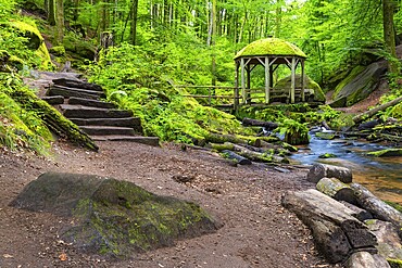
Stream, stone steps, pavilion, Karlstal Gorge, Trippstadt, Pfläzerwald, Rhineland-Palatinate, Germany
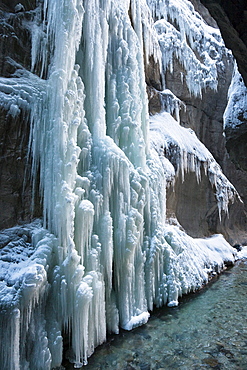
Waterfall in Taugler Strubklamm, Taugl, Hallein District, Salzburg, Austria, Europe
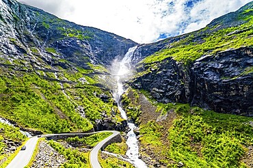
Trollstigen /Troll Staircase/ - the most popular tourist spot in Norway. The huge Stigfossen waterfall. The road serpentine meanders picturesquely on the green slopes of the canyon
Wooden footbridge over waterfall in the Dr. Vogelgesang gorge at Trattenbach, Spital am Pyhrn, Upper Austria, Austria, Europe
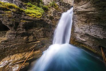
Waterfall, Lower Falls, Mountain River in a Gorge, Johnston Creek in Johnston Canyon, Bow Valley, Banff National Park, Rocky Mountains, Alberta, Canada, North America
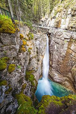
Waterfall, Upper Falls, Mountain River in a Gorge, Johnston Creek in Johnston Canyon, Bow Valley, Banff National Park, Rocky Mountains, Alberta, Canada, North America

Aerial view, gorge with river Torrent de Pareis, Sa Calobra, Majorca, Balearic Islands, Spain, Europe
Waterfall in the Wolfsklamm gorge, Stans, Karwendel Mountains, Tyrol, Austria, Europe
Gertelbach brook, Gertelbachschlucht gorge, Buehl, Buehlertal valley, Black Forest, Baden-Wuerttemberg, Germany, Europe
Waterfall in Taugler Strubklamm, Taugl, Hallein District, Salzburg, Austria, Europe
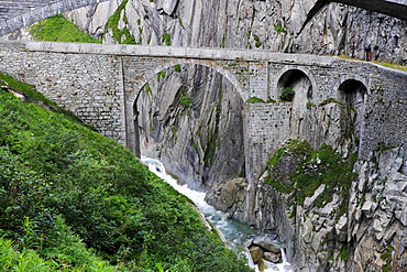
Historic DevilÃs Bridge crossing Schoellenen Gorge with Reuss River, canton of Uri, Switzerland, Europe
Waterfall at a mountain river, Johnston Creek in Johnston Canyon, Bow Valley, Banff National Park, Rocky Mountains, Alberta, Canada, North America