Results
7 results found
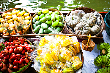
Top view of boat full of fresh fruits on sale, Floating Market, Bangkok, Thailand
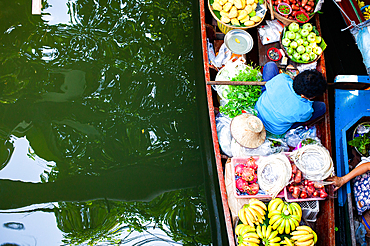
Top view of boat full of fresh fruits on sale, Floating Market, Bangkok, Thailand
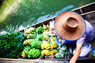
Top view of boat full of fresh fruits on sale, Floating Market, Bangkok, Thailand
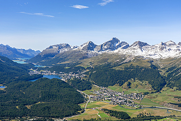
View of St. Moritz, Celerina and the Engadin lakes from top of Muottas Muragl, Canton of Grisons, Switzerland
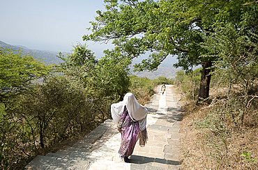
Jain pilgrim covered in white shawl, climbing Shatrunjaya Hill to Jain shrines, hoping to achieve Nirvana, Palitana, Gujarat, India, Asia
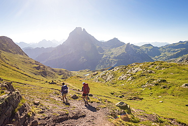
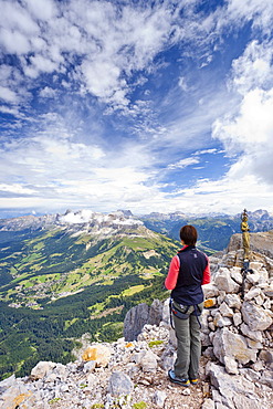
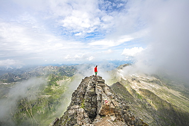
Walkers descend from the top of Col d'Ayous on the GR10 trekking route in the French Pyrenees, Pyrenees Atlantiques, France, Europe
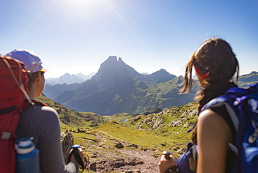
Walkers admire the view of Pic du Midi d'Ossau from the top of Col d'Ayous on the GR10 trekking route, Pyrenees Atlantiques, France, Europe

Arrabal 11, Pintxos, Tapas Bar, calle Arrabal 11, Santander, Camino de la Costa, Coastal route, Camino del Norte, Way of Saint James, Camino de Santiago, pilgrims way, province of Cantabria, Cantabria, Northern Spain, Spain, Europe
Two traders on the wayside of the Pilgrimage route, Emei Shan, Sichuan province, China, Asia
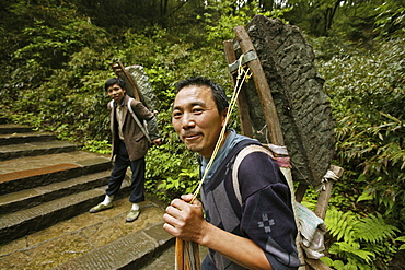
Two porters carrying heavy load on the pilgrimage route, Emei Shan, Sichuan province, China, Asia
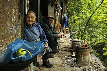
Two traders on the wayside of the Pilgrimage route, Emei Shan, Sichuan province, China, Asia
Climber crossing the Latemar massif, fixed rope route, Dolomites, on the Torre Diamantidi peak, in the back the Rosengarten group, South Tyrol, Italy, Europe
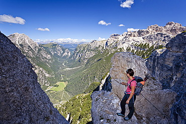
Mountain climber ascending Monte Piano climbing route, Alta Pusteria, in front of the Val di Landro Valley, Dolomites, Alto Adige, Italy, Europe
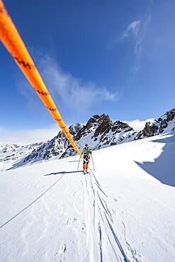
Ski tourer with rope, rope team on the Vadret da Porchabella glacier on the ascent to the summit of Piz Kesch, mountain landscape in winter, alpine tour, ski tour Bündner Haute Route, Albula Alps, Rhaetian Alps, Grisons, Eastern Switzerland, Switzerland
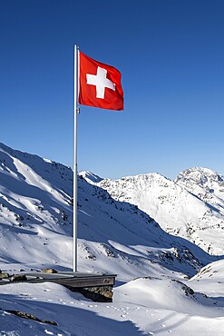
Swiss flag in front of mountain landscape in winter, mountain panorama with the peaks of the Bergüner Stöcke Tinzenhorn and Piz Ela, view at the Keschhütte in winter, Bündner Haute Route, Albula Alps, Rhaetian Alps, Grisons, Eastern Switzerland, Switzerland
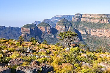
Blyde River Canyon with Three Rondawels peak, view of canyon and table mountains, canyon landscape, Three Rondavels Viewpoint, Panorama Route, Mpumalanga, South Africa
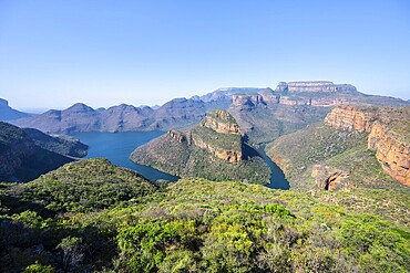
Panorama, Blyde River Canyon with Three Rondawels peak, view of canyon with Blyde River and Table Mountains, canyon landscape, Panorama Route, Mpumalanga, South Africa
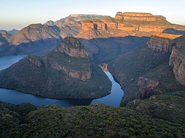
Sunset at Blyde River Canyon with Three Rondawels peak, view of canyon with Blyde River and table mountains in the evening light, canyon landscape, Panorama Route, Mpumalanga, South Africa
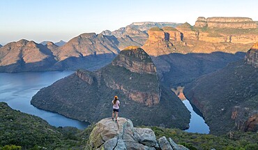
Hiker enjoying panorama, Blyde River Canyon with summit Three Rondawels, view of canyon with river Blyde River and table mountains, canyon landscape, Panorama Route, Mpumalanga, South Africa
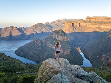
Hiker enjoying panorama, Blyde River Canyon with summit Three Rondawels, view of canyon with river Blyde River and table mountains, canyon landscape, Panorama Route, Mpumalanga, South Africa

Rock climbers on Hindelanger climbing route, Oberstdorf, Allgaeu, Bavaria, Germany, Europe

Aerial view of sand dunes in the Gobi desert with caravan route, Silk Road, Dunhuang, Gansu, China, Asia

Aerial view, RWE Power Kraftwerk Westfalen power plant, Schmehausen, Hamm, Ruhrgebiet region, North Rhine-Westphalia, Germany, Europe
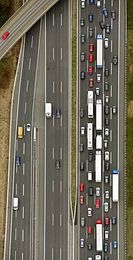
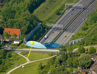
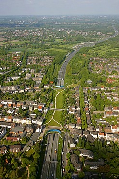
Aerial photo, motorway bridge, traffic jam, Kamen, Ruhr Area, North Rhine-Westphalia, Germany, Europe
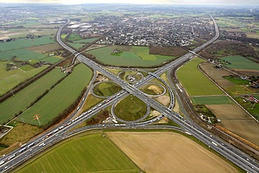
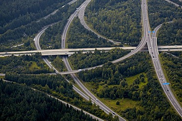
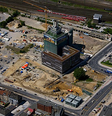
Aerial photo, Kamen cross, junction A1 A2, Kamen, Ruhr area, North Rhine-Westphalia, Germany, Europe

Aerial photo, Kamen cross, junction A1 A2, Kamen, Ruhr Area, North Rhine-Westphalia, Germany, Europe
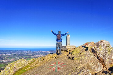
A male hiker celebrating the climb to the top of Mount Adarra in Urnieta. Gipuzkoa, Basque Country
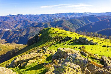
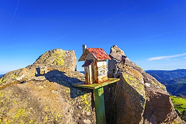
Beautiful landscape at the top of Mount Adarra in Urnieta. Gipuzkoa, Basque Country
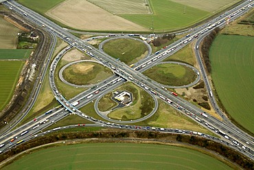
Aerial photo, Kamen cross, junction A1 A2, Kamen, Ruhr area, North Rhine-Westphalia, Germany, Europe

Aerial photo, Kamen cross, junction A1 A2, Kamen, Ruhr Area, North Rhine-Westphalia, Germany, Europe
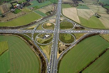
Aerial photo, Kamen cross, junction A1 A2, Kamen, Ruhr area, North Rhine-Westphalia, Germany, Europe
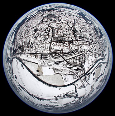
Aerial view, fisheye, Ruhr river, Hohenheide, Froendenberg, Ruhrgebiet area, North Rhine-Westphalia, Germany, Europe
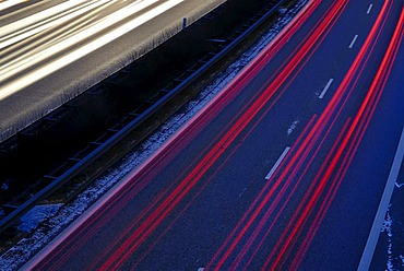
Rush hour, traffic, long exposure, Kiel, Schleswig-Holstein, Germany, Europe
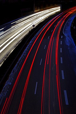
Rush hour, traffic, long exposure, Kiel, Schleswig-Holstein, Germany, Europe
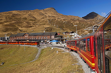
Kleine Scheidegg mountain pass with Jungfraubahn, Mt Jungfrau rail service, Top of Europe, Bernese Oberland, Canton Bern, Switzerland, Europe
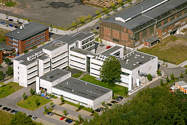
Aerial photo, Phoenix-West, MST.Factory Dortmund, Technology Centre, Dortmund, Ruhr area, North Rhine-Westphalia, Germany, Europe

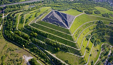
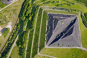
Aerial view, tailings dam, waste dump, landscape construction with an amphitheater, Halde Haniel, Bottrop, Ruhr Area, North Rhine-Westphalia, Germany, Europe
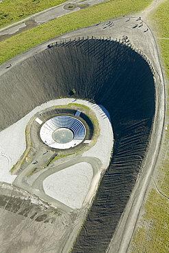
Aerial view, tailings dam, waste dump, landscape construction with an amphitheater, Halde Haniel at Bergwerk Prosper-Haniel colliery, shaft 1 2 Bottrop, Ruhr Area, North Rhine-Westphalia, Germany, Europe
Aerial view, mine Graf Bismarck 3, 5, A2 motorway cover, Schachtzeichen RUHR.2010 art installation, Gelsenkirchen, Ruhrgebiet region, North Rhine-Westphalia, Germany, Europe
Aerial view, mine Hugo I 1, 2, with Halde Runge heap and view point, Schachtzeichen RUHR.2010, Gelsenkirchen, Ruhrgebiet region, North Rhine-Westphalia, Germany, Europe

View from the Via Ferrata d'Trincee, climbing route above the Fedaia Pass, looking towards Gran Vernel and Marmolada mountains, Dolomites, above the Fedaia Pass and Lake Fedaia, Trentino, Italy, Europe
Hiker on the summit of the Hochgolling with rising fog, Schladminger Höhenweg, Schladminger Tauern, Schladming, Steiermark, Austria, Europe
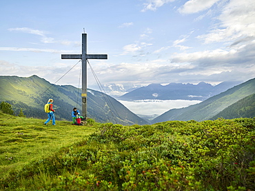
Hikers at summit cross, Kemater Alm, Kalkkögel, Tyrol, Austria, Europe

Hot-air balloon above an arid plain and isolated mountain ridges, at dawn, Namib Desert, aerial view from a second balloon, NamibRand Nature Reserve, Namibia, Africa
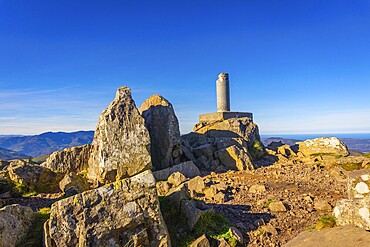
Procious summit of Mount Adarra in Urnieta. Gipuzkoa, Basque Country
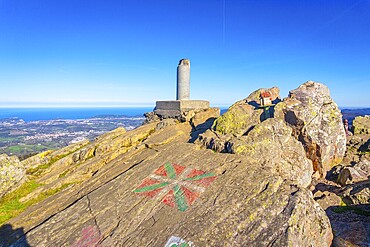
Procious summit of Mount Adarra in Urnieta. Gipuzkoa, Basque Country
Beautiful sculpture on the top of Mount Adarra in Urnieta. Gipuzkoa, Basque Country
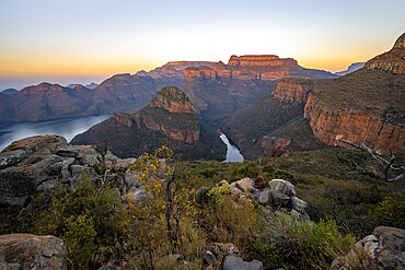
Sunset at Blyde River Canyon with Three Rondawels peak, view of canyon with Blyde River and Mesa Mountains in the evening light, canyon landscape, Panorama Route, Mpumalanga, South Africa, Africa
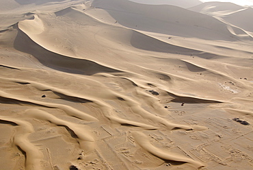
Aerial view of sand dunes with caravan route in the Gobi desert, silk road, Dunhuang, Gansu, China, Asia
Aerial view, mine Graf Bismarck 3.5, Gelsenkirchen, Ruhrgebiet region, North Rhine-Westphalia, Germany, Europe

Souvenir, Route 66, Seligman, Arizona, USA, North America
Aerial photo, Villach highway junction, Carinthia, Austria, Europe

Landmark on the Halde Rheinelbe dump, Route der Industriekultur Route of Industrial Heritage, Gelsenkirchen, Ruhrgebiet region, North Rhine-Westphalia, Germany, Europe
Hiker at the summit cross of Hochgolling, Schladminger Höhenweg, Schladminger Tauern, Schladming, Styria, Austria, Europe
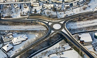
Aerial photo, street intersection in the snow in winter, Siegen, Sauerland, North Rhine-Westphalia, Germany, Europe
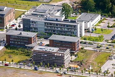
Aerial photo, Phoenix-West, MST.Factory Dortmund, Technology Centre, Dortmund, Ruhr area, North Rhine-Westphalia, Germany, Europe
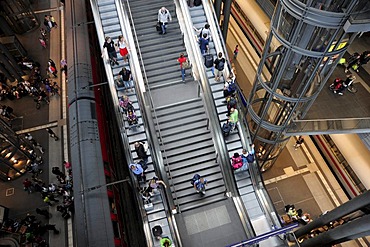
Stairs to the platforms, Berlin Central Station, Mitte district, Berlin, Germany, Europe

Aerial photo, bridges crossing the Moselle River, Europe Bridge, Railway Bridge and the Baldwin Bridge from left to right, Koblenz, Rhineland-Palatinate, Germany, Europe
Aerial view, mine Hugo I 1, 2, with Halde Runge heap and view point, Schachtzeichen RUHR.2010, Gelsenkirchen, Ruhrgebiet region, North Rhine-Westphalia, Germany, Europe

Cima Rocca fixed rope route, view of Lake Garda, Riva and Nago-Torbole, province of Trento, Italy, Europe
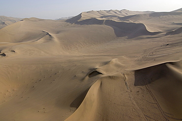
Aerial view of sand dunes with caravan route in the Gobi desert, silk road, Dunhuang, Gansu, China, Asia
Aerial photo, Dortmund U, downtown Dortmund, Ruhrgebiet area, North Rhine-Westphalia, Germany, Europe
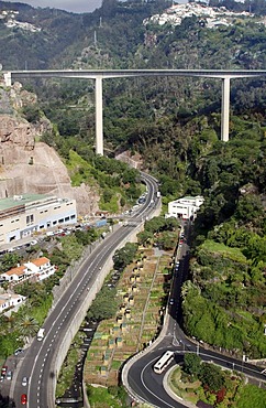
Highway, Funchal, Madeira, Portugal, Europe
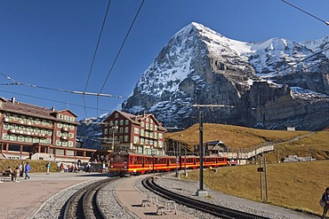
Mt Eiger from Kleine Scheidegg mountain pass and Jungfraubahn, Mt Jungfrau rail service, Top of Europe, Bernese Oberland, Canton Bern, Switzerland, Europe
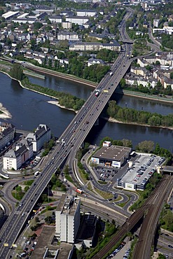
Aerial photo, Europe Bridge, Koblenz, Rhineland-Palatinate, Germany, Europe

Aerial photo, traffic route, main road, Niedersprockhoevel, Sprockhoevel, Ruhrgebiet region, North Rhine-Westphalia, Germany, Europe
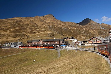
Kleine Scheidegg mountain pass with Jungfraubahn, Mt Jungfrau rail service, Top of Europe, Bernese Oberland, Canton Bern, Switzerland, Europe
A woman wearing a tank top and striped pants reaches for chalk while climbing The Rapture (5.8) on Lower Gibraltar Rock in Santa Barbara, California. The Rapture is a very nice and unbelievably well protected route on the left arête of Lower Gibraltar Rock.

A woman wearing a red tank top crimps down on a small hold while climbing The Rapture (5.8) on Lower Gibraltar Rock in Santa Barbara, California. The Rapture is a very nice and unbelievably well protected route on the left arête of Lower Gibraltar Rock.

A rock climber in a blue tank top climbing a steep and technical route in Rifle Colorado.
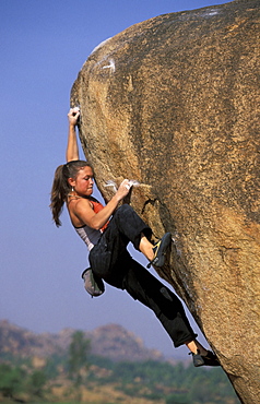
Katie Brown sucks it up as she nears the top of an overhanging bouldering route. Katie Brown, one of the world's leading sport climbers and the first woman to flash a 5.14a sport route, is bouldering near the Hampi, ruins outside of Hampi, India.
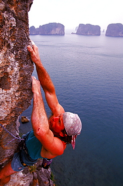
Todd Skinner, top American rock climber, uses small holes and edges in the rock to climb one of the over 3,000 limestone towers and islands in Ha Long Bay, on a route called "Sing Sing", which he rated 5.13c. In the background, other rock spires rise directly from the ocean. Ha Long Bay, a UNESCO World Heritage site, encompasses some 1,600 islands and islets, forming a spectacular seascape of limestone pillars, most of them uninhabited.
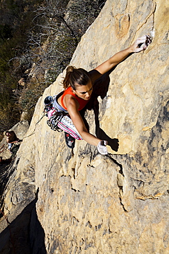
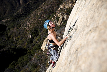
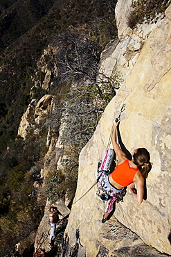
A woman wearing a red tank top and striped pants climbs The Rapture (5.8) on Lower Gibraltar Rock in Santa Barbara, California on. The Rapture is a very nice and unbelievably well protected route on the left arête of Lower Gibraltar Rock.
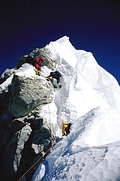
Mountaineers navigating through the Hillary Step on Mount Everest. The Hillary Step is a nearly vertical part (height around 40 ft) of upper Mount Everest. It lies almost at the top of the mountain, halfway from the "south summit" to the summit top, and is the last real challenge before the summit. It is reached by climbing the South East route. It was named after Sir Edmund Hillary, who was the first person, along with Tenzing Norgay, who passed it to reach the summit, Nepal
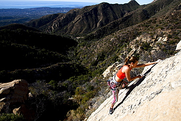
A woman wearing a red tank top and striped pants clips a quick draw while climbing The Rapture (5.8) on Lower Gibraltar Rock in Santa Barbara, California. The Rapture is a very nice and unbelievably well protected route on the left arête of Lower Gibraltar Rock.
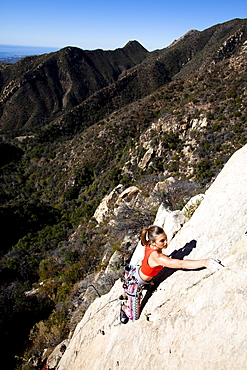
A woman wearing a red tank top and striped pants climbs The Rapture (5.8) on Lower Gibraltar Rock in Santa Barbara, California. The Rapture is a very nice and unbelievably well protected route on the left arête of Lower Gibraltar Rock.
A woman wearing a red tank top and striped pants climbs The Rapture (5.8) on Lower Gibraltar Rock in Santa Barbara, California. The Rapture is a very nice and unbelievably well protected route on the left arête of Lower Gibraltar Rock.