Results
7 results found
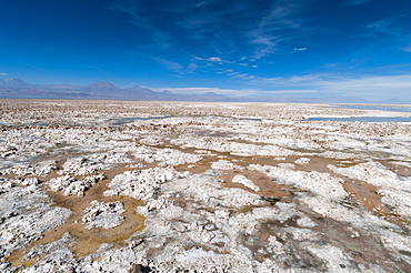
Salt crust, Salar de Atacama, Atacama Desert, Chile, South America
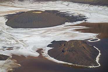
Aerial of the Trou du Natron volcanic crater and its natron lakes, Tibesti Mountains, Chad
Aerial of the Trou du Natron volcanic crater and its natron lakes, Tibesti Mountains, Chad
Aerial of the Trou du Natron volcanic crater and its natron lakes, Tibesti Mountains, Chad
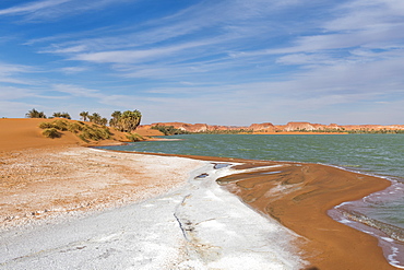
Salt crust at the shores of Ounianga Kebir part of the Ounianga lakes, UNESCO World Heritage Site, northern Chad, Africa

Salt crust, Salar de Atacama, Atacama Desert, Chile, South America

Salt crust, Salar de Atacama, Atacama Desert, Chile, South America
Badwater, saltpan in desert, death valley national park, california, usa
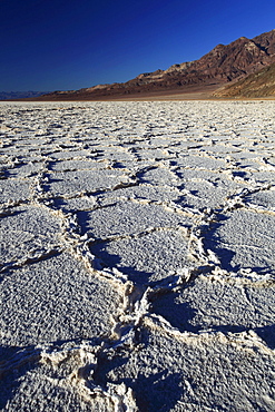
Badwater, saltpan in desert, death valley national park, california, usa
Desert Erg Iguidi, Algeria, True Colour Satellite Image. True colour satellite image of Erg Iguidi, a sand desert between Algeria and Mauritania. The 250m wide dunes lay in the South on a sand plain, and in the North on a blakek sandstone area. The light blue areas are calcareous and salt crusts left out from the evaporation of the oueds' water. Image taken on 29 March 1987 using LANDSAT data.
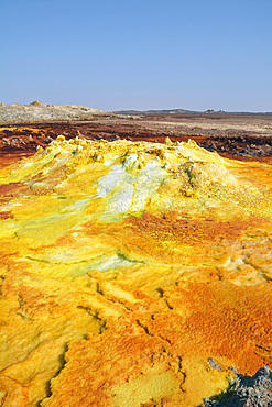
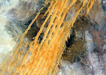
Ethiopia; Afar region; Danakil Desert; Danakil Depression; Dallol geothermal area; hot sulfur springs; cone-like formation in intense yellow, red and green tones
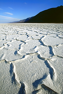
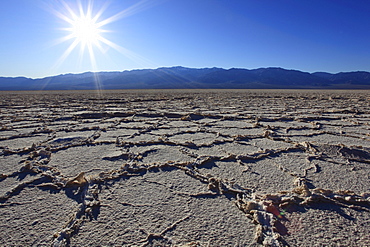
Salt crust, Death Valley, California, USA
Flamingos at Laguna Colorada, National Park Eduardo Avaroa, Bolivia

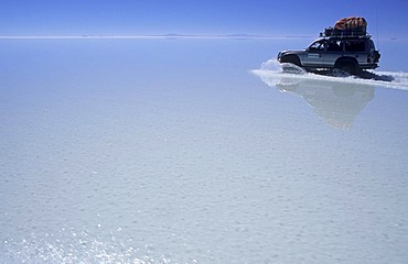
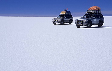
Fourwheeldrive vehicle with tourists on the Salar de Uyuni, Bolivia
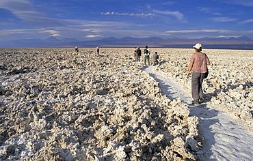
Tourists hiking on Salar de Atacama, Atacama Desert, Chile
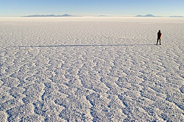
Person standing on Salar de Uyuni, Bolivia
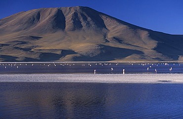
Flamingos at Laguna Colorada, National Park Eduardo Avaroa, Bolivia
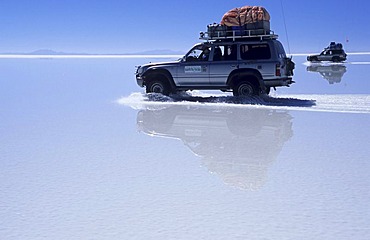
Fourwheeldrive vehicle driving over Salar de Uyuni, Bolivia
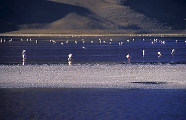
Flamingos at Laguna Colorada, National Park Eduardo Avaroa, Bolivia

Fourwheeldrive vehicle with tourists on the Salar de Uyuni, Bolivia
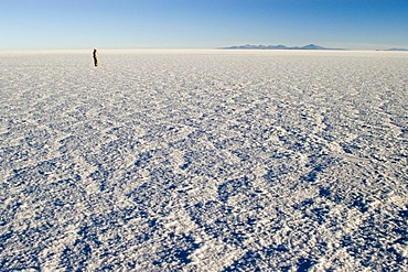
Person standing on Salar de Uyuni, Bolivia
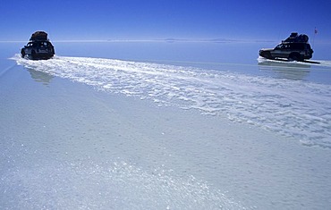
Fourwheeldrive vehicle driving over Salar de Uyuni, Bolivia
Fourwheeldrive vehicle driving over Salar de Uyuni, Bolivia
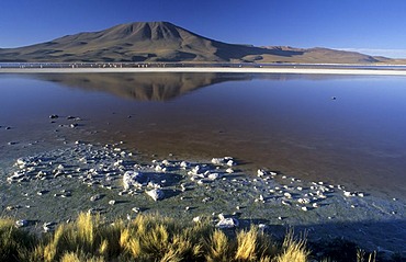
Flamingos at Laguna Colorada, National Park Eduardo Avaroa, Bolivia

Fourwheeldrive vehicle with tourists on the Salar de Uyuni, Bolivia
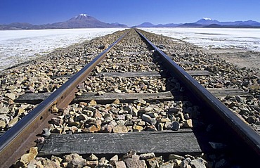
Railroad tracks across Salar de Chiguana, Bolivia
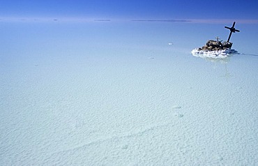
Roadside cross on Salar de Uyuni, Bolivia
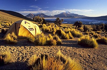
Camp at Cerro Rojo, Salar de Surire, Reserva Nacional de las Vicunas, Lauca National Park, Chile
Fourwheeldrive vehicle driving over Salar de Uyuni, Bolivia
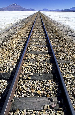
Railroad tracks across Salar de Chiguana, Bolivia
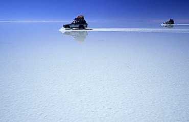
Fourwheeldrive vehicle driving over Salar de Uyuni, Bolivia
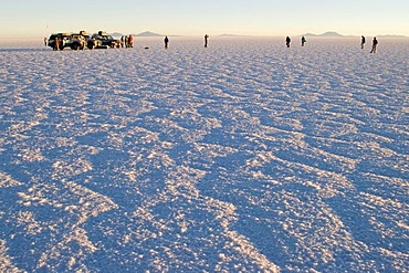
Fourwheeldrive vehicle with tourists on the Salar de Uyuni, Bolivia
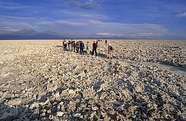
Tourists hiking on Salar de Atacama, Atacama Desert, Chile
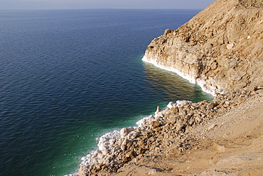
White salt crust at the east bank of the Dead Sea, Jordan

Salty shores of a salt lake, salt production, Cagliari, Sardinia, Italy, Europe
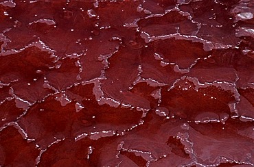
Aerial view, salt crust coloured red by cyanobacteria, Lake Natron, Great Rift Valley, Tanzania, Africa
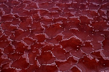
Aerial view, salt crust coloured red by cyanobacteria, Lake Natron, Great Rift Valley, Tanzania, Africa
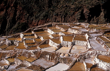
Salt production by evaporation on a mountain slope at Pichingote, the salt terraces were already in use during the time of the Incas, southern Peru, South America
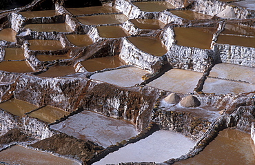
Salt production by evaporation on a mountain slope at Pichingote, the salt terraces were already in use during the time of the Incas, southern Peru, South America

Spectacular lighting after sunset, salt crust on the Devil's Golf Course, Panamint Range, Black Mountains, Death Valley National Park, Mojave Desert, California, United States of America, USA
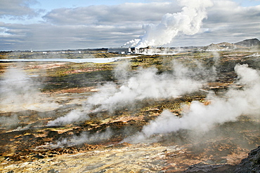
Steam from the countless holes and fractures in the earth's crust, the Solfatarten, behind it a geothermal power station and a factory for salt extraction, which is operated with geothermal energy, geothermal region of Gunnuhver, southern Iceland, Iceland
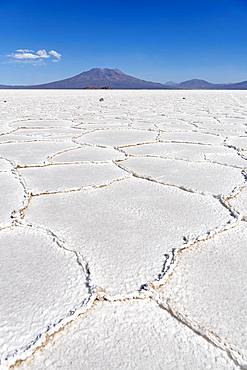
Salt crust, Salar de Uyuni, Altiplano, Bolivia, South America
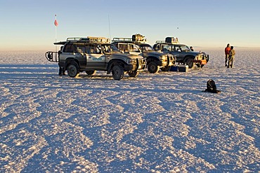
Fourwheeldrive vehicle with tourists on the Salar de Uyuni, Bolivia
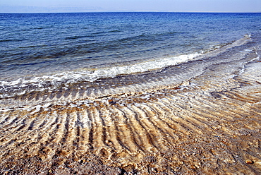
Salt crust at the east bank of the Dead Sea, Jordan
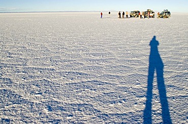
Fourwheeldrive vehicle with tourists on the Salar de Uyuni, Bolivia
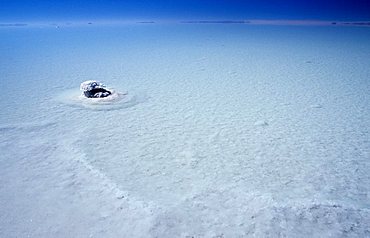
small salt island at Salar de Uyuni, Bolivia
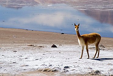
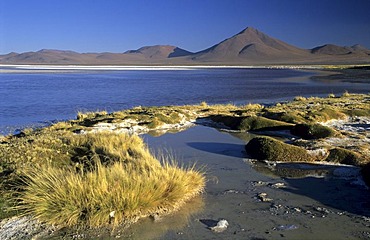
vicunas at the salt lake Salar de Surire, Chile

Crusts of salt at the Devils Golf Course, Death Valley National Park, California, USA
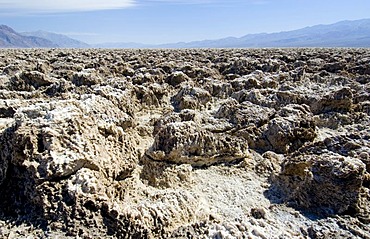
Crusts of salt at the Devils Golf Course, Death Valley National Park, California, USA

Ojos de Mar. The Argentinian Altiplano along the Routa 27 near Tolar Grande and the Salar de Arizaro. South America, Argentina
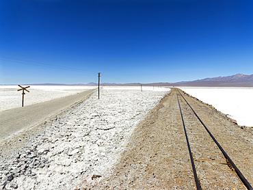
The salt flats Salar de Pocitos in the Argentinian Altiplano. Routa 27 and the railway Salta - Antofagasta is crossing the salt flats. South America, Argentina

Ojos de Mar. The Argentinian Altiplano along the Routa 27 near Tolar Grande and the Salar de Arizaro. South America, Argentina