Results
24 results found
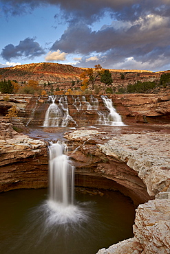
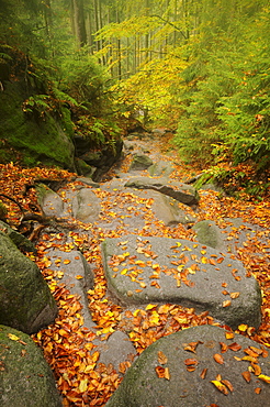
Secret Falls in the fall, Washington County, Utah, United States of America, North America
Secret Falls in the fall, Washington County, Utah, United States of America, North America

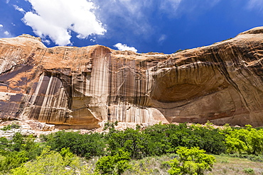
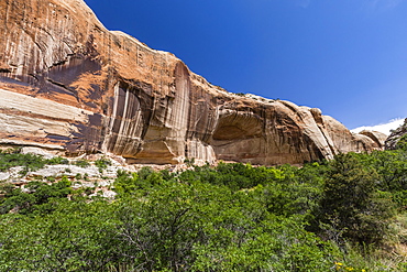
Canyon de Chelly National Monument, Canyon del Muerto in Fall Colors, Arizona, United States of America, North America

Canyon de Chelly National Monument, Canyon del Muerto in Fall Colors, Arizona, United States of America, North America
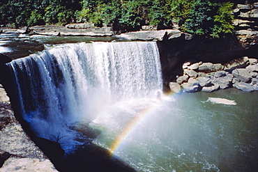
Cumberland Falls on the Cumberland River, it drops 60 feet over the sandstone edge, Kentucky, USA
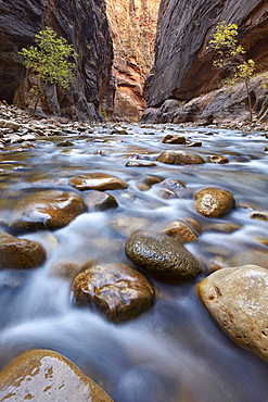
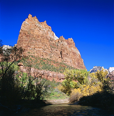
The Narrows of the Virgin River in the fall, Zion National Park, Utah, United States of America, North America
Jagged sandstone cliffs above the Virgin River, Zion National Park, Utah, USA
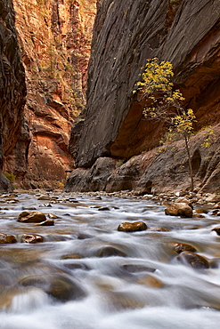
The Narrows of the Virgin River in the fall, Zion National Park, Utah, United States of America, North America
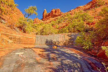
A dry waterfall sandstone ledge on a trail to Steamboat Rock, Coconino National Forest, Sedona, Arizona, United States of America, North America
Sandstone rock formation named Orloj (astronomical clock), Marianska vyhlidka, Hruba Skala, Semily District, Liberec Region, Bohemia, Czech Republic (Czechia), Europe
Navajo sandstone in Lower Calf Creek Falls Trail, Grand Staircase-Escalante National Monument, Utah, United States of America, North America
Navajo sandstone in Lower Calf Creek Falls Trail, Grand Staircase-Escalante National Monument, Utah, United States of America, North America
View from Wehlnadel rocks to Bastei Bridge in Elbe Sandstone Mountains, Germany, Europe

The Castle, an iconic sandstone peak forming part of the Waterpocket Fold, autumn, Fruita, Capitol Reef National Park, Utah, United States of America, North America
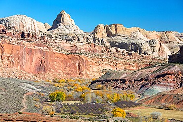
View across valley to the Waterpocket Fold from the Fremont River Trail, autumn, Fruita, Capitol Reef National Park, Utah, United States of America, North America

The Castle, an iconic sandstone peak forming part of the Waterpocket Fold, autumn, Fruita, Capitol Reef National Park, Utah, United States of America, North America
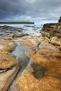
Old Red Sandstone ledges at the Bay of Skaill, Mainland, Orkney Islands, Scotland, United Kingdom, Europe
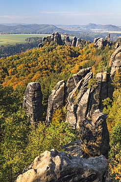
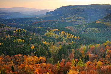
Schrammsteine rocks during autumn in Elbe Sandstone Mountains, Germany, Europe
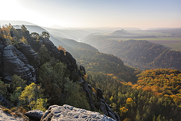
View from Schrammsteine rocks across Elbe Sandstone Mountains, Germany, Europe
View from Schrammsteine rocks to Hohe Liebe mountain in Elbe Sandstone Mountains, Germany, Europe
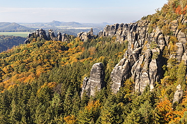
Schrammsteine rocks during autumn in Elbe Sandstone Mountains, Germany, Europe
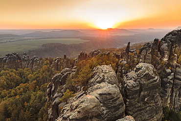
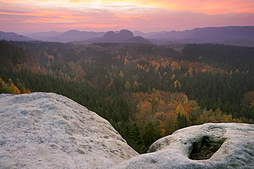
Schrammsteine rocks at sunset in Elbe Sandstone Mountains, Germany, Europe

Wehlnadel rocks at sunset in Elbe Sandstone Mountains, Germany, Europe
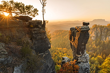
Wehlnadel rocks at sunset in Elbe Sandstone Mountains, Germany, Europe
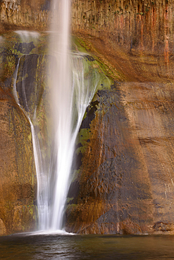
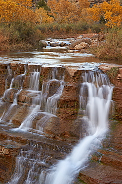
Lower Calf Creek Falls drops down a sandstone rock face in Grand Staircase - Escalante National Monument, Utah.
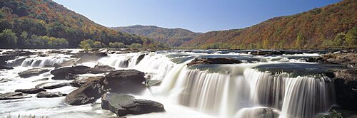
Sandstone Falls New River Gorge WV USA
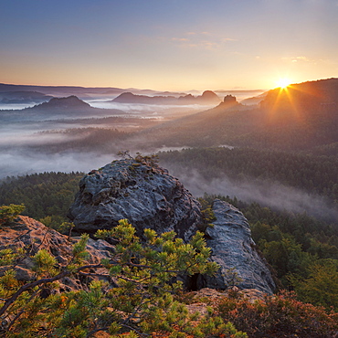
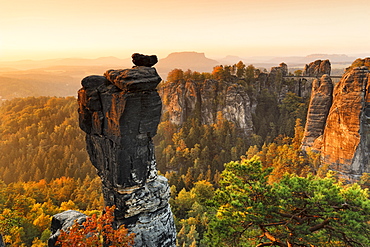
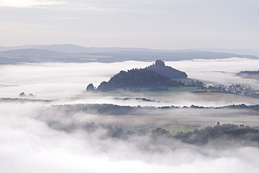
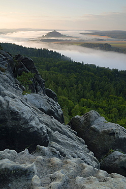
View from Gleitmannshorn over the small Zschand with fog at sunrise with rocks in foreground, Kleiner Winterberg, National Park Saxon Switzerland, Saxony, Germany
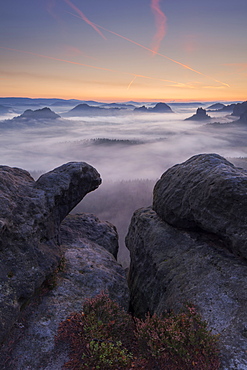
View from Gleitmannshorn over the small Zschand at dawn with rocks and blooming heather in the foreground, Kleiner Winterberg, National Park Saxon Switzerland, Saxony, Germany
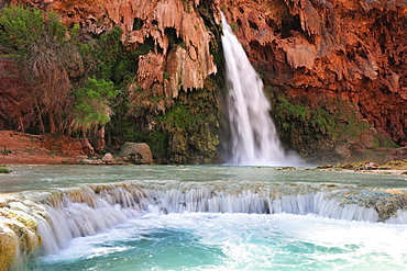
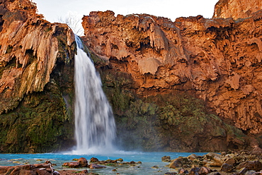
Waterfall Havasu Fall, Havasu, Supai, Grand Canyon, Grand Canyon National Park, UNESCO World Heritage Site Grand Canyon, Arizona, Southwest, USA, America
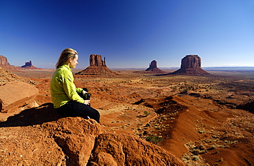
Young woman sitting on a rock looking at the view, Monument Valley, Utah, North America, America
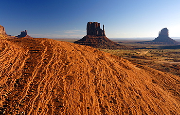
Red sandstone at Monument Valley, Utah, North America, America
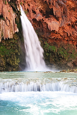
Waterfall Havasu Fall, Havasu, Supai, Grand Canyon, Grand Canyon National Park, UNESCO World Heritage Site Grand Canyon, Arizona, Southwest, USA, America

View out of a tent at a sitting woman, Monument Valley, Utah, North America, America
Waterfall Havasu Fall, Havasu, Supai, Grand Canyon, Grand Canyon National Park, UNESCO World Heritage Site Grand Canyon, Arizona, Southwest, USA, America
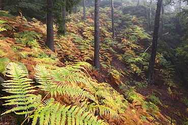
Natural forest with a carpet of ferns in the Saxon Switzerland National Park in autumn, Saxony, Germany

Young woman sitting on a rock looking at the view, Monument Valley, Utah, North America, America
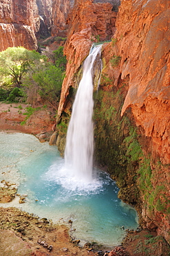
Waterfall Havasu Fall, Havasu, Supai, Grand Canyon, Grand Canyon National Park, UNESCO World Heritage Site Grand Canyon, Arizona, Southwest, USA, America

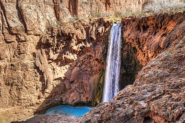
Waterfall Mooney Fall, Havasu, Supai, Grand Canyon, Grand Canyon National Park, UNESCO World Heritage Site Grand Canyon, Arizona, Southwest, USA, America
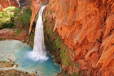
Waterfall Havasu Fall, Havasu, Supai, Grand Canyon, Grand Canyon National Park, UNESCO World Heritage Site Grand Canyon, Arizona, Southwest, USA, America
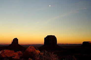
Monument Valley at dusk, Utah, North America, America
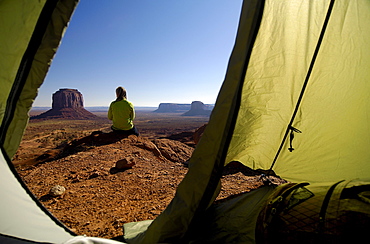
View out of a tent at a sitting woman, Monument Valley, Utah, North America, America
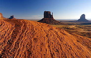
Red sandstone at Monument Valley, Utah, North America, America
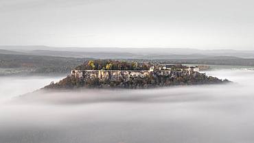
Fortress Koenigstein im Nebel, Elbe Sandstone Mountains, Saxon Switzerland, Germany, Europe
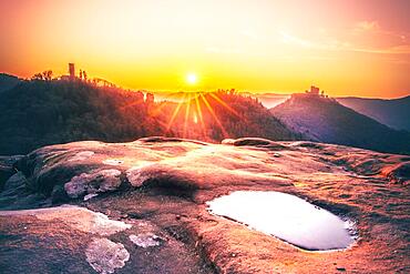
Viewpoint on a sandstone, in autumn and winter sunrise in the morning, Dahn, Palatinate Forest, Rhineland-Palatinate, Germany, Europe
View of the Nasser Grund from the Gratweg ridge trail, Saechsische Schweiz, Saxon Switzerland, Elbe Sandstone Mountains, Saxony, Germany, Europe
View of the Elbe Valley from the Gratweg ridge trail, Saechsische Schweiz, Saxon Switzerland, Elbe Sandstone Mountains, Saxony, Germany, Europe
View of Saxon Switzerland at sunrise as seen from a cowshed, Saxony, Germany, Europe
View of the Elbe valley from the Schrammsteine rock formation, Saechsische Schweiz, Saxon Switzerland, Elbe Sandstone Mountains, Saxony, Germany, Europe
View of the Elbe valley from the Schrammsteine rock formations, Saechsische Schweiz, Saxon Switzerland, Elbe Sandstone Mountains, Saxony, Germany, Europe
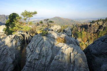
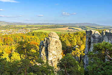
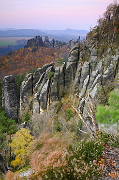
Rock formations in the Saechsische Schweiz, Saxon Switzerland, Elbe Sandstone Mountains, Saxony, Germany, Europe
View of the Elbe valley from the Schrammsteine rock formations, Saechsische Schweiz, Saxon Switzerland, Elbe Sandstone Mountains, Saxony, Germany, Europe
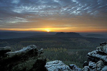
Sunset in the Saechsische Schweiz, Saxon Switzerland, from Gohrisch, Elbe Sandstone Mountains, Saxony, Germany, Europe
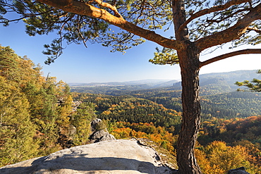
Wilde Hoelle trail in autumn in the Saechsische Schweiz, Saxon Switzerland, Elbe Sandstone Mountains, Saxony, Germany, Europe
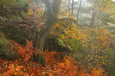
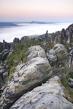
Foggy mood in autumn in the Saechsische Schweiz, Saxon Switzerland, Elbe Sandstone Mountains, Saxony, Germany, Europe

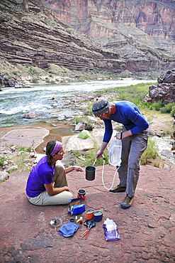
Male hiker filters water on a cliff-pinched patio near Deer Creek Falls in the Grand Canyon outside of Fredonia, Arizona November 2011. The 21.4-mile loop starts at the Bill Hall trailhead on the North Rim and descends 2000-feet in 2.5-miles through Coconino Sandstone to the level Esplanada then descends further into the lower canyon through a break in the 400-foot-tall Redwall to access Surprise Valley. Hikers connect Thunder River and Tapeats Creek to a route along the Colorado River and climb out Deer Creek.
Hikers setup camp on a beach along the Colorado River near the plumeting 180-foot Deer Creek Falls in the Grand Canyon outside of Fredonia, Arizona November 2011. The 21.4-mile loop starts at the Bill Hall trailhead on the North Rim and descends 2000-feet in 2.5-miles through Coconino Sandstone to the level Esplanada then descends further into the lower canyon through a break in the 400-foot-tall Redwall to access Surprise Valley. Hikers connect Thunder River and Tapeats Creek to a route along the Colorado River and climb out Deer Creek.
Hikers setup camp on a beach along the Colorado River near the plumeting 180-foot Deer Creek Falls in the Grand Canyon outside of Fredonia, Arizona November 2011. The 21.4-mile loop starts at the Bill Hall trailhead on the North Rim and descends 2000-feet in 2.5-miles through Coconino Sandstone to the level Esplanada then descends further into the lower canyon through a break in the 400-foot-tall Redwall to access Surprise Valley. Hikers connect Thunder River and Tapeats Creek to a route along the Colorado River and climb out Deer Creek.
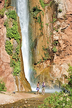
Hikers swim in the pool below 180-foot Deer Creek Falls in the Grand Canyon outside of Fredonia, Arizona November 2011. The 21.4-mile loop starts at the Bill Hall trailhead on the North Rim and descends 2000-feet in 2.5-miles through Coconino Sandstone to the level Esplanada then descends further into the lower canyon through a break in the 400-foot-tall Redwall to access Surprise Valley. Hikers connect Thunder River and Tapeats Creek to a route along the Colorado River and climb out Deer Creek.
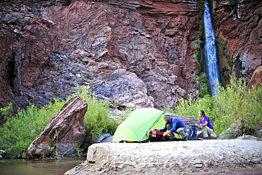
Hikers setup camp on a beach along the Colorado River near the plumeting 180-foot Deer Creek Falls in the Grand Canyon outside of Fredonia, Arizona November 2011. The 21.4-mile loop starts at the Bill Hall trailhead on the North Rim and descends 2000-feet in 2.5-miles through Coconino Sandstone to the level Esplanada then descends further into the lower canyon through a break in the 400-foot-tall Redwall to access Surprise Valley. Hikers connect Thunder River and Tapeats Creek to a route along the Colorado River and climb out Deer Creek.
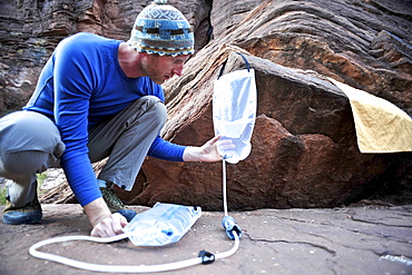
Male hiker filters water on a cliff-pinched patio near Deer Creek Falls in the Grand Canyon outside of Fredonia, Arizona November 2011. The 21.4-mile loop starts at the Bill Hall trailhead on the North Rim and descends 2000-feet in 2.5-miles through Coconino Sandstone to the level Esplanada then descends further into the lower canyon through a break in the 400-foot-tall Redwall to access Surprise Valley. Hikers connect Thunder River and Tapeats Creek to a route along the Colorado River and climb out Deer Creek.
Male hiker filters water on a cliff-pinched patio near Deer Creek Falls in the Grand Canyon outside of Fredonia, Arizona November 2011. The 21.4-mile loop starts at the Bill Hall trailhead on the North Rim and descends 2000-feet in 2.5-miles through Coconino Sandstone to the level Esplanada then descends further into the lower canyon through a break in the 400-foot-tall Redwall to access Surprise Valley. Hikers connect Thunder River and Tapeats Creek to a route along the Colorado River and climb out Deer Creek.
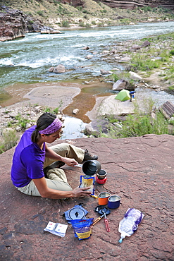
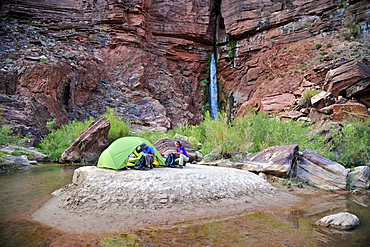
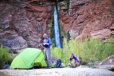
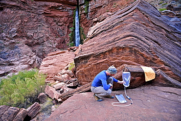
Female hiker cooks dinner on a cliff-pinched patio above camp and the Colorado River near Deer Creek Falls in the Grand Canyon outside of Fredonia, Arizona November 2011. The 21.4-mile loop starts at the Bill Hall trailhead on the North Rim and descends 2000-feet in 2.5-miles through Coconino Sandstone to the level Esplanada then descends further into the lower canyon through a break in the 400-foot-tall Redwall to access Surprise Valley. Hikers connect Thunder River and Tapeats Creek to a route along the Colorado River and climb out Deer Creek.
Hikers cook dinner on a cliff-pinched patio above camp and the Colorado River near Deer Creek Falls in the Grand Canyon outside of Fredonia, Arizona November 2011. The 21.4-mile loop starts at the Bill Hall trailhead on the North Rim and descends 2000-feet in 2.5-miles through Coconino Sandstone to the level Esplanada then descends further into the lower canyon through a break in the 400-foot-tall Redwall to access Surprise Valley. Hikers connect Thunder River and Tapeats Creek to a route along the Colorado River and climb out Deer Creek.
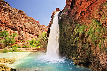
Havasu Falls, Havasupai Indian Reservation, Grand Canyon, Arizona, United States Of America
Mooney Falls, Havasupai Reservation, Arizona, United States Of America

Tree with yellow fall leaves and cliff in Zion National Park