Results
13 results found
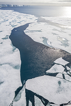
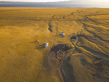
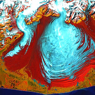
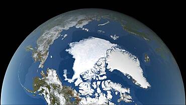
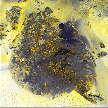
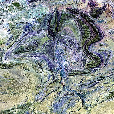
Views of Austfonna, an ice cap located on Nordaustlandet in the Svalbard archipelago in Norway, Arctic, Europe
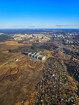
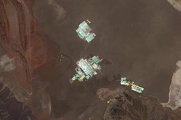
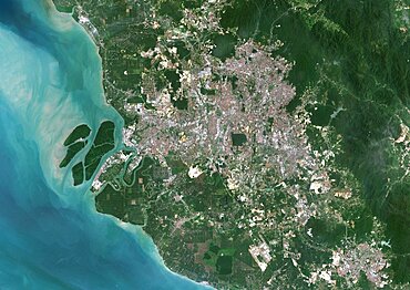
Aerial of the satellitte cities of Moscow, Russia
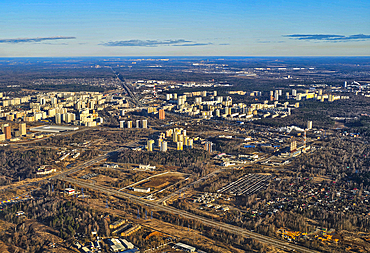
Aerial of the satellitte cities of Moscow, Russia
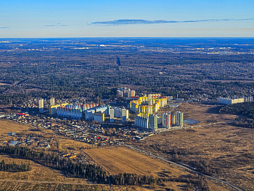
Aerial of the satellitte cities of Moscow, Russia
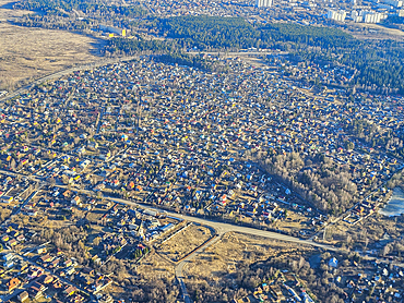
Aerial of the satellitte cities of Moscow, Russia
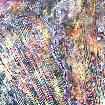
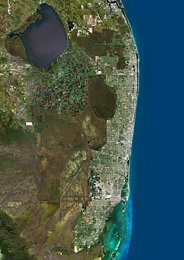
default
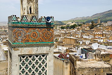
Speaker and Satellite dishes, Chrabliyine Mosque, UNESCO, Fes, Morocco
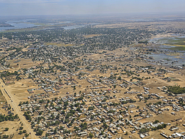
Aerial of N´Djamena, capital of Chad and the Chari River, Chad
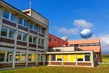
Geneva Observatory offices, Sauverny, Canton of Geneva, Geneva, Switzerland
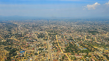
Aerial of Goma, Democratic Republic of Congo, Africa
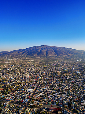
San Martin de las Piramides, aerial view, Mexico State, Mexico
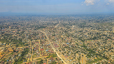
Aerial of Goma, Democratic Republic of Congo, Africa
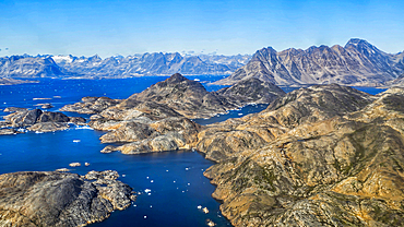
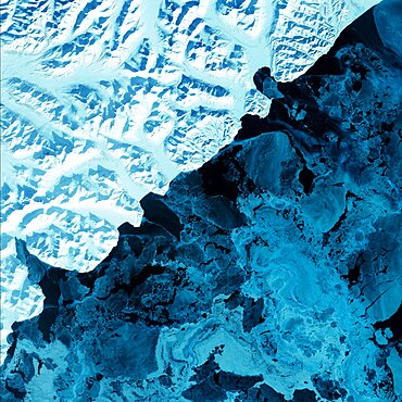
Aerial of the mountainous coastline around Kulusuk, Greenland, Polar Regions
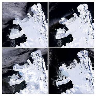
Ice Shelf Disintegrating, Spring 2008
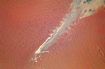
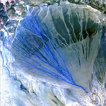
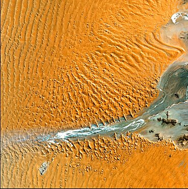
Tsauchab River and Sossus Vlei Lakebed, Namibia
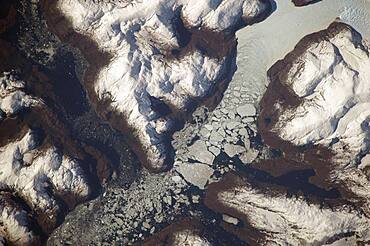
Glacier Outlet, Southern Patagonian Ice Field, Chile
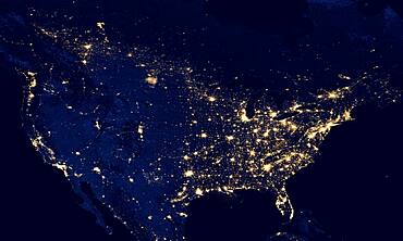
United States at Night, 2012
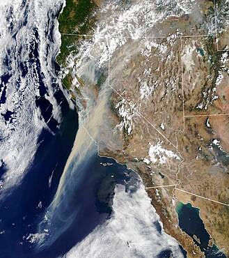
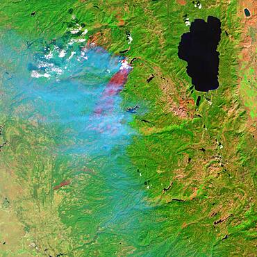
Northern California Wildfire Smoke Plumes

Astronaut Barry Wilmore EVA
Sugarcane Fields, Controlled Burn, Infrared Satellite Image
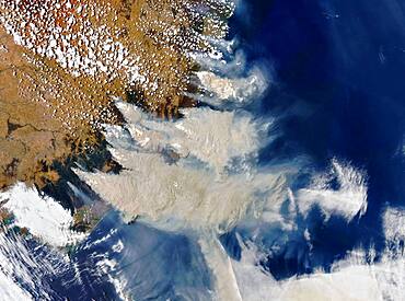
Australia Bushfire Smoke Plumes, Satellite View
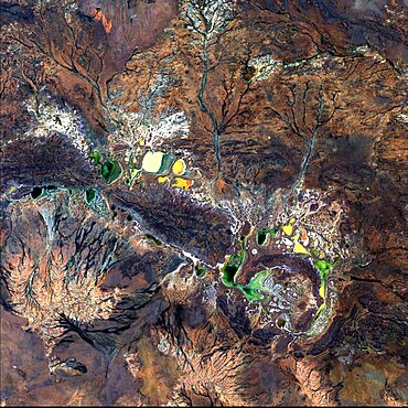
Water Imprints in Desert, Oman
Northern Territory, Australia
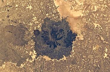
Es Safa Volcanic Field, Syria
Forest Fire

Astronaut Terry Virts Spacewalk
Harrat Al Birk, Saudi Arabia
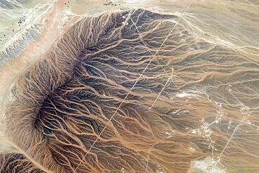
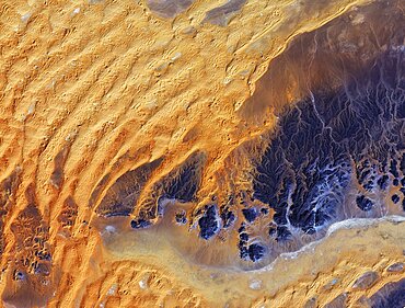
Saharan desert rivers, satellite image
Alluvial Fan, China
Campeche, Mexico
Namib Desert, Namibia
Sahara Desert, Algeria
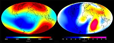
Earth's Magnetism
Kamchatka Peninsula, Russia
Malaspina Glacier, Alaska
Aurora australis, ISS Image, 2014

Astronaut Terry Virts EVA
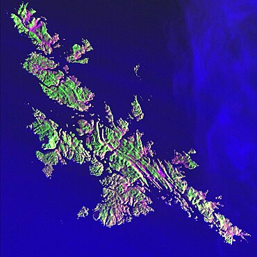
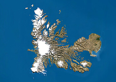
Shetland Islands, Scotland
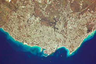
Greater Bridgetown Area, Barbados
Evaporation Ponds, Salar de Atacama, Chile
Kalahari Desert, Namibia
Arctic Sea Ice Minimum, 2020
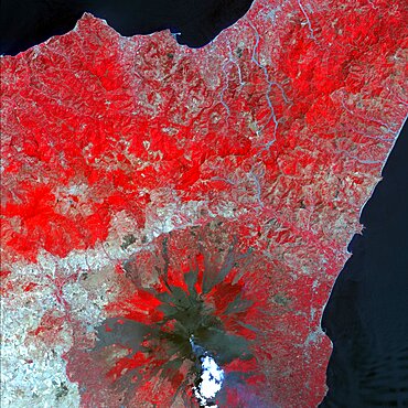
Mt. Etna, Sicily
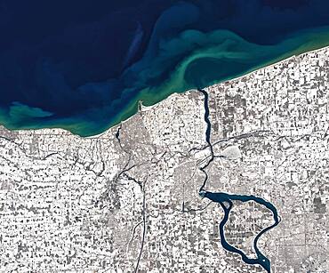
Niagara River in Winter, Satellite Image
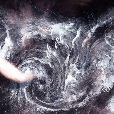
Whirlpool in the Air
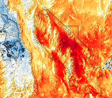
Hottest Temperatures Recorded at Death Valley, Satellite Data Map
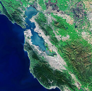
San Francisco Bay, Landsat 8
Pinacate Volcano Field, Mexico
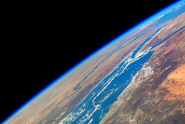
Atlantic Ocean, ISS View
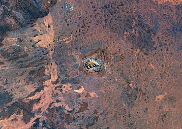
Shoemaker Crater, Landsat Image
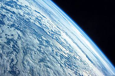
Earth From Space
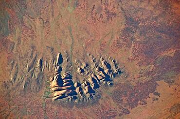
The MacDonnell Ranges, Australia
Northern Africa, Satellite View
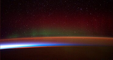
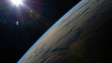
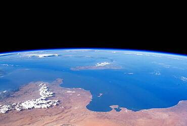
Earth's Horizon, Red Sea
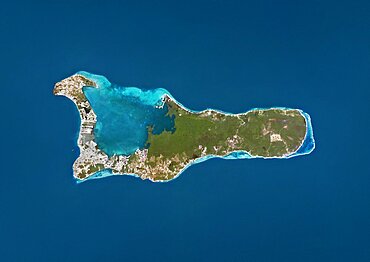
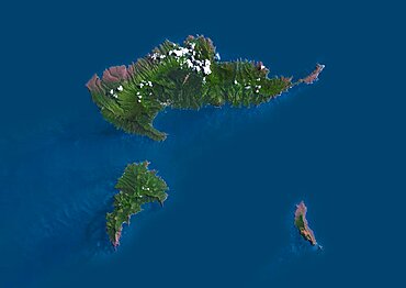
Satellite view of Wallis Island, part of Wallis and Futuna Islands. This image was compiled from data acquired by Landsat 8 satellite in 2014.
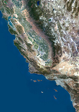
Color satellite image of San Francisco to Los Angeles, California, United States

Satellite view of Cuba and Jamaica. This image was compiled from data acquired by Landsat satellites.
Satellite view of the Kerguelen Islands, a group of islands in the southern Indian Ocean that is part of the French Southern and Antarctic Lands
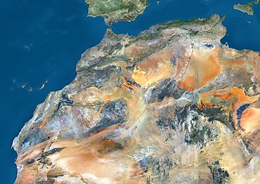
Satellite view of Algeria, Morocco and Tunisia. This image was compiled from data acquired in 2014 by Landsat 8 satellite.
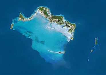
Satellite view of Grand Bahama, Bahamas. This image was compiled from data acquired by Landsat satellites.
Satellite view of Europe in winter, with partial snow cover. This image was compiled from data acquired by Landsat 7 & 8 satellites.
Color satellite image of Mumbai and Navi Mumbai, India. Navi Mumbai is a planned township located East of Mumbai. Both cities are connected by the Vashi bridge, also called Thane Creek Bridge
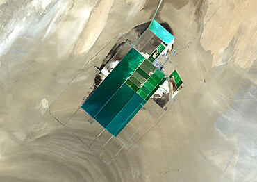
The satellite image shows potash evaporation ponds in Lop Nur, a former salt lake in the Xinjiang Region, that spread over 20 kilometers
Satellite view of Turks and Caicos Islands. This image was compiled from data acquired by Landsat satellites.
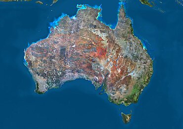
Satellite view of Australia. This image was compiled from data acquired by Landsat 8 satellite in 2014.
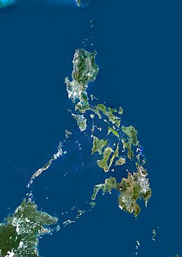
Philippines, Asia, True Colour Satellite Image. Satellite view of the Philippines. This image was compiled from data acquired by LANDSAT 5 & 7 satellites.
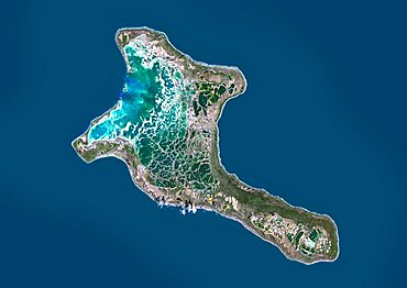
Satellite view of Christmas Island, Kiribati. This image was compiled from data acquired by Landsat 8 satellite in 2014.
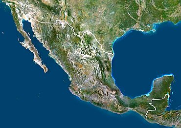
Mexico, North America, True Colour Satellite Image With Border. Satellite view of Mexico (with border). This image was compiled from data acquired by LANDSAT 5 & 7 satellites.
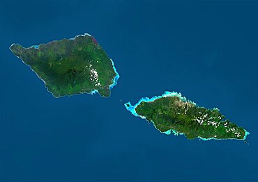
Satellite view of Samoa that consists of two large islands, Upolu and Savaii. This image was compiled from data acquired by Landsat 8 satellite in 2014.

Color satellite image of Tunis, capital city of Tunisia. Image collected on August 19, 2017 by Sentinel-2 satellites.

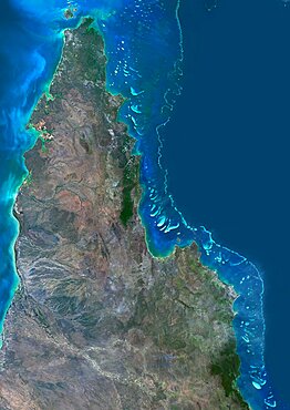
Satellite view of the Great Barrier Reef. It extends along most of Queensland's coastline in north-east Australia, from Torres Strait and Cape York peninsula down to Fraser Island
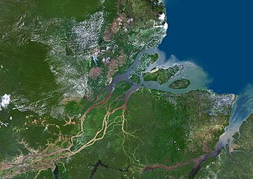
Color satellite image of the Amazon Delta, Brazil. Image collected by Landsat satellites.
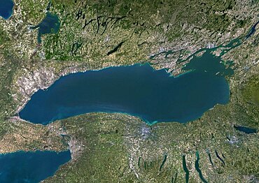
Color satellite image of Lake Ontario, North America. Image collected on May 1, 2016 by Landsat 8 satellite.

Satellite image of Abu Dhabi, United Arab Emirates, taken on June 26, 2014 by the satellite Landsat 8. The territory covered is 78 km x 55 km.
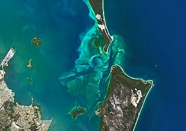
Satellite view of Moreton Bay, Queensland, Australia. This image was compiled from data acquired in 2014 by Landsat 8 satellite.
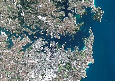
Color satellite image of Sydney, Australia. Image collected on August 23, 2017 by Sentinel-2 satellites.

Color satellite image of Manama, capital city of Bahrain. Image collected on October 17, 2017 by Sentinel-2 satellites.
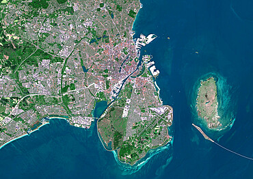
Color satellite image of Copenhagen, capital city of Denmark. The Oresund Bridge which is a combination of tunnel and bridge, connects Copenhagen to the Swedish city of Malmo. Image collected on May 27, 2017 by Sentinel-2 satellites.
Satellite view of the Northern Great Barrier Reef along the east coast of Cape York Peninsula in north Australia. This image was compiled from data acquired in 2014 by Landsat 8 satellite.
Satellite view of Uluru Ayers Rock, Northern Territory, Australia. This image was compiled from data acquired by Landsat satellites.
Color satellite image of Kuala Lumpur, capital city of Malaysia. Image collected on February 03, 2017 by Sentinel-2 satellites.
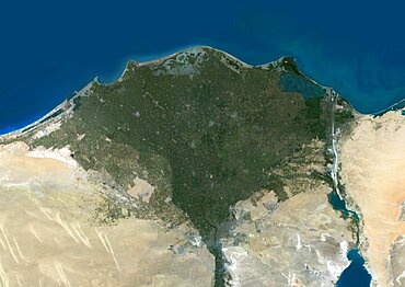
Color satellite image of the Nile Delta. It is formed in Northern Egypt where the Nile River spreads out and drains into the Mediterranean Sea. Image collected on October 1, 2017 by Sentinel-2 satellites.
Satellite view of Grand Cayman. It is the largest of the three Cayman Islands. This image was compiled from data acquired by Landsat satellites.

Satellite image of Typhoon Talim in 2017 over the East China Sea. Image taken on September 16, 2017.

Satellite view of Senegal River that forms the border between Senegal and Mauritania in West Africa.This image was taken in 2014 by Landsat 8 satellite.

Oman, Middle East, Asia, True Colour Satellite Image With Border. Satellite view of Oman (with border). This image was compiled from data acquired by LANDSAT 5 & 7 satellites.
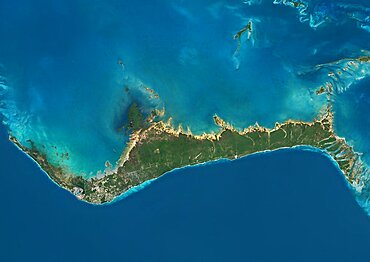
Mayotte, Africa, True Colour Satellite Image. Satellite view of Mayotte, an overseas collectivity of France, in the northern Mozambique Channel in the Indian Ocean. This image was compiled from data acquired by LANDSAT 5 & 7 satellites.
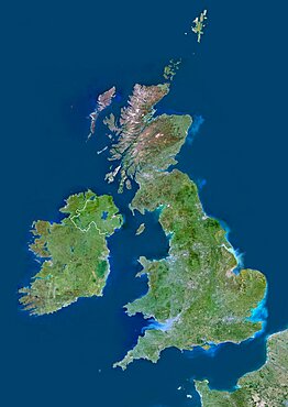
United Kingdom, Europe, True Colour Satellite Image With Border. Satellite view of Bulgaria (with border). This image was compiled from data acquired by LANDSAT 5 & 7 satellites.
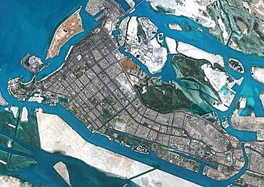
Color satellite image of Abu Dhabi, capital city of United Arab Emirates. The city is on an island connected by bridges to the mainland and other islands. Image collected on September 21, 2017 by Sentinel-2 satellites.
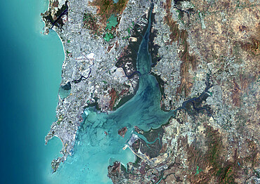
Color satellite image of Osaka, Japan. Image collected on November 02, 2016 by Sentinel-2 satellites.
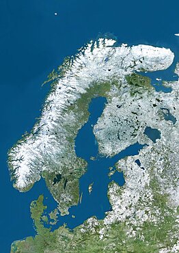
Satellite view of Northern Europe showing Scandinavia and the Baltic States in winter, with partial snow cover. This image was compiled from data acquired by Landsat 7 & 8 satellites.
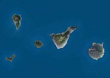
Satellite view of La Palma, Tenerife and Gran Canaria, Canary Islands, Spain. The smallest islands of La Gomera and El Hierro are also shown. This image was compiled from data acquired by Landsat 8 satellite in 2014.
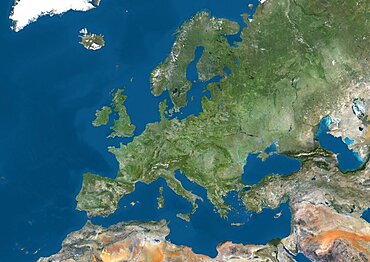
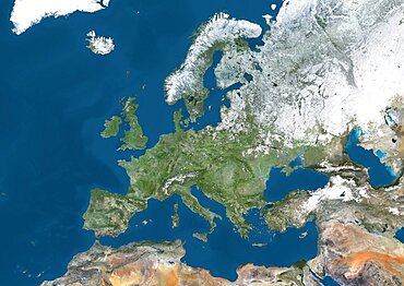
Satellite view of Europe. This image was compiled from data acquired by Landsat 7 & 8 satellites.
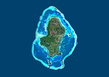
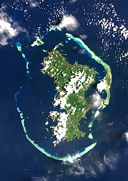
Satellite view of Hiva Oa, the second largest island in the Marquesas Islands, in French Polynesia. This image was compiled from data acquired by Landsat 8 satellite in 2014.
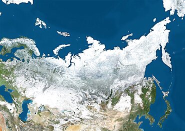
Satellite view of Russia and Central Asia in winter, with partial snow cover. This image was compiled from data acquired by Landsat 7 & 8 satellites.
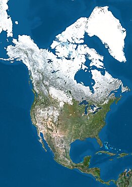
Satellite view of North America in winter, with partial snow cover. This image was compiled from data acquired by Landsat 7 & 8 satellites.
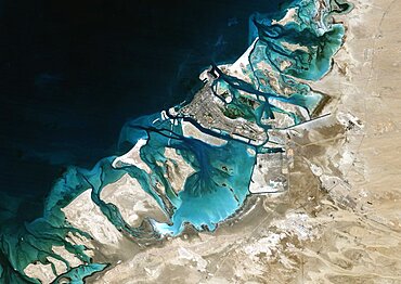
Satellite image of Abu Dhabi, United Arab Emirates, taken on February 2, 1985 by the satellite Landsat 5. The territory covered is 78 km x 55 km.
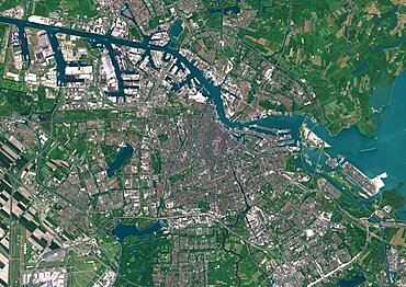
Color satellite image of Amsterdam, capital city of Netherlands. The River Amstel flows through the city. Image collected on May 26, 2017 by Sentinel-2 satellites.
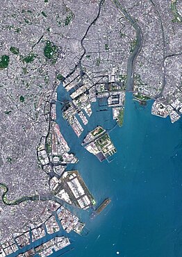
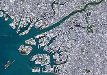
Color satellite image of Tokyo, capital city of Japan. Image collected on May 08, 2017 by Sentinel-2 satellites.
Color satellite image of Miami Metropolitan Area, Florida, United States. The Everglades natural region is at west and Biscayne National Park at south. Image collected on January 06, 2017 by Sentinel-2 satellites.