Results
30 results found
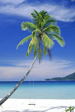
Palm tree and beach, Long Beach, Perhentian Kecil, smaller of the two Perhentian Islands, Terenggenu (Terengganu), Malaysia, Asia
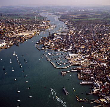
Aerial image of Cowes, on the west bank of the estuary of the River Medina facing the smaller town of East Cowes on the east bank, Isle of Wight., England, United Kingdom, Europe
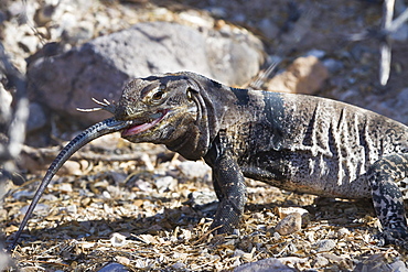
San Esteban spiny-tailed iguana (Ctenosaura conspicuosa) eating smaller lizard, Isla San Esteban, Gulf of California (Sea of Cortez), Baja California, Mexico, North America
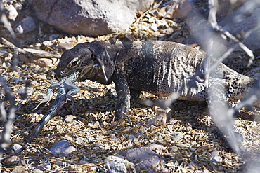
San Esteban spiny-tailed iguana (Ctenosaura conspicuosa) eating smaller lizard, Isla San Esteban, Gulf of California (Sea of Cortez), Baja California, Mexico, North America
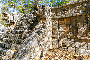
Carved stonework figure, possibly erotic on smaller building, Mayan ruins, Chichen Itza, UNESCO World Heritage Site, Yucatan, Mexico, North America
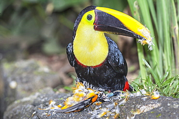
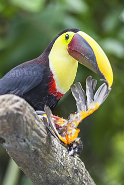
Chestnut-mandibled Toucan (Ramphastos swainsonii) feeding on a smaller bird, Sarapiqui, Costa Rica, Central America
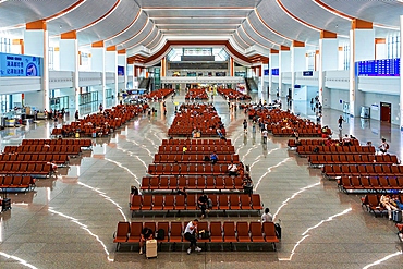
Chaoshan Station. This hi-speed rail station is typical of train stations in smaller cities in China. Chaozhou, Guangdong Province, China
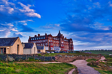
A scenic view of a large, historic hotel building with red brick architecture, set against a backdrop of blue skies and clouds. In the foreground, there are smaller, simpler buildings and a pathway leading towards the hotel. The landscape is grassy and op
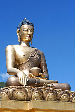
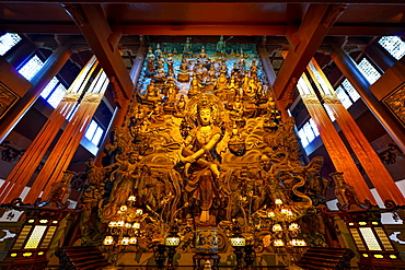
Buddha Dordenma statue, bronze, gilded in gold, 51.5 metres high, a Shakyamuni statue housing 100 smaller Buddha statues, Thimpu, Bhutan, Asia
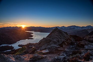
Ben A'an, one of the most popular of Scotland's smaller hills with stunning views over Loch Katrine, The Trossachs, Scotland, United Kingdom, Europe
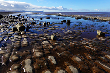
The intertidal zone of the Quantock Coast, West Somerset, contains an abundance of geology and wildlife. It is a Site of Special Scientific Interest (SSSI) and is of international geological importance.
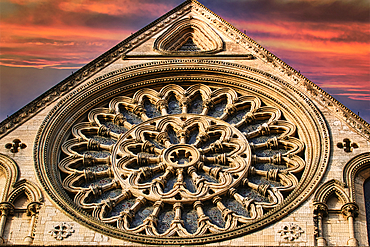
A large, circular stone window, known as a rose window, is featured in this image. The window is a centerpiece of a large, light-colored building and features a intricate design of arches and smaller windows in York, North Yorkshire, UK.
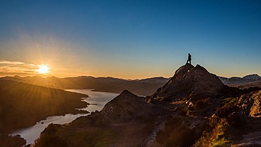
Ben A'an, one of the most popular of Scotland's smaller hills with stunning views over Loch Katrine, The Trossachs, Scotland, United Kingdom, Europe
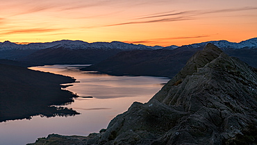
Ben A'an, one of the most popular of Scotland's smaller hills with stunning views over Loch Katrine, The Trossachs, Scotland, United Kingdom, Europe
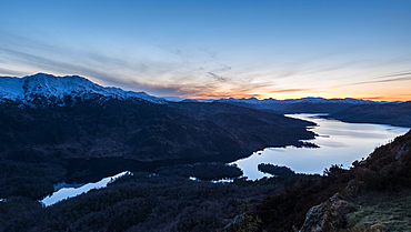
Ben A'an, one of the most popular of Scotland's smaller hills with stunning views over Loch Katrine, The Trossachs, Scotland, United Kingdom, Europe
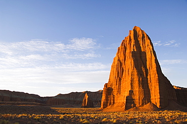
Sunrise at the Temple of the Sun and smaller Temple of the Moon in Cathedral Valley, Capitol Reef National Park, Utah, United States of America, North America
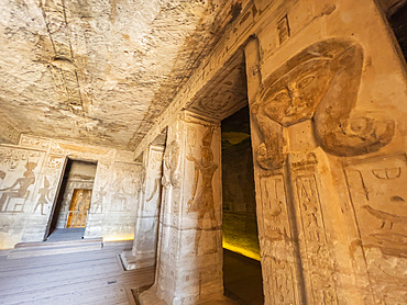
Interior view of the Small Temple of Abu Simbel with its successively smaller chambers leading to the sanctuary, UNESCO World Heritage Site, Abu Simbel, Egypt, North Africa, Africa
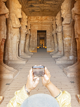
Interior view of the Great Temple of Abu Simbel with its successively smaller chambers leading to the sanctuary, UNESCO World Heritage Site, Abu Simbel, Egypt, North Africa, Africa
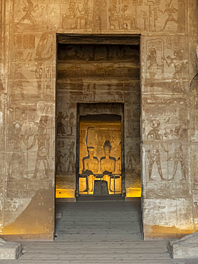
Interior view of the Great Temple of Abu Simbel with its successively smaller chambers leading to the sanctuary, UNESCO World Heritage Site, Abu Simbel, Egypt, North Africa, Africa
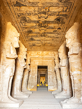
Interior view of the Great Temple of Abu Simbel with its successively smaller chambers leading to the sanctuary, UNESCO World Heritage Site, Abu Simbel, Egypt, North Africa, Africa
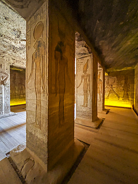
Interior view of the Small Temple of Abu Simbel with its successively smaller chambers leading to the sanctuary, UNESCO World Heritage Site, Abu Simbel, Egypt, North Africa, Africa
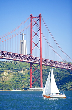
25th April bridge over the Tagus river and the Christ Statue in background, a gift from Brazil, this smaller replica represents the lasting friendship of the former colony), Lisbon, Portugal, Europe

A chambered cairn, the smaller one of two, dating from 2000 BC, near Creetown, Dumfries and Galloway, Scotland, United Kingdom, Europe
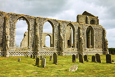
St. Andrew's Church, built in the 14th and 15th centuries but fell into ruin, and a smaller church was built inside in the 17th century, Covehithe, Suffolk, England, United Kingdom, Europe

View of Clocher de l'Eau Benite and smaller clock tower, Cluny Abbey, Saone et Loire, Burgundy, France, Europe
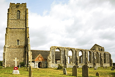
St. Andrew's Church, built in the 14th and 15th centuries but fell into ruin, and a smaller church was built inside in the 17th century, Covehithe, Suffolk, England, United Kingdom, Europe
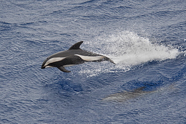
Hourglass Dolphin, Lagenorhynchus cruciger, Female Dolphin porpoising, Drake Passage, Southern Ocean. Females of this species can be identified by the smaller less-hooked dorsal fin and the lack of a post-anal keel.
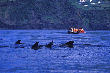
Short-finned Pilot Whale (Globicephala macrorhynchus) & whale-watchers. It is by law that whale watchers should stay at least 50meters (150 feet) away from large whales, including Pilot Whale (in picture here). Unless special in-water permits are given, snorkelers can only swim with smaller dolphins, but not big whales. Azores, Portugal, Atlantic.
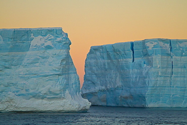
Huge tabular icebergs and smaller ice floes in the Weddell Sea, on the eastern side of the Antarctic Peninsula
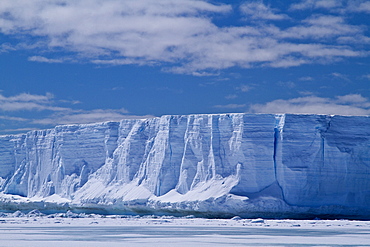
Huge tabular icebergs and smaller ice floes in the Weddell Sea, on the eastern side of the Antarctic Peninsula
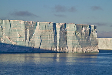
Huge tabular icebergs and smaller ice floes in the Weddell Sea, on the eastern side of the Antarctic Peninsula
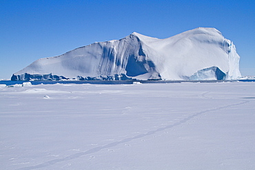
Huge tabular icebergs and smaller ice floes in the Weddell Sea, on the eastern side of the Antarctic Peninsula
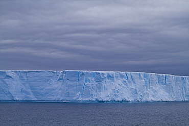
Huge tabular icebergs and smaller ice floes in the Weddell Sea, on the eastern side of the Antarctic Peninsula
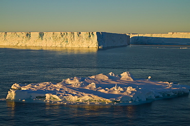
Huge tabular icebergs and smaller ice floes in the Weddell Sea, on the eastern side of the Antarctic Peninsula
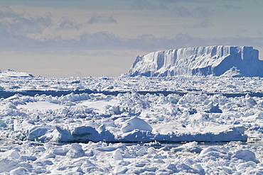
Huge tabular icebergs and smaller ice floes in the Weddell Sea, on the eastern side of the Antarctic Peninsula
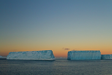
Huge tabular icebergs and smaller ice floes in the Weddell Sea, on the eastern side of the Antarctic Peninsula
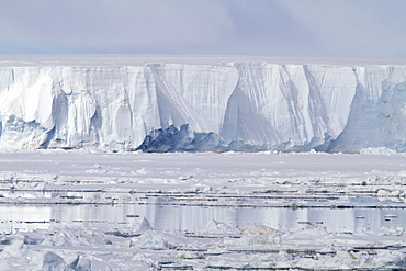
Huge tabular icebergs and smaller ice floes in the Weddell Sea, on the eastern side of the Antarctic Peninsula
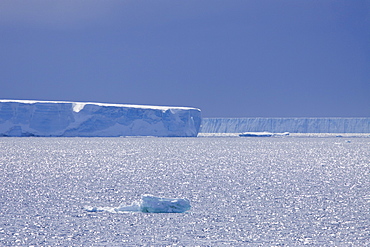
Huge tabular icebergs and smaller ice floes in the Weddell Sea, on the eastern side of the Antarctic Peninsula
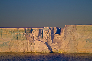
Huge tabular icebergs and smaller ice floes in the Weddell Sea, on the eastern side of the Antarctic Peninsula
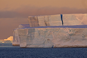
Huge tabular icebergs and smaller ice floes in the Weddell Sea, on the eastern side of the Antarctic Peninsula
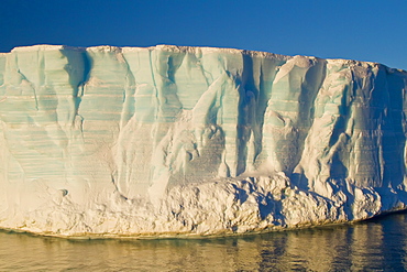
Huge tabular icebergs and smaller ice floes in the Weddell Sea, on the eastern side of the Antarctic Peninsula
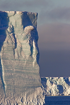
Huge tabular icebergs and smaller ice floes in the Weddell Sea, on the eastern side of the Antarctic Peninsula
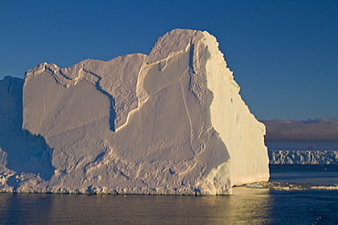
Huge tabular icebergs and smaller ice floes in the Weddell Sea, on the eastern side of the Antarctic Peninsula
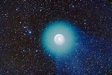
Comet Holmes, 17P, taken Nov 1, 2007 on excellent night. Taken with A&M 105mm apo refractor at f/5 with Borg 0.85x compressor/field flattener on SkyWatcher HEQ5 mount. Canon 20Da camera at ISO400. Composite of 4 min, 2min, 1min, 30sec, 15sec, and 7 sec exposures, each exposure being a stack of 3 to 4 identical exposures. Registered and stacked in Photoshop (HDR mode did not produce usable result, so manually composited with sucessively smaller masks to reveal short exposure content around nucleus. Contrast exaggerated with Curves to bring out very faint tail structure. North up, so tail to the S and SW.Nucleus is dot at upper left of inner coma, other star in inner coma at right is a field star

The complex area of clusters and nebulosity in central Auriga, including: M38 the Starfish Cluster and its smaller companion cluster NGC 1907; the emission/reflection nebulas NGC 1931, IC 417, IC 410 and IC 405 (from right to left here). Magenta and cyan (from emission and reflection components) IC 405 at right is the Flaming Star Nebula. Between IC 405 and IC 410 is the asterism known as The Little Fish.
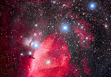
This is the Belt of Orion with its three blue stars across the top of the frame (L to R: Alnitak, Alnilam, and Mintaka), with the iconic Horsehead Nebula (aka B33) below Alnitak, with the dark Horsehead set against the bright nebula IC 434, aka Orion's Dagger. The pinkish nebula above Alnitak is NGC 2024, the Flame Nebula. The small blue reflection nebula left of the Horsehead is NGC 2023, with smaller IC 435 to the left of it. The field is filled with the large open cluster Collinder 70. The multiple star at bottom left of centre is Sigma Orionis. Many other smaller bits of reflection nebulas populate the field in and around the Belt.
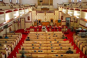
A parishioner at mass. The Evangelist Catholic Churc. 65 138th Street in harlem, New York, USA. Abyssinian Baptist Church, just across Malcolm X Boulevard (7th Ave), provide a more real than it is a Mass in Harlem, not so paraphernalia or gibberish vision. Located across from each other, offer Mass on Sunday morning at 9 and 11, with a more modest gospel choir and an infinitely smaller audience.

The colourful region around Antares in Scorpius, the yellow star at centre. To the right is the globular cluster Messier 4. Above right of Antares is the smaller globular NGC 6144. Above are the nebulas associated with Rho Ophiuchi. The area is filled with reflection (yellow and blue) and emission nebulas (red and pink). The field simulates a binocular field.
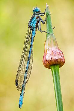
Damselflies are similar to dragonflies, but are smaller, have slimmer bodies, and most species fold the wings along the body when at rest.

Measles virus (of large size) and SV40 virus (of small size), TEM. This electron micrograph reveals both a paramyxovirus measles virus, and virions of the polyomavirus, simian virus SV40 (smaller circles)

Proszenium arch of a paper theater, Castle Burg, Schloss Burg, Solingen, Bergisches Land, NRW, Germany
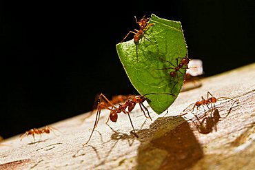
Leafcutter Ant (Atta cephalotes) carrying a piece of a leaf and smaller ants defending against Phorid flies, rainforest, Costa Rica, Central America

Krupp symbol, three rings, exhibition in the smaller house of the Villa Huegel mansion, Baldeney district, Essen, North Rhine-Westphalia, Germany, Europe
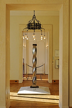
Column made of nickel and steel, twisted by 360 degrees, exhibition in the smaller house of the Villa Huegel mansion, Baldeney district, Essen, North Rhine-Westphalia, Germany, Europe
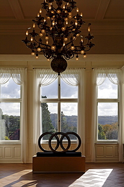
Krupp symbol, three rings, exhibition in the smaller house of the Villa Huegel mansion, Baldeney district, Essen, North Rhine-Westphalia, Germany, Europe
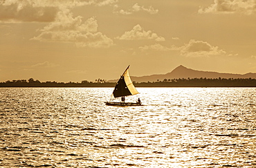
The Louisiade Archipelago is a string of ten larger volcanic islands frequently fringed by coral reefs, and 90 smaller coral islands located 200 km southeast of New Guinea, stretching over more than 160 km and spread over an ocean area of 26,000 km? between the Solomon Sea to the north and the Coral Sea to the south. The aggregate land area of the islands is about 1,790 km? (690 square miles), with Vanatinai (formerly Sudest or Tagula as named by European claimants on Western maps) being the largest.Sideia Island and Basilaki Island lie closest to New Guinea, while Misima, Vanatinai, and Rossel islands lie further east. The archipelago is divided into the Local Level Government (LLG) areas Louisiade Rural (western part, with Misima), and Yaleyamba (western part, with Rossell and Tagula islands. The LLG areas are part of Samarai-Murua District district of Milne Bay. The seat of the Louisiade Rural LLG is Bwagaoia on Misima Island, the population center of the archipelago.
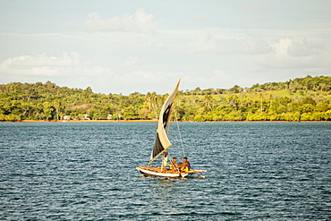
The Louisiade Archipelago is a string of ten larger volcanic islands frequently fringed by coral reefs, and 90 smaller coral islands located 200 km southeast of New Guinea, stretching over more than 160 km and spread over an ocean area of 26,000 km? between the Solomon Sea to the north and the Coral Sea to the south. The aggregate land area of the islands is about 1,790 km? (690 square miles), with Vanatinai (formerly Sudest or Tagula as named by European claimants on Western maps) being the largest. Sideia Island and Basilaki Island lie closest to New Guinea, while Misima, Vanatinai, and Rossel islands lie further east. The archipelago is divided into the Local Level Government (LLG) areas Louisiade Rural (western part, with Misima), and Yaleyamba (western part, with Rossell and Tagula islands. The LLG areas are part of Samarai-Murua District district of Milne Bay. The seat of the Louisiade Rural LLG is Bwagaoia on Misima Island, the population center of the archipelago.
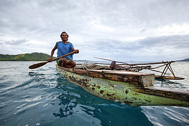
Nimoa Island - here the island mission will impress. The five-sided church features murals of island life and all mission buildings are surrounded by well maintained paths and gardens filled with flowering plants. Edged by jungle-covered mountains, postcard beaches and crystal clear waters - an island paradise indeed! The Louisiade Archipelago is a string of ten larger volcanic islands frequently fringed by coral reefs, and 90 smaller coral islands located 200 km southeast of New Guinea, stretching over more than 160 km and spread over an ocean area of 26,000 km? between the Solomon Sea to the north and the Coral Sea to the south. The aggregate land area of the islands is about 1,790 km? (690 square miles), with Vanatinai (formerly Sudest or Tagula as named by European claimants on Western maps) being the largest. Sideia Island and Basilaki Island lie closest to New Guinea, while Misima, Vanatinai, and Rossel islands lie further east. The archipelago is divided into the Local Level Government (LLG) areas Loui!
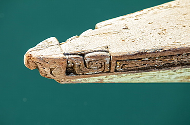
Nimoa Island - here the island mission will impress. The five-sided church features murals of island life and all mission buildings are surrounded by well maintained paths and gardens filled with flowering plants. Edged by jungle-covered mountains, postcard beaches and crystal clear waters - an island paradise indeed! The Louisiade Archipelago is a string of ten larger volcanic islands frequently fringed by coral reefs, and 90 smaller coral islands located 200 km southeast of New Guinea, stretching over more than 160 km and spread over an ocean area of 26,000 km? between the Solomon Sea to the north and the Coral Sea to the south. The aggregate land area of the islands is about 1,790 km? (690 square miles), with Vanatinai (formerly Sudest or Tagula as named by European claimants on Western maps) being the largest. Sideia Island and Basilaki Island lie closest to New Guinea, while Misima, Vanatinai, and Rossel islands lie further east. The archipelago is divided into the Local Level Government (LLG) areas Loui!

Nimoa Island - here the island mission will impress. The five-sided church features murals of island life and all mission buildings are surrounded by well maintained paths and gardens filled with flowering plants. Edged by jungle-covered mountains, postcard beaches and crystal clear waters - an island paradise indeed! The Louisiade Archipelago is a string of ten larger volcanic islands frequently fringed by coral reefs, and 90 smaller coral islands located 200 km southeast of New Guinea, stretching over more than 160 km and spread over an ocean area of 26,000 km? between the Solomon Sea to the north and the Coral Sea to the south. The aggregate land area of the islands is about 1,790 km? (690 square miles), with Vanatinai (formerly Sudest or Tagula as named by European claimants on Western maps) being the largest. Sideia Island and Basilaki Island lie closest to New Guinea, while Misima, Vanatinai, and Rossel islands lie further east. The archipelago is divided into the Local Level Government (LLG) areas Louisiade Rural (western part, with Misima), and Yaleyamba (western part, with Rossell and Tagula islands. The LLG areas are part of Samarai-Murua District district of Milne Bay. The seat of the Louisiade Rural LLG is Bwagaoia on Misima Island, the population center of the archipelago.
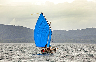
Nimoa Island - here the island mission will impress. The five-sided church features murals of island life and all mission buildings are surrounded by well maintained paths and gardens filled with flowering plants. Edged by jungle-covered mountains, postcard beaches and crystal clear waters - an island paradise indeed! The Louisiade Archipelago is a string of ten larger volcanic islands frequently fringed by coral reefs, and 90 smaller coral islands located 200 km southeast of New Guinea, stretching over more than 160 km and spread over an ocean area of 26,000 km? between the Solomon Sea to the north and the Coral Sea to the south. The aggregate land area of the islands is about 1,790 km? (690 square miles), with Vanatinai (formerly Sudest or Tagula as named by European claimants on Western maps) being the largest. Sideia Island and Basilaki Island lie closest to New Guinea, while Misima, Vanatinai, and Rossel islands lie further east.
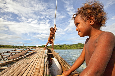
Children playing with a outrigger canoe in the village of Hessessai Bay at PanaTinai (Panatinane)island in the Louisiade Archipelago in Milne Bay Province, Papua New Guinea. The island has an area of 78 km2. The Louisiade Archipelago is a string of ten larger volcanic islands frequently fringed by coral reefs, and 90 smaller coral islands located 200 km southeast of New Guinea, stretching over more than 160 km and spread over an ocean area of 26,000 km? between the Solomon Sea to the north and the Coral Sea to the south. The aggregate land area of the islands is about 1,790 km? (690 square miles), with Vanatinai (formerly Sudest or Tagula as named by European claimants on Western maps) being the largest. Sideia Island and Basilaki Island lie closest to New Guinea, while Misima, Vanatinai, and Rossel islands lie further east. The archipelago is divided into the Local Level Government (LLG) areas Louisiade Rural (western part, with Misima), and Yaleyamba (western part, with Rossell and Tagula islands. The LLG areas are part of Samarai-Murua District district of Milne Bay. The seat of the Louisiade Rural LLG is Bwagaoia on Misima Island, the population center of the archipelago.PanaTinai (Panatinane) is an island in the Louisiade Archipelago in Milne Bay Province, Papua New Guinea.

Nimoa Island - here the island mission will impress. The five-sided church features murals of island life and all mission buildings are surrounded by well maintained paths and gardens filled with flowering plants. Edged by jungle-covered mountains, postcard beaches and crystal clear waters - an island paradise indeed! The Louisiade Archipelago is a string of ten larger volcanic islands frequently fringed by coral reefs, and 90 smaller coral islands located 200 km southeast of New Guinea, stretching over more than 160 km and spread over an ocean area of 26,000 km? between the Solomon Sea to the north and the Coral Sea to the south. The aggregate land area of the islands is about 1,790 km? (690 square miles), with Vanatinai (formerly Sudest or Tagula as named by European claimants on Western maps) being the largest. Sideia Island and Basilaki Island lie closest to New Guinea, while Misima, Vanatinai, and Rossel islands lie further east. The archipelago is divided into the Local Level Government (LLG) areas Louisiade Rural (western part, with Misima), and Yaleyamba (western part, with Rossell and Tagula islands. The LLG areas are part of Samarai-Murua District district of Milne Bay. The seat of the Louisiade Rural LLG is Bwagaoia on Misima Island, the population center of the archipelago.
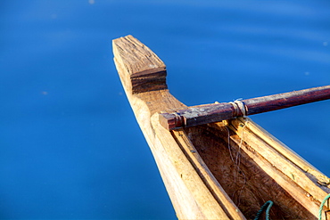
Nimoa Island - here the island mission will impress. The five-sided church features murals of island life and all mission buildings are surrounded by well maintained paths and gardens filled with flowering plants. Edged by jungle-covered mountains, postcard beaches and crystal clear waters - an island paradise indeed! The Louisiade Archipelago is a string of ten larger volcanic islands frequently fringed by coral reefs, and 90 smaller coral islands located 200 km southeast of New Guinea, stretching over more than 160 km and spread over an ocean area of 26,000 km? between the Solomon Sea to the north and the Coral Sea to the south. The aggregate land area of the islands is about 1,790 km? (690 square miles), with Vanatinai (formerly Sudest or Tagula as named by European claimants on Western maps) being the largest. Sideia Island and Basilaki Island lie closest to New Guinea, while Misima, Vanatinai, and Rossel islands lie further east. The archipelago is divided into the Local Level Government (LLG) areas Louisiade Rural (western part, with Misima), and Yaleyamba (western part, with Rossell and Tagula islands. The LLG areas are part of Samarai-Murua District district of Milne Bay. The seat of the Louisiade Rural LLG is Bwagaoia on Misima Island, the population center of the archipelago.
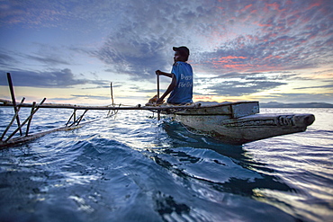
Nimoa Island - here the island mission will impress. The five-sided church features murals of island life and all mission buildings are surrounded by well maintained paths and gardens filled with flowering plants. Edged by jungle-covered mountains, postcard beaches and crystal clear waters - an island paradise indeed! The Louisiade Archipelago is a string of ten larger volcanic islands frequently fringed by coral reefs, and 90 smaller coral islands located 200 km southeast of New Guinea, stretching over more than 160 km and spread over an ocean area of 26,000 km? between the Solomon Sea to the north and the Coral Sea to the south. The aggregate land area of the islands is about 1,790 km? (690 square miles), with Vanatinai (formerly Sudest or Tagula as named by European claimants on Western maps) being the largest. Sideia Island and Basilaki Island lie closest to New Guinea, while Misima, Vanatinai, and Rossel islands lie further east. The archipelago is divided into the Local Level Government (LLG) areas Loui!
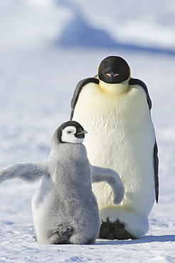
An adult Emperor penguin and a smaller fluffy penguin chick spreading its flippers out, Weddell Sea, Snow Hill Island, Antarctica

globular alga volvox is found in ponds and ditches Up to 1000 single-celled green algae each one with a tiny pair of whip-like tails are linked together to form a hollow sphere Inside this sphere you can see smaller daugther-colonies which eventually come free when the original colony disintegrates magnification 60x at 5x7
