Results
1 2 Next »
101 results found
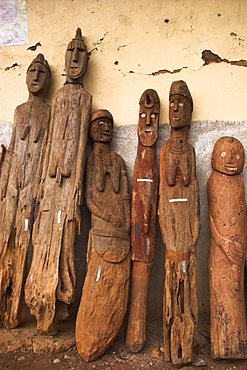
Famous carved wooden effigies of Waga (Wakka) chiefs and warriors, now becoming rare as many have been stolen by art collectors, Konso, southern area, Ethiopia, Africa
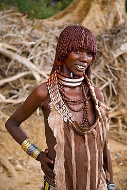
Portrait of a Hamer woman with goscha (ochre and resin hair tresses), Hamer Tribe, Lower Omo Valley, southern area, Ethiopia, Africa
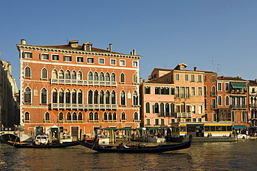
Gothic Palazzo Bembo, 15th century Palace in San Marco district near Rialto Bridge, Grand Canal, Venice, Veneto, Italy, Europe
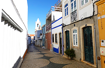
The Old Town of Lagos, Algarve, Portugal
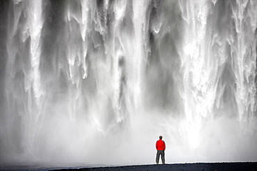
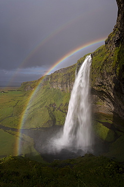
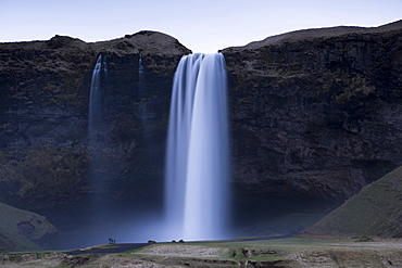
Man in red jacket standing in front of the 62m high Skogafoss waterfall near the village of Skogar, southern area, Iceland, Polar Regions
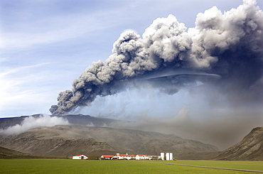
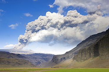
Farm buildings and green fields with the ash plume of the Eyjafjallajokull eruption in the distance, near Hella, southern area, Iceland, Polar Regions
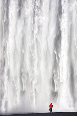
Man in red jacket standing in front of the 62m high Skogafoss waterfall near the village of Skogar, southern area, Iceland, Polar Regions

Porta Rudiae (Rudiae Gate), Lecce, Salento, Apulia, Italy

Casa d'Amore, UNESCO, Alberobello, Bari, Apulia, Italy
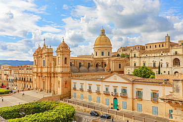
San Nicolo Cathedral, Noto, UNESCO, Noto Valley, Sicily, Italy
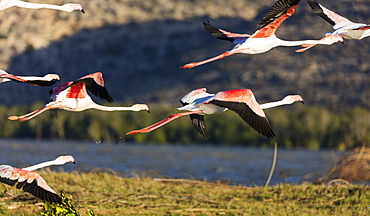
Greater flamingo (Phoenicopterus roseus), St. Augustine, southern area, Madagascar, Africa
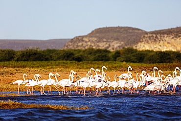
Greater flamingo (Phoenicopterus roseus), St. Augustine, southern area, Madagascar, Africa

Scrimieri Palace, Galatina, Lecce, Salento, Apulia, Italy
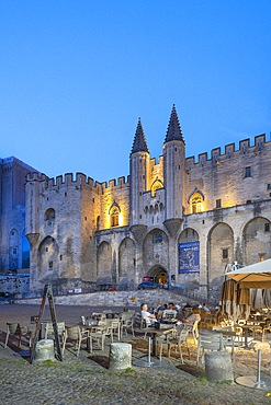
Palace of the Popes, UNESCO, Avignon, Rhone Valley, Grand Avignon, Vaucluse, Provence-Alpes-Cote d'Azur, France

Via Arco Mastrovito, Martina Franca, Taranto, Apulia, Italy
Junno District, Monte Sant'Angelo, Foggia, Apulia, Italy
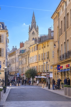
Aix-en-Provence, Bouches du Rhone, Provence-Alpes-Cote d'Azur, France
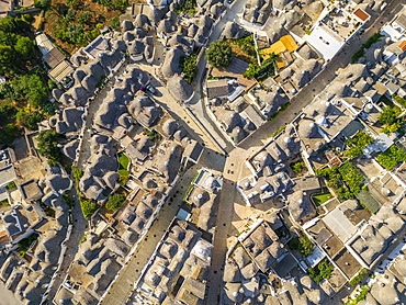
Aerial of trulli, Rione Monti, UNESCO, Alberobello, Bari, Apulia, Italy
Torri Rotonde, Martina Franca, Taranto, Apulia, Italy
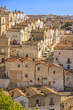
Junno District, Monte Sant'Angelo, Foggia, Apulia, Italy
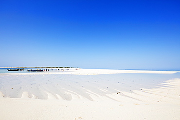
Anakao, Nosy Ve island, southern area, Madagascar, Africa
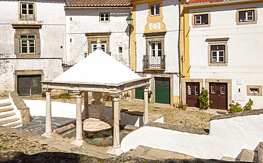
Historic public water supply from fountain in old Jewish area (the Judiara), Castelo de Vide, Alto Alentejo, Portugal, Europe
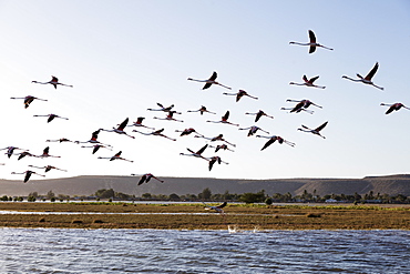
Greater flamingo (Phoenicopterus roseus), St. Augustine, southern area, Madagascar, Africa
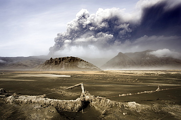
Landscape covered in volcanic ash and dust with the ash plume of the Eyjafjallajokull eruption in the distance, southern area, Iceland, Polar Regions

Billowing ash plume of the Eyjafjallajokull eruption, southern area, Iceland, Polar Regions
Seljalandsfoss Waterfall captured at dusk using long exposure to record movement in the water, near Hella, southern area, Iceland, Polar Regions
Seljalandsfoss Waterfall captured at dusk using long exposure to record movement in the water, near Hella, southern area, Iceland, Polar Regions
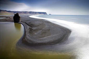
View from Dyrholaey towards the volcanic sand beach and rock stacks at Reynisdrangar, near the village of Vik i Myrdal, southern area, Iceland, Polar Regions
Distant view towards mountains with the ash plume of the Eyjafjallajokull eruption in the distance, near Hella, southern area, Iceland, Polar Regions
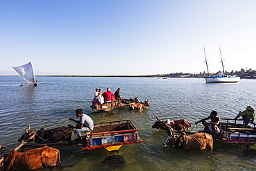
Tulear, boat to shore transfer by zebu cart for tourists, southern area, Madagascar. Africa
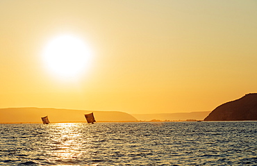
St. Augustine, sailboats on the horizon at sunrise, southern area, Madagascar, Africa
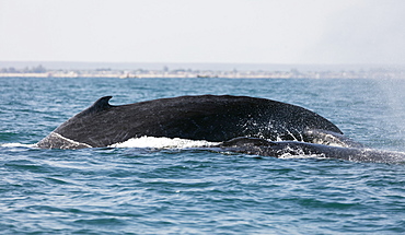
Humpback whale (Megaptera novaeangliae), Anakao, southern area, Madagascar, Africa

Verreaux's sifaka (Propithecus verreauxi), Zombitse-Vohibasia National Park, southern area, Madagascar, Africa
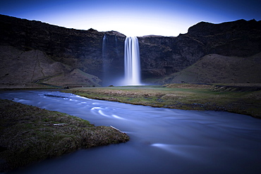
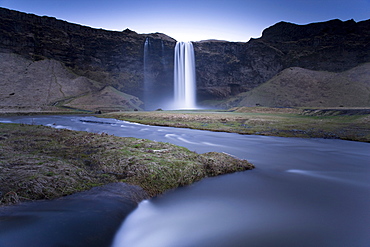
Seljalandsfoss waterfall, Seljalandsfoss, southern area, Iceland, Polar Regions
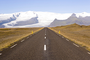
Empty road leading towards Fjallsjokull Glacier near Jokulsarlon, Vatnajokull Icecap, southern area, Iceland, Polar Regions
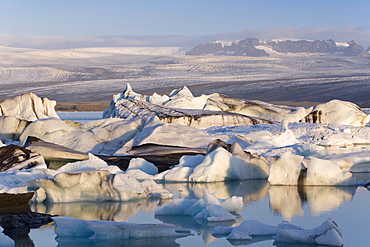
Icebergs floating in the Lagoon beneath Breidamerkurjokull Glacier, Jokulsarlon (Glacial River Lagoon), southern Vatnajokull, southern area, Iceland, Polar Regions
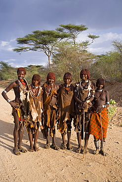
A group of Hamer women with goscha (ochre and resin hair tresses), Hamer Tribe, Lower Omo Valley, southern area, Ethiopia, Africa
Pregnant female southern elephant seal (Mirounga leonina) giving birth on the beach in Stromness Bay, South Georgia Island
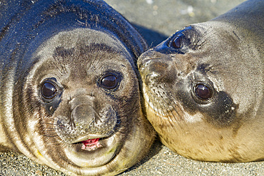
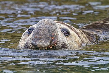
Southern elephant seal (Mirounga leonina) pup, called weaners once their mothers stop nursing them, South Georgia Island, Southern Ocean
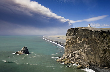
Headland with lighthouse at Dyrholaey looking towards a black volcanic sand beach stretching 15 miles into the distance and the ash plume of the Eyjafjallajokull eruption, near Vik i Myrdal, southern area, Iceland, Polar Regions
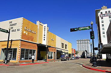
Street in downtown Beaumont, Texas, United States of America
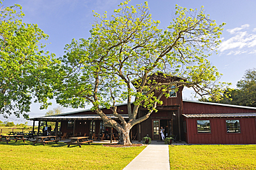
Pecan tree in front of Amelia Farm and Market, 8600 Dishman Road, Beaumont, Texas, United States of America
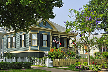
Houses on Avenue M Rear, Residential area, City of Galveston, Galveston island, Gulf of Mexico, Texas, United States of America

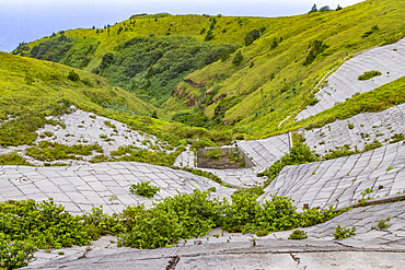
Drone aerial view of Kriaritsi project area with abandoned roads in the south of Greece, Sithonia, Chalkidiki, Greece
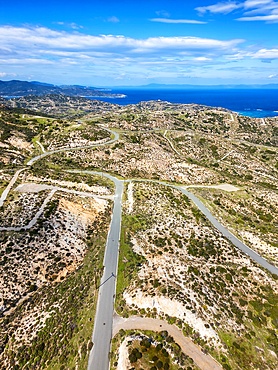
Drone aerial view of Kriaritsi project area with abandoned roads in the south of Greece, Sithonia, Chalkidiki, Greece
Drone aerial view of Kriaritsi project area with abandoned roads in the south of Greece, Sithonia, Chalkidiki, Greece
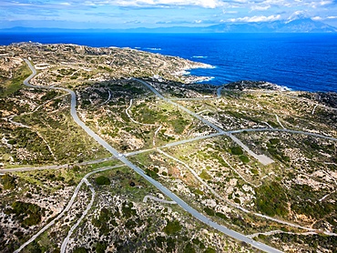
Drone aerial view of Kriaritsi project area with abandoned roads in the south of Greece, Sithonia, Chalkidiki, Greece
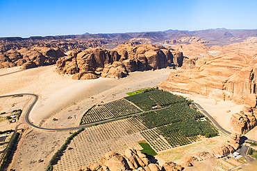
Aerial view from helicopter, of a farm in an ancient oasis in the desert with canyons of the Ashar Valley,AlUla, Medina Province, Saudi Arabia
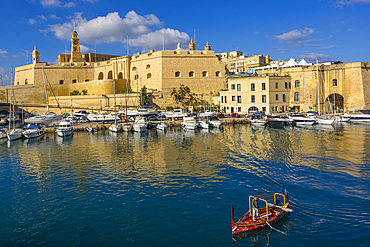
The Harbour at Kalkara, Malta
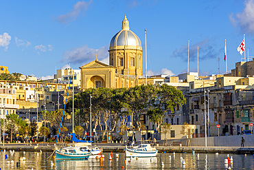
Grand Harbour looking towards Cospicua, Malta
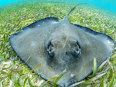
Southern stingray (Hypanus americanus) over sand in shark and ray alley, Caye Caulker, Mesoamerican Barrier Reef, Belize
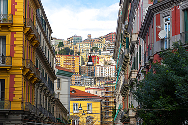
Residential Buildings fill the hills surrounding Naples, Campania, Italy
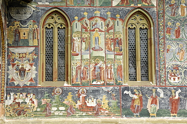
Painted monastery of Sucevita, Moldavia and Southern Bucovina area, Romania, Europe

Painted monastery of Sucevita, Moldavia and Southern Bucovina area, Romania, Europe
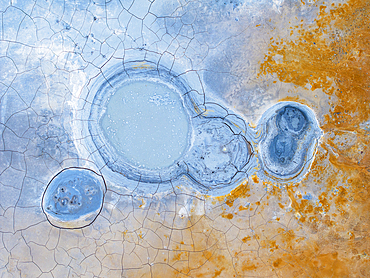
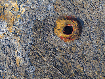
Aerial abstract view of the geothermal area near to Icleandic southern coast, Iceland, Polar Regions

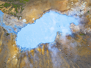
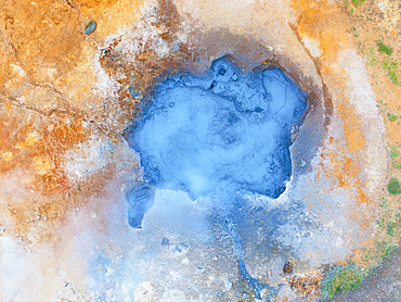
Aerial view of the volcanic cone in eruption area near to Reykjavik, Icelandic southern coast, Iceland, Polar Regions
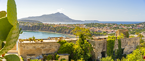
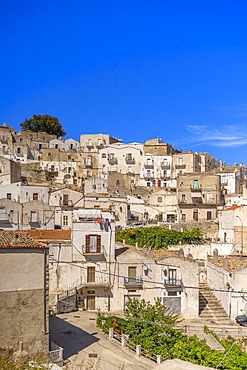
View of old fort area, Terra Murata, Procida, Phlegraean Islands, Gulf of Naples, Campania, Southern Italy, Italy, Europe
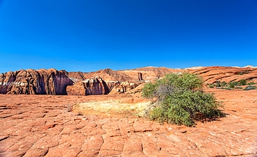
Petrified sand dunes, White Canyon State Park, Red Cliffs Desert Reserve near St. George, Utah, United States of America
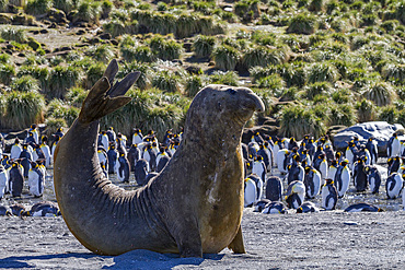
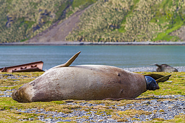
Bull southern elephant seal (Mirounga leonina) on South Georgia Island, Southern Ocean
Bull southern elephant seal (Mirounga leonina) on South Georgia Island, Southern Ocean
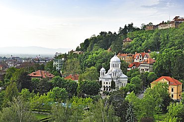
View North to beyond the Nicolae Titulescu Park from the Aro Palace hotel, Brasov, Transylvania, Romania
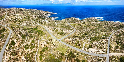
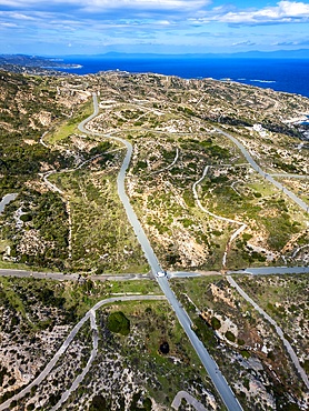
Drone aerial view of Kriaritsi project area with abandoned roads in the south of Greece, Sithonia, Chalkidiki, Greece
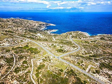
Drone aerial view of Kriaritsi project area with abandoned roads in the south of Greece, Sithonia, Chalkidiki, Greece
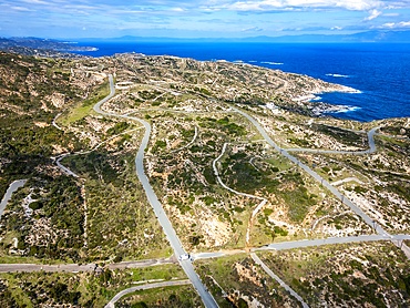
Drone aerial view of Kriaritsi project area with abandoned roads in the south of Greece, Sithonia, Chalkidiki, Greece

Dining Area in Casa Rocca Piccola, Valletta, Malta
View of the old water catchment area atop Green Mountain on Ascension Island in the southern tropical Atlantic Ocean, South Atlantic Ocean
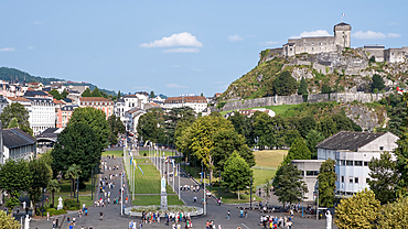
Urban landscape of Lourdes, a market town in the Pyrenees with Chateau Fort in backgroun,, Lourdes, Hautes-Pyrenees, Occitanie, France
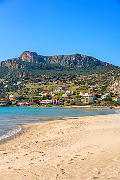
Plitra beach with turquoise water in Karavostasi in the south of Greece, Peloponnese, Greece

Petrified forest, Agia Marina, Agios Nikolaos Geopark, beach with turquoise water in the south of Greece, Greece
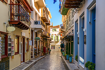
Nafplion historic city center colorful houses, Nafplion, Peloponnese, Greece

Painted monastery of Sucevita, Moldavia and Southern Bucovina area, Romania, Europe
View towards the coast and sea from the Vatnajokull Glacier, southern area, Iceland, Polar Regions
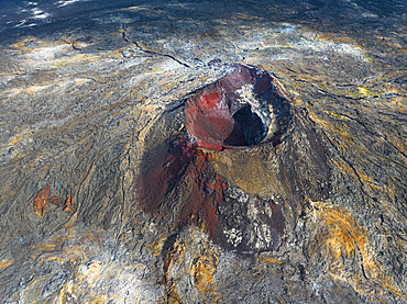
Aerial view of volcanic cone in the eruption area near to Reykjavik, Icelandic southern coast, Iceland, Polar Regions

Craggy rock spires overlooking South Rim Gorge, an area between Hance Canyon and the Sinking Ship, which is right of center in the distance, southern most part of Grand Canyon National Park, UNESCO World Heritage Site, Arizona, United States of America, North America

Aerial view of the eruption area near to Reykjavik, Icelandic southern coast, Iceland, Polar Regions
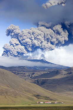
Houses at foot of mountains with the ash plume of the Eyjafjallajokull eruption in the distance, southern area, Iceland, Polar Regions
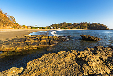
Playa Marsella, a lovely quiet beach in this popular southern surf coast area, Playa Marsella, San Juan del Sur, Rivas, Nicaragua, Central America
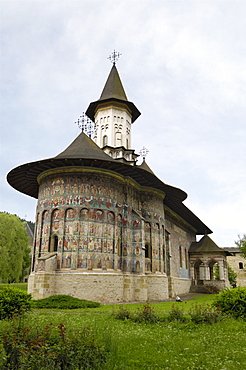
Painted monastery of Sucevita, Moldavia and Southern Bucovina area, Romania, Europe
Aerial view of the eruption area near to Reykjavik, Icelandic southern coast, Iceland, Polar Regions

Aerial view of the eruption area near to Reykjavik, Icelandic southern coast, Iceland, Polar Regions
Aerial abstract view of the geothermal area near to Icleandic southern coast, Iceland, Polar Regions
Aerial abstract view of the geothermal area near to Icleandic southern coast, Iceland, Polar Regions
Seljalandsfoss Waterfall captured at dusk using long exposure to record movement in the water, near Hella, southern area, Iceland, Polar Regions
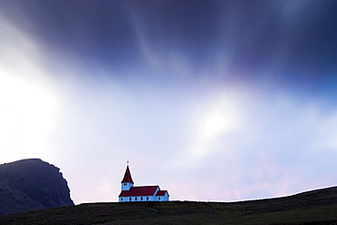
Hilltop church against twilight sky, Vik i Myrdal, southern area, Iceland, Polar Regions
Cyprus. Abandoned houses along th Green Line in Nicosia dividing the Republic of Cyprus and Turkish controlled northern part. The United Nations Buffer Zone in Cyprus runs for more than 180.5?kilometres (112.2?mi) along what is known as the Green Line and has an area of 346?square kilometres (134?sq?mi). The zone partitions the island of Cyprus into a southern area effectively controlled by the government of the Republic of Cyprus (which is the de jure government for the entire island save for the British Sovereign Base Areas), and the northern area controlled by the Turkish army
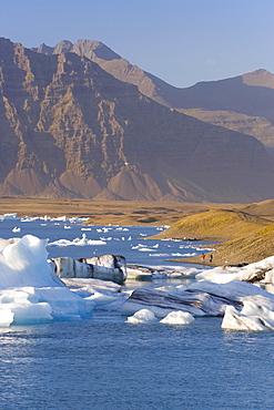
Icebergs floating in the Lagoon beneath Breidamerkurjokull Glacier, Jokulsarlon (Glacial River Lagoon), southern Vatnajokull, southern area, Iceland, Polar Regions
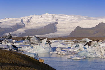
Icebergs floating in the Lagoon beneath Breidamerkurjokull Glacier, Jokulsarlon (Glacial River Lagoon), southern Vatnajokull, southern area, Iceland, Polar Regions
Cyprus. Abandoned houses along th Green Line in Nicosia dividing the Republic of Cyprus and Turkish controlled northern part. The United Nations Buffer Zone in Cyprus runs for more than 180.5?kilometres (112.2?mi) along what is known as the Green Line and has an area of 346?square kilometres (134?sq?mi). The zone partitions the island of Cyprus into a southern area effectively controlled by the government of the Republic of Cyprus (which is the de jure government for the entire island save for the British Sovereign Base Areas), and the northern area controlled by the Turkish army
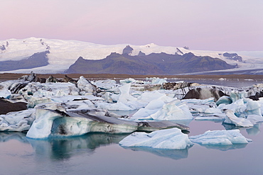
Icebergs floating in the Lagoon beneath Breidamerkurjokull Glacier, Jokulsarlon (Glacial River Lagoon), southern Vatnajokull, southern area, Iceland, Polar Regions
Cyprus. Abandoned houses along th Green Line in Nicosia dividing the Republic of Cyprus and Turkish controlled northern part. The United Nations Buffer Zone in Cyprus runs for more than 180.5?kilometres (112.2?mi) along what is known as the Green Line and has an area of 346?square kilometres (134?sq?mi). The zone partitions the island of Cyprus into a southern area effectively controlled by the government of the Republic of Cyprus (which is the de jure government for the entire island save for the British Sovereign Base Areas), and the northern area controlled by the Turkish army
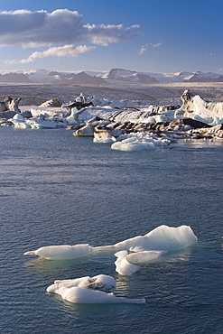
Icebergs floating in the Lagoon beneath Breidamerkurjokull Glacier, Jokulsarlon (Glacial River Lagoon), southern Vatnajokull, southern area, Iceland, Polar Regions
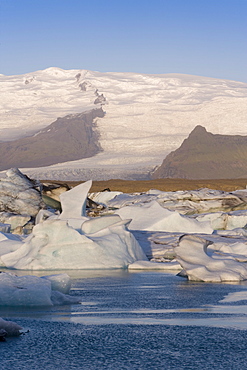
Icebergs floating in the Lagoon beneath Breidamerkurjokull Glacier, Jokulsarlon (Glacial River Lagoon), southern Vatnajokull, southern area, Iceland, Polar Regions
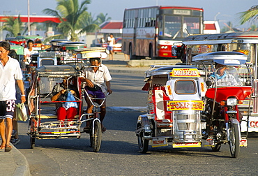
Trishaws, port of Lucena, southern area, island of Luzon, Philippines, Southeast Asia, Asia
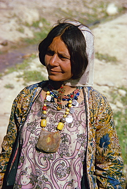
Woman of the Qashqai tribe, southern area, Iran, Middle East
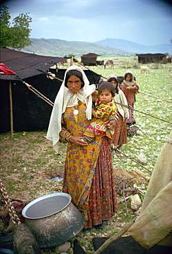
Qashqai woman and child, southern area, Iran, Middle East
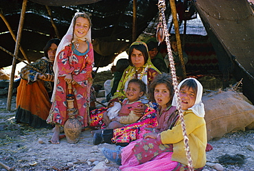
Qashqai women and children in camp, southern area, Iran, Middle East
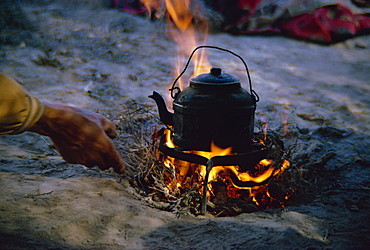
Kettle on fire in Qashqai camp, southern area, Iran, Middle East
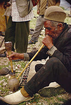
Qashqai man smoking, southern area, Iran, Middle East

Qashqai woman spinning, southern area, Iran, Middle East
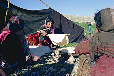
Qashqai women making bread in camp, southern area, Iran, Middle East