Results
3 results found
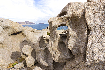
Las Serenitas, wind and wave erosion sculptures, Cabo Pulmo, UNESCO World Heritage Site, Baja California, Mexico, North America
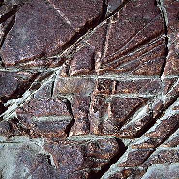
Red jasper rock at Orinduik Falls, Ireng River, Guyana, South America
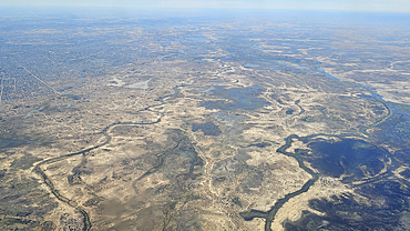
Aerial of N´Djamena, capital of Chad and the Chari River, Chad

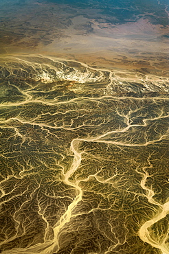
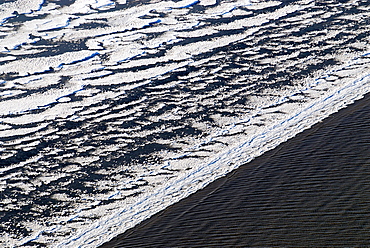
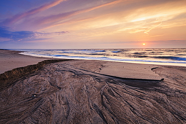
Aerial abstract view taken by drone of the textured river along the Icelandic southern coast, Iceland, Polar Regions

Aerial view of milky glacial water flow structures and patterns on the Holsa River near Selfoss, just before the estuary, South Coast, Iceland, Europe

Structures in a dry river bed, Monument Valley, Arizona, USA
Aerial view, wadis, dry river valleys in Hurghada, Egypt, Africa
Ice on the Elbe River, ice floes are deposited on the beach by the tides, bizarre ice floes on the Elbe River, Hamburg, Germany, Europe
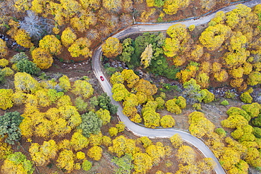
Sweet chestnut trees (Castanea sativa) in autumnal colours, aerial view, drone shot, Genal river valley, Malaga province, Andalusia, Spain, Europe
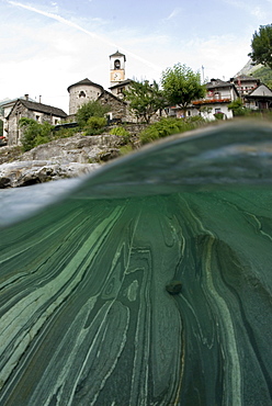
Lavertezzo, Ticino, Switzerland, Europe
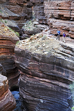
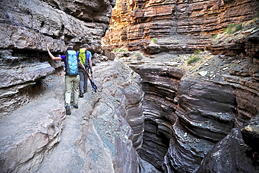
Hikers walk along Deer Creek Narrows in the Grand Canyon outside of Fredonia, Arizona November 2011. The 21.4-mile loop starts at the Bill Hall trailhead on the North Rim and descends 2000-feet in 2.5-miles through Coconino Sandstone to the level Esplanada then descends further into the lower canyon through a break in the 400-foot-tall Redwall to access Surprise Valley. Hikers connect Thunder River and Tapeats Creek to a route along the Colorado River and climb out Deer Creek.
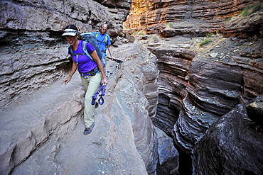
Hikers walk along Deer Creek Narrows in the Grand Canyon outside of Fredonia, Arizona November 2011. The 21.4-mile loop starts at the Bill Hall trailhead on the North Rim and descends 2000-feet in 2.5-miles through Coconino Sandstone to the level Esplanada then descends further into the lower canyon through a break in the 400-foot-tall Redwall to access Surprise Valley. Hikers connect Thunder River and Tapeats Creek to a route along the Colorado River and climb out Deer Creek.
Hikers walk along Deer Creek Narrows in the Grand Canyon outside of Fredonia, Arizona November 2011. The 21.4-mile loop starts at the Bill Hall trailhead on the North Rim and descends 2000-feet in 2.5-miles through Coconino Sandstone to the level Esplanada then descends further into the lower canyon through a break in the 400-foot-tall Redwall to access Surprise Valley. Hikers connect Thunder River and Tapeats Creek to a route along the Colorado River and climb out Deer Creek.

Imprint of a cottonwood leaf in cracked mud along the banks of the recently flooded Freemont River, Hanksville, Utah.
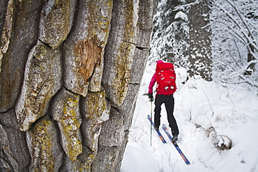
Cross Country Skiing Along The Russian River To Aspen Flats Cabin, Kenai Mountains Peninsula, Southcentral Alaska, Alaska, United States Of America
Dawn Over St. Lawrence River, Rivi