Results
1 results found
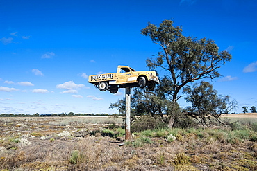
Old truck on a huge pole in the Mungo National Park, part of the Willandra Lakes Region, UNESCO World Heritage Site, Victoria, Australia, Pacific
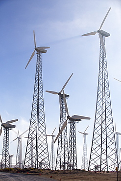
Part of the Tehachapi Pass wind farm, the first large scale wind farm area developed in the US, California, USA.

Part of the Tehachapi Pass wind farm, the first large scale wind farm area developed in the US, California, USA.

Hardest hit was a 650 kilometers stretch of the somali coastline between garacad (mudung region) and xaafuun (bari region), which forms part of the puntland province near the horn of africa. The tsunami resulted in the death of some 300 people and extensive destruction of shelters, houses and water sources as well as fishing gear. The livelihoods of many people residing in towns and small villages along the somali indian ocean coastline, particularly in the northern regions, were devastated
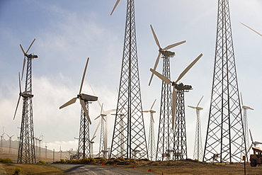
Part of the Tehachapi Pass wind farm, the first large scale wind farm area developed in the US, California, USA.

Part of the Tehachapi Pass wind farm, the first large scale wind farm area developed in the US, California, USA, at sunrise.

Part of the Tehachapi Pass wind farm, the first large scale wind farm area developed in the US, California, USA, at sunrise.
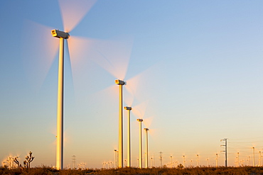
Part of the Tehachapi Pass wind farm, the first large scale wind farm area developed in the US, California, USA, at sunrise.
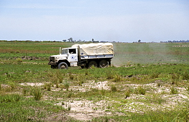
Zambia un truck delivering food aid to a remote part of shangombo district during a time of drought and near-famine 2002-2003
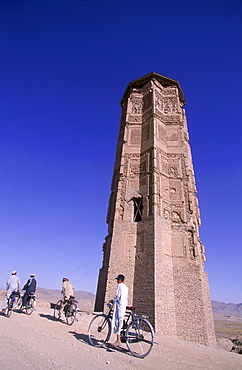
Men and boys on bikes ride past a towering, ancient minaret, outside of Ghazni, Afghanistan, October 1, 2002. Made of brick decorated with Kufic and Naksh Script and floral motifs, the minaret dates back to the early 12th century and was built by Sultan Masud III of the Ghaznavid Dynasty, who ruled over an empire encompassing much of Afghanistan, Northern India, Persia and Central Asia. The minaret was once three times as tall as its current 70 feet, and is thought to have been part of a large mosque complex. Now an important truck stop on the road to Kandahar, Ghazni, located on the Lora River at the elevation of 2,225 meters, is the capital of Ghazni province and is a market for sheep, wool, camel hair cloth, corn, and fruit-it also continues to be a haven for Taliban insurgents.

Afghan men pause on the road with an ancient brick minaret and many shrines in the background, outside of Ghazni, Afghanistan, October 1, 2002. Made of brick decorated with Kufic and Naksh Script and floral motifs, the minaret dates back to the early 12th century and was built by Sultan Masud III of the Ghaznavid Dynasty, who ruled over an empire encompassing much of Afghanistan, Northern India, Persia and Central Asia. The minaret was once three times as tall as its current 70 feet, and is thought to have been part of a large mosque complex. Now an important truck stop on the road to Kandahar, Ghazni, located on the Lora River at the elevation of 2,225 meters, is the capital of Ghazni province with a population of 35,900, and is a market for sheep, wool, camel hair cloth, corn, and fruit, and continues to be a haven for Taliban insurgents.

Men on bikes ride past an ancient brick minaret toward the old walls and citadel of the town of Ghazni, Afghanistan, October 1, 2002. Made of brick decorated with Kufic and Naksh Script and floral motifs, the minaret dates back to the early 12th century and was built by Sultan Masud III of the Ghaznavid Dynasty, who ruled over an empire encompassing much of Afghanistan, Northern India, Persia and Central Asia. The minaret was once three times as tall as its current 70 feet, and is thought to have been part of a large mosque complex. Now an important truck stop on the road to Kandahar, Ghazni, located on the Lora River at the elevation of 2,225 meters, is the capital of Ghazni province with a population of 35,900, and is a market for sheep, wool, camel hair cloth, corn, and fruit.

The province of Mendoza is part of all Argentine provinces that are vertically crossed by the Cordillera de Los Andes. The Principal Cordillera is the result of an early folding, with an average height of about 6500 meters. It has two distinct sectors: in the north and to the provincial Diamond Rio is characterized by a high narrow strip, which finds its highest expression in the Cerro Aconcagua 6962 m. In the southern provinces, from Diamond Rio to the South forms a wider and less high orographic belt.
