Results
31 results found
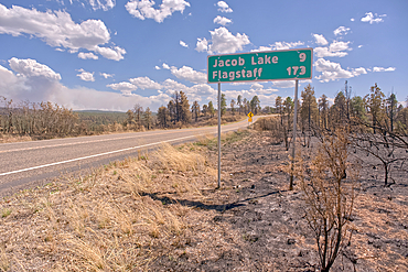
Road sign along US89A north of Jacob Lake Arizona that has been partially damaged by the White Sage Fire.
Smoke from the Dragon Bravo Wildfire burning on Grand Canyon North Rim billowing off the Kaibab Plateau. Viewed north of US89A across from Vermilion Cliffs.
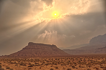
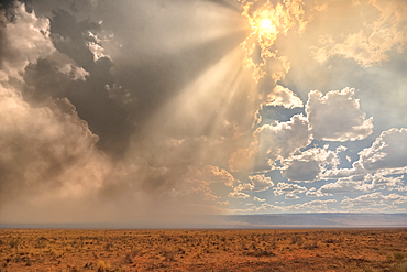
Sun shining thru dense smoke from the Dragon Bravo Wildfire enshrouding Vermilion Cliffs National Monument Arizona. Viewed from US89A.
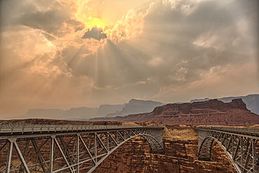
Sun shining thru dense smoke from the Dragon Bravo Wildfire enshrouding Vermilion Cliffs National Monument Arizona. Viewed from US89A at Navajo Bridge.
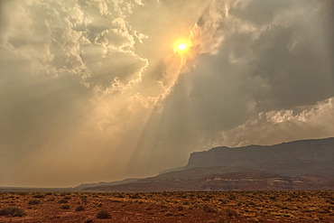
Sun shining thru dense smoke from the Dragon Bravo Wildfire enshrouding Vermilion Cliffs National Monument Arizona. Viewed from US89A.
Smoke from the Dragon Bravo Wildfire enshrouding Vermilion Cliffs National Monument Arizona. Viewed from US89A.
Late day sun shining thru dense smoke from the Dragon Bravo Wildfire billowing off the Kaibab Plateau. Viewed from US89A across from Vermilion Cliffs Arizona.
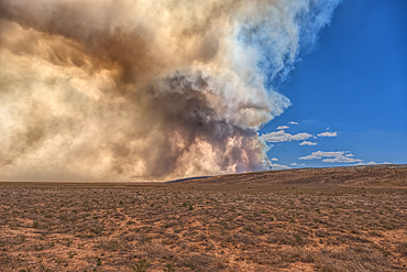
Smoke from the Dragon Bravo Wildfire burning on Grand Canyon North Rim billowing off the Kaibab Plateau. Viewed from US89A across from Vermilion Cliffs.
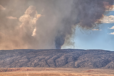
Smoke from the Dragon Bravo Wildfire burning on Grand Canyon North Rim billowing off the Kaibab Plateau. Viewed from US89A across from Vermilion Cliffs.
Smoke from the Dragon Bravo Wildfire burning on Grand Canyon North Rim billowing off the Kaibab Plateau. Viewed from US89A across from Vermilion Cliffs.
Vermilion Cliffs at Marble Canyon Arizona enshrouded with smoke from the Dragon Bravo Wildfire burning on Grand Canyon North Rim. Viewed from US89A.
Smoke from the Dragon Bravo Wildfire burning on Grand Canyon North Rim billowing off the Kaibab Plateau. Viewed from US89A next to Vermilion Cliffs.
Vermilion Cliffs at Marble Canyon Arizona enshrouded with smoke from the Dragon Bravo Wildfire burning on Grand Canyon North Rim. Viewed from US89A.
Vermilion Cliffs National Monument Arizona at sunset viewed from House Rock Road north of US89A.
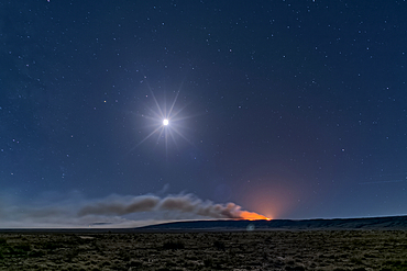
Dragon Bravo Wildfire on Grand Canyon North Rim viewed from US89A near Vermilion Cliffs Arizona at night under moonlight.
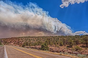
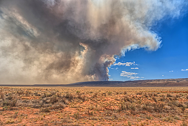
Smoke from the Dragon Bravo Wildfire burning on Grand Canyon North Rim billowing off the Kaibab Plateau. Viewed from US89A.
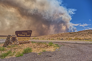
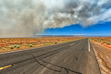
Smoke from the Dragon Bravo Wildfire burning on Grand Canyon North Rim billowing off the Kaibab Plateau. Viewed from US89A at the Kaibab National Forest Boundary.
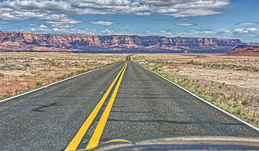
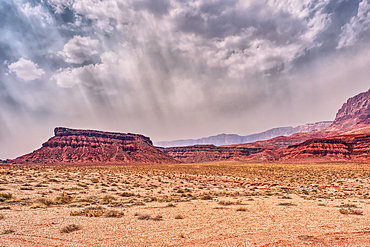
Vermilion Cliffs National Monument, Arizona, USA
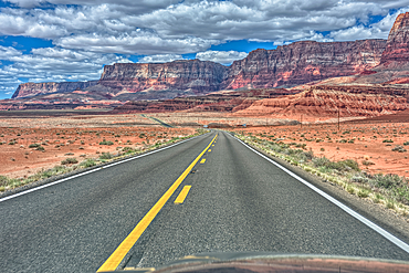
Vermilion Cliffs National Monument, Arizona, USA
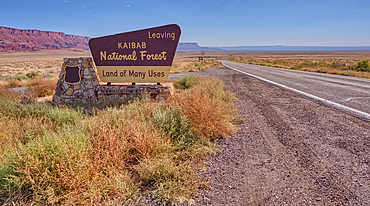
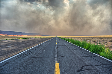
Highway US89A looking east to Vermilion Cliffs National Monument with Kaibab National Forest boundary sign, Arizona, United States of America
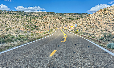
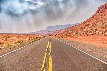
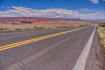
Highway US89A ascending onto the Kaibab Plateau, Arizona, USA
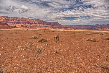
An abandoned lawn chair in view of Vermilion Cliffs near Marble Canyon Arizona from US89A on a mostly cloudy day. Located between the little town of Bitter Springs on the Navajo Reservation and the Vermilion Cliffs National Monument.
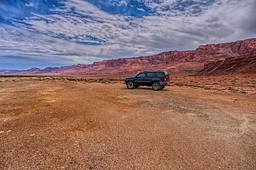
Vehicle parked next to Jackass Creek off of US89A near Echo Cliffs on the way to Vermilion Cliffs Arizona. Located on the Navajo Indian Reservation between Bitter Springs and Marble Canyon.
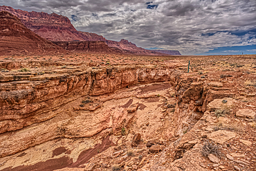
View of a small slot canyon called Jackass Creek off of US89A next to Echo Cliffs on the way to Vermilion Cliffs Arizona. Located on the Navajo Indian Reservation between Bitter Springs and Marble Canyon.
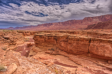
View of a small slot canyon called Jackass Creek off of US89A next to Echo Cliffs on the way to Vermilion Cliffs Arizona. Located on the Navajo Indian Reservation between Bitter Springs and Marble Canyon.
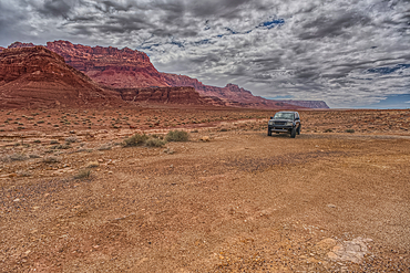
Vehicle parked next to Jackass Creek off of US89A near Echo Cliffs on the way to Vermilion Cliffs Arizona. Located on the Navajo Indian Reservation between Bitter Springs and Marble Canyon.
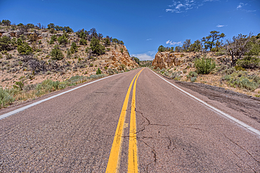
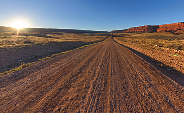
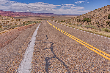
US89A ascending to the Kaibab Plateau in Arizona north of the Vermilion Cliffs National Monument.
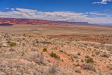
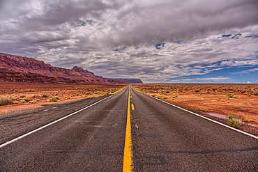
View of Vermilion Cliffs Arizona from US89A from and overlook above House Rock Valley.
View of Vermilion Cliffs Arizona from US89A ascending to the Kaibab Plateau.
View of Vermilion Cliffs Arizona from US89A ascending to the Kaibab Plateau.
View of Echo Cliffs near Marble Canyon Arizona from US89A on a mostly cloudy day. This section of the cliffs is near the little town of Bitter Springs on the Navajo Reservation adjacent to the Vermilion Cliffs National Monument.