Results
44 results found
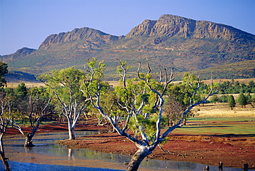
Gum trees in a billabong at Rawnsley and the south west escarpment of Wilpena Pound, a huge natural basin, Flinders Ranges National Park, South Australia, Australia
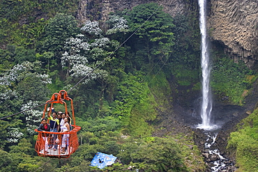
Cable car at the Rio Verde waterfall in the valley of the Pastaza River that flows from the Andes to the upper Amazon Basin, near Banos, Ambato Province, Central Highlands, Ecuador, South America
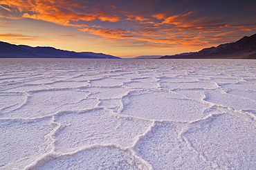
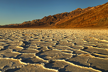
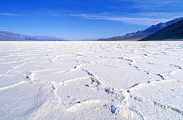
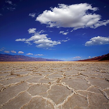
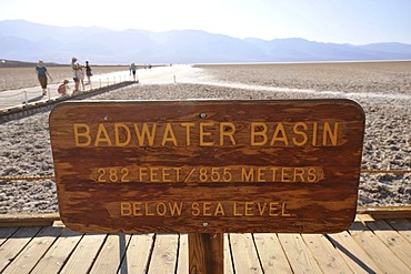
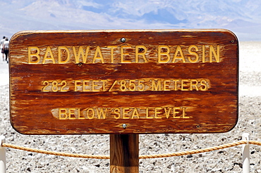
Sunset at the Salt pan polygons, Badwater Basin, 282ft below sea level and the lowest place in North America, Death Valley National Park, California, United States of America, North America
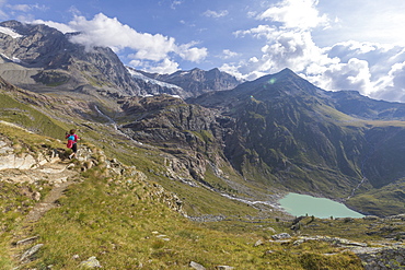
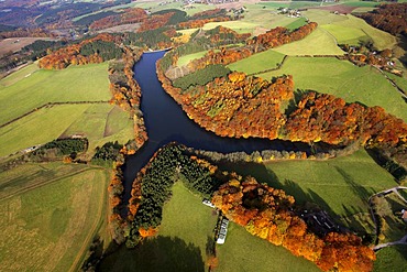
Sentiero Glaciologico and water basin and dam of Alpe Gera on the background, Malenco Valley, Valtellina, Lombardy, Italy, Europe
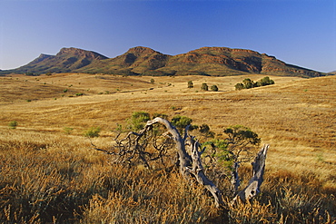
Gnarled tree and east escarpment of Wilpena Pound, a huge natural basin in the Flinders Ranges National Park, South Australia, Australia
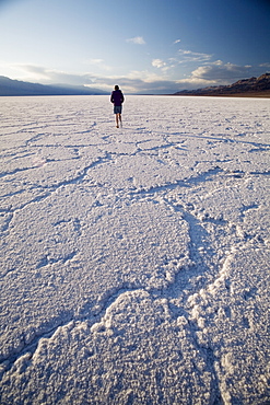
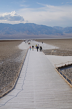
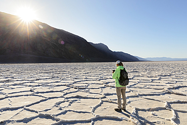
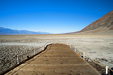
Woman walking on salt flats, Badwater Basin, at minus 282 feet the lowest point in the United States, Death Valley National Park, California, United States of America, North America

Hiker on path towards Rifugio Bignami beside the dam and water basin of Alpe Gera, Malenco Valley, Valtellina, Lombardy, Italy, Europe
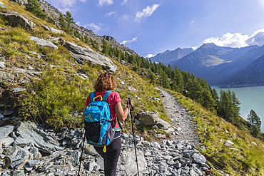
Hiker on path towards Rifugio Bignami beside the dam and water basin of Alpe Gera, Malenco Valley, Valtellina, Lombardy, Italy, Europe
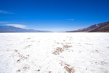
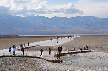
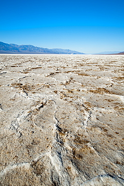
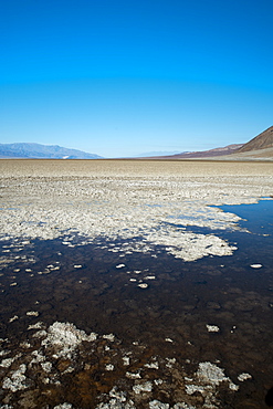
Salt flats near Badwater Basin, Death Valley National Park, California, United States of America, North America
Badwater Basin, Death Valley, California, United States of America, North America
Badwater Basin, Death Valley, California, United States of America, North America
Badwater Basin, Death Valley, California, United States of America, North America
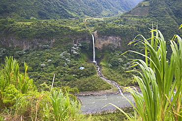
Cable car at the Rio Verde waterfall in the valley of the Pastaza River that flows from the Andes to the upper Amazon Basin, near Banos, Ambato Province, Central Highlands, Ecuador, South America
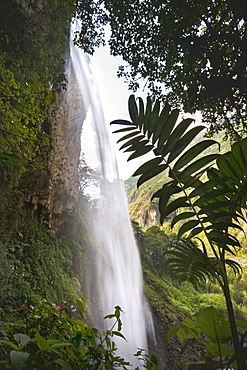
The Rio Verde waterfall, one of many in the valley of the Pastaza River that flows from the Andes to the upper Amazon Basin, near Banos, Ambato Province, Central Highlands, Ecuador, South America
Salt pans on sunny day, Badwater Basin, Death Valley National Park, Eastern California, California, United States of America, North America

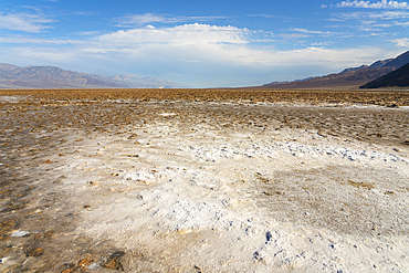
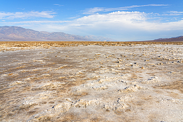
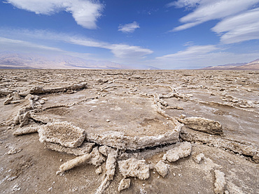
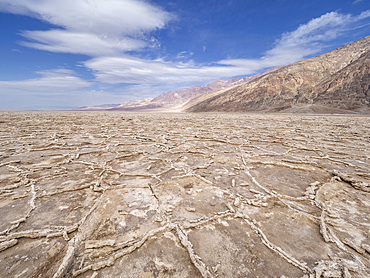
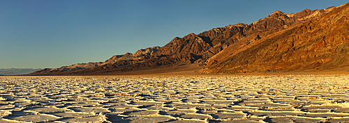
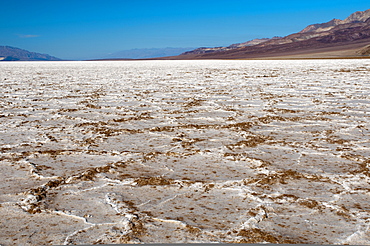
Salt pan polygons at Badwater Basin, 282ft below sea level and the lowest place in North America, Death Valley National Park, California, United States of America, North America
Salt pans on sunny day, Badwater Basin, Death Valley National Park, Eastern California, California, United States of America, North America
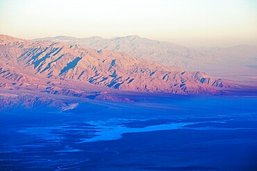
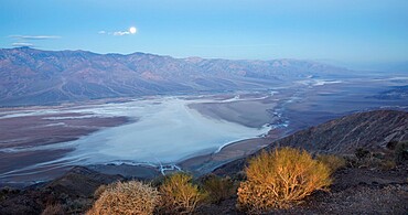
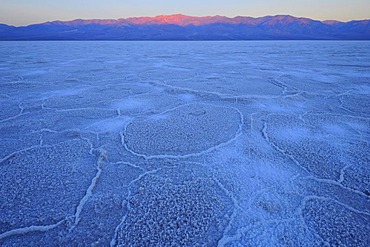
View over Badwater Basin to the Panamint Range, sunrise, Dante's View, Death Valley National Park, California, United States of America, North America
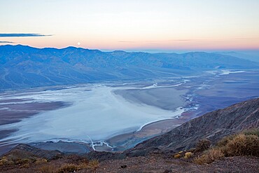
View by moonlight over Badwater Basin to the Panamint Range, Dante's View, Death Valley National Park, California, United States of America, North America
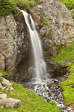
Porphyry Basin Waterfall, San Juan National Forest, Colorado, United States of America, North America
The Salt Flats of Badwater Basin, the lowest point in North America, Death Valley National Park, California, United States of America, North America
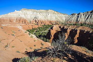
Redrock sandstone formations in the Kodachrome Basin State Park, Utah, United States of America, North America

Salt pan polygons at Badwater Basin, 282ft below sea level and the lowest place in North America, Death Valley National Park, California, United States of America, North America
Badwater Basin, Death Valley National Park, California, United States of America, North America

The Salt Flats of Badwater Basin, the lowest point in North America, Death Valley National Park, California, United States of America, North America
Panoramic view by moonlight over Badwater Basin to the Panamint Range, Dante's View, Death Valley National Park, California, United States of America, North America
The Salt Flats of Badwater Basin, the lowest point in North America, Death Valley National Park, California, United States of America, North America

Sunset at the Salt pan polygons, Badwater Basin, 282ft below sea level and the lowest place in North America, Death Valley National Park, California, United States of America, North America

Rhododendrons on the shores of the basin, Montespluga, Chiavenna Valley, Sondrio province, Valtellina, Lombardy, Italy, Europe
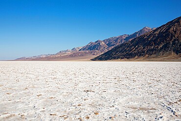
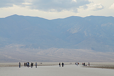
View across vast expanse of salt flats to the Black Mountains, Badwater Basin, Death Valley National Park, California, United States of America, North America
Badwater Basin at sunset, Death Valley National Park, California, United States of America, North America
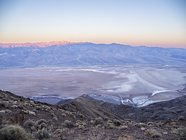
Sunrise across Badwater Basin, Telescope Peak from Dante's View in Death Valley National Park, California, United States of America, North America

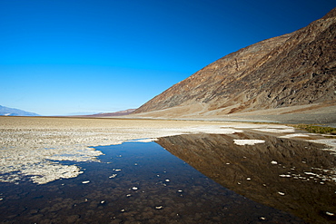
A permanent springfed pool near the salt pans at Badwater Basin, 282ft below sea level and the lowest place in North America, Death Valley National Park, California, United States of America, North America
Badwater Basin at sunset, Death Valley National Park, California, United States of America, North America
Badwater Basin, Death Valley National Park, California, United States of America, North America
Badwater Basin, Death Valley National Park, California, United States of America, North America
Badwater Basin, Death Valley National Park, California, United States of America, North America
Badwater Basin, Death Valley National Park, California, United States of America, North America
Badwater Basin, Death Valley National Park, California, United States of America, North America

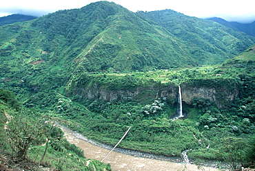
One of many picturesque waterfalls in the valley of the Rio Pastaza that flows from the Andes to the upper Amazon Basin, near Banos, Ambato Province, Central Highlands, Ecuador, South America
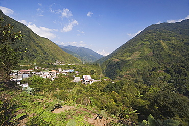
Small town of Machay in the Pastaza River valley, that flows from the Andes to the upper Amazon Basin, near Banos, Ambato Province, Central Highlands, Ecuador, South America
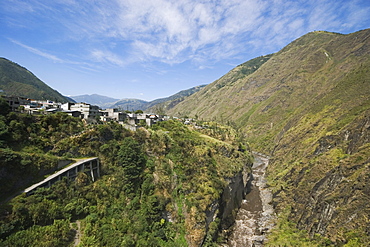
The valley of the Pastaza River, that flows from the Andes to the upper Amazon Basin, near Banos, Ambato Province, Central Highlands, Ecuador, South America
The valley of the Pastaza River, that flows from the Andes to the upper Amazon Basin, near Banos, Ambato Province, Central Highlands, Ecuador, South America

Salt pan polygons at Badwater Basin, 282ft below sea level and the lowest place in North America, Death Valley National Park, California, United States of America, North America

Salt pan polygons at Badwater Basin, 282ft below sea level and the lowest place in North America, Death Valley National Park, California, United States of America, North America
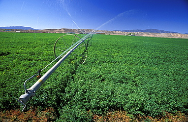
Irrigation from the Meadow Valley Wash makes the desert green with crops near Panaca in south west Nevada, The Great Basin, Nevada, United States of America (USA), North America
Salt flat formations in Badwater Basin, Death Valley National Park, California.
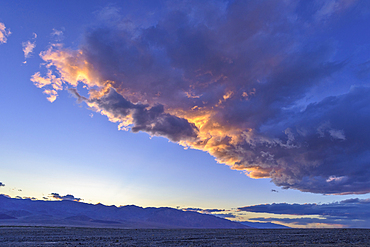
Sunset clouds over Badwater Basin, Death Valley National Park, California.
Hyogo Prefecture, Japan
Nagano Prefecture, Japan
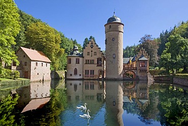
The moated castle Mespelbrunn is located in a remote side valley of the Elsava valley in Spessart, Bavaria, Germany.

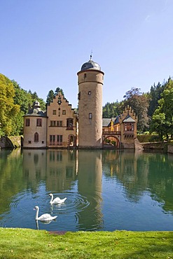
The moated castle Mespelbrunn is located in a remote side valley of the Elsava valley in Spessart, Bavaria, Germany.
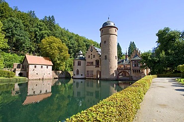
The moated castle Mespelbrunn is located in a remote side valley of the Elsava valley in Spessart, Bavaria, Germany.
The moated castle Mespelbrunn is located in a remote side valley of the Elsava valley in Spessart, Bavaria, Germany.

Salt plain, sign Badwater Basin, Death Valley National Park, California, USA, North America
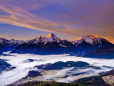
Sunrise at the peaks of the Steinernes Meer, Watzmann and Hochkalter, fog in the valley basin of Berchtesgaden, winter landscape, Berchtesgaden, Schoenau am Koenigssee, Berchtesgadener Land, Upper Bavaria, Bavaria, Germany, Europe
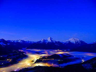
Fog in the valley basin of Berchtesgaden, behind the Steinerne Meer, Watzmann and Hochkalter, dawn, winter landscape, Berchtesgaden, Schoenau am Koenigssee, Berchtesgadener Land, Upper Bavaria, Bavaria, Germany, Europe
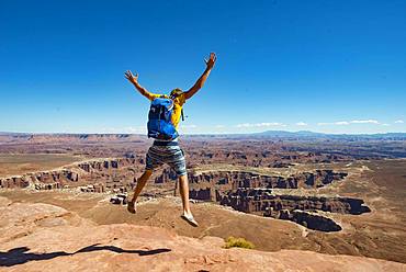
Young man jumping with outstretched arms, view from Grand Viewpoint, rugged gorges of the Green River, canyon landscape, erosion landscape, rock formations, Monument Basin, White Rim, Island in the Sky, Canyonlands National Park, Utah, USA, North America
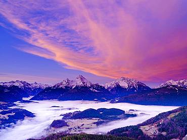
Fog in the valley basin of Berchtesgaden, behind the Steinerne Meer, Watzmann, Hochkalter and Reiteralpe, dawn, winter landscape, Berchtesgaden, Schoenau am Koenigssee, Berchtesgadener Land, Upper Bavaria, Bavaria, Germany, Europe
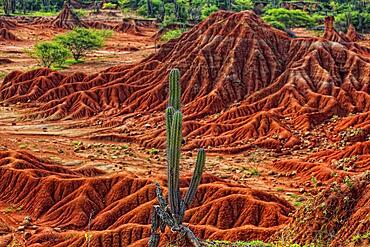
Republic of Colombia, Tatacoa Desert, landscape in the department of Huila, Desierto de la Tatacoa, Tatacoa Desert is a desert of about 330 km² in Colombia, in the northern part of the province of Huila in the valley of the Rio Magdalena, a dry basin at the foot of the Eastern Cordillera, tropical dry forest, playful rock cones, washed-out gorges and rock formations, Colombia, South America
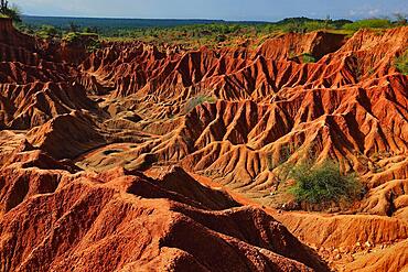
Republic of Colombia, Tatacoa Desert, landscape in the department of Huila, Desierto de la Tatacoa, Tatacoa Desert is a desert of about 330 km² in Colombia, in the northern part of the province of Huila in the valley of the Rio Magdalena, a dry basin at the foot of the Eastern Cordillera, tropical dry forest, playful rock cones, washed-out gorges and rock formations, Colombia, South America
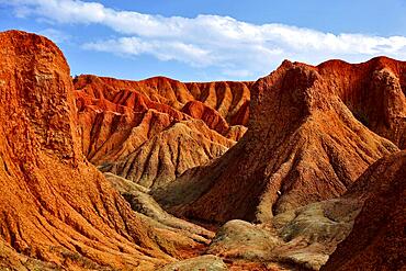
Republic of Colombia, Tatacoa Desert, landscape in the department of Huila, Desierto de la Tatacoa, Tatacoa Desert is a desert of about 330 km² in Colombia, in the northern part of the province of Huila in the valley of the Rio Magdalena, a dry basin at the foot of the Eastern Cordillera, tropical dry forest, playful rock cones, washed-out gorges and rock formations, Colombia, South America
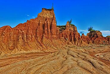
Republic of Colombia, Tatacoa Desert, landscape in the department of Huila, Desierto de la Tatacoa, Tatacoa Desert is a desert of about 330 km² in Colombia, in the northern part of the province of Huila in the valley of the Rio Magdalena, a dry basin at the foot of the Eastern Cordillera, tropical dry forest, playful rock cones, washed-out gorges and rock formations, Colombia, South America
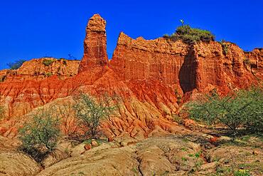
Republic of Colombia, Tatacoa Desert, landscape in the department of Huila, Desierto de la Tatacoa, Tatacoa Desert is a desert of about 330 km² in Colombia, in the northern part of the province of Huila in the valley of the Rio Magdalena, a dry basin at the foot of the Eastern Cordillera, tropical dry forest, playful rock cones, washed-out gorges and rock formations, Colombia, South America

Hair salon chair with towel armchair
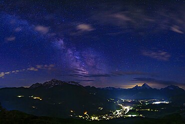
Milky Way over the valley basin of Berchtesgaden, behind Hoher Göll, Steinernes Meer and Watzmann, Berchtesgadener Land, Upper Bavaria, Bavaria, Germany
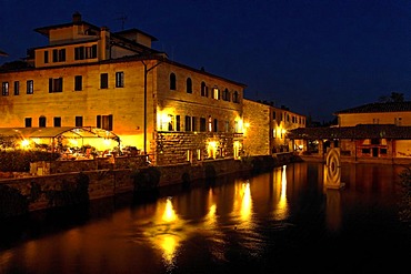
The basin of hot sulphur spring in Bagno Vignoni and Hotel Le Terme at night, Orcia Valley, Tuscany, Italy, Europe

Fog in the valley basin of Berchtesgaden, behind the Watzmann, dawn, winter landscape, Berchtesgaden, Schoenau am Koenigssee, Berchtesgadener Land, Upper Bavaria, Bavaria, Germany, Europe
Badwater Basin Death Valley salt formations in California National Park
Salt pan, salt crystals, sunrise in Badwater Basin above Panamint Range, Death Valley National Park, Mojave Desert, California, USA
Sign, Badwater Basin, Death Valley National Park, Mojave Desert, California, USA
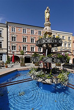
Kraiburg upon the river Inn district of Muehldorf Upper Bavaria Germany market square with St Mary's column and fountain
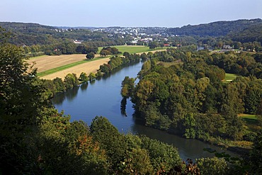
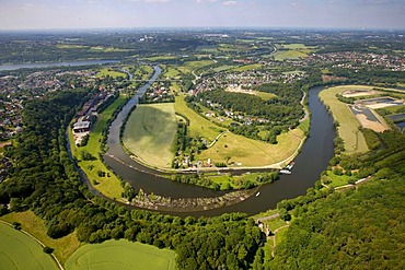
Ruhr Valley, the Ruhr River, between the districts Werden and Kettwig in the southern part of the city of Essen, with nature reserves, forest and fields, Essen, North Rhine-Westphalia, Germany, Europe

Lonely highway trough Goshute Valley, Nevada, USA
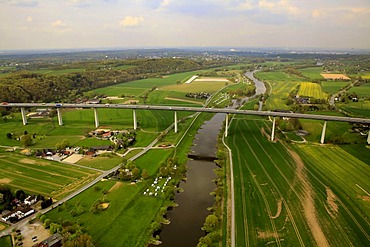
Aerial view, Ruhrtalbruecke bridge, A52, Ruhr river in the Ruhr valley, Muelheim an der Ruhr, Ruhrgebiet region, North Rhine-Westphalia, Germany, Europe
Aerial view, Lohmann company, loop of the Ruhr river, Herbede, Ruhr river, Ruhrtal valley, Witten, Ruhrgebiet area, North Rhine-Westphalia, Germany, Europe
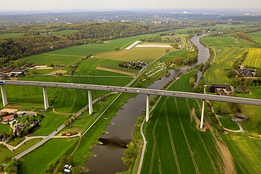
Aerial view, Ruhrtalbruecke bridge, A52, Ruhr river in the Ruhr valley, Muelheim an der Ruhr, Ruhrgebiet region, North Rhine-Westphalia, Germany, Europe
Aerial shot, autumn, Heilenbeck Dam, Ennepetal valley, Bergisches Land, Ruhr district, North Rhine-Westphalia, Germany, Europe
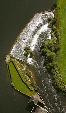
Aerial view, weir, hydroelectric power plant in Witten, river Ruhr, Ruhr Valley, Ruhr Area, North Rhine-Westphalia, Germany, Europe
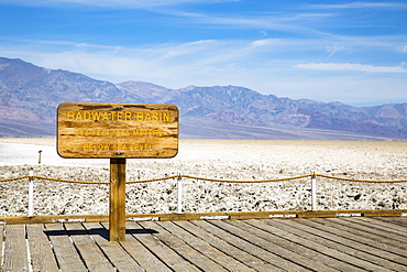
Lowest point in North America, Badwater Basin sign, Death Valley National Park, California, USA, North America
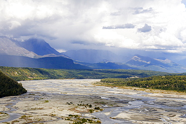
Matanuska River Valley, Alaska, USA
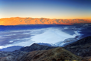
View from Dante's View at sunrise over Badwater Basin, Death Valley National Park, California, USA
"Badwater Basin", Death Valley National Park, California, USA, North America
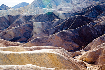
USA, California, Death Valley is a desert valley located in Eastern California. It is the lowest, driest, and hottest area in North America. Zabriskie Point.
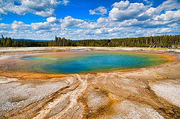
Grand Prismatic Spring Geyser, Yellowstone National Park.
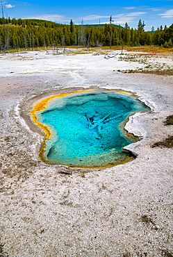
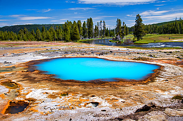
Sapphire Pool in Biscuit Basin, Yellowstone National Park, Wyoming.
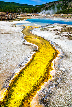
Creek and pool in Biscuit Basin, Yellowstone National Park, Wyoming.
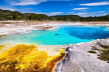
Black Opal Pool in Biscuit Basin, Yellowstone National Park, Wyoming.
Sapphire Pool in Biscuit Basin, Yellowstone National Park, Wyoming.
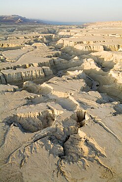
Aerial photograph of a wadi in the southern basin of the Dead sea, Israel
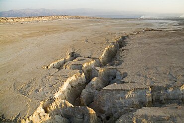
Aerial southern basin of the Dead sea, Israel
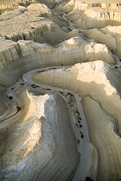
Aerial photograph of a wadi in the southern basin of the Dead sea, Israel
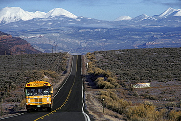
School bus in early morning in the Paradox Valley, an unusual valley at the center of the Paradox Basin, Colorado. The Paradox Basin was home to numerous uranium mines.
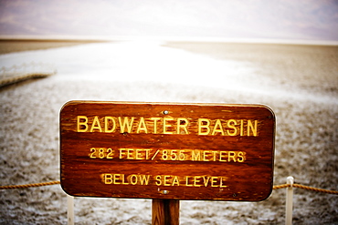
Bad Water Basin sign. Death Valley National Park, California.
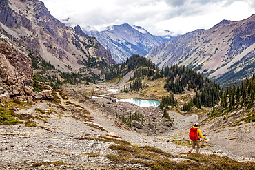
Male hiker in Royal Basin, Olympic Mountains, Olympic National Park, Washington, United States of America

Brooks Range, Gates Of The Arctic National Park, Northwestern Alaska, Alaska, United States Of America

Noatak River And The Brooks Range, Gates Of The Arctic National Park, Northwestern Alaska, Alaska, United States Of America
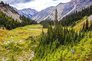
Woman backpacking through forest, Royal Basin, Olympic Mountains, Olympic National Park, Washington, United States of America
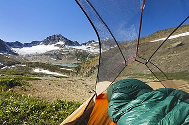
View from inside a tent of Russell Peak and Limestone Lakes Basin in Height-of-the-Rockies Provincial Park.
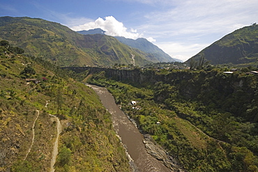
The Highlands to Amazon Basin, Pastaza River Valley descent from highlands at Banos (1800 meters) into Amazon basin at Puyo suspension bridge at Agoyan Falls, Highlands, Ecuador